
Stops along the way
Stops between Ankara and İzmir
557 km, roughly 7 hours of driving. The stops below are ordered as you pass them — the same road in both directions.
In short
The drive between Ankara and İzmir is 557 km and takes roughly 7 hours. There are 349 described places within 20 km of this route; it crosses 7 provinces, and the densest stretch is in İzmir (63 places).
There are 349 places within 20 km of this corridor; the 56 below are spread evenly along the drive.
1
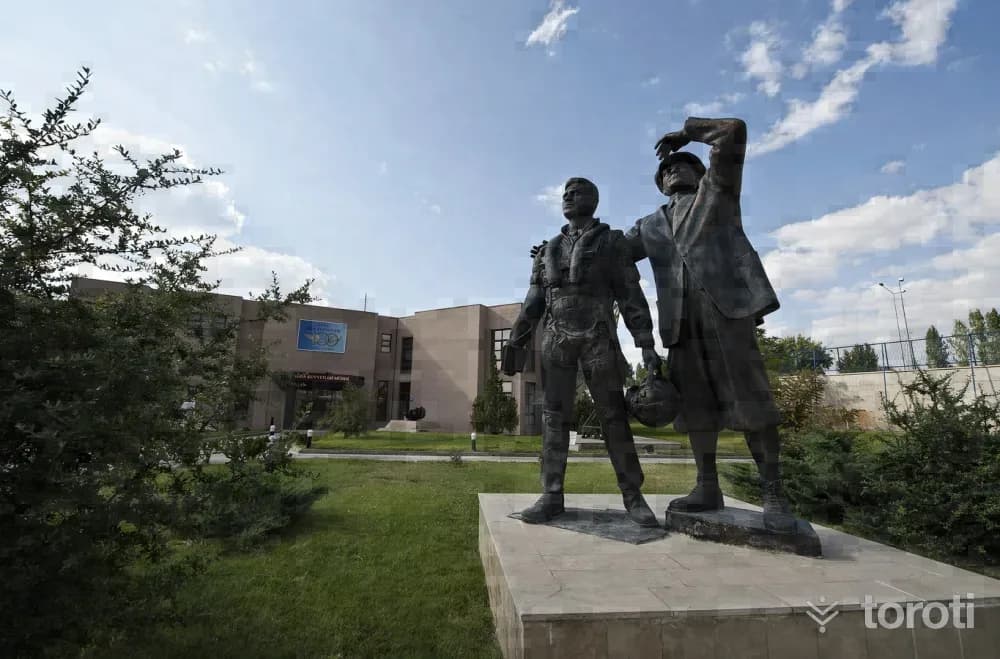
Hava Kuvvetleri Müzesi
Etimesgut, Ankara
The Air Force Museum is located in Şaşmaz Mevkii, established at the 12th kilometre of İstanbul Yolu. The museum, which entered service on 18 September 1998, was officially opened by Mustafa Kemal Atatürk’s adopted daughter, our country’s first female pilot, Sabiha Gökçen.

2
Türkiye Eğitim Derneği Ankara Koleji Okul Müzesi
Gölbaşı, Ankara
TED Ankara College School Museum, which conveys the historical accumulation of TED Ankara College Foundation Schools from its founding year of 1931 to the present day to future generations, is located on the ground floor of the administrative building on the İncek campus. The museum, which opened on 21 May 2008, has been granted the status of “Private Museum” by the Ministry of Culture and Tourism.
3
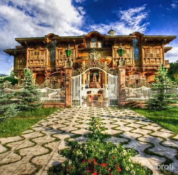
Anadolu Mimarlik Ve Mobilya Kültürel Miras Müzesi Ve Araştirma Merkezi
Çankaya, Ankara
Anadolu Architecture and Furniture Cultural Heritage Museum and Research Center, the first architecture and furniture museum in our country, was opened on 25 December 2008. It is in Merik Mansion on Lodumlu Doğramacı Caddesi. It is Bilkent’s famous Merik Mansion or, as it is popularly known, the “Golden Mansion”.
4
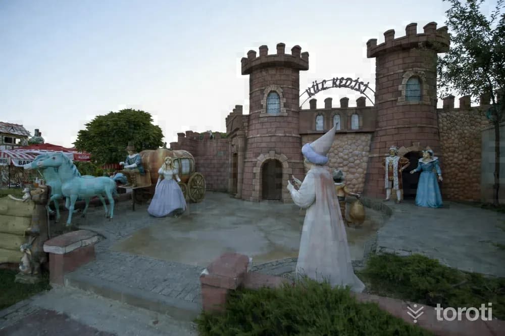
Harikalar Diyari
Sincan, Ankara
Within Harikalar Diyarı, which is planned with approximately 771 thousand square meters of green area, 330 thousand square meters of roads and squares, 40 thousand square meters of parking area, 67 thousand square meters of building area, and 92 thousand square meters of water areas, there is also a Fairy Tale Island established in an area of 25 thousand square meters for children.
5
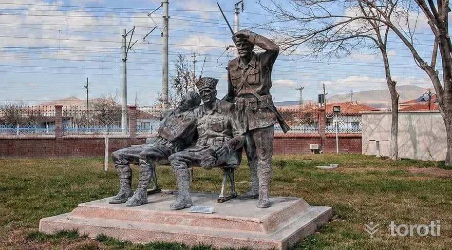
Tcdd Maliköy Tren İstasyonu Müzesi
Sincan, Ankara
Malıköy, located on the Ankara-Eskişehir railway line, is a settlement center connected to the Polatlı district. The Malıköy station located here is a very important station that affected the fate of the nation in this region where the Battle of Sakarya took place.
6
Topçu Ve Füze Okulu Sinif Müzesi
Polatlı, Ankara
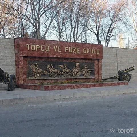
The Topçu ve Füze Okulu Sınıf Müzesi, established with the aim of reflecting the social, cultural and technical development of the artillery class according to periods, conducting scientific research on military cultural assets that will shed light on our military history, and passing on our history and culture to future generations, was completed and opened to service in April 1973. The museum consists of three main sections: the museum garden, the museum section and the Şeref Salonu.
7
Mehmetçik Anıti
Polatlı, Ankara
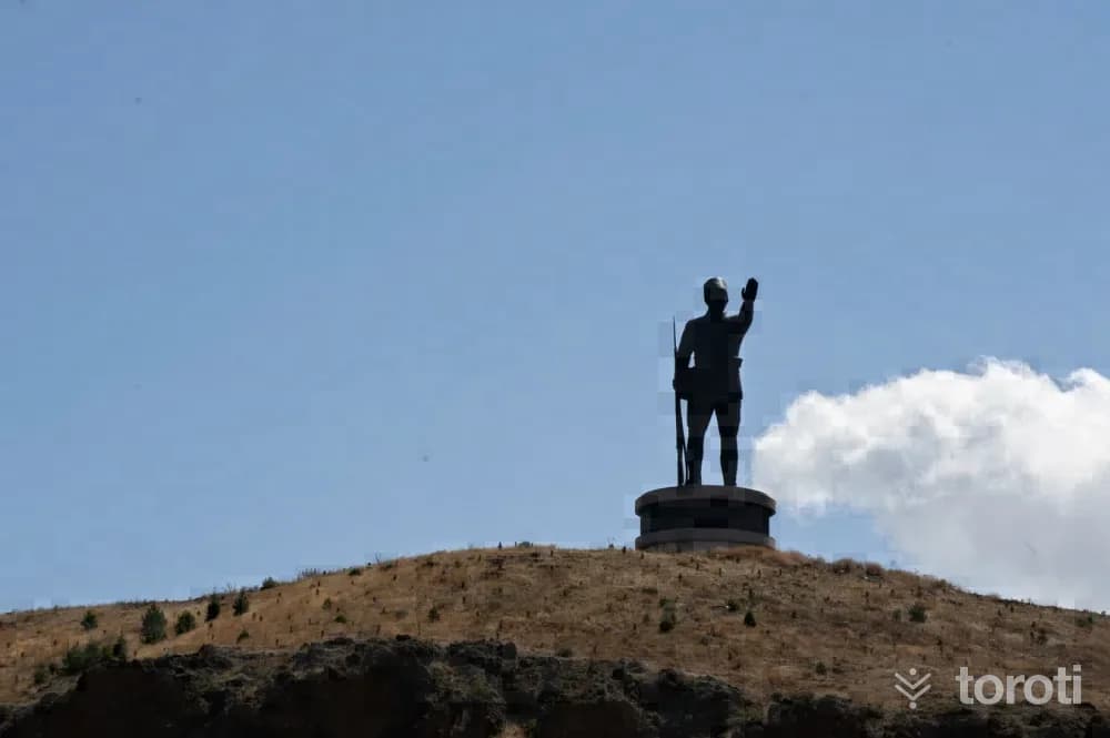
The Sakarya Victory Mehmetçik Monument, Kartal Tepe Mehmetçik monument, rises by the E–90 highway 6 kilometers west of Polatlı District. Although it fell into enemy hands from 31 August 1921 to 12 September 1921, this was an area where the enemy's advance was prevented by bayonet charges. The Mehmetçik monument was made by sculptor Associate Professor Dr. Sait Rüstem. Including its pedestal, it has a total height of 32 meters, and the monument itself is 22 meters.
8
Duatepe Anıti
Polatlı, Ankara
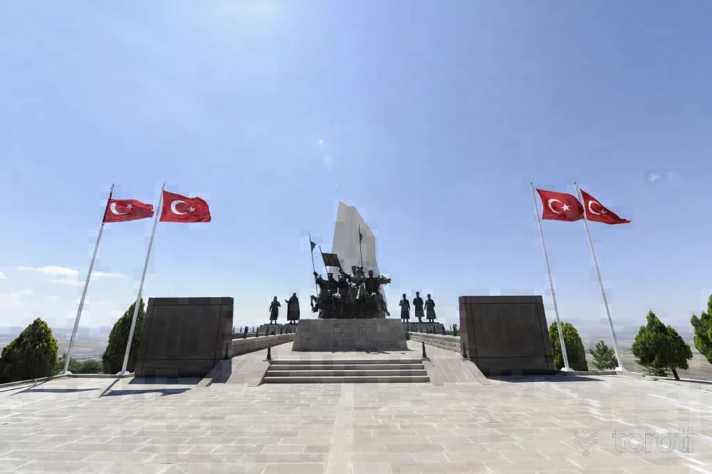
Duatepe Monument was created by afforesting Gazi Tepe, Türbe Tepe and Mangal Dağı on the last defense line where the Battle of Sakarya, considered the turning point of the War of Independence, was fought. Work began at Duatepe in October 1999, 20 thousand trees were planted, and the monument was completed and opened on 12 September 2000. Polatlı, Duatepe Monument consists of five parts: parking lot, access road, walking path, ceremony area and monument.
9
Gordion Antik Kenti
Polatlı, Ankara
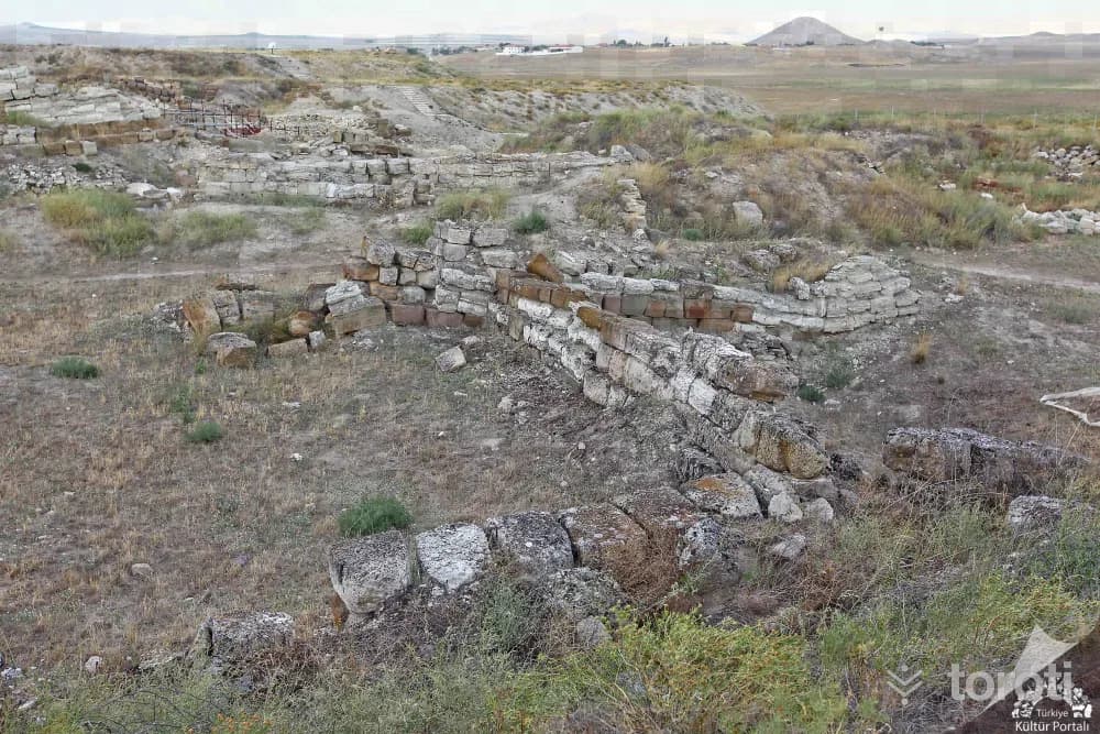
Gordion Ancient City, one of the most important archaeological sites of Anatolia, was inscribed on the World Heritage List by UNESCO in 2023. Servet Uygun Gordion Ancient City is located in the Central Anatolia Region, approximately 90 kilometers southwest of Ankara city center and approximately 18 kilometers northwest of Polatlı district, in the Yassıhöyük neighborhood. Over a long period of 4500 years, settlement in and around Gordion was interrupted very little.
10
Hamamkarahisar Cami
Günyüzü, Eskişehir
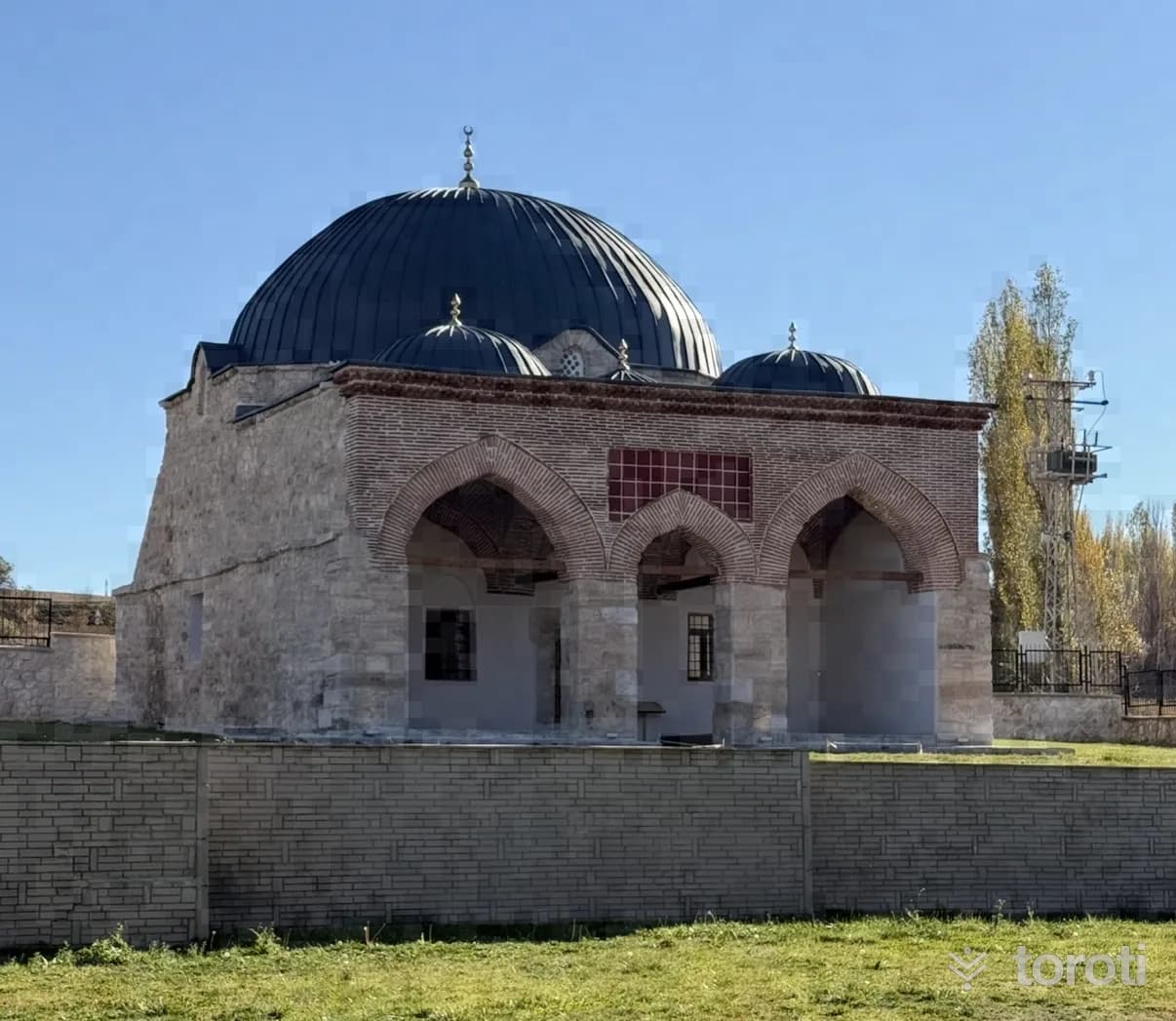
It was commissioned in 1259 by Emir Seyfettin Kızıl in Hamamkarahisar Village. It is stated that Emir Seyfettin Kızıl was the Bey of the Turkmen Bayındır Tribe and one of the three great emirs consulted by İzzeddin Keykavus. Hamamkarahisar Camii is an original example that has preserved its identity to the present day in terms of the shaping and integration of its sections as the main space and the last congregation area during the transition to Ottoman architecture.
- No image
11
Zey Köyü Ören yeri
Sivrihisar, Eskişehir
It was established on a rocky slope on the northern foothills of the Sivrihisar Mountains. In the higher parts of the rock masses that border a narrow valley from two sides, about 1 km south of the village, there are twelve chamber tombs, two stepped altars and a grape pressing pool. These monuments, which constitute original examples of Phrygian rock art, belong to the Phrygian settlement of Zey Kalesi, 1 km south of this area.
12
Seyyit Mahmut Suzanı Külliyesi
Sivrihisar, Eskişehir
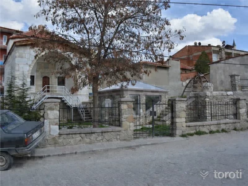
The külliye is a whole enclosed by a courtyard, consisting of a kümbet, tomb, hazire (open grave), and ruined madrasas. The kümbet was built of dressed stone with wooden material. In the hazire section, there is a sarcophagus bearing an inscription written in marble in kufic and Ottoman letters, and other types of graves. Seyyit Mahmut Suzani Külliyesi consists of the kümbet, tomb, and hazire section. It is a structure from the Seljuk Period. The kümbet was built of dressed block stone material.
13
Alemşah Kümbeti
Sivrihisar, Eskişehir
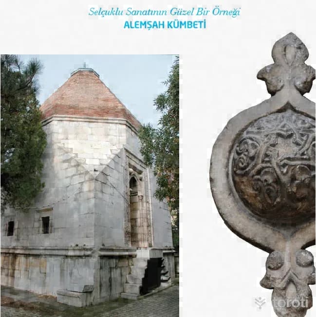
Alemşah Kümbeti, a fine example of Seljuk art, was commissioned by Melikşah in 1328 for his martyred brother Sultan Şah. The tomb is opposite Sivrihisar Ulu Camii. It is a two-storey structure with a square plan and was built of cut stone. Bricks were also used in places in its construction. Sivrihisar Belediyesi There is a mummification chamber on the lower floor of the tomb. In the door decorations of the mummification chamber, motifs frequently used by the Seljuks can be seen.
14
Sivrihisar Ulu Cami
Sivrihisar, Eskişehir
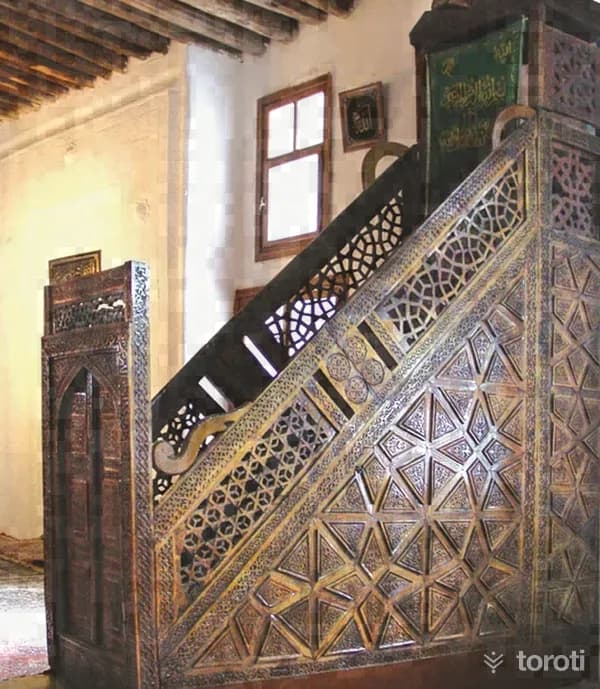
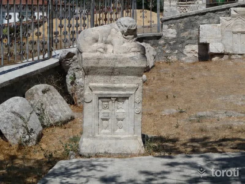
Sivrihisar Ulu Cami is one of the most important examples of mosques with wooden columns and wooden ceilings in Anatolia. Servet Uygun Various sources state that the mosque was first built in 1231-1232 by Emir Celaleddin Ali, and that in 1274 it was brought to its present form by Emineddin Mikail, one of the disciples of Mevlana Celaleddin Rumi.
15
Pessinus Ören Yeri
Sivrihisar, Eskişehir
Where is the Pessinus archaeological site? The Ancient City of Pessinus is located in Ballıhisar, 13 kilometers south of Sivrihisar on the Ankara-Eskişehir highway. Today, Ballıhisar Village has been established on top of the ancient city, which was on the old King's Road. The Ancient City of Pessinus is known as one of the most important places of worship where the mother goddess, called "Goddess Kybele" by the Phrygians, was located.
16
Suvermez Şehitliği
Emirdağ, Afyonkarahisar
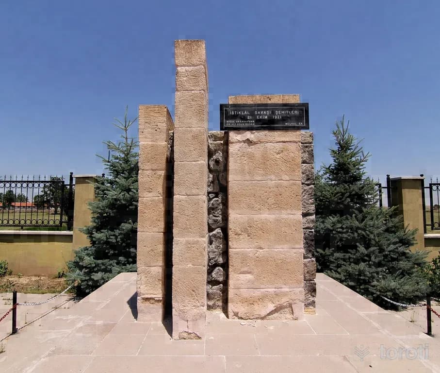
It is located in Suvermez Village, Emirdağ District. It was built in 1971 in the name of two privates who were martyred as a result of enemy reconnaissance aircraft fire during the War of Independence.
17
Yedikapilar Kaya Yerleşimi
Bolvadin, Afyonkarahisar
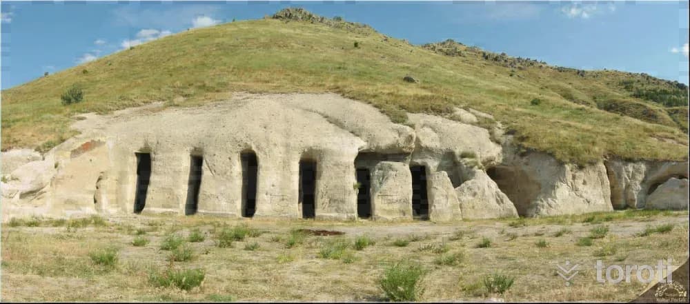
Yedikapılar Rock Settlement is located approximately 3,5 km northeast of Kemerkaya village in Bolvadin district. It is a U-shaped complex carved into the main rock, consisting of interconnected rooms arranged around a courtyard. The Yedikapılar Underground Settlement, carved into the tuff rock beneath the ground, is located here. The underground settlement consists of rooms and galleries formed by carving the tuff rock.
18
Hüsrev Paşa Camii
Bayat, Afyonkarahisar
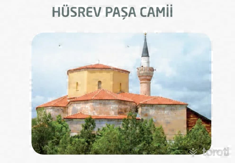
The mosque, the most important structure of the Menzil Külliyesi built by Hüsrev Paşa, one of the viziers of IV. Murat, between 1631-1638, is intact today and open for use. The mosque, probably built on a church belonging to the Byzantine period, has an inverted “T” (Zaviyeli) plan type. It is covered with a large central dome supported by semi-domes on four sides. It bears the architectural characteristics of the 16th and 17th centuries.
19
Derbent Elicek Kaya Mezar Odaları
Bayat, Afyonkarahisar
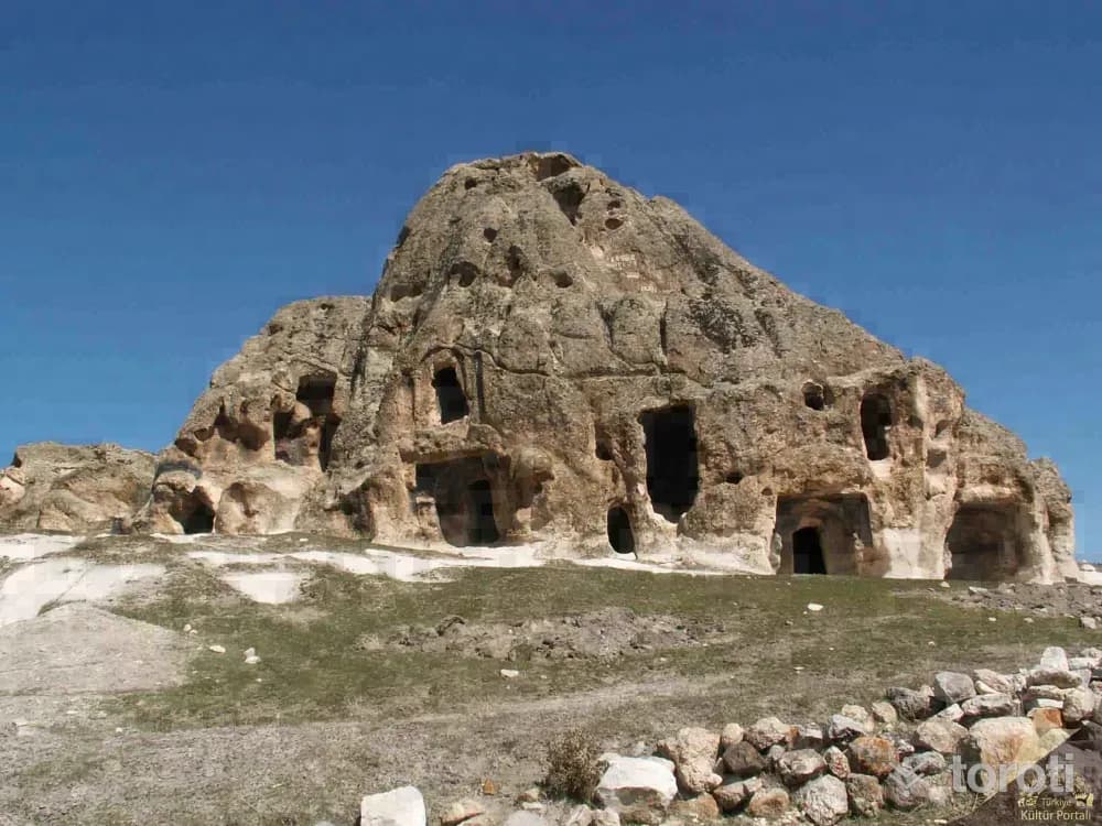
Derbent Elicek Rock Tomb is located in Bayat district, Derbent village, in Ericek locality, 4,5 km southeast of Bayat district center. It is an archaeological necropolis and rock settlement consisting of numerous rock spaces and rock tombs. Photo: Afyonkarahisar Museum The tomb chambers are generally single-roomed, with triangular hipped roofs and vaulted ceilings. Niches are also found near the tombs and spaces.
20
Han Yeraltı Şehri Ve Çevresi
Bayat, Afyonkarahisar
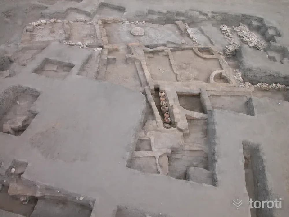
Han, one of the most important junctions on the ancient road connecting east to west and south throughout history, is the first shelter of Christianity and the stopover city of the Seljuk and Ottoman. Ancient Han has Roman and Byzantine rock settlements on its connecting roads.
21
Seydiler Peribacaları
İscehisar, Afyonkarahisar
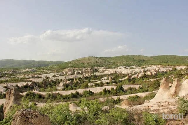
Located at the 33rd km of the Afyonkarahisar-Ankara highway, 500-1000 m east of the secondary road branching off from the main road, the area around Seydiler is the area where fairy chimneys of very different morphotypes can best be seen, within an area of approximately 1-2 km2. Due to the geological structure of Afyonkarahisar province, there are numerous fairy chimneys in various forms, with or without caps, in the districts of İhsaniye, İscehisar, Bayat and Bolvadin, which are located on volcanic terrain.
22
Leylek Kayaliği
İscehisar, Afyonkarahisar
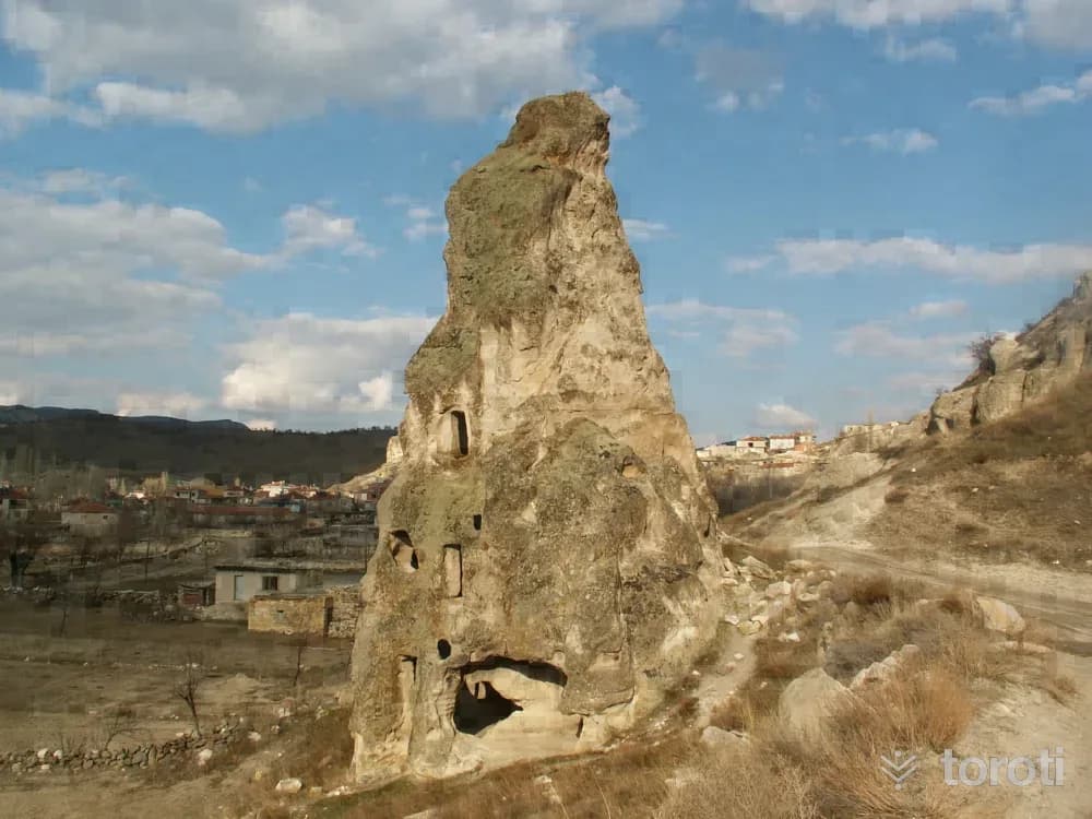
Leylek Kayalığı, located in the Harmanüstü area of Seydiler Town in İscehisar district, has natural and archaeological features. There are conical single and grouped fairy chimneys generally formed by tuffs. One of the fairy chimneys located to the west of the rock and on the lower part of the road has been carved into three storeys including the ground floor. On the ground floor there is a chapel and a space, on the first floor there is a chapel and a space, and on the top floor there is a space.
23
Afyonkarahisar Müzesi
Afyonkarahisar (Merkez İlçe), Afyonkarahisar
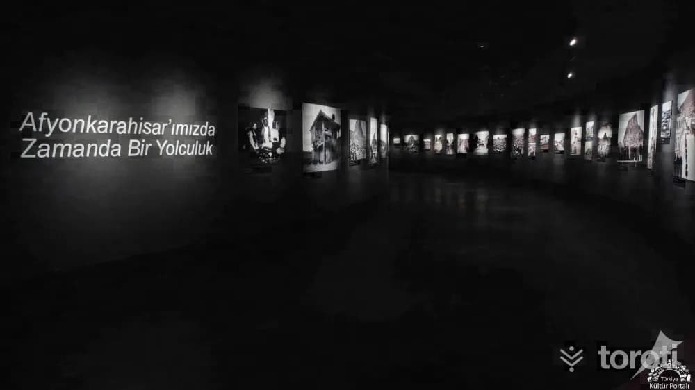
With the efforts of the Asar-ı Atika Muhipleri Cemiyeti, established in Afyonkarahisar in the early years of the Republic, antiquities began to be collected in Taş Medrese; in 1931 it became an official museum depot, and in 1933 it became the Museum Directorate. Serving as a mixed museum (Archaeology and Ethnography) in Taş Medrese from 1933 to 1970, the institution moved to its second service building in 1971. In 2023, the current museum building was opened for service.
24
Çeşmeli Konak (afyon Kültür Ve Çevre Evi)
Afyonkarahisar (Merkez İlçe), Afyonkarahisar
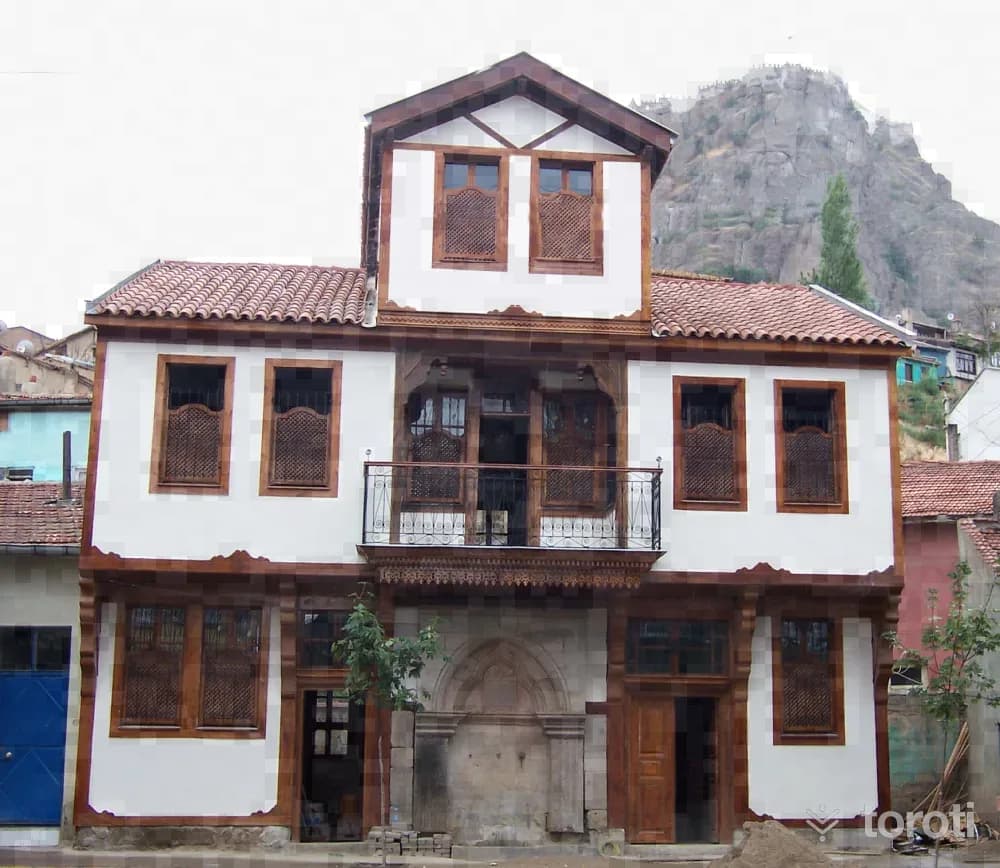
Çeşmeli Konak, located at Afyonkarahisar Province, Merkez Nurcu Mahallesi, Milli Birlik Caddesi No: 59-61, is registered in the land registry with sheet 36, block 534 and parcel numbers 16-17. It is a Late Ottoman work and forms an integral whole with the monumental fountain on its façade. The fountain was first commissioned for charitable purposes by Kahvecioğlu İsmail Efendi, who was engaged in the silk and fabric trade, and later the mansion needed by his own family was built.
25
Millet Hamamı
Afyonkarahisar (Merkez İlçe), Afyonkarahisar
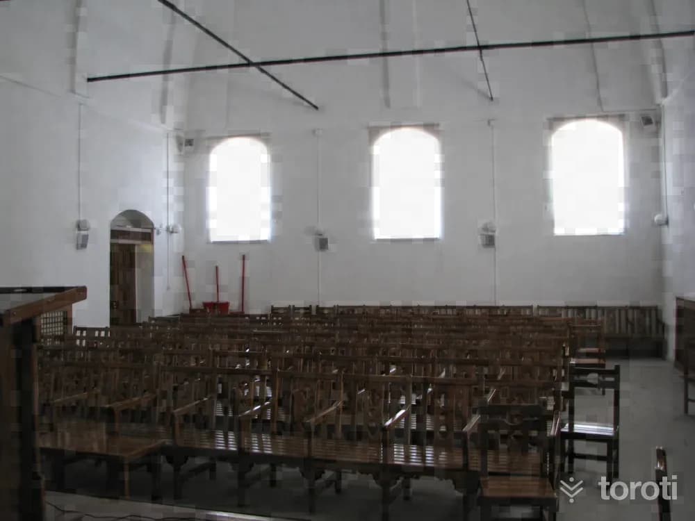
It is located in Tac-ı Ahmet Mahallesi, on Hamam Aralığı Sokağı. In the northern section of the structure, which was built on sloping land descending from south to north, is the men's section, while in the southern section is the women's section. The women's changing room on the east facade of the structure is attached to the southern wing of the facade. The furnace on this facade is adjacent to the north wall of the changing room. In the northern section of the facade, there are three window openings.
26
Cumhuriyet Şehitliği
Afyonkarahisar (Merkez İlçe), Afyonkarahisar
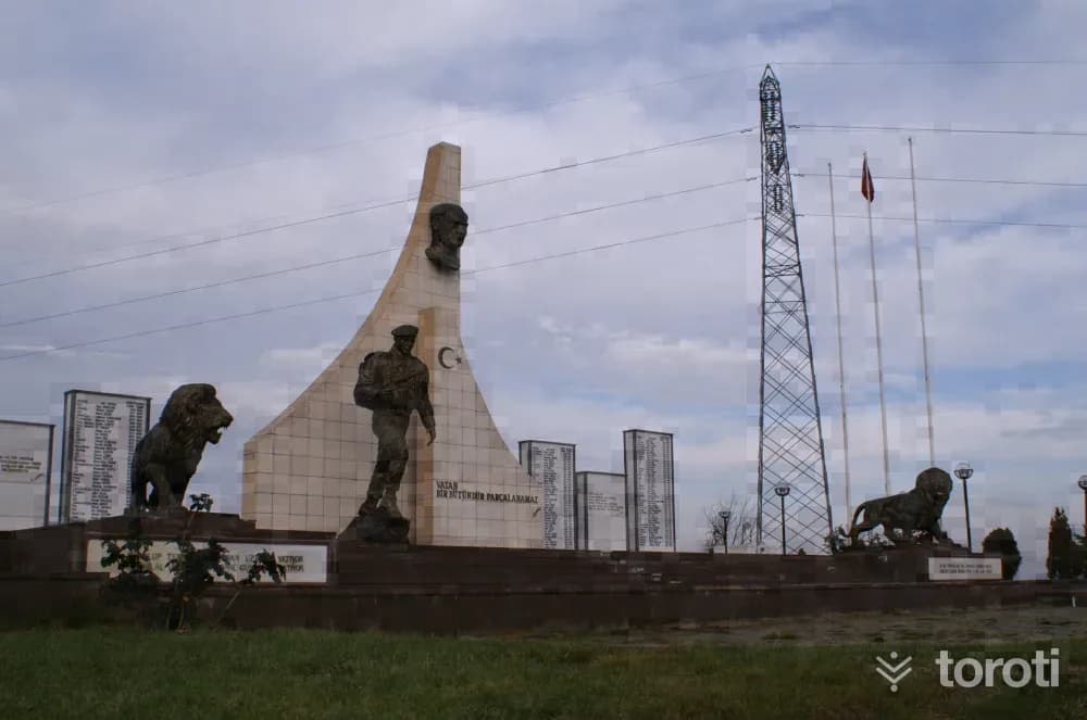
The Cumhuriyet Şehitleri Monument is located 9 kilometers from Afyonkarahisar, on the İzmir-Antalya highway. It is a martyrdom built in 1999 in the name of the Mehmetçik and police officers who were martyred in the struggles during the Republican Period. Some of the martyrs of the Republican Period are in the Hava Şehitliği, and others are in cemeteries in the cities where the martyrs' families live. In 1999, a symbolic martyrdom was built on a hill overlooking Afyonkarahisar in memory of the martyrs.
27
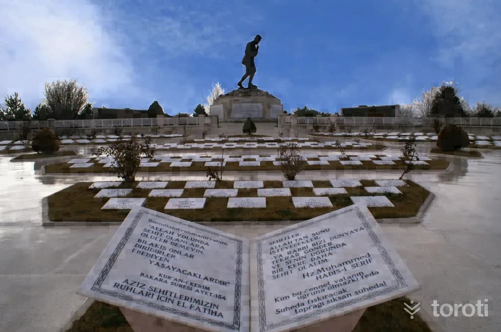
Büyük Taarruz Şehitliği Ve Mustafa Kemal Atatürk Anıti
Sinanpaşa, Afyonkarahisar
It is located on Işık (Sarıkız) Tepe at the Antalya-İzmir road junction, 16 kilometers from Afyonkarahisar. Built so that vehicles traveling from Central Anatolia and Marmara to the Aegean and Mediterranean can see it, the Martyrs' Cemetery and Monument are open to visitors every day of the year.
28
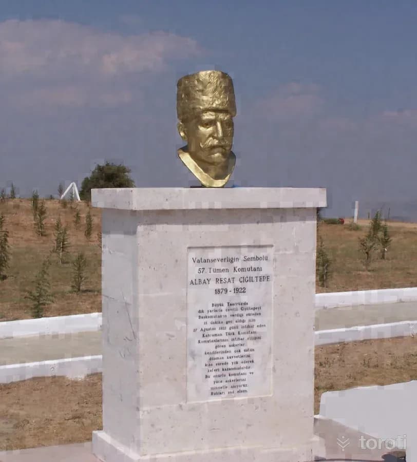
Albay Reşat Çiğiltepe Şehitliği
Sinanpaşa, Afyonkarahisar
It is located on Çiğiltepe, at an altitude of 1591, in the southeast of Sinanpaşa District, in the southwest of Afyonkarahisar, and is 18 kilometers from Sinanpaşa District. On 27 August 1922, Miralay Reşat Bey, Commander of the 57th Division, who was assigned to capture Çiğiltepe, promised Başkomutan Gazi Mustafa Kemal that he would capture the hill within half an hour, but when he could not keep his word, he committed suicide by placing his pistol to his temple.
29
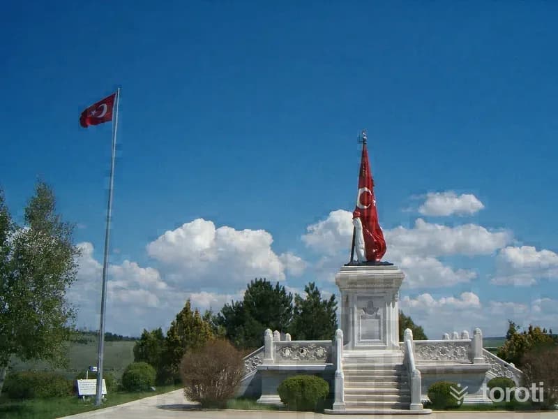
Zafertepeçalköy Zafer Anıti
Altıntaş, Kütahya
It was built in Zafertepeçalköy on the hill at an altitude of 1181 where the Commander-in-Chief Field Battle was directed and administered. Its construction began in 1964 and it was opened to visitors in 1968. It is the place where the 30 August Victory Day ceremonies are held. The Victory Monument, whose distant appearance evokes crossed weapons and the feeling of a blazing torch, in its true meaning symbolizes our War of Independence.
30
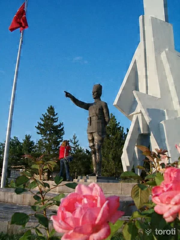
Şehit Sancaktar Mehmetcik Anıti
Dumlupınar, Kütahya
While touring the battlefield on 31 August 1922, Atatürk sees a standard-bearer among the martyrs, buried in a pit opened by an enemy artillery shell. This revered martyr is holding the standard upright with his arm, stiffened above the ground. Moved by the scene, the Commander-in-Chief orders that this be taken as the symbol for the Martyr Soldier Monument to be built after the war.
31
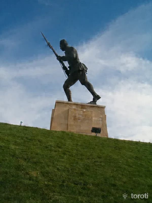
Dumlupinar İlk Hedef Anıti
Dumlupınar, Kütahya
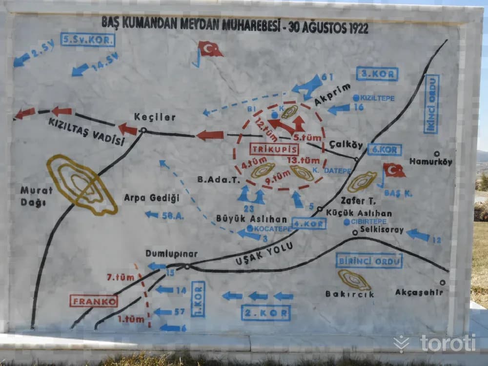
This war, which took place between 26-30 August 1922, took its place in the pages of history under the name of the Commander-in-Chief Field Battle, formed the basis for the establishment of the Republic of Türkiye, and changed the course of history by leaving deep repercussions all over the world as a result, began in Afyonkarahisar Kocatepe, and on 30 August a great victory was achieved with the extraordinary heroism and courage shown by the Turkish Armies on the Zafertepeçalköy-Dumlupınar line.
32
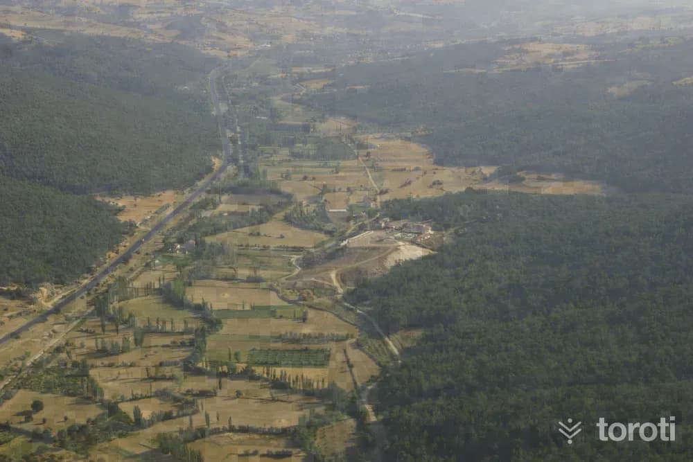
Dumlupinar Şehitliği
Dumlupınar, Kütahya
The Commander-in-Chief Field Battle began on 26 August 1922 from Afyonkarahisar-Kocatepe and ended with a great victory in Dumlupınar on 30 August 1922. Dumlupınar Martyrs' Cemetery was built by the Ministry of Culture and Tourism in memory of the sons of the homeland who were martyred on all fronts throughout the War of Independence, and was opened to visitors with a grand ceremony on 30 August 1992, the 70th anniversary of the Great Offensive.
33
Hamamboğazi Termal Turizm Tesisleri
Banaz, Uşak
The Hamamboğazı thermal tourism area, besides being intertwined with nature, also has a significant advantage in terms of transportation, as it is located on the İzmir-Ankara highway and close to Uşak Airport and Zafer Airport. In the Hamamboğazı thermal tourism area, which has significant potential with a flow rate of 268 liters per second and a temperature of 68 degrees, 18 parcels have been approved by our Ministry as tourism facility areas. These parcels are awaiting their investors.
34
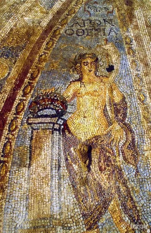
Banaz Akmonia Antik Kenti
Banaz, Uşak
It is an ancient city established on the high hill to the south of Ahat Village in the Banaz district of Uşak. Like most other historical places in Uşak, this place is also on the Lydian King's Road. A large number of mosaic areas have been found in the city, and there are Roman and Byzantine ceramic fragments, a gynnasium area, building foundations, architectural stone-marble pieces, two temple podiums, and a theater pit. The artifacts unearthed here are exhibited in the Uşak Archaeology Museum.
35
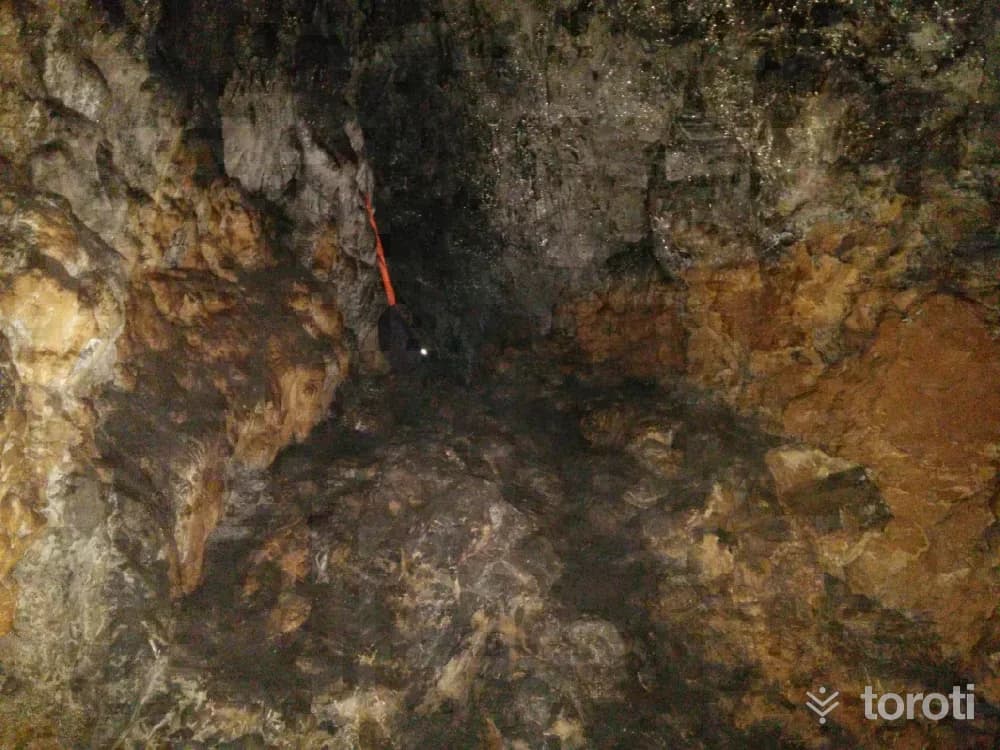
Çokrağan Mağarası
Banaz, Uşak
Uşak’s drinking water comes from this cave. It is located in the area where Çalüstü Tepe is situated, to the north of Yukarı Karacahisar Village. It is a cave developed within recrystallized limestones of Jurassic age. The total length of the cave is 2050 meters. It is a multi-storey cave. It consists of three levels. The first level is located at 1372 meters. There are no dripstone formations on this level. Another level is located 15 meters below this level.
36
Atli Cirit
Uşak merkez, Uşak
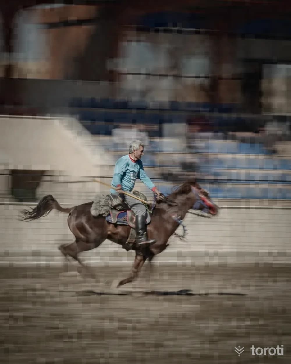
Cirit is a traditional Turkish sport played on horseback since Central Asia. There are 35 official equestrian sports clubs in Uşak province, and competitions are organized nationwide every year in April. In addition, many associations operate in our province in order to keep the ancestral sport of cirit alive in Uşak.
37
Uşak Arkeoloji Müzesi
Uşak merkez, Uşak
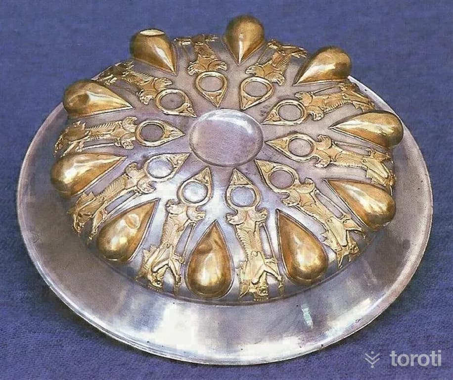
ARE YOU READY TO DISCOVER THE KARUN TREASURES? The Archaeology Museum, which served in the same building for approximately 48 years, was moved to the train station area in 2018 after the exhibition and arrangement works of the new museum building were completed, thus taking its place among modern museums. Our museum consists of 3 floors, and 43 thousand collections and 2000 artifacts are exhibited.
38
Dokur Evi
Uşak merkez, Uşak
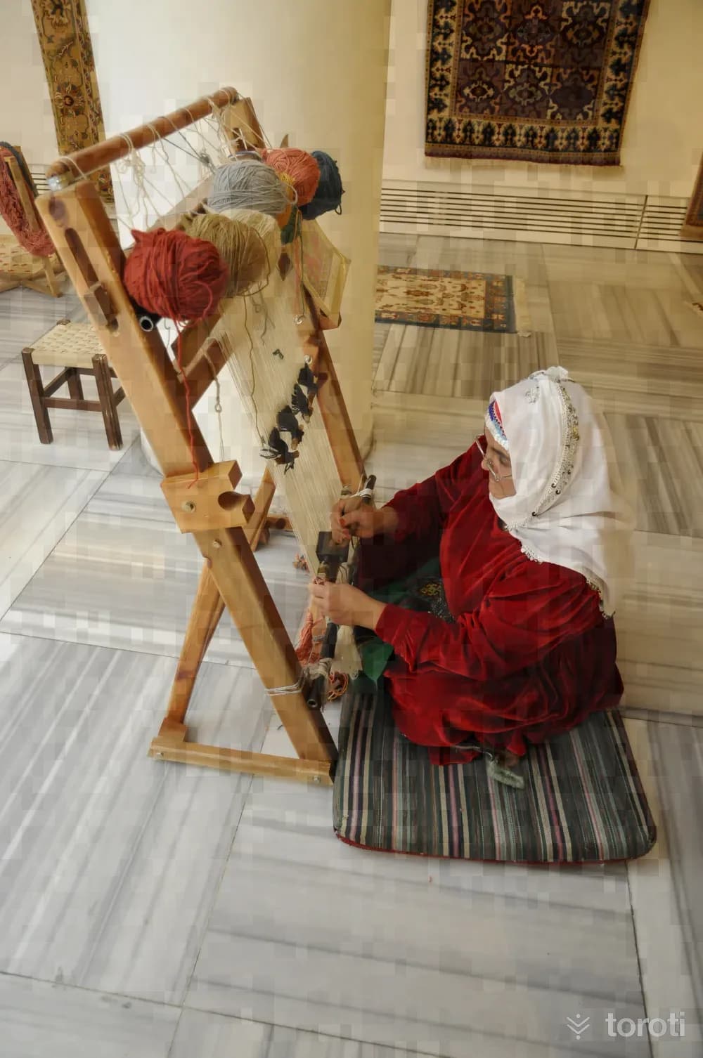
Dokur Evi, whose restoration was completed by Uşak Municipality by preserving its original materials and replacing structural elements that had begun to decay, become deformed, and lost their characteristics, began operating in 2010 under the name “Uşak Belediyesi Dokur Evi Geleneksel El Sanatları Halıcılık Merkezi” in accordance with its 180-year-old historical texture. There are 40 carpet looms in Dokur Evi.
39
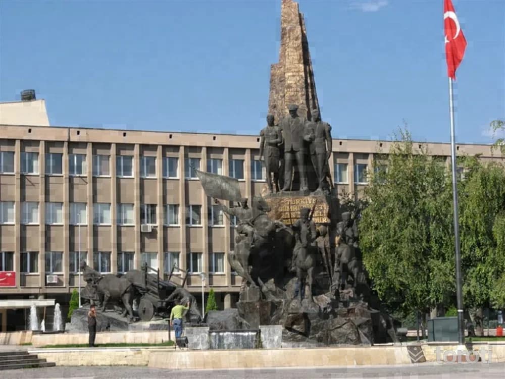
Atatürk Ve Kurtuluş Anıti
Uşak merkez, Uşak
The Atatürk and Liberation Monument is an important statue located in Uşak, symbolizing the freedom of the Turkish nation.
40
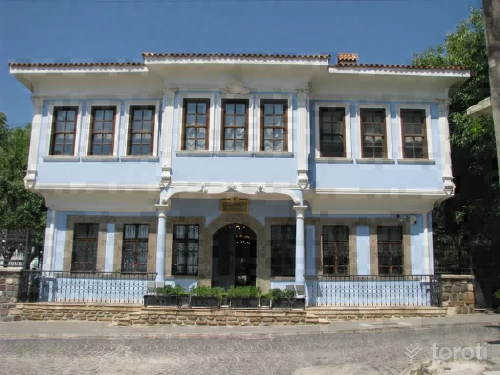
Uşak Atatürk Ve Etnografya Müzesi
Uşak merkez, Uşak
The museum building, opened on 1 September 1978, is an Ottoman-period structure and is the place where the Greek Commander-in-Chief Trikopis was captured after the War of Independence. Although Commander-in-Chief Trikopis was taken prisoner, he was received by Atatürk with Turkish hospitality. On the ground floor of the two-storey wooden building, local ethnographic materials, old weapons, clothes, jewelry and other works are exhibited. The entire upper floor has been arranged as the Atatürk Museum.
41
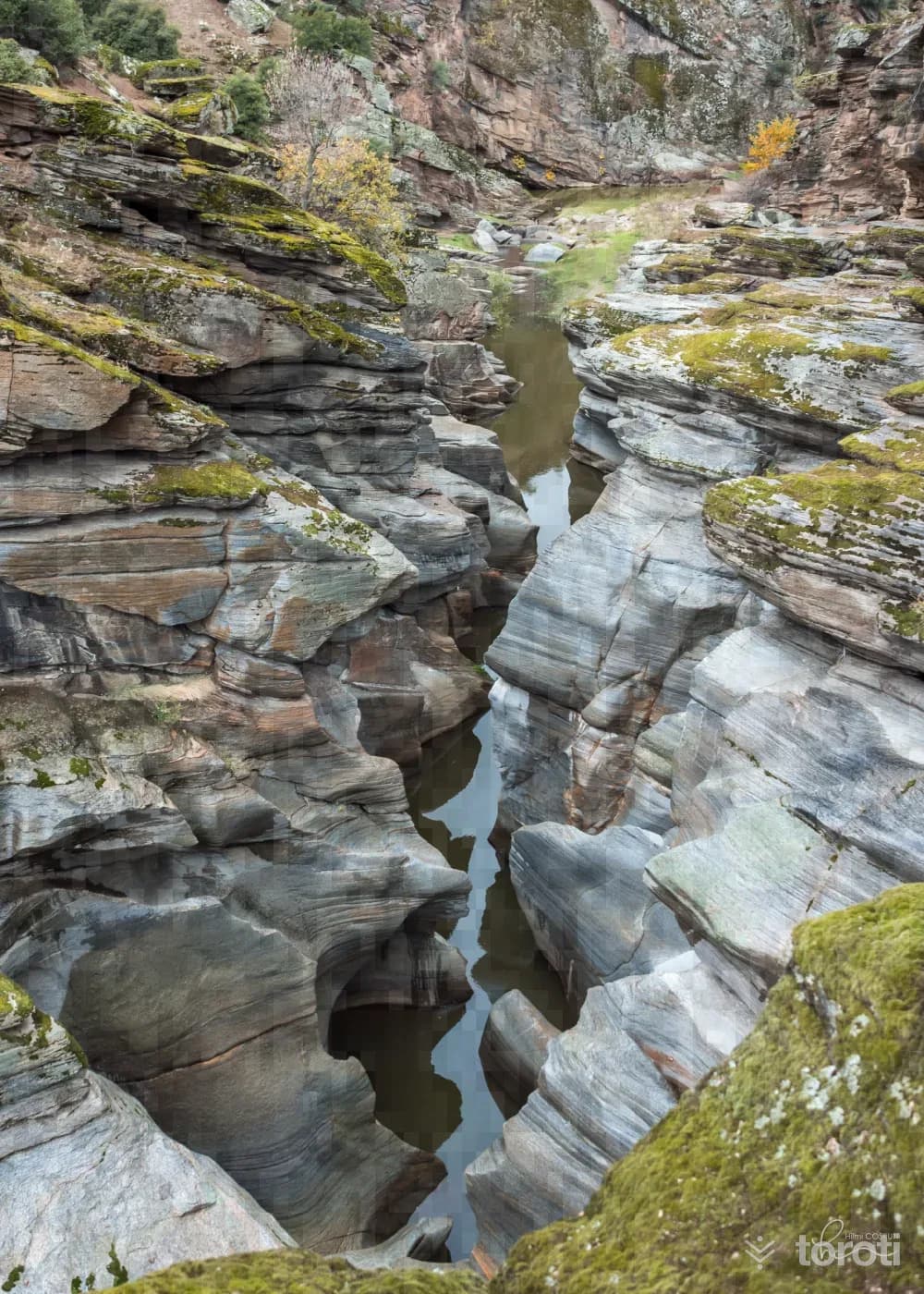
Taşyaran Vadisi
Eşme, Uşak
Taşyaran Valley is a natural beauty located on the Uşak-İzmir highway, known for its interesting geological formations. Its rich vegetation and impressive landscapes attract both domestic and foreign tourists.
42
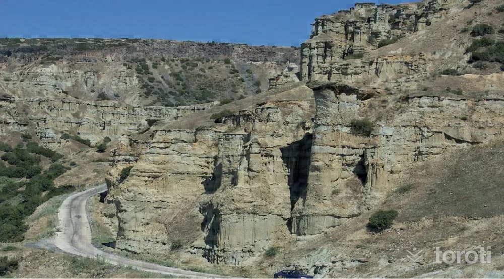
Kula Peri Bacaları
Uşak merkez, Uşak
Kula and its surroundings have a geological structure with volcanic characteristics. In the Burgaz area, in the upper part of the Gediz River, natural formations resembling fairy chimneys, formed by temperature changes, rain, wind and erosion, can be seen. Within the Gediz Valley, they create a magnificent landscape in pastel tones.
43
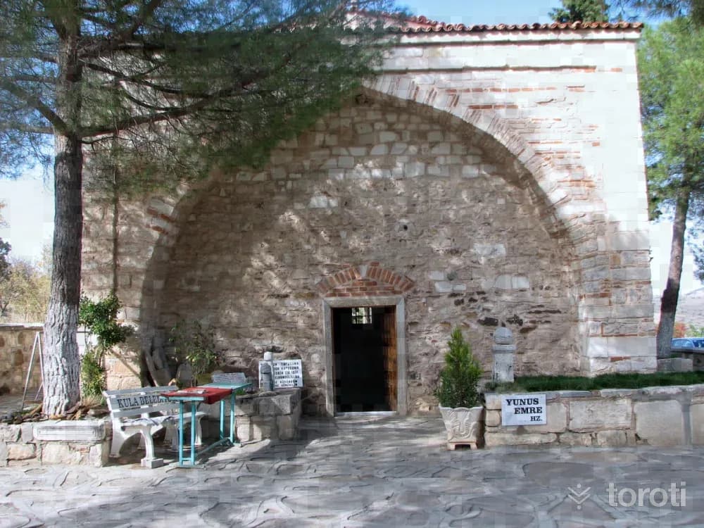
Yunus Emre Ve Tapduk Emre Türbesi
Kula, Manisa
In Emre Village, connected to Kula, a fountain dated to the year H.954, the remains of two baths, and the foundation of a madrasa have survived to the present day. The structure known as Tapduk Emre Tomb bears great similarities in terms of architectural elements to the Saruhan Bey Tomb in Manisa. Inside the tomb, there are ten graves, the one in the middle said to belong to Tapduk Emre and the others to his family members.
44
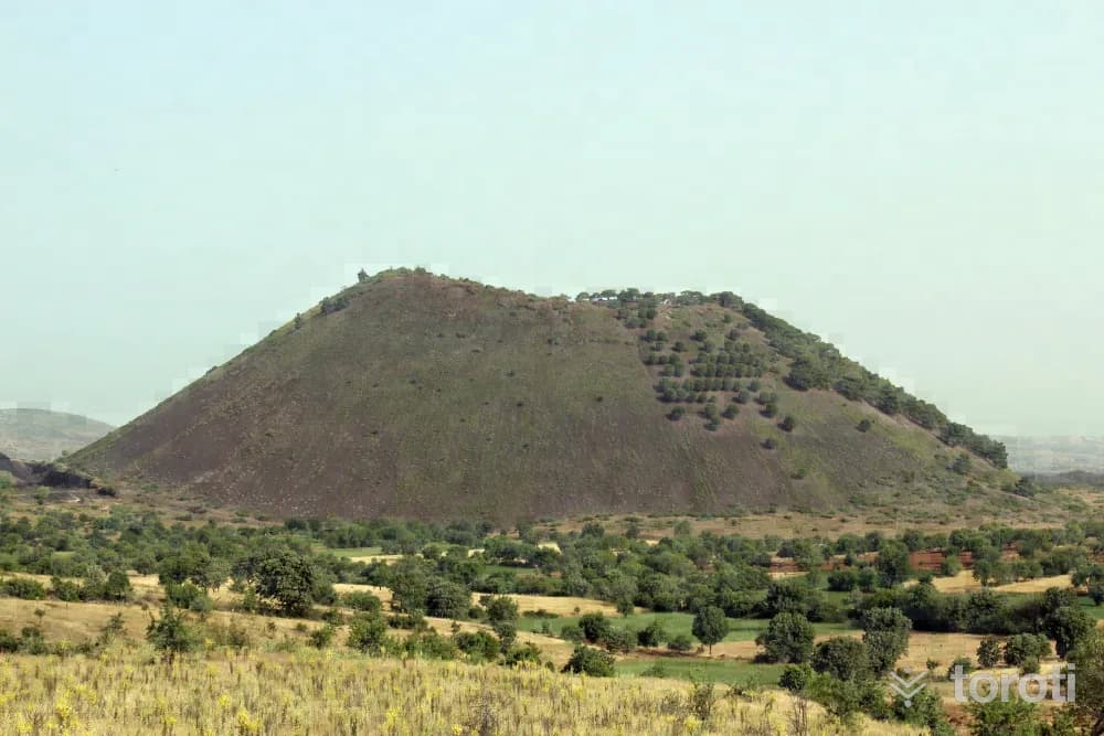
Kula Volkanlari
Kula, Manisa
Where are the Kula Volcanoes? The Kula Volcanoes and their surroundings, located in the Kula district of Manisa, have a geological structure with volcanic characteristics. In the Kula region, volcanic activity continued until the beginning of the Quaternary period and young volcanoes were formed. In this area, where there are extinct small volcanoes, eruptions occurred in various periods and lava flows spread to the surroundings. Because of this characteristic, Kula and its surroundings were called the Burnt Land (Katakekaumene) in history.
- No image
45
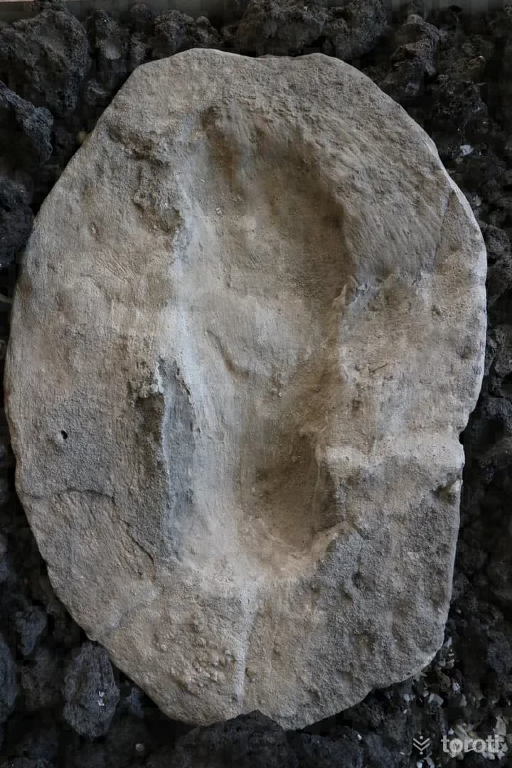
İlk İnsan (Fosil) Ayak İzleri
Salihli, Manisa
The fossil human footprints, determined to be 4 thousand 200 to 4 thousand 500 years old and found during dam construction in Manisa, have been on display for about 1 month at the interactive museum at the entrance of Kula-Salihli UNESCO Global Jeoparkı, Turkey's first and only UNESCO-certified geopark. The footprints are thought to be between sizes 44 and 45 and to belong to a man.
46
İlk İnsan Ayak İzleri
Salihli, Manisa
The First Human Footprints are a historical find located in Salihli, Manisa. The footprints, dating back 26,000 years, were discovered along the banks of the Gediz River.
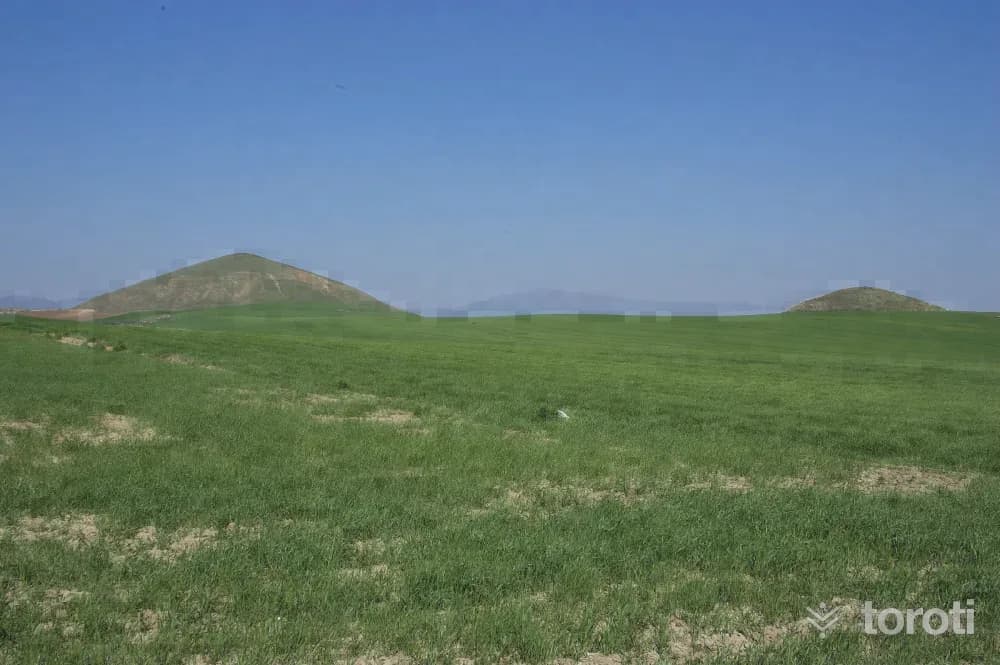
47
Bin Tepeler
Salihli, Manisa
Bin Tepeler, known as the Lydian King's Cemetery, is a historical site containing tombs dating back to the 6th and 5th centuries BC.
48
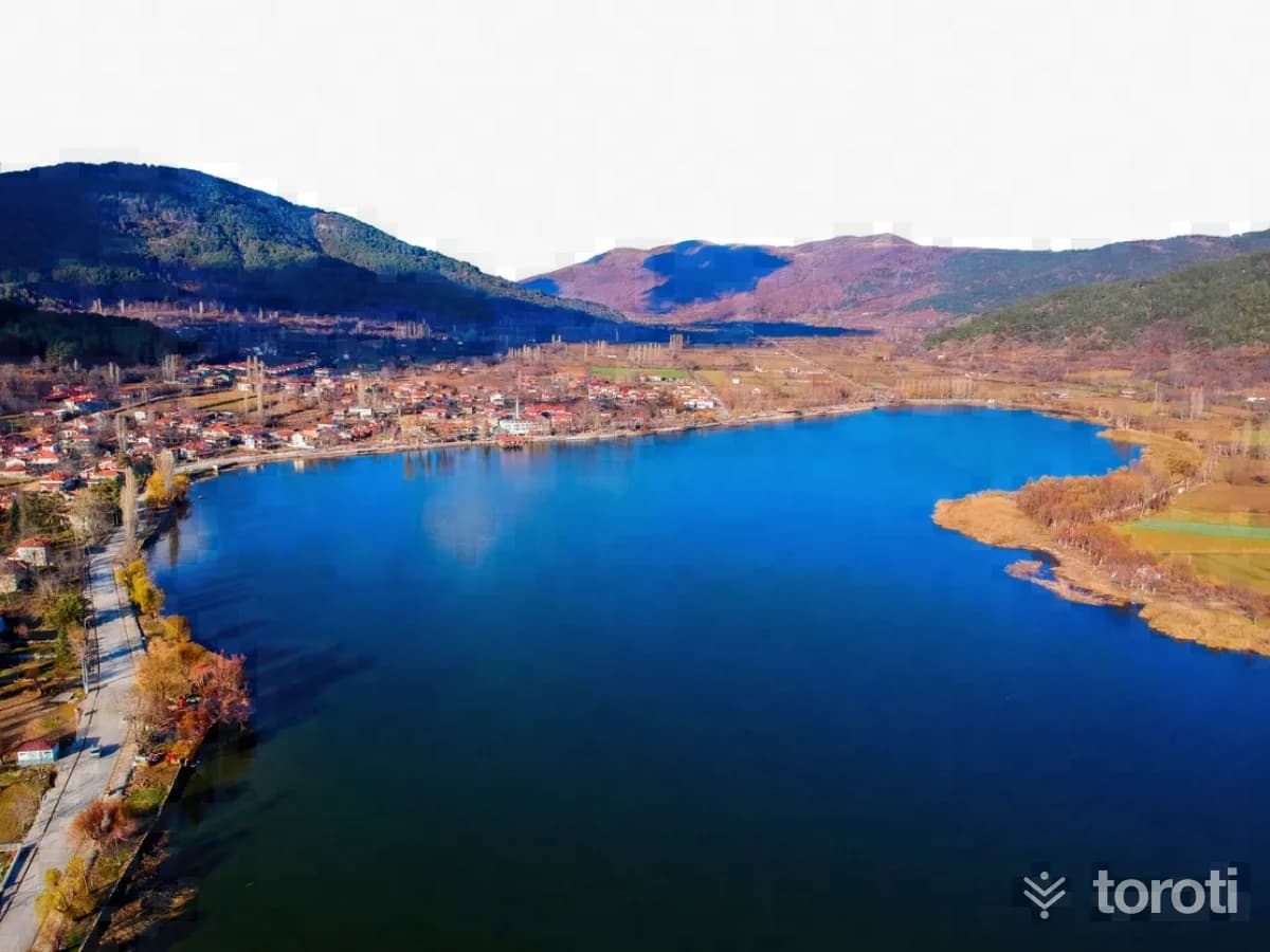
Gölcük Yaylası
Ödemiş, İzmir
Gölcük Plateau is the largest plateau on Bozdağlar and offers suitable areas for eco-tourism.
49
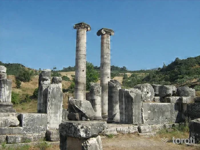
Sardes Antik Kenti
Salihli, Manisa
Sardes Ancient City is located in the Salihli district of Manisa and holds historical significance as the capital of the Lydian State.
- No image
50
Sardes Artemis Tapınağı
Salihli, Manisa
The Sardes Temple of Artemis is a historical structure located in the ancient capital of Lydia, Sart. Built during the Hellenistic period, the temple is notable for its rich history and natural beauty.
51
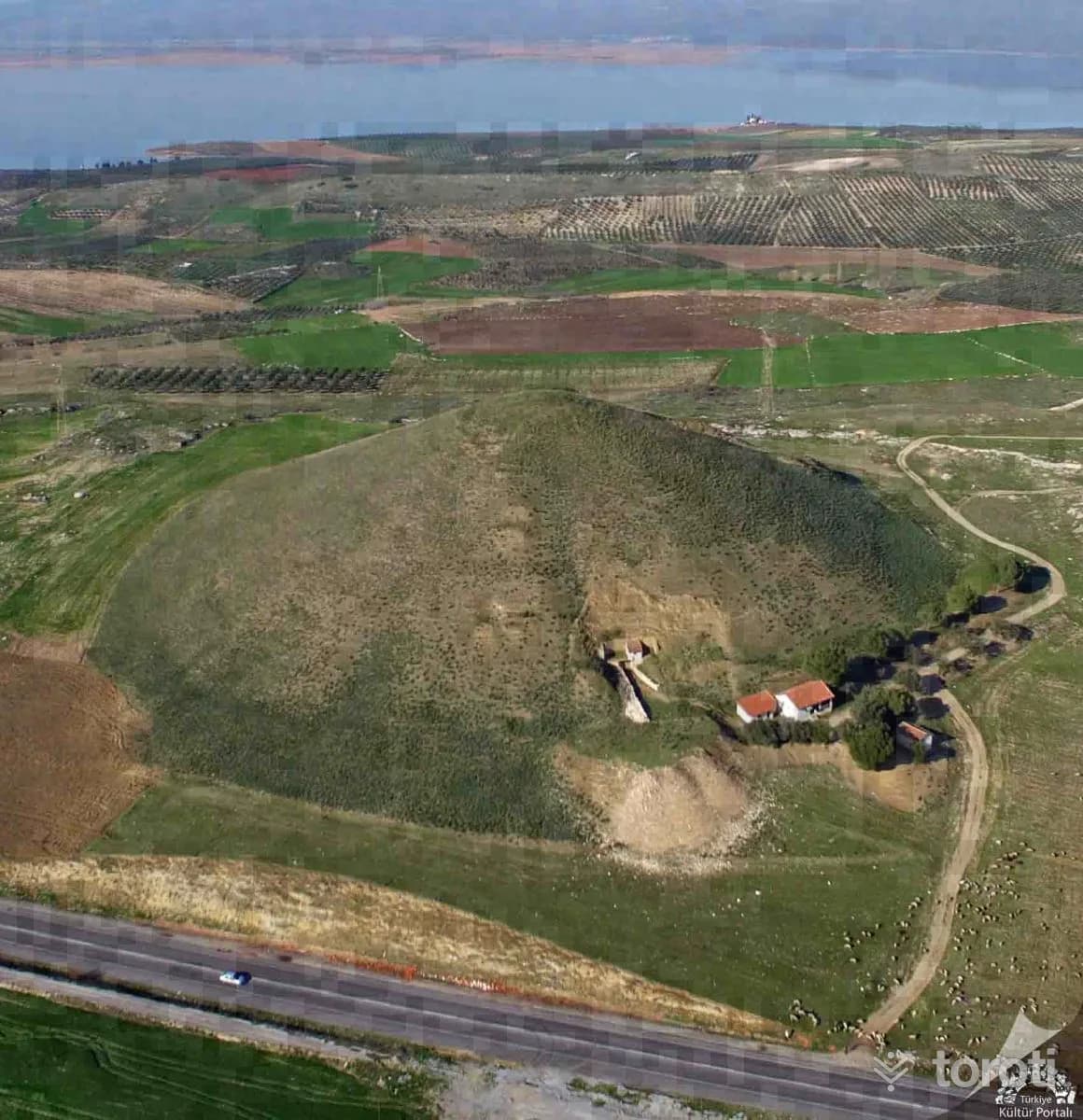
Bin Tepeler Kral Mezarları
Salihli, Manisa
The Bintepeler Royal Tombs were built by the Lydians in the 7th and 6th centuries BC. The largest tumulus, belonging to King Alyattes II, is notable for its impressive size.
- No image
52
Nif Dağı Antik Kazı Alanı
Kemalpaşa, İzmir
The Nif Mountain Archaeological Site, known as Olympos in ancient times, hosts remnants of various cultures.
- No image
53
Çeşnigir Camii
Şehzadeler, Manisa
Çeşnigir Mosque, built in 1474 by Çeşnigir Sinan Bey, who was freed by II. Mehmed, is one of the oldest mosques in the city.
- No image
54
Muradiye Camii ve Külliyesi
Şehzadeler, Manisa
The Muradiye Mosque and Complex was built between 1583-1592 on behalf of Sultan Murad III and is based on a design by Mimar Sinan.
- No image
55
Hisar Camii
Konak, İzmir
Hisar Mosque is the largest and most impressive mosque in Izmir, built in 1592. It features typical characteristics of classical Ottoman architecture.
56
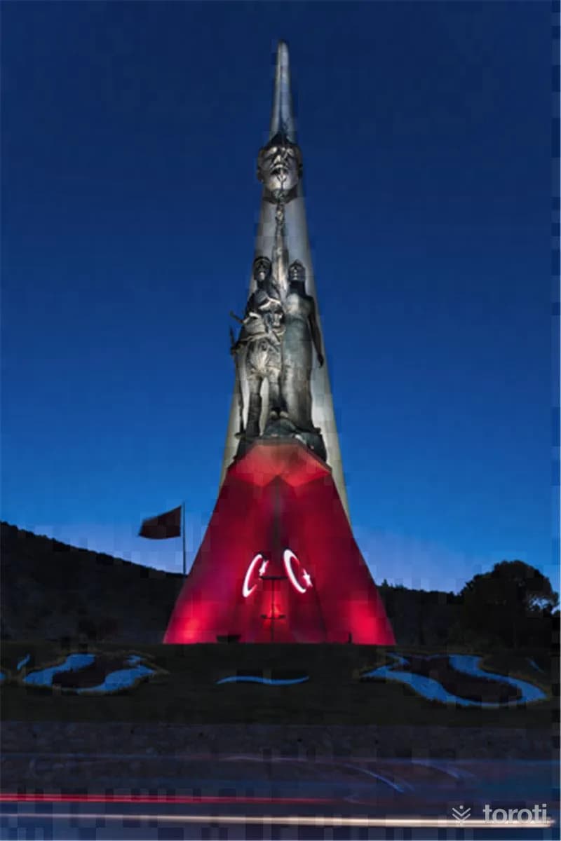
Kuvayı Milliye Anıtı
Yunusemre, Manisa
The Kuvayı Milliye Monument is a composition that elevates Atatürk's revolutions and progressive thoughts alongside the people.
Move the stops into your own plan, split them across days, and add places to sleep and eat.
Frequently asked
- How far is it between Ankara and İzmir, and how long does it take?
- Driving between Ankara and İzmir is roughly 557 kilometres and takes about 7 hours without stops.
- Where is it worth stopping between Ankara and İzmir?
- There are 349 described places within 20 km of the road between Ankara and İzmir. toroti lists 56 of them spread evenly along the drive, in the order you pass them; Hava Kuvvetleri Müzesi comes early on, and Kuvayı Milliye Anıtı sits near the end.
- Which provinces does the Ankara to İzmir route cross?
- The route between Ankara and İzmir crosses Ankara → Eskişehir → Afyonkarahisar → Kütahya → Uşak → Manisa → İzmir. The stretch richest in places to visit is in İzmir.
- Should I take the toll highway or traditional route between Ankara and İzmir?
- Toll motorways save driving time between Ankara and İzmir, whereas traditional state roads pass directly through historic town centers, local culinary stops, and scenic nature viewpoints.
- How should breaks be scheduled between Ankara and İzmir?
- For a drive of around 7 hours, taking a break every 2 to 2.5 hours is recommended. The catalogued attractions in İzmir and neighboring provinces offer memorable stopovers compared to generic highway rest areas.