
Stops along the way
Stops between Ankara and Mersin
638 km, roughly 8 hours of driving. The stops below are ordered as you pass them — the same road in both directions.
In short
The drive between Ankara and Mersin is 638 km and takes roughly 8 hours. There are 437 described places within 20 km of this route; it crosses 7 provinces, and the densest stretch is in Ankara (127 places).
There are 437 places within 20 km of this corridor; the 45 below are spread evenly along the drive.
- No image
1
Türk Hava Kurumu Müzesi
Altındağ, Ankara
This museum was planned with the aim of showing the stages of progress of Turkish Aviation and passing this on to future generations. In the Türk Hava Kurumu Müzesi, built next to the historic parachute tower, in addition to the history section where the firsts of Turkish Aviation are explained, extensive information about THK is also included. This information is supported by historical documents, photographs and various models.
- No image
2
Seğmenler Parkı
Çankaya, Ankara
The park, opened in 1983 in the Kavaklıdere district, has a large amphitheater. The park, located in the valley between Atatürk Bulvarı and İran Caddesi, has a 40 thousand square meter lawn area and a 250 square meter children's playground area, and totals 57 thousand 250 square meters. It contains pools, a children's garden, واسعة walking areas, and the Seymenler Monument, which is the symbol of Ankara folklore.
- No image
3
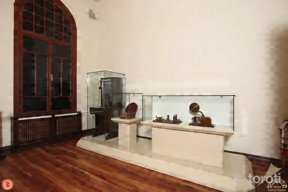
Prof. Dr. Ülker Muncuk Müzesi
Yenimahalle, Ankara
It was established in 1974 within the aforementioned school under the leadership of a group of idealist teachers of the Girls' Technical Higher Teachers' School and Ülker Muncuk. The museum began operating on 02.07.1982 as a private museum under the supervision of the Directorate of the Ethnography Museum.
4
Kurtuluş Savaşı Müzesi
Altındağ, Ankara
War of Independence Museum (First TBMM Building) History of the First Grand National Assembly of Turkey Building The building used as the First Grand National Assembly of Turkey building was constructed in its time as a party building. In 1916, it was decided to build it as the Committee of Union and Progress building. By order of Minister of War Enver Pasha, the building was designed by Architect Salim Bey, and the construction work of the project was assigned to Military Architect Hasip Bey.
5
Atatürk Konutu Ve Demiryollari Müzesi
Altındağ, Ankara
One of the few state buildings in Ankara during the War of Independence, the “Direksiyon Binası” continues to be a living witness to the national struggle. When you visit this building, where important historical decisions were made, you will take a journey through time to the years of struggle and witness the spirit of the years when the Republic was founded.
6
Kesikköprü Baraj Gölü
Bala, Ankara
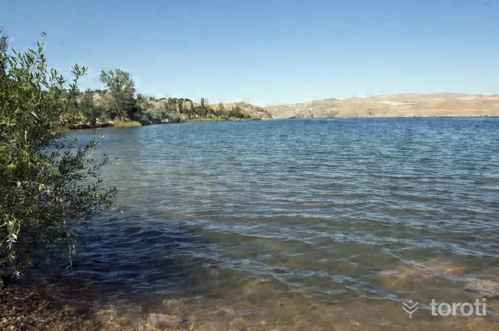
In the reservoir lake, which has a depth of approximately 30 meters, it is possible to swim and do water sports such as surfing, skiing and diving. After passing Gölbaşı, turn toward Bala and follow the direction of the Beynam Ormanları sign to reach the lake. On the lakeshore, there are municipal facilities and a kiosk. It is located approximately 70 kilometers from Ankara.
- No image
7
Tuz Gölü
Şereflikoçhisar, Ankara
Tuz Gölü, Turkey's second largest lake by surface area, is located at the deepest point of a wide tectonic depression buried between the surrounding plateaus. Under less rainy climatic conditions, the lake's surface area has shrunk. The lake, which has become even smaller over time, has reached its present state. 40% of Turkey's salt requirement is supplied from this lake.
8
Öresin(Tepesidelik) Han
Aksaray merkez, Aksaray
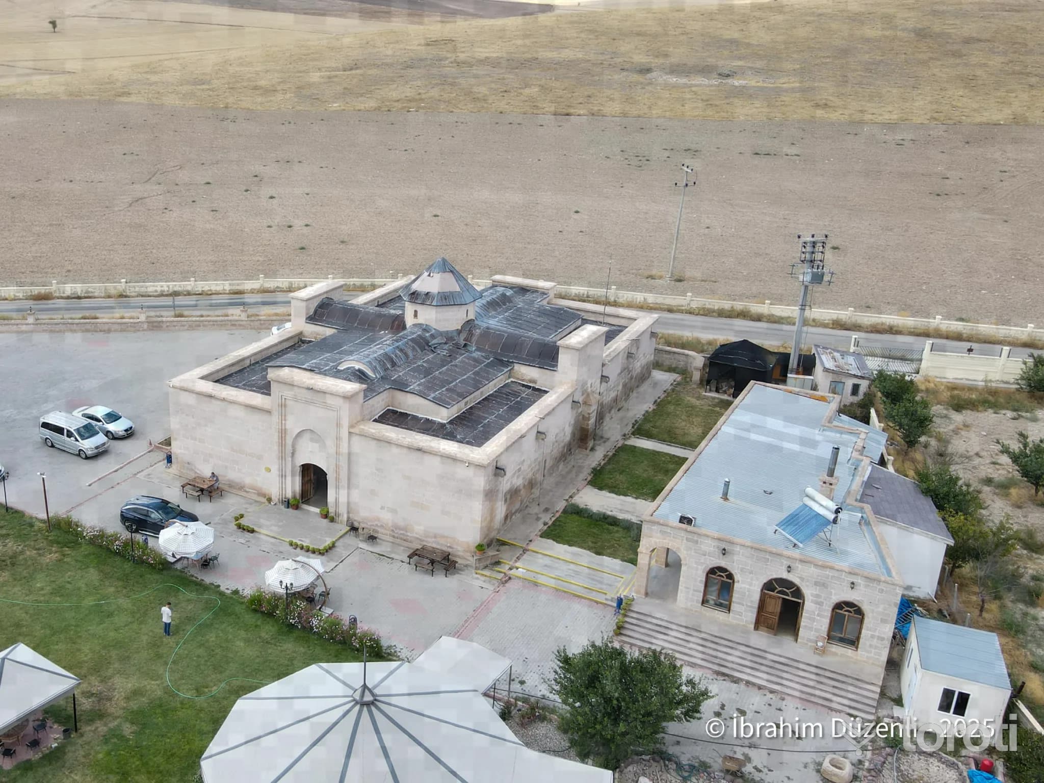
Öresin Han is a historical structure with a ruined facade and entrance. It is believed to be similar to Çay Han.
9
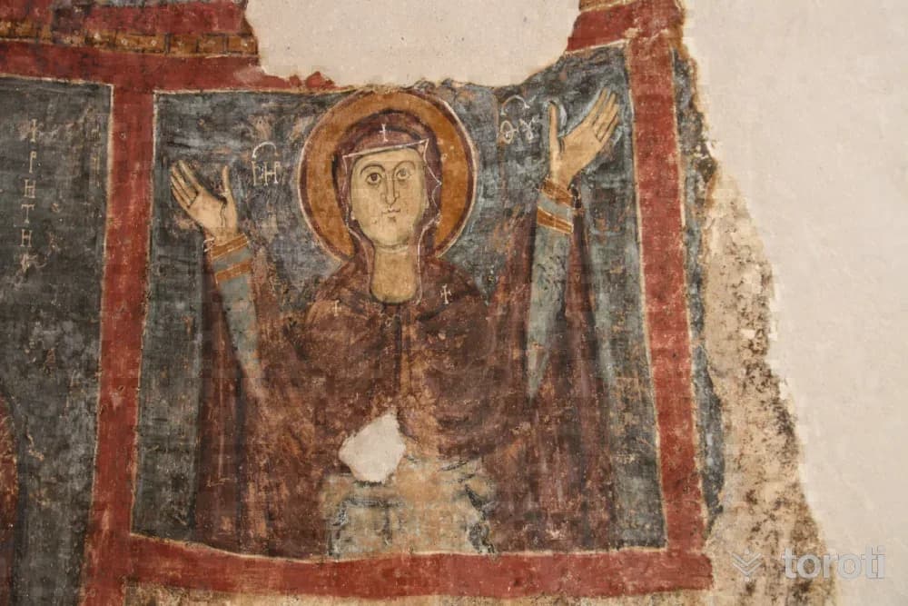
Tatlarin Yer Altı Şehri
Acıgöl, Nevşehir
Tatlarin Underground City is a historical underground settlement located in Acıgöl district of Nevşehir. It was first discovered in 1975 and opened to visitors in 1991.
10
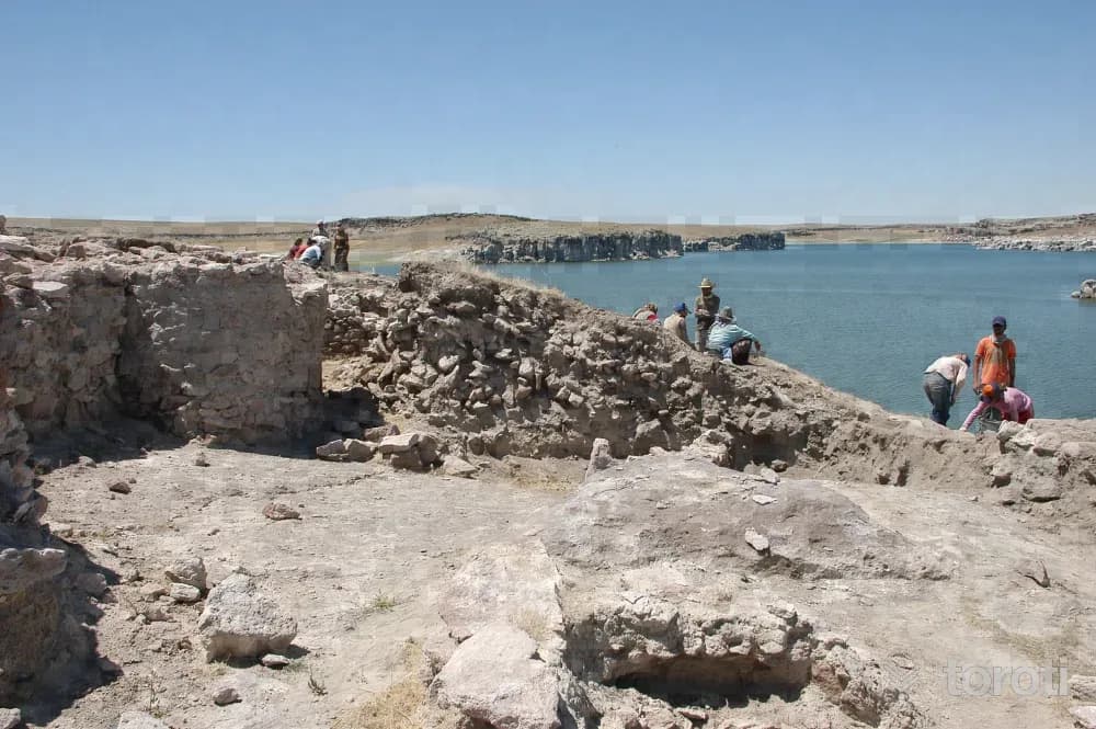
Güvercinkayası
Gülağaç, Aksaray
Güvercinkayası is a pioneer of the castle city model in Anatolia, holding historical significance with its 7,000-year history.
11
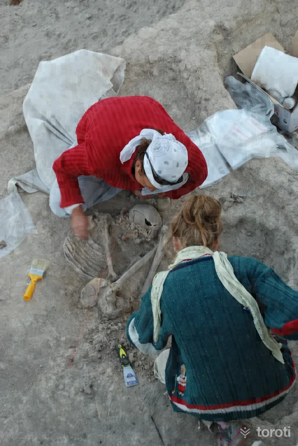
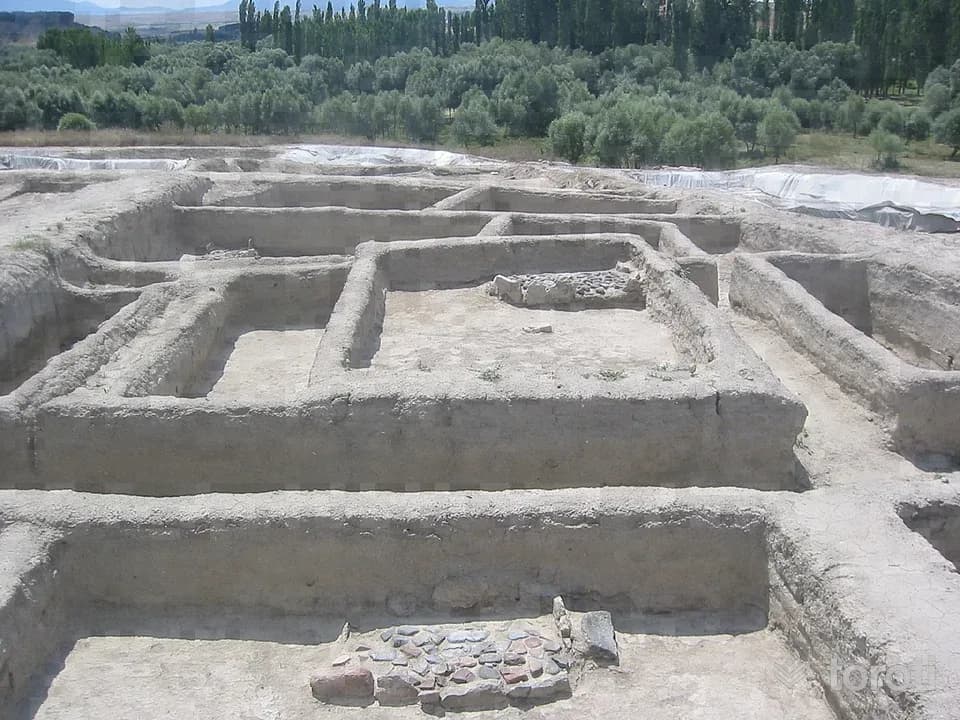
Aşikli Höyük
Gülağaç, Aksaray
Aşıklı Höyük is known as the first village in Central Anatolia, showcasing the transition from a hunter-gatherer society to an agricultural community.
12
Musular Höyük
Gülağaç, Aksaray
Musular Höyük is a historical settlement located south of Kızılkaya Village, containing remains from the Neolithic period.
13
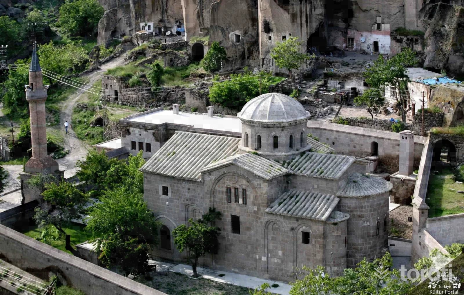
Yüksek Kilise
Güzelyurt, Aksaray
The High Church, located 3 km from Güzelyurt, is a historical structure built on steep rocks.
14
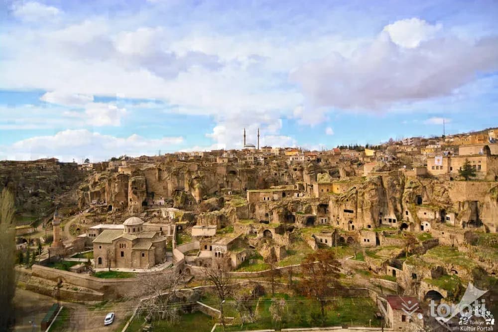
Aksaray Manastir Vadisi
Güzelyurt, Aksaray
Monastery Valley is an important site featuring 28 churches and 2 underground cities, showcasing both historical and natural beauty.
15
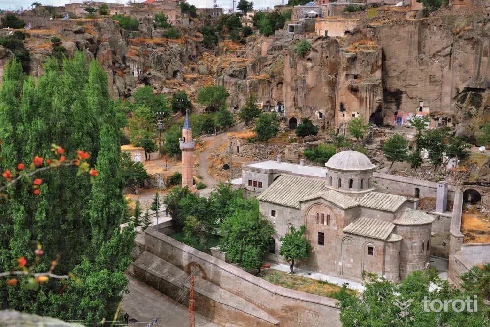
Kilise Cami (aziz Gregorius Kilisesi)
Güzelyurt, Aksaray
The Church Mosque of St. Gregory is an important structure from the early Christian period in Cappadocia. Located in Güzelyurt, this historical mosque holds great architectural and religious significance.
16
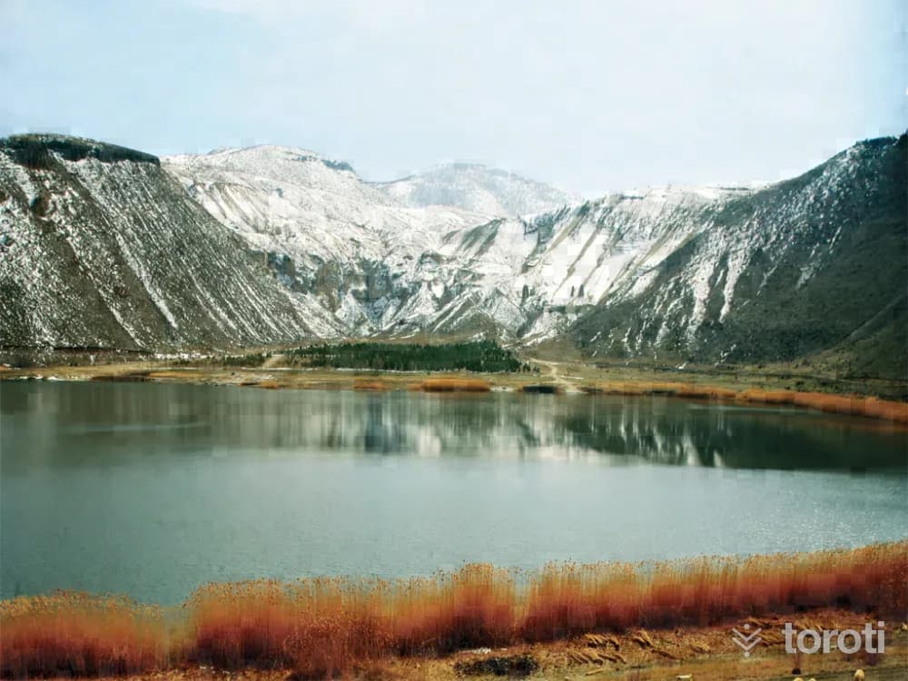
Narli Göl Kaplıcaları
Gülağaç, Aksaray
Narlı Göl Thermal Springs is a natural crater lake with sulfurous water that aids in the treatment of rheumatic and skin diseases.
17
Konakli Rum Kilisesi
Niğde (merkez), Niğde
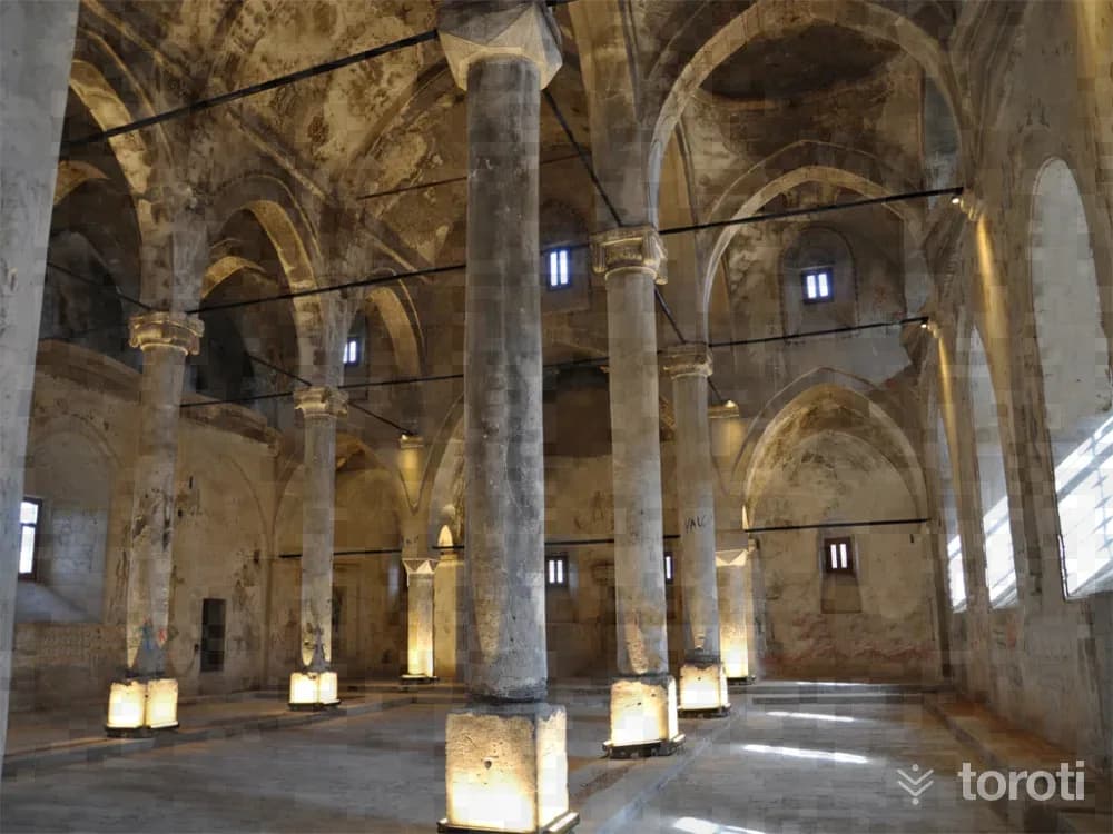
The Konaklı Greek Church is a basilica-plan historical structure made of basalt stone, featuring three naves and various decorative elements in its interior.
- No image
18
Dörtayak Camii ve Türbesi
Niğde (merkez), Niğde
Dörtayak Mosque and Tomb was built in 1312-13 and commissioned by Hüdavend Hatun, the daughter of the Seljuk Sultan Rukneddin Kılıç Aslan IV.
- No image
19
Sungurbey Cami
Niğde (merkez), Niğde
Sungurbey Mosque, believed to be built around 1335, was commissioned by Sungur Bey, the governor of Niğde during the Ilkhanate period.
- No image
20
Köşk Höyük
Bor, Niğde
It shows that the oldest community of the Bor plain engaged in agriculture and animal husbandry (6050–4911 B.C.) settled in this area. The first four layers of the five-layer settlement belong to the Late Neolithic, while the latest layer belongs to the Early Chalcolithic period. There is an architecture consisting of small multi-room spaces expanded according to need during the Neolithic period.
21
Tyana Ören Yeri Ve Su Kemerleri
Bor, Niğde
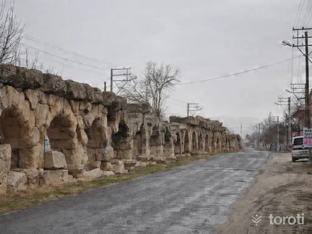
Tyana Ruins and Aqueducts The ancient ruins of Tyana are in Kemerhisar Town of Bor district. The ruins remain under a large part of the town. Important sculptural works found in various conditions in different parts of the town, and the works and architectural pieces uncovered as a result of the scientific excavations carried out at the ruins, are exhibited in Niğde Museum.
22
Ulukişla Mehmet Paşa Külliyesi
Ulukisla, Niğde
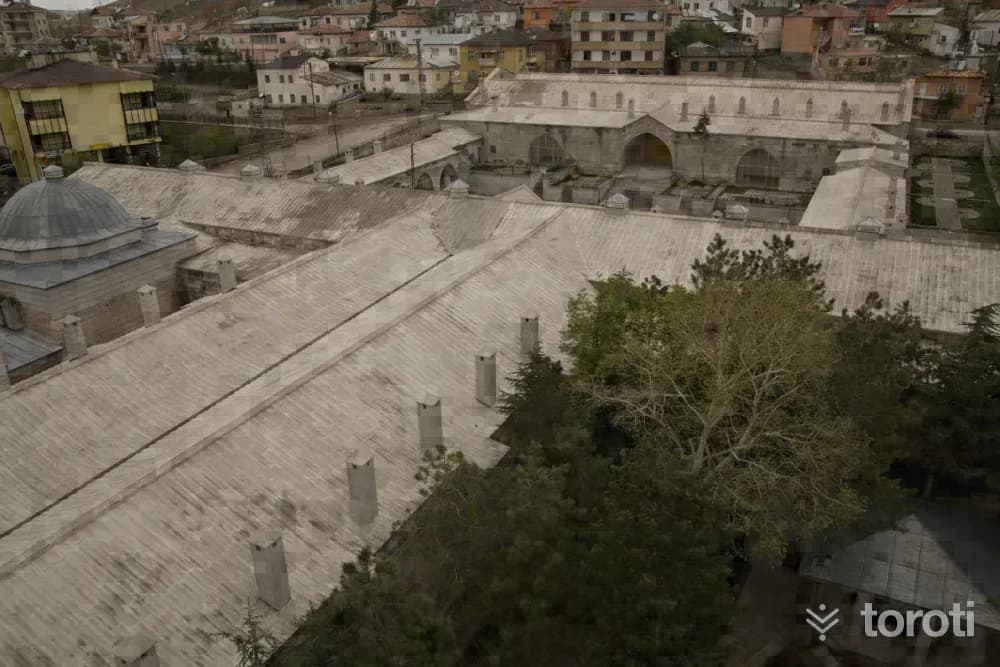
The Grand Vizier Mehmet Paşa Caravanserai, known as the largest caravanserai in our country, is in Ulukışla.
23
Çiftehan Kaplıcaları
Ulukisla, Niğde
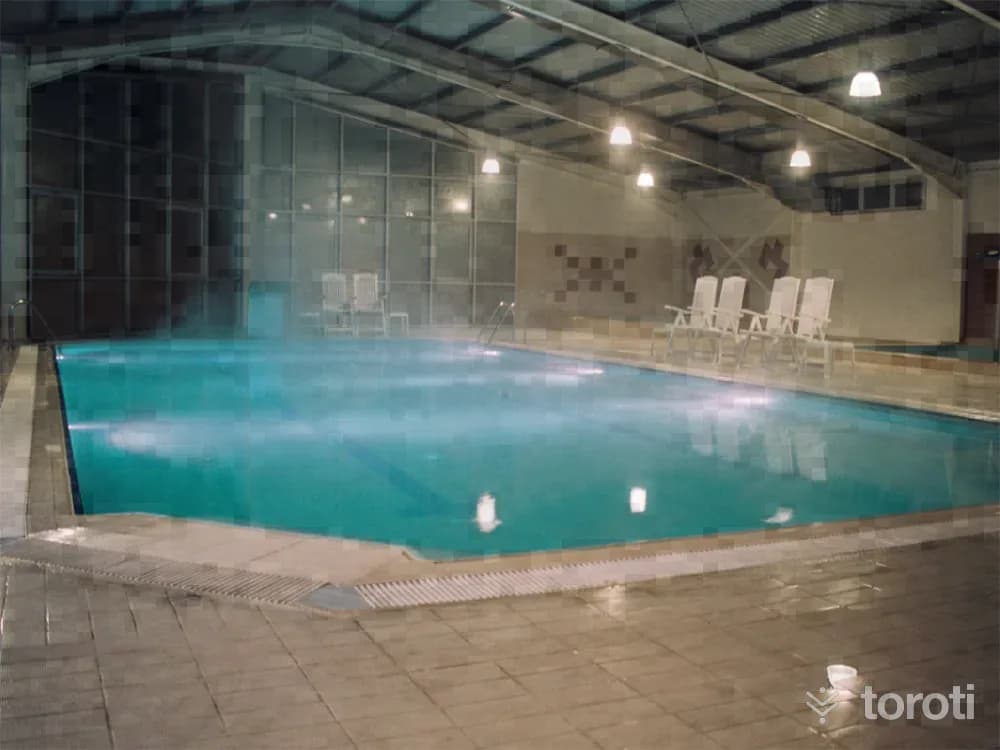
ÇİFTEHAN THERMAL SPRINGS: It is located in the town of Çiftehan in the district of Ulukışla, 80 km from Niğde. The thermal spring waters, which are suitable for both bathing and drinking, have positive effects on ailments such as rheumatism, nervous disorders, skin diseases, women's diseases, and nutritional disorders. The facilities in the thermal spring center are modern and have a large capacity. The town's location on the Ankara-Adana Road makes transportation quite easy.
- No image
24
Pozanti-belemedik Yaylası
Pozantı, Adana
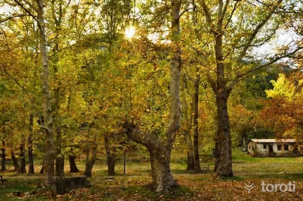
The plateau, located 10 kilometers from Pozantı, is reached by a stabilized road passing through Anbaş Village. It is established on the bank of the Çakıt Stream, and accommodation is provided in the region’s plateau houses made of stone and wood. On the plateau, which is rich in wildlife, wild goats, wild boars, and birds of prey can be observed.
25
Yaban Hayati Gözlemciliği - Belemedik Yaylası
Pozantı, Adana
Belemedik Plateau can be reached from Pozantı via a 10-kilometer stabilized road passing through Anbaş Village. On the plateau, established on the banks of the Çakıt Stream, there are plateau houses made of wood and stone. On the plateau, which is rich in wildlife, wild goats, wild boars and birds of prey can be observed. Belemedik Train Station and the buildings around it were built during the period when the Berlin‐Baghdad railway line was constructed.
26
İbrahim Paşa Tabyaları
Tarsus, Mersin
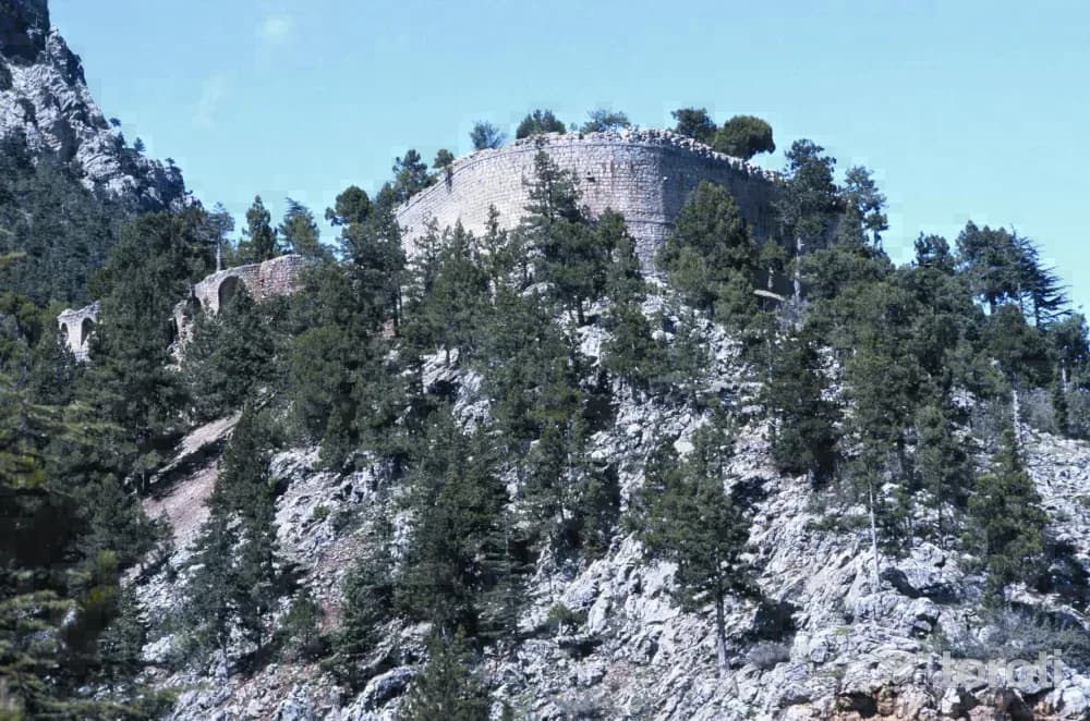
İbrahim Paşa Tabyaları is one of the quite solid structures from the Ottoman Period, of which there are very few in the region. It was commissioned by İbrahim Paşa around the 1830s to resist attacks coming from the east. While proceeding on the motorway in the direction of Tarsus Pozantı, before reaching the Tekir (Akçatekir) Yaylası area of Adana, a structure can be seen on the high hill to the left of the road. This structure is called Kızıl Tabya (Büyük or Fenerli Tabya).
27
Karboğazi Kuvayi Milliye Anıti
Tarsus, Mersin
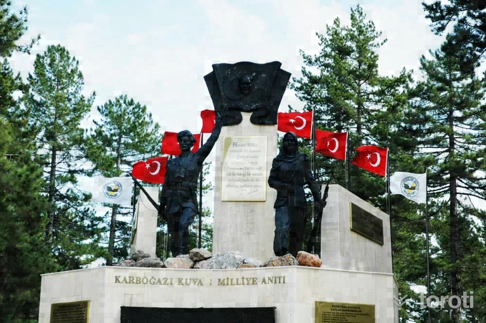
The French forces stranded in Pozantı were being harassed every day in Pozantı by the Kuvayi Milliye militias. For this reason, realizing that they would not be able to hold on in Pozantı, the French wanted to break out of the blockade in Pozantı and go to Mersin by passing through the Namrun and Gözne highlands.
- No image
28
Kadıncik Vadisi
Çamlıyayla, Mersin
It has an area of 8776 hectares. Access is by turning right at the junction when about 6 km from Çamlıyayla District and entering the valley. There is a natural trout production facility within the valley. The natural trout produced here are later released into the streams in order to enrich them. In the 2011 inventory, 491 wild goats were identified. Protection is carried out by the Olukkoyağı Village Legal Entity.
- No image
29
Namrun Kalesi
Çamlıyayla, Mersin
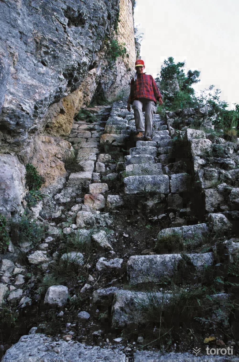
Namrun, which dates to the Middle Ages and is one of the most famous castles in the region, is in the Çamlıyayla district center. It was known as “Illibru” during the Hittite and Assyrian Periods. The defensive castle, built on a high hill, is reached by a ruined staircase. Namrun’s strategic importance lies in its role in protecting the Cilician Gates above Gülek Kalesi. The Hetums ruled in Namrun for a long time.
- No image
30
Sağlikli Köyü, Roma Yolu Ve Tarsus Parkuru
Tarsus, Mersin
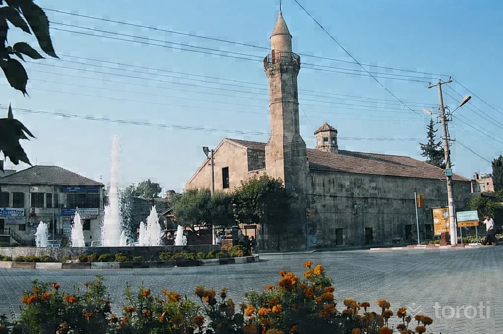
Near Sağlıklı Köyü to the north of Tarsus, the broad and impressive road is entered from beneath a Roman Arch. The road crosses the Taurus Mountains south-north and descends to İvriz. It is thought that St. Paul went to Derbe by this road on his 2nd journey. The route is a route with 3 tented overnight stays.
31
Tarsus Eski Camii
Tarsus, Mersin
It is said that the church-based structure in Çarşıbaşı was built in 1102 as St. Paul Cathedral. It is noteworthy for its thick and high walls in the Roman style, its spacious interior, its narrow outward-facing side, its deep windows, and its thick columns.
- No image
32
Gözlükule Höyük
Tarsus, Mersin
The mound in the district center of Tarsus consists of two hills. The presence of a watchtower on the mound in the Middle Ages must have led to the name Gözlükule. Obsidian tools and fragments of baked clay vessels belonging to the Neolithic Period have been uncovered. Houses with mudbrick walls on simple stone foundations and narrow streets have been revealed.
33
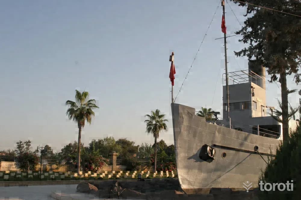
Nusrat Mayin Gemisi
Tarsus, Mersin
The mines laid by Nusrat changed the fate of the Battle of Çanakkale on 18 March 1915, earning it the title of "the world's most famous minelayer." With its crew of 639, Nusrat's mines sent the battleships Bouvet, followed by Inflexible and Bolva, to the bottom.
34
Paperon Kalesi - Çandir Kalesi
Toroslar, Mersin
This castle is the richest in architectural terms and the most complex historically among the Armenian castles. However, the history of the castle goes back further than the Armenians. It is suggested that this place may be the Byzantine castle Papirion or Papurion. In the middle of the 14th century, it was occupied for a short time by the Karamanoğulları, and at the end of the 14th century it passed into the hands of the Mamluks. The important feature of the castle is its gate.
- No image
35
Soğucak Yaylası
Toroslar, Mersin
It is reached by a 1 km asphalt road branching off at the 23rd km of the Gözne road. In Soğucak Town, which is a plateau village, there are also summer houses belonging to the people of Mersin. Its infrastructure has been completed, and PTT and a Health Center provide services on the plateau. The country restaurants and country coffeehouses in the surrounding area do not have touristic characteristics. The area around the plateau is covered with maquis and rocks.
- No image
36
Kepirli Yaylası
Toroslar, Mersin
The plateau, connected to Mersin by a 23 km asphalt road, is at an altitude of 950 m. Passenger transportation is provided from Mersin to Kepirli. Around the plateau there are pine, juniper, oak and maquis forests, as well as various fruit orchards. Infrastructure services such as electricity and water are available on the plateau.
37
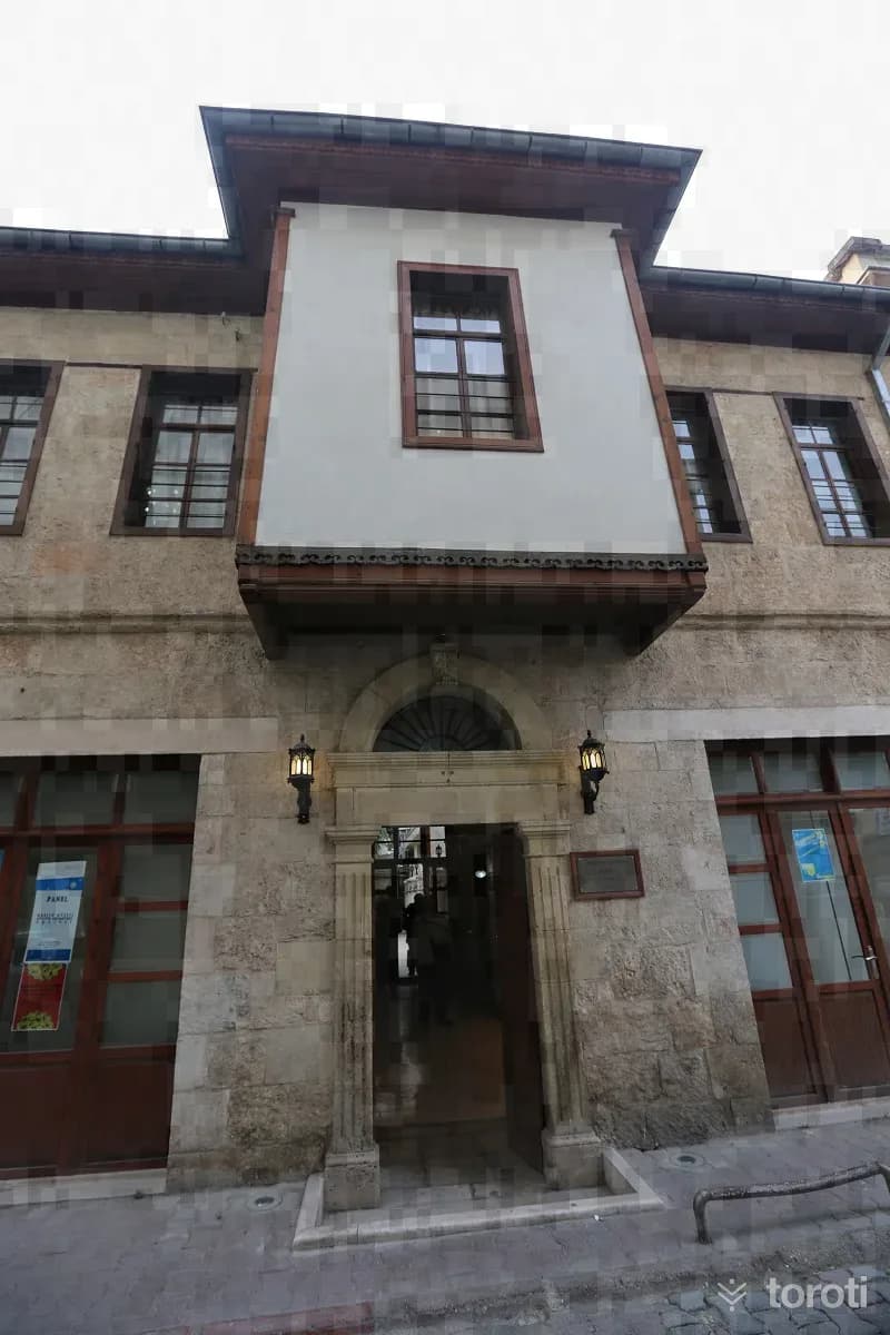
Mustafa Erim Mersin Kent Tarihi Müzesi
Akdeniz, Mersin
The "City History Museum," which brings a new color and breath to Mersin's cultural life, is an example of nearly 150-year-old civil architecture. It was restored and arranged for exhibition by Mustafa ERİM and brought into Mersin's cultural and artistic life. Mersin was also affected by the rapid change seen in all our cities in the second half of the 20th century, and very few of these examples of traditional civil architecture have survived to the present day.
- No image
38
Lamas Kanyonu
Erdemli, Mersin
It is a canyon with steep walls on both sides. The Lamas Stream flows through the middle. The stream flows among various vegetation and vines, forming waterfalls. On the left wall of the canyon, you can see carved channels that once carried water to the city of Korykos. A footpath extends along the canyon. In the summer months, it is possible to swim in the stream. You can walk as much as you like in the canyon.
39
Kanli Divane Ören Yeri
Erdemli, Mersin
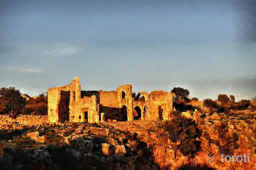
Kanytella, which was within the borders of Rough Cilicia in the Ancient Period and is known today as Kanlı Divane, is located approximately 50 km from Mersin and 13 km west of Erdemli District. It is reached by a 3 km road turning north from Kumkuyu Yemişkumu Mahallesi. The ancient settlement of Kanlı Divane was established around a large sinkhole at its center, called the Kanlı Divane Obruğu.
- No image
40
Prensesin Ayak İzleri Parkuru
Silifke, Mersin
It is a route carried out among ancient cities and ruins approximately 40 km long between Silifke Uzuncaburç and Kızkalesi. On the route starting from Uzuncaburç, the Uğuralanı-Cambazlı stage is 16 km, the Cambazlı-Hüseyinler stage is 12 km, and the Hüseyinler-Kızkalesi stage is 12 km. On the route organized in the ancient areas where the life and reign of Olba Queen Aba took place, the walk can be organized as 3 or 4 days.
- No image
41
Karakizderesi Parkuru
Erdemli, Mersin
The route, located at an altitude of 1700, is one of the suitable routes for winter tourism due to snowfall in the winter months. Within the route area is Karakızderesi Pond, one of the ideal places for angling and water sports. The route is approximately 30 km north of Erdemli Merkez district and within the boundaries of Karahıdırlı Village.
- No image
42
Tapureli Antik Kenti
Erdemli, Mersin
The ruins, whose history goes back to the Hellenistic Period, are difficult to visit as they are covered by shrubs and trees. Houses are lined up at close intervals on part of the slope. It is possible to come across tomb structures belonging to the Roman Period. The necropolis area is on the southern slope. Sarcophagi and burial chambers are among the types of tombs located within this necropolis area.
- No image
43
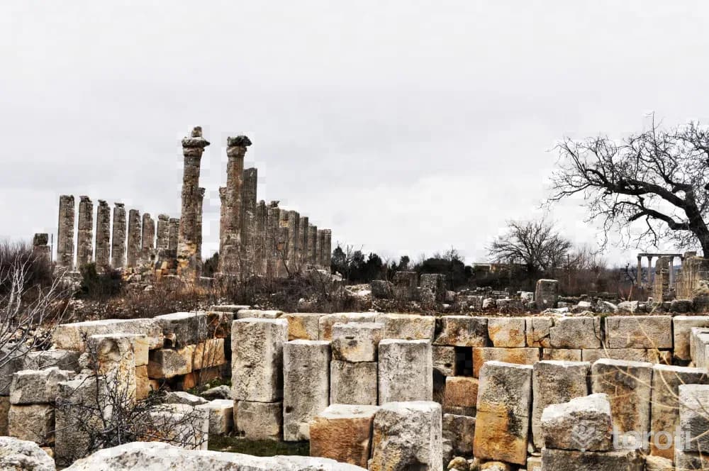
Diokaisareia Antik Kenti
Silifke, Mersin
In the Hellenistic Period, the present-day settlement of Uzuncaburç, which was the place of worship of the Olba Territorium located 4 km. east of central Uzuncaburç, was separated from Olba in the Roman Period, in 72 during the time of Emperor Vespasianus, and became an autonomous city minting coins in its own name under the name Diokaesareia (City of the God-Emperor).
44
Uzuncaburç Yaylası
Silifke, Mersin
The town, located 27 km north of the district of Silifke, is accessible by asphalt road. Minibuses can be found from Silifke. The town, which was established on the ancient city of Olba Diokayzerim, lives intertwined with history. Country coffeehouses, country restaurants, grocery stores, PTT, Health Center, and Gendarmerie provide services. It is possible to meet basic needs in the town.
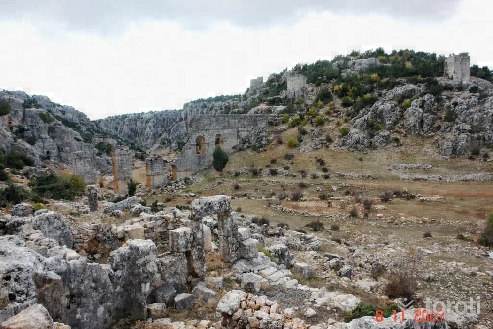
45
Olba Antik Kenti
Silifke, Mersin
It was the center of the Kingdom of Olba and an important trading city in the Hellenistic Period. Olba was also an important religious center. Especially during the Christian period, this is evident not only in written sources but also in the remains of religious architecture.
Move the stops into your own plan, split them across days, and add places to sleep and eat.
Frequently asked
- How far is it between Ankara and Mersin, and how long does it take?
- Driving between Ankara and Mersin is roughly 638 kilometres and takes about 8 hours without stops.
- Where is it worth stopping between Ankara and Mersin?
- There are 437 described places within 20 km of the road between Ankara and Mersin. toroti lists 45 of them spread evenly along the drive, in the order you pass them; Türk Hava Kurumu Müzesi comes early on, and Olba Antik Kenti sits near the end.
- Which provinces does the Ankara to Mersin route cross?
- The route between Ankara and Mersin crosses Ankara → Kırşehir → Aksaray → Nevşehir → Niğde → Adana → Mersin. The stretch richest in places to visit is in Ankara.
- Should I take the toll highway or traditional route between Ankara and Mersin?
- Toll motorways save driving time between Ankara and Mersin, whereas traditional state roads pass directly through historic town centers, local culinary stops, and scenic nature viewpoints.
- How should breaks be scheduled between Ankara and Mersin?
- For a drive of around 8 hours, taking a break every 2 to 2.5 hours is recommended. The catalogued attractions in Ankara and neighboring provinces offer memorable stopovers compared to generic highway rest areas.