
Stops along the way
Stops between Ankara and Muğla
582 km, roughly 7 hours of driving. The stops below are ordered as you pass them — the same road in both directions.
In short
The drive between Ankara and Muğla is 582 km and takes roughly 7 hours. There are 346 described places within 20 km of this route; it crosses 6 provinces, and the densest stretch is in Denizli (71 places).
There are 346 places within 20 km of this corridor; the 59 below are spread evenly along the drive.
1
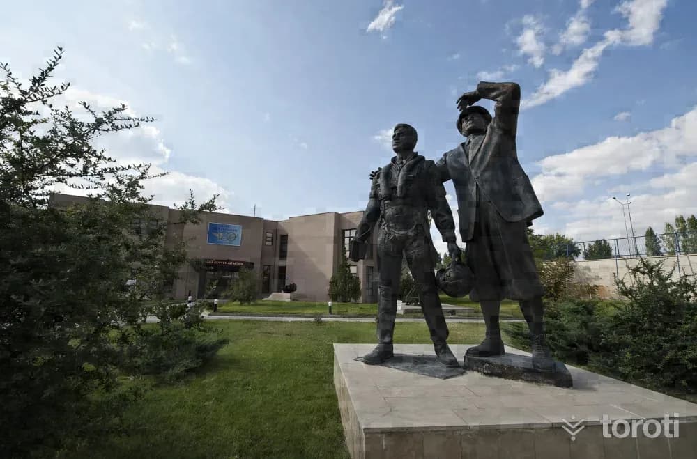
Hava Kuvvetleri Müzesi
Etimesgut, Ankara
The Air Force Museum is located in Şaşmaz Mevkii, established at the 12th kilometre of İstanbul Yolu. The museum, which entered service on 18 September 1998, was officially opened by Mustafa Kemal Atatürk’s adopted daughter, our country’s first female pilot, Sabiha Gökçen.

2
Türkiye Eğitim Derneği Ankara Koleji Okul Müzesi
Gölbaşı, Ankara
TED Ankara College School Museum, which conveys the historical accumulation of TED Ankara College Foundation Schools from its founding year of 1931 to the present day to future generations, is located on the ground floor of the administrative building on the İncek campus. The museum, which opened on 21 May 2008, has been granted the status of “Private Museum” by the Ministry of Culture and Tourism.
3
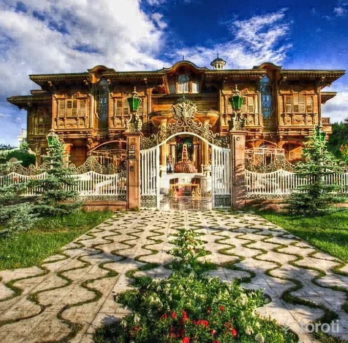
Anadolu Mimarlik Ve Mobilya Kültürel Miras Müzesi Ve Araştirma Merkezi
Çankaya, Ankara
Anadolu Architecture and Furniture Cultural Heritage Museum and Research Center, the first architecture and furniture museum in our country, was opened on 25 December 2008. It is in Merik Mansion on Lodumlu Doğramacı Caddesi. It is Bilkent’s famous Merik Mansion or, as it is popularly known, the “Golden Mansion”.
4
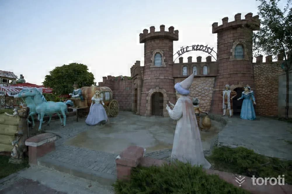
Harikalar Diyari
Sincan, Ankara
Within Harikalar Diyarı, which is planned with approximately 771 thousand square meters of green area, 330 thousand square meters of roads and squares, 40 thousand square meters of parking area, 67 thousand square meters of building area, and 92 thousand square meters of water areas, there is also a Fairy Tale Island established in an area of 25 thousand square meters for children.
5
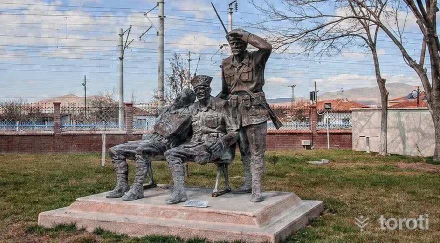
Tcdd Maliköy Tren İstasyonu Müzesi
Sincan, Ankara
Malıköy, located on the Ankara-Eskişehir railway line, is a settlement center connected to the Polatlı district. The Malıköy station located here is a very important station that affected the fate of the nation in this region where the Battle of Sakarya took place.
6
Topçu Ve Füze Okulu Sinif Müzesi
Polatlı, Ankara
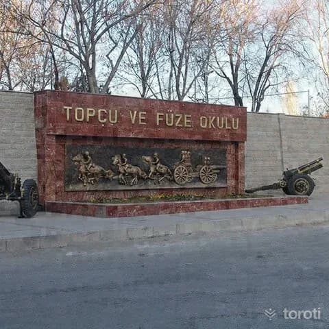
The Topçu ve Füze Okulu Sınıf Müzesi, established with the aim of reflecting the social, cultural and technical development of the artillery class according to periods, conducting scientific research on military cultural assets that will shed light on our military history, and passing on our history and culture to future generations, was completed and opened to service in April 1973. The museum consists of three main sections: the museum garden, the museum section and the Şeref Salonu.
7
Mehmetçik Anıti
Polatlı, Ankara
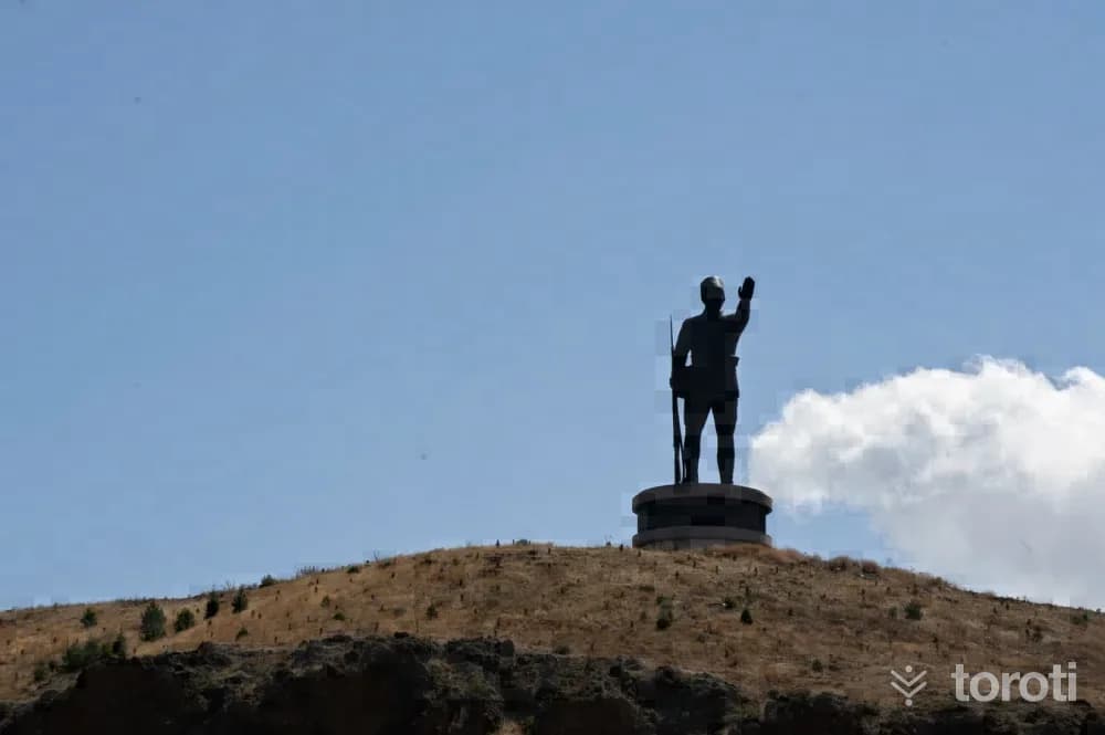
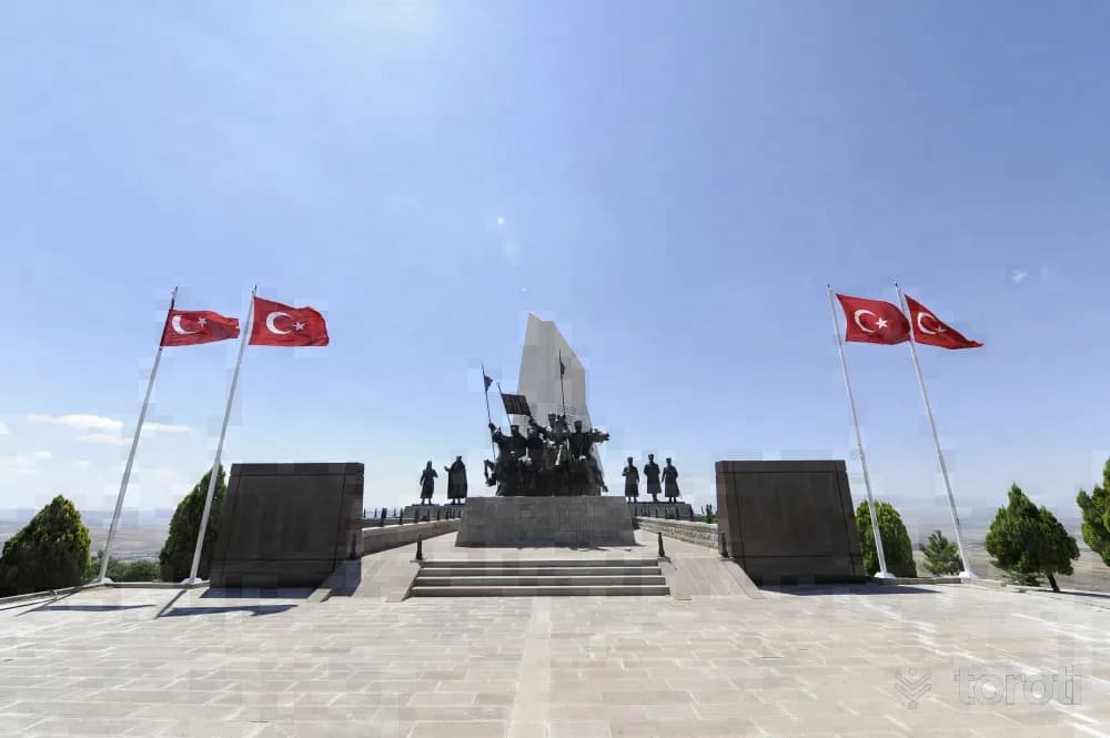
The Sakarya Victory Mehmetçik Monument, Kartal Tepe Mehmetçik monument, rises by the E–90 highway 6 kilometers west of Polatlı District. Although it fell into enemy hands from 31 August 1921 to 12 September 1921, this was an area where the enemy's advance was prevented by bayonet charges. The Mehmetçik monument was made by sculptor Associate Professor Dr. Sait Rüstem. Including its pedestal, it has a total height of 32 meters, and the monument itself is 22 meters.
8
Duatepe Anıti
Polatlı, Ankara
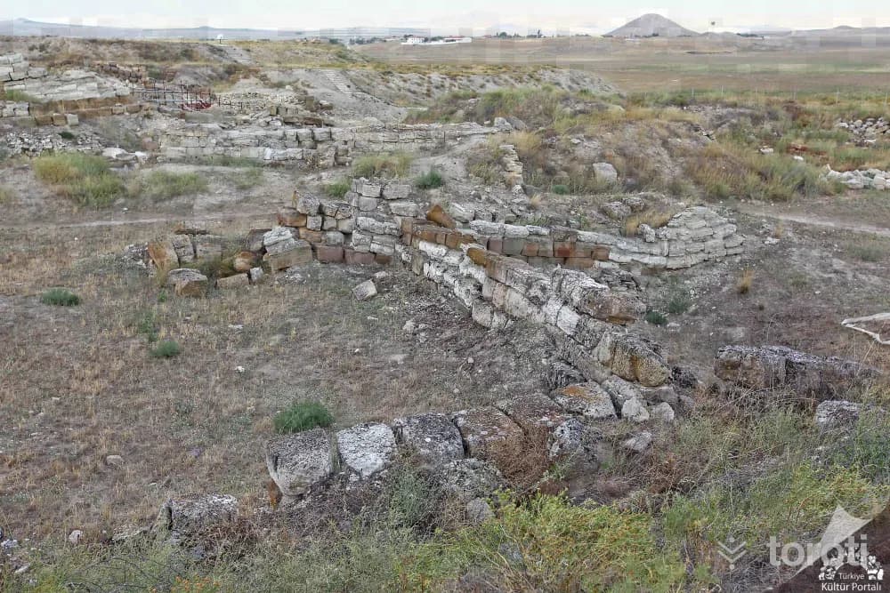
Duatepe Monument was created by afforesting Gazi Tepe, Türbe Tepe and Mangal Dağı on the last defense line where the Battle of Sakarya, considered the turning point of the War of Independence, was fought. Work began at Duatepe in October 1999, 20 thousand trees were planted, and the monument was completed and opened on 12 September 2000. Polatlı, Duatepe Monument consists of five parts: parking lot, access road, walking path, ceremony area and monument.
9
Gordion Antik Kenti
Polatlı, Ankara
Gordion Ancient City, one of the most important archaeological sites of Anatolia, was inscribed on the World Heritage List by UNESCO in 2023. Servet Uygun Gordion Ancient City is located in the Central Anatolia Region, approximately 90 kilometers southwest of Ankara city center and approximately 18 kilometers northwest of Polatlı district, in the Yassıhöyük neighborhood. Over a long period of 4500 years, settlement in and around Gordion was interrupted very little.
10
Hamamkarahisar Cami
Günyüzü, Eskişehir
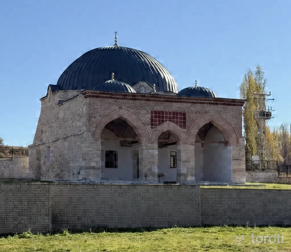
It was commissioned in 1259 by Emir Seyfettin Kızıl in Hamamkarahisar Village. It is stated that Emir Seyfettin Kızıl was the Bey of the Turkmen Bayındır Tribe and one of the three great emirs consulted by İzzeddin Keykavus. Hamamkarahisar Camii is an original example that has preserved its identity to the present day in terms of the shaping and integration of its sections as the main space and the last congregation area during the transition to Ottoman architecture.
- No image
11
Zey Köyü Ören yeri
Sivrihisar, Eskişehir
It was established on a rocky slope on the northern foothills of the Sivrihisar Mountains. In the higher parts of the rock masses that border a narrow valley from two sides, about 1 km south of the village, there are twelve chamber tombs, two stepped altars and a grape pressing pool. These monuments, which constitute original examples of Phrygian rock art, belong to the Phrygian settlement of Zey Kalesi, 1 km south of this area.
12
Seyyit Mahmut Suzanı Külliyesi
Sivrihisar, Eskişehir
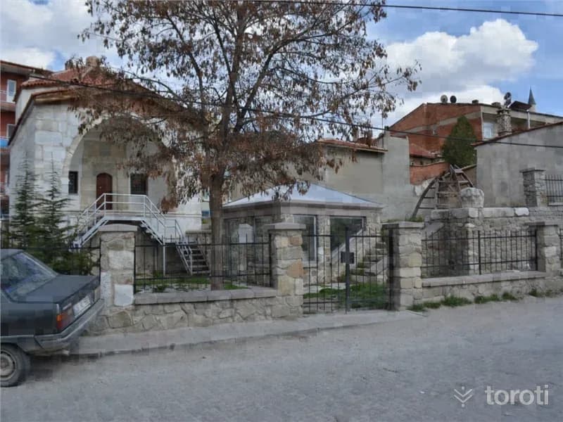
The külliye is a whole enclosed by a courtyard, consisting of a kümbet, tomb, hazire (open grave), and ruined madrasas. The kümbet was built of dressed stone with wooden material. In the hazire section, there is a sarcophagus bearing an inscription written in marble in kufic and Ottoman letters, and other types of graves. Seyyit Mahmut Suzani Külliyesi consists of the kümbet, tomb, and hazire section. It is a structure from the Seljuk Period. The kümbet was built of dressed block stone material.
13
Alemşah Kümbeti
Sivrihisar, Eskişehir
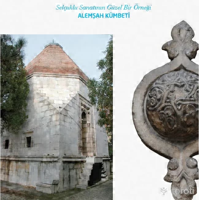
Alemşah Kümbeti, a fine example of Seljuk art, was commissioned by Melikşah in 1328 for his martyred brother Sultan Şah. The tomb is opposite Sivrihisar Ulu Camii. It is a two-storey structure with a square plan and was built of cut stone. Bricks were also used in places in its construction. Sivrihisar Belediyesi There is a mummification chamber on the lower floor of the tomb. In the door decorations of the mummification chamber, motifs frequently used by the Seljuks can be seen.
14
Sivrihisar Ulu Cami
Sivrihisar, Eskişehir
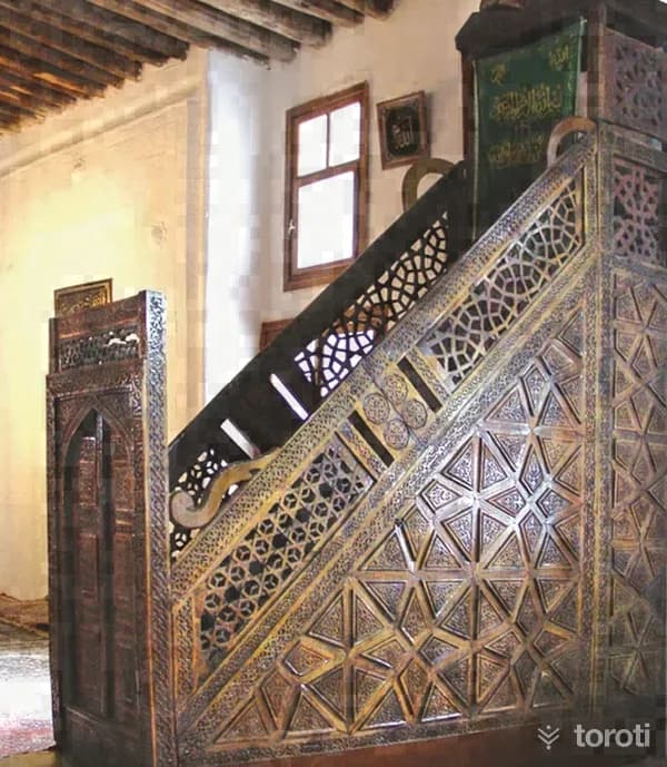
Sivrihisar Ulu Cami is one of the most important examples of mosques with wooden columns and wooden ceilings in Anatolia. Servet Uygun Various sources state that the mosque was first built in 1231-1232 by Emir Celaleddin Ali, and that in 1274 it was brought to its present form by Emineddin Mikail, one of the disciples of Mevlana Celaleddin Rumi.
15
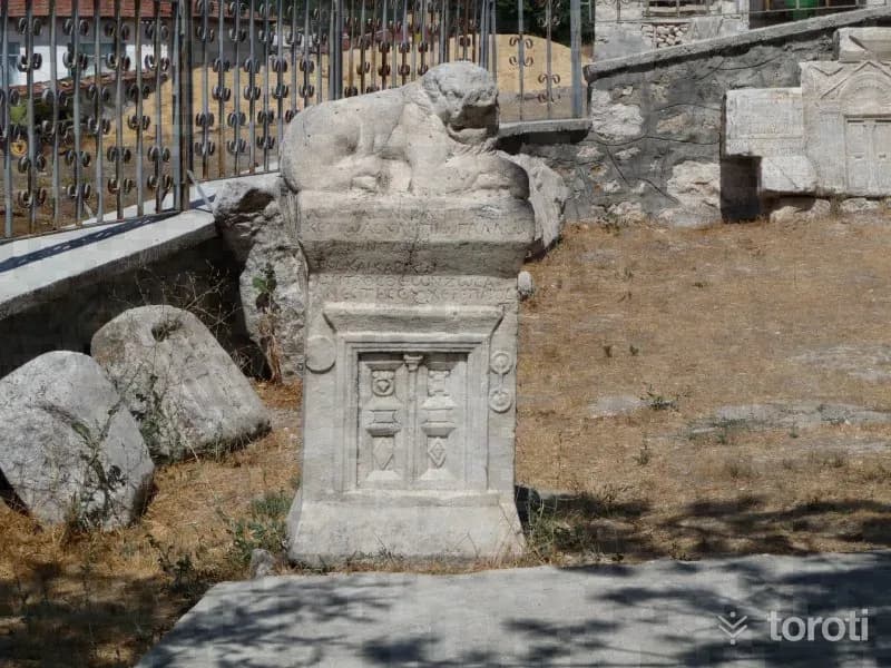
Pessinus Ören Yeri
Sivrihisar, Eskişehir
Where is the Pessinus archaeological site? The Ancient City of Pessinus is located in Ballıhisar, 13 kilometers south of Sivrihisar on the Ankara-Eskişehir highway. Today, Ballıhisar Village has been established on top of the ancient city, which was on the old King's Road. The Ancient City of Pessinus is known as one of the most important places of worship where the mother goddess, called "Goddess Kybele" by the Phrygians, was located.
16
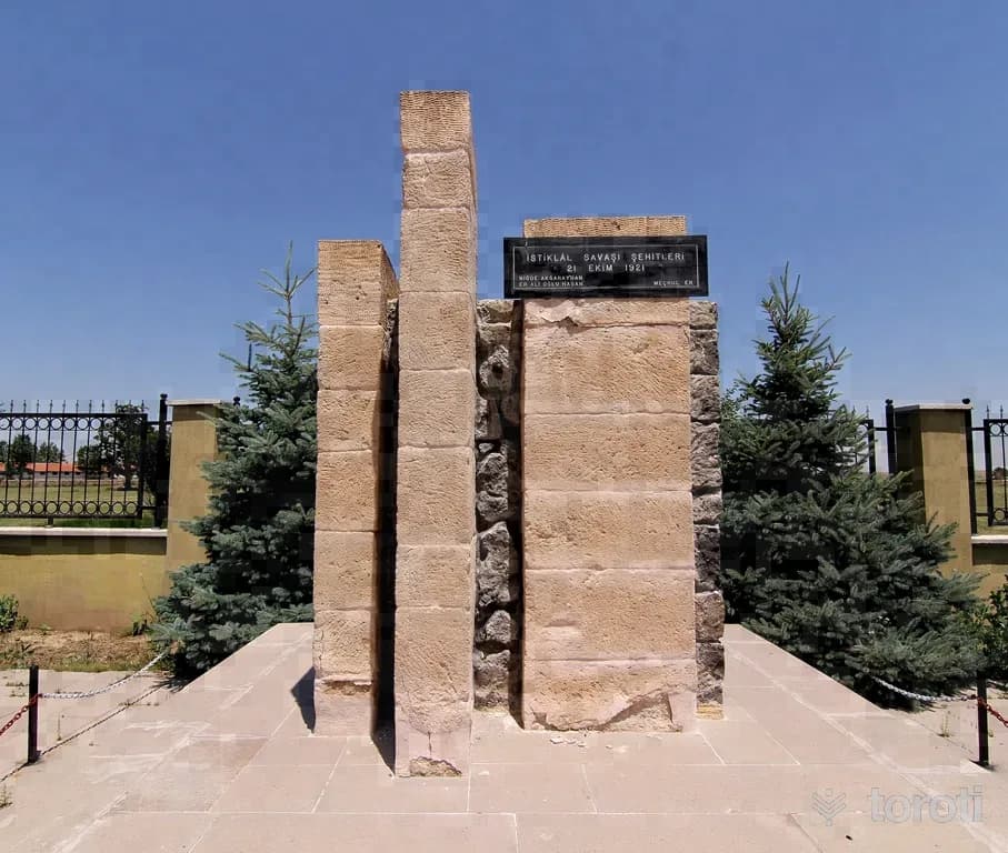
Suvermez Şehitliği
Emirdağ, Afyonkarahisar
It is located in Suvermez Village, Emirdağ District. It was built in 1971 in the name of two privates who were martyred as a result of enemy reconnaissance aircraft fire during the War of Independence.
17
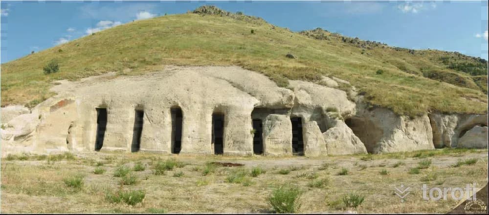
Yedikapilar Kaya Yerleşimi
Bolvadin, Afyonkarahisar
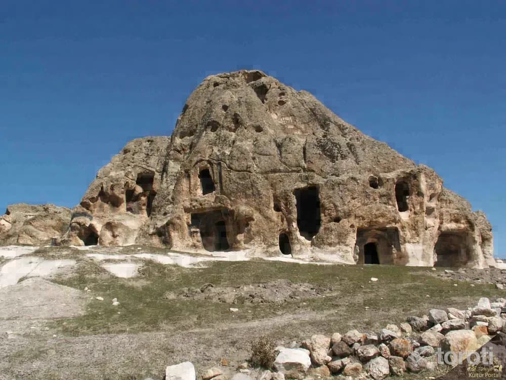
Yedikapılar Rock Settlement is located approximately 3,5 km northeast of Kemerkaya village in Bolvadin district. It is a U-shaped complex carved into the main rock, consisting of interconnected rooms arranged around a courtyard. The Yedikapılar Underground Settlement, carved into the tuff rock beneath the ground, is located here. The underground settlement consists of rooms and galleries formed by carving the tuff rock.
18
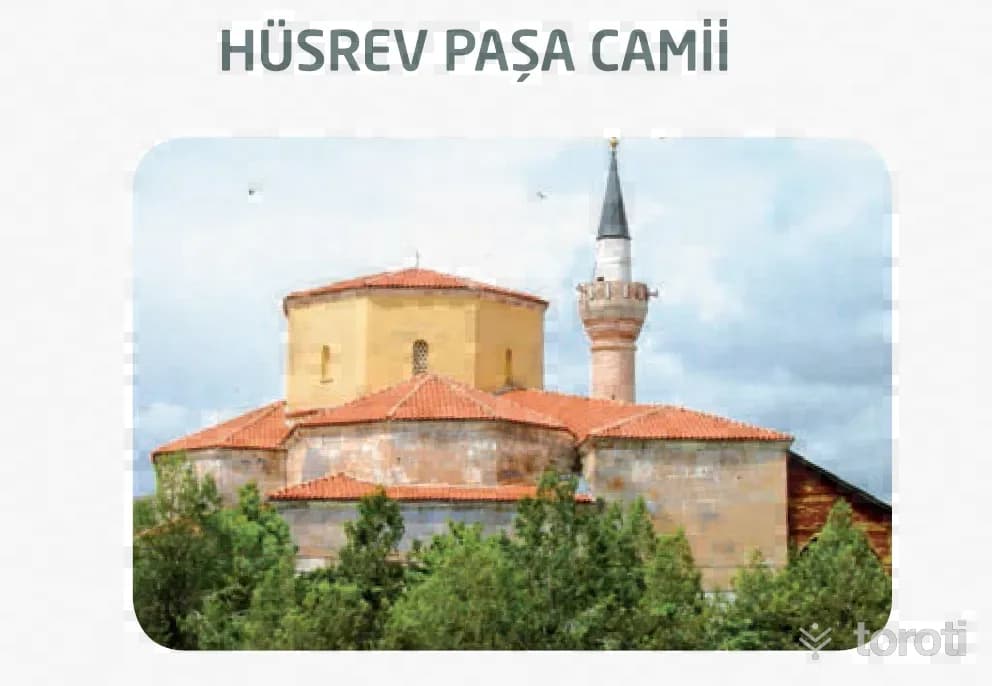
Hüsrev Paşa Camii
Bayat, Afyonkarahisar
The mosque, the most important structure of the Menzil Külliyesi built by Hüsrev Paşa, one of the viziers of IV. Murat, between 1631-1638, is intact today and open for use. The mosque, probably built on a church belonging to the Byzantine period, has an inverted “T” (Zaviyeli) plan type. It is covered with a large central dome supported by semi-domes on four sides. It bears the architectural characteristics of the 16th and 17th centuries.
19
Derbent Elicek Kaya Mezar Odaları
Bayat, Afyonkarahisar
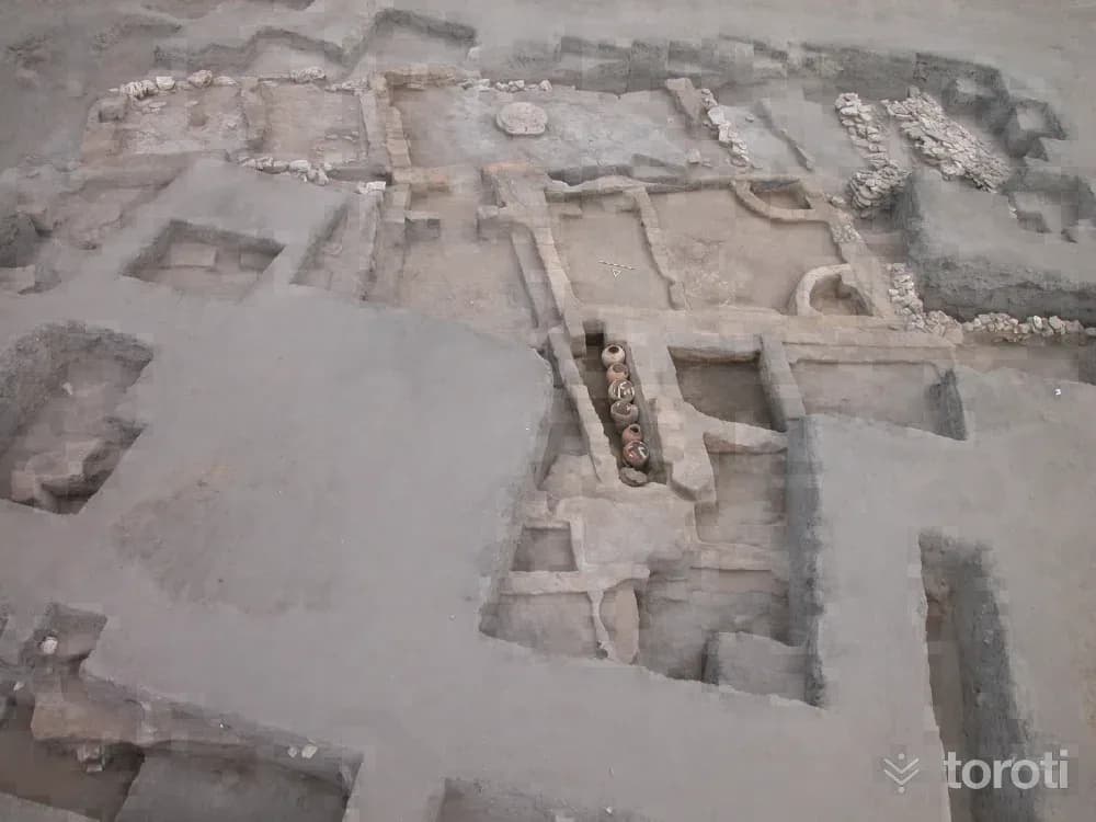
Derbent Elicek Rock Tomb is located in Bayat district, Derbent village, in Ericek locality, 4,5 km southeast of Bayat district center. It is an archaeological necropolis and rock settlement consisting of numerous rock spaces and rock tombs. Photo: Afyonkarahisar Museum The tomb chambers are generally single-roomed, with triangular hipped roofs and vaulted ceilings. Niches are also found near the tombs and spaces.
20
Han Yeraltı Şehri Ve Çevresi
Bayat, Afyonkarahisar
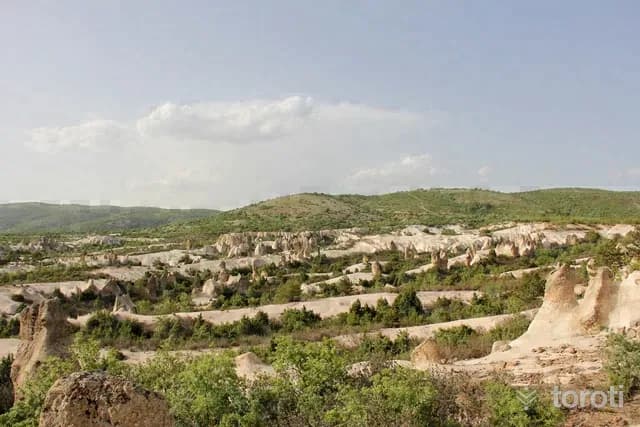
Han, one of the most important junctions on the ancient road connecting east to west and south throughout history, is the first shelter of Christianity and the stopover city of the Seljuk and Ottoman. Ancient Han has Roman and Byzantine rock settlements on its connecting roads.
21
Seydiler Peribacaları
İscehisar, Afyonkarahisar
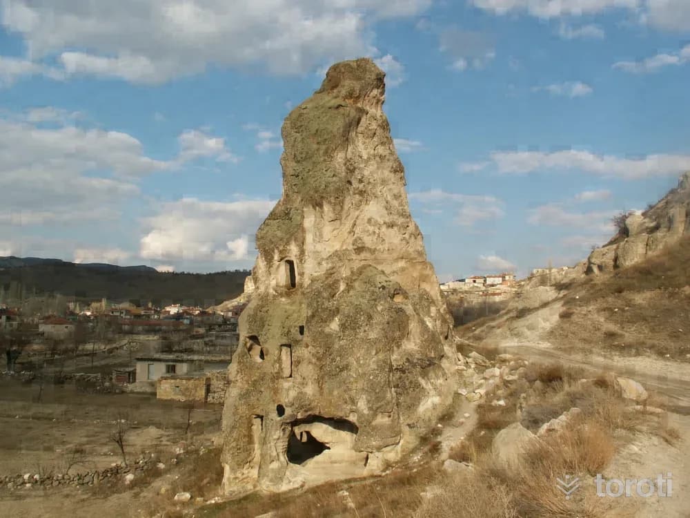
Located at the 33rd km of the Afyonkarahisar-Ankara highway, 500-1000 m east of the secondary road branching off from the main road, the area around Seydiler is the area where fairy chimneys of very different morphotypes can best be seen, within an area of approximately 1-2 km2. Due to the geological structure of Afyonkarahisar province, there are numerous fairy chimneys in various forms, with or without caps, in the districts of İhsaniye, İscehisar, Bayat and Bolvadin, which are located on volcanic terrain.
22
Leylek Kayaliği
İscehisar, Afyonkarahisar
Leylek Kayalığı, located in the Harmanüstü area of Seydiler Town in İscehisar district, has natural and archaeological features. There are conical single and grouped fairy chimneys generally formed by tuffs. One of the fairy chimneys located to the west of the rock and on the lower part of the road has been carved into three storeys including the ground floor. On the ground floor there is a chapel and a space, on the first floor there is a chapel and a space, and on the top floor there is a space.
23
Afyonkarahisar Müzesi
Afyonkarahisar (Merkez İlçe), Afyonkarahisar
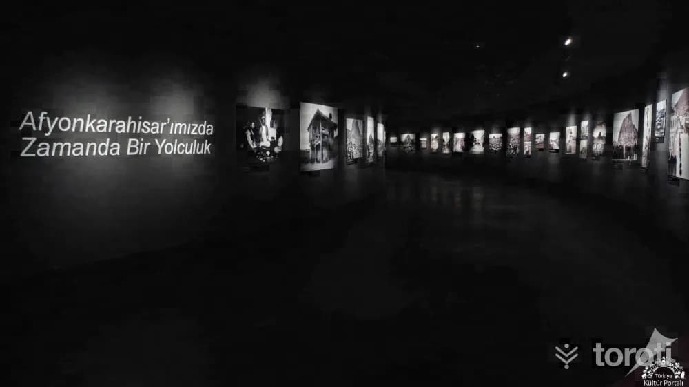
With the efforts of the Asar-ı Atika Muhipleri Cemiyeti, established in Afyonkarahisar in the early years of the Republic, antiquities began to be collected in Taş Medrese; in 1931 it became an official museum depot, and in 1933 it became the Museum Directorate. Serving as a mixed museum (Archaeology and Ethnography) in Taş Medrese from 1933 to 1970, the institution moved to its second service building in 1971. In 2023, the current museum building was opened for service.
24
Çeşmeli Konak (afyon Kültür Ve Çevre Evi)
Afyonkarahisar (Merkez İlçe), Afyonkarahisar
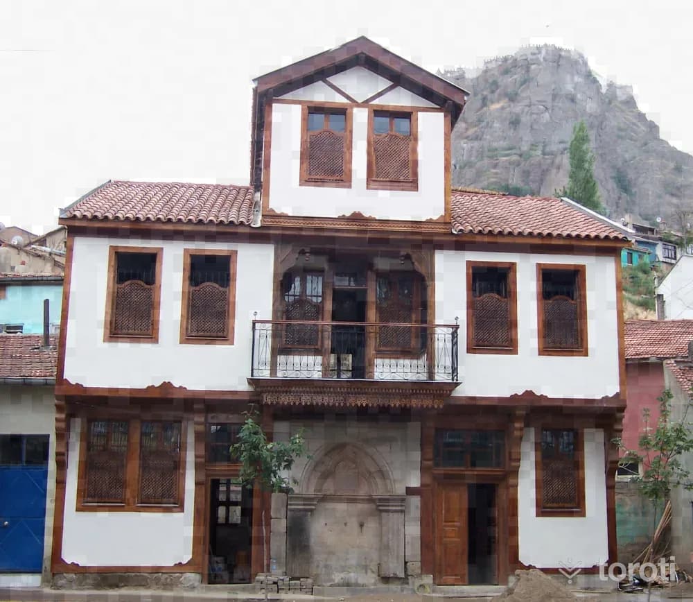
Çeşmeli Konak, located at Afyonkarahisar Province, Merkez Nurcu Mahallesi, Milli Birlik Caddesi No: 59-61, is registered in the land registry with sheet 36, block 534 and parcel numbers 16-17. It is a Late Ottoman work and forms an integral whole with the monumental fountain on its façade. The fountain was first commissioned for charitable purposes by Kahvecioğlu İsmail Efendi, who was engaged in the silk and fabric trade, and later the mansion needed by his own family was built.
25
Millet Hamamı
Afyonkarahisar (Merkez İlçe), Afyonkarahisar
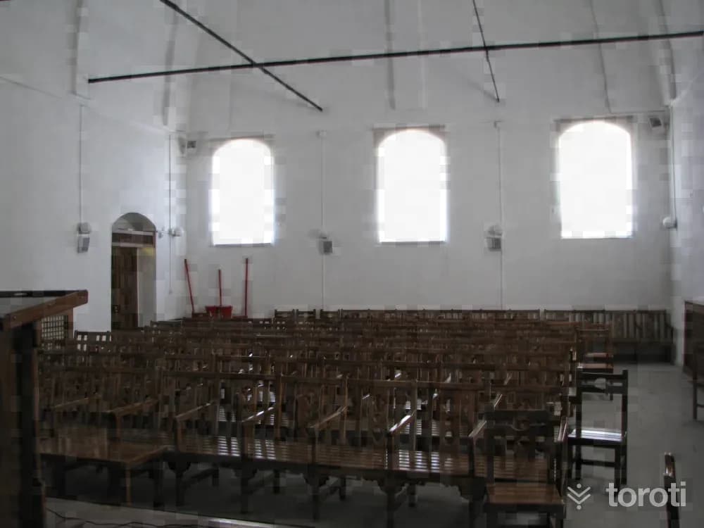
It is located in Tac-ı Ahmet Mahallesi, on Hamam Aralığı Sokağı. In the northern section of the structure, which was built on sloping land descending from south to north, is the men's section, while in the southern section is the women's section. The women's changing room on the east facade of the structure is attached to the southern wing of the facade. The furnace on this facade is adjacent to the north wall of the changing room. In the northern section of the facade, there are three window openings.
26
Kocatepe Atatürk Anıti Ve Kitabesi
Afyonkarahisar (Merkez İlçe), Afyonkarahisar
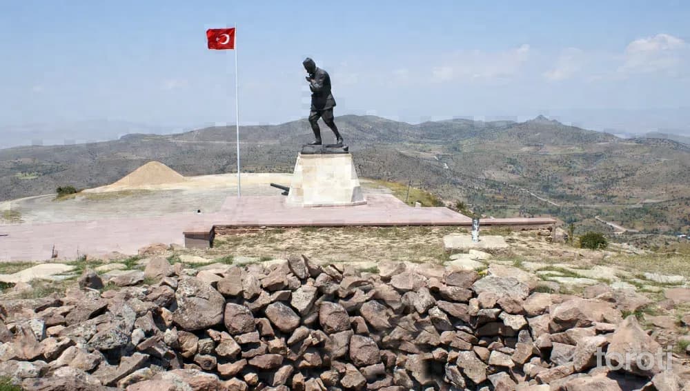
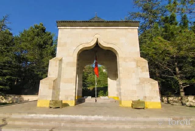
Kocatepe Atatürk Monument and Inscription is located within the borders of Büyük Kalecik Town in the Central district of Afyonkarahisar province and on Kocatepe at an altitude of 1874. Its asphalt road is closed in the winter season due to heavy snow. Kocatepe is the place where the Great Offensive, which ensured the liberation of Anatolia and the Turkish Nation, was launched and directed by Commander-in-Chief Mustafa Kemal on 26 August 1922.
27
Yüzbaşi AgÂh Efendi Şehitliği
Afyonkarahisar (Merkez İlçe), Afyonkarahisar
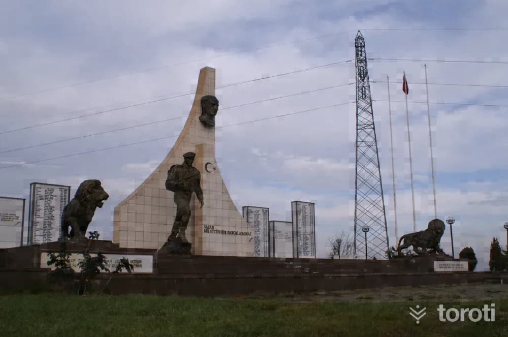
It is located within the town of Büyük Kalecik, in the central district of Afyonkarahisar province. It is 12 kilometers from Afyonkarahisar city center.
28
Cumhuriyet Şehitliği
Afyonkarahisar (Merkez İlçe), Afyonkarahisar
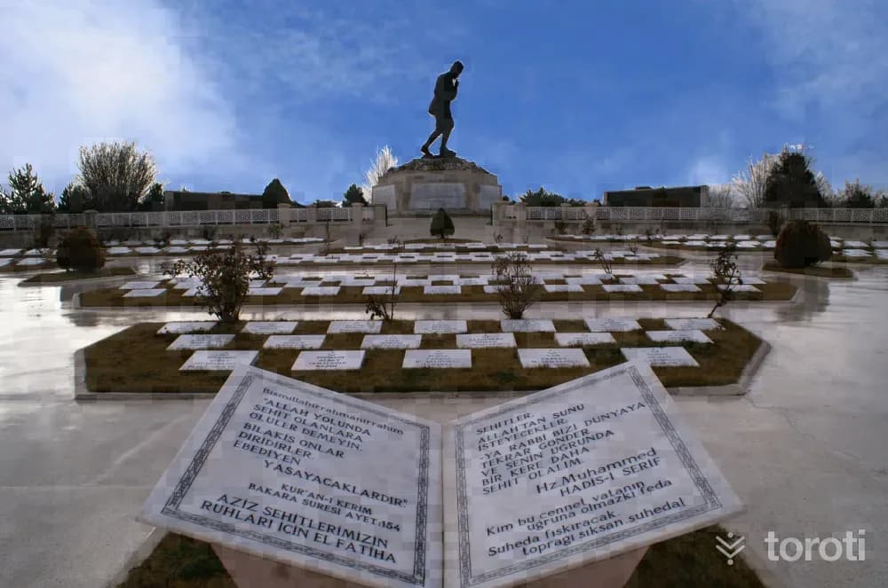
The Cumhuriyet Şehitleri Monument is located 9 kilometers from Afyonkarahisar, on the İzmir-Antalya highway. It is a martyrdom built in 1999 in the name of the Mehmetçik and police officers who were martyred in the struggles during the Republican Period. Some of the martyrs of the Republican Period are in the Hava Şehitliği, and others are in cemeteries in the cities where the martyrs' families live. In 1999, a symbolic martyrdom was built on a hill overlooking Afyonkarahisar in memory of the martyrs.
29
Büyük Taarruz Şehitliği Ve Mustafa Kemal Atatürk Anıti
Sinanpaşa, Afyonkarahisar
It is located on Işık (Sarıkız) Tepe at the Antalya-İzmir road junction, 16 kilometers from Afyonkarahisar. Built so that vehicles traveling from Central Anatolia and Marmara to the Aegean and Mediterranean can see it, the Martyrs' Cemetery and Monument are open to visitors every day of the year.
30
Albay Reşat Çiğiltepe Şehitliği
Sinanpaşa, Afyonkarahisar
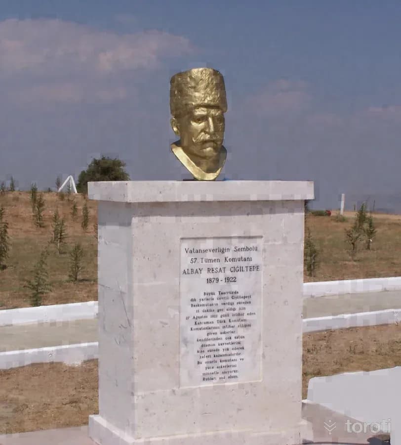
It is located on Çiğiltepe, at an altitude of 1591, in the southeast of Sinanpaşa District, in the southwest of Afyonkarahisar, and is 18 kilometers from Sinanpaşa District. On 27 August 1922, Miralay Reşat Bey, Commander of the 57th Division, who was assigned to capture Çiğiltepe, promised Başkomutan Gazi Mustafa Kemal that he would capture the hill within half an hour, but when he could not keep his word, he committed suicide by placing his pistol to his temple.
31
Bininler Kaya Evleri
Şuhut, Afyonkarahisar
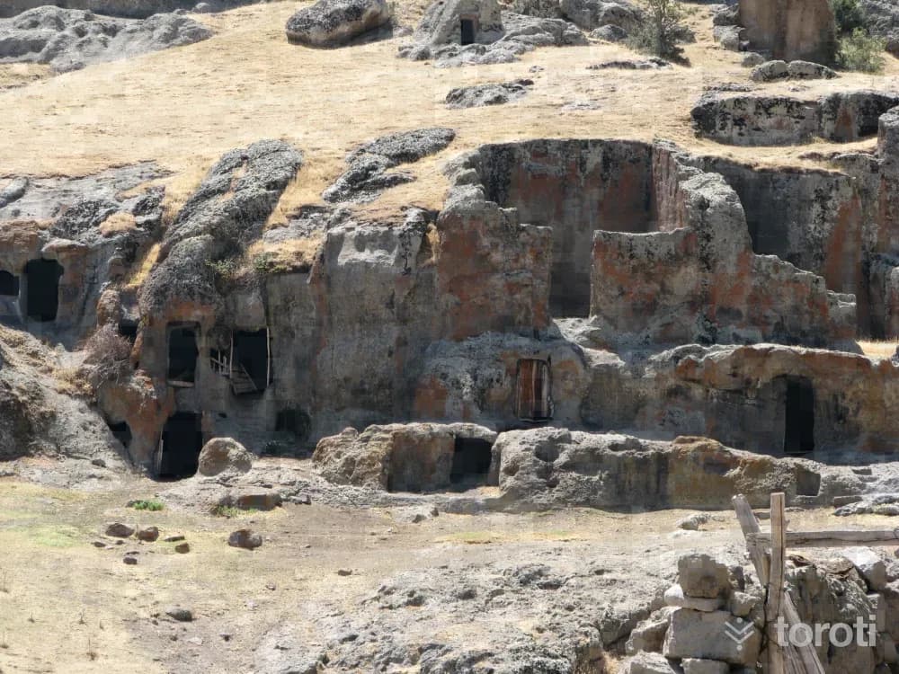
Bininler Rock Houses are located in difficult-to-access mountainous terrain in Şuhut district, in Senir village, about 4 km west of the village. On the north bank of Senir stream, along the streambed with andesite characteristics, they were carved side by side and one above the other in three sections separated by small rivulets in the rocky terrain approximately 150-200 meters long. The lower floors of the houses were made as shelters for animals, and the upper floors as living spaces for people.
32
Yaban Hayati (fauna) Gözlemciliği - Akdağ Tabiat Parkı
Sandıklı, Afyonkarahisar
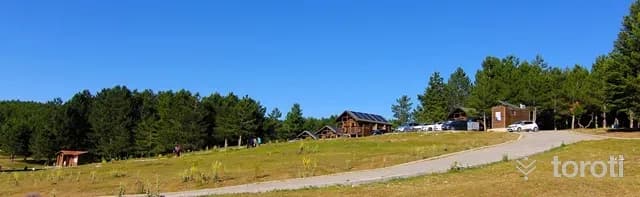
Akdağ, at an altitude of 2 thousand 500 meters, is an ideal setting to feel the crystal-clear mountain air in your lungs. Heading south from Sorkun Town of Sandıklı District, following the winding stabilized forest road surrounded by oak forests, where black pine trees become denser as the altitude increases, at the end of the road, Kocayayla and the valley are reached.
33
Doğa Yürüyüşü - Tokali Kanyonu
Çivril, Denizli
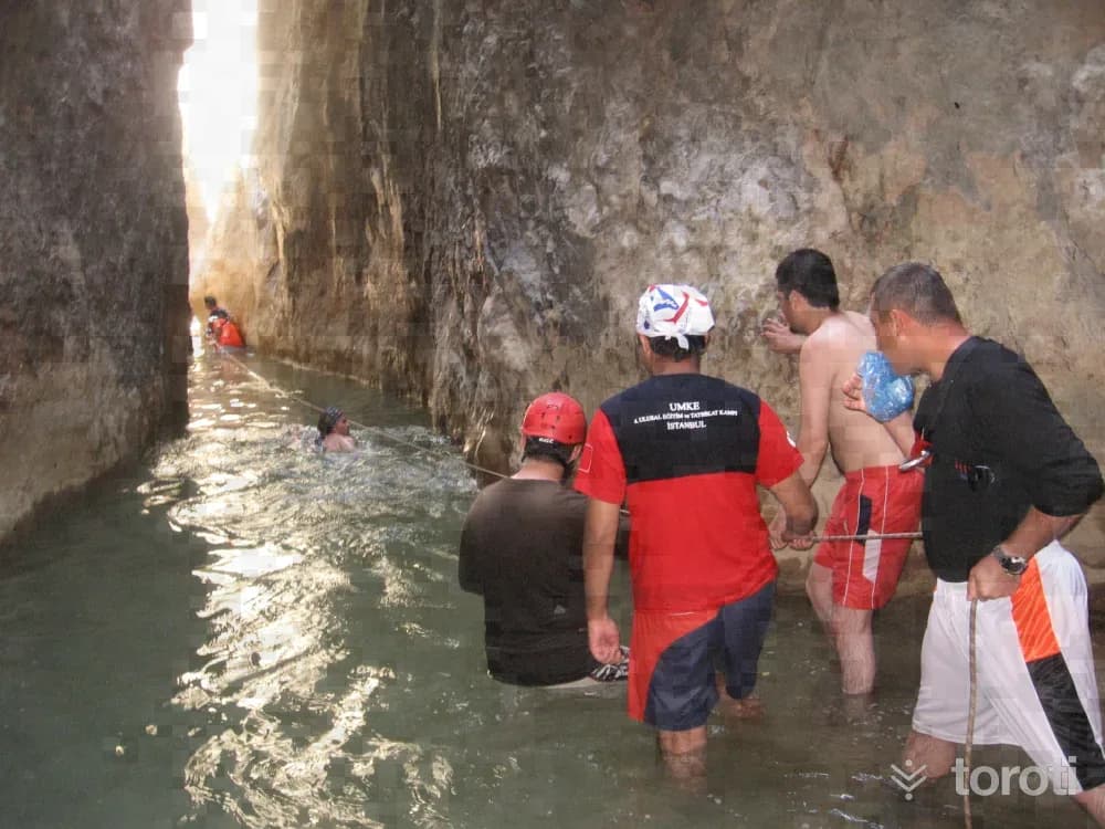
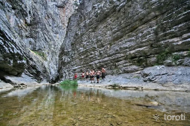
Nature Walk - Tokali Canyon Tokalı Canyon, located in Akdağ Nature Park in Sandıklı District, is a canyon with high recognition throughout the country. The canyon, estimated to be 20 kilometers long, and Akçay, which flows from the canyon into Çivril Lake, are worth seeing. Along the canyon, there are caves untouched by humans and routes that will attract the interest of those who do trekking. The narrowest part of the canyon is 1,5 meters and the widest part is 4 meters. Passing through the canyon takes 7-8 hours.
34
Çivril Tokali Kanyonu
Çivril, Denizli
Çivril Tokalı Canyon extends over an area of 20 kilometers. The canyon, at an altitude of 1600 meters, ends at the 900-meter-altitude settlement of Çivril's Gümüşsu (Homa) Town. The 1200-meter-long section of the canyon consists of rock masses, as if cut with a knife, whose height reaches 200 meters in places. Akdağ Canyon, formed by the stream flowing between these rocks, which are 4 meters apart at their widest point and 1,5 meters at their narrowest, can only be crossed in 7-8 hours.
35
Kuş Gözlemciliği - Karakuyu Göleti
Dinar, Afyonkarahisar
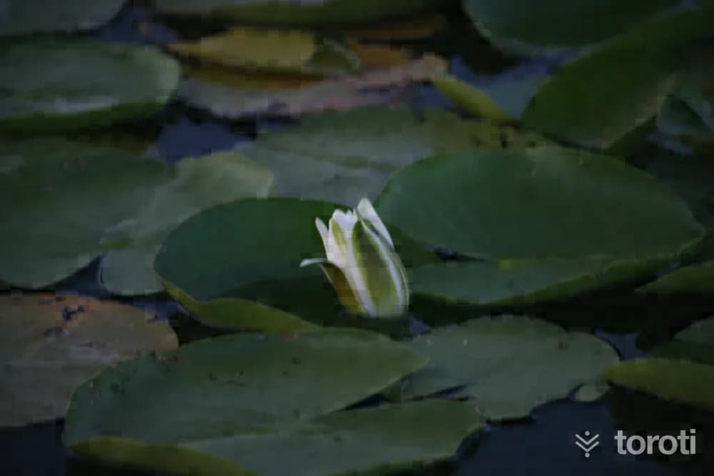
Because Afyonkarahisar province is located in the Lakes Region, it has many lakes and ponds that may attract the interest of tourism. In addition to natural lakes such as Akşehir, Eber, Karamık, and Acıgöl, there are also many irrigation ponds such as Karakuyu, Pınarbaşı, Bayat, Selevir, Örenler, Kırka, Emre, and Taşoluk. Among these, the most remarkable in terms of natural and touristic aspects is Karakuyu.
36
Suçikan Parkı
Dinar, Afyonkarahisar
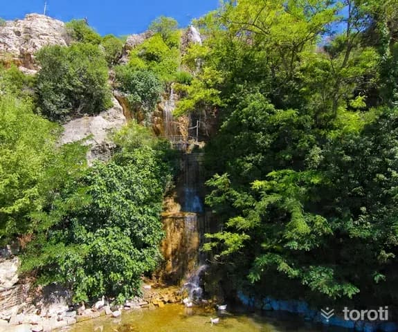
Suçıkan Park is in the center of Dinar district. Its entrance is the Suçıkan cave located behind Suçıkan Park Hotel. The excess water stored in Karakuyu Pond is discharged through the sinkhole near Karakuyu village, and this discharged water re-emerges from the base of the rocks in Suçıkan Park, forming a branch of the Menderes river. For this reason, it is thought that the cave is quite large and that there may also be small pools inside.
37
Apameia Kibotos Antik Kenti
Dinar, Afyonkarahisar
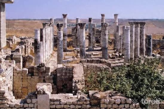
The Ancient City of Apameia Kibotos, located in the Dinar district, is a historical center. This ancient city, significant during the Roman period, features monumental structures such as a stadium and theater.
38
Kuş Gözlemciliği - Acigöl
Yeşilova, Burdur
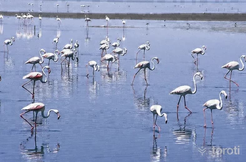
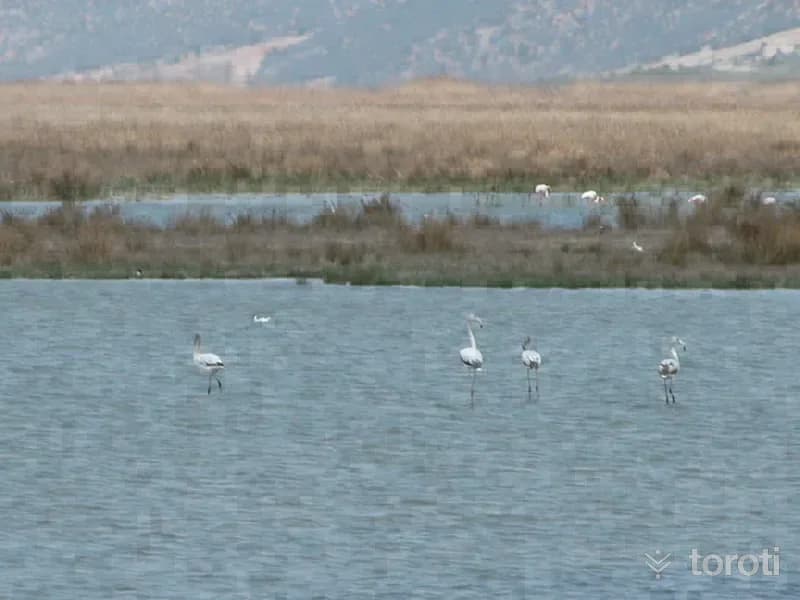
Part of it lies within the borders of Afyonkarahisar and part within the borders of Denizli province. Its surface area is 41.5 square kilometers, and 20 square kilometers of it lie within the borders of the Başmakçı and Dazkırı districts of Afyonkarahisar. Its elevation above sea level is 842 meters. Sodium sulfate and its derivatives are produced from the lake, whose water is alkaline. The waters springing from the foothills of Söğüt Dağı, located to the southeast of the lake, both feed the lake and create habitats.
39
Aci Göl
Çardak, Denizli
Acı Göl, or by its other name Çardak Gölü, is a tectonic lake. Its surface area is 41,34 km. It is between Çardak district and Afyon-Dazkırı district. The lake is fed by waters descending from the Söğüt mountains. The lake, also called a bitter salt lake, has an altitude of 836 meters. In the lake there are potassium, sodium and sulfate combined with salt. In Gemiş (Kasabası) Mahallesi, south of Çardak, there is a bird observation tower for the birds living on the lake.
40
Çardak Kervansarayı
Çardak, Denizli
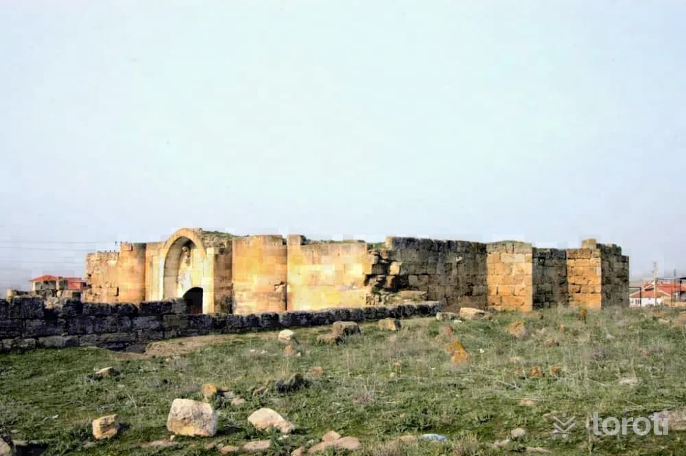
According to the seven-line inscription on Çardak Kervansarayı, it was commissioned during the time of Alaeddin Keykubat by his freed slave and one of his emirs, Esededdin Ayaz bin Abdullah el Şahabi. It was completed in the month of Ramadan in 1230 and, according to its inscription, was built as a “Ribat”. Built on an east-west axis, the han constitutes a simplified counterpart of the sultan hans with its rather large square courtyard and its hall consisting of six sections and five aisles.
41
Hüsamettin Bey Türbesi
Baklan, Denizli
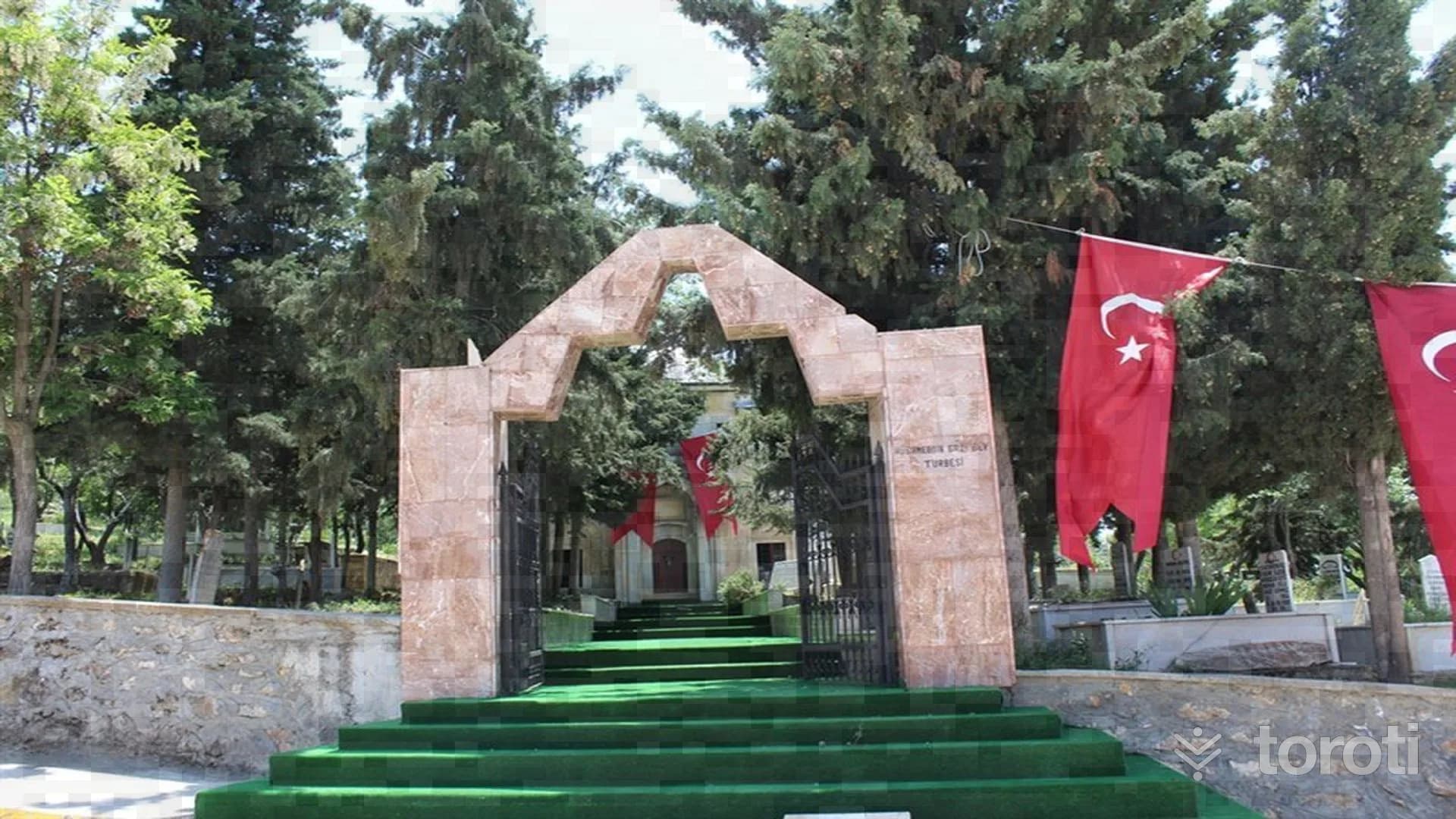
The tomb is clad in marble in the style of Seljuk architecture, and its walls are made of cut stone. It is thought that one of these graves belongs to Hüsamettin Bey, one to Hüsamettin Bey's wife, and the other two graves to their relatives. There is an inscription above the marble entrance door. In addition, there are mixed writings in Arabic, Persian and Ottoman Turkish on the door frames. These writings have not been fully translated.
42
Boğaziçi Kasabası Eski Camii
Baklan, Denizli
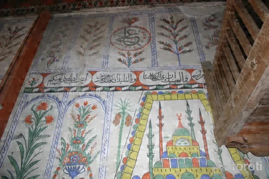
Boğaziçi Kasabası Eski Camii has a vertically rectangular plan and three naves. It was built in Hijri 1181. Its walls are stone up to foundation level, with adobe masonry above. The rectangular-plan prayer hall is divided into three naves by wooden supports. The supports are connected to each other by Bursa arches. The side walls are supported internally and externally by square wooden posts. The mihrab is in the form of a semicircular niche covered with a muqarnas semi-dome.
43
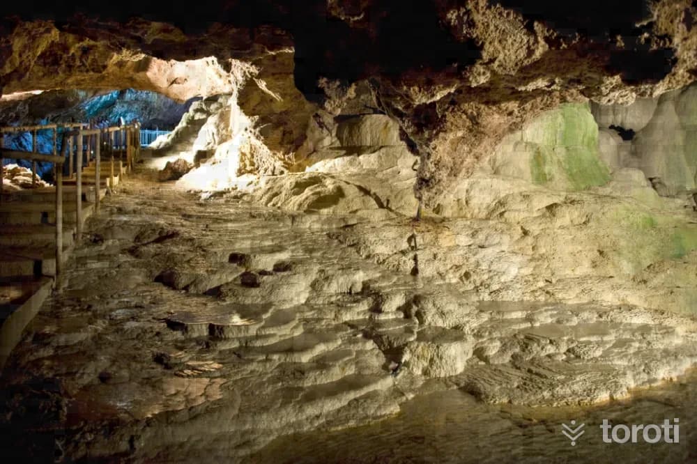
Kaklik Mağarası
Honaz, Denizli
Kaklık Cave is located in Kaklık Neighborhood of Honaz district, 30 kilometers from Denizli city center on the Denizli-Ankara highway. There is thermal water inside the cave. TGA It is known that the clear, colorless and sulfur-smelling water is good for some skin diseases. In addition, a swimming pool, small amphitheater, viewing areas, cafeteria and gazebos near the cave have been made available for visitors since May 2002.
44
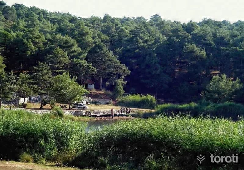
Sakli Göl
Honaz, Denizli
Saklı Göl, or by its other name Yukarı Dağdere Gölü, is a natural lake with a very beautiful view among pine trees. Picnics can be held around the lake. It is an ideal area for day trips and nature walks. Its water is fresh, and there are freshwater fish. Where is Saklı Göl? By following the Denizli-Ankara highway for approximately 28 kilometres, turn onto the road branching off to the south before reaching Kaklık Mahallesi.
- No image
45
Hierapolis Antik Kenti
Pamukkale, Denizli
Denizli ilinin 18 km. kuzeyinde yer alan Hierapolis antik kentinin Arkeoloji literatüründe “Holy City” yani Kutsal Kent olarak adlandırılması, kentte bilinen bir çok tapınak ve diğer dinsel yapının varlığından kaynaklanmaktadır. Kentin kuruluşu hakkında bilgilerin kısıtlı olmasına karşın; Bergama Krallarından II. Eumenes tarafından MÖ. II.
- No image
46
Ahi Sinan Türbesi
Merkezefendi, Denizli
Ahi Sinan organized the tradesmen of Denizli and brought them together under one roof. He made very great contributions to the Ahi culture in Denizli and took his place in history. In the 13th century, he was serving in the lodge bearing his own name to the west of the present-day Kaleiçi Çarşısı. It is known from written sources that after his death, his tomb was also built within this lodge and that it remained in service until 1876.
- No image
47
Laodikya Antik Kenti
Merkezefendi, Denizli
Laodikeia Ancient City was established at a very favorable geographical point and to the south of the Lykos River. The name of the city appears in ancient sources mostly as “Laodikeia on the banks of the Lykos.” According to other ancient sources, the city was founded by Antiochos II between 261-263 BC, and the city was given the name of Antiochos's wife, Laodike.
- No image
48
Hierapolis Hamam Bazilika
Pamukkale, Denizli
The bath, located next to the Frontinus gate and built in the 3rd century A.D., had the south-facing calidarium wall demolished after the 5th century and an apse added, thus transforming the bath into a three-aisled basilica. The barrel vault belonging to the previous structure was also replaced by 3 domes.
- No image
49
Hatipoğlu Cami
Pamukkale, Denizli
The structure, which was built right at the beginning of the 20th century, is a building that needs to be preserved due to its location, dimensions, use of local materials, and facade arrangement.
50
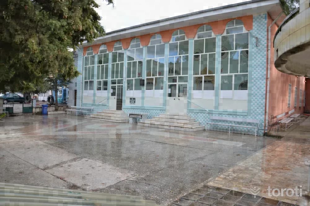
Nikfer Hasan Feyzi Efendi Camii
Tavas, Denizli
The load-bearing elements and eaves of the square-planned structure were built in masonry. The tomb and the mosque are under the same roof. The outer edge decorations of the windows on the exterior facades, the interior doors of the mosque and the tomb, and the arched passages seen on the lower and upper floors in the last congregation area are parts belonging to the original structure. Its current covering is in the form of a saddle roof, covered with Marseille-type tiles. The ceiling was made as a flat wooden ceiling.
51
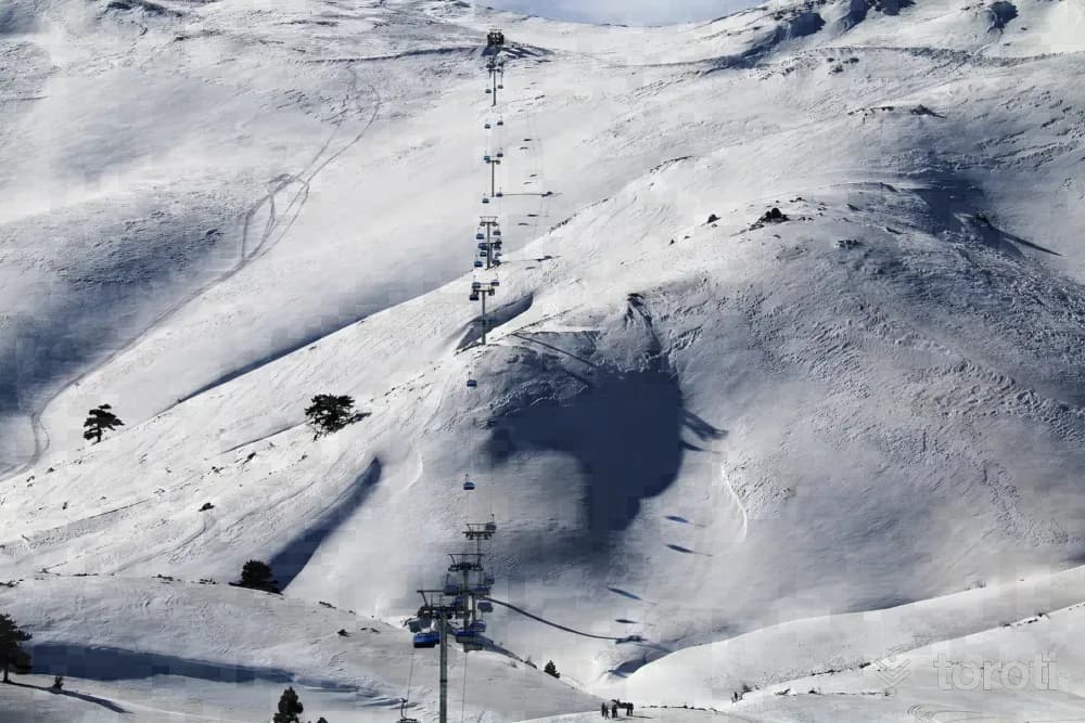
Denizli Kayak Merkezi
Tavas, Denizli
Located at an altitude of 2420 meters and 75 km from Denizli city center, Denizli Kayak Merkezi is situated on Bozdağ within the borders of Nikfer Mahallesi, which is connected to Tavas District. The center has 9 slopes with a total length of 13 kilometers, and features 2 chairlifts, 1 ski lift and a moving walkway. The mechanical facilities, which serve amateur and professional skiers, can carry 2,500 people per hour.
52
Solmaz Çarşı Camii Ve Haziresi
Tavas, Denizli
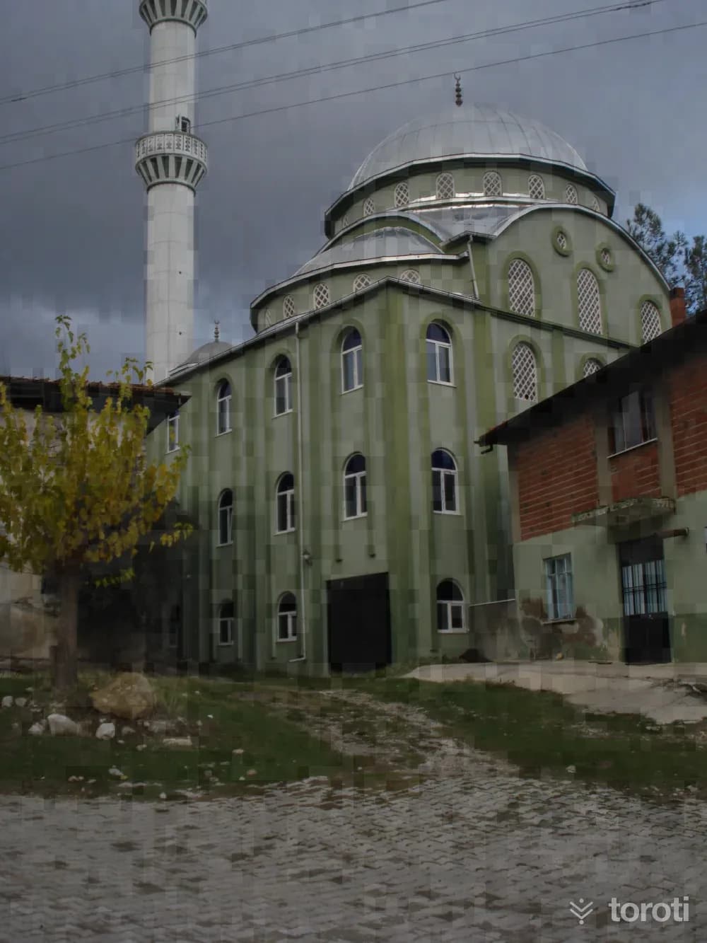
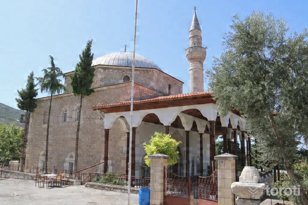
The mosque is a square-planned structure with a flat wooden ceiling, covered with a hipped roof. Its minaret is made of brick. It is a mosque that reflects the characteristics of its period with its mihrab and decorated ceiling centerpiece. In the prayer hall, the women's gallery is located on arches carried by wooden supports. Its windows are rectangular in form. Over time, some of them have been replaced with aluminum joinery. In the graveyard located in its garden, there are two old graves dated 1242 and 1244.
53
Hirka Camii
Tavas, Denizli
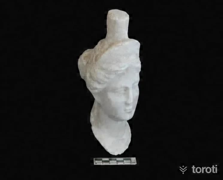
Hırka Camii, located in Hırka Neighborhood of Tavas district, is an architectural work belonging to the Ottoman Period. The prayer hall of the mosque has a square plan and is covered with a dome. To the north of the prayer hall is the last congregation area, and at its northwest corner is its minaret. Rough-hewn stone, rubble stone, and partly cut stone were used in the walls of the structure. Marble was used in the jambs and lintels of the windows and in the entrance opening of the prayer hall. The walls of the mosque are partly plastered.
54
Tabea Antik Kenti
Kale, Denizli
The Ancient City of Tabae has the appearance of a natural fortress. Until 30 years ago, settlement continued on the old fortress. Tabae is one of the city-states established in Anatolia after Alexander the Great. Tabae has witnessed uninterrupted settlement from the Hellenistic Period to the present day. In the Ancient Period, it minted coins in its own name. The coins were first minted in silver and later in bronze.
- No image
55
Muğla Yaylaları
Menteşe, Muğla
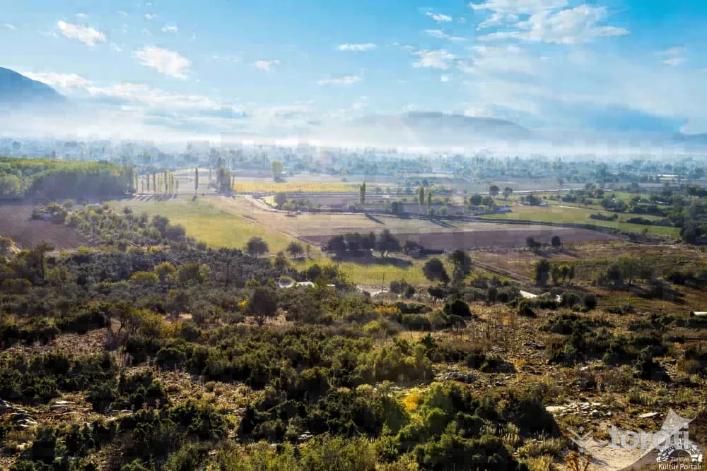
Gökçukur plateau is at an altitude of 1700. On the plateau, which is completely covered with forest, there is an auberge-type accommodation unit belonging to the Forestry Directorate. Yerküpü Plateau, 5 kilometers from Menteşe and 15 kilometers from Kavaklıdere, is the most popular plateau in the region.
56
Karabağlar Yaylası
Menteşe, Muğla
Karabağlar Yaylası, 3 kilometers from Muğla city center, is a place worth setting aside time to see. With its cold spring water, ancient plane trees, and abundant fruit trees, Karabağlar is a place of escape on hot days. . The plateau’s whitewashed, red-tiled houses share the same characteristics as the protected historic houses of Muğla’s Saburhane Mahallesi. This settlement on the plateau has been placed under protection, and ugly construction has not been allowed.
57
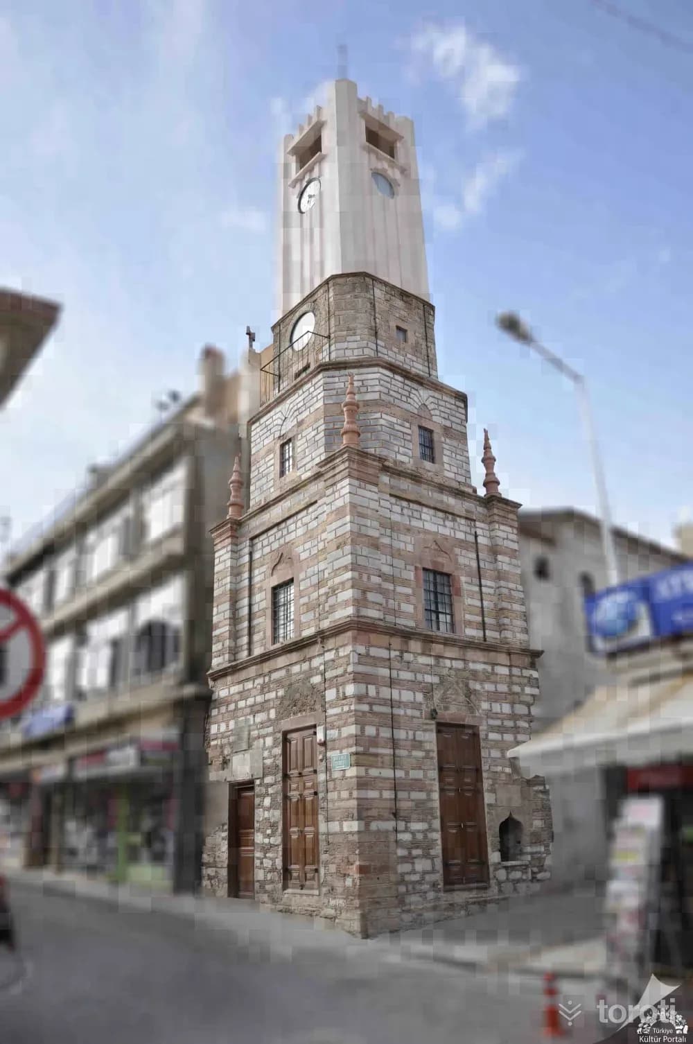
Muğla Saatli Kule
Menteşe, Muğla
The clock tower located on Kara Mustafa Caddesi in Balıbey Mahallesi was commissioned in 1895 by Hacı Kadızade Süleyman Efendi, Muğla’s first Mayor, and his wife Pembe Ana. After returning from the pilgrimage, they had a similar tower to the one they saw in the city of Damascus built by the famous Greek master Filvarus. Muğla Provincial Directorate of Culture and Tourism The Clock Tower is square-planned and five storeys high, built using cut stone and brick, and narrows from bottom to top.
- No image
58
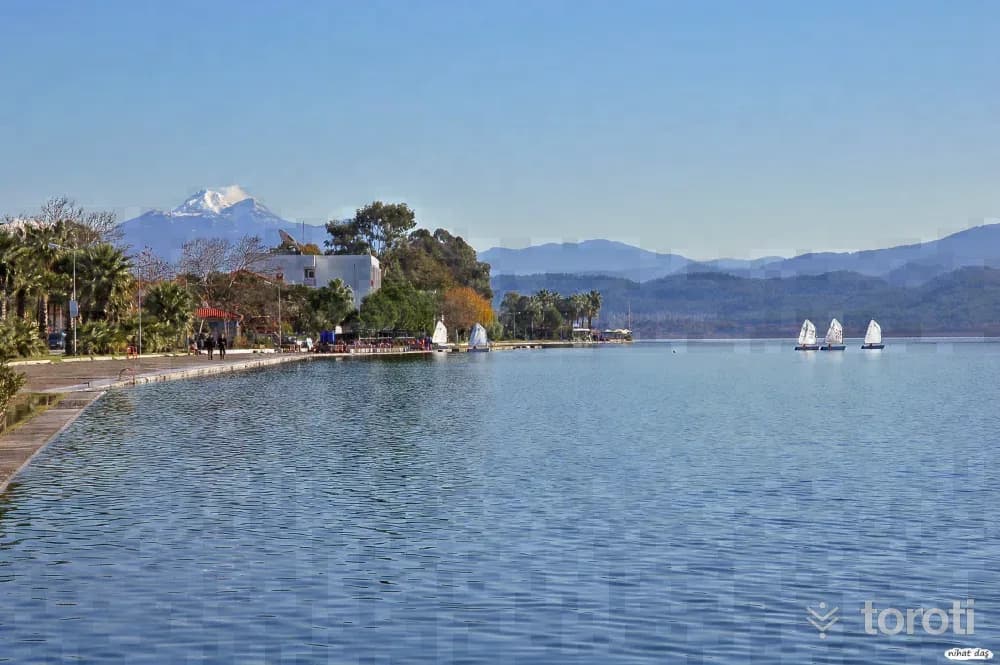
Ula Belediyesi Akyaka Halk Plajı
Ula, Muğla
Ula Belediyesi Akyaka Public Beach is a public beach candidate included in the 2025 Blue Flag official list.
59
Köyceğiz Gölü
Köyceğiz, Muğla
The lake is fed by waters descending from the mountains in seven branches and by abundant water sources, and for this reason it does not lose its characteristic in summer or winter. It is a lake that discharges its excess water into the Mediterranean through a narrow 10-kilometer-long channel (Dalyan). If you do not have a detailed map of the surroundings, while traveling around the area it can easily be confused which is the lake and which is the sea. The best clue is the lake’s reed beds. The area covered by the lake, which is connected to the Mediterranean by the Dalyan Strait, is 6300 hectares.
Move the stops into your own plan, split them across days, and add places to sleep and eat.
Frequently asked
- How far is it between Ankara and Muğla, and how long does it take?
- Driving between Ankara and Muğla is roughly 582 kilometres and takes about 7 hours without stops.
- Where is it worth stopping between Ankara and Muğla?
- There are 346 described places within 20 km of the road between Ankara and Muğla. toroti lists 59 of them spread evenly along the drive, in the order you pass them; Hava Kuvvetleri Müzesi comes early on, and Köyceğiz Gölü sits near the end.
- Which provinces does the Ankara to Muğla route cross?
- The route between Ankara and Muğla crosses Ankara → Eskişehir → Afyonkarahisar → Denizli → Burdur → Muğla. The stretch richest in places to visit is in Denizli.
- Should I take the toll highway or traditional route between Ankara and Muğla?
- Toll motorways save driving time between Ankara and Muğla, whereas traditional state roads pass directly through historic town centers, local culinary stops, and scenic nature viewpoints.
- How should breaks be scheduled between Ankara and Muğla?
- For a drive of around 7 hours, taking a break every 2 to 2.5 hours is recommended. The catalogued attractions in Denizli and neighboring provinces offer memorable stopovers compared to generic highway rest areas.