
Stops along the way
Stops between İstanbul and Bolu
344 km, roughly 4 hours of driving. The stops below are ordered as you pass them — the same road in both directions.
In short
The drive between İstanbul and Bolu is 344 km and takes roughly 4 hours. There are 655 described places within 20 km of this route; it crosses 5 provinces, and the densest stretch is in Kocaeli (119 places).
There are 655 places within 20 km of this corridor; the 57 below are spread evenly along the drive.
1
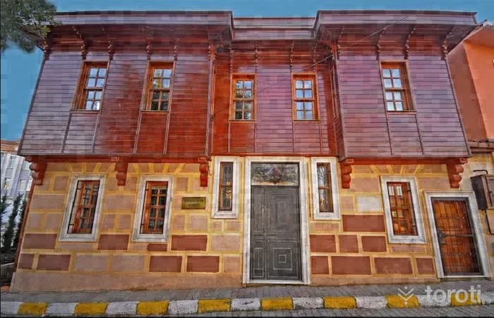
Avrupa Kültür Başkenti Mübadele Müzesi
Çatalca, İstanbul
The European Capital of Culture Exchange Museum is Turkey's first migration-themed museum, providing an important space for those nostalgic about the past.
- No image
2
Arnavutköy Yeniköy Halk Plajı
Arnavutköy, İstanbul
Arnavutköy Yeniköy Public Beach is a public beach candidate included in the official 2025 Blue Flag list.
3
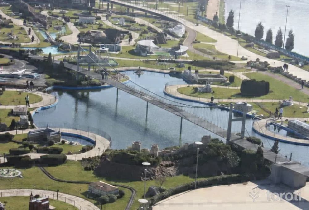
Miniatürk
Beyoğlu, İstanbul
Miniatürk is Turkey's first miniature park, showcasing 120 fixed models of significant cultural artifacts. The park aims to promote cultural heritage with representations from Istanbul and Anatolia.
4
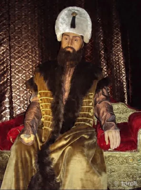
Jale Kuşhan Balmumu Heykel Müzesi
Kağıthane, İstanbul
The Jale Kuşhan Wax Sculpture Museum is established to promote wax sculpture art in Turkey. The museum showcases wax figures of significant figures from Turkish and world history.
5
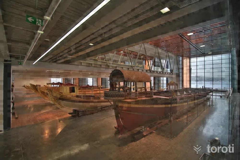
İstanbul Deniz Müzesi
Beşiktaş, İstanbul
Istanbul Naval Museum is an important museum with one of the largest and richest collections in the field of maritime in Turkey.
6
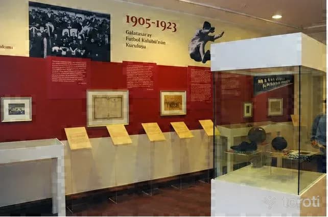
Galatasaray Müzesi
Sarıyer, İstanbul
Galatasaray Museum, established in 1915 by Ali Sami Yen, is Turkey's first sports museum. It showcases the history and achievements of Galatasaray Sports Club.
7
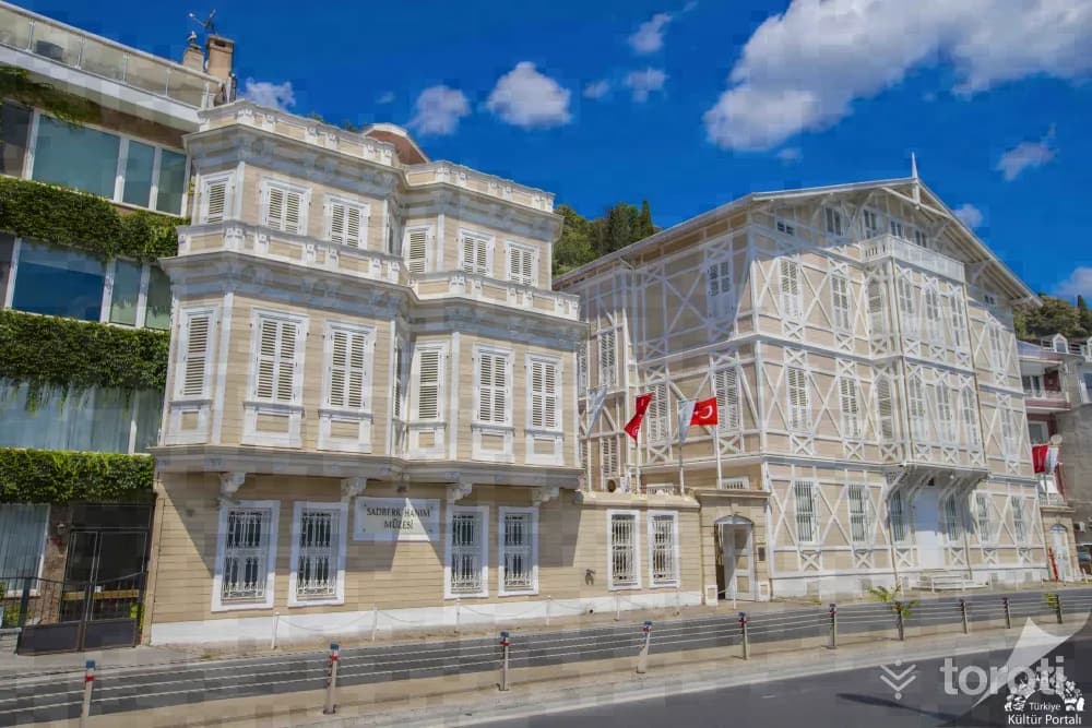
Sadberk Hanim Müzesi
Sarıyer, İstanbul
Sadberk Hanım Museum is located in a 19th-century building and hosts a rich collection of artifacts.
- No image
8
Rumeli Feneri
Sarıyer, İstanbul
Rumeli Feneri is a historic lighthouse located at the point where the Bosphorus meets the Black Sea.
9
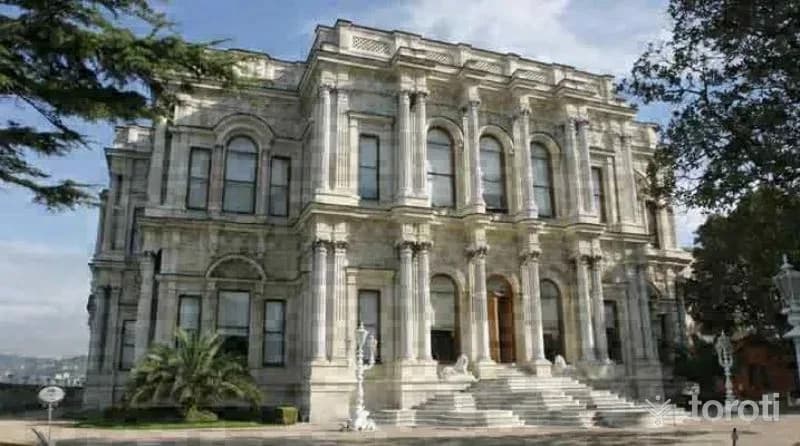
Beylerbeyi Sarayı
Üsküdar, İstanbul
Beylerbeyi Palace was built as a summer residence for Ottoman sultans and served to host foreign heads of state.
10
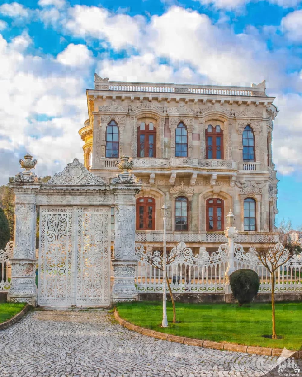
Küçüksu Kasri
Beykoz, İstanbul
Küçüksu Pavilion is a historical structure located in the Bosphorus, used as one of the sultans' private gardens during the Ottoman period.
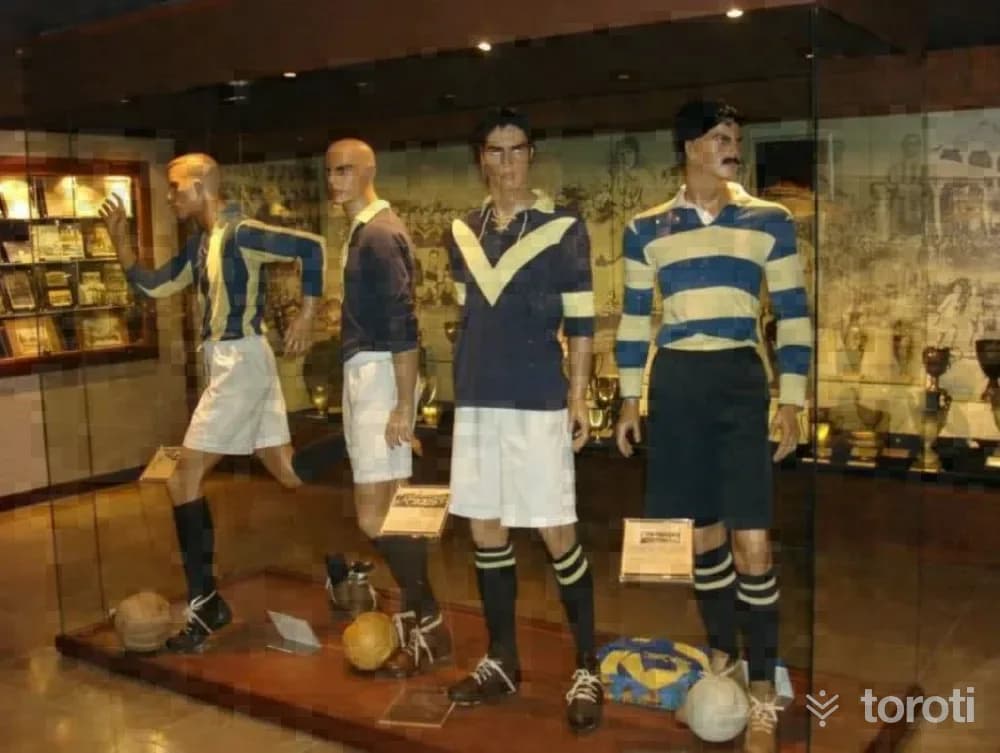
11
Fenerbahçe Spor Kulübü Müzesi
Kadıköy, İstanbul
The Fenerbahçe Sports Club Museum showcases the 100 years of achievements and awards of Fenerbahçe, an essential part of Turkish sports.
- No image
12
Polonezköy
Beykoz, İstanbul
Polonezköy is a village located 30 km away from Istanbul, immersed in nature. It is a peaceful getaway with walking paths and cycling trails.
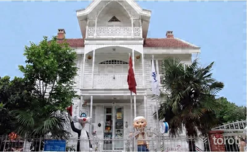
13
İstanbul Oyuncak Müzesi
Kadıköy, İstanbul
The Istanbul Toy Museum, founded by poet-writer Sunay Akın, opened its doors in 2005. The museum showcases over 4,000 toys acquired from various parts of the world.
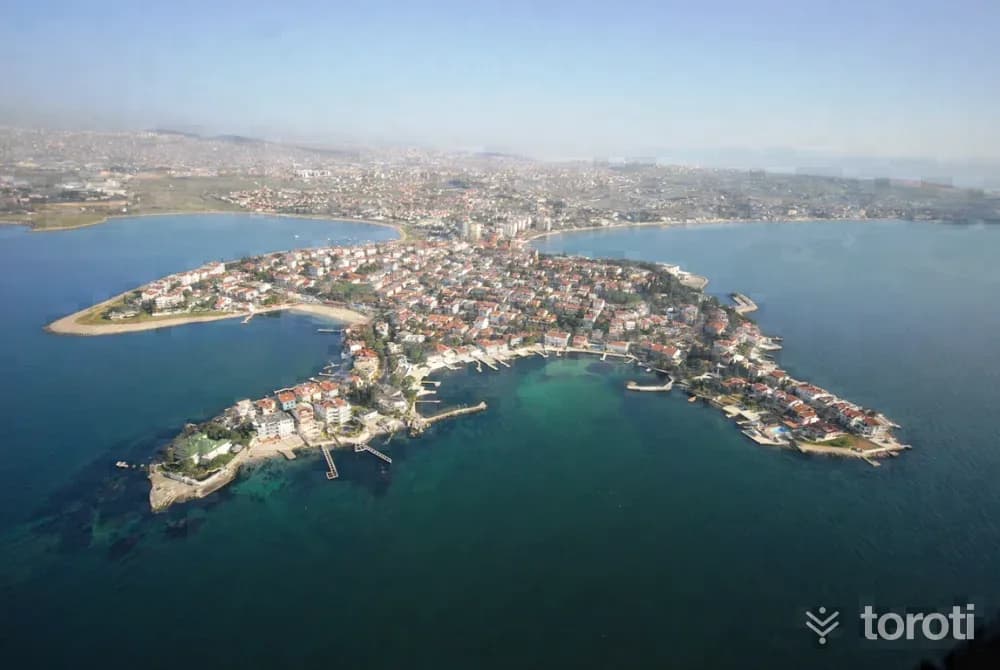
14
Bayramoğlu Adası
Darıca, Kocaeli
Bayramoğlu Island is a peninsula known for its historical background and natural beauty. It is an ideal place for walking during the summer months.
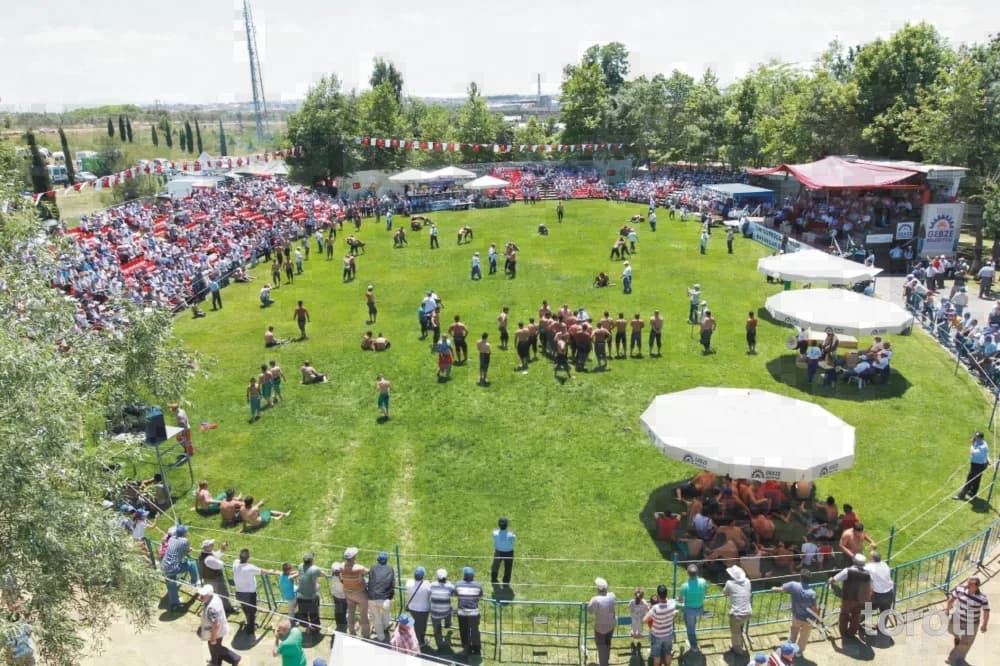
15
HünkÂr Çeşmesi Ve Çayiri
Gebze, Kocaeli
Hünkâr Çeşmesi and Çayırı is a historical site dedicated to Fatih Sultan Mehmet, featuring a fountain and hosting traditional wrestling festivals annually.
16
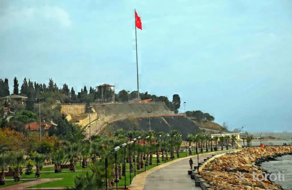
Denize Sevgi Parkı-darica
Darıca, Kocaeli
Denize Sevgi Parkı is a beautiful area offering opportunities for relaxation, entertainment, and sports.
17
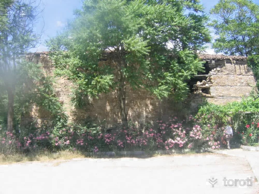
Su Dolabi / Gebze
Gebze, Kocaeli
The Water Reservoir is a historical structure located in the center of Gebze. Built in the 16th century, this structure was constructed to meet the water needs.
- No image
18
Ballikayalar
Gebze, Kocaeli
Ballıkayalar is a nature park located in Gebze, offering an ideal area for mountaineering.
- No image
19
Çerkeşli Kayalitepe
Dilovası, Kocaeli
This route, which goes from Çerkeşli village to the summit of Kayalıtepe, is the longest of Kocaeli'nin natural hiking routes. In addition to the length of the distance, the steep ascent and descent should be taken into consideration. Çerkeşli Village forms the starting point of this route.
- No image
20
Büyükdere Vadisi
Gebze, Kocaeli
Büyükdere Valley is a natural trail located within the borders of Gebze, stretching between Tavşanlı and Tepemayır villages.
- No image
21
Ambargölü Deresi
Gebze, Kocaeli
Ambargölü Stream is located between Gebze and Körfez districts, featuring shallow canyon formations. The trail starts from Elbizli village and continues along the Ambargölü stream.
- No image
22
Taşköprü Çobangeçidi Kanyonu
Körfez, Kocaeli
Taşköprü Çobangeçidi Canyon is an area notable for its historical and archaeological richness.
- No image
23
Sultan Baba Türbesi
Gölcük, Kocaeli
It is the only tomb structure from the Ottoman Period, located on a raised platform on a hill surrounded by cypress trees in Örcün Village, Değirmendere, Gölcük District. Inside, there is a wooden sarcophagus belonging to Sultan Baba and a decree dating from the years 1787 from the time of Selim III. He is a member of the Şemsi Branch of the Halveti Order. In the graveyard located to the right of the tomb entrance, there is an Ottoman Grave dated 1879.
- No image
24
Sarayli Köyü Yukarı Değirmendere
Gölcük, Kocaeli
Saraylı Village is attractive for its cultural heritage houses, its cemetery dating from the Ottoman Period, and the Çavuş grape. This route is of a kind where one can enjoy walking through a historic village in the Samanlı Mountains and within the Değirmendere Valley. A short section of the route is a steep ascent, and then another short section continues flat. Since the other sections continue as steep descents, the use of poles is absolutely necessary.
- No image
25
İzmit Elektronik Kent Müzesi
İzmit, Kocaeli
The Electronic City Museum introduces the city's history, economy, culture and tourism, historical artifacts and municipal services to all local and foreign visitors in an electronic environment. In the museum's sections, there are models of 10 important historical structures integrated with an audio system.
- No image
26
Cami Düzü Yuvacik Baraji
Başiskele, Kocaeli
This route consists of a traffic-free dirt vehicle road located just across from the main highway around Yuvacık Barajı. Rest areas have been created within the route by the Metropolitan Municipality. We recommend Cami Düzü village as the starting point of the route. The end point of the route is the area where the body of Yuvacık Barajı is located. A 5 km section of the route consists of a flat dirt vehicle road.
- No image
27
Aytepe Değirmen Düzü
Başiskele, Kocaeli
A large part of this route, which is visually perfect and has a geography where everyone can walk comfortably, consists of descents. Therefore, it is especially useful to use a walking stick throughout the hike. The last flat stretch on the road descending from Aytepe to soğuk su is the point we prefer as the starting place of this trail. This route, consisting of a dirt forest road and occasional paths, can be walked in all four seasons, although the most ideal times are the seasons excluding the winter period.
- No image
28
Sultaniye Serindere
Kartepe, Kocaeli
Sultaniye Village is a settlement established by people who migrated from the Eastern Black Sea, located on the foothills of the Samanlı Mountains. It is a route where one can enjoy walking in the direction of Serindere's flow within an untouched geography. Sultaniye Village, connected to Kartepe, is located deep inside the Samanlı Mountains, and the route ends in Örnek Village, also connected to Kartepe, just below the village.
- No image
29
Kuzu Yaylası
Kartepe, Kocaeli
When you arrive at Kuzu Yaylası by roads surrounded by pine, beech and linden trees and colorful flowers, the panoramic view and nature create a very impressive atmosphere. If you want to lose yourself in an endless whiteness, rise above the clouds, in short, live a snow-white dream, Kartepe is the owner of this impressive beauty. Its ارتفاع is 1602 m.
- No image
30
Haciyakup Çayiri Kartepe Zirvesi
Sapanca, Sakarya
Kartepe, the Samanlı Mountains and Kocaeli's highest point (1602 m.), it is possible to observe Bursa Uludağ and the entire Samanlı range from the Summit Point and to watch the Gulf of İzmit and Lake Sapanca from a bird's-eye view. Kartepe has become a center of attraction in terms of ski tourism in recent years. The journey, which begins after passing Kuzu Yayla located just below the summit point of Kartepe, ends within the borders of Sakarya.
- No image
31
Altıoluk Eskiyayla
Sapanca, Sakarya
The route, which starts from a place near the summit of Kartepe, ends at Eski Yayla (Öküzyatağı), located within the borders of Sakarya's Pamukova district, after Altıoluk Yaylası. Thus, we walk the Samanlı Mountains from the northern direction (İzmit Gulf) toward the southern direction (Sakarya Valley). The journey, which begins after passing Kuzu Yayla, located just below the summit point on Kartepe, ends within the borders of Sakarya.
- No image
32
Su Kayağı
Sapanca, Sakarya
Sapanca Gölü, a large part of which is in our province, is located here. Today, water skiing has become a popular sport in many countries where environmental conditions such as calm seas, rivers, and lakes are suitable. The Vali Yazıcıoğlu water skiing competitions, first held in 2004, continue to be organized every year at Sapanca Gölü. Athletes from many parts of Turkey participate in the championship.
- No image
33
Çark
Adapazarı, Sakarya
A mill was built on today’s Çark Suyu between 1581-1585 to meet the needs of Ada Karyesi. In place of this mill, which served for nearly 250 years, in 1734 the philanthropist Devoğlu Mustafa had a primitive “water wheel”/“çark” built and ditches-canals opened, and the water of Çark was carried to the Orta Camii fountain and to Adapazarı as drinking water.
- No image
34
Kent Park
Adapazarı, Sakarya
Located in the city center, Kentpark, created by transforming 160 thousand m² of rubble into greenery, was turned into a place where people can breathe and escape the exhausting city life. With an approximately 4.500-meter walking area, all surfaces in Kentpark were grassed while preserving the natural environment and trees. The park has a 14.000 m² pond.
35
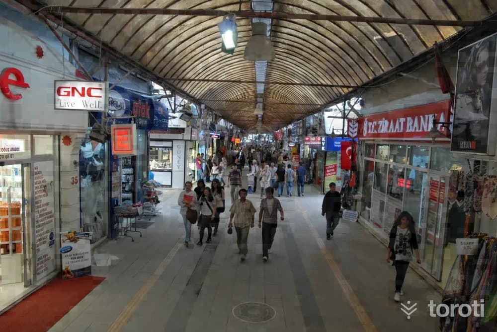
Uzun Çarşı
Adapazarı, Sakarya
Adapazarı is not only the junction point of three continents, but also the heir to three separate empires. Of the Bithynians, who gave the river the name of the “queen-goddesses Sangaryus,” and the famous II, who had the Jüstinyanus Bridge (known among the people as Beşköprü) built.
36
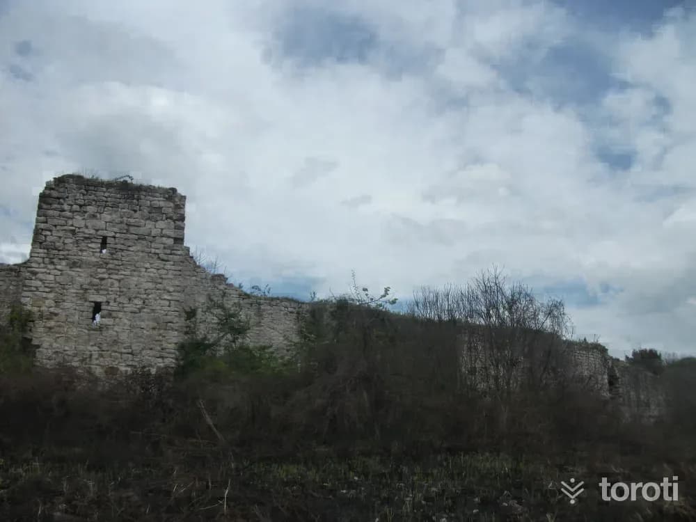
Harmantepe Kalesi
Adapazarı, Sakarya
Harmantepe Castle, located to the north of Adapazarı Harmantepe Village, was built on a small natural hill. While its surroundings were marshy and swampy, they were later transformed into fertile agricultural land thanks to the canals opened on both sides. To reach the castle, it is necessary to turn onto the field road branching off to the left from the road going from Küçük Söğütlü to Akçakamış Village. Access is a little difficult in rainy weather.
- No image
37
Kuzuluk Orman İÇİ Dinlenme Yeri
Akyazı, Sakarya
It is located on the Adapazarı-Akyazı-Mudurnu road, 8 kilometers from Akyazı and 34 kilometers from Adapazarı. It has an area of 11,85 hectares. It was established in 1996. In the area; there are facilities such as a countryside casino, toilet, fountain, entrance control booth, and children's playground. The forest recreation area, covered with beech and oak forest, has a development plan.
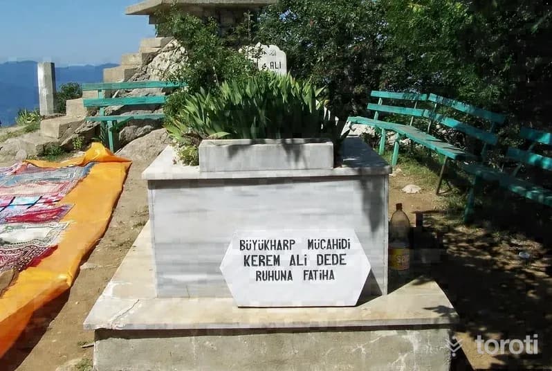
38
Keremali Türbesi
Akyazı, Sakarya
Keremali Tomb is located on Keramali Plateau in the Akyazı district. Various legends are told about Keremali Tomb: When four of the seven saintly brothers who rendered great services in the Islamization of Anatolia died, the remaining Kerem, Ali and Hasan came by boat to the foot of present-day Keremali Hill. Although Kerem and Ali got off the boat, Hasan did not. The others shouted after him, “Stop Hasan,” but Hasan did not stop and disappeared into the water.
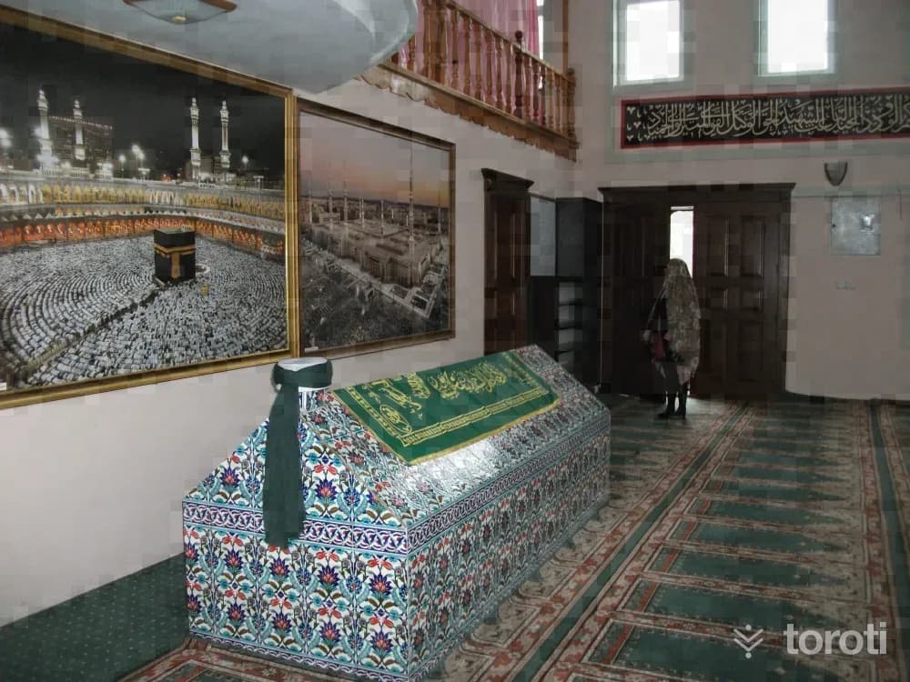
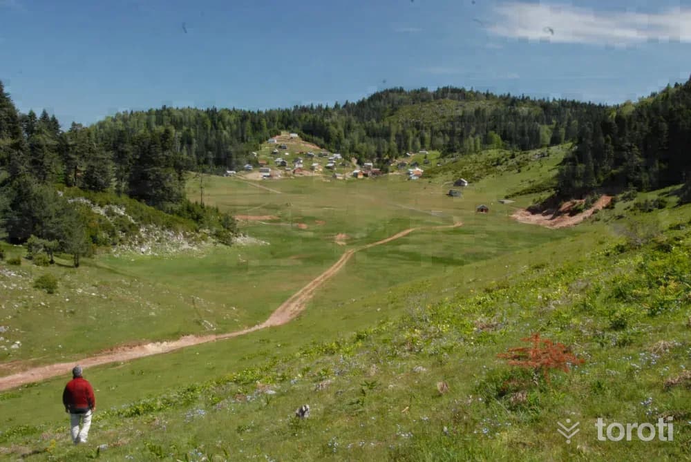
39
Selman Dede Türbesi
Hendek, Sakarya
According to the belief regarding the tomb in Uludere, which is visited for various illnesses and for prayers for rain, it is said that the water left there is gone by the next morning. It is also rumored that a white-haired old man worships with this water.
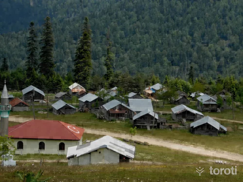
40
Çiğdem Yaylası
Hendek, Sakarya
Çiğdem Yaylası, where houses notable for their structure are located, has been listed among Turkey’s ten most beautiful plateaus by a large jury consisting of tourism professionals, travelers and writers. With its wide area covered with grass called topukotu, and its small and gently sloping hills, the plateau has a very pleasant view. Plateau festivals are held on the plateau every year in the second week of July.
41
Dikmen Yaylası
Gölyaka, Düzce
It is located within the borders of Hendek district. The distance between Hendek and Dikmen Yaylası is 1,5 hours. Dikmen and Çiğdem villages can be reached via Hendek-Karadere, and from there the plateau can be reached. Electricity is available on the plateau, which is famous for its rhododendrons. It is the highest peak of our province at an altitude of 1722 meters. Summer season festivities are held here every year.
42
Harmankaya Şelalesi
Cumayeri, Düzce
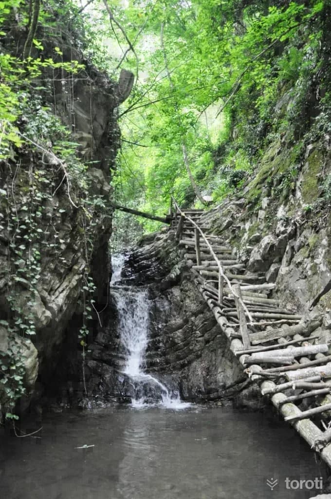
Harmankaya Waterfall, located in Harmankaya village in Düzce’s Cumayeri District, is 31 km from Düzce and 11 km from the district center. Harmankaya Waterfall is 5 km from Turkey’s 3rd largest rafting area, with its 13 km course on the Büyük Melen River passing by Cumayeri - Dokuzdeğirmen village. In addition to its magnificent appearance, Harmankaya Waterfall is also the hidden paradise of the region with its 700 m medium-difficulty walking trail.
- No image
43
Sarıyayla Şelalesi
Akçakoca, Düzce
Aktaş Waterfall is located within the borders of Aktaş Village, 11km. from Akçakoca city center. With its nature and the rich vegetation around it, it is one of Akçakoca’s natural beauties worth seeing. Aktaş Waterfall, one of the places that tourists coming to the region for sea tourism have only recently begun to discover, is quite suitable for nature sports such as trekking and photo safari among the sound of the water falling from 50mt. and the greenery surrounding it.
44
Tarihi Uğurlu Köyü Yeni Meze Cami
Akçakoca, Düzce
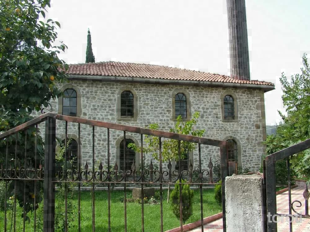
It is located in Uğurlu Köyü, 16km from Akçakoca. The mosque, which is a fine example of stone workmanship, was built in 1885. The mosque, which contains inscriptions dating back to the Ottomans, is one of the important values of the province.
45
Efteni Gölü
Düzce merkez, Düzce
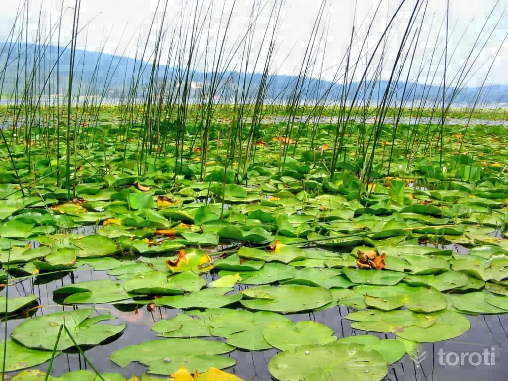
Efteni Lake is at the nodal point of an ecological network where, at the foot of the Elmacık Mountain range, the stream network of the Düzce Plain converges (the waters of Aksu, Asar, Uğur, Küçük Melen and side streams) and flows into the Black Sea through the Büyük Melen channel. Efteni Lake, located within the borders of Gölyaka in Düzce, is 5 kilometers from the district center and 25 kilometers from Düzce center.
- No image
46
Antik Tiyatro
Düzce merkez, Düzce
The Konuralp Ancient City, whose history dates back to the 3rd century BC, contains the historical and cultural values of Düzce province with the Konuralp Museum, Roman Bridge, Aqueducts and Ancient Theatre.
47
Düzce'nin Endemik Bitkileri
Düzce merkez, Düzce
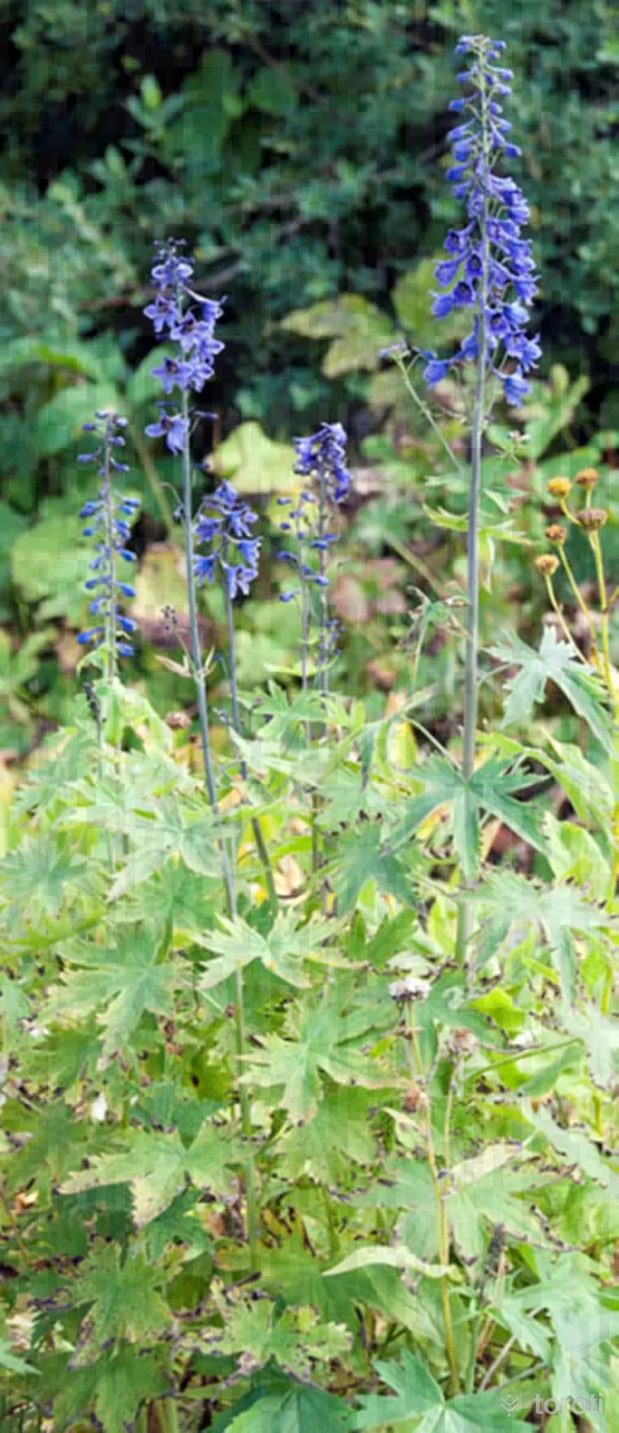
Düzce has a very rich floristic structure in terms of herbaceous and woody species and is home to 700 different plant species and 71 endemic plant species within the diversity of dune, maquis, stream, rock, forest and alpine vegetation. Of these species, 11 have been evaluated as "Endangered" in the Red Data Book of Turkish Plants. Cornflower: This plant taxon, which is unique to the Düzce-Elmacık mountains, is a local endemic species.
48
Abant Gölü Milli Parkı
Kaynaşlı, Düzce
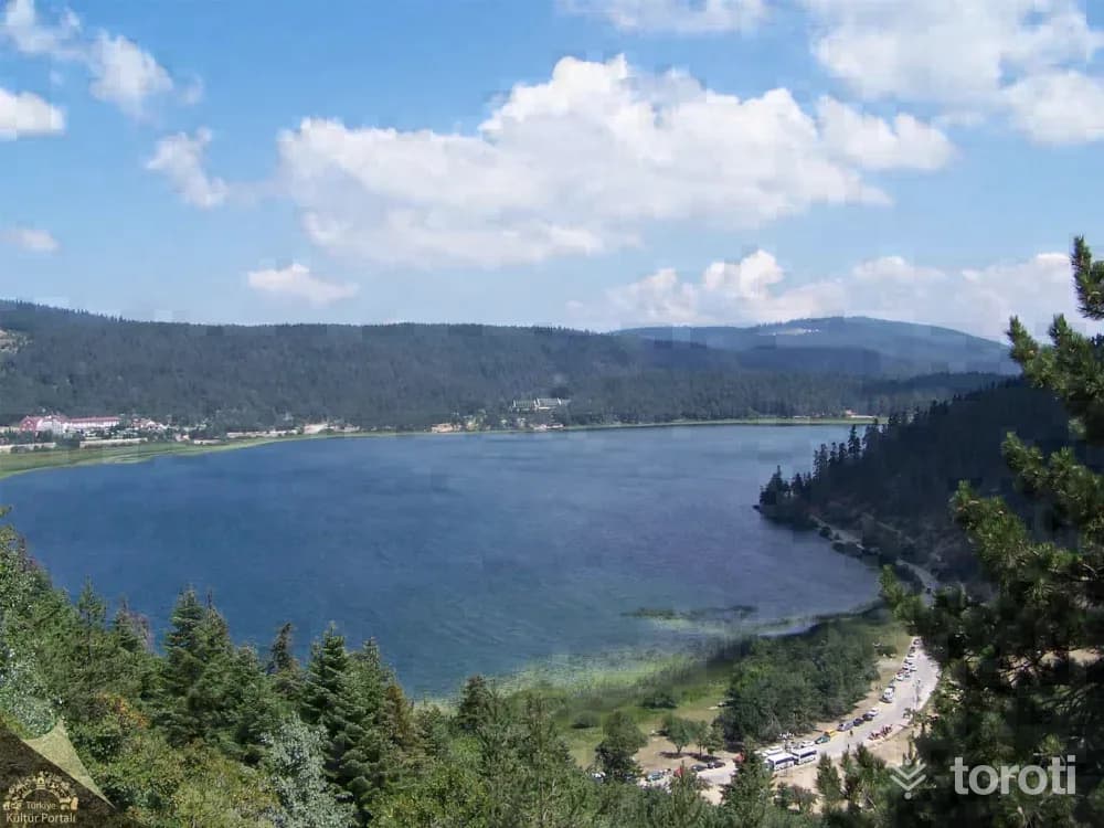
Abant Lake National Park is a popular holiday destination located southwest of Bolu, known for its natural beauty. It offers different landscapes throughout the year and is ideal for activities like hiking and picnicking.
- No image
49
Saz Köy
Kaynaşlı, Düzce
For those looking for an alternative holiday with a traditional lifestyle and wanting to experience village life, the 90-year-old Tekir Village House, located in the village and built according to the Abhaz Culture tradition, serves those who wish to stay. Its nature and the farm animals in its garden, the wood stove burning in winter, dinners eaten by the fireplace, and its authentic atmosphere win the appreciation of visitors.
50
Abant Tabiat Gölü
Kaynaşlı, Düzce
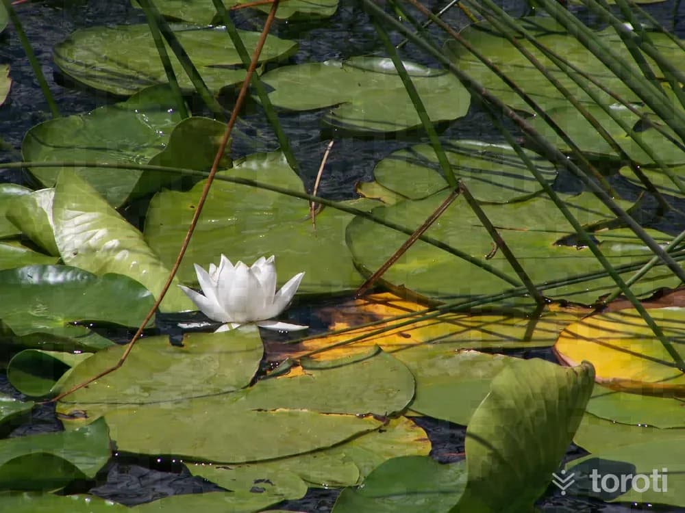
Abant Nature Lake is a natural lake located in the southwest of Bolu. With its rich vegetation and various activities, it is an ideal destination for nature lovers.
- No image
51
Hasanlar Barajı
Yığılca, Düzce
The lake, of a size and beauty too great to fit in the eye, attracts people by offering pastoral delights in all its exuberance and beauty from every curve and every height. While the road running parallel to the lake occasionally allows descent all the way to the lakeshore, it offers the chance to picnic on the shore.
52
Hayreddin-i Tokadı Türbesi
Bolu Merkez, Bolu
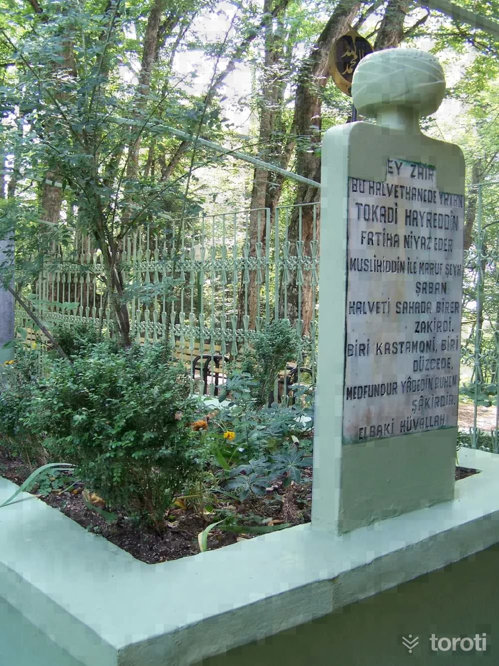
It is located 13 km. west of Bolu city center, within the borders of Elmalık Village, 4 km. from the Abant road junction on the northern side, on a hill known by its own name, within a forested area. The graves belonging to Hayrettin-i Tokadi, a member of the Halvetiyye order, and his disciples have been enclosed within a concrete frame. The grave belonging to Hayrettin-i Tokadi, who died in 1524, is located within an iron cage.
53
Bolu Ormanlar, Anıt Ağaçlar, Endemik Bitkiler
Bolu Merkez, Bolu
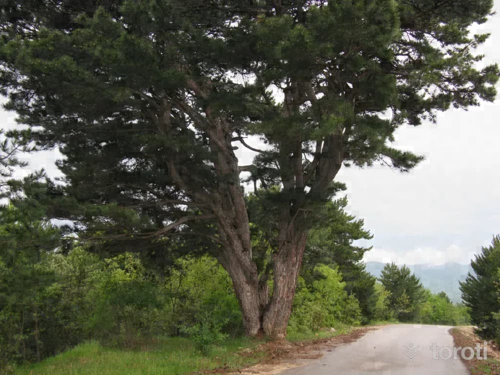
Bolu is one of the provinces with the most beautiful forests, with its rich tree and plant communities. Bolu's forests consist of Uludağ Fir, beech, Scots pine, black pine and oak. In Bolu's forests, up to an average of 1000 meters, beech, oak, Uludağ Fir, black pine, maple, elm and alders are seen. At elevations between 1000-2000 meters, there are forests consisting of Scots pine, Uludağ fir and eastern beech.
54
Bolu Müzesi
Bolu Merkez, Bolu
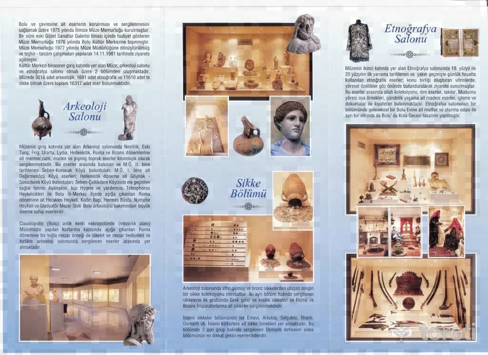
In the museum located in the Cultural Center belonging to the Provincial Directorate of Culture and Tourism, as of 2018, there are a total of 17083 works, including 3351 archaeological works, 1627 ethnographic works and 12105 coins. The Museum, located on the ground floor of the Cultural Center building, consists of 2 sections: the archaeology hall and the ethnography hall.
55
İmaret Cami
Bolu Merkez, Bolu
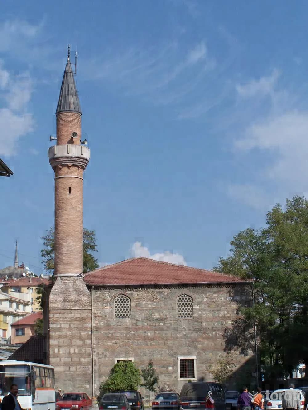
According to foundation records, the mosque, understood to have been built in the 16th century by Şemsi Ahmet Paşa, a descendant of Kızıl Ahmed Bey, has largely lost its originality through the repairs it has undergone over time.
56
Aktaş Cami
Bolu Merkez, Bolu
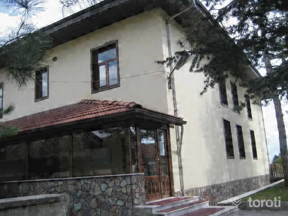
The mosque, with a rectangular plan and a flat wooden ceiling, has an enclosed last congregation area. There is a women's gallery with wooden railings and latticework. To the right of the entrance is the muezzin's gallery. It has a muqarnas mihrab and a wooden minbar. In the mosque, rectangular windows with wooden jambs were used. There is a tomb adjoining the left facade of the mosque and a fountain to its north. It is covered externally with a hipped roof. It has wide wooden eaves.
- No image
57
Gölcük Tabiat Parkı
Bolu Merkez, Bolu
It is an artificial barrier lake built 13 km. south of Bolu. The lake, surrounded by pine and fir trees, has a magnificent view in every season. The lake and its surroundings are under protection by the National Parks as a “Forest Recreation Area”. Vehicles are not allowed into the surroundings of this very charming and small lake.
Move the stops into your own plan, split them across days, and add places to sleep and eat.
Frequently asked
- How far is it between İstanbul and Bolu, and how long does it take?
- Driving between İstanbul and Bolu is roughly 344 kilometres and takes about 4 hours without stops.
- Where is it worth stopping between İstanbul and Bolu?
- There are 655 described places within 20 km of the road between İstanbul and Bolu. toroti lists 57 of them spread evenly along the drive, in the order you pass them; Avrupa Kültür Başkenti Mübadele Müzesi comes early on, and Gölcük Tabiat Parkı sits near the end.
- Which provinces does the İstanbul to Bolu route cross?
- The route between İstanbul and Bolu crosses İstanbul → Kocaeli → Sakarya → Düzce → Bolu. The stretch richest in places to visit is in Kocaeli.
- Should I take the toll highway or traditional route between İstanbul and Bolu?
- Toll motorways save driving time between İstanbul and Bolu, whereas traditional state roads pass directly through historic town centers, local culinary stops, and scenic nature viewpoints.
- How should breaks be scheduled between İstanbul and Bolu?
- For a drive of around 4 hours, taking a break every 2 to 2.5 hours is recommended. The catalogued attractions in Kocaeli and neighboring provinces offer memorable stopovers compared to generic highway rest areas.