
Stops along the way
Stops between Ankara and Bursa
376 km, roughly 5 hours of driving. The stops below are ordered as you pass them — the same road in both directions.
In short
The drive between Ankara and Bursa is 376 km and takes roughly 5 hours. There are 560 described places within 20 km of this route; it crosses 5 provinces, and the densest stretch is in Bursa (236 places).
There are 560 places within 20 km of this corridor; the 54 below are spread evenly along the drive.
1
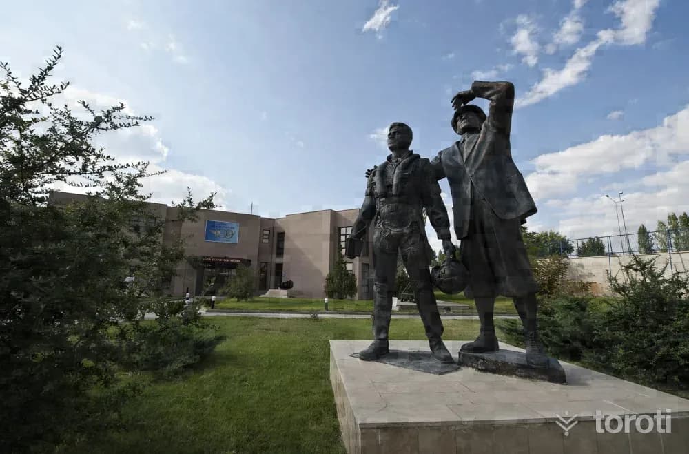
Hava Kuvvetleri Müzesi
Etimesgut, Ankara
The Air Force Museum is located in Şaşmaz Mevkii, established at the 12th kilometre of İstanbul Yolu. The museum, which entered service on 18 September 1998, was officially opened by Mustafa Kemal Atatürk’s adopted daughter, our country’s first female pilot, Sabiha Gökçen.

2
Türkiye Eğitim Derneği Ankara Koleji Okul Müzesi
Gölbaşı, Ankara
TED Ankara College School Museum, which conveys the historical accumulation of TED Ankara College Foundation Schools from its founding year of 1931 to the present day to future generations, is located on the ground floor of the administrative building on the İncek campus. The museum, which opened on 21 May 2008, has been granted the status of “Private Museum” by the Ministry of Culture and Tourism.
3
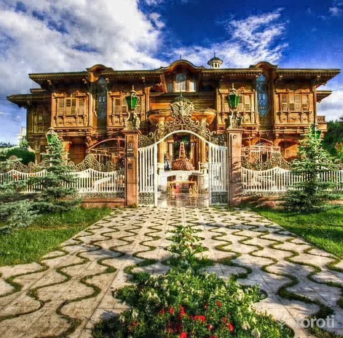
Anadolu Mimarlik Ve Mobilya Kültürel Miras Müzesi Ve Araştirma Merkezi
Çankaya, Ankara
Anadolu Architecture and Furniture Cultural Heritage Museum and Research Center, the first architecture and furniture museum in our country, was opened on 25 December 2008. It is in Merik Mansion on Lodumlu Doğramacı Caddesi. It is Bilkent’s famous Merik Mansion or, as it is popularly known, the “Golden Mansion”.
4
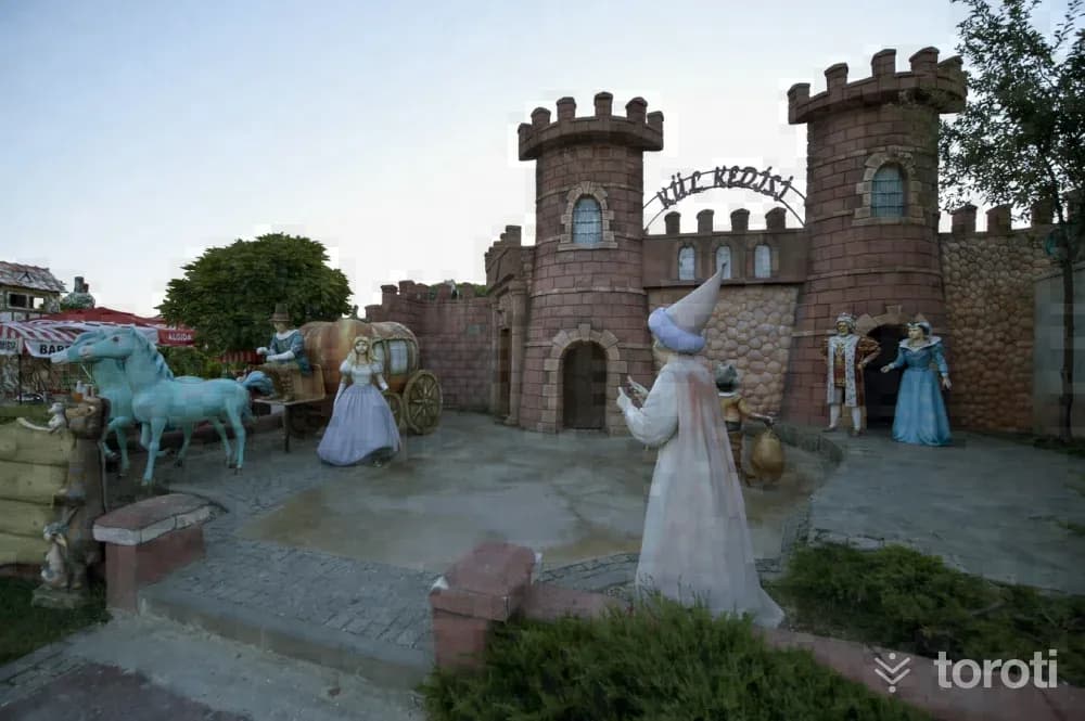
Harikalar Diyari
Sincan, Ankara
Within Harikalar Diyarı, which is planned with approximately 771 thousand square meters of green area, 330 thousand square meters of roads and squares, 40 thousand square meters of parking area, 67 thousand square meters of building area, and 92 thousand square meters of water areas, there is also a Fairy Tale Island established in an area of 25 thousand square meters for children.
5
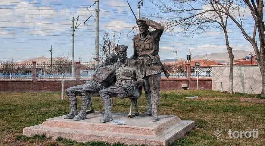
Tcdd Maliköy Tren İstasyonu Müzesi
Sincan, Ankara
Malıköy, located on the Ankara-Eskişehir railway line, is a settlement center connected to the Polatlı district. The Malıköy station located here is a very important station that affected the fate of the nation in this region where the Battle of Sakarya took place.
6
Topçu Ve Füze Okulu Sinif Müzesi
Polatlı, Ankara
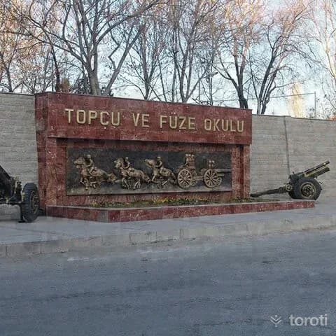
The Topçu ve Füze Okulu Sınıf Müzesi, established with the aim of reflecting the social, cultural and technical development of the artillery class according to periods, conducting scientific research on military cultural assets that will shed light on our military history, and passing on our history and culture to future generations, was completed and opened to service in April 1973. The museum consists of three main sections: the museum garden, the museum section and the Şeref Salonu.
7
Mehmetçik Anıti
Polatlı, Ankara
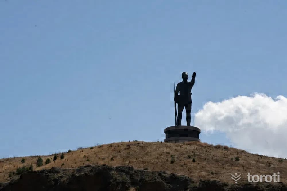
The Sakarya Victory Mehmetçik Monument, Kartal Tepe Mehmetçik monument, rises by the E–90 highway 6 kilometers west of Polatlı District. Although it fell into enemy hands from 31 August 1921 to 12 September 1921, this was an area where the enemy's advance was prevented by bayonet charges. The Mehmetçik monument was made by sculptor Associate Professor Dr. Sait Rüstem. Including its pedestal, it has a total height of 32 meters, and the monument itself is 22 meters.
8
Duatepe Anıti
Polatlı, Ankara
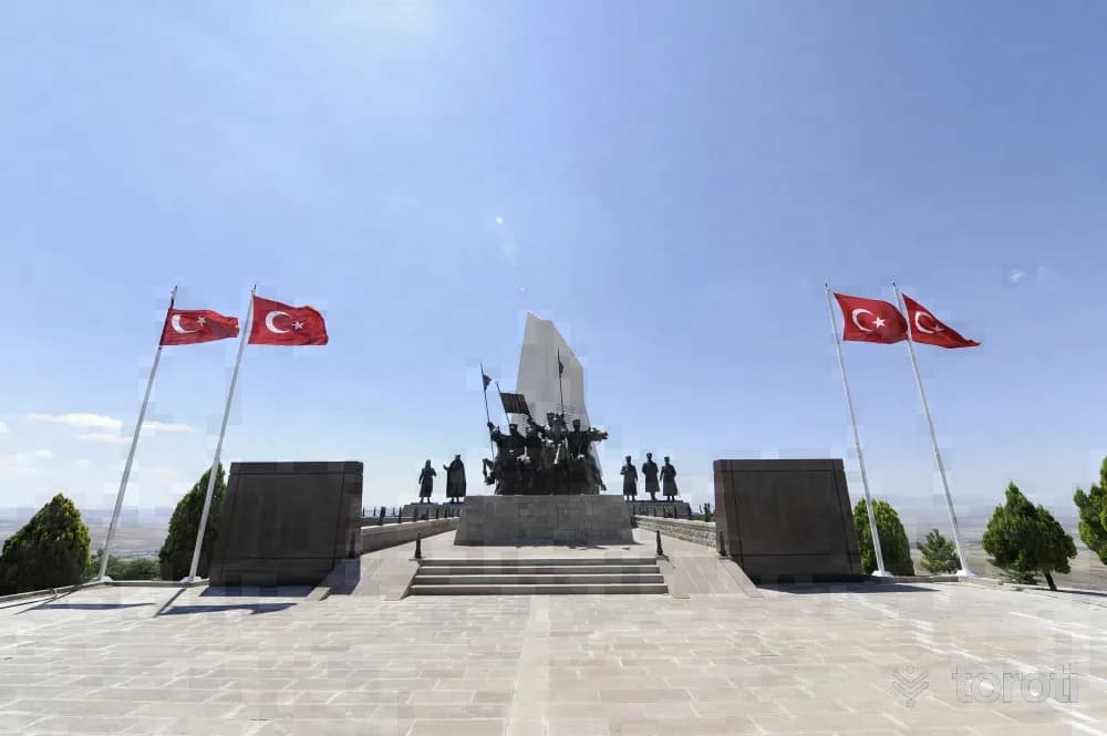
Duatepe Monument was created by afforesting Gazi Tepe, Türbe Tepe and Mangal Dağı on the last defense line where the Battle of Sakarya, considered the turning point of the War of Independence, was fought. Work began at Duatepe in October 1999, 20 thousand trees were planted, and the monument was completed and opened on 12 September 2000. Polatlı, Duatepe Monument consists of five parts: parking lot, access road, walking path, ceremony area and monument.
- No image
9
Kartaltepe Mehmetçik Anıtı ve Panorama Müzesi
Polatlı, Ankara
The Sakarya Victory Mehmetçik Monument is located at Kartaltepe, by the E–90 highway, 6 km west of Polatlı district. The Mehmetçik Monument was built with a total height of 40 metres, with a 22-metre statue and an 18-metre base, and was opened on 6 August 2008.
10
Gordion Müzesi
Polatlı, Ankara
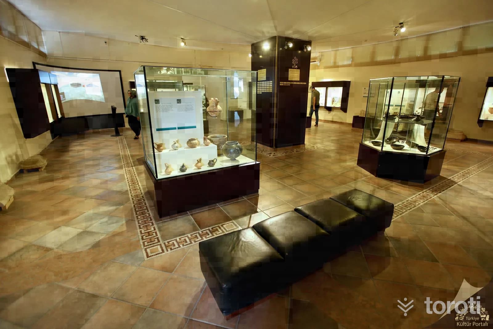
It was established in 1963 next to a small village with a population of 500, known as Yassıhöyük, in the Polatlı district of Ankara. Today, a chronological exhibition is presented at Gordion Müzesi, and each period is represented by characteristic examples.
11
Gordion Antik Kenti
Polatlı, Ankara
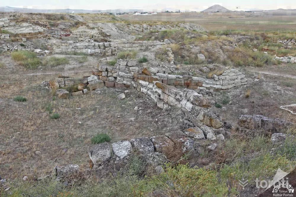
Gordion Ancient City, one of the most important archaeological sites of Anatolia, was inscribed on the World Heritage List by UNESCO in 2023. Servet Uygun Gordion Ancient City is located in the Central Anatolia Region, approximately 90 kilometers southwest of Ankara city center and approximately 18 kilometers northwest of Polatlı district, in the Yassıhöyük neighborhood. Over a long period of 4500 years, settlement in and around Gordion was interrupted very little.
12
Doğan Aslan Mescidi
Sivrihisar, Eskişehir
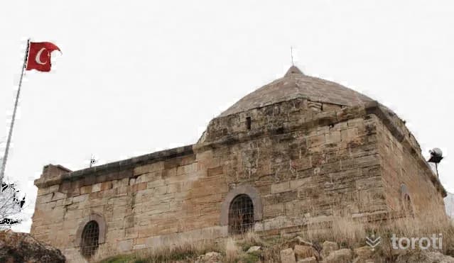
It was commissioned in 1247 by Doğan Aslan Bey, the standard-bearer of II.Gıyaseddin Keyhüsrev. It has an architectural style different from the structures in the region, with its eight-segmented dome and last congregation area.
13
Hamamkarahisar Cami
Günyüzü, Eskişehir
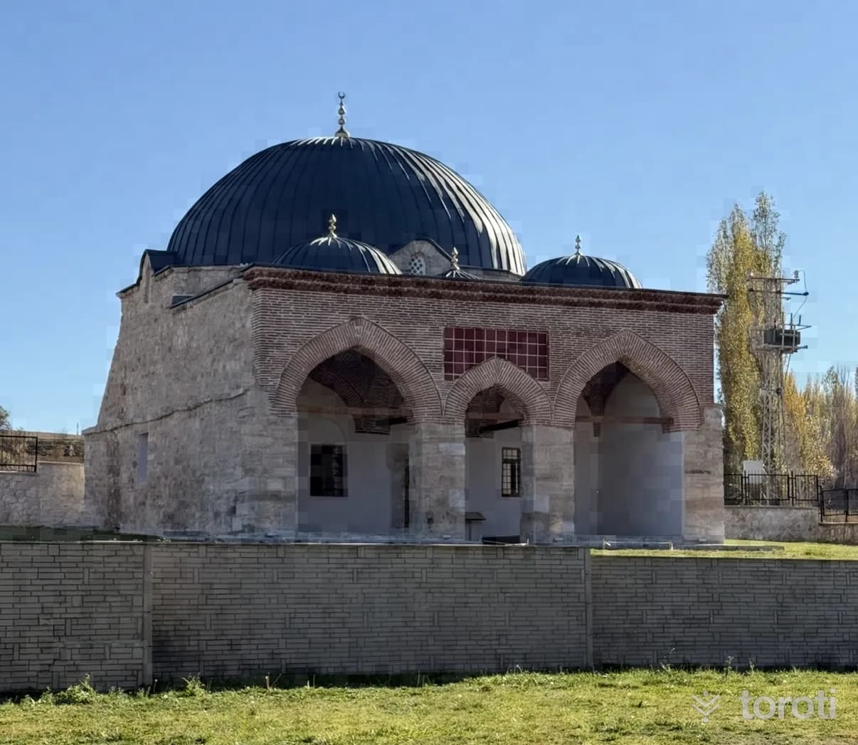
It was commissioned in 1259 by Emir Seyfettin Kızıl in Hamamkarahisar Village. It is stated that Emir Seyfettin Kızıl was the Bey of the Turkmen Bayındır Tribe and one of the three great emirs consulted by İzzeddin Keykavus. Hamamkarahisar Camii is an original example that has preserved its identity to the present day in terms of the shaping and integration of its sections as the main space and the last congregation area during the transition to Ottoman architecture.
14
Nasreddin Hoca'nin Evi
Sivrihisar, Eskişehir
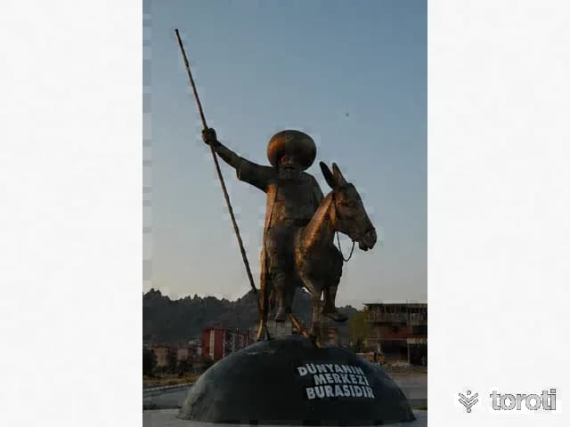
Nasreddin Hoca, an educator, religious man, and jurist who lived in the 13th century, was born in 1284 in Hortu (Nasreddin Hoca Beldesi) Village of Sivrihisar. Nasreddin Hoca's house was built as a simple masonry structure with a ground floor and one upper floor, consisting of houses with inner courtyards. The houses are in an attached order, and their roof was covered with reed matting over solid logs. Sivrihisar is important as the land that witnessed both the birth and death of Nasreddin Hoca.
- No image
15
Zey Köyü Ören yeri
Sivrihisar, Eskişehir
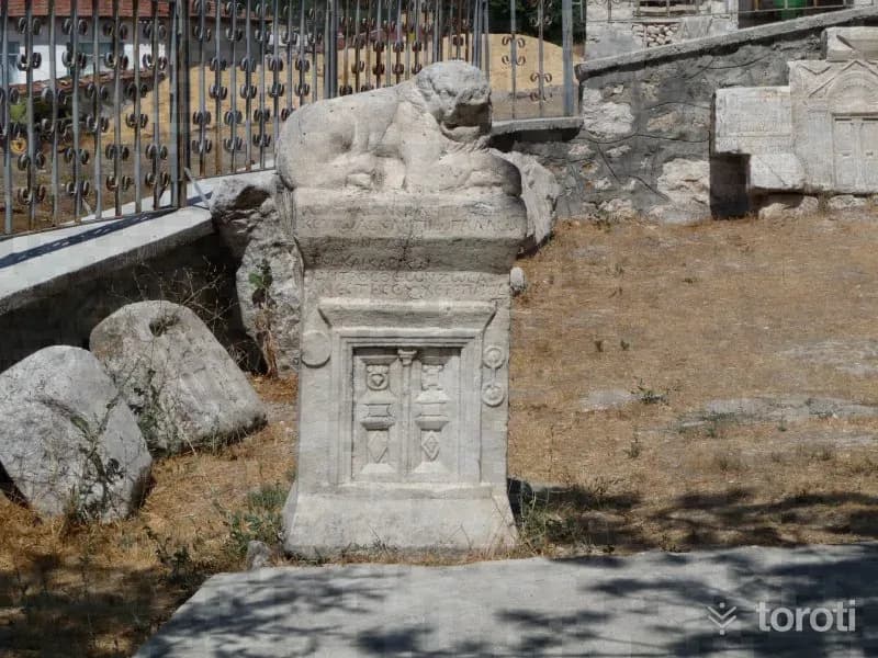
It was established on a rocky slope on the northern foothills of the Sivrihisar Mountains. In the higher parts of the rock masses that border a narrow valley from two sides, about 1 km south of the village, there are twelve chamber tombs, two stepped altars and a grape pressing pool. These monuments, which constitute original examples of Phrygian rock art, belong to the Phrygian settlement of Zey Kalesi, 1 km south of this area.
16
Seyyit Mahmut Suzanı Külliyesi
Sivrihisar, Eskişehir
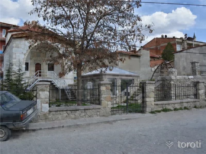
The külliye is a whole enclosed by a courtyard, consisting of a kümbet, tomb, hazire (open grave), and ruined madrasas. The kümbet was built of dressed stone with wooden material. In the hazire section, there is a sarcophagus bearing an inscription written in marble in kufic and Ottoman letters, and other types of graves. Seyyit Mahmut Suzani Külliyesi consists of the kümbet, tomb, and hazire section. It is a structure from the Seljuk Period. The kümbet was built of dressed block stone material.
17
Alemşah Kümbeti
Sivrihisar, Eskişehir
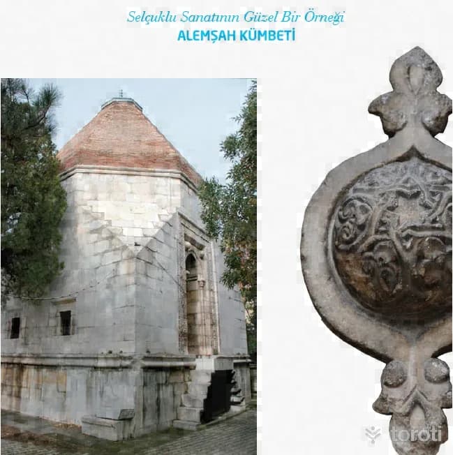
Alemşah Kümbeti, a fine example of Seljuk art, was commissioned by Melikşah in 1328 for his martyred brother Sultan Şah. The tomb is opposite Sivrihisar Ulu Camii. It is a two-storey structure with a square plan and was built of cut stone. Bricks were also used in places in its construction. Sivrihisar Belediyesi There is a mummification chamber on the lower floor of the tomb. In the door decorations of the mummification chamber, motifs frequently used by the Seljuks can be seen.
18
Sivrihisar Ulu Cami
Sivrihisar, Eskişehir
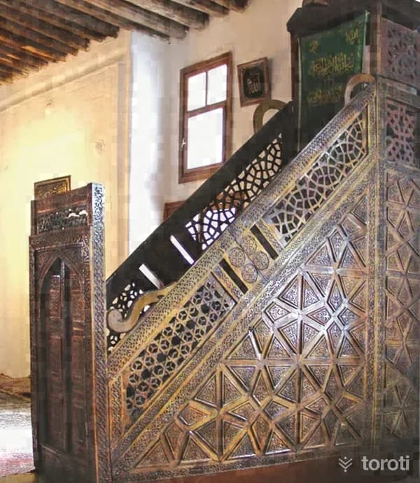
Sivrihisar Ulu Cami is one of the most important examples of mosques with wooden columns and wooden ceilings in Anatolia. Servet Uygun Various sources state that the mosque was first built in 1231-1232 by Emir Celaleddin Ali, and that in 1274 it was brought to its present form by Emineddin Mikail, one of the disciples of Mevlana Celaleddin Rumi.
19
Pessinus Ören Yeri
Sivrihisar, Eskişehir
Where is the Pessinus archaeological site? The Ancient City of Pessinus is located in Ballıhisar, 13 kilometers south of Sivrihisar on the Ankara-Eskişehir highway. Today, Ballıhisar Village has been established on top of the ancient city, which was on the old King's Road. The Ancient City of Pessinus is known as one of the most important places of worship where the mother goddess, called "Goddess Kybele" by the Phrygians, was located.
20
Karakaya
Sivrihisar, Eskişehir
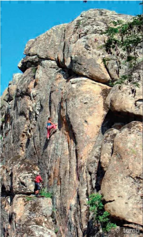
Karakaya, a beautiful village reached by a 4 km road to the left immediately after the town of Kaymaz at the 60th km of the Eskişehir-Ankara highway, attracts great interest with its granite rock formations that are very suitable for rock climbing. The most suitable seasons for climbing are spring, summer and autumn. Since most of the routes are on the north face of the rocks, they are shaded all day in summer except for the early hours. As winter is very cold, climbing is difficult even if the weather is dry.
21
Motosiklet
Çifteler, Eskişehir
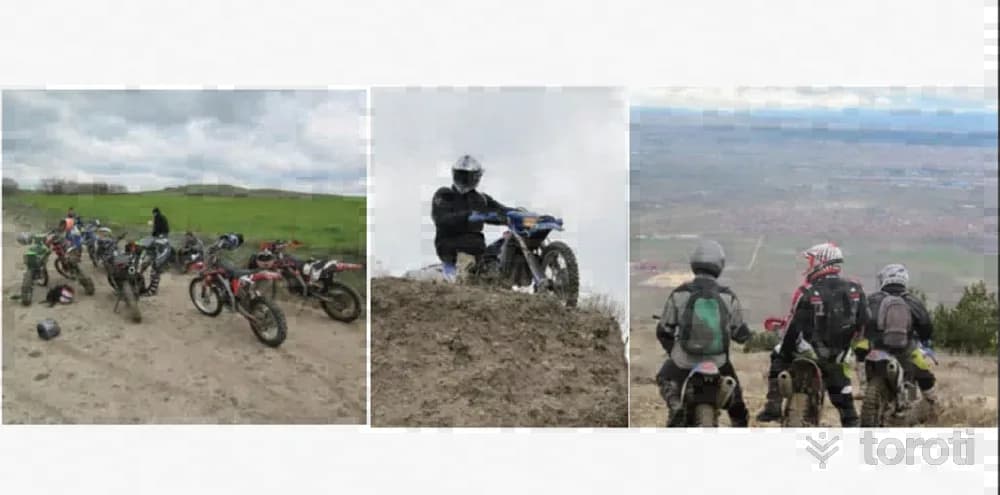
Our city is almost tailor-made for motorcycle rides as well. In this motorcycle sport, practiced far from all kinds of road environments, you may sometimes find yourself in the depths of the Çatacık forests, and at other times in the historical texture of the Phrygian valley. If you want to get away from the stress of city life, if you are looking for an alternative sport, if you want to spend time in nature and discover new places, then it means you have met a hobby that is just right for you.
22
Melik Gazi Türbesi
Seyitgazi, Eskişehir
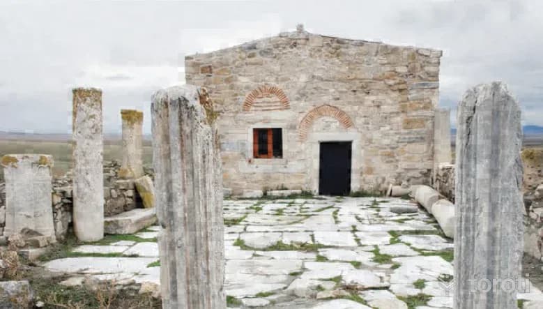
After Danişmend Gazi died in 1105, he was succeeded by his eldest son, Emir (Melîk) Gazi, who ruled for approximately thirty years. After the death of Danişmend Gazi, struggles for the throne arose among the members of the dynasty. Taking advantage of this, I. Kılıç Aslan captured Malatya. Emir (Melik) Gazi was initially subject to the Anatolian Seljuks.
23
Üryan Baba Türbesi
Seyitgazi, Eskişehir
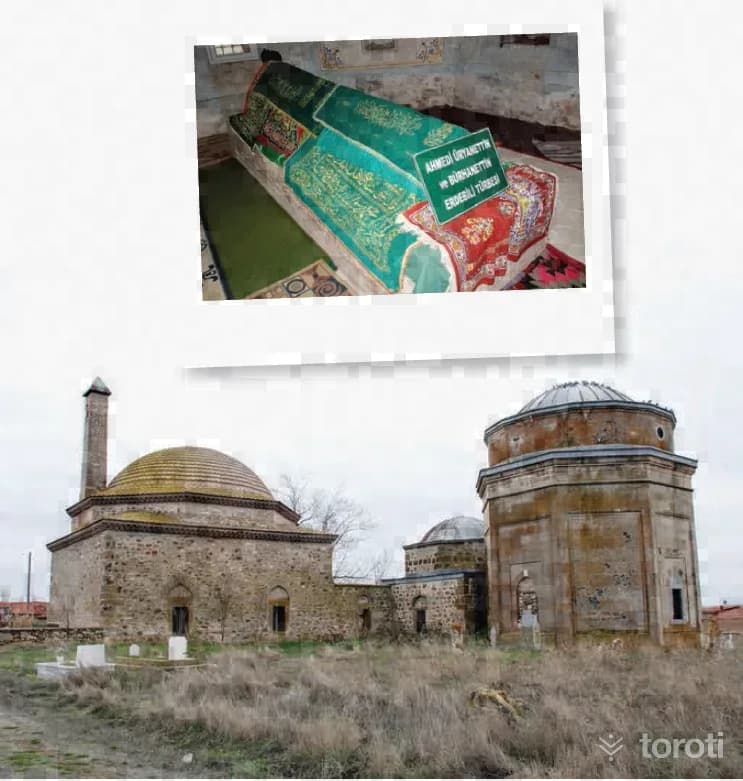
There is almost no information about Üryan Baba in the sources. However, it is known that this figure was a Kalenderi dervish. In addition, the fact that the idea of nudity, which exists in the religious foundations of both Melami, Haydari and Cavlaki, as well as Kalenderi, is evaluated in a more abstract way with such a name also suggests that this is connected with the verbal discourse gaining power and meaning on a much more real level.
24
Karahüyük midaio
Odunpazarı, Eskişehir
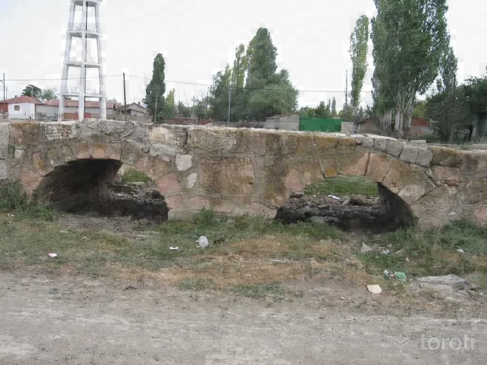
Known as a city founded by the Phrygian King Midas, Midaion/Karahöyük is one of Eskişehir’s large and famous mounds. It is located 30 km east of Eskişehir, on the bank of the Porsuk River, in a place overlooking the fertile Alpu Plain. It saw continuous settlement from the Early Bronze Age to the Byzantine Age.
25
Karahöyük / Midaio
Odunpazarı, Eskişehir
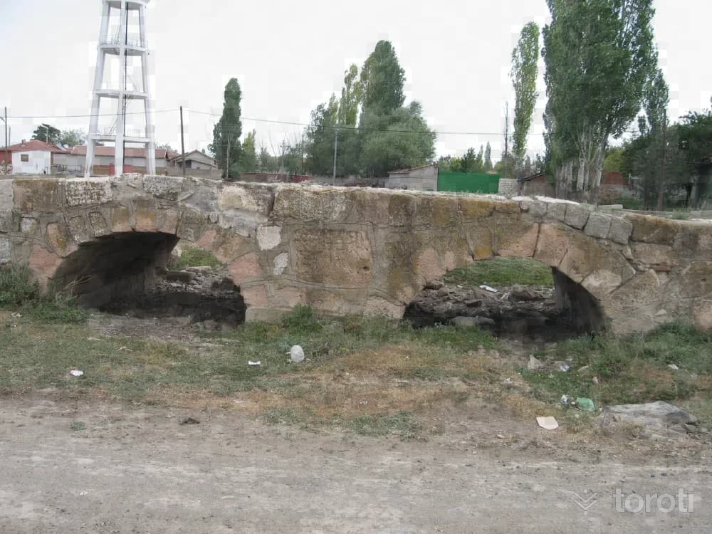
Known as a city founded by the Phrygian King Midas, Midaion / Karahöyük is one of Eskişehir’s large and famous mounds. It is located 30 kilometres east of Eskişehir, on the bank of the Porsuk River, in a place overlooking the fertile Alpu Plain. It is 500 metres in diameter and 20 metres high. It saw continuous settlement from the Early Bronze Age to the Byzantine Age.
- No image
26
Eşekini Mağarası
Odunpazarı, Eskişehir
It is located on the right slope of Çayboğazı Stream, 2 km north of Sorkun village, which is 15 km northwest of Mihalıççık. This road, which goes along Çayboğazı Stream after the Sorkun village turnoff from the Mihalıçcık-Nallıhan highway, reaches just above the cave after 1.5 km. From here, the cave is reached with a 10-minute walk. It is a fossil cave that has completed its development. It has two entrances. Source: - Eskişehir Governorship.(2014).
- No image
27
Yarimkaya Mağarası
Odunpazarı, Eskişehir
It is located on the left slope of Değirmen Deresi near Kayı village, connected to Han. It can be reached via the Eskişehir-Çifteler-Han-Kayı village or Eskişehir-Seyitgazi- Bardakçı-Karağaç-Kayı village roads. There is a road up to the front of the cave, which is 1.5 km south of Kayı village. It is a horizontally developed cave in the form of a sinkhole. Its entrance is 20 m above the valley floor; it is in the form of a steep vertical shaft of -3 m. Source: - Eskişehir Governorship.(2014). Eskişehir Guide(5.
- No image
28
Çalpinar Mağarası
Odunpazarı, Eskişehir
It is located to the northwest of Kale Tepe (1490 m), 2 km north of Dağcı village, which is 7 km west of Mihalıççık. The cave, situated on the right slope of Pazar Çayı, which joins Koca Çay, a major tributary of the Porsuk River, is reached by taking the road to Dağcı village that branches off at the 5th km of the Mihalıçcık-Eskişehir road. From the village, a 3 km stabilized road extends to the front of the cave. Bibliography: - Eskişehir Governorship.(2014).
- No image
29
Düdensuyu
Odunpazarı, Eskişehir
It is connected to Düdensuyu Stream near the village of Beyyayla, which is affiliated with Sarıcakaya. Düdensuyu Stream enters through the southeast-facing mouth of the cave and exits through the northwest-facing mouth. The gallery carved by Düdensuyu Stream within the rock mass is quite wide. The stream has formed small pools in places inside the cave. In seasons when the water level is high, it is necessary to use a boat to cross these pools. Bibliography: - Eskişehir Governorship.(2014).
- No image
30
Kaya Tirmanişi
Odunpazarı, Eskişehir
The areas most commonly used for basic training to practice this sport, which brings together balance, aesthetics, flexibility and strength, in Eskişehir are Bozdağ in the Sündiken Mountains, Kızıltepe in the Sakarılıca Baths, and the Taştepe area of Mayıslar village. For rock climbing training, the cliffs of Kızılinler and Sivrihisar are used. Source: - Eskişehir Governorship.(2014). Eskişehir Guide(5.
31
Ertuğrul Gazi Türbesi
Söğüt, Bilecik
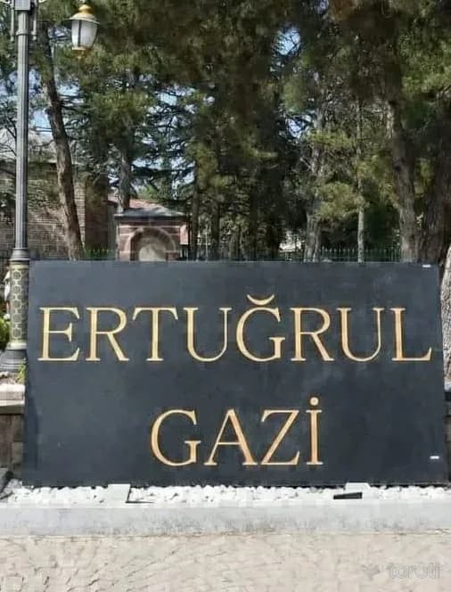
Ertuğrul Gazi Tomb is the tomb of Seljuk frontier lord Ertuğrul Gazi, the father of Osman Gazi, the founder of the Ottoman Principality, located in the Söğüt district of Bilecik province. Hüseyin Zekai Paşa, Söğüt Ertuğrul Gazi Tomb The construction date of the structure, built at the end of the 13th century, is not known exactly. It was first built by Osman Gazi as an open grave, and later turned into a tomb by I. Mehmet Çelebi. In 1757, III.
32
Çelebi Mehmet Camii
Söğüt, Bilecik
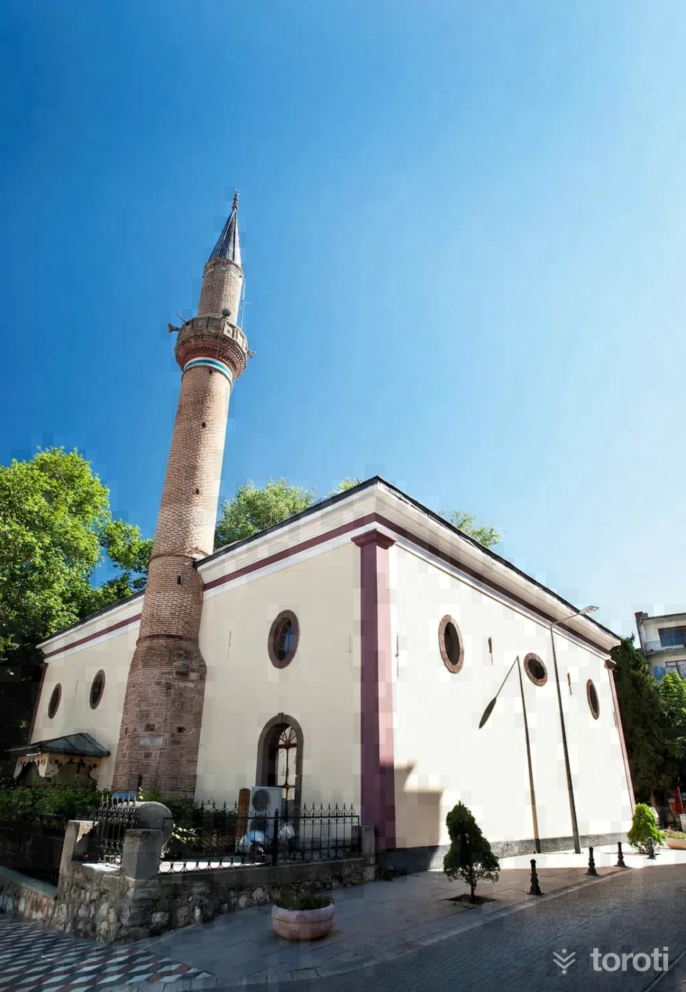
It was commissioned by Sultan Mehmed I Çelebi between 1414—1420 and is among the first examples of Ottoman architectural art in the type of domed structures. The Mosque, which has a rectangular appearance and 12 domes, was repaired by Sultan Abdülhamit II and underwent some changes as it was enlarged during the restoration.
- No image
33
Hamidiye Camii
Söğüt, Bilecik
In Söğüt District, it is a fine example of the neo-classical architectural style of the late Ottoman period. It was commissioned by Abdülhamit II in 1903-1905. It has a square plan, and its walls are of red cut stone. The structure is covered with a single lead-clad dome. Since it has two minarets, it is also known among the local people as the "Çifte Minareli Camii".
- No image
34
Ertuğrul Gazi Mescidi (Kuyulu Mescid)
Söğüt, Bilecik
The masjid located on the bank of Söğüt Çayı is said to be the place where Ertuğrul Gazi first pitched a tent when he arrived with his tribe. The structure, which contains a well inside and is also called "Kuyulu Mescit," was commissioned by Ertuğrul Gazi before 1276, built by II. Abdülhamit on the same foundations in 1902, and underwent restoration in later years.
- No image
35
Metris Tepe Zafer Anıtı
Bozüyük, Bilecik
Located 12 km off the road at the end of the Bozüyük-Eskişehir highway, the monument was built on Metris Tepe, where the İnönü Battles were won and which the great leader Atatürk referred to in the congratulatory telegram he sent to İsmet İnönü, saying, "There you defeated not only the enemy, but also the nation's ill fate," in order to keep alive the noble memories of our martyrs.
36
Kumral Abdal Türbesi
Bozüyük, Bilecik
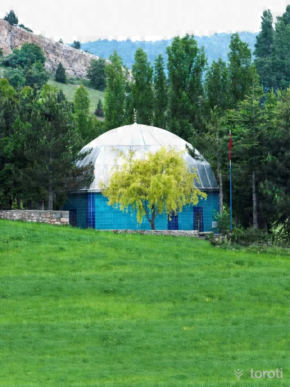
Kumral Abdal, one of the dervishes who held an important place in the foundation period of the Ottoman State, was Ertuğrul Gazi's standard-bearer and a disciple of Şeyh Edebalı. His tomb is located 2 km from Bozüyük, on the road to Kovalıca Village.
37
Kasim Paşa Camii
Bozüyük, Bilecik
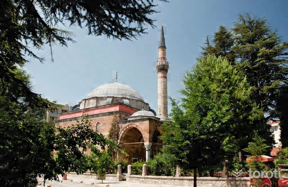
It is one of the examples of classical Ottoman mosques and one of Mimar Sinan's apprentice works. It was commissioned by Kasım Paşa, one of the commanders who joined Kanuni Sultan Süleyman's Baghdad campaign, in the years 1525-1528. Its walls are of cut stone. The wooden shutters of the entrance door and the windows next to the mihrab, with their woodwork and ivory inlays, make the structure interesting. Its minbar is covered with tiles of various colors on white marble.
38
Türbin Mesire Yeri
Bozüyük, Bilecik
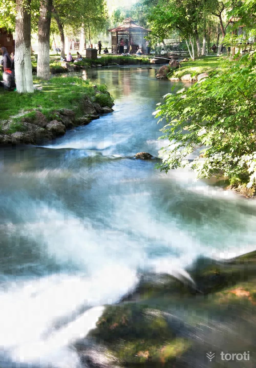
Türbin Mesire Yeri is a recreation and picnic area 7 kilometers from Bozüyük, rich in greenery, water and oxygen. Electricity is generated from the waterfall on the slope by means of a generator, and the area is known by this name from the turbine of the said generator. Due to the increase in demand for the recreation area, whose appearance has been beautified by the investments made by the municipality, the nearby empty area was also arranged and afforested and included in the recreation area.
- No image
39
Atatürk Köşkü
Bozüyük, Bilecik
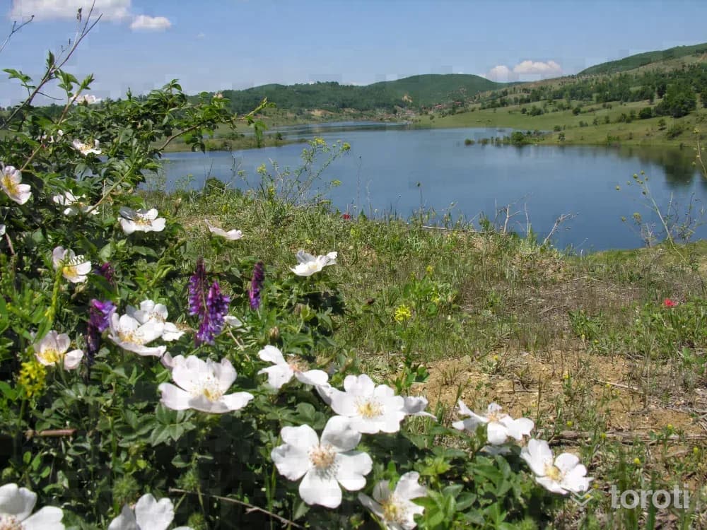
ATATÜRK FOREST MANSION, located in the Gülalan area 7 km from Erikli village, was built by İbrahim Çolak, one of Atatürk’s close comrades-in-arms and one of the important figures identified with Bilecik through his deeds. During Atatürk’s visit to Bilecik in 1930, he was hosted in this mansion. The building bears the characteristics of Bulgarian Architecture.
40
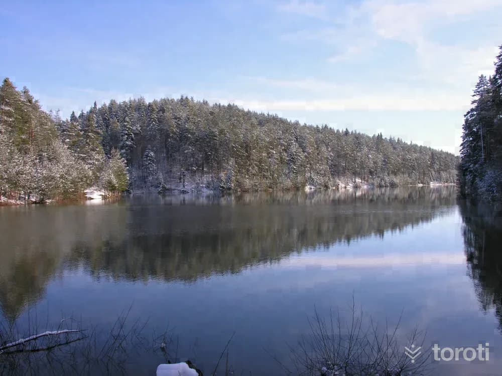
Günyurdu Göleti
Pazaryeri, Bilecik
The pond, built for irrigation purposes, has over time become one of Bilecik's most preferred recreation areas both for its natural beauty and for angling.
41
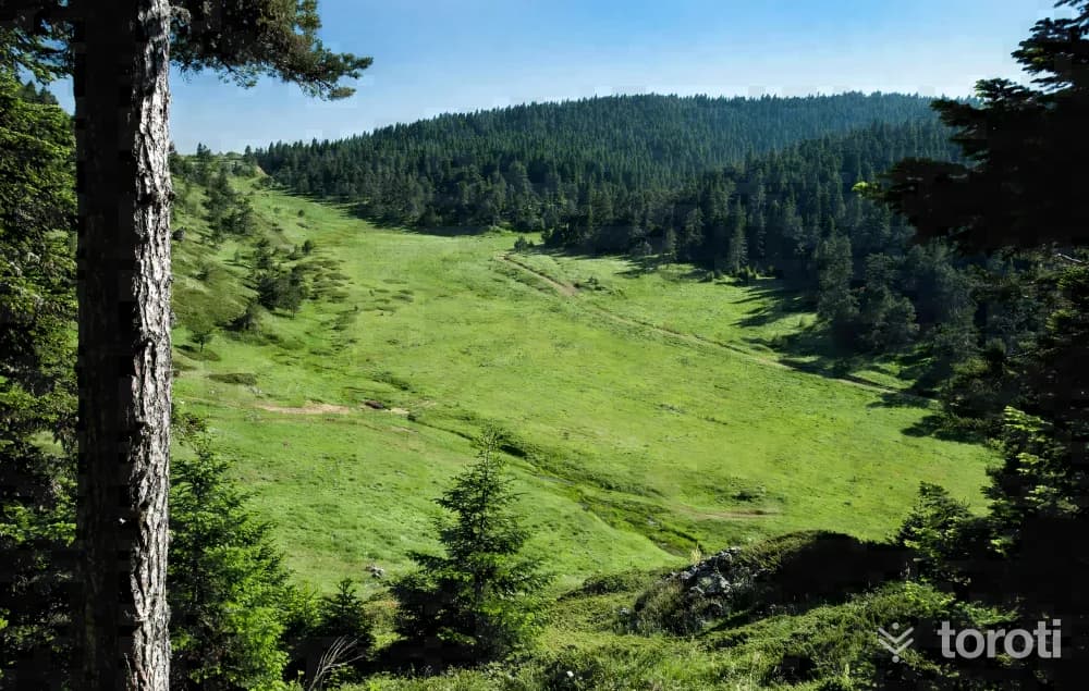
Bozcaarmut Göleti
Pazaryeri, Bilecik
Bozcaarmut Pond is a natural wonder that visitors cannot give up, with its untouched nature, suitability for angling, the meeting of the pine trees surrounding the lake with the waters, its air, silence, and extraordinary beauty. Where is Bozcaarmut Pond? It is near Bozcaarmut Village in the Pazaryeri district of Bilecik.
42
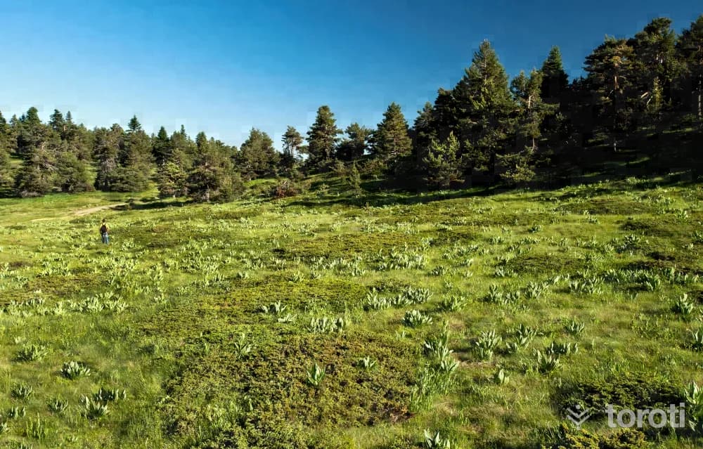
Kömürsu Yaylası
Bozüyük, Bilecik
Located 28 kilometers from the center of Bozüyük district, the plateau is covered with fir, black pine, beech, juniper trees and all kinds of flowers, and has 4 spring waters. Its highest peak is around 1700 meters. It is planned that this natural paradise, which is currently used for plateau and trekking tourism, will be used as a winter tourism center with the arrangements to be made.
43
Çiçekli Yayla
Bozüyük, Bilecik
At an altitude of 1906 meters, Çiçekli Yayla, the highest plateau of Bozüyük District, is a natural wonder of extraordinary beauty with its crystal-clear air, clear waters, lush green grass, colorful flowers, forest texture, and the endemic plant “Çimtien,” while the scents of thyme cover the whole of nature, and it is located in the Üç Tepeler area.
44
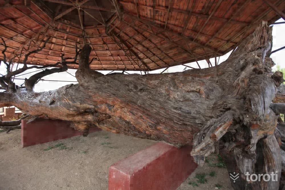
Mizik Çami
Domaniç, Kütahya
This black pine, the species of pine in which the cradle of Osman Gazi, the founder of the Ottoman State, was set up in his infancy, fell in 1980 as a result of natural causes. It was determined that the pine was 11 meters tall, had a circumference of 4.70 meters, and was approximately 740 years old, and it was registered as a monumental tree by the Council for the Protection of Cultural and Natural Assets on 15.07.1988.
45
Oylat Mağarası
İnegöl, Bursa
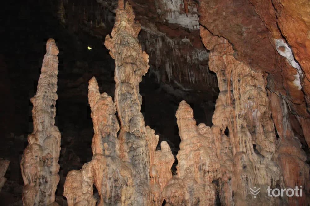
Mağara Bursa-Ankara kara yolundan Oylat Kaplıcasına ayrılan yoldan yaklaşık 17 km. içeride Hilmiye köyünün bir km. güneyinde yer almaktadır. Özellikleri: Toplam uzunluğu 665 m. olan mağara iki ana bölümden oluşur. Dar galerilerden oluşan birinci bölüm girişten çöküntü sonuna kadar olan kısımdır. İçeride dev kazanları ve damlataş havuzları bulunur. İkinci bölüm büyük bir çöküntü salonudur. İri blok ve dev damlataş şekillerinden (sarkıt, dikit ve sütun) oluşmaktadır.
46
İnegöl Kent Müzesi
İnegöl, Bursa
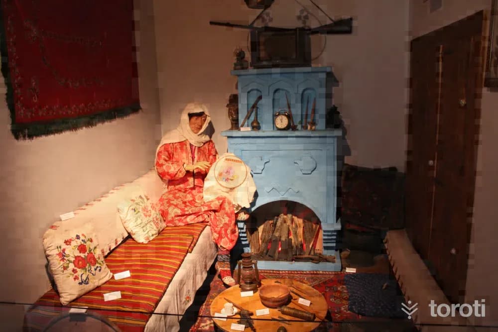
For the City Museum, the old municipal building, estimated to be approximately 150 years old, was restored in accordance with its original form and completely renovated as 1054 square meters. By conducting one-on-one interviews with 3000-3500 people, more than 2 thousand household items, objects and materials, and nearly 15 thousand documents and photographs were added to the museum archive, and it was opened in 2009.
47
İshak Paşa Cami Ve Külliyesi
İnegöl, Bursa
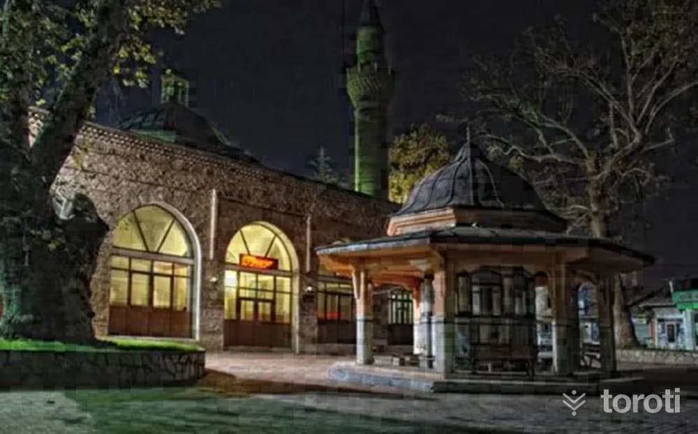
The mosque in the area in İnegöl known as belediye önü was commissioned by İshak Paşa, who commanded a part of the Ottoman forces during the siege of Istanbul and held various high offices during the reigns of Murat II, Fatih Sultan Mehmet and Bayezid II (grand vizier twice during the Fatih period and once during the Bayezid II period). According to waqf records, it is understood that the construction date was before 873 H. (1468-69).
48
Yıldirim Cami
İnegöl, Bursa
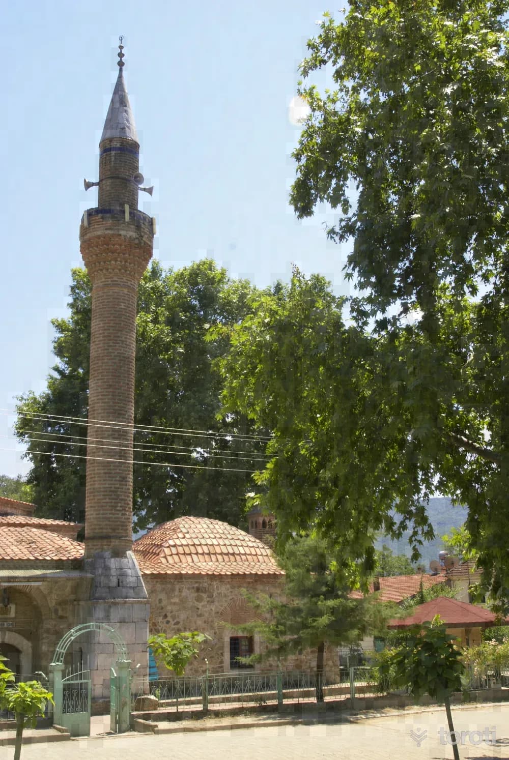
Although it is recorded under this name in the records of the General Directorate of Foundations, it has also been identified among the local people by the names İmaret Cami, Yukarı Cami or Yıldırım Cami. The mosque is listed in the 939 H. (1533) endowment deed of Hanzade Hançerli Fatma Sultan. The mosque extends in the north-south direction and consists of the entrance and main prayer spaces, and side spaces adjoining the entrance section on the east and west. The prayer space has a square plan and is covered with a dome transitioned by pendentives.
- No image
49
Alaçam Şelalesi ve Kanyonu
Kestel, Bursa
With its footpaths, greenery, canyon and waterfall, Alaçam Köyü is a magnificent place for nature lovers and those interested in mountain sports. The vegetation of Alaçam Köyü, which is an ideal place especially for those who want to go mountain hiking, extends up to 1800 metres of Uludağ.
- No image
50
Emir Sultan Külliyesi
Yıldırım, Bursa
Emir Sultan, who lived in Bursa in the first quarter of the 15th century and died in 1429, was born in Bukhara. Because he was descended from Hz. Muhammed, he was called "Emir," and because he won hearts, he was called "Sultan," and he became renowned by the name "Emir Sultan." His real name is Muhammed. He was shown great respect in Bursa. He married Hundi Hatun, the daughter of the Ottoman sultans Yıldırım Beyazıd.
- No image
51
Yeşil İmareti
Yıldırım, Bursa
It was built in the 15th century, during the reign of Çelebi Sultan Mehmet, under the supervision of Hacı İvaz. Today, a large part of it is still standing. The imaret and dining hall walls have also survived to the present day. Its roof has completely collapsed. The two-domed kitchen section is quite sound. The main walls were built with stone and brick, and the storage section is also in a collapsed state. On Fridays, Çelebi Sultan Mehmet used to distribute food to the poor from this imaret.
- No image
52
Balabancık ve Gazi Aktimur Hisarı
Yıldırım, Bursa
Gazi Osman Bey planned to turn toward Bursa after Bilecik, İnegöl, Sakarya and Yenişehir. Since the Bursa castle, surrounded by steep rocks, could not be taken easily, Osman Gazi built two observation points that we call havale towers, one on the hill to the east of the city and the other near the hot springs to the west of the city, and blockaded the city by controlling the entrances and exits.
- No image
53
Hünkar Köşkü
Yıldırım, Bursa
Hünkar Köşkü Museum was built in Temenyeri on the slopes of Uludağ during the reign of Abdülmecit to serve as a hunting lodge. The mansion was built in 1859. Abdülaziz and V.
- No image
54
Aladdin Paşa Cami
Osmangazi, Bursa
According to sources describing the early Ottoman period, it was commissioned in 1326 by Alaaddin Bey, one of Osman Gazi’s sons and Orhan Bey’s brother. It is known as the first mosque built in Bursa. In the repair carried out in 1861-62 of the mosque, which was heavily damaged in the 1855 earthquake, some parts were altered, its portico was rebuilt, and a triangular pediment, unsuitable for a Turkish minaret, was made on its facade.
Move the stops into your own plan, split them across days, and add places to sleep and eat.
Frequently asked
- How far is it between Ankara and Bursa, and how long does it take?
- Driving between Ankara and Bursa is roughly 376 kilometres and takes about 5 hours without stops.
- Where is it worth stopping between Ankara and Bursa?
- There are 560 described places within 20 km of the road between Ankara and Bursa. toroti lists 54 of them spread evenly along the drive, in the order you pass them; Hava Kuvvetleri Müzesi comes early on, and Aladdin Paşa Cami sits near the end.
- Which provinces does the Ankara to Bursa route cross?
- The route between Ankara and Bursa crosses Ankara → Eskişehir → Bilecik → Kütahya → Bursa. The stretch richest in places to visit is in Bursa.
- Should I take the toll highway or traditional route between Ankara and Bursa?
- Toll motorways save driving time between Ankara and Bursa, whereas traditional state roads pass directly through historic town centers, local culinary stops, and scenic nature viewpoints.
- How should breaks be scheduled between Ankara and Bursa?
- For a drive of around 5 hours, taking a break every 2 to 2.5 hours is recommended. The catalogued attractions in Bursa and neighboring provinces offer memorable stopovers compared to generic highway rest areas.