
Places to visit
Things to do in Eskişehir
60 destinations, each with a description, how long it takes and where it sits on the map.
In short
toroti’s catalogue holds 60 described destinations within Eskişehir. The themes that come up most: Nature, Local culture, History, Faith heritage, Museum, Culture.
Districts of Eskişehir
Yarasa İni Mağarası
It is reached by the Eskişehir-Sarıcakaya-Mihalgazi-Alpagut and İnhisar-Söğüt road. The road from Mihalgazi to Alpagut and İnhisar passes right in front of the cave. The distance between Alpagut and the cave is 2 km. It extends in a northwest-southeast direction and shows a multi-level development feature. Right on the bank of the Sakarya River; it is a dry, fossil, three-level cave whose development has been completed. It has two connected entrances. Stalactite and stalagmite formations are rarely encountered.
45 minutes
Kötüfatma Mağarası
It is located 3 km east of Kara Mağara. Between the two caves, Girdap Dere flows within a deep, canyon-shaped valley. The cave, whose entrance faces the Sakarya River, can be reached via the Alpu-Karacaören-Otluk or Alpu-Bozan-Büğdüz-Ağaçhisar -Kandamlamış-Otluk route. The cave is reached on foot with a one-hour walk from Atçım Mahallesi of Otluk village. The cave has three separate entrances. It is a fossil cave that has completed its development. Bibliography: - Eskişehir Valiliği.(2014).
45 minutes
Heybeci Mağarası
It is located above the area where Heybeci (Çat) Stream, which passes through the town of Dinek, 1 km east of Gürleyik Cave, splits into two branches. It is reached from the town of Dinek on the Mihalıççık-Nallıhan highway. The cave is reached from here with a 15-minute walk. It has developed vertically in the form of a shaft. The cave, where wall dripstones have developed in its final section, ends with a small chamber filled with rubble. Source: - Eskişehir Governorship.(2014).
45 minutes
Düdensuyu
It is connected to Düdensuyu Stream near the village of Beyyayla, which is affiliated with Sarıcakaya. Düdensuyu Stream enters through the southeast-facing mouth of the cave and exits through the northwest-facing mouth. The gallery carved by Düdensuyu Stream within the rock mass is quite wide. The stream has formed small pools in places inside the cave. In seasons when the water level is high, it is necessary to use a boat to cross these pools. Bibliography: - Eskişehir Governorship.(2014).
45 minutes
Eşekini Mağarası
It is located on the right slope of Çayboğazı Stream, 2 km north of Sorkun village, which is 15 km northwest of Mihalıççık. This road, which goes along Çayboğazı Stream after the Sorkun village turnoff from the Mihalıçcık-Nallıhan highway, reaches just above the cave after 1.5 km. From here, the cave is reached with a 10-minute walk. It is a fossil cave that has completed its development. It has two entrances. Source: - Eskişehir Governorship.(2014).
45 minutes
Çalpinar Mağarası
It is located to the northwest of Kale Tepe (1490 m), 2 km north of Dağcı village, which is 7 km west of Mihalıççık. The cave, situated on the right slope of Pazar Çayı, which joins Koca Çay, a major tributary of the Porsuk River, is reached by taking the road to Dağcı village that branches off at the 5th km of the Mihalıçcık-Eskişehir road. From the village, a 3 km stabilized road extends to the front of the cave. Bibliography: - Eskişehir Governorship.(2014).
45 minutes
Yarimkaya Mağarası
It is located on the left slope of Değirmen Deresi near Kayı village, connected to Han. It can be reached via the Eskişehir-Çifteler-Han-Kayı village or Eskişehir-Seyitgazi- Bardakçı-Karağaç-Kayı village roads. There is a road up to the front of the cave, which is 1.5 km south of Kayı village. It is a horizontally developed cave in the form of a sinkhole. Its entrance is 20 m above the valley floor; it is in the form of a steep vertical shaft of -3 m. Source: - Eskişehir Governorship.(2014). Eskişehir Guide(5.
45 minutes
Gürleyik Mağarası
It is located on the right slope of Kayalıboğaz Stream, 2 km south of Mihallıçcık. It is reached via the Mihalıçcık-Nallıhan highway. It can be reached with a 45-minute walk from the town of Dinek on this road. It is a fossil cave that has completed its development and remained suspended. Dense formations (stalactites, stalagmites, columns, wall and curtain dripstones, and macaroni formations) have developed inside. Source: - Eskişehir Governorship.(2014). Eskişehir Guide(5.
45 minutes
Kaya Tirmanişi
The areas most commonly used for basic training to practice this sport, which brings together balance, aesthetics, flexibility and strength, in Eskişehir are Bozdağ in the Sündiken Mountains, Kızıltepe in the Sakarılıca Baths, and the Taştepe area of Mayıslar village. For rock climbing training, the cliffs of Kızılinler and Sivrihisar are used. Source: - Eskişehir Governorship.(2014). Eskişehir Guide(5.
45 minutes
Güvercin İni Mağarası
It is located on Sarıcakaya Yaylası together with Afarın Düdeni and Sarıkız Subatanı. It is 1.5 km northeast of Afarın Düdeni. It has developed vertically within the Upper Jurassic Lower Cretaceous aged Bilecik limestones. The entrance of the cave is 9x5 m in size; it is like a shaft. There are also two more entrances, at -25 and -15 m. Source: - Eskişehir Governorship.(2014). Eskişehir Guide(5.
45 minutes
Eskişehir Osmangazi Üniversitesi Ve Kent Ormanı
In the forests located behind Eskişehir Osmangazi University Faculty of Medicine, orienteering and cross-country Turkey Championships are held. One of the most suitable courses for orienteering is located in the Osmangazi forests. You can see athletes training here during the day. This course, close to the city, exceeds 100 km. Source: - Eskişehir Governorship.(2014). Eskişehir Guide(5.
45 minutes
Zey Köyü Ören yeri
It was established on a rocky slope on the northern foothills of the Sivrihisar Mountains. In the higher parts of the rock masses that border a narrow valley from two sides, about 1 km south of the village, there are twelve chamber tombs, two stepped altars and a grape pressing pool. These monuments, which constitute original examples of Phrygian rock art, belong to the Phrygian settlement of Zey Kalesi, 1 km south of this area.
45 minutes
Eskişehir Mihaliççik, Alpu Ve Saricakaya Yabanil Hayati Koruma Sahası
Its north is the line following Mahmuthisar, Sarıyar Dam, Gökçekaya Dam and the southern shore of the Sakarya River to Mayıslar Village; its south is the line connecting Kozyu, Çardak, Bahçekuyu, Ağaçhisar, Yukarıdereköy, Kozlubel, Sepetçi, Tandır and Yarımca Villages. Its west is from Yarımca, Dağküplü to Mayıslar Village. Its east is the southern shore of Sarıyar Dam following Kozlu, Gözeler, Obruk and Mahmuthisar.
45 minutes
Sarisungur Göleti Parkuru
On the Eskişehir-Seyitgazi road, a distance of 18 km is covered up to the Sarısungur sign. When you turn, the descent takes you to Sarısungur Pond. There are a series of trails around the pond. Mountain Bike Criterium and Cross-country Races are held here. Bibliography: - Eskişehir Governorship.(2014). Eskişehir Guide(5.
45 minutes
Kalburcu
Kalburcu, where Atatürk considered having a sanatorium built, is a forest recreation area. It is 5 km away, to the north of Mihalıççık. With its clean air and abundant oxygen, it is a beautiful place to relax. Every year, on the 2nd Sunday of June, Mihalıççıklılar Günü is held here. Source: - Eskişehir Governorship.(2014). Eskişehir Guide(5.
45 minutes
Aşağı Ve Yukarı Ilica
It is located 30 km south of the city center, on the bank of Ilıca Suyu, which flows into Kalabak Deresi. It is in a location close to Seyitgazi district. The springs are within simple walls. Its waters are hot, naturally flavored and slightly sulfurous. It is used for painful illnesses. Source: - Eskişehir Governorship.(2014). Eskişehir Guide(5.
45 minutes
Kalabak Başi
Located on the foothills of Türken Dağı and home to Eskişehir’s drinking water sources, Kalabak Mevkii is a preferred picnic area in the forest with its clean air and delicious drinking water. Source: retrieved from the address on 28 August 2014.
45 minutes
Develik Han
It is located in Derebenek Neighborhood, the center of Seyitgazi district. It was commissioned by Murat IV in 1635 while on the way to the Revan Campaign. It was built in a rectangular plan, in masonry. It has lost its original appearance due to repairs.
30 minutes
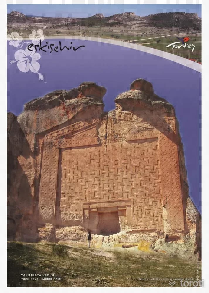
Midas Anıti
The Midas Monument, or by its other name Yazılı Kaya, is the most magnificent example of Phrygian rock facades. It is located on the rock mass projecting forward on the northeastern slope of the Midas city plateau. It was first examined in 1800 by W. M. Leake and his companions, and a rough drawing of it was made. This drawing by G. Koehler, despite its many errors and omissions, holds a special place because it is the first drawing to give an idea of the general appearance of Phrygian facades.
45 minutes
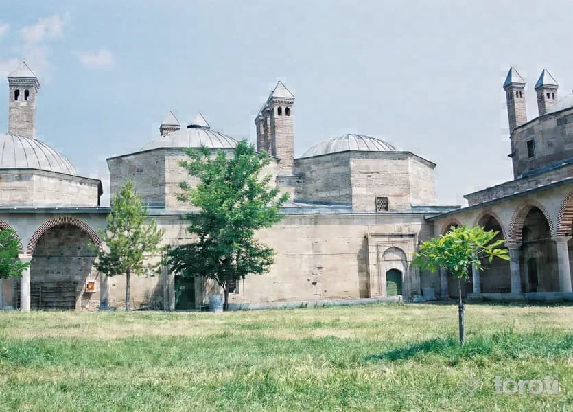
Şeyh Sücaeddin-i Veli Külliyesi Ve Türbesi
According to the Velâyetnâme-i Sultan Şucâeddîn, which provides very important information about Sultan Şucâeddin, he lived in the first half of the 15th century, witnessed the periods of Çelebi Mehmed and Murad II, and was an important alp-eren ghazi belonging to the group of Rum Abdals. According to what is told in the Şeyh Şucâ Menkıbesi, the sheikhs living in the dervish lodges around Bursa, Kütahya and Manisa had a very good and respectful relationship with him.
45 minutes
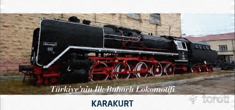
tülomsaş Müzesi / Devrim Ve Karakurt
Türkiye Locomotive and Engine Industry Inc. has been writing the city’s story of production and development since 1894. The company, which became legendary by achieving firsts, continues to accomplish great successes today. Turkey’s first automobile, DEVRİM. . On 16 June 1961, about 20 managers and engineers from the State Railways Factories and traction departments are called to a meeting in Ankara. At the meeting, the letter received from the Ministry of Transport is read.
45 minutes
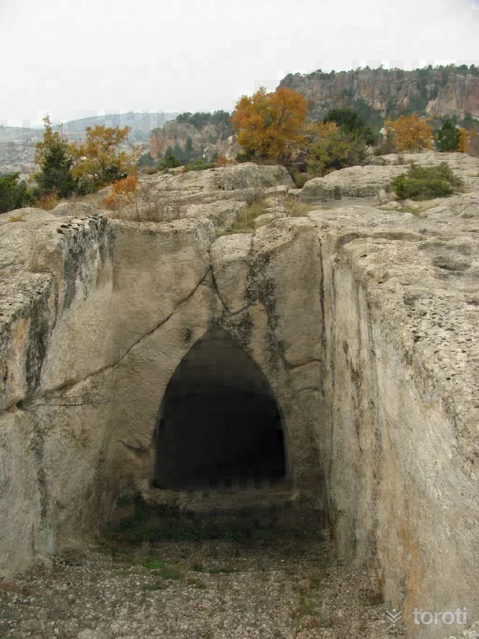
Dağlik Frigya Yazilikaya Vadisi
The Yazılıkaya Platform, which the Phrygians chose as a religious center, is located in the Yazılıkaya Valley, which they equipped with rock monuments. Yazılıkaya, the Cybele Belief Center and its surroundings were placed under protection by the Phrygian Castles where the military noble class lived. The Yazılıkaya Phrygian Belief Center is located in Yazılıkaya Village of Han District, Eskişehir, and this important center can be reached by asphalt road; 75 kilometers from Eskişehir, 39 kilometers from Çifteler, and 30 kilometers from Seyitgazi.
45 minutes
Melik Gazi Türbesi
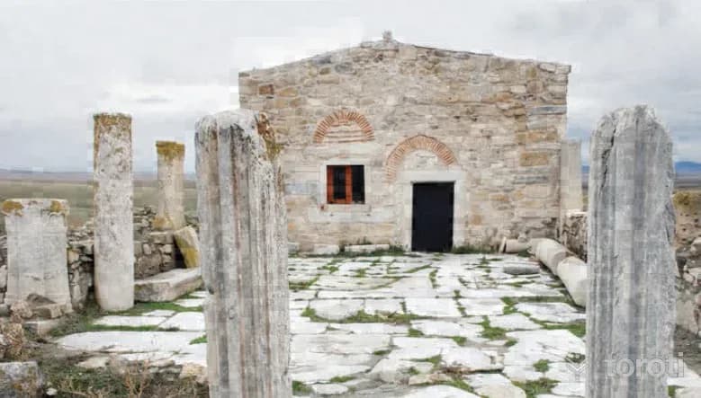
After Danişmend Gazi died in 1105, he was succeeded by his eldest son, Emir (Melîk) Gazi, who ruled for approximately thirty years. After the death of Danişmend Gazi, struggles for the throne arose among the members of the dynasty. Taking advantage of this, I. Kılıç Aslan captured Malatya. Emir (Melik) Gazi was initially subject to the Anatolian Seljuks.
45 minutes
Lületaşi Müzesi
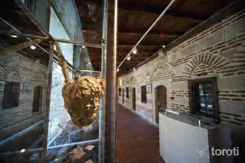
It is located within the Urban Protected Area within the boundaries of the Merkez district of Odunpazarı. The works exhibited in the international Meerschaum Festivals, Meerschaum Handicrafts competitions and exhibitions held by the Eskişehir Governorship since 1998 were purchased by the Provincial Special Administration, and the first step was taken in the establishment of the meerschaum museum.
45 minutes
Sivrihisar Ulu Cami
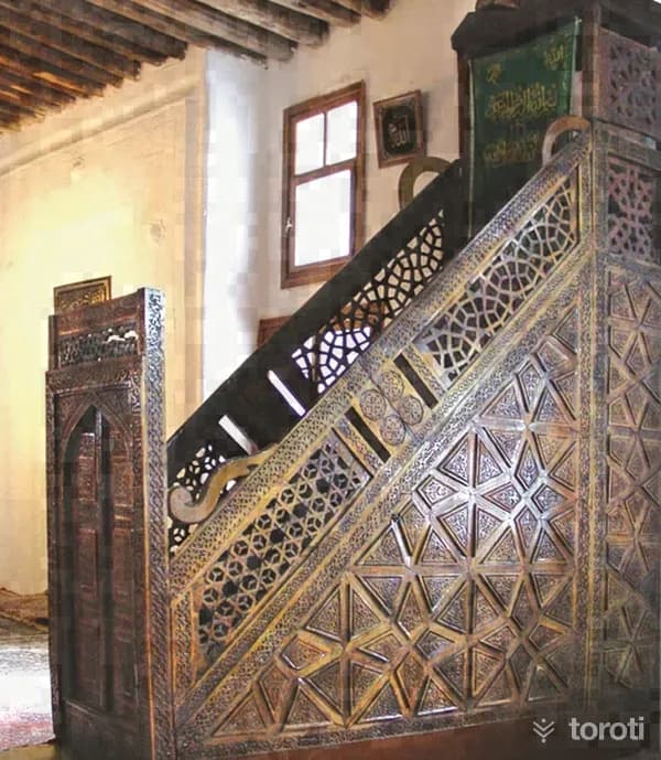
Sivrihisar Ulu Cami is one of the most important examples of mosques with wooden columns and wooden ceilings in Anatolia. Servet Uygun Various sources state that the mosque was first built in 1231-1232 by Emir Celaleddin Ali, and that in 1274 it was brought to its present form by Emineddin Mikail, one of the disciples of Mevlana Celaleddin Rumi.
45 minutes
Seyyit Mahmut Suzanı Külliyesi
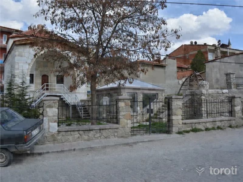
The külliye is a whole enclosed by a courtyard, consisting of a kümbet, tomb, hazire (open grave), and ruined madrasas. The kümbet was built of dressed stone with wooden material. In the hazire section, there is a sarcophagus bearing an inscription written in marble in kufic and Ottoman letters, and other types of graves. Seyyit Mahmut Suzani Külliyesi consists of the kümbet, tomb, and hazire section. It is a structure from the Seljuk Period. The kümbet was built of dressed block stone material.
45 minutes
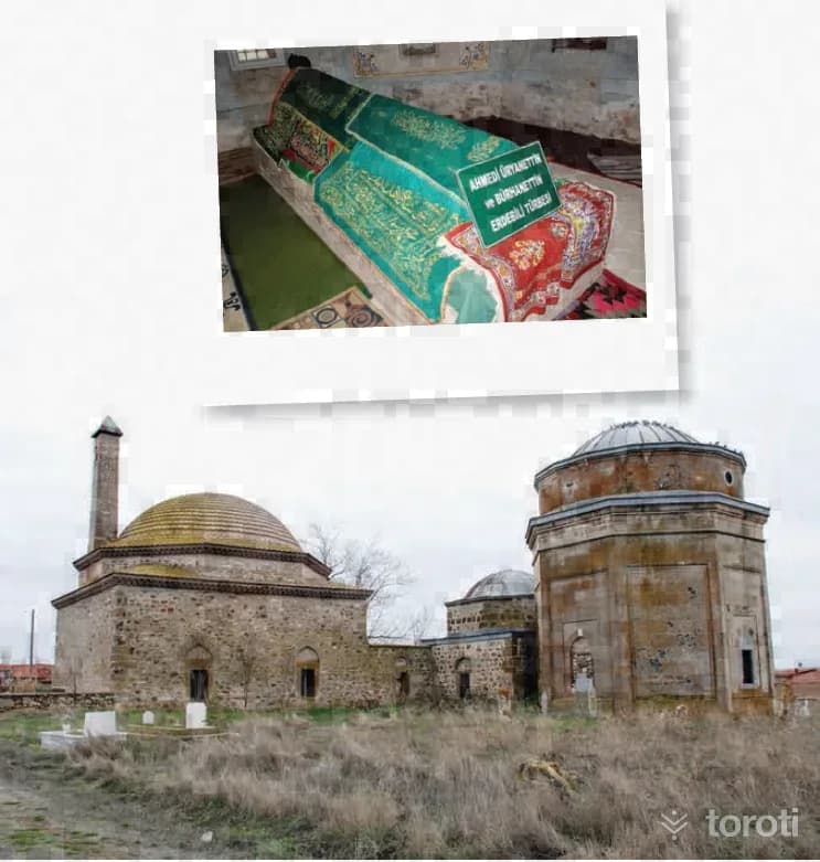
Üryan Baba Türbesi
There is almost no information about Üryan Baba in the sources. However, it is known that this figure was a Kalenderi dervish. In addition, the fact that the idea of nudity, which exists in the religious foundations of both Melami, Haydari and Cavlaki, as well as Kalenderi, is evaluated in a more abstract way with such a name also suggests that this is connected with the verbal discourse gaining power and meaning on a much more real level.
45 minutes
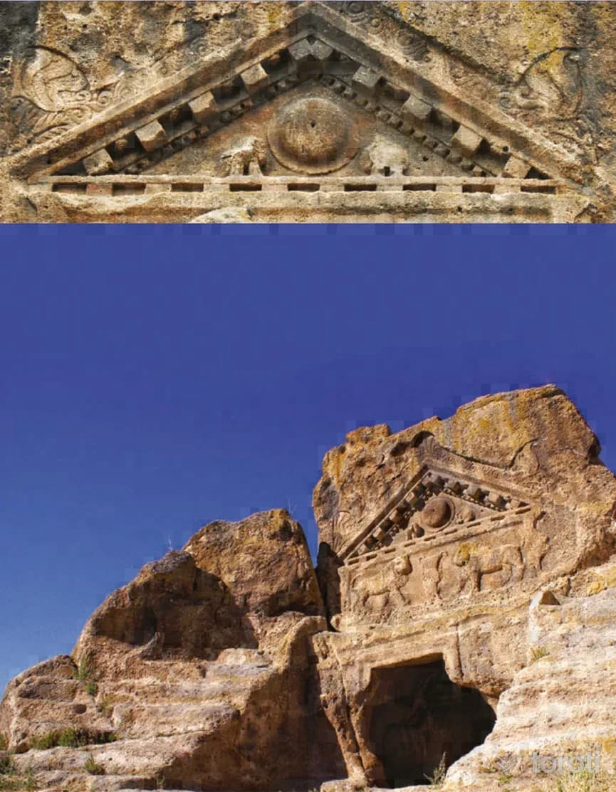
Dağlik Frigya Kümbet Vadisi
Kümbet Valley is on the ancient road leading to Yazılıkaya Platformu, the faith center of the Phrygian Civilization. Located 75 kilometers south of Eskişehir and 36 kilometers south of Seyitgazi, Kümbet Village is 2 kilometers inland from the Eskişehir-Afyonkarahisar highway. On the mound on whose slope Kümbet Village was established, there are Solon’un Mezarı (Arslanlı Mabet), which was used in the Phrygian and Roman periods, and Himmet Baba Türbesi.
45 minutes
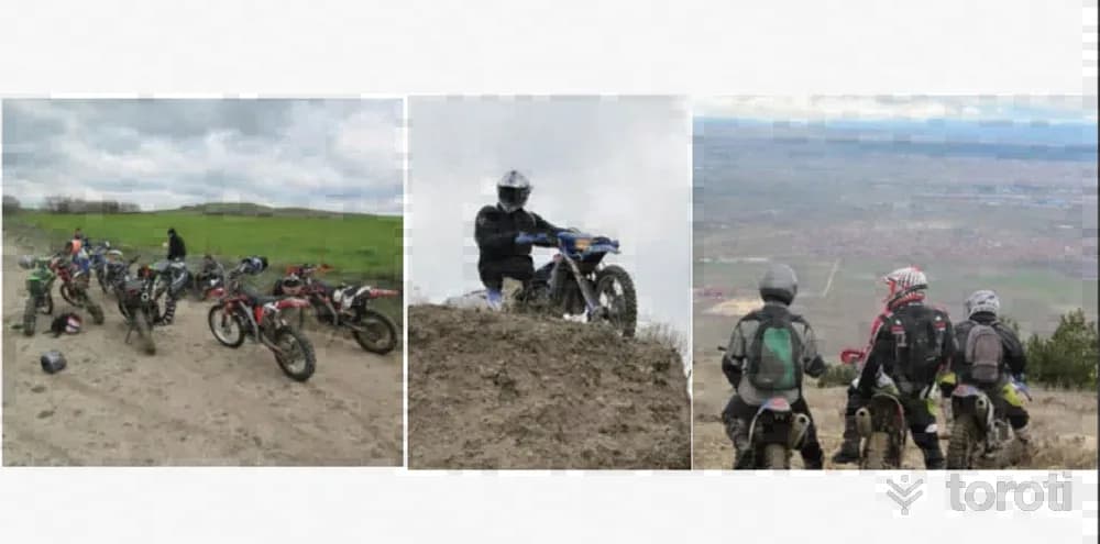
Motosiklet
Our city is almost tailor-made for motorcycle rides as well. In this motorcycle sport, practiced far from all kinds of road environments, you may sometimes find yourself in the depths of the Çatacık forests, and at other times in the historical texture of the Phrygian valley. If you want to get away from the stress of city life, if you are looking for an alternative sport, if you want to spend time in nature and discover new places, then it means you have met a hobby that is just right for you.
45 minutes
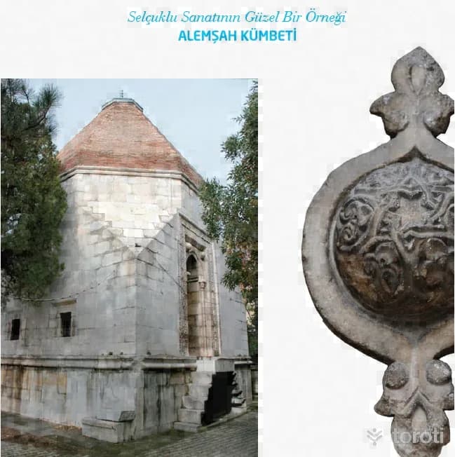
Alemşah Kümbeti
Alemşah Kümbeti, a fine example of Seljuk art, was commissioned by Melikşah in 1328 for his martyred brother Sultan Şah. The tomb is opposite Sivrihisar Ulu Camii. It is a two-storey structure with a square plan and was built of cut stone. Bricks were also used in places in its construction. Sivrihisar Belediyesi There is a mummification chamber on the lower floor of the tomb. In the door decorations of the mummification chamber, motifs frequently used by the Seljuks can be seen.
45 minutes
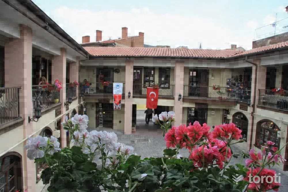
Atlihan El Sanatları Çarşısı
Atlıhan Handicrafts Bazaar, located within the Urban Conservation Area in the Odunpazarı district of Eskişehir province, was built in the 1850s by Takattin Bey for the accommodation of both the traders, travelers and villagers coming from surrounding villages, towns and cities, and their animals.
45 minutes
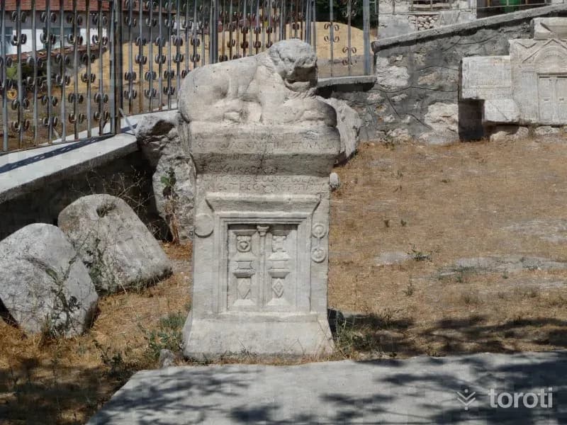
Pessinus Ören Yeri
Where is the Pessinus archaeological site? The Ancient City of Pessinus is located in Ballıhisar, 13 kilometers south of Sivrihisar on the Ankara-Eskişehir highway. Today, Ballıhisar Village has been established on top of the ancient city, which was on the old King's Road. The Ancient City of Pessinus is known as one of the most important places of worship where the mother goddess, called "Goddess Kybele" by the Phrygians, was located.
45 minutes
Ulubük Mağarası
It is located on Ulubük Plateau, 2 km south of Alapınar village, approximately 30 km northwest of Alpu. The area where the cave is located forms a high ridge separating the drainage basins of the Sakarya River and the Porsuk River. The cave, which faces Sakarya, is reached via the Eskişehir-Alpu-Gökçekaya Dam road. The 10 km stabilized road branching off to the left from the 20th km of the road leading to the dam first passes through Ulubük Plateau, then through Alapınar village, and goes to Sakarı Karacaören.
45 minutes
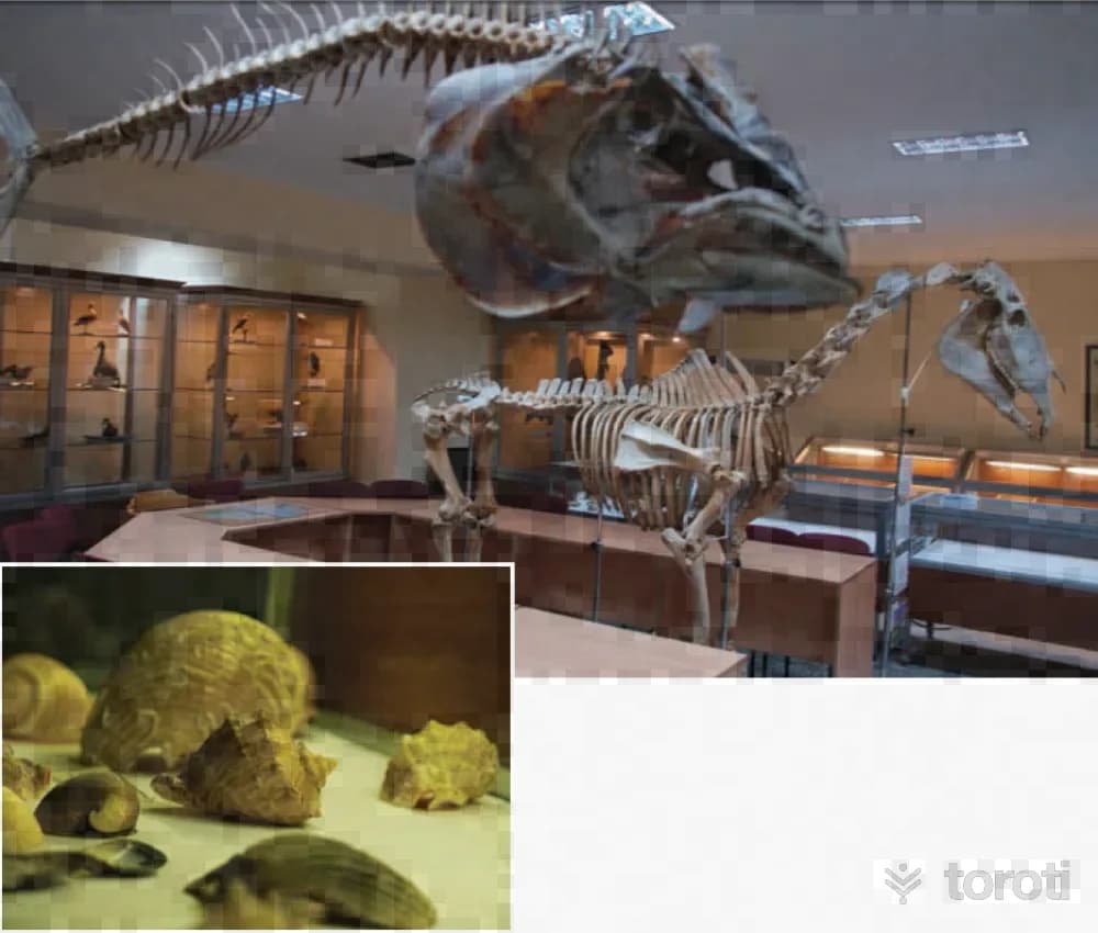
Esogü Zooloji Müzesi
Our country is one of the smallest land masses showing continental characteristics. It is the homeland and gene center of many economic products such as wheat, cherries, almonds, figs, apricots, lentils, and tulips. Anatolia has greater biological diversity than the entire European continent. Biological diversity and all natural resources are the true heritage to be left to future generations. Anatolia is a living museum. For this reason, the biological diversity of Anatolia is extremely important.
45 minutes
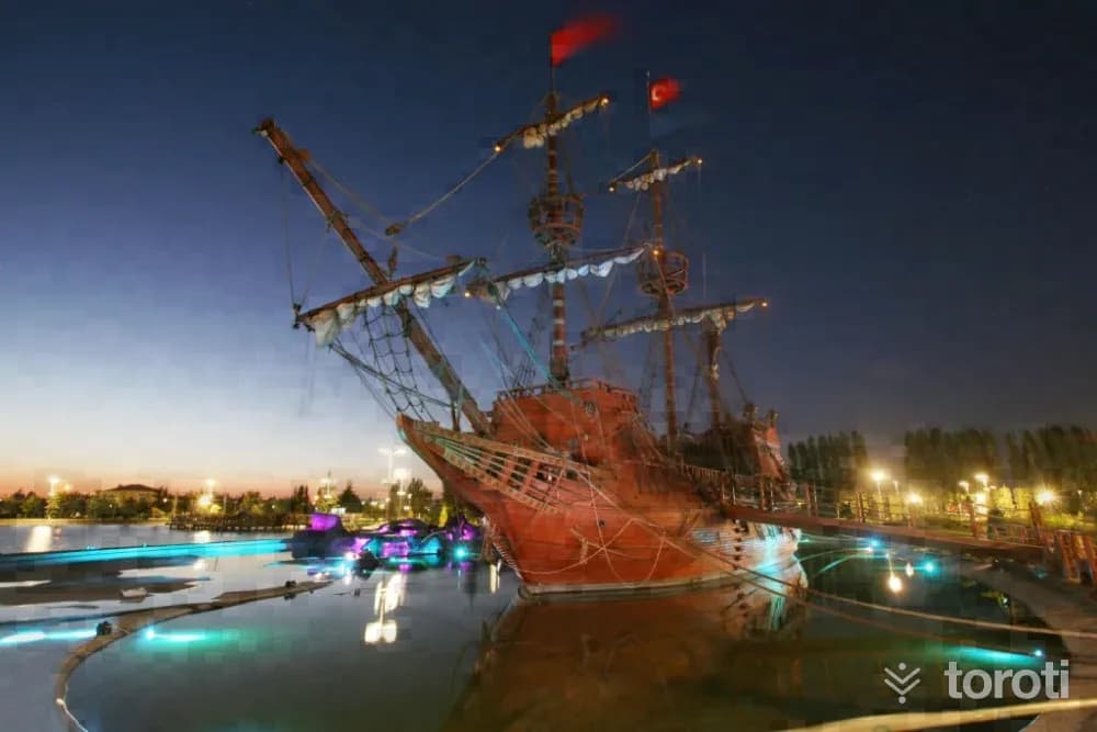
Bilim Kültür Ve Sanat Parkı
Bilim Kültür ve Sanat Park, located within the central boundaries of Eskişehir Tepebaşı District, is distinguished as Eskişehir’s largest park with its area of approximately 400 thousand square meters.
45 minutes
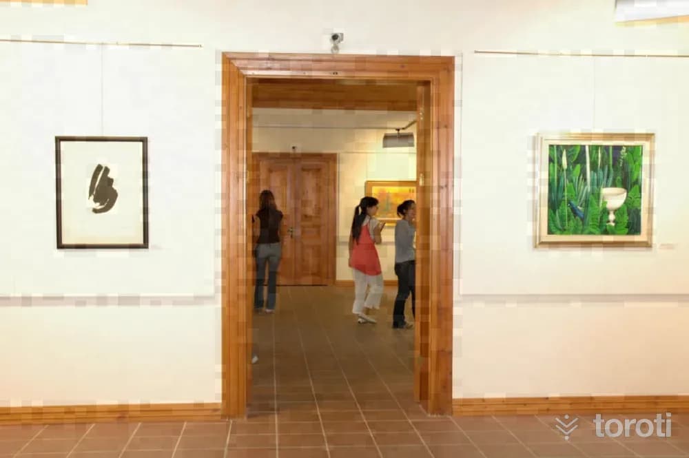
Anadolu Üniversitesi Çağdaş Sanatlar Müzesi
Within the borders of Eskişehir Tepebaşı District; the museum building, located on Anadolu Üniversitesi Yunus Emre Campus, is one of the examples of the First National Architecture Period and was used in the past as a Military Barracks and Drill Building. The exterior facade was painted yellow-white while remaining faithful to the original. In the museum building, located within a green area close to the parking lot, there are 3 exhibition halls as well as archives and administrative sections.
45 minutes
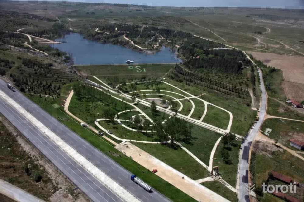
Şehr-i Derya Parkı
Şehr-i Derya Park, located within the central boundaries of Odunpazarı district in Eskişehir Province, is situated next to Kanlıpınar Pond. With the works carried out between 2010-2012, the wooded area and the surroundings of the pond located on the Ankara-Eskişehir Highway in the Kanlıpınar locality were rearranged and transformed into a usable picnic area.
45 minutes
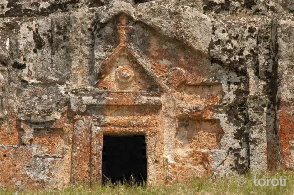
Dağlik Frigya Yapildak Vadisi
Yapıldak Valley, on the ancient route leading to Yazılıkaya Platformu, the faith center of the Phrygian Civilization, can be reached by an 83-kilometer asphalt road from Eskişehir, 47 kilometers from Çifteler, 38 kilometers from Seyitgazi, and 23 kilometers from Kırka. In the valley are Phrygian rock tombs, Dübecik Kale, and Ayterek Kale. Dübecik Kale: It is on a rock plateau surrounded by wooded hills, south of Yapıldak village.
45 minutes
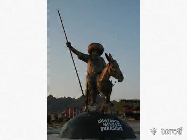
Nasreddin Hoca'nin Evi
Nasreddin Hoca, an educator, religious man, and jurist who lived in the 13th century, was born in 1284 in Hortu (Nasreddin Hoca Beldesi) Village of Sivrihisar. Nasreddin Hoca's house was built as a simple masonry structure with a ground floor and one upper floor, consisting of houses with inner courtyards. The houses are in an attached order, and their roof was covered with reed matting over solid logs. Sivrihisar is important as the land that witnessed both the birth and death of Nasreddin Hoca.
45 minutes
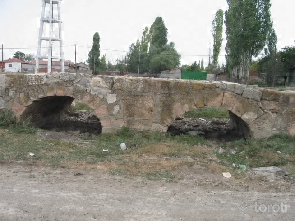
Karahöyük / Midaio
Known as a city founded by the Phrygian King Midas, Midaion / Karahöyük is one of Eskişehir’s large and famous mounds. It is located 30 kilometres east of Eskişehir, on the bank of the Porsuk River, in a place overlooking the fertile Alpu Plain. It is 500 metres in diameter and 20 metres high. It saw continuous settlement from the Early Bronze Age to the Byzantine Age.
45 minutes
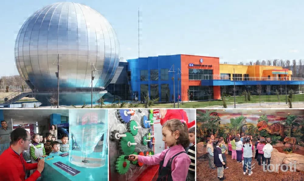
Sabanci Uzay Evi
Sabancı Uzay Evi offers the people of Eskişehir and tourist groups coming to Eskişehir the opportunity to watch and learn about the magical world of space. The Space House, whose advanced technological equipment was provided with the contributions of Sabancı Foundation and ÇİMSA, presents to visitors the images and information it receives simultaneously from international institutions such as NASA and the European Space Agency through state-of-the-art visual systems.
45 minutes
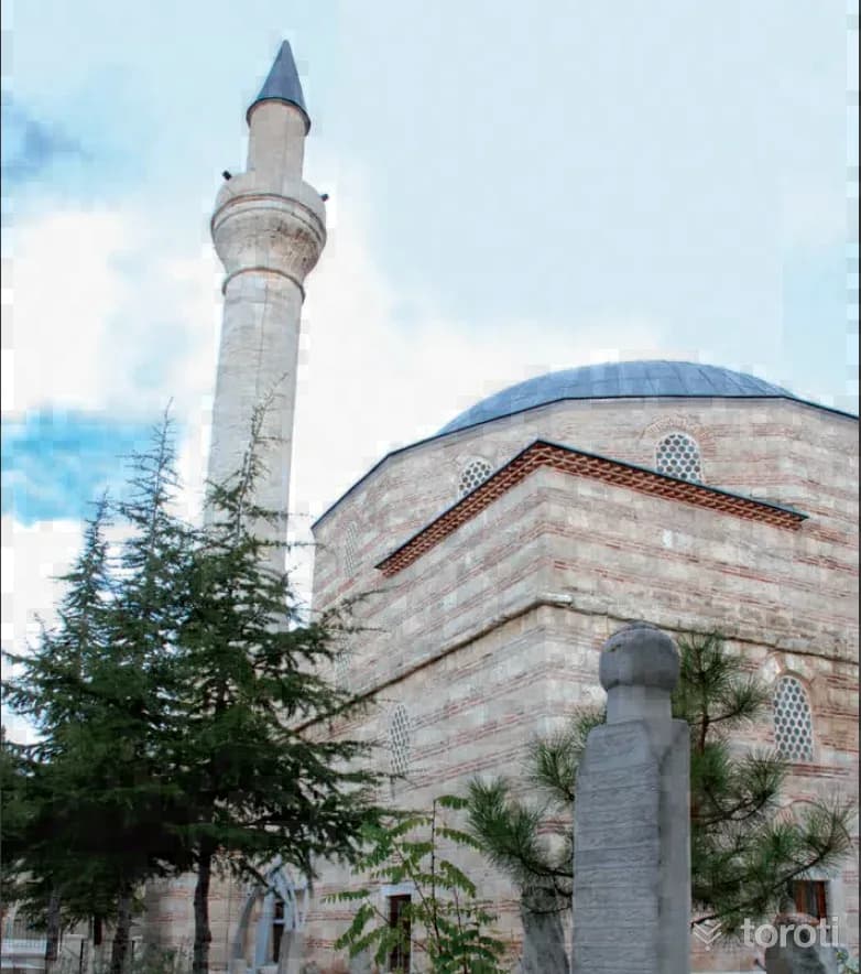
Kurşunlu Cami / Sivrihisar
It is stated that Şeyh Baba Yusuf of Sivrihisar inaugurated the II. Bayezid Medresesi in Istanbul and gave the opening lesson at the first Friday prayer in Bayezid Camii. The mosque in the district center was commissioned by Şeyh Baba Yusuf. According to its inscription, its construction date is 1492. The building has a single-domed plan. It has a three-domed last congregation area, an elegant minaret of the mosque on its right, and a fountain in front of it.
45 minutes
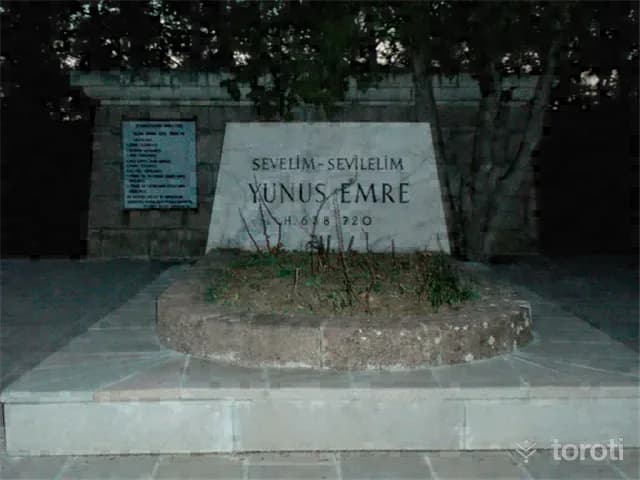
Yunus Emre Külliyesi Ve Türbesi
The Yunus Emre Museum, located in Eskişehir Mihalıçcık District, was opened to visitors in 1974 by the Ministry of Culture and Tourism. The grave of Yunus Emre, located in Eskişehir in the XIII.yüzyıl, was destroyed during the Greek occupation, and in 1949 it was moved behind a fountain built that year and a new grave was made. This grave XIII.
45 minutes
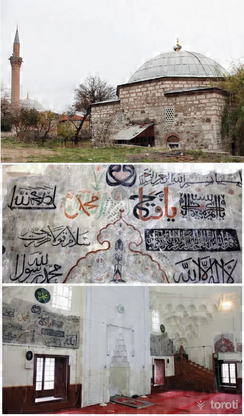
Hazinedar Mescidi / Sivrihisar
Hazinedar Mescidi is Anatolia’s first masjid with a Kaaba miniature. Hazinedar Mescidi, one of the most important historical works of Sivrihisar District, is in the district center. The interior of the masjid, commissioned in 1274 by Necibiddin Mustafa, who was Hazinedar (Minister of Finance) of the Anatolian Seljuks, is adorned with miniatures dating to the 15th century. Hazinedar Mescidi, with its magnificent calligraphy and decorative art, with its fresco above the mihrab, at the International III held in Cambridge in 1967.
45 minutes
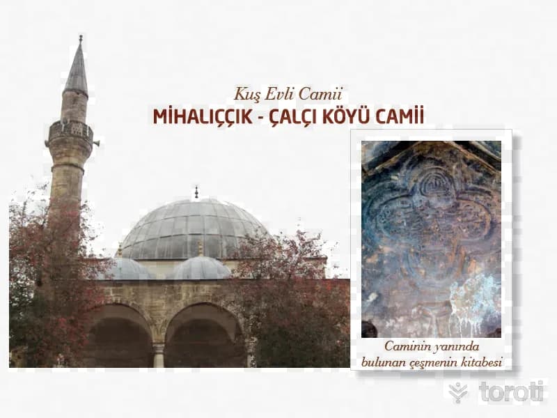
Çalçi Köyü Camii / Mihaliççik Camii / Kuş Evli Camii
It is in Çalçı Village, 13 kilometers north of Mihaliıççık District. It is stated that the mosque belongs to the Ottoman Period and that its name was Babüsaade Ağası “Mehmet Ağa Camii.” The mosque has a square plan, a single-space interior, is domed, and the drum of the dome is polygonal. In front of it there is a last congregation area with three arches and three domes. It has a single minaret and it is polygonal. According to its plan type and other architectural features, the mosque resembles 16-17th century Ottoman mosques.
45 minutes
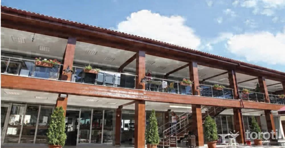
Arasta Çarşısı
Arasta, the glass, tile and ceramics bazaar, is a tourist bazaar created by Odunpazarı Municipality in 2012 through the demolition and reconstruction of a group of buildings located within the Urban Protected Area. In 14 shops, formed mostly by certified entrepreneurs who received training in courses, especially on glass, as part of efforts to make glass a brand in Odunpazarı and Eskişehir, works by tile and ceramic artists are offered for sale alongside glass.
45 minutes
Osmanli Evi
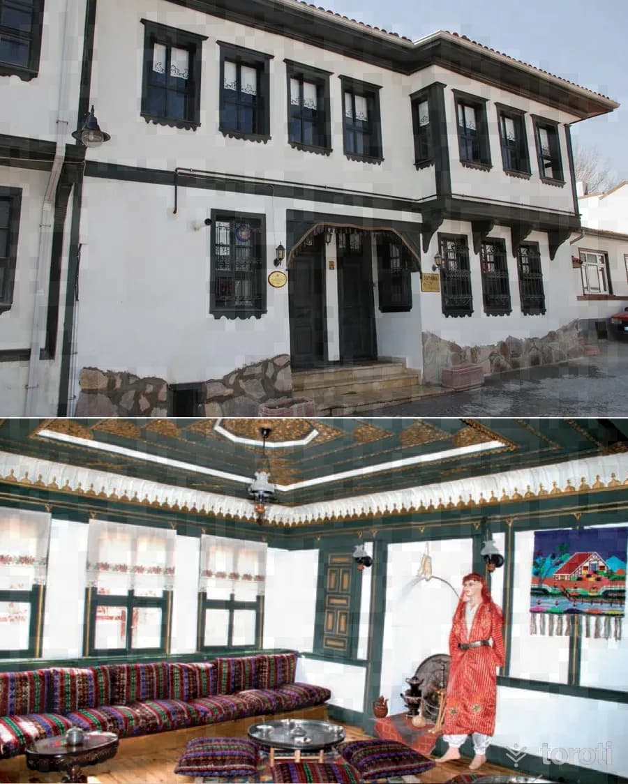
The building located in Dede Mahallesi is a typical example of 19th-century wooden civil architecture. The house, which belonged to Halil İbrahim Efendi (Sipahioğlu), one of the first-term members of parliament, and is known as “Yeşil Efendi Evi,” also has a special importance because Atatürk was hosted here. The selamlık section of the house was opened to visitors in 1984 after the restoration and arrangements carried out.
45 minutes
Sarıkaya Mağarası
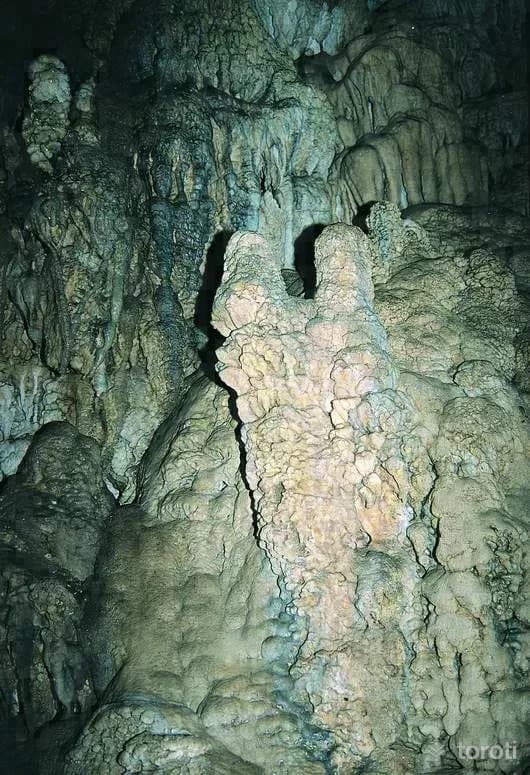
It is located 1 km east of Yalımkaya (Domya) village, on the left slope of Çatalkaya Stream, a branch of Domya Stream. The cave can be reached via one of the Büydüz-Sasa-Yalımkaya or Mihalıççık-Gürleyik-Yalımkaya roads branching off from the Eskişehir-Mihalıççık road. The cave is reached after a one-hour walk from Yalımkaya village. It consists of three galleries and three levels connected to each other by narrow passages. It has two entrances at different elevations.
45 minutes
İnönü Savaşlari Karargah Evi
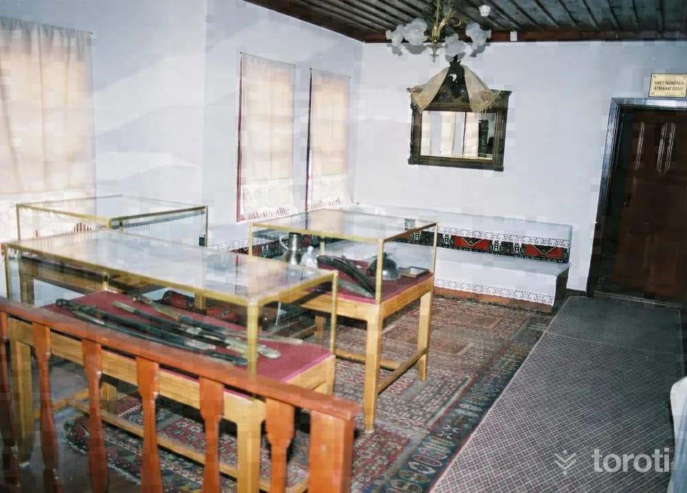
The museum, created in the house used as the headquarters building of Western Front Commander İsmet İnönü during the War of Independence, was opened in 2001. Photographs covering the İnönü Battles, front-line orders issued by İnönü and other commanders, weapons provided by Akşehir 1185.Sefer Malzeme Ana Depo Komutanlığı, and weapons and military materials collected from the battlefield by the İnönü District Governorate are exhibited in the museum.
45 minutes
Yelini Mağarası
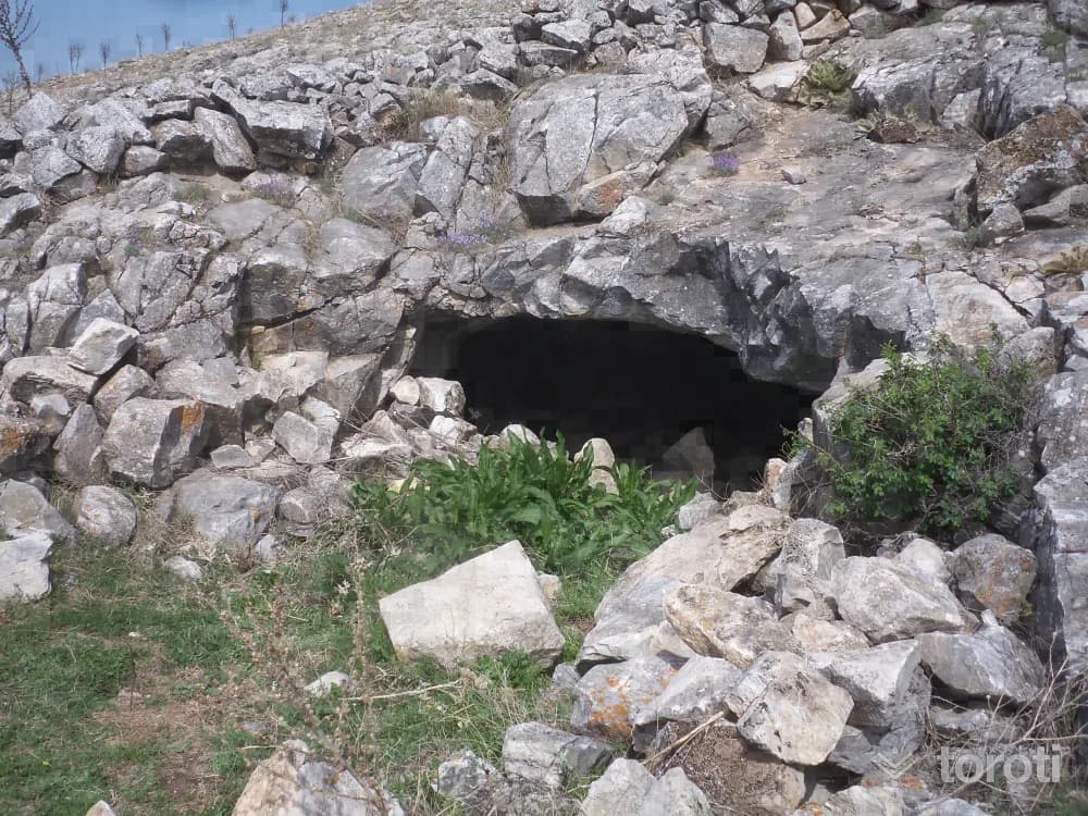
It is located in the southeast of the Sivrihisar Mountains. The cave can be reached via the Ankara-Eskişehir or Ankara-Polatlı-Yunak highways. It is located to the south of Yelinüstü Cave. The cave is also known by the name “Yılanlı.” The cave, divided into many halls and chambers by stalactites and large blocks fallen from the ceiling, is covered with extremely beautiful dripstones.
45 minutes
Kent Park
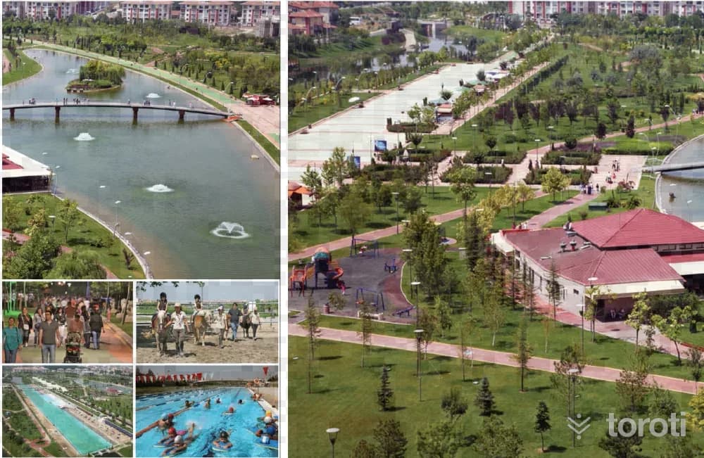
Kent Park is located in an area of approximately 300 thousand square meters between the New Bus Terminal and Gökmeydan Mahallesi. Within Kent Park, there are indoor and outdoor swimming pools, an artificial beach that is a first in Turkey, restaurants, horse riding areas, and playgrounds. With the Kent Park project, Eskişehir has gained the privilege of having a beach in a city in Turkey without a sea.
45 minutes
Şeyh Şehabeddin Sühreverdi Zaviyesi (sali Tekkesi)
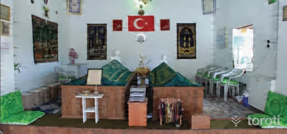
Since people used to gather regularly at the zaviye every Tuesday in the past, it is popularly called “Salı Tekkesi.” In the zaviye lies Sheikh Şehabettin Sühreverdi, who came to Anatolia as the envoy of the Abbasid Caliph to invite the Anatolian Seljuk Sultans I. İzzeddin Keykavus and I.Alaeddin Keykubat to the Fütüvvet Teşkilatı. The Fütüvvet Teşkilatı, which also included the Anatolian Seljuk Sultans, formed the basis of the Ahi Teşkilatı in Anatolia.
45 minutes
Urumkuş Kayaliklari
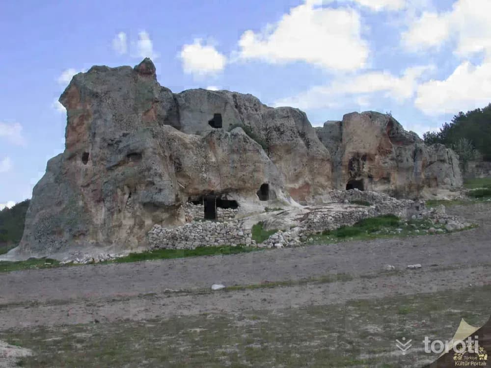
Urumkuş Rocks is a natural tuff rock formation located in İhsaniye district, about 5,5 km to the northeast of the town of Döğer as the crow flies. The sides of the rock facing the plain are quite steep. Photo: Afyonkarahisar Museum On the top of the rock and on its side sections, there are traces of rock-cut foundations, niches, rock altars, sacrificial pools and kaklıklar. This situation shows that the rock was used as a sacred area and perhaps also as a settlement area during the Phrygian period.
45 minutes
Gerdekkaya Mezar Anıti
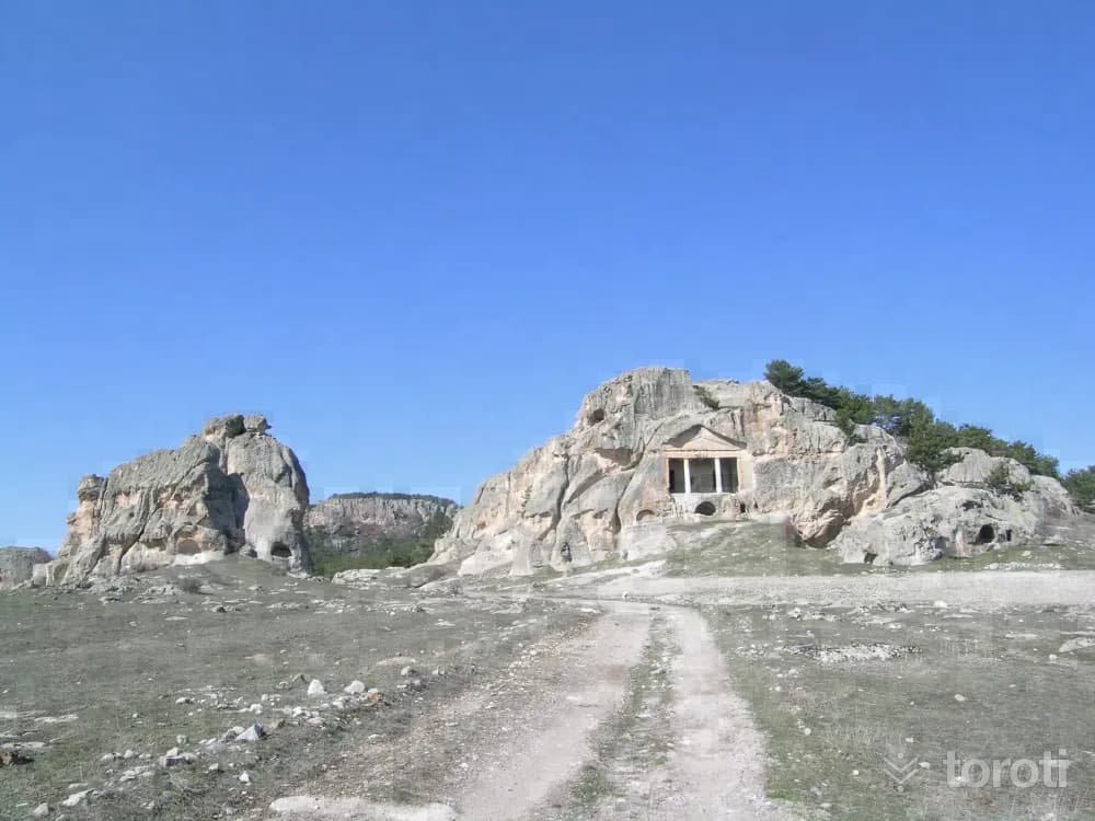
Gerdekkaya Tomb Monument; it was carved into the eastern face of a large rock mass in Doğanlı Valley, 500 m southwest of Çukurca village. In the Doric order, it is in the form of a temple façade with a triangular pediment and cornice carried by two columns. Behind the monumental entrance hall, there are two side-by-side burial chambers entered through two separate doors. Arched burial troughs are located on the side and rear walls of the chambers.
45 minutes
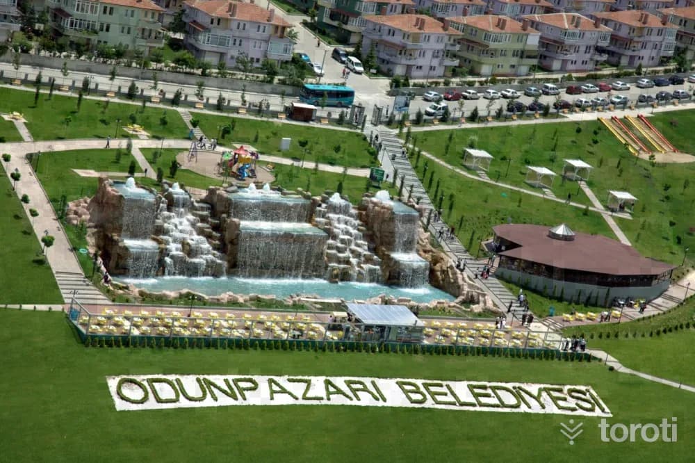
Şelale Park
Located in Çankaya Mahallesi at a point overlooking the Odunpazarı district and the city, the Park is a place where time can be spent accompanied by a magnificent view of Eskişehir across an area of 38 thousand square meters. Apart from the city view, the 1400-square-meter artificial waterfall, windmill, and Don Quixote and Sancho Panza statues in the park are also among the places that are обязательно photographed by those who come to visit Eskişehir.
45 minutes
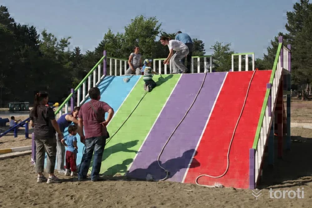
Eskişehir Regülatör Piknik Alanı
Eskişehir Regülatör Picnic Area, located within the central boundaries of Odunpazarı district of Eskişehir, is at the 5th kilometre of the Eskişehir–Kütahya road. The recreation area, located in Orhangazi Mahallesi Regülatör Mevkii, was renovated by Odunpazarı Municipality from 2012 onwards and transformed into a picnic and recreation centre.
45 minutes
Fidanlik Orman İÇİ Dinlenme Yeri
The Forest Nursery, located 7 kilometers from Eskişehir city center, is very close to Karacaşehir Village. In the upper parts of the slope to the south of the Nursery, which was established in 1962, there are the ruins of Karacaşehir Castle. It is a wooded area on the bank of Porsuk Stream, and it is possible to reach it by public transportation. It has an important place in meeting the recreation and entertainment needs of the people of Eskişehir.
45 minutes
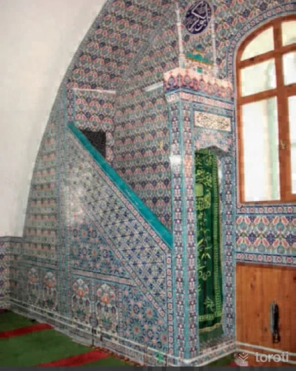
Alpu Büğdüz Köyü Camii
The mosque, which was built in the village square, is located within a garden. The walls of the mosque, which was built in masonry, are plastered and painted inside and out. Above the body walls, which are approximately 155 cm, there is a dodecagonal drum rising in two stages, covered with tiles. The courtyard of the mosque, whose north and south facades face the road and whose east and west facades face the garden, can be entered through two different gates, from the west and from the western side of the south facade.
45 minutes
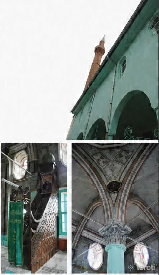
Aziz Mahmud Hüdayi Camii / Sivrihisar
The mosque, commissioned by Aziz Mahmud Hüdâyî in 1591 and known by his name, was called Yeni Camii instead of Aziz Mahmud Hüdâyî Camii because it was rebuilt in 1893. It was built in a wooden style with a large central section and semi-domes around it. Its minaret was built in 1894. There are two bands below the balcony. It is understood that during construction, the height of the first band was not considered sufficient and was raised.
45 minutes
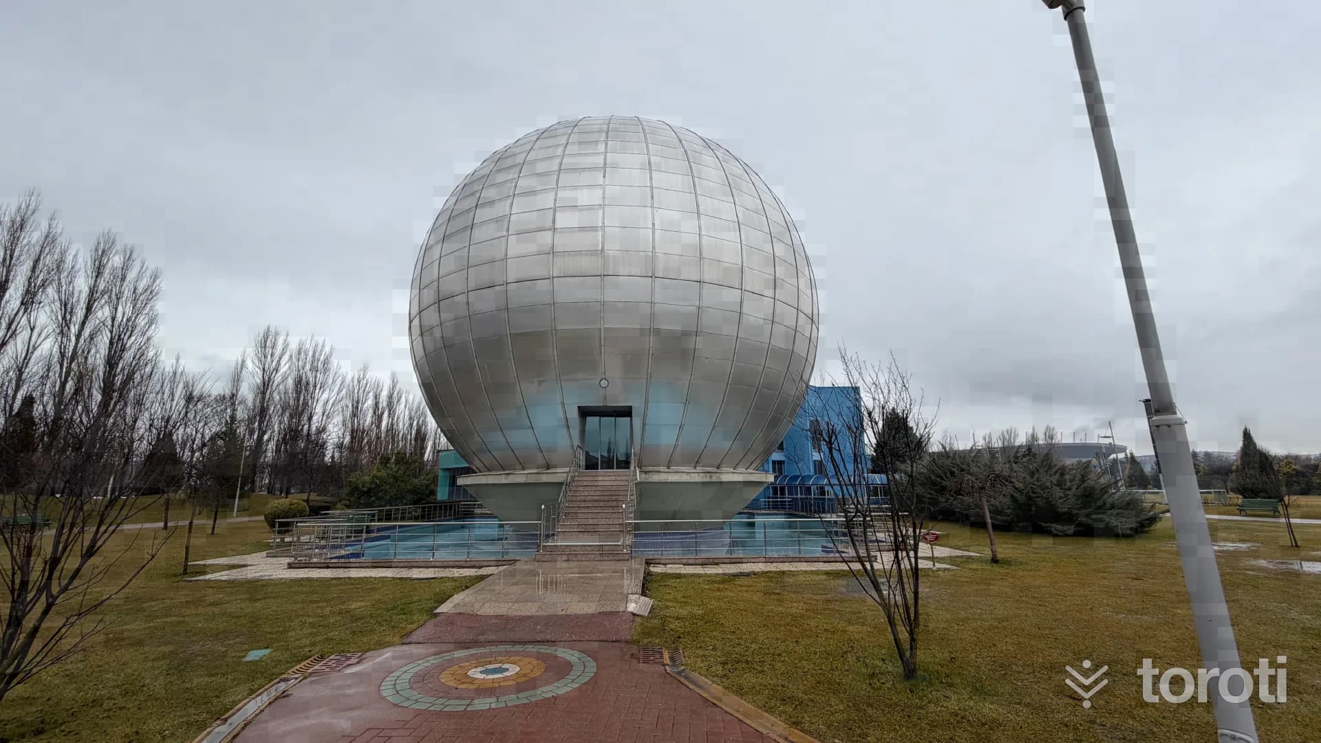
Bilim Deney Merkezi
Bilim-Deney Merkezi, one of the projects implemented by the Metropolitan Municipality for children, enables primary school students to become acquainted with science. Endearing science to children and breaking the rote-learning approach to education, the Center opens the doors of the infinite world of science to our children through hands-on science education.
60 minutes