
Places to visit
Things to do in Odunpazarı
45 destinations, each with a description, how long it takes and where it sits on the map.
In short
toroti’s catalogue holds 45 described destinations within Odunpazarı, Eskişehir. The themes that come up most: Local culture, Nature, Museum, Culture, History, Faith heritage.
Düdensuyu
It is connected to Düdensuyu Stream near the village of Beyyayla, which is affiliated with Sarıcakaya. Düdensuyu Stream enters through the southeast-facing mouth of the cave and exits through the northwest-facing mouth. The gallery carved by Düdensuyu Stream within the rock mass is quite wide. The stream has formed small pools in places inside the cave. In seasons when the water level is high, it is necessary to use a boat to cross these pools. Bibliography: - Eskişehir Governorship.(2014).
45 minutes
Eşekini Mağarası
It is located on the right slope of Çayboğazı Stream, 2 km north of Sorkun village, which is 15 km northwest of Mihalıççık. This road, which goes along Çayboğazı Stream after the Sorkun village turnoff from the Mihalıçcık-Nallıhan highway, reaches just above the cave after 1.5 km. From here, the cave is reached with a 10-minute walk. It is a fossil cave that has completed its development. It has two entrances. Source: - Eskişehir Governorship.(2014).
45 minutes
Çalpinar Mağarası
It is located to the northwest of Kale Tepe (1490 m), 2 km north of Dağcı village, which is 7 km west of Mihalıççık. The cave, situated on the right slope of Pazar Çayı, which joins Koca Çay, a major tributary of the Porsuk River, is reached by taking the road to Dağcı village that branches off at the 5th km of the Mihalıçcık-Eskişehir road. From the village, a 3 km stabilized road extends to the front of the cave. Bibliography: - Eskişehir Governorship.(2014).
45 minutes
Yarimkaya Mağarası
It is located on the left slope of Değirmen Deresi near Kayı village, connected to Han. It can be reached via the Eskişehir-Çifteler-Han-Kayı village or Eskişehir-Seyitgazi- Bardakçı-Karağaç-Kayı village roads. There is a road up to the front of the cave, which is 1.5 km south of Kayı village. It is a horizontally developed cave in the form of a sinkhole. Its entrance is 20 m above the valley floor; it is in the form of a steep vertical shaft of -3 m. Source: - Eskişehir Governorship.(2014). Eskişehir Guide(5.
45 minutes
Kaya Tirmanişi
The areas most commonly used for basic training to practice this sport, which brings together balance, aesthetics, flexibility and strength, in Eskişehir are Bozdağ in the Sündiken Mountains, Kızıltepe in the Sakarılıca Baths, and the Taştepe area of Mayıslar village. For rock climbing training, the cliffs of Kızılinler and Sivrihisar are used. Source: - Eskişehir Governorship.(2014). Eskişehir Guide(5.
45 minutes
Güvercin İni Mağarası
It is located on Sarıcakaya Yaylası together with Afarın Düdeni and Sarıkız Subatanı. It is 1.5 km northeast of Afarın Düdeni. It has developed vertically within the Upper Jurassic Lower Cretaceous aged Bilecik limestones. The entrance of the cave is 9x5 m in size; it is like a shaft. There are also two more entrances, at -25 and -15 m. Source: - Eskişehir Governorship.(2014). Eskişehir Guide(5.
45 minutes
Eskişehir Osmangazi Üniversitesi Ve Kent Ormanı
In the forests located behind Eskişehir Osmangazi University Faculty of Medicine, orienteering and cross-country Turkey Championships are held. One of the most suitable courses for orienteering is located in the Osmangazi forests. You can see athletes training here during the day. This course, close to the city, exceeds 100 km. Source: - Eskişehir Governorship.(2014). Eskişehir Guide(5.
45 minutes
Sarisungur Göleti Parkuru
On the Eskişehir-Seyitgazi road, a distance of 18 km is covered up to the Sarısungur sign. When you turn, the descent takes you to Sarısungur Pond. There are a series of trails around the pond. Mountain Bike Criterium and Cross-country Races are held here. Bibliography: - Eskişehir Governorship.(2014). Eskişehir Guide(5.
45 minutes
Kalburcu
Kalburcu, where Atatürk considered having a sanatorium built, is a forest recreation area. It is 5 km away, to the north of Mihalıççık. With its clean air and abundant oxygen, it is a beautiful place to relax. Every year, on the 2nd Sunday of June, Mihalıççıklılar Günü is held here. Source: - Eskişehir Governorship.(2014). Eskişehir Guide(5.
45 minutes
Aşağı Ve Yukarı Ilica
It is located 30 km south of the city center, on the bank of Ilıca Suyu, which flows into Kalabak Deresi. It is in a location close to Seyitgazi district. The springs are within simple walls. Its waters are hot, naturally flavored and slightly sulfurous. It is used for painful illnesses. Source: - Eskişehir Governorship.(2014). Eskişehir Guide(5.
45 minutes
Kalabak Başi
Located on the foothills of Türken Dağı and home to Eskişehir’s drinking water sources, Kalabak Mevkii is a preferred picnic area in the forest with its clean air and delicious drinking water. Source: retrieved from the address on 28 August 2014.
45 minutes
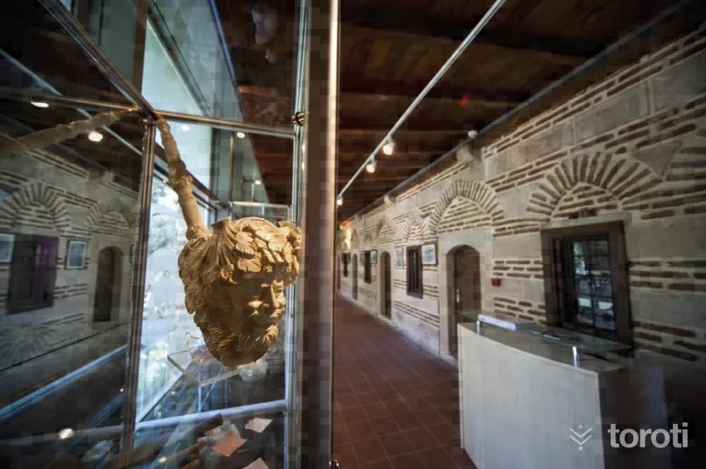
Lületaşi Müzesi
It is located within the Urban Protected Area within the boundaries of the Merkez district of Odunpazarı. The works exhibited in the international Meerschaum Festivals, Meerschaum Handicrafts competitions and exhibitions held by the Eskişehir Governorship since 1998 were purchased by the Provincial Special Administration, and the first step was taken in the establishment of the meerschaum museum.
45 minutes
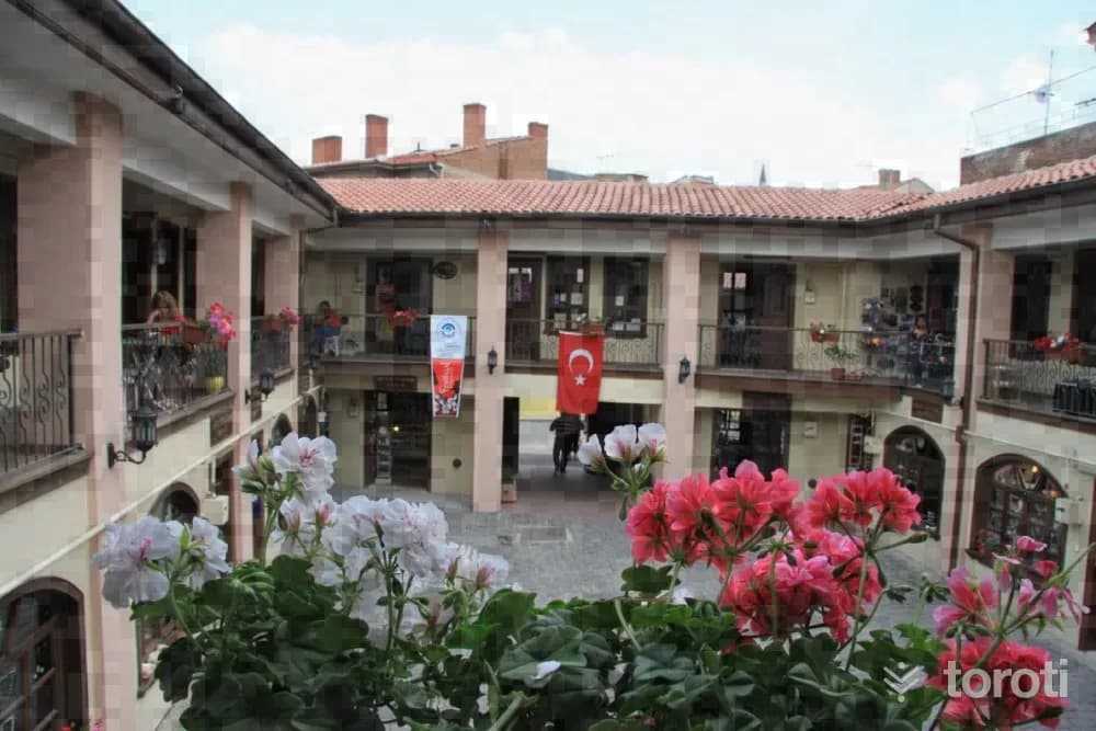
Atlihan El Sanatları Çarşısı
Atlıhan Handicrafts Bazaar, located within the Urban Conservation Area in the Odunpazarı district of Eskişehir province, was built in the 1850s by Takattin Bey for the accommodation of both the traders, travelers and villagers coming from surrounding villages, towns and cities, and their animals.
45 minutes
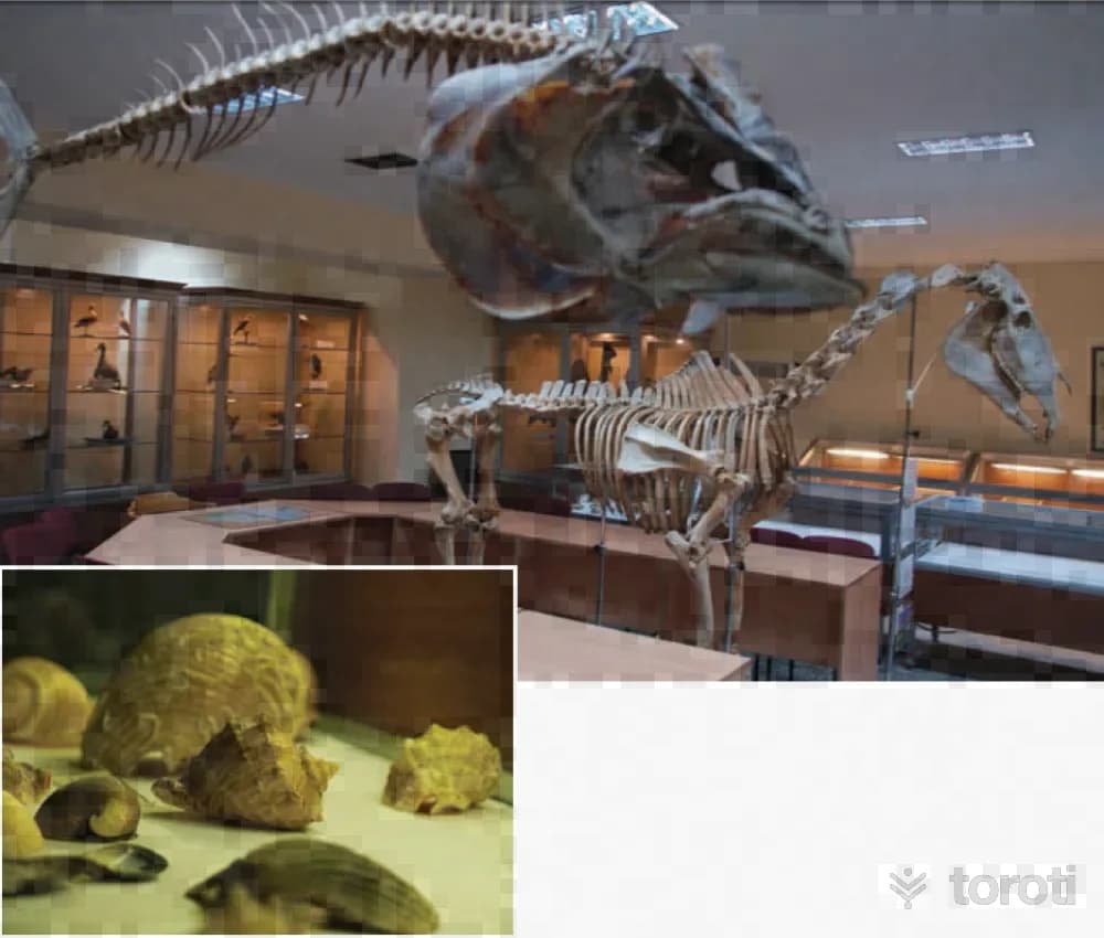
Esogü Zooloji Müzesi
Our country is one of the smallest land masses showing continental characteristics. It is the homeland and gene center of many economic products such as wheat, cherries, almonds, figs, apricots, lentils, and tulips. Anatolia has greater biological diversity than the entire European continent. Biological diversity and all natural resources are the true heritage to be left to future generations. Anatolia is a living museum. For this reason, the biological diversity of Anatolia is extremely important.
45 minutes
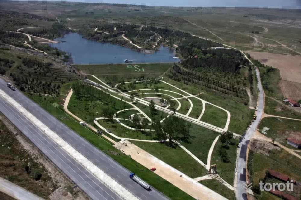
Şehr-i Derya Parkı
Şehr-i Derya Park, located within the central boundaries of Odunpazarı district in Eskişehir Province, is situated next to Kanlıpınar Pond. With the works carried out between 2010-2012, the wooded area and the surroundings of the pond located on the Ankara-Eskişehir Highway in the Kanlıpınar locality were rearranged and transformed into a usable picnic area.
45 minutes
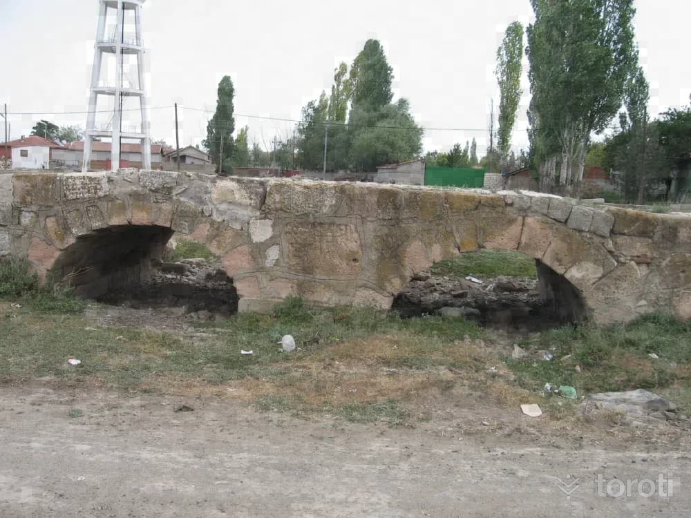
Karahöyük / Midaio
Known as a city founded by the Phrygian King Midas, Midaion / Karahöyük is one of Eskişehir’s large and famous mounds. It is located 30 kilometres east of Eskişehir, on the bank of the Porsuk River, in a place overlooking the fertile Alpu Plain. It is 500 metres in diameter and 20 metres high. It saw continuous settlement from the Early Bronze Age to the Byzantine Age.
45 minutes
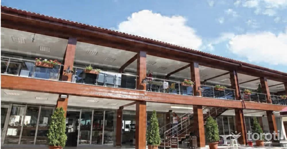
Arasta Çarşısı
Arasta, the glass, tile and ceramics bazaar, is a tourist bazaar created by Odunpazarı Municipality in 2012 through the demolition and reconstruction of a group of buildings located within the Urban Protected Area. In 14 shops, formed mostly by certified entrepreneurs who received training in courses, especially on glass, as part of efforts to make glass a brand in Odunpazarı and Eskişehir, works by tile and ceramic artists are offered for sale alongside glass.
45 minutes
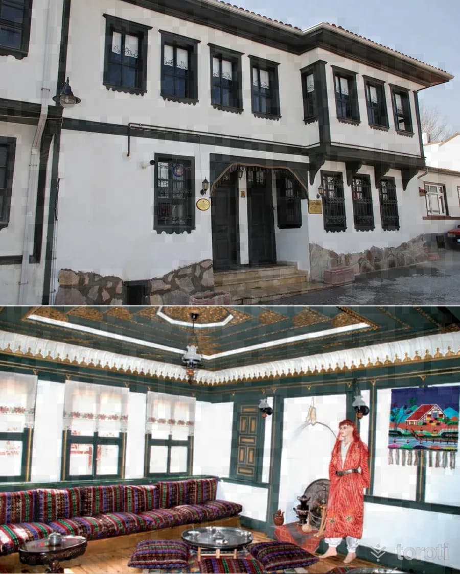
Osmanli Evi
The building located in Dede Mahallesi is a typical example of 19th-century wooden civil architecture. The house, which belonged to Halil İbrahim Efendi (Sipahioğlu), one of the first-term members of parliament, and is known as “Yeşil Efendi Evi,” also has a special importance because Atatürk was hosted here. The selamlık section of the house was opened to visitors in 1984 after the restoration and arrangements carried out.
45 minutes
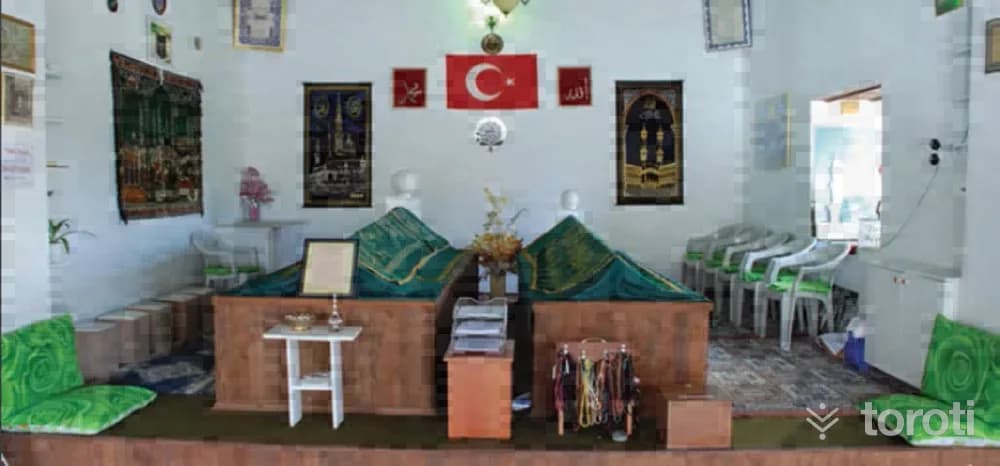
Şeyh Şehabeddin Sühreverdi Zaviyesi (sali Tekkesi)
Since people used to gather regularly at the zaviye every Tuesday in the past, it is popularly called “Salı Tekkesi.” In the zaviye lies Sheikh Şehabettin Sühreverdi, who came to Anatolia as the envoy of the Abbasid Caliph to invite the Anatolian Seljuk Sultans I. İzzeddin Keykavus and I.Alaeddin Keykubat to the Fütüvvet Teşkilatı. The Fütüvvet Teşkilatı, which also included the Anatolian Seljuk Sultans, formed the basis of the Ahi Teşkilatı in Anatolia.
45 minutes
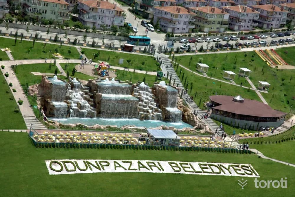
Şelale Park
Located in Çankaya Mahallesi at a point overlooking the Odunpazarı district and the city, the Park is a place where time can be spent accompanied by a magnificent view of Eskişehir across an area of 38 thousand square meters. Apart from the city view, the 1400-square-meter artificial waterfall, windmill, and Don Quixote and Sancho Panza statues in the park are also among the places that are обязательно photographed by those who come to visit Eskişehir.
45 minutes
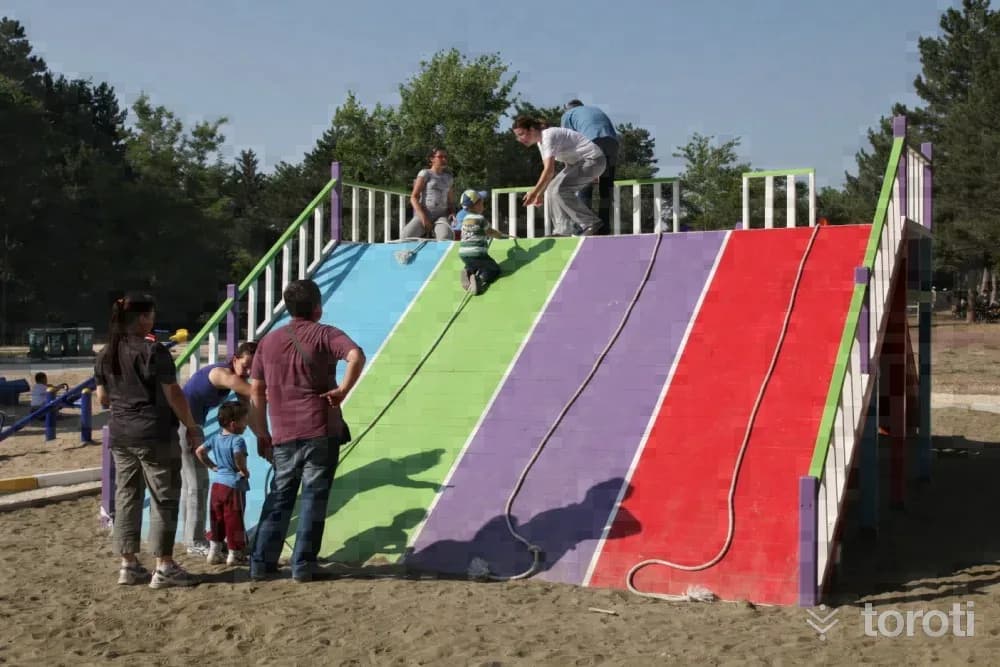
Eskişehir Regülatör Piknik Alanı
Eskişehir Regülatör Picnic Area, located within the central boundaries of Odunpazarı district of Eskişehir, is at the 5th kilometre of the Eskişehir–Kütahya road. The recreation area, located in Orhangazi Mahallesi Regülatör Mevkii, was renovated by Odunpazarı Municipality from 2012 onwards and transformed into a picnic and recreation centre.
45 minutes
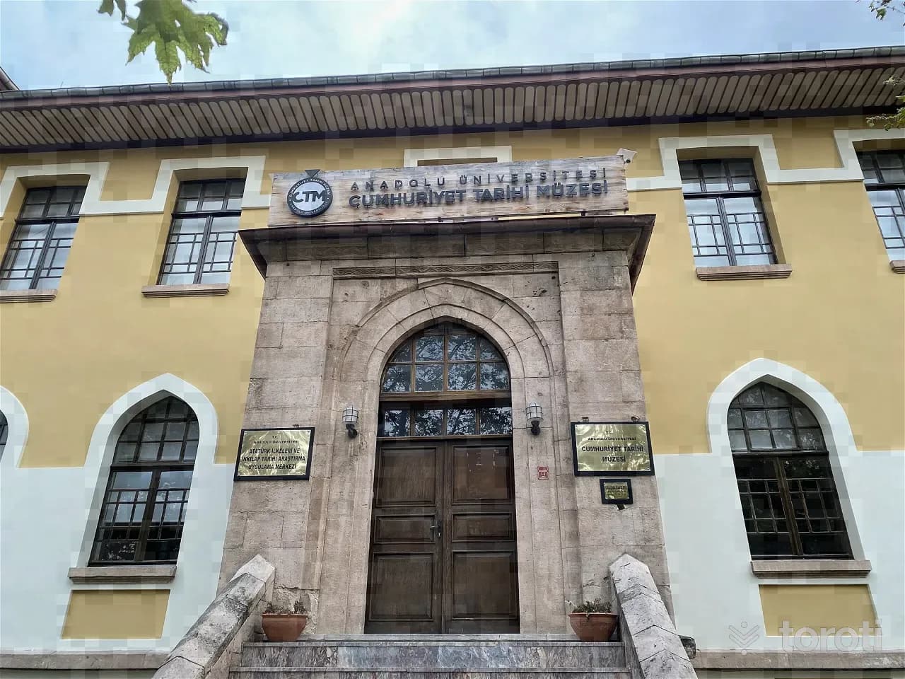
Cumhuriyet Tarihi Müzesi
The building was constructed by Mimar Kemalettin between 1915-1916 under the name Turan Numune Mektebi. Photographs documenting the birth of the Republic of Türkiye are exhibited, from the Çanakkale Wars, the Congresses, the Grand National Assembly, the İnönü Wars, the Sakarya War, the Great Offensive, and the first years of the Republic.
45 minutes
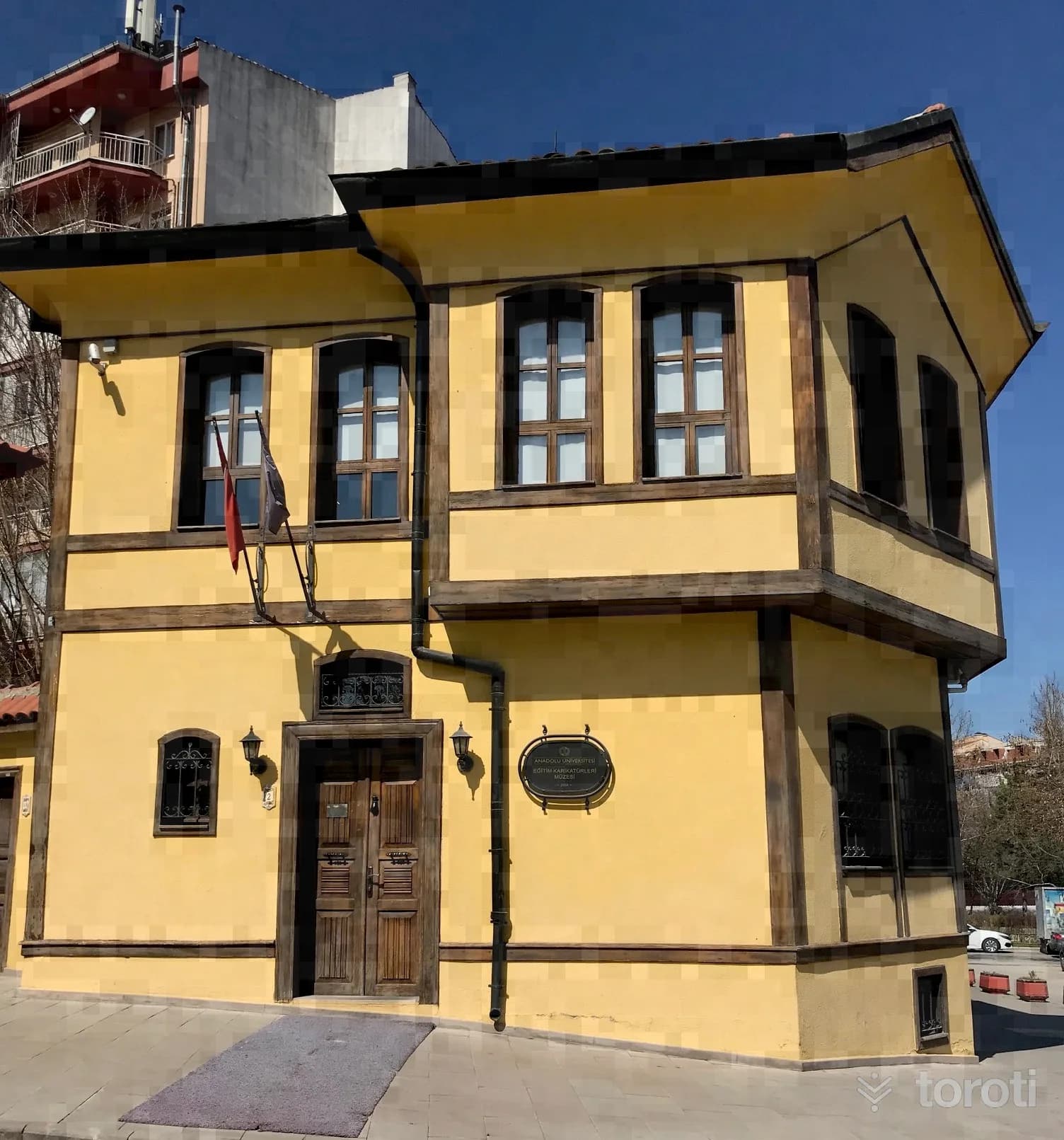
Anadolu Üniversitesi Eğitim Karikatürleri Müzesi
The museum was created through the restoration and renovation of a wooden building located in the Odunpazarı district, estimated to have been built in the early 1900s and used as a residence. The building is a typical Eskişehir Odunpazarı house. The ground floor is an area where short-term solo and group exhibitions are held. Research and practical studies, as well as a library, are also located there.
45 minutes
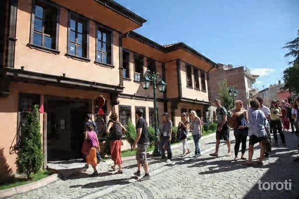
Çağdaş Cam Sanatları Müzesi
The Contemporary Glass Arts Museum, located within the central boundaries of Odunpazarı district, was established in 2007 through the cooperation of the Metropolitan Municipality, Anadolu University and the Glass Friends Group. In Turkey’s first glass museum, the works of 58 local and 10 foreign artists are exhibited. If you are curious about what can emerge as a result of the combination of the transparency of glass with art, you should definitely visit its dazzling collections.
45 minutes
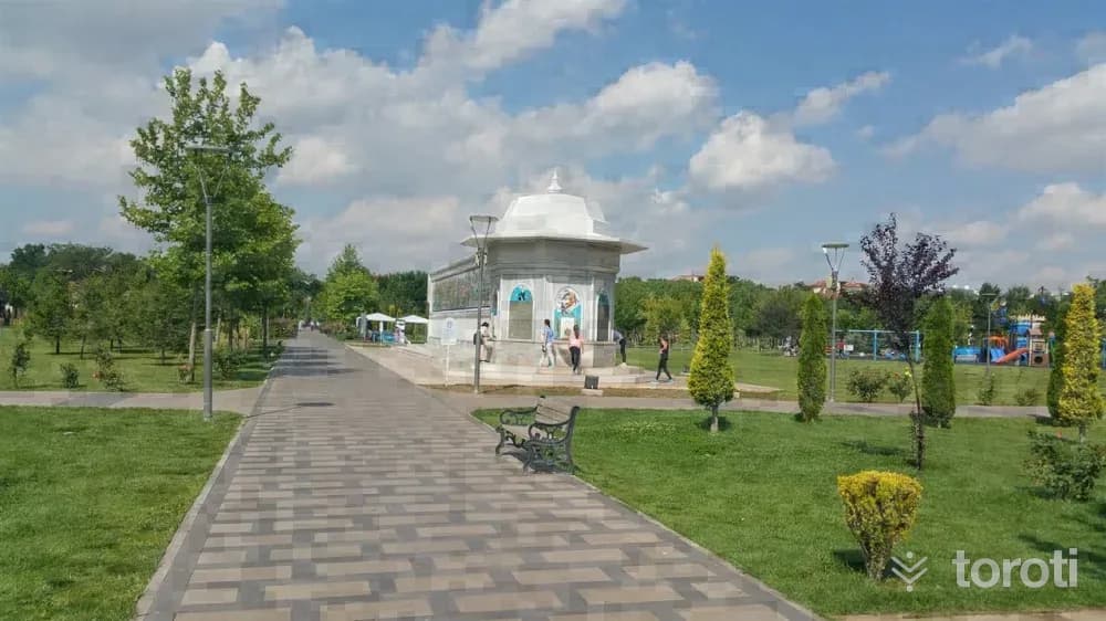
Dede Korkut Anıt Duvarı
It was built within the boundaries of Dede Korkut Park in Odunpazarı District of Eskişehir province as part of the permanent works of the 2013 Eskişehir Capital of Culture Agency. On both facades of the 46 metre long wall, there is a tile application featuring the epics of Dede Korkut, while the stories are located on the lower part of the facades. On the front facade of the wall, there is a water fountain and water curtains, and it is a work of art made for the first time in Turkey.
45 minutes
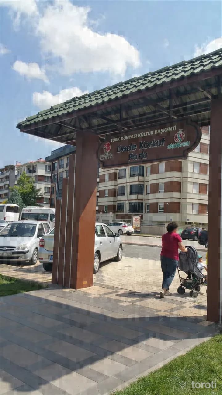
Dede Korkut Parkı
Within the scope of the 2013 Eskişehir Kültür Başkenti Ajansı Permanent Works; by landscaping the area located within the district boundaries of Odunpazarı in Eskişehir Province, it was turned into a park where sports can be practiced and children can spend enjoyable time. Work on Dede Korkut Parkı, which began in January 2014, was completed in June and it was opened for service.
45 minutes
Musaözü Baraji
It is a picnic area of 50 hectares located 21 km from the central district on the Eskişehir-Kütahya road. The recreation area created around the D.S.İ. irrigation pond can be used for day trips. It was established in 1967. Its green cover consisting of black pine, oak, willow and juniper species, and its pond containing carp, catfish and crayfish, which allows angling, are the natural assets of the recreation area.
45 minutes
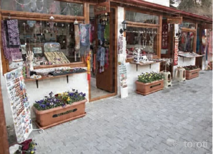
Kırk Ambar Çarşısı
Kırk Ambar Çarşısı, one of the new venues of historic Odunpazarı, is full of surprises with its authentic atmosphere. The restaurant inside also offers its guests local flavors. The most important feature of Kırk Ambar, which is full of shops and workshops featuring small souvenirs belonging to many handicrafts from meerschaum to glass, is that it is operated by women entrepreneurs.
45 minutes
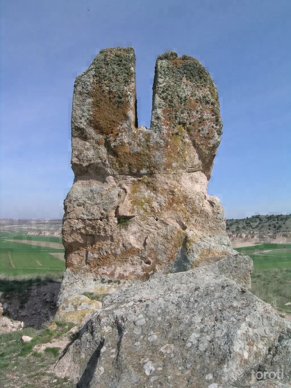
Çatalkaya
The Phrygian settlement takes its name from the rock described as Kes Kaya or Çatalkaya, rising on a low hill. The Phrygians carved and smoothed the rock and opened a vertical, deep groove in its middle. To the east of this rock, on another rock mass called Sivri Kaya/Uzun Kaya, there is also a small Phrygian rock monument.
45 minutes
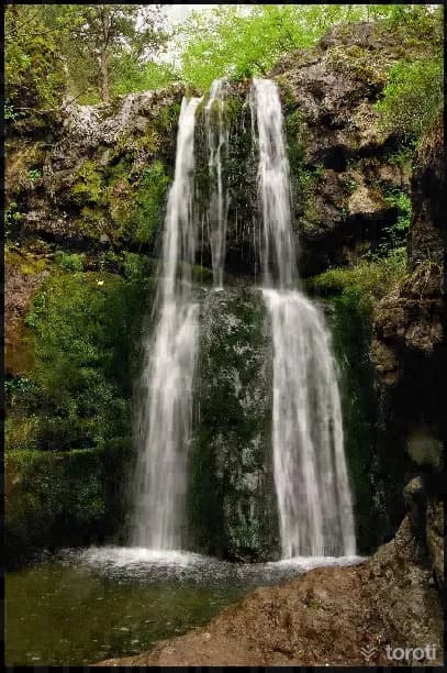
Kabalak Şelalesi Mesire Yeri
The picnic area located in the forest near Kalabak Köyü has a beautiful natural appearance with the waterfall from which it takes its name and its rich flora consisting of black pine, juniper, plane tree, maple, hazelnut, willow, hawthorn, cornelian cherry, blackberry, wild rose, oak and ivy species. It is 35 kilometers from the city center.
45 minutes
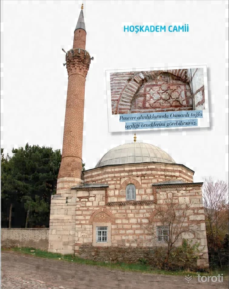
Hoşkadem Camii
This mosque, dating to the 15th century, was commissioned by Hacı Hoşkadem. The structure has a single-space square plan and is covered with a dome. You can see examples of Ottoman brickwork on the window pediments.
45 minutes
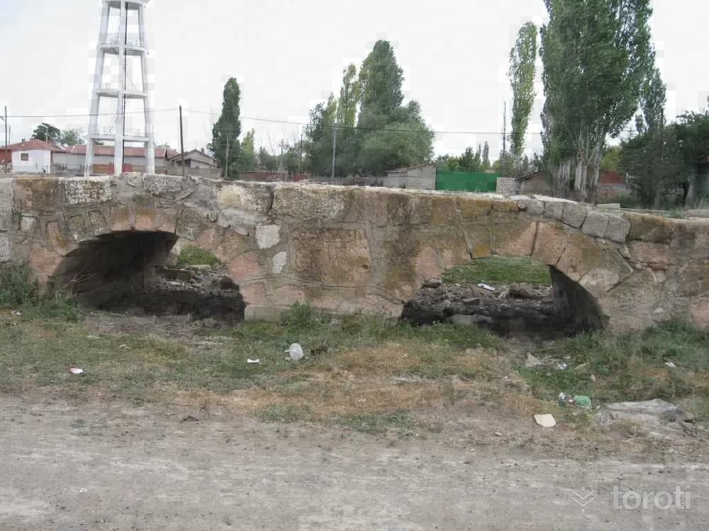
Karahüyük midaio
Known as a city founded by the Phrygian King Midas, Midaion/Karahöyük is one of Eskişehir’s large and famous mounds. It is located 30 km east of Eskişehir, on the bank of the Porsuk River, in a place overlooking the fertile Alpu Plain. It saw continuous settlement from the Early Bronze Age to the Byzantine Age.
30 minutes
Sündiken Dağlari Bozdağ Bölgesi
The Sündiken Mountains are approximately 120 km long from west to east in the north of Eskişehir province. The highest points of the mountain, Kızıltepe 1811 m, Uzunyatak Tepe 1789 m and Sündiken Tepe 1769 m, are located in Mihalıççık district. Due to ease of access, the Bozdağ region of the Sündiken Mountains; the area between the villages of Muttalip–Hekimdağ (Taşköprü)–Bozaniç–Mayıslar–Laçin–Tandır–Yarımca–Karadere is the most commonly used section.
45 minutes
Eskişehir-kütahya Frig Vadisi Parkuru
Following the Eskişehir-Kütahya ring road, after passing Porsuk Dam, turn toward Sabuncupınar village. After passing this charming station village, you arrive at Fındık village. This valley is a route with similar features where bicycle lovers can experience the opportunities of Cappadocia. . Don’t forget to drink the famous water of İncik village on the route.
45 minutes
Dumanlikaya Mağarası
It is located very close to Ballık Mahallesi, approximately 12 km east of İnönü. The cave, which developed on a karstic plateau carved by the Ballık and Kayala streams that flow into Sarısu Çayı, a tributary of the Porsuk Nehri, can be reached via the Eskişehir-İnönü-Kütahya highway or the Ankara-Eskişehir-İstanbul railway. The cave is reached with a half-hour walk from Ballık Mahallesi. It is located in a plateau-like area rising with a steep slope immediately south of the İnönü Plain.
45 minutes
Şaban’in Düdeni
It is located immediately next to Şabanpınarı Fountain, 3 km south of Küçük Sasa village. The cave, which developed at the bottom of a depression on the ridge separating the stream basins of Domya Stream and Porsuk River, is reached by the road connecting the villages of Çırçır-Ağaçhisar-Sasa-Yalımkaya (Domya), which branches off at the town of Bozan on the Eskişehir Mihalıççık highway. Its entrance is in the form of a -6m shaft. It then ends at -46 m relative to the entrance with a sloping floor.
45 minutes
Karlik Düdeni
It is located on Karlıkkale Tepe (1737 m), northwest of Arayit Dağı (1819 m), at the southeastern end of the Sivrihisar Mountains. The sinkhole, which is close to Yelini and Yelüstü caves, is located northeast of Karacaören village, which is connected to Sivrihisar. The cave is reached via the Sivrihisar-Ballıhisar-Çaykoz or Günyüzü-Kayakent-Karacaören-Çaykoz roads. The cave is reached after a 2-hour walk from the village. The first entrance is a -13 m vertical descent.
45 minutes
Tozman Düdeni
It is located on the northern border of Tozman Plateau, approximately 15 km northwest of Mihalgazi, facing Yenipazar. The cave, located in the high plateau region deeply cut by the Sakarya River, can be reached via the Eskişehir- Sarıcakaya-Mihalgazi-Çayköy-İnhisar or Eskişehir-Söğüt-İnhisar-Çayköy- Mihalgazi routes. The road branching off from Çayköy and passing through Tozman village then passes right by the cave on Tozman Plateau and reaches Yenipazar district.
45 minutes
Alaeddin Camii
It was built in 1267 during the Anatolian Seljuk State period, in the time of III. Gıyaseddin Keyhüsrev. After 1267, changes were made to the mosque, and with restorations it lost its Seljuk architectural features. The mosque, located within the park bearing its own name, is one of the oldest mosques in the city. The mosque, which was used as a museum between 1944-1951, was restored again from this date onward and opened for worship.
20 minutes
Kent Belleği Müzesi
Kent Belleği Müzesi has been designed as a museum in a style befitting the age, based on a brand-new understanding in which, rather than exhibiting artistic or historical objects, the elements that have played a role in Eskişehir’s development from past to present and are unique to Eskişehir are digitally recorded.
45 minutes
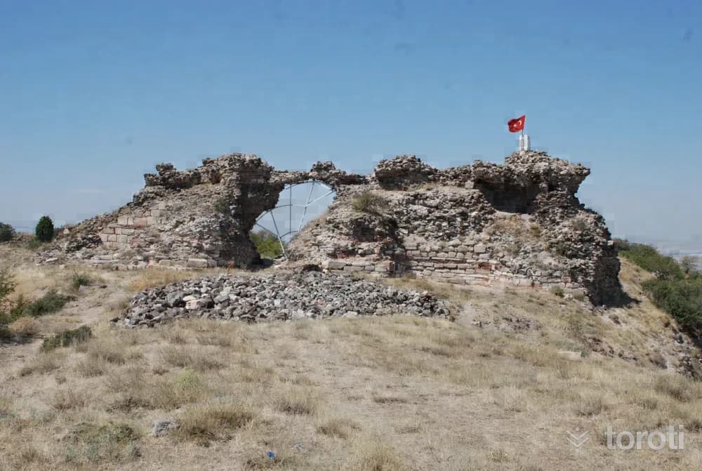
Karacahisar Kalesi
The Conquest and History of Karacahisar Castle The first castle conquered by the Ottomans is Karacahisar Castle. In terms of its location and architectural features, Karacahisar Castle reflects the characteristics of settlements called “Kastron” or “Castle City.” Castle cities, which began to emerge in Anatolia in the 7th and 8th centuries, are defined as the military cities of the Middle Byzantine Period.
45 minutes
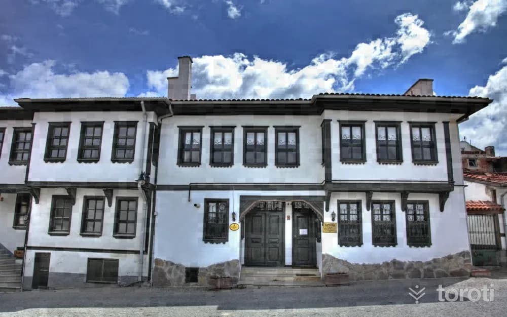
Odunpazari Kentsel Sit Alanı
The Odunpazarı quarter was established on the hills to the south of the city. Preserving examples of Traditional Anatolian Turkish Architecture, the quarter has survived to the present day with its winding roads, dead-end streets, wooden ornamented-adjacent order-bay-windowed houses, preserving its customs, traditions and practices. "...It has many notables and cavalrymen. . The city consists of 17 neighborhoods. Its houses are adjoining, with gardens and prosperous. The 4 surroundings of the city are full of roses, rose gardens, vineyards and vegetable gardens, and it is a city with abundant grain...".
45 minutes
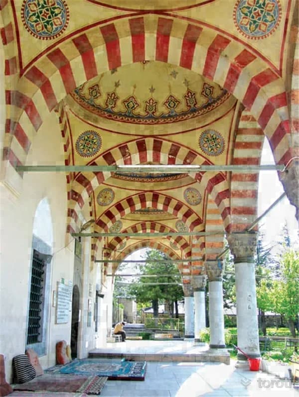
Eskişehir Kurşunlu Camisi Ve Külliyesi
Eskişehir Kurşunlu Mosque and Complex is located in the Odunpazarı district. The complex, located next to the historic Odunpazarı Houses, and the historic houses almost complement each other and take you on a journey to the past. Kurşunlu Complex is a work belonging to the 16th-century Ottoman Period. It was built in 1517 by Çoban Mustafa Paşa, one of the viziers of the Ottoman State.
45 minutes
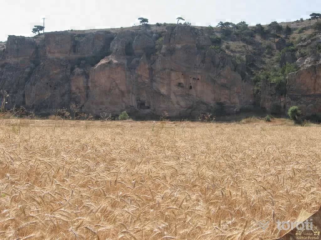
Dağlık Frigya Porsuk Vadisi
The Porsuk Valley, which reaches the city center from Porsuk Barajı in the southwest of the city, is an attractive tourism center with the fertility and natural beauty that have given life to the settlements around it since ancient times, and with the healing thermal water sources along the valley. One of the important centers of the Porsuk ( Tembris ) Valley, which has continuously maintained its original culture from ancient times to the present day, is Çatalkaya ( Keskaya ) near Eskişehir's Merkez Karaalan Village.It takes its name from being carved in the shape of a fork.
45 minutes
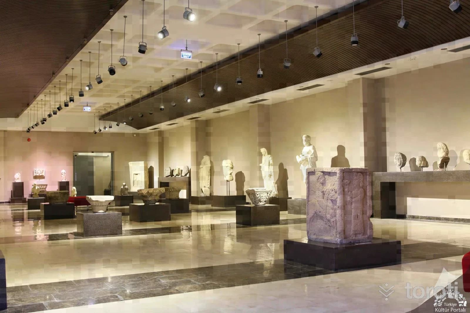
Eskişehir Eti Arkeoloji Müzesi
The foundation of the museum is based on the storage of artifacts collected from the surrounding area in Eskişehir Alaaddin Camii in 1945. It was later moved to Kurşunlu Külliyesi in Odunpazarı in 1966. Its move to the museum's current location took place in 1974. The museum houses nearly 18 thousand artifacts.
45 minutes