
Destination
Ulubük Mağarası
It is located on Ulubük Plateau, 2 km south of Alapınar village, approximately 30 km northwest of Alpu. The area where the cave is located forms a high ridge separating the drainage basins of the Sakarya River and the Porsuk River. The cave, which faces Sakarya, is reached via the Eskişehir-Alpu-Gökçekaya Dam road. The 10 km stabilized road branching off to the left from the 20th km of the road leading to the dam first passes through Ulubük Plateau, then through Alapınar village, and goes to Sakarı Karacaören.
Ulubük Mağarası and 6 places around it
Free · no sign-up needed
Highlights
- Nature
Good for
- Nature break
Suggested visit:45 minutes
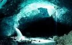
It is located on Ulubük Yaylası, 2 km south of Alapınar village, approximately 30 km northwest of Alpu. The area where the cave is located is in the form of a high ridge separating the drainage basins of the Sakarya Nehri and Porsuk Nehri. The cave, which faces Sakarya, is reached via the Eskişehir-Alpu-Gökçekaya Barajı road. The 10 km stabilized road branching off to the left from the 20th km of the road to the dam first passes through Ulubük Yaylası and then Alapınar village and goes to Sakarı Karacaören. The road goes right up to the front of the cave. The entrance of the cave is in the form of a narrow -4 m shaft. This entrance, later widened by people, developed on a distinct crack. It is quite close to the surface (2-5 m). It consists of three interconnected halls. From this hall, which has a thick deposit of fossilized soil and sand on its floor, one passes to the second section, where dripstones (stalactites, stalagmites, columns, wall and flowstone dripstones, macaroni formations and pools) have developed densely. This section, with a ceiling height of 1-3 m, is connected to the large hall by a narrow gallery. It is a cave rich in formations. Toward the last section of the cave, human bones and ceramic fragments were encountered. Bibliography: - Eskişehir Valiliği.(2014). Eskişehir Rehberi(5.Baskı)
Last updated: 21 October 2026
Location and surroundings
Ulubük Mağarası sits within Alpu, Eskişehir. The toroti catalogue holds 122 described stops across Eskişehir, 3 of them in Alpu.
The nearest stop is Mayislar Mağarası, 16 km to the west. Another 6 catalogued points lie within a 30 km radius.
See Ulubük Mağarası and its surroundings in one plan
- Order your stops on the map and spread them across days
- See driving and visiting time at a glance
- Get places around it suggested automatically
- Free — no sign-up needed to start
Other places nearby
Frequently asked
- What is Ulubük Mağarası?
- It is located on Ulubük Plateau, 2 km south of Alapınar village, approximately 30 km northwest of Alpu. The area where the cave is located forms a high ridge separating the drainage basins of the Sakarya River and the Porsuk River. The cave, which faces Sakarya, is reached via the Eskişehir-Alpu-Gökçekaya Dam road. The 10 km stabilized road branching off to the left from the 20th km of the road leading to the dam first passes through Ulubük Plateau, then through Alapınar village, and goes to Sakarı Karacaören.
- Where is Ulubük Mağarası?
- Ulubük Mağarası is in Alpu, Eskişehir.
- How long does it take to visit Ulubük Mağarası?
- The suggested visit time for Ulubük Mağarası is about 45 minutes.
- What else is there to see near Ulubük Mağarası?
- toroti’s catalogue holds other destinations within 30 km of Ulubük Mağarası; the closest are Mayislar Mağarası, Kara Mağara, Yarasa İni Mağarası.