
Stops along the way
Stops between Samsun and Trabzon
409 km, roughly 7 hours of driving. The stops below are ordered as you pass them — the same road in both directions.
In short
The drive between Samsun and Trabzon is 409 km and takes roughly 7 hours. There are 410 described places within 20 km of this route; it crosses 5 provinces, and the densest stretch is in Ordu (93 places).
There are 410 places within 20 km of this corridor; the 52 below are spread evenly along the drive.
1
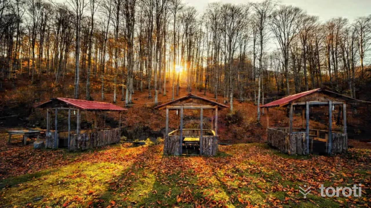
Nebiyan Yaylası
19 Mayıs, Samsun
Located on the ridges of 19 Mayıs district, 20 km south of the district center, Nebiyan mountain has a geography worth seeing with its magnificent nature and landscapes in every season. Nebiyan plateau, located in its upper parts, has the typical characteristics of a Black Sea plateau.
2
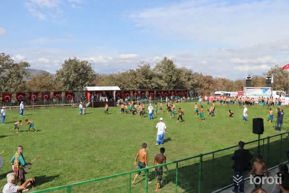
Yaşar Doğu Müze Evi
Kavak, Samsun
The house where national wrestler Yaşar Doğu lived in Emirli Mahallesi has been brought into tourism as a museum following restoration works. The museum, where personal belongings of world and Olympic champion Yaşar Doğu can be seen, was designed with the aim of honoring Yaşar Doğu's memory and inspiring new generations. Next to the museum, a wrestling field has also been built in Emirli Mahallesi, and traditional wrestling tournaments are held there every year.
- No image
3
Kaledoruğu Höyüğü
Kavak, Samsun
It is a mound located in Yeni Camii Mahallesi of Kavak District. The hill measures approximately 350 x 250 meters and is 25 meters high. There are ruins of a castle on this steep-sloped hill.
4
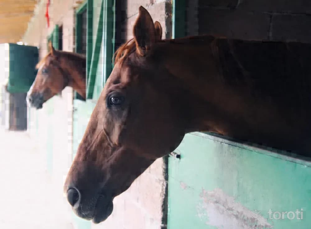
Samsun Büyükşehir Belediyesi Binicilik Tesisleri
Atakum, Samsun
Love and passion for horses are hidden in the genetic codes of the Turkish people. In order to experience this passion, to get away from the troubles of the day even a little, and to spend time pleasantly, Equestrian Sports Facilities with all kinds of equipment have been established within the boundaries of Büyükoyumca Mahallesi in Samsun's Atakum district. It is a fully equipped equestrian facility where all equestrian sports can be practiced and which is also used in the rehabilitation of disabled people.
5
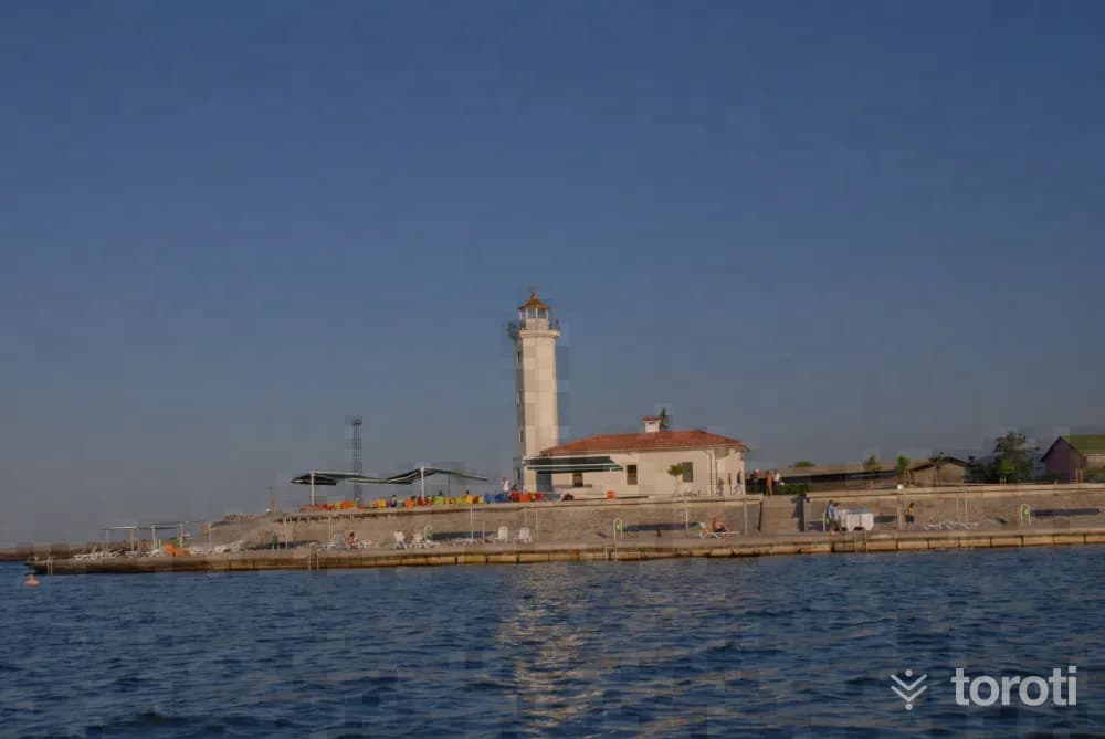
Sahiller
Atakum, Samsun
Vast shores and developing beaches are located in Samsun, in the Central Black Sea. The total length of the Black Sea coast is 120 kilometers. This coast, which starts from Alaçam and extends to Terme Miliç, includes a sandy beach whose depth reaches 200 meters in some places. It is a beautiful beach with fine sand. Starting from the center of Samsun and especially from the Atakum Region, the number of beaches also increases.
6
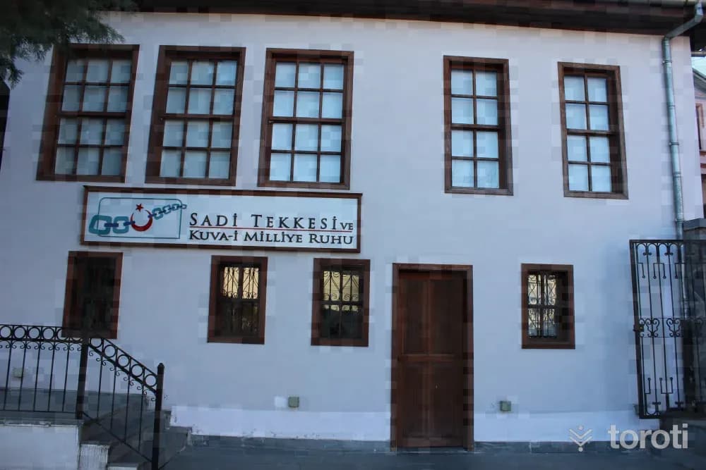
Sadi Tekkesi Kuvayi Milliye Müzesi
İlkadım, Samsun
Sadi Tekkesi Kuvâyi Milliye Museum reflects to the present day the spirit of the liberation struggle that began on 19 Mayıs 1919. Şeyh Sadi Tekkesi, which has an important place in the history of the National Struggle, was restored by Samsun Metropolitan Municipality in 2013 and turned into the Kuvâyi Milliye Museum.
7
Dündar Tepe / Öksürük Tepe
İlkadım, Samsun
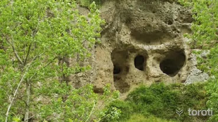
On the 15-meter-high mound located 3 kilometers southeast of Samsun İlkadım District, there are three cultural layers belonging to the Chalcolithic, Early Bronze, and Hittite ages. The latest settlement on the top of the mound belongs to the Early Bronze Age. A Hittite settlement was found on the slopes of the mound. In the first cultural layer, structural remains dated to the Chalcolithic period, handmade ceramic fragments, baked clay weights, flint knives, etc. were found.
8
Onur Anıti
İlkadım, Samsun
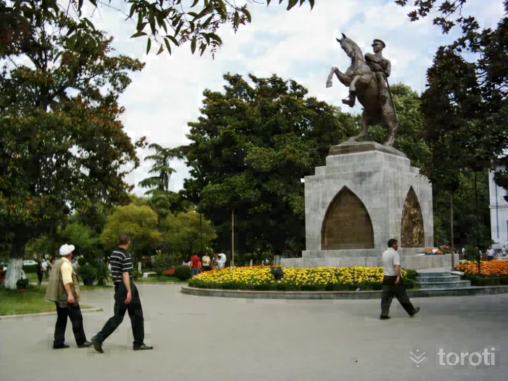
The bronze Atatürk statue, considered the symbol of Samsun, was commissioned by the people of Samsun from the Austrian sculptor H. Kriphel. The statue was brought to Samsun on 15 November 1931 by a German steamer. Along with the statue unloaded from the steamer, H. Kriphel and a Viennese engineer named Mayer also came to Samsun. The opening ceremony of the Gazi Statue took place on Friday, 15 January 1932, with the participation of a large crowd.
9
Kurtuluş Yolu
İlkadım, Samsun
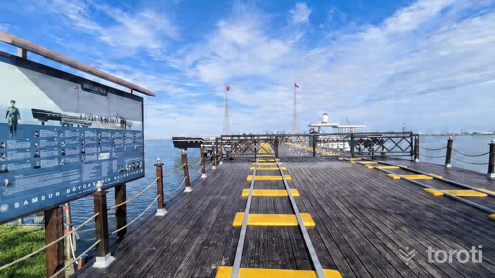
The road stretching from Tütün İskelesi, where Atatürk and his 18 companions set foot on land, to the Mıntıka Palas hotel, was turned into the “Protocol Road” and opened for use on 19 May 2009. Tütün İskelesi, where Atatürk came ashore, was rebuilt, and the Protocol Road, in front of which a symbolic Bandırma Vapuru was also constructed, is 45 metres wide and 400 metres long.
10
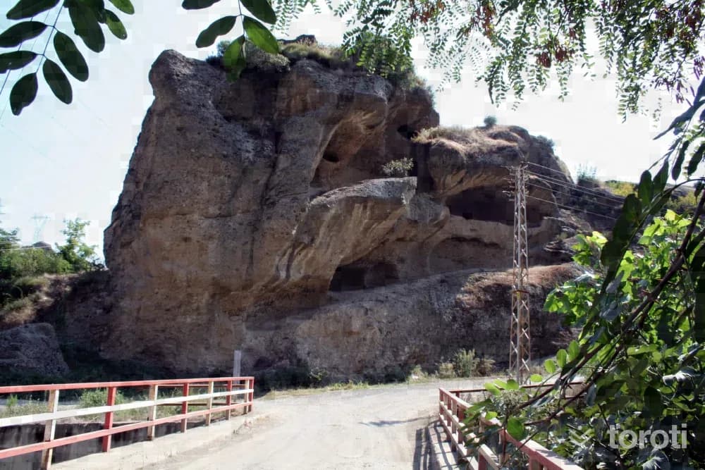
Tekkeköy Mağaraları
Tekkeköy, Samsun
As a result of the archaeological excavations carried out in 1940, finds belonging to the Hittite and Early Bronze Age periods were uncovered. Among the finds, wheel-made, camel-hair-colored, red ceramics are predominant.
11
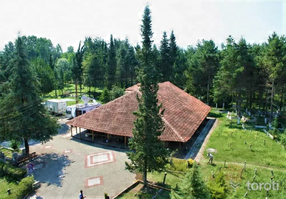
Göğceli Camii
Çarşamba, Samsun
Göğceli Camii, one of the finest examples of the Anatolian building tradition, is one of the oldest wooden mosques still standing within the borders of Türkiye. As a result of tests carried out on wooden samples taken from the mosque, which has no construction inscription, it was understood that it was built in 1206 and that the portico in front of it was added or repaired in 1335. The building underwent a comprehensive restoration in 2007.
12
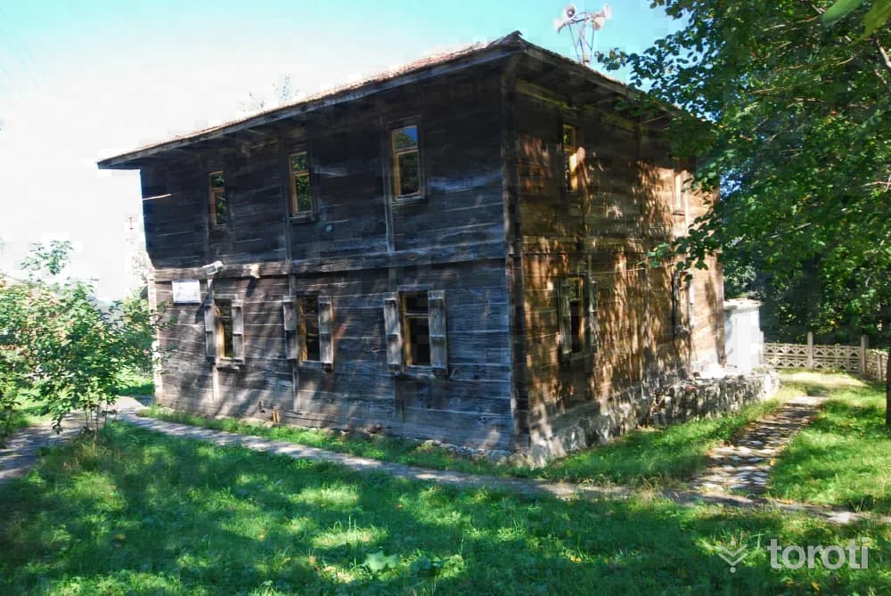
Çayir Camii / Çaybaşi
Çaybaşı, Ordu
Çayır Camii, located within the borders of Çaybaşı district, bears an exact resemblance to Kargalı Ahşap Camisi, located to the south of the same district. It is also not known when and by whom this mosque was built. The dates H. 1281 and 1288 are inscribed on the fountain in the courtyard. These dates, corresponding to the years 1864-65 and 1871 in the Gregorian calendar, may be the dates when the mosque and the şadırvan were built.
13
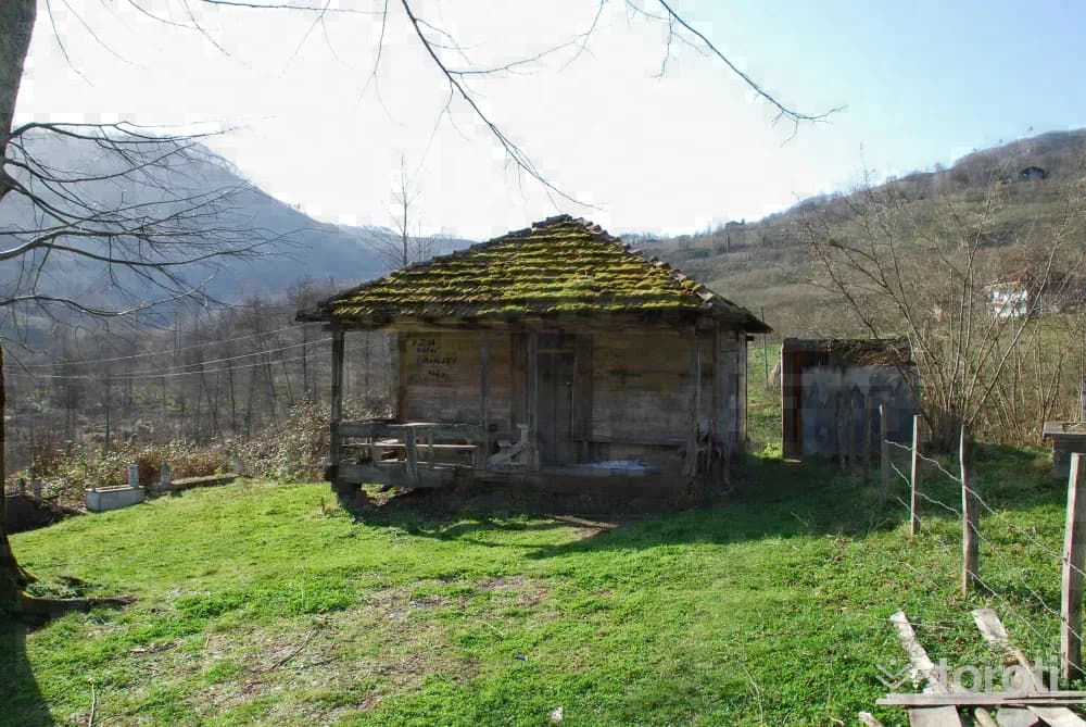
Tekke Camii / Kargili Camii
Çaybaşı, Ordu
This mosque and school, located in Kargalı Neighborhood of Çaybaşı District, resemble the Çaybaşı Çayır Mosque in terms of their construction dates and building style. It is not known for certain when and by whom both mosques and schools were commissioned. The dates H. 1281 and H. 1288 / M. 1864–65 and M. 1871 on the fountain of Çayır Camii suggest that both mosques may have been built on these dates.
- No image
14
Çınarsuyu Mesire Yeri
Ünye, Ordu
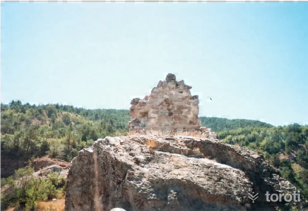
The recreation area, located 7 km from Ünye District, is established on an area of 11 hectares.
15
Kaleköy Kalesi Kaya Mezarları
Ünye, Ordu
It is carved into the rock on the southeastern side and at the foot of Ünye Kalesi, which is located within the borders of Kale Köyü, about 7 kilometers northeast of the district center. The entrance of the tomb, which was neatly carved into the rock, was arranged in the form of Doric-order Greek temples. In terms of its overall appearance and workmanship, it is the rock tomb that best reflects the Hellenistic Period art of the Region. The lion relief symbolizing power on the pediment acroterion has been damaged.
- No image
16
Saray Hamamı
Ünye, Ordu
It is located in the Kaledere neighborhood in the district center of Ünye. It is rectangular in shape from the outside. It consists of cold, warm and hot sections. It was built of cut stone and rubble stone. The exterior facade surface, domes and window jambs have been repaired, and it is still in use. The structure, originally a church, was later converted into a bath.
17
Cingirt Kalesi
Fatsa, Ordu
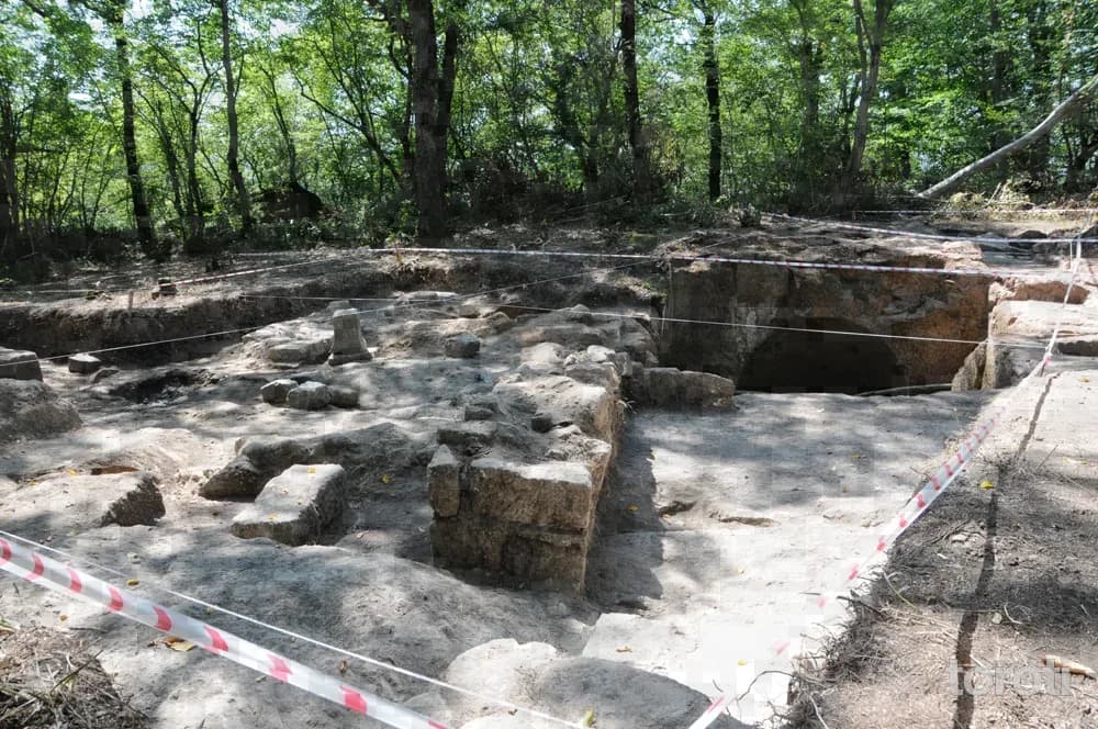
Located within the borders of Yapraklı Village, ‘Cıngırt Kalesi is 5 kilometers from Fatsa. The literature studies conducted show that stepped tunnels, in the form of tunnels carved into single or multiple rocks, which could safely reach water between 301-63 BC, are characteristic of this type of castle settlement. It is a 1st degree archaeological site.
18
Gaga Gölü / Fatsa
Fatsa, Ordu
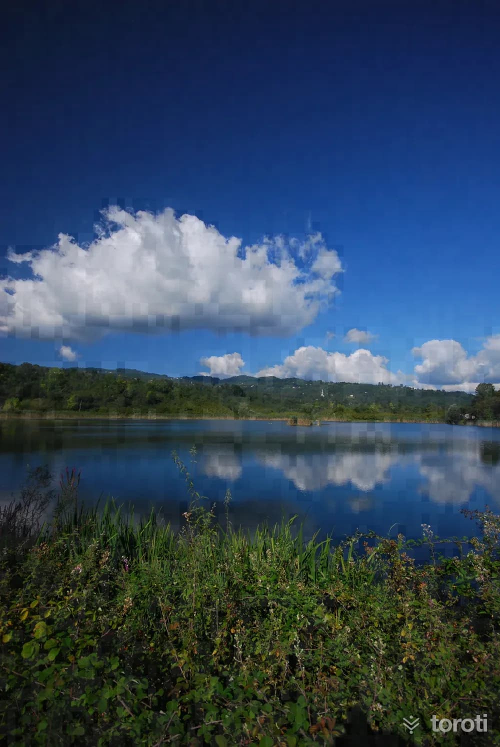
Located on the Fatsa-Aybastı highway, 10 kilometers northeast of Fatsa District, Gaga Gölü is within the boundaries of Örencik Village. It covers an area of 60 decares. Gaga Gölü was formed on the surface of the upper Cretaceous flyschs forming the structure, as a result of a landslide affecting an area of approximately 6 square kilometers between Bolaman Irmağı and the Yassıtaş locality to its west. The depth of the lake varies between 10-15 meters. There is a small islet in the middle of the lake.
19
Çamaş Hisarbey Köyü Kaya Mezarı
Çamaş, Ordu
It is located in Çamaş District, Hisarbey Bey Village, on the immovable property registered on parcel no. 434 in the Çevlik Gölü locality. On the upper part of the entrance, a triangular pediment-shaped decoration was made in relief. The front part of the entrance was emphasized by carving 40 centimeters inward from the edge of the bedrock. There is a bench in the nearly square rectangular planned burial chamber. On the bench to the right of the entrance, there is a niche 40 centimeters high and 45 centimeters wide.
20
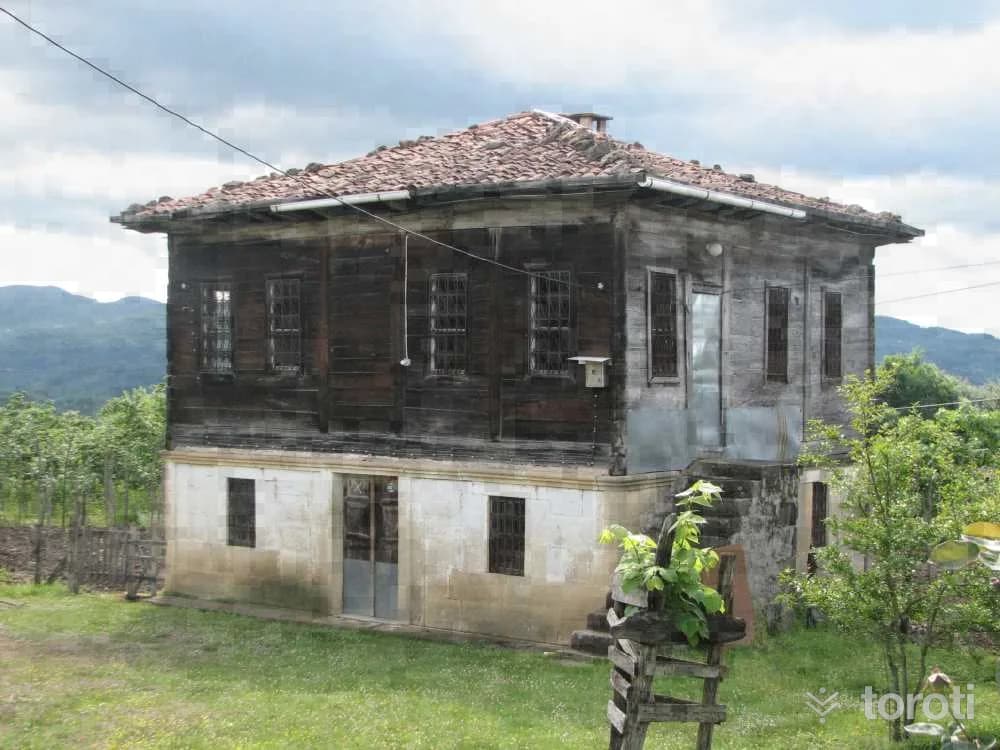
Kabakdağ Köyü
Fatsa, Ordu
It is 9 km from Fatsa. It is the only village with an eco-tourism initiative together with organic agriculture. There are 180 registered households in the village, which was founded by those who migrated from around Batum after the 1877 Ottoman - Russian war. 20 houses are registered. There are more than 100 varieties of local dishes in the village. It has also been successful in organic agriculture. (honey, eggs, dairy products, vegetables and fruit).
21
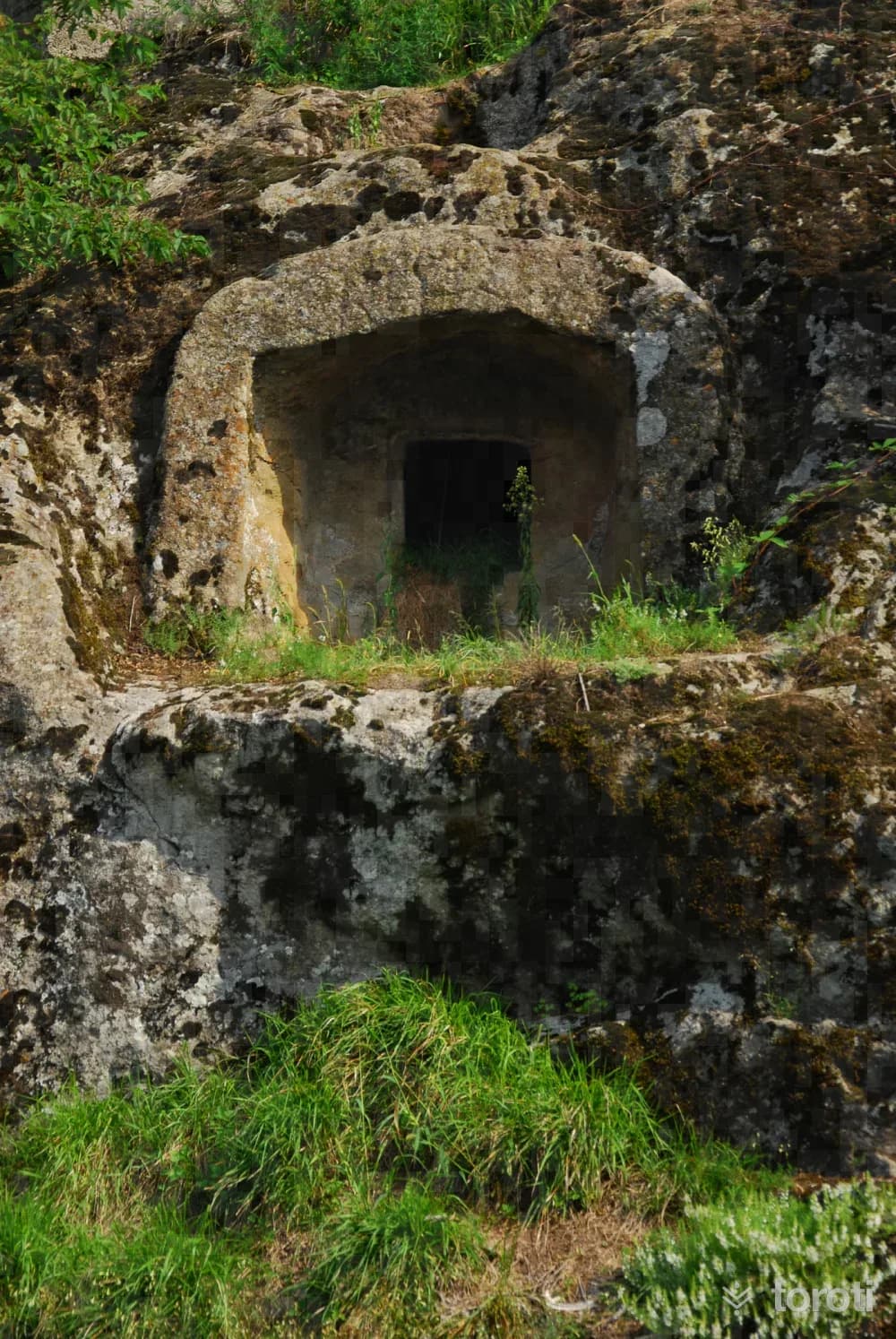
Sucuali Kaya Mezarı
Çamaş, Ordu
The burial chamber has a nearly square plan and measures approximately 2x2 meters. Since the interior is filled with water and stones, it could not be determined whether there is a bench in the burial chamber or how many there are. It is located on the immovable property registered in Çamaş District, Sucuali Neighborhood, İnüstü Mevkii, block 282, parcel no. 61.
- No image
22
Sayacabaşı Mesire Yeri
Ulubey, Ordu
It is a recreation area located on the Ordu-Sivas highway, 27 km from Ordu city center and 7 km from Ulubey district center, in Sayaca Village, covering a total area of 6,4 hectares. Food-beverage and resting facilities are available.
- No image
23
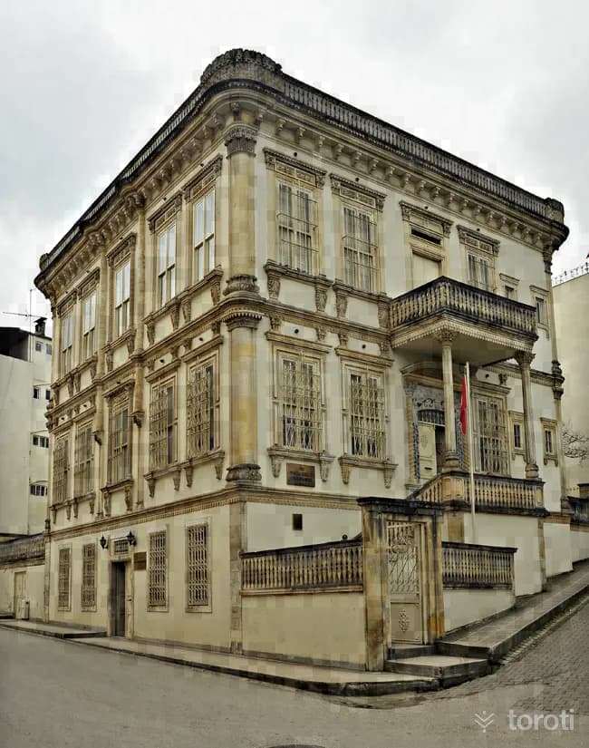
Kültür Merkezi (Taşbaşı Kilisesi)
Altınordu, Ordu
An old Greek Orthodox church located in the Taşbaşı neighborhood. The church, built in 1853, was also used as a prison between 1937 and 1977, and was restored by the Ministry of Culture and Tourism in 1983. It was converted into a cultural center in 2000.
24
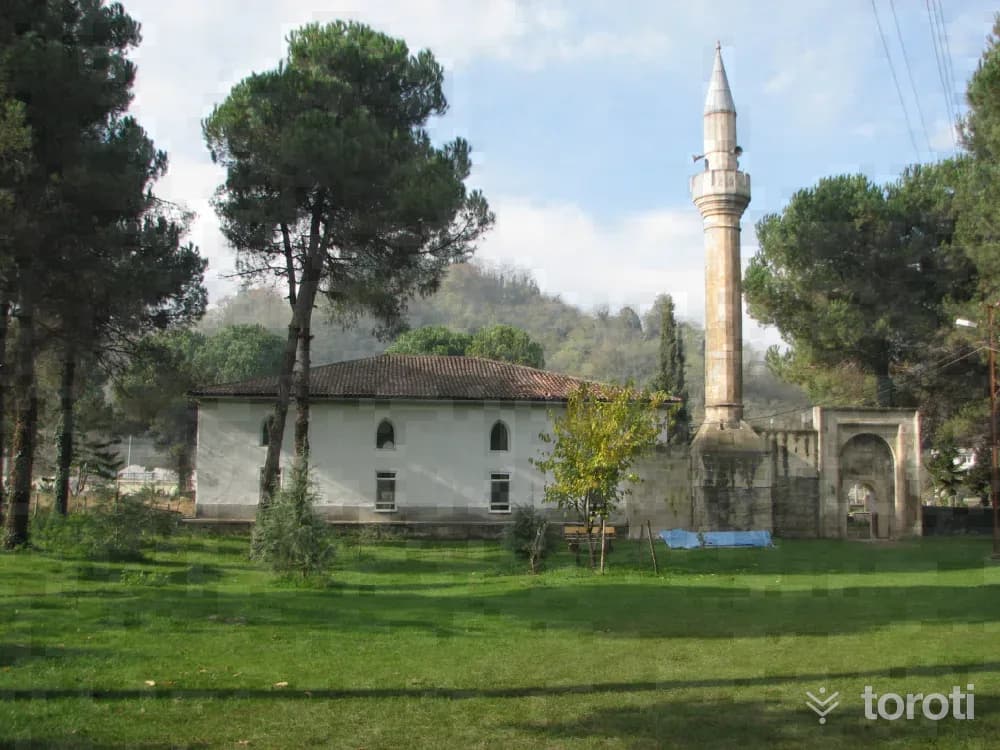
Paşaoğlu Konağı Etnografya Müzesi
Altınordu, Ordu
Paşaoğlu Mansion, rising on the corner where Taşocak Avenue and Erkoçak Street intersect in Selimiye Neighborhood in Ordu city center, was built in 1896 by Paşaoğlu Hüseyin Efendi. Built on an area of 625 square meters together with its garden, the stones of the mansion were brought from Ünye, its wooden material from Romania, and its construction was carried out by a master from Istanbul.
25
Eskipazar Bayram Bey Camii Ve Hamamlari
Altınordu, Ordu
Old Market is Ordu’s second settlement area. Eskipazar Mosque has a rectangular plan. It was founded by the Hacıemiroğulları around 1380. The mosque was repaired in Rumi 1197 (Gregorian 1781) by the Şebinkarahisar governor Hüseyin Battal Paşa. The mosque, which was ruined by the earthquake, was repaired at the beginning of the century. From the old mosque, only the entrance door and portal have survived to the present day.
- No image
26
Eskipazar Hamamı
Altınordu, Ordu
Large Bath: It consists of three sections as cold, warm and hot. The exterior of the bath was built of rubble stone, while the interior was built of smoothly cut stone. Domes and vaults were used in the covering. It is a 16th-century work. Small Bath: It consists of a single square space and a water reservoir. It is estimated to have been built in the 18th century.
- No image
27
Tirilizade Beyler Konağı
Piraziz, Giresun
Tiralizade Hasan Bey Mansion is considered the oldest historical work in the town. This work, which was built between 1906-1908 during the final period of the Ottoman Empire, is a rare example of civil architecture in the Black Sea Region in terms of reflecting mansion life and its architectural features.
28
Bulancak Şeyh Ali Ağa Cami
Bulancak, Giresun
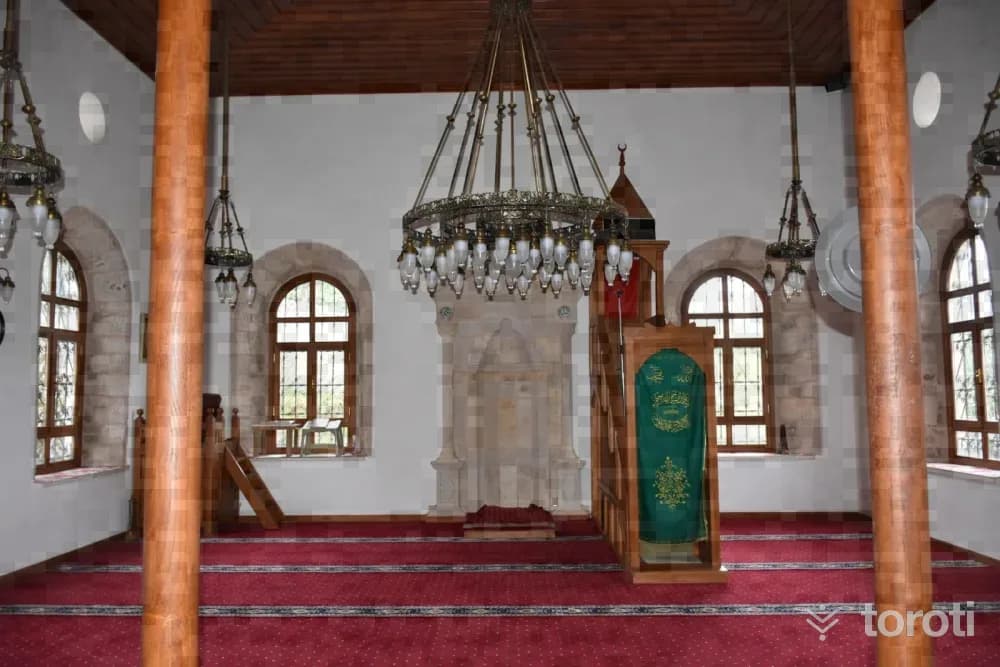
Bulancak District. Şeyh Ali Ağa (Şemsettin) Mosque was registered as a Cultural Property requiring protection and taken under protection by the decision of the High Council of Immovable Cultural and Natural Assets of the Ministry of Culture and Tourism, dated 25.06.2009 and numbered 2211. It is written on the surface of the mosque’s north facade that it was built in 1896 (H. 1312). The mosque’s first establishment dates back to the 15th century.
29
Acisu Kaya Kilise
Bulancak, Giresun
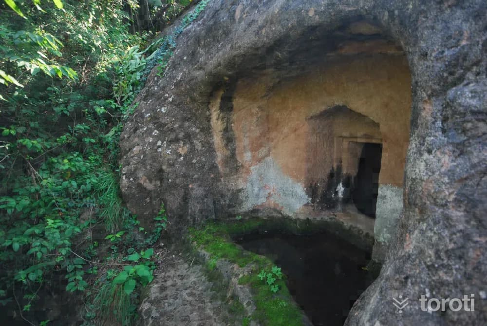
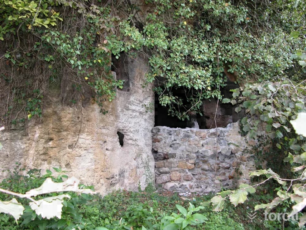
It is located in Bulancak District, approximately 300 meters west of İncüvez Stream, within a hazelnut garden. The church, carved into the main rock mass, was registered and taken under protection by the decision of the Trabzon Council for the Protection of Cultural and Natural Assets dated 11.10.1990 and numbered 856.
30
Boztekke Köyü Şeyh Keramettin Türbesi
Giresun, Giresun
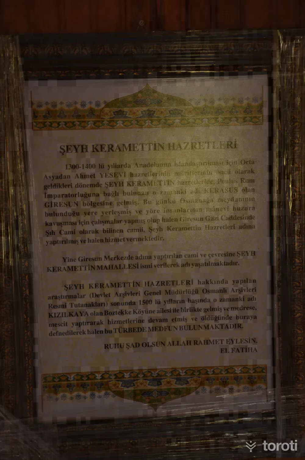
The tomb, located to the east of the Boztekke Köyü cemetery in central Giresun, was registered by the Trabzon Regional Board Directorate for the Protection of Cultural Assets with decision no. 788 dated 23.07.1990. It is the tomb of a hodja named Şeyh Keramettin, who is believed to have come from Horasan, and is a waqf consisting of a mosque, well, soup kitchen and mill built at different times. The tomb was probably built by the local people after the death of Şeyh Keramettin.
31
Sayca Köyü Manaroğlu Camii
Giresun, Giresun
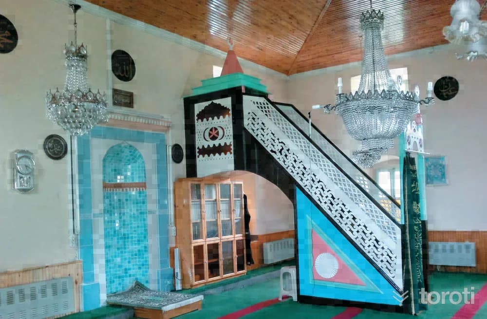
According to the inscription above the entrance door of the mosque, it was built in 1909 (1325 R.). The structure, built in a masonry system, has a longitudinal rectangular plan. In terms of materials, dressed stone was used in the main walls, and cut stone was used in the mouldings and jambs. The mosque, which has neither a last congregation area nor a minaret, is covered with a wooden ceiling on the inside and a four-sided hipped roof on the outside, and the roof is covered with traditional tiles. The facades of the mosque are arranged symmetrically.
- No image
32
Şeyh Keramettin Camii
Giresun, Giresun
The masonry mosque located in the neighborhood bearing the same name was built on the site of the wooden mosque that had previously been commissioned by a person named Şeyh Keramettin, who endowed the land for it. However, since the mosque collapsed over time, it was rebuilt in 1900 as a charitable work by the heirs of Sarı Alemdarzade İzzet Kaptan.
- No image
33
Kufa Kuyusu Suyu
Giresun, Giresun
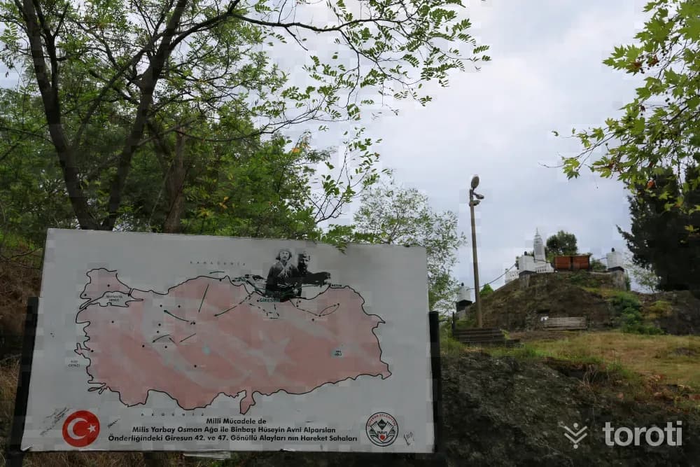
Kufa Well, which is said to have been used as a place of visitation in the Pontus period, is at the foot of the north-facing side of Giresun Castle. It is thought to date from the Byzantine period. The mouth of the well is 2 m. long and was built of cut stones 80 cm. wide. According to rumor, this water was sent to kings in jugs and would remedy their various troubles.
34
Topal Osman Ağa Anıt Mezarı
Giresun, Giresun
Osman Ağa was born in 1883 in Giresun’s Hacı Hüseyin Mahallesi. In his youth, as he was “intelligent, determined, enterprising,” he began to be known by the لقب “ağa.” Although his family had paid the military exemption fee, when the Balkan War broke out on 8 October 1912, he voluntarily joined the Balkan War.
35
Yağlidere Tekkeköy Cami
Yağlıdere, Giresun
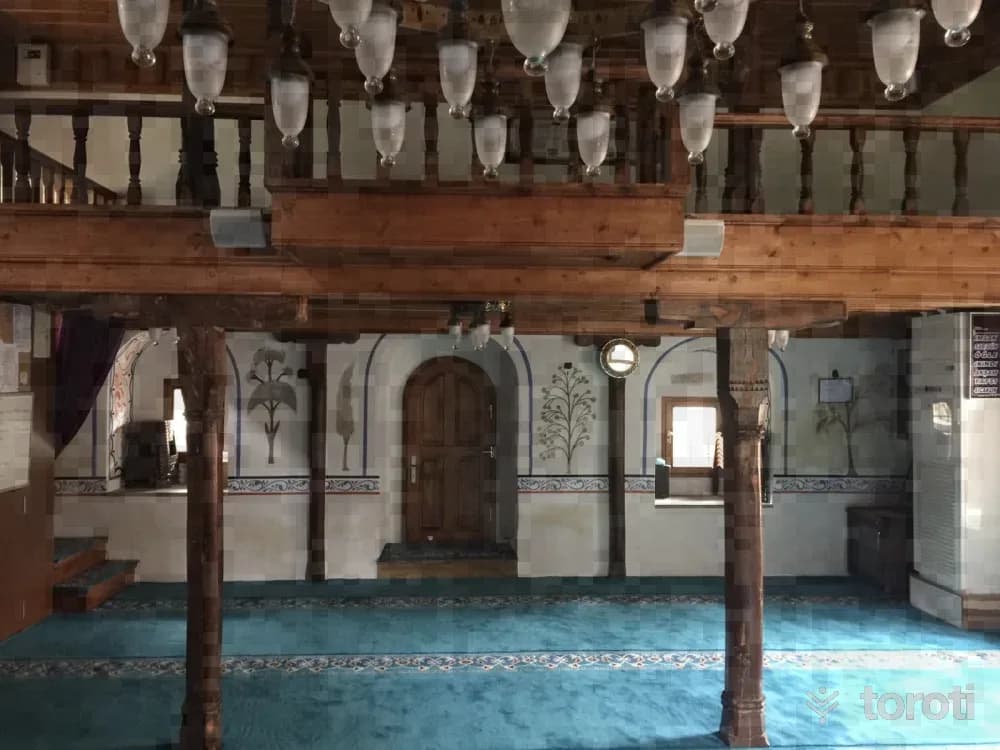
There are publications stating that the Hacı Abdullah Külliyesi was founded by Gülbahar Hatun, the mother of Yavuz Sultan Selim, during his governorship of Trabzon (1489-1512), and that its administration was left to Hacı Abdullah Halife. Of the külliye, the mosque, zaviye-hearth, guesthouse, mill, and the tomb of the founding sheikh in Tuğlacık Köyü have survived to the present day. The bakery has been removed, and an imam's house has been built in place of the zaviye guesthouse right next to the mosque.
- No image
36
Andoz Kalesi
Espiye, Giresun
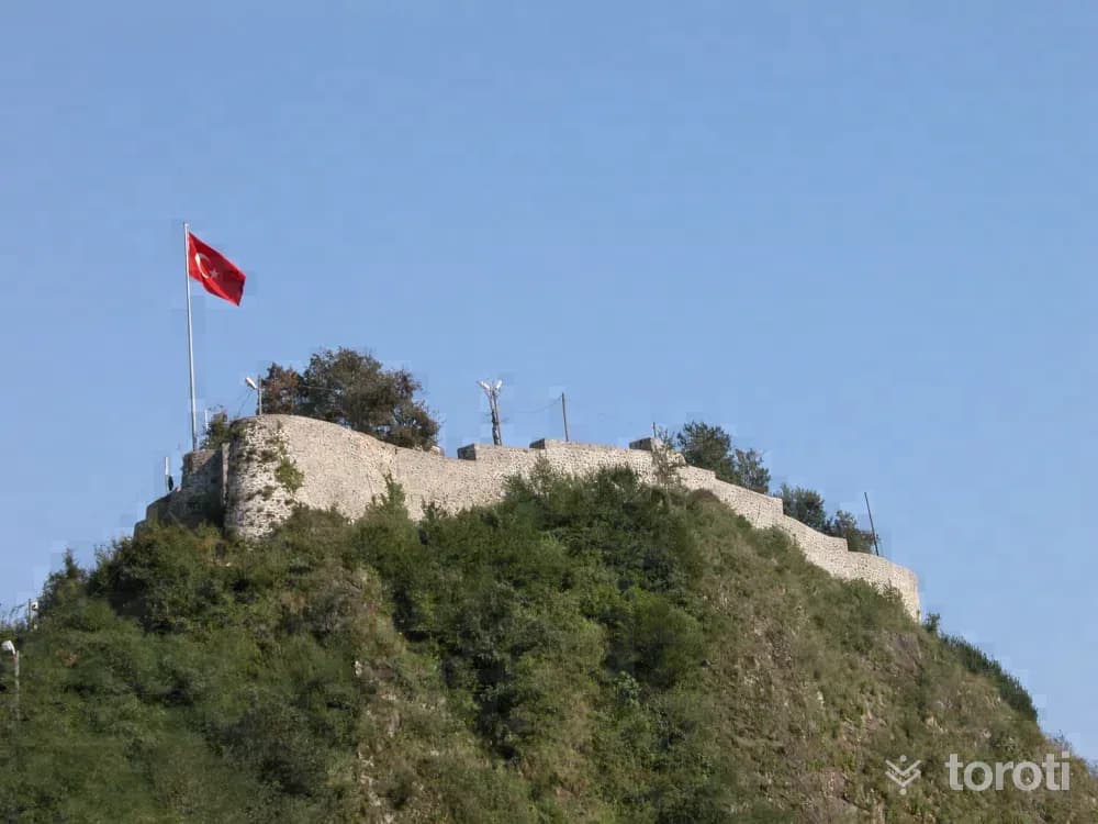
It is located on a natural pointed hill overlooking the sea and the valley, on the bank of Yağlıdere Stream at the entrance of Espiye District. It is estimated to have been built in the 1300s B.C. It is surrounded by walls. The walls have collapsed in places. There are towers in some parts.
37
Espiye Andoz Kalesi
Espiye, Giresun
It is a small castle located at the entrance of Espiye District, on the bank of Yağlıdere Stream, on a natural pointed hill overlooking the sea and the valley. It was placed under protection by the decision of the Trabzon Cultural and Natural Heritage Preservation Board dated 30.11.1990 and numbered 908. It is estimated to have been built in the 1300s B.C. Access to the castle is provided by the road on its north. It is surrounded by walls. In some parts, there are towers.
38
Espiye Yedi Değirmenli Mağarası
Espiye, Giresun
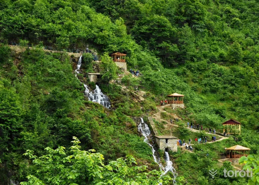
It is located 33 kilometers from the center of Espiye district, between Avluca Köyü and Yeniköy. Here, it has been determined that the karst spring whose outflowing water powered seven mills is actually a cave. The most important feature of the cave is that water flows vigorously inside it. The cave is 207 meters long, and its height varies between half a meter and ten meters. In addition, the cave is adorned with stalactites, stalagmites and similar formations, like a surrealist painting.
39
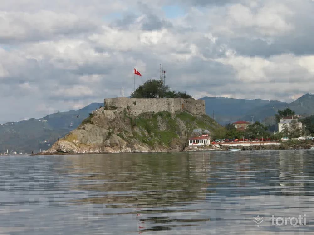
Tirebolu Kalesi
Tirebolu, Giresun
The historic Tirebolu Kalesi (Saint-Jean), located in the center of Tirebolu district, is a small castle situated on a peninsula in the sea to the north of the district. Built in accordance with the natural structure of the peninsula, the castle is reached from the south by a steep staircase. The castle was built as masonry with rubble stone material. The entrance is provided through a low-arched opening facing the town. Its walls were supported at intervals from the outside with buttresses.
40
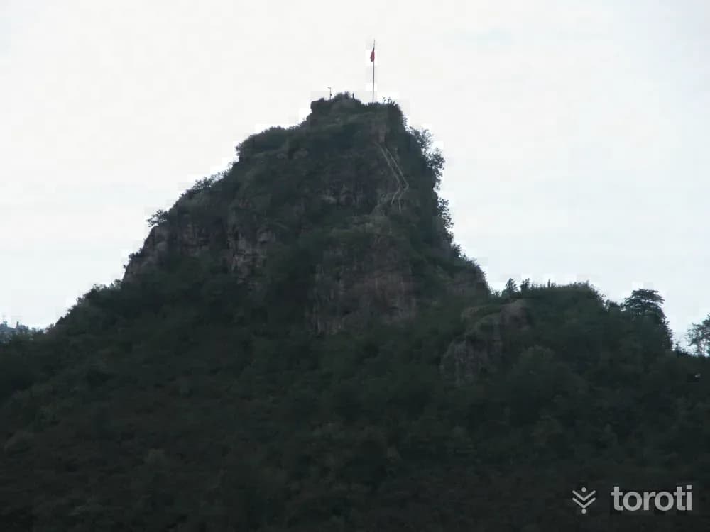
Tirebolu Bedrama Kalesi
Tirebolu, Giresun
The castle, located in Örenkaya Village approximately 8 kilometers inland from Tirebolu District, was built on a natural, pointed and quite high rock overlooking the seashore. Bedrama Kalesi was placed under protection by the Trabzon Cultural and Natural Heritage Preservation Board with Decision No. 1534 dated 18.12.1992. Although the construction date of the castle is unknown, the view that it is a medieval structure is widespread. Extending in a north-south direction, the castle displays a plan close to a rectangle.
- No image
41
Görele Paşaca Şelalesi
Şalpazarı, Trabzon
It is located between the villages of Yeşildere and Beşirli in Görele District of Giresun. The area where the waterfall is located has been declared a Nature Park. The waterfall is not only a waterfall on its own, but after completing its drop, it continues on its way by forming small cascades for hundreds of meters.
42
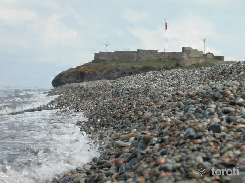
Eynesil Kalesi
Beşikdüzü, Trabzon
The castle was placed under protection by the decision of the Trabzon Cultural and Natural Heritage Preservation Board dated 23.12.1994 and numbered 2124. There is no academic source providing information about the construction date of Eynesil Kalesi, located on a rocky peninsula 2 kilometres east of Eynesil District, or about who had it built. Current sources state that Eynesil Kalesi, meeting the blue of the sea, dates back to the Romans.
43
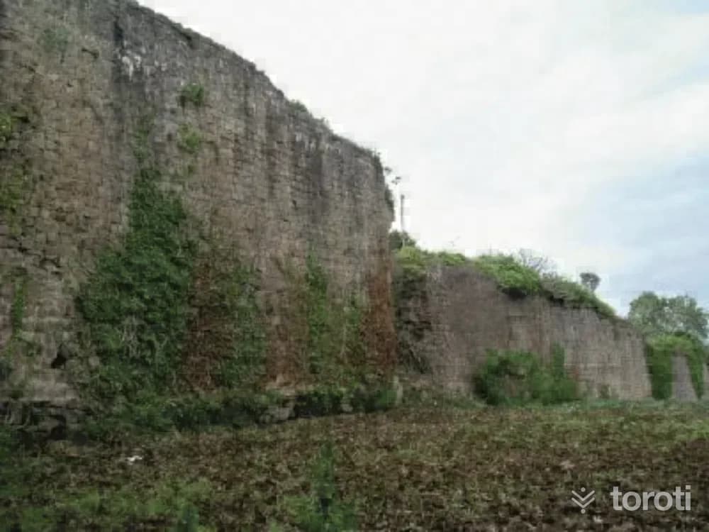
Akçakale
Akçaabat, Trabzon
Akçakale, located 18 kilometers west of Trabzon, was established on a terrace overlooking the sea. The castle that gave the district its name is thought to have been built by Emperor Alexios II between 1297-1330 in order to protect it from the Seljuks. After the conquest of Trabzon, the castle was repaired during the Ottoman Period. Although many parts of the castle, built of rubble and cut stone, have been destroyed, it still has not strayed far from its original appearance.
44
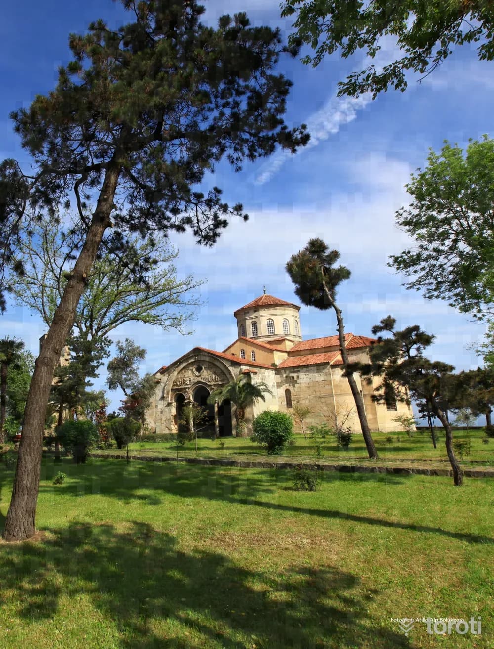
Ayasofya Cami
Ortahisar, Trabzon
Ayasofya Cami was reopened for Muslim worship after 52 years, with the performance of the daily prayer on Friday, 28 June 2013. Trabzon Ayasofya Museum, which is a mosque today, was built during the reign of 1. Manuel Komnenos, one of the kings of the Trabzon Empire (1238-1263). The bell tower, dated to 1427, is located to the west of the church. The remains of the three-apsed chapel to the north of the church belong to an earlier period.
45
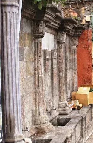
Abdülhamit Çeşmesi
Ortahisar, Trabzon
Abdülhamit Fountain was built in İskender Paşa Neighborhood in 1891, in memory of Sultan Abdülhamit. On the rectangular fountain, which is made of cut stone, there is the tughra of Sultan Abdülhamit II. The column capitals and bases are decorated with acanthus leaves.
46
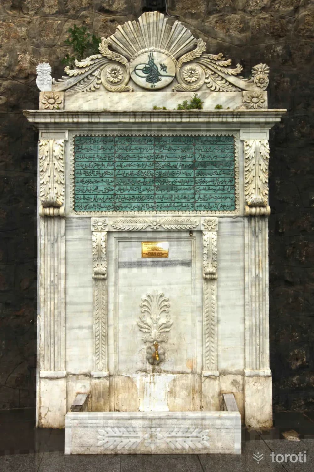
Abdullah Paşa Çeşmesi
Ortahisar, Trabzon
Abdullah Paşa Fountain is located at the eastern entrance of Zağnos Paşa Tower. It is known to have been built in Taksim Square in 1844 by Trabzon Governor Haznedarzade Abdullah Paşa. The structure was later moved to its present location. Photo: Servet Uygun The rectangular fountain was built in the Empire style. In the center of the fountain’s triangular pediment is the tughra of Sultan Abdülmecid, with broken branches on either side of the tughra and a rosette on each side.
47
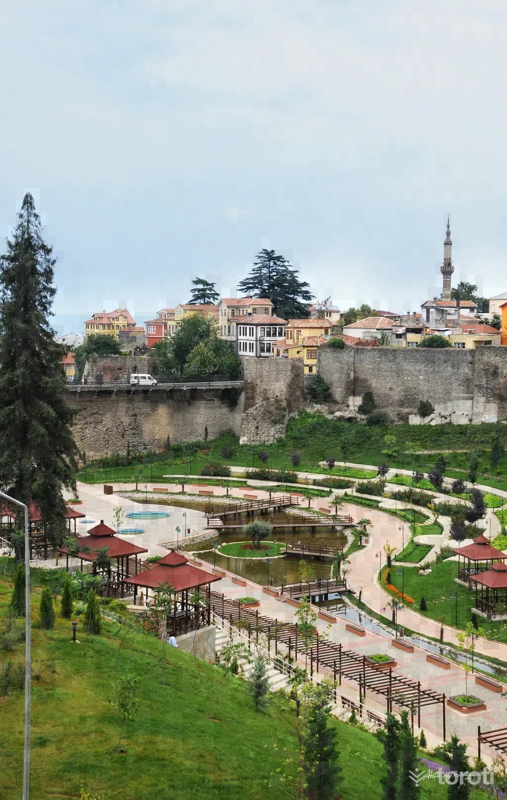
Zağnos Köprüsü
Ortahisar, Trabzon
Zağnos Bridge provides the connection between Orta Hisar and Zağnos (Atapark) Square. A bridge with two superimposed arched spans, it was originally built with 6 or 7 arched openings. A large part of the lower sections of the bridge was built during the Roman Period. In addition, workmanship belonging to the Byzantine Period can be seen. In the 15th century, it was repaired by Zağnos Mehmet Paşa. With the repairs carried out over time, the width of the bridge increased.
48
Paşa Hamamı
Ortahisar, Trabzon
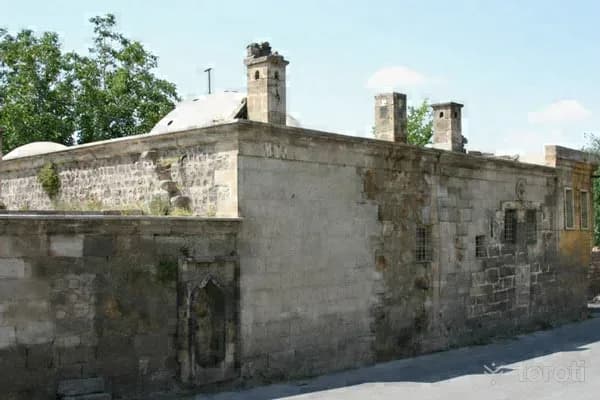
Paşa Hamamı, also known as İskender Paşa Hamamı, was commissioned in 1531 by Trabzon Governor İskender Paşa, and although its inscription was destroyed, the bath itself has survived intact to the present day. The architecture of İskender Paşa Hamamı is a typical example of Ottoman architecture. The bath, which has two separate sections for men and women, has a double bath plan layout. Above the men's section, there is an octagonal roof supported by columns.
49
Cephanelik
Ortahisar, Trabzon
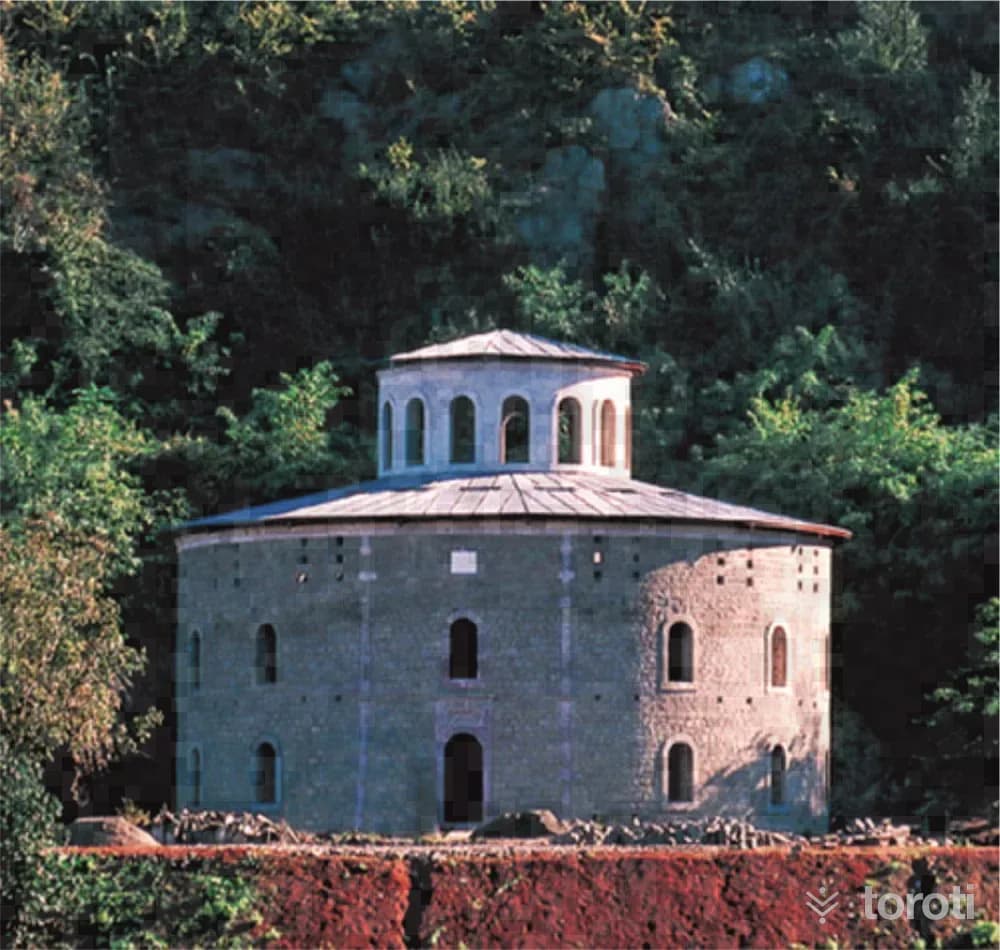
Cephanelik is one of the most striking and debated structures among the buildings of Trabzon. Under the photograph of the structure in the Yıldız Sarayı albums, it is written that it was commissioned in the year H.1305. The tughra of Abdülhamit II above its door and the inscription also confirm this. It is clearly understood that Cephanelik was commissioned in 1887. It consists of two concentric circular sections with an approximate diameter of 25-40 meters. The inner section has four storeys, while the outer section has three storeys.
- No image
50
Kuş Gözlem
Ortahisar, Trabzon
Bird Watching Trabzon plateaus and especially Altındere Valley National Park offer favorable opportunities for bird watchers. The National Park is within the borders of Maçka district. It is quite rich in terms of biodiversity and bird diversity.
- No image
51
Ahi Evren Dede Camii
Ortahisar, Trabzon
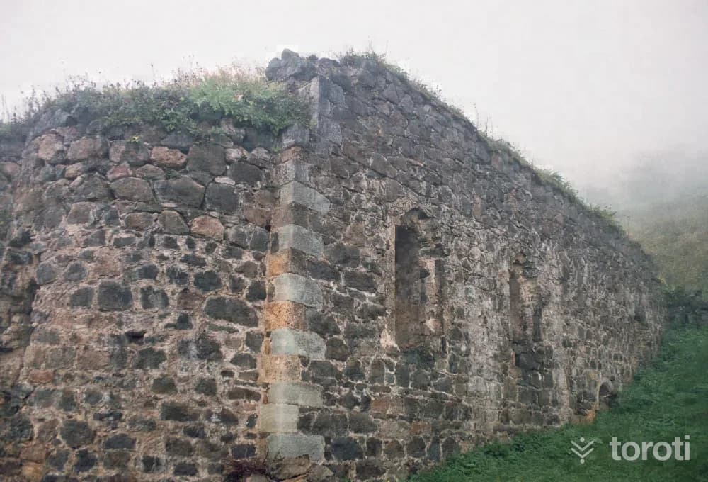
It is adjacent to Ahi Evren Dede Camii located in Boztepe. The square-planned tomb is covered with a dome. This tomb, restored by Hacı Hakkı Baba in 1887-1888, took its present form. Next to the grave of Ahi Evren Dede are also the graves of Hacı Hakkı Baba and his sons.
52
Santa Harabeleri
Gümüşhane merkez, Gümüşhane
Santa Ruins is located approximately 82 kilometers from the city center of Gümüşhane, within the borders of Dumanlı Village of Yağmurdere Township. Santa was established on three separate slopes divided from each other by the valleys where the Santa Yanbolu Stream originates. The Santa Region was conquered during the period of Fatih Sultan Mehmet - between 1461-1476 - together with the whole of Trabzon and the Eastern Black Sea region, and was incorporated into the lands of the Ottoman Empire.
Move the stops into your own plan, split them across days, and add places to sleep and eat.
Frequently asked
- How far is it between Samsun and Trabzon, and how long does it take?
- Driving between Samsun and Trabzon is roughly 409 kilometres and takes about 7 hours without stops.
- Where is it worth stopping between Samsun and Trabzon?
- There are 410 described places within 20 km of the road between Samsun and Trabzon. toroti lists 52 of them spread evenly along the drive, in the order you pass them; Nebiyan Yaylası comes early on, and Santa Harabeleri sits near the end.
- Which provinces does the Samsun to Trabzon route cross?
- The route between Samsun and Trabzon crosses Samsun → Ordu → Giresun → Trabzon → Gümüşhane. The stretch richest in places to visit is in Ordu.
- Should I take the toll highway or traditional route between Samsun and Trabzon?
- Toll motorways save driving time between Samsun and Trabzon, whereas traditional state roads pass directly through historic town centers, local culinary stops, and scenic nature viewpoints.
- How should breaks be scheduled between Samsun and Trabzon?
- For a drive of around 7 hours, taking a break every 2 to 2.5 hours is recommended. The catalogued attractions in Ordu and neighboring provinces offer memorable stopovers compared to generic highway rest areas.
Other routes