
Stops along the way
Stops between İstanbul and Trabzon
1159 km, roughly 14 hours of driving. The stops below are ordered as you pass them — the same road in both directions.
In short
The drive between İstanbul and Trabzon is 1159 km and takes roughly 14 hours. There are 1237 described places within 20 km of this route; it crosses 15 provinces, and the densest stretch is in Kocaeli (119 places).
There are 1237 places within 20 km of this corridor; the 60 below are spread evenly along the drive.
- No image
1
Arnavutköy Yeniköy Halk Plajı
Arnavutköy, İstanbul
Arnavutköy Yeniköy Public Beach is a public beach candidate included in the official 2025 Blue Flag list.
2
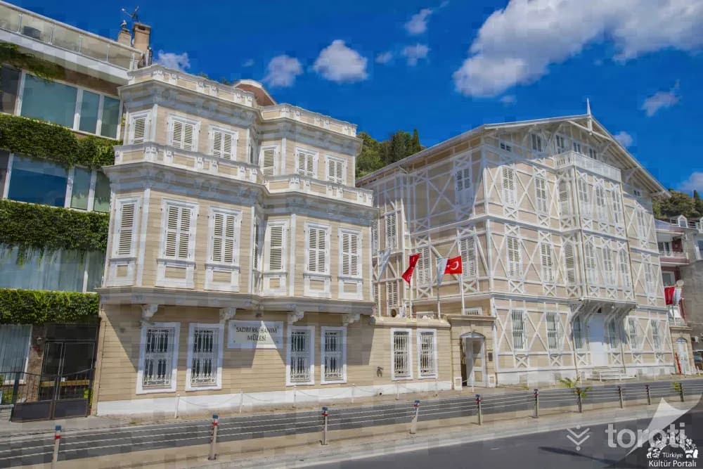
Sadberk Hanim Müzesi
Sarıyer, İstanbul
Sadberk Hanım Museum is located in a 19th-century building and hosts a rich collection of artifacts.
- No image
3
Rumeli Feneri
Sarıyer, İstanbul
Rumeli Feneri is a historic lighthouse located at the point where the Bosphorus meets the Black Sea.
4
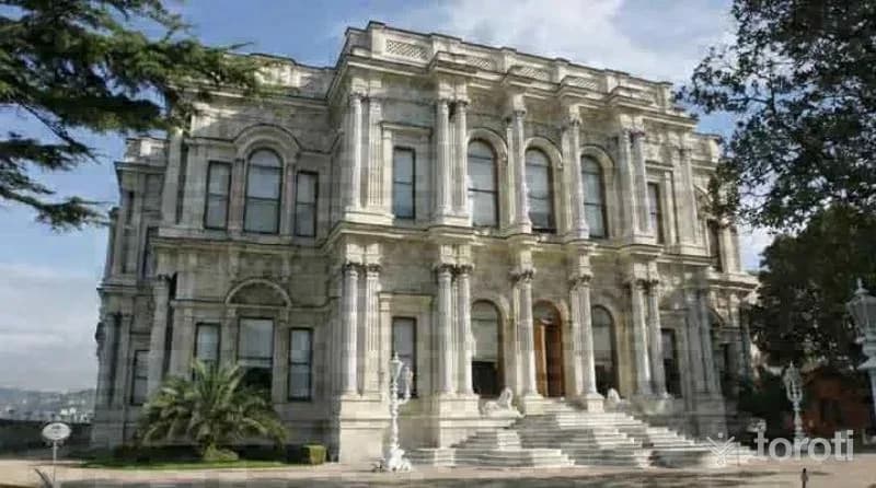
Beylerbeyi Sarayı
Üsküdar, İstanbul
Beylerbeyi Palace was built as a summer residence for Ottoman sultans and served to host foreign heads of state.
- No image
5
Polonezköy
Beykoz, İstanbul
Polonezköy is a village located 30 km away from Istanbul, immersed in nature. It is a peaceful getaway with walking paths and cycling trails.
- No image
6
Ballikayalar
Gebze, Kocaeli
Ballıkayalar is a nature park located in Gebze, offering an ideal area for mountaineering.
- No image
7
İzmit Elektronik Kent Müzesi
İzmit, Kocaeli
The Electronic City Museum introduces the city's history, economy, culture and tourism, historical artifacts and municipal services to all local and foreign visitors in an electronic environment. In the museum's sections, there are models of 10 important historical structures integrated with an audio system.
- No image
8
Cami Düzü Yuvacik Baraji
Başiskele, Kocaeli
This route consists of a traffic-free dirt vehicle road located just across from the main highway around Yuvacık Barajı. Rest areas have been created within the route by the Metropolitan Municipality. We recommend Cami Düzü village as the starting point of the route. The end point of the route is the area where the body of Yuvacık Barajı is located. A 5 km section of the route consists of a flat dirt vehicle road.
- No image
9
Aytepe Değirmen Düzü
Başiskele, Kocaeli
A large part of this route, which is visually perfect and has a geography where everyone can walk comfortably, consists of descents. Therefore, it is especially useful to use a walking stick throughout the hike. The last flat stretch on the road descending from Aytepe to soğuk su is the point we prefer as the starting place of this trail. This route, consisting of a dirt forest road and occasional paths, can be walked in all four seasons, although the most ideal times are the seasons excluding the winter period.
- No image
10
Altıoluk Eskiyayla
Sapanca, Sakarya
The route, which starts from a place near the summit of Kartepe, ends at Eski Yayla (Öküzyatağı), located within the borders of Sakarya's Pamukova district, after Altıoluk Yaylası. Thus, we walk the Samanlı Mountains from the northern direction (İzmit Gulf) toward the southern direction (Sakarya Valley). The journey, which begins after passing Kuzu Yayla, located just below the summit point on Kartepe, ends within the borders of Sakarya.
- No image
11
Çark
Adapazarı, Sakarya
A mill was built on today’s Çark Suyu between 1581-1585 to meet the needs of Ada Karyesi. In place of this mill, which served for nearly 250 years, in 1734 the philanthropist Devoğlu Mustafa had a primitive “water wheel”/“çark” built and ditches-canals opened, and the water of Çark was carried to the Orta Camii fountain and to Adapazarı as drinking water.
- No image
12
Kuzuluk Orman İÇİ Dinlenme Yeri
Akyazı, Sakarya
It is located on the Adapazarı-Akyazı-Mudurnu road, 8 kilometers from Akyazı and 34 kilometers from Adapazarı. It has an area of 11,85 hectares. It was established in 1996. In the area; there are facilities such as a countryside casino, toilet, fountain, entrance control booth, and children's playground. The forest recreation area, covered with beech and oak forest, has a development plan.
13
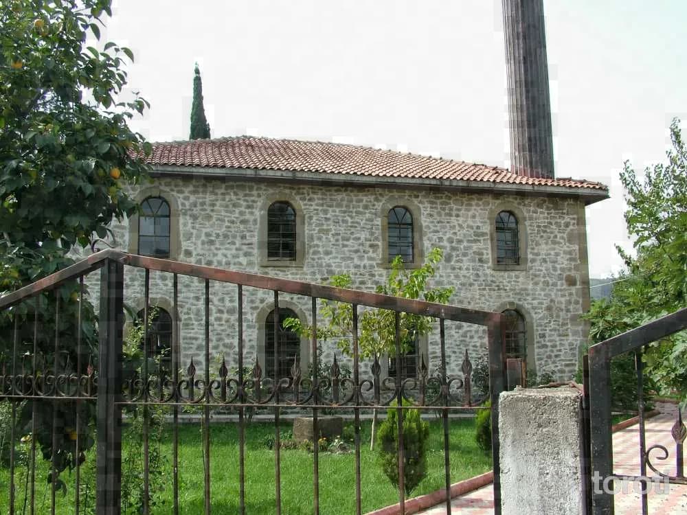
Tarihi Uğurlu Köyü Yeni Meze Cami
Akçakoca, Düzce
It is located in Uğurlu Köyü, 16km from Akçakoca. The mosque, which is a fine example of stone workmanship, was built in 1885. The mosque, which contains inscriptions dating back to the Ottomans, is one of the important values of the province.
- No image
14
Sarıyayla Şelalesi
Akçakoca, Düzce
Aktaş Waterfall is located within the borders of Aktaş Village, 11km. from Akçakoca city center. With its nature and the rich vegetation around it, it is one of Akçakoca’s natural beauties worth seeing. Aktaş Waterfall, one of the places that tourists coming to the region for sea tourism have only recently begun to discover, is quite suitable for nature sports such as trekking and photo safari among the sound of the water falling from 50mt. and the greenery surrounding it.
- No image
15
Saz Köy
Kaynaşlı, Düzce
For those looking for an alternative holiday with a traditional lifestyle and wanting to experience village life, the 90-year-old Tekir Village House, located in the village and built according to the Abhaz Culture tradition, serves those who wish to stay. Its nature and the farm animals in its garden, the wood stove burning in winter, dinners eaten by the fireplace, and its authentic atmosphere win the appreciation of visitors.
16
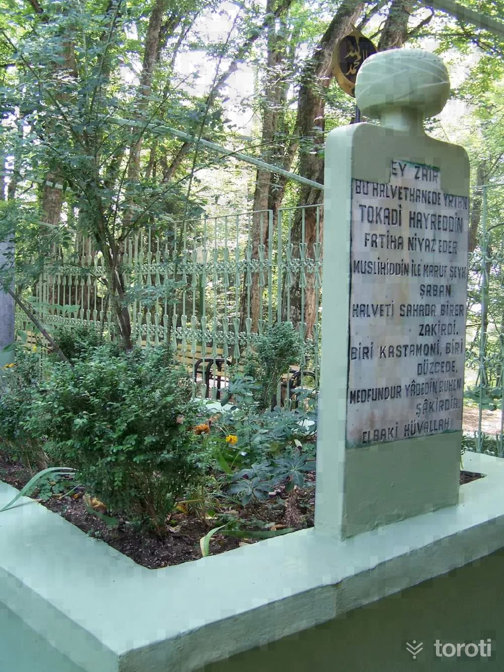
Hayreddin-i Tokadı Türbesi
Bolu Merkez, Bolu
It is located 13 km. west of Bolu city center, within the borders of Elmalık Village, 4 km. from the Abant road junction on the northern side, on a hill known by its own name, within a forested area. The graves belonging to Hayrettin-i Tokadi, a member of the Halvetiyye order, and his disciples have been enclosed within a concrete frame. The grave belonging to Hayrettin-i Tokadi, who died in 1524, is located within an iron cage.
17
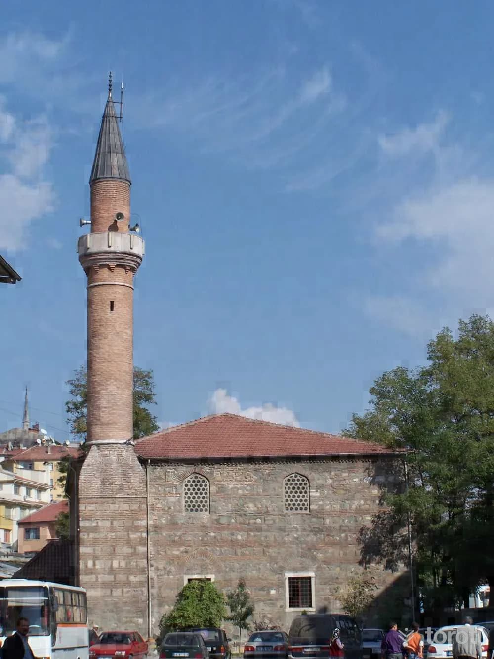
İmaret Cami
Bolu Merkez, Bolu
According to foundation records, the mosque, understood to have been built in the 16th century by Şemsi Ahmet Paşa, a descendant of Kızıl Ahmed Bey, has largely lost its originality through the repairs it has undergone over time.
18
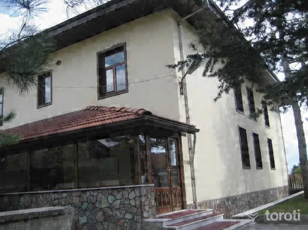
Aktaş Cami
Bolu Merkez, Bolu
The mosque, with a rectangular plan and a flat wooden ceiling, has an enclosed last congregation area. There is a women's gallery with wooden railings and latticework. To the right of the entrance is the muezzin's gallery. It has a muqarnas mihrab and a wooden minbar. In the mosque, rectangular windows with wooden jambs were used. There is a tomb adjoining the left facade of the mosque and a fountain to its north. It is covered externally with a hipped roof. It has wide wooden eaves.
- No image
19
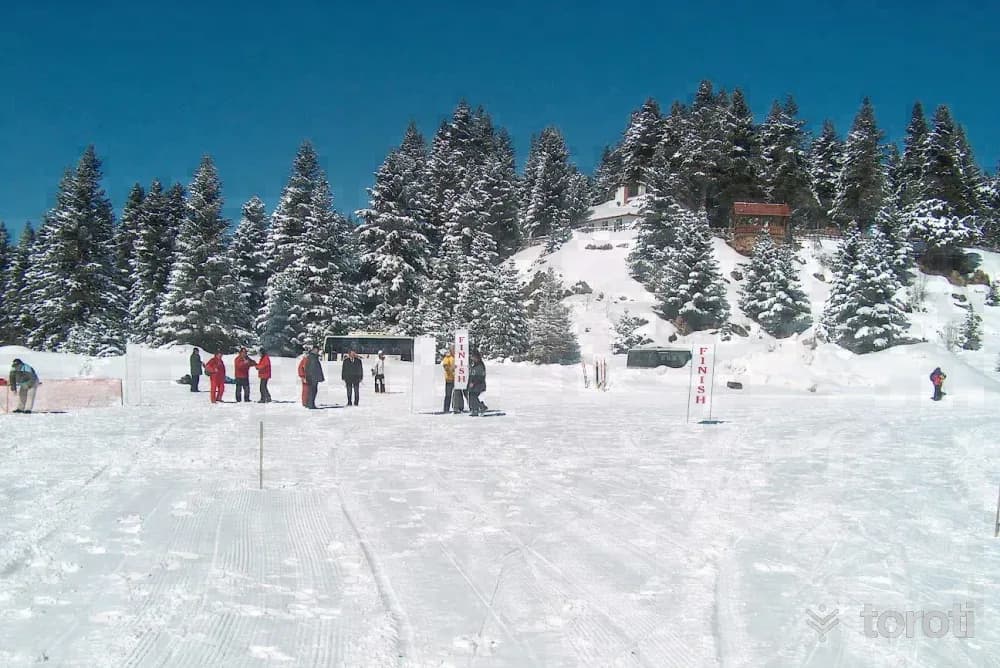
Gölcük Tabiat Parkı
Bolu Merkez, Bolu
It is an artificial barrier lake built 13 km. south of Bolu. The lake, surrounded by pine and fir trees, has a magnificent view in every season. The lake and its surroundings are under protection by the National Parks as a “Forest Recreation Area”. Vehicles are not allowed into the surroundings of this very charming and small lake.
20
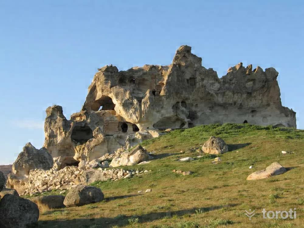
Gerede Arkut Dağı Kayak Merkezi
Gerede, Bolu
Arkut Mountain Ski Center is located 4 km north of Gerede at an altitude of 1,800 meters and offers slopes suitable especially for beginners, cross-country skiing, and alpine skiing. In winter it is used for skiing from January to March, while in summer the area supports camping, trekking, mountain biking, and off-road activities.
21
Asar Kalesi
Gerede, Bolu
It is located in Cuma Mahallesi of Göynük District. After Akşemseddin, the teacher of Fatih Sultan Mehmet, the spiritual conqueror of Istanbul and a great scholar, died in 1459, his tomb was built in H. 864 / A.D. 1464. Inside the tomb are the sarcophagi of Akşemseddin and his sons.
22
Hadrianopolis Antik Kenti
Eskipazar, Karabük
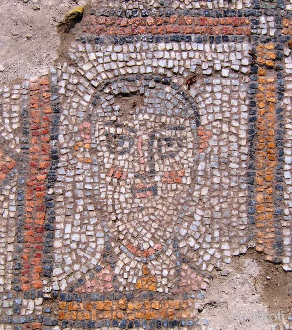
The ancient city was founded in the 4th century during the Roman period. It is accessed via the asphalt road in Hacı Ahmetler Köyü, which is 3 km from the center of Eskipazar located on the Ankara-Karabük road. In the ancient city, there are many marble columns and column capitals, churches, walls, water cisterns, rock tombs, a Roman bath, tear bottles, tunnels, food and wine cellars.
23
Hadrianapolis Antik Kenti
Eskipazar, Karabük
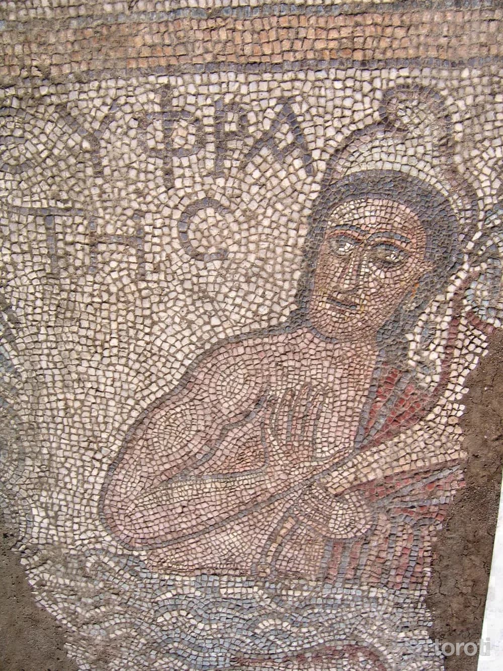
The place called “Paphlagonia Hadrianapolis” is today located in a scattered manner on the area called ‘Viranşehir’ and the surrounding land, 3 kilometers west of the Eskipazar District Center of Karabük Province. Hadrianapolis Ancient City includes the villages of Budaklar, Büyükyaylalar, Çaylı and Beytarla. The ruins of the city are concentrated in Hacı Ahmetler Neighborhood of Budaklar Village, and this location is called Viranşehir.
24
Sakaeli Kaya Mezarları Ve Peri Bacaları
Orta, Çankırı
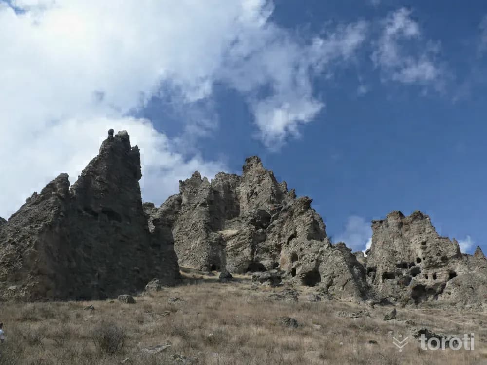
The Sakaeli Rock Tombs, generally estimated to belong to the Roman and Byzantine periods, are located on the steeply descending southern slopes of the hill against which the village leans. The cavities on the surface of the hill, which has the characteristics of a sedimentary rock with pebbles, those close to the ground are used by the villagers for various purposes by closing off the front.
- No image
25
Çavundur Termal Kaynağı
Atkaracalar, Çankırı
In the area, there is a modern 300-bed facility built by the Çankırı Special Provincial Administration and operated by the private sector, as well as a two-pool, 115-bed accommodation facility operated by the town municipality, and also a pension.
26
İndağı Kaya Mezarları
Ilgaz, Çankırı
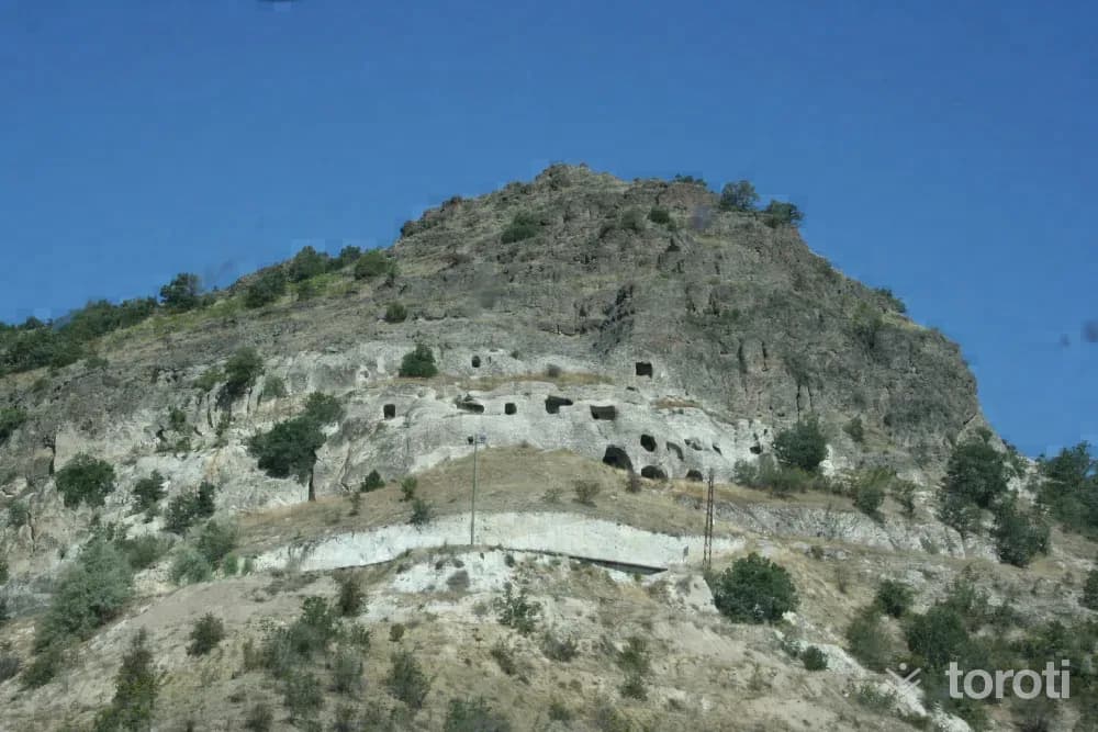
The monumental structures in the region are on the south of Devrez Stream and on the east-facing slopes of a rocky, somewhat high hill on the left side of the Çankırı-Kastamonu road. Here there are numerous man-made caves, rock tombs, a temple thought to possibly be a rock church, and cavities whose purpose is not exactly known. It is estimated that the tombs were places where religious ceremonies were held and were probably among the places considered sacred and connected with the mound.
27
Koca Meşe
Yapraklı, Çankırı
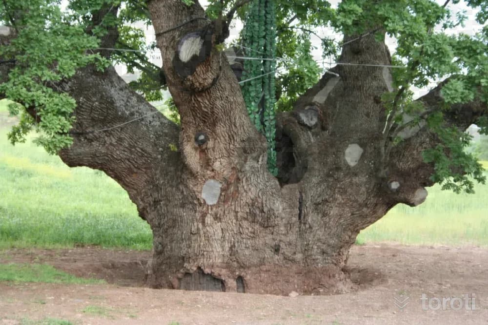
It is known that the protected oak tree, located in Karacaözü Village of Yapraklı District, 27 kilometers from the city center, is 550 years old and is considered among the oldest oaks in the world.
- No image
28
Ilgaz Doruk Mevkii
Ilgaz, Çankırı
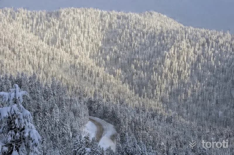
Doruk Mevkii attracts many visitors, especially in the winter season, with its natural beauty and rich wildlife as well as its winter sports facilities. There are slopes and mechanical facilities for skiers. On the northern slopes belonging to Kastamonu, mechanical facilities and slopes as well as accommodation facilities are also available, and visitors can make use of both slopes.
29
Ilgaz Kiş Sporları Turizm Merkezi
Kastamonu merkez, Kastamonu
Since the province is surrounded by the Küre (İsfendiyar) Mountains to the north and Ilgaz Mountain to the south, it receives abundant snowfall in winter. Both because of its terrain features and because it receives heavy snowfall, it is highly popular for winter tourism. While a large part of it lies within the borders of Kastamonu Province, it also extends into the borders of Çankırı Province. It is on the Kastamonu – Ankara highway route. The facilities section is 1.5 km from the main road. It is located on Ilgaz Mountain.
- No image
30
Oğuz Köyü Cami
Kargı, Çorum
It is not known by whom this mosque, located in Oğuz Village of Kargı district, was commissioned. However, it is thought to have been built in the 16.yüzyılda based on its architectural style.It belongs to the group of single-domed mosques in Ottoman architecture and has a narthex in front of it. The prayer hall is covered with a central dome supported by a semi-dome with three vaults.
- No image
31
Kizilcaoluk Şelalesi
Taşköprü, Kastamonu
Kızılcaoluk Waterfall, located near Başköy in Kargı district, hosts views resembling a riot of colors in autumn, while at times it takes on a mysterious atmosphere beneath a cloud of mist. The waterfall near Kargı Tatil Köyü is a place for those seeking tranquility.
- No image
32
Hacıhamza Kalesi
Kargı, Çorum
The castle, located to the north of İncesu Stream in Hacıhamza Town, has an irregular plan. It is understood from the Şeriye Sicil records that the castle was built by III. Ahmet in 1723, and it housed the townspeople until the 1940s.
33
Hamamözü Arkutbey Kaplıcaları
Laçin, Çorum
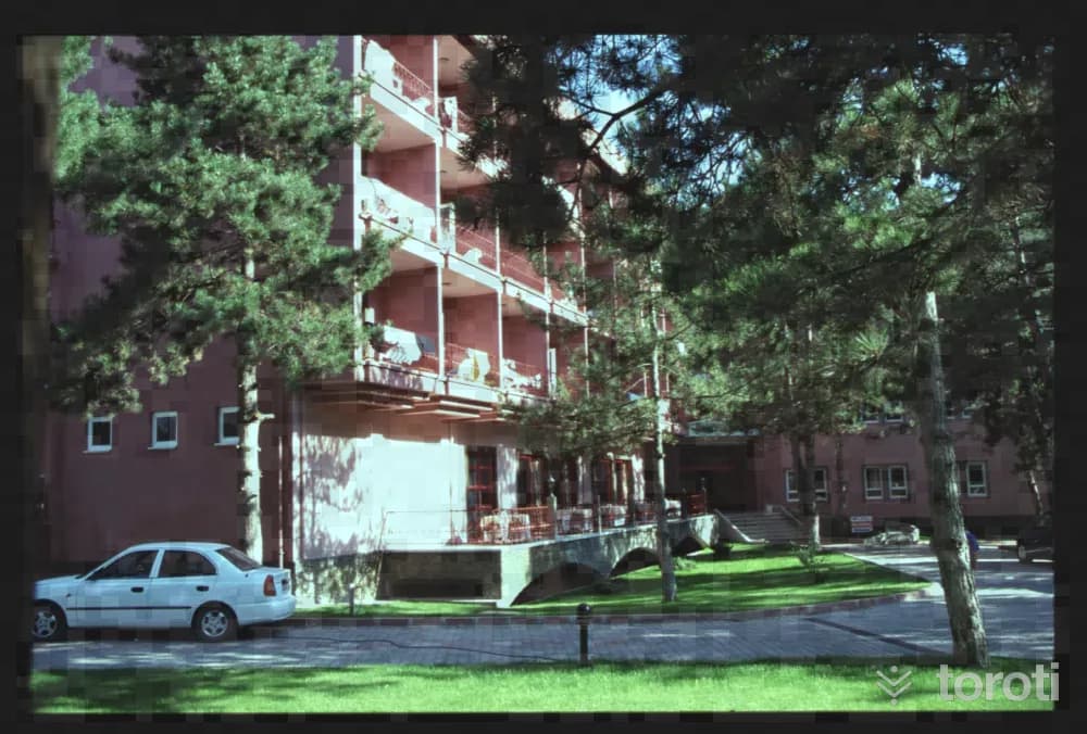
Although the exact history of Hamamözü Arkutbey Kaplıcaları is not known, there is a small bath and pool that have been used since Antiquity. It takes its current name from Seljuk Arkut Bey.
34
Maden Camii
Gümüşhacıköy, Amasya
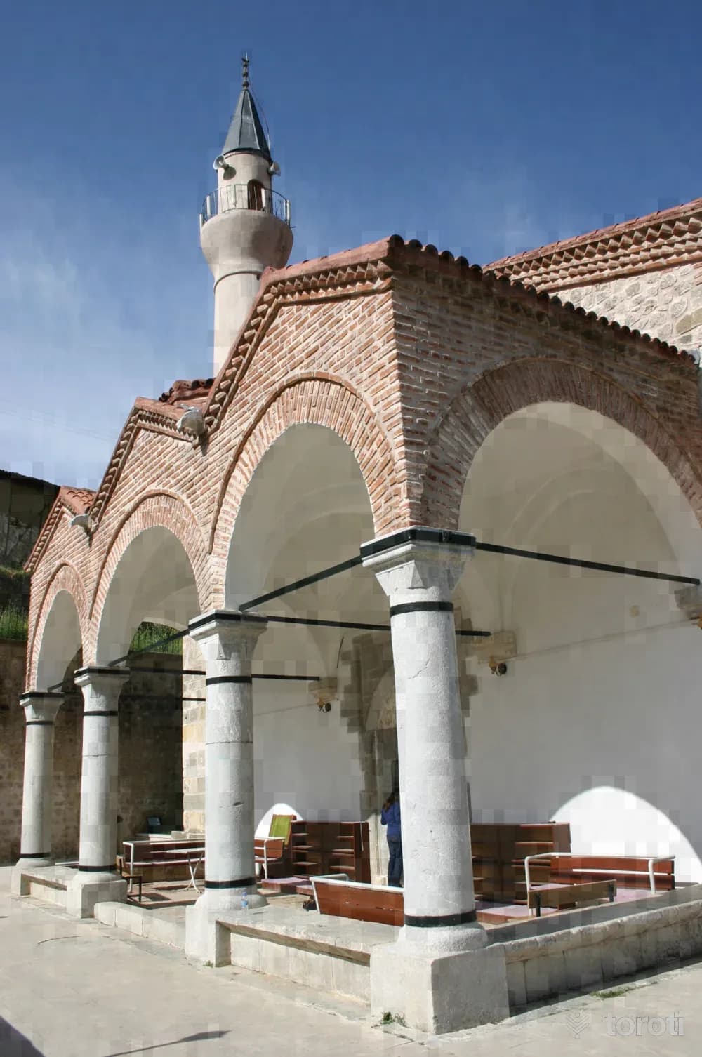
The original form of the mosque, located in the Maden Neighborhood of Gümüş Town in Gümüşhacıköy district, is a church built here in the mid-19th century. In 1928, it was converted into a mosque by those who migrated here from Western Thrace, with its original structure preserved. The corners of the facade walls of the rectangular-planned mosque are of dressed stone, and the main walls are of regular stone masonry. The interior consists of three naves extending from west to east and covered with vaults above.
35
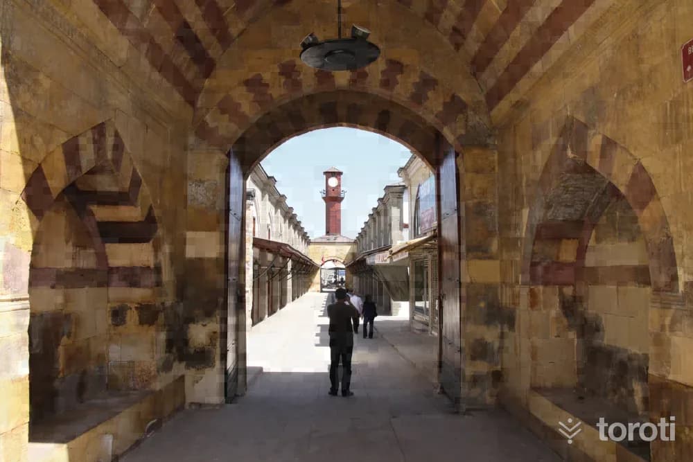
Gümüşhaciköy Bedesteni Ve Saat Kulesi
Gümüşhacıköy, Amasya
The bedesten, located in Hacıyahya Neighborhood in the city center of Amasya, was built by Köprülü Mehmet Paşa, who wanted a külliye to be built next to the mosque that had been built in his own name in 1660. At the time it was built, the caravanserai part of this külliye, which consisted of a caravanserai and a bedesten, was destroyed over time, while the bedesten part has survived to the present day after undergoing significant repairs. The bedesten, in the shape of a long rectangle, has four doors.
36
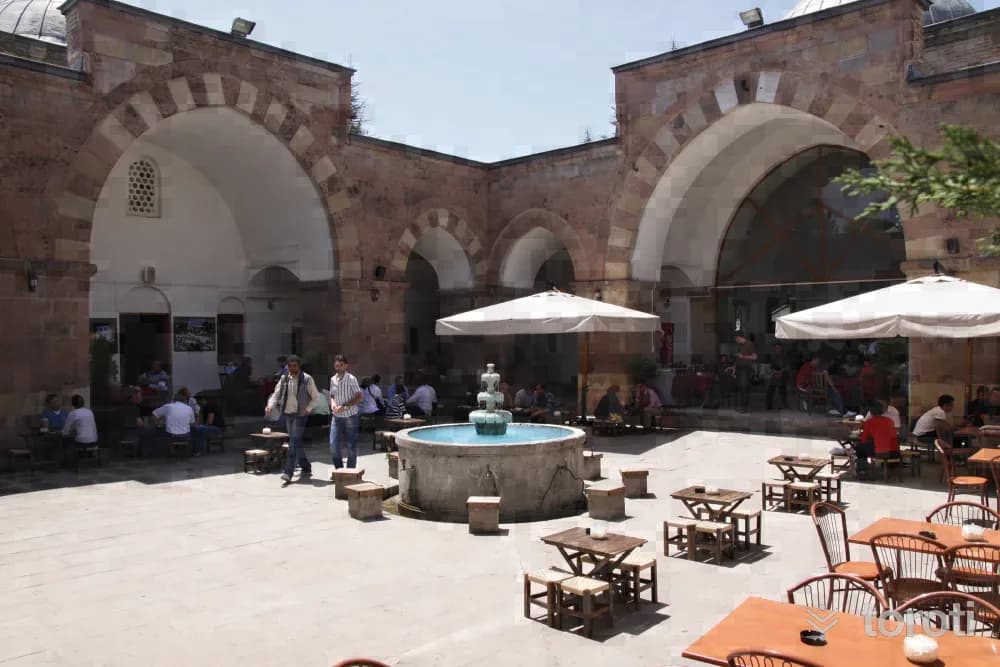
Çelebi Mehmet Medresesi
Merzifon, Amasya
Çelebi Mehmet Medresesi was commissioned by Çelebi Mehmet in 1414 for Ebubekir Mehmet Bin Hamza. It follows the plan of Seljuk madrasas. The square-planned, four-iwan, open-courtyard madrasa is entered through the monumental gate on its east side. The entrance, above which is an inscription consisting of a single line and three sections, is decorated using colored cut stone and marble. The iwan-shaped monumental portal, adorned with rows of red and white cut stone, is one of the most striking parts of the structure.
37
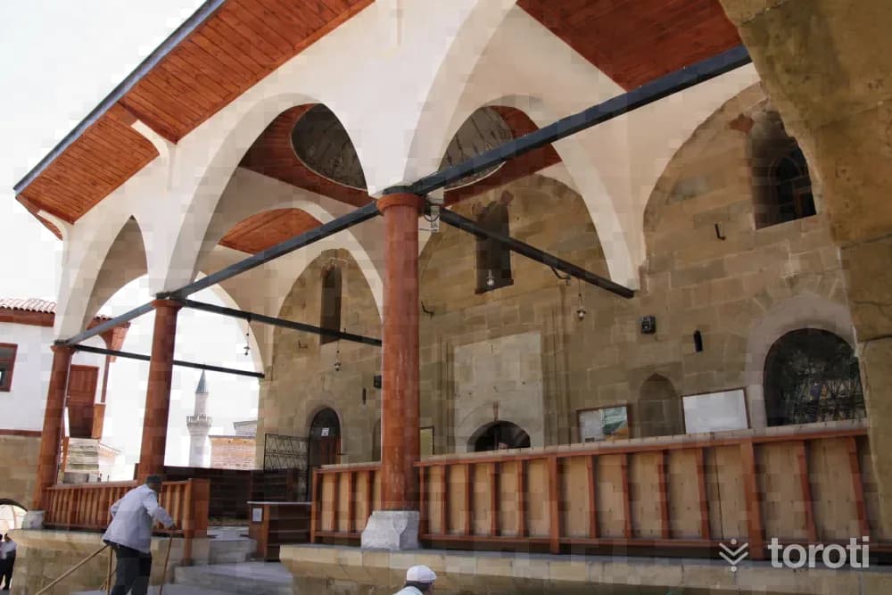
Merzifonlu Kara Mustafa Paşa Camii
Merzifon, Amasya
It was commissioned in 1666 by Kara Mustafa Paşa, one of the Ottoman grand viziers. The exterior walls of the rectangular-plan mosque were built entirely of smoothly cut stone. There is a three-bay last congregation area formed by four columns connected with pointed arches, with a wooden-covered ceiling. The prayer hall is covered with a rather large dome.
38
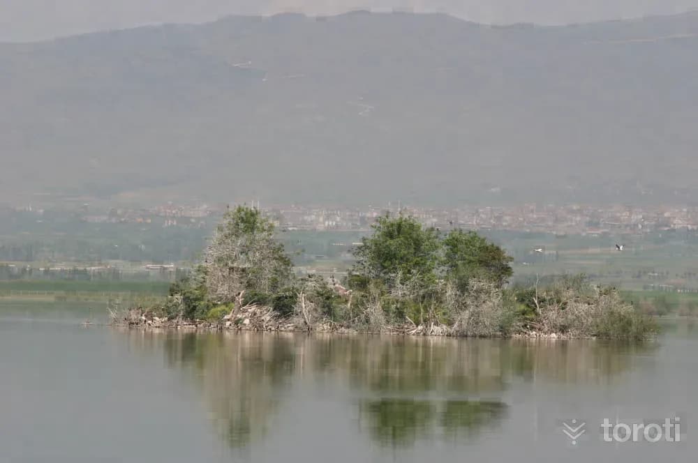
Yedikir Baraj Gölü
Suluova, Amasya
Yedikır Dam Lake, or by its other name Yedikuğular Bird Paradise, is located within the borders of Suluova district, 35 kilometres from Amasya city centre, 8 kmilometres from Suluova and 12 kilometres from Merzifon. Yedikır Dam Wildlife Protection Area covers an area of approximately 900 hectares. About 600 hectares of the area is formed by the lake. The remaining part is a reed bed and afforestation area containing social facilities and picnic areas.
- No image
39
Sivrikese Cami
Havza, Samsun
In Havza’s Sivrikese Village, this mosque, known by the name of the village, was commissioned by Ali Osman Ağa to Todor Usta in 1903.
40
Yaşar Doğu Müze Evi
Kavak, Samsun
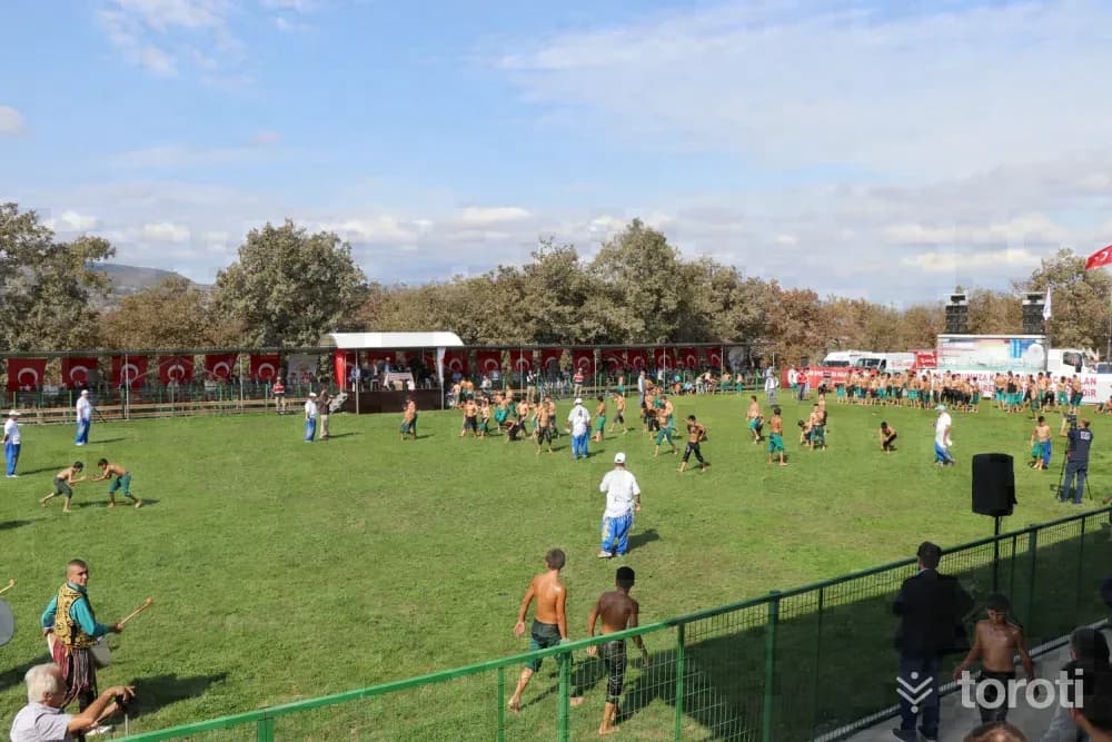
The house where national wrestler Yaşar Doğu lived in Emirli Mahallesi has been brought into tourism as a museum following restoration works. The museum, where personal belongings of world and Olympic champion Yaşar Doğu can be seen, was designed with the aim of honoring Yaşar Doğu's memory and inspiring new generations. Next to the museum, a wrestling field has also been built in Emirli Mahallesi, and traditional wrestling tournaments are held there every year.
41
Samsun Büyükşehir Belediyesi Binicilik Tesisleri
Atakum, Samsun
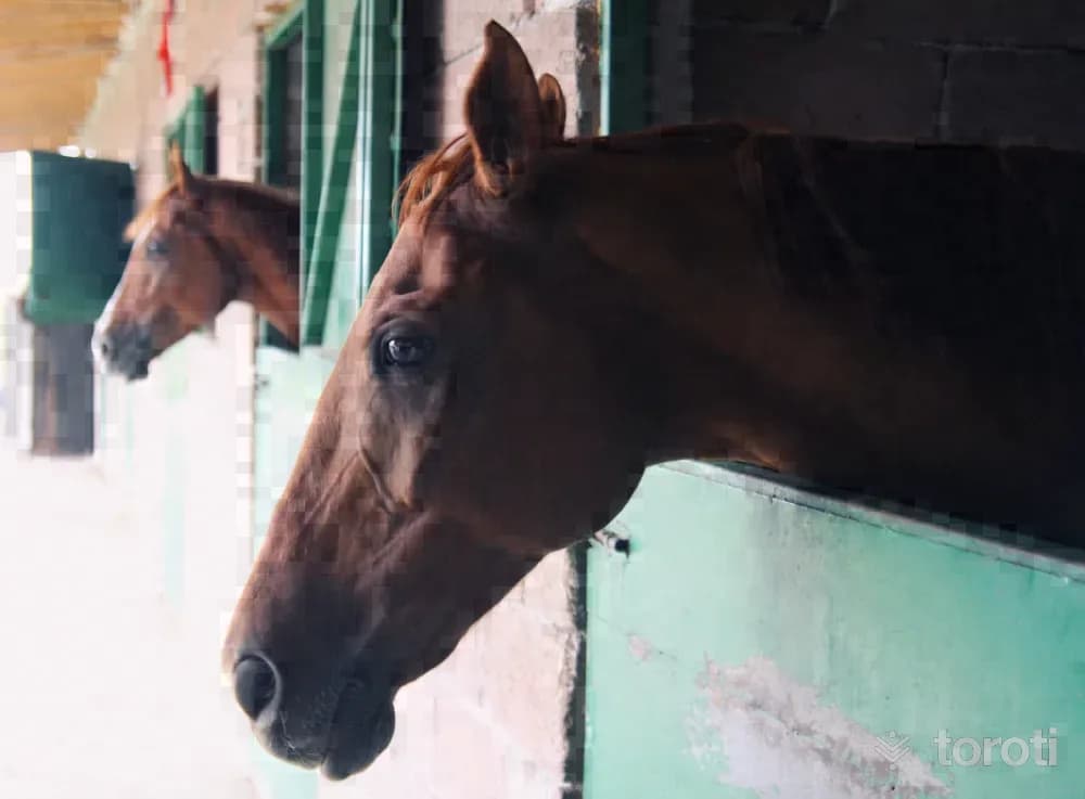
Love and passion for horses are hidden in the genetic codes of the Turkish people. In order to experience this passion, to get away from the troubles of the day even a little, and to spend time pleasantly, Equestrian Sports Facilities with all kinds of equipment have been established within the boundaries of Büyükoyumca Mahallesi in Samsun's Atakum district. It is a fully equipped equestrian facility where all equestrian sports can be practiced and which is also used in the rehabilitation of disabled people.
42
Sadi Tekkesi Kuvayi Milliye Müzesi
İlkadım, Samsun
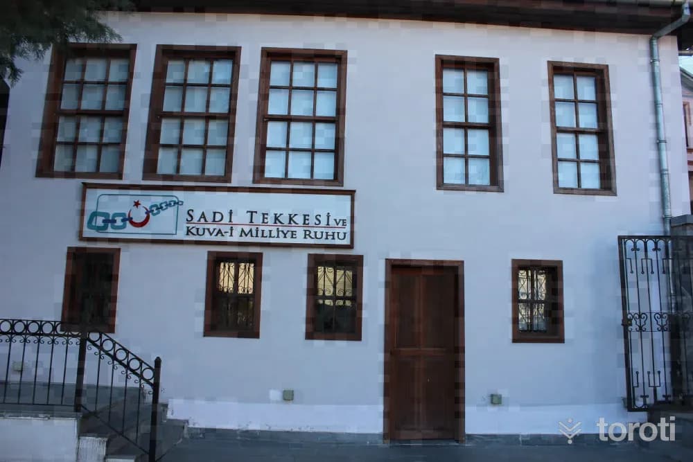
Sadi Tekkesi Kuvâyi Milliye Museum reflects to the present day the spirit of the liberation struggle that began on 19 Mayıs 1919. Şeyh Sadi Tekkesi, which has an important place in the history of the National Struggle, was restored by Samsun Metropolitan Municipality in 2013 and turned into the Kuvâyi Milliye Museum.
43
Dündar Tepe / Öksürük Tepe
İlkadım, Samsun
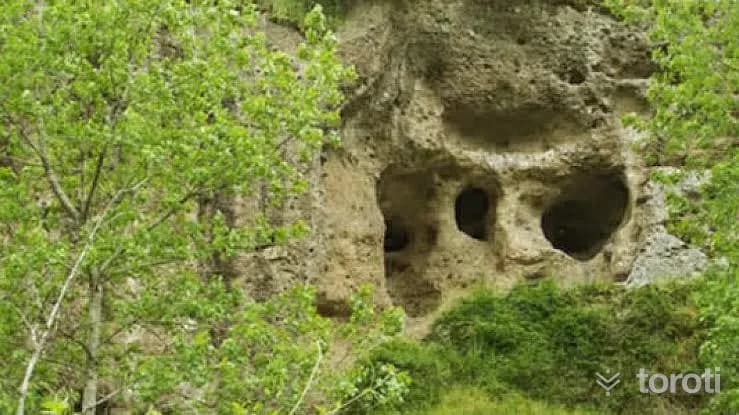
On the 15-meter-high mound located 3 kilometers southeast of Samsun İlkadım District, there are three cultural layers belonging to the Chalcolithic, Early Bronze, and Hittite ages. The latest settlement on the top of the mound belongs to the Early Bronze Age. A Hittite settlement was found on the slopes of the mound. In the first cultural layer, structural remains dated to the Chalcolithic period, handmade ceramic fragments, baked clay weights, flint knives, etc. were found.
44
Onur Anıti
İlkadım, Samsun
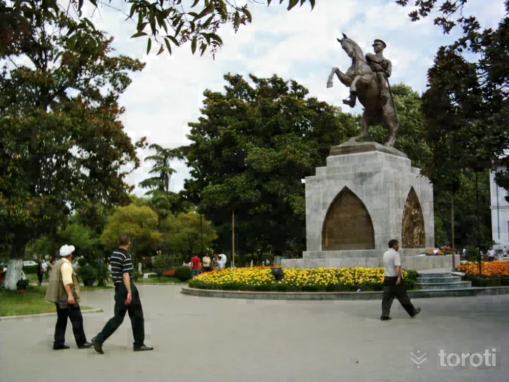
The bronze Atatürk statue, considered the symbol of Samsun, was commissioned by the people of Samsun from the Austrian sculptor H. Kriphel. The statue was brought to Samsun on 15 November 1931 by a German steamer. Along with the statue unloaded from the steamer, H. Kriphel and a Viennese engineer named Mayer also came to Samsun. The opening ceremony of the Gazi Statue took place on Friday, 15 January 1932, with the participation of a large crowd.
45
Göğceli Camii
Çarşamba, Samsun
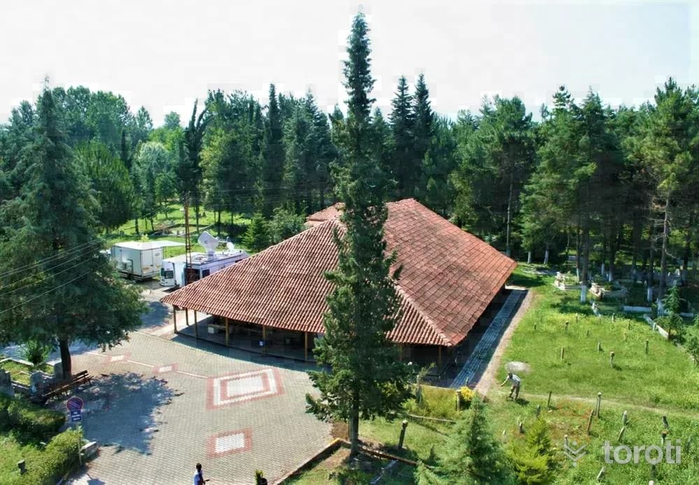
Göğceli Camii, one of the finest examples of the Anatolian building tradition, is one of the oldest wooden mosques still standing within the borders of Türkiye. As a result of tests carried out on wooden samples taken from the mosque, which has no construction inscription, it was understood that it was built in 1206 and that the portico in front of it was added or repaired in 1335. The building underwent a comprehensive restoration in 2007.
- No image
46
Çınarsuyu Mesire Yeri
Ünye, Ordu
The recreation area, located 7 km from Ünye District, is established on an area of 11 hectares.
- No image
47
Saray Hamamı
Ünye, Ordu
It is located in the Kaledere neighborhood in the district center of Ünye. It is rectangular in shape from the outside. It consists of cold, warm and hot sections. It was built of cut stone and rubble stone. The exterior facade surface, domes and window jambs have been repaired, and it is still in use. The structure, originally a church, was later converted into a bath.
- No image
48
Sayacabaşı Mesire Yeri
Ulubey, Ordu
It is a recreation area located on the Ordu-Sivas highway, 27 km from Ordu city center and 7 km from Ulubey district center, in Sayaca Village, covering a total area of 6,4 hectares. Food-beverage and resting facilities are available.
- No image
49
Kültür Merkezi (Taşbaşı Kilisesi)
Altınordu, Ordu
An old Greek Orthodox church located in the Taşbaşı neighborhood. The church, built in 1853, was also used as a prison between 1937 and 1977, and was restored by the Ministry of Culture and Tourism in 1983. It was converted into a cultural center in 2000.
- No image
50
Eskipazar Hamamı
Altınordu, Ordu
Large Bath: It consists of three sections as cold, warm and hot. The exterior of the bath was built of rubble stone, while the interior was built of smoothly cut stone. Domes and vaults were used in the covering. It is a 16th-century work. Small Bath: It consists of a single square space and a water reservoir. It is estimated to have been built in the 18th century.
- No image
51
Tirilizade Beyler Konağı
Piraziz, Giresun
Tiralizade Hasan Bey Mansion is considered the oldest historical work in the town. This work, which was built between 1906-1908 during the final period of the Ottoman Empire, is a rare example of civil architecture in the Black Sea Region in terms of reflecting mansion life and its architectural features.
- No image
52
Şeyh Keramettin Camii
Giresun, Giresun
The masonry mosque located in the neighborhood bearing the same name was built on the site of the wooden mosque that had previously been commissioned by a person named Şeyh Keramettin, who endowed the land for it. However, since the mosque collapsed over time, it was rebuilt in 1900 as a charitable work by the heirs of Sarı Alemdarzade İzzet Kaptan.
- No image
53
Kufa Kuyusu Suyu
Giresun, Giresun
Kufa Well, which is said to have been used as a place of visitation in the Pontus period, is at the foot of the north-facing side of Giresun Castle. It is thought to date from the Byzantine period. The mouth of the well is 2 m. long and was built of cut stones 80 cm. wide. According to rumor, this water was sent to kings in jugs and would remedy their various troubles.
- No image
54
Andoz Kalesi
Espiye, Giresun
It is located on a natural pointed hill overlooking the sea and the valley, on the bank of Yağlıdere Stream at the entrance of Espiye District. It is estimated to have been built in the 1300s B.C. It is surrounded by walls. The walls have collapsed in places. There are towers in some parts.
- No image
55
Görele Paşaca Şelalesi
Şalpazarı, Trabzon
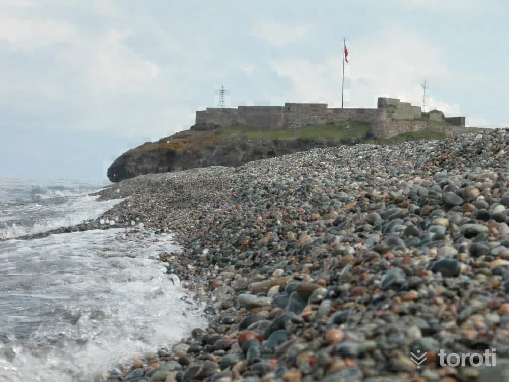
It is located between the villages of Yeşildere and Beşirli in Görele District of Giresun. The area where the waterfall is located has been declared a Nature Park. The waterfall is not only a waterfall on its own, but after completing its drop, it continues on its way by forming small cascades for hundreds of meters.
56
Eynesil Kalesi
Beşikdüzü, Trabzon
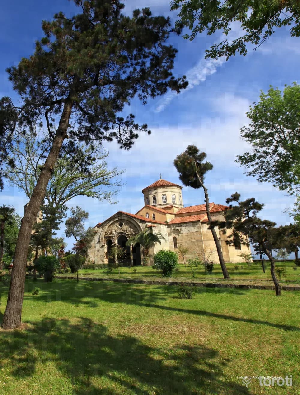
The castle was placed under protection by the decision of the Trabzon Cultural and Natural Heritage Preservation Board dated 23.12.1994 and numbered 2124. There is no academic source providing information about the construction date of Eynesil Kalesi, located on a rocky peninsula 2 kilometres east of Eynesil District, or about who had it built. Current sources state that Eynesil Kalesi, meeting the blue of the sea, dates back to the Romans.
57
Ayasofya Cami
Ortahisar, Trabzon
Ayasofya Cami was reopened for Muslim worship after 52 years, with the performance of the daily prayer on Friday, 28 June 2013. Trabzon Ayasofya Museum, which is a mosque today, was built during the reign of 1. Manuel Komnenos, one of the kings of the Trabzon Empire (1238-1263). The bell tower, dated to 1427, is located to the west of the church. The remains of the three-apsed chapel to the north of the church belong to an earlier period.
- No image
58
Kuş Gözlem
Ortahisar, Trabzon
Bird Watching Trabzon plateaus and especially Altındere Valley National Park offer favorable opportunities for bird watchers. The National Park is within the borders of Maçka district. It is quite rich in terms of biodiversity and bird diversity.
- No image
59
Ahi Evren Dede Camii
Ortahisar, Trabzon
It is adjacent to Ahi Evren Dede Camii located in Boztepe. The square-planned tomb is covered with a dome. This tomb, restored by Hacı Hakkı Baba in 1887-1888, took its present form. Next to the grave of Ahi Evren Dede are also the graves of Hacı Hakkı Baba and his sons.
60
Santa Harabeleri
Gümüşhane merkez, Gümüşhane
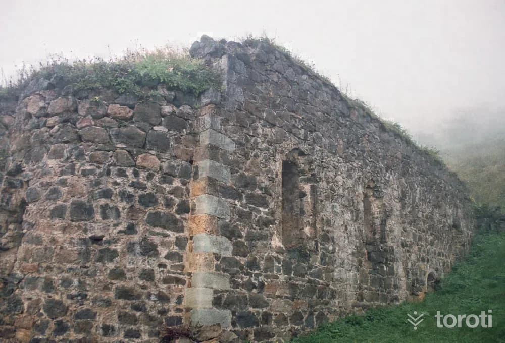
Santa Ruins is located approximately 82 kilometers from the city center of Gümüşhane, within the borders of Dumanlı Village of Yağmurdere Township. Santa was established on three separate slopes divided from each other by the valleys where the Santa Yanbolu Stream originates. The Santa Region was conquered during the period of Fatih Sultan Mehmet - between 1461-1476 - together with the whole of Trabzon and the Eastern Black Sea region, and was incorporated into the lands of the Ottoman Empire.
Move the stops into your own plan, split them across days, and add places to sleep and eat.
Frequently asked
- How far is it between İstanbul and Trabzon, and how long does it take?
- Driving between İstanbul and Trabzon is roughly 1159 kilometres and takes about 14 hours without stops.
- Where is it worth stopping between İstanbul and Trabzon?
- There are 1237 described places within 20 km of the road between İstanbul and Trabzon. toroti lists 60 of them spread evenly along the drive, in the order you pass them; Arnavutköy Yeniköy Halk Plajı comes early on, and Santa Harabeleri sits near the end.
- Which provinces does the İstanbul to Trabzon route cross?
- The route between İstanbul and Trabzon crosses İstanbul → Kocaeli → Sakarya → Düzce → Bolu → Karabük → Çankırı → Kastamonu → Çorum → Amasya → Samsun → Ordu → Giresun → Trabzon → Gümüşhane. The stretch richest in places to visit is in Kocaeli.
- Should I take the toll highway or traditional route between İstanbul and Trabzon?
- Toll motorways save driving time between İstanbul and Trabzon, whereas traditional state roads pass directly through historic town centers, local culinary stops, and scenic nature viewpoints.
- How should breaks be scheduled between İstanbul and Trabzon?
- For a drive of around 14 hours, taking a break every 2 to 2.5 hours is recommended. The catalogued attractions in Kocaeli and neighboring provinces offer memorable stopovers compared to generic highway rest areas.