
Stops along the way
Stops between Antalya and Mersin
410 km, roughly 8 hours of driving. The stops below are ordered as you pass them — the same road in both directions.
In short
The drive between Antalya and Mersin is 410 km and takes roughly 8 hours. There are 452 described places within 20 km of this route; it crosses 2 provinces, and the densest stretch is in Antalya (321 places).
There are 452 places within 20 km of this corridor; the 48 below are spread evenly along the drive.
1
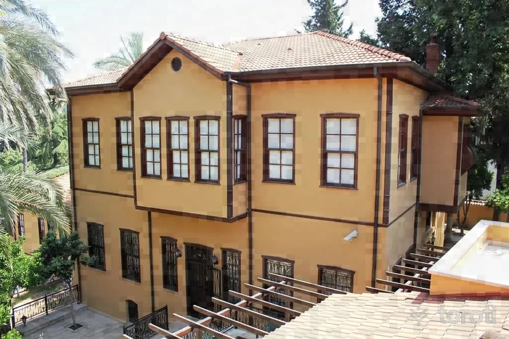
Etnografya Müzesi
Muratpaşa, Antalya
The Antalya Ethnography Museum consists of two mansions showcasing Ottoman architecture and Turkish-Islamic artifacts. It is an important site reflecting Antalya's cultural heritage.
2
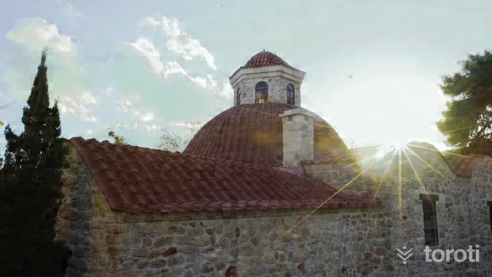
Mevlevihane Müzesi
Muratpaşa, Antalya
The Antalya Mevlevihane Museum is a historical complex that includes a Mevlevihane, a bathhouse, and tombs.
3
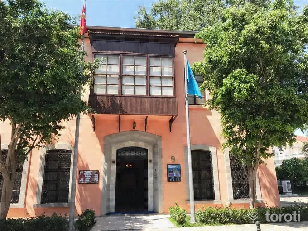
Antalya Atatürk Evi Müzesi
Muratpaşa, Antalya
The Antalya Atatürk House Museum is a museum dedicated to Atatürk's visits to Antalya. Visitors can see Atatürk's personal belongings and documents related to Antalya.
- No image
4
Antalya Büyükşehir Belediyesi Lara Halk Plajı Lazlo Beach
Muratpaşa, Antalya
Antalya Metropolitan Municipality Lara Public Beach Lazlo Beach is a public beach candidate included in the 2025 Blue Flag official list.
5
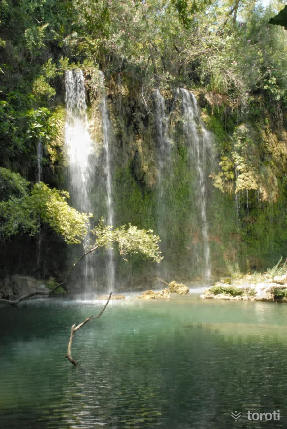
Kurşunlu Şelalesi
Aksu, Antalya
Kurşunlu Waterfall is an ideal place for nature walks and picnics, featuring rich flora and stunning natural beauty.
6
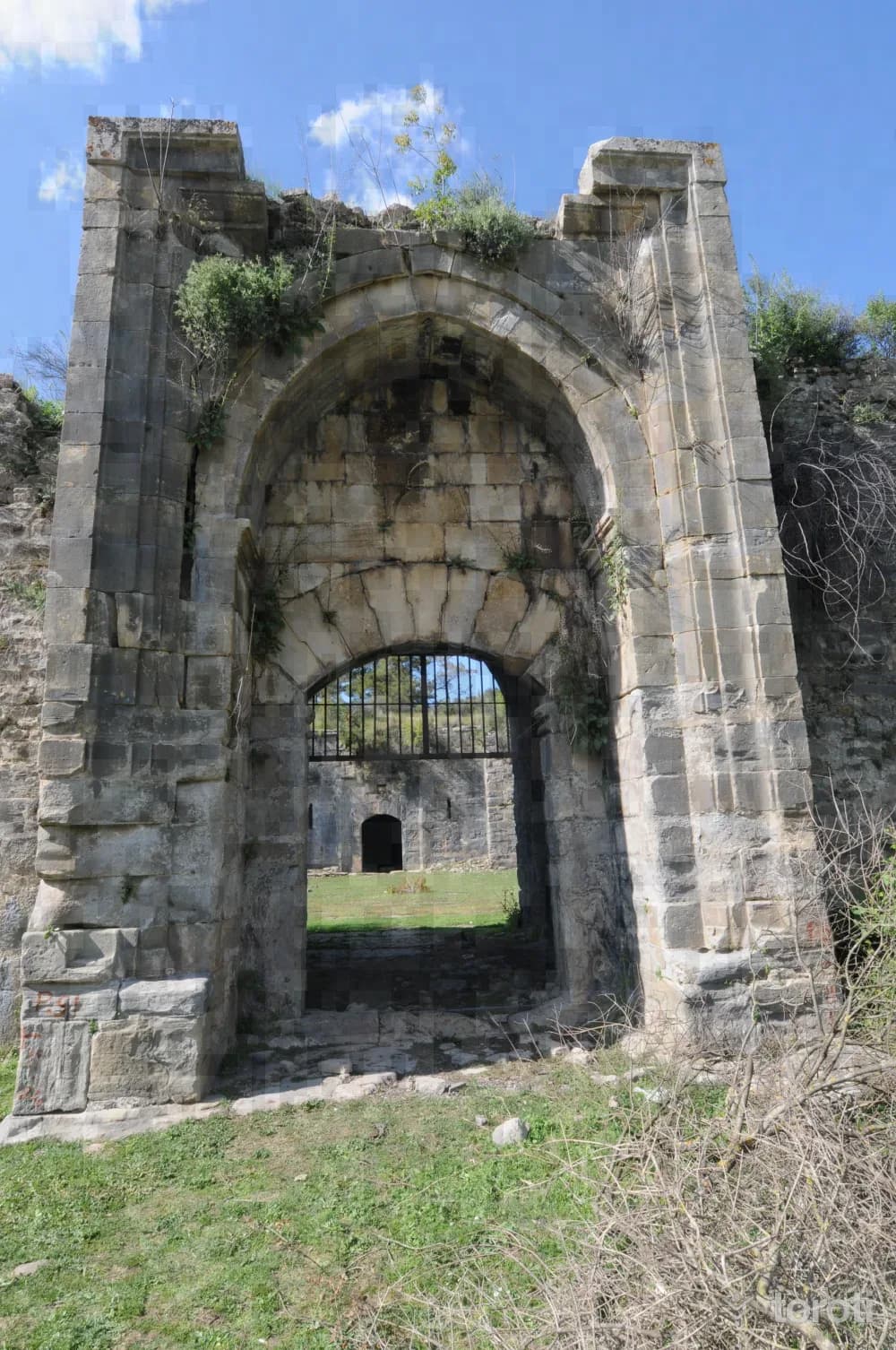
Kargihan
Manavgat, Antalya
Kargihan is a historical caravanserai located in Manavgat, Antalya, dating back to the Anatolian Seljuk period.
- No image
7
Manavgat Belediyesi Evrenseki Halk Plajı
Manavgat, Antalya
Manavgat Belediyesi Evrenseki Public Beach is a public beach candidate included in the official 2025 Blue Flag list.
8
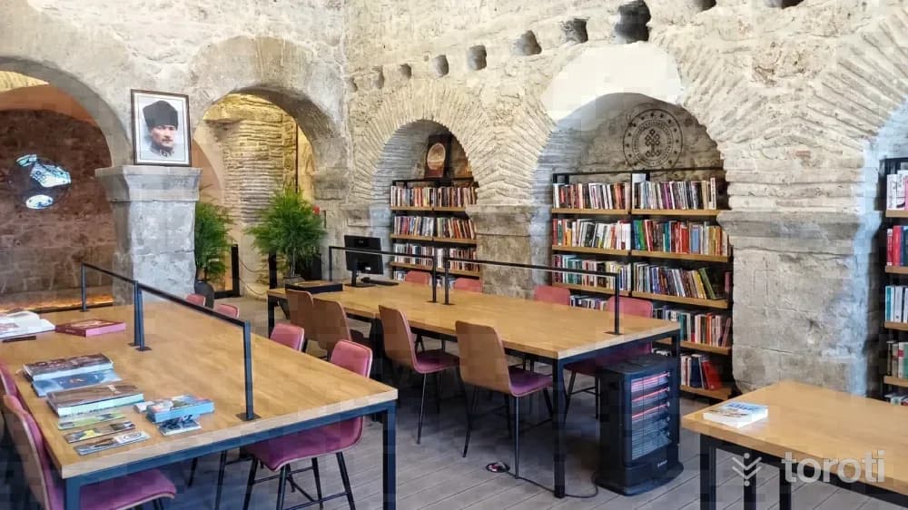
Side Turizm Ve Seyahat Kütüphanesi
Manavgat, Antalya
The Side Tourism and Travel Library is Turkey's first tourism and travel library located in an ancient building. It offers visitors a collection of works related to tourism and travel.
9
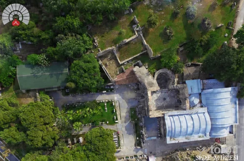
Side Müzesi
Manavgat, Antalya
The Side Museum is a historical museum showcasing artifacts from the Ancient Roman period. Located in a bathhouse dating back to the 2nd century AD, the museum offers visitors a journey through history with its rich collection.
10
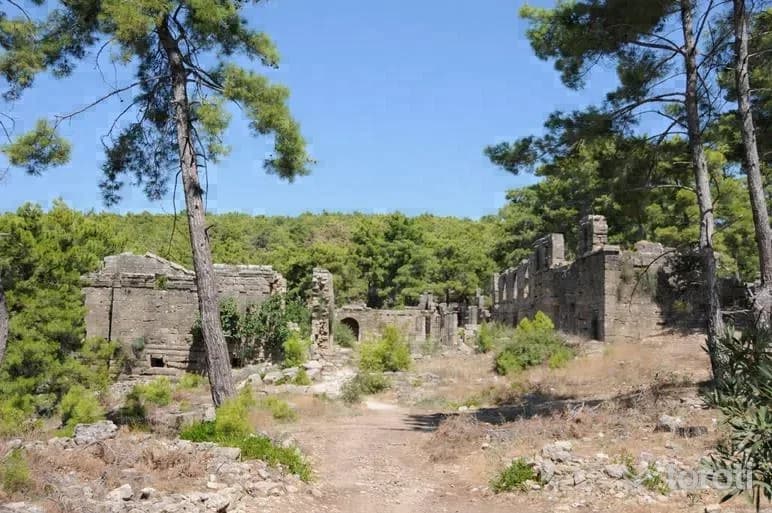
Lyrbe Antik Kenti
Manavgat, Antalya
Lyrbe Ancient City is a historical settlement located in Manavgat, Antalya. It features well-preserved walls and remains dating back to the Hellenistic Period.
- No image
11
Kızılağaç Plajı
Manavgat, Antalya
Kızılağaç Plajı is a public Blue Flag beach on the coast at Manavgat.
- No image
12
Kızılot Plajı
Manavgat, Antalya
Kızılot Plajı is a public Blue Flag beach on the coast at Manavgat.
- No image
13
Okurcalar Plajı
Alanya, Antalya
Okurcalar Plajı is a public Blue Flag beach on the coast at Alanya.
14
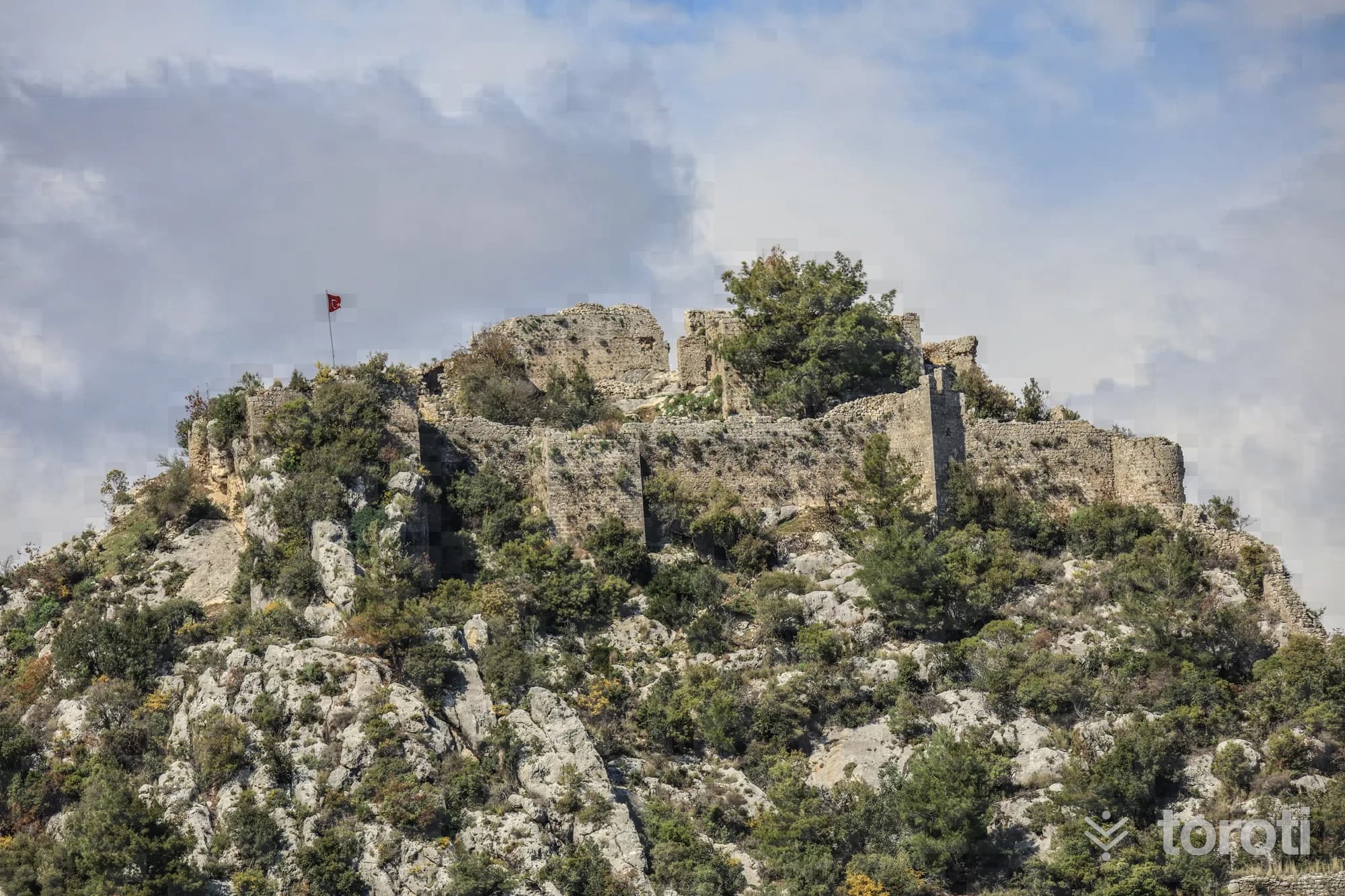
Alara Kalesi
Alanya, Antalya
Alara Castle was built in 1232 by Seljuk Sultan I. Alaeddin Keykubad and served to ensure the safety of caravans on the Silk Road.
15
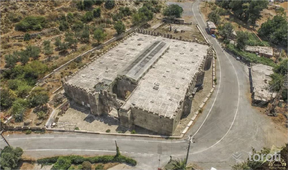
Alara Han
Alanya, Antalya
Alara Han, built between 1231-1232 by Seljuk Sultan I. Alaeddin Keykubad, is a historical site located on the Antalya-Alanya route, notable for its architecture.
16
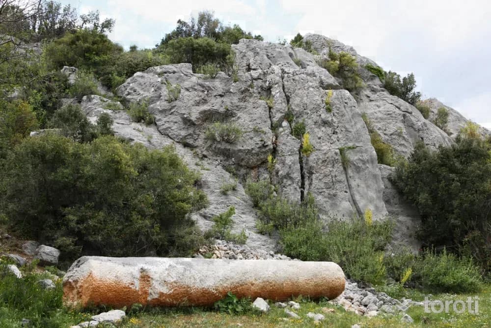
Colybrassus
Gündoğmuş, Antalya
Colybrassus is a historical settlement located approximately 30 kilometers northeast of Alanya. This ancient city, bearing traces of the Hellenistic Period, shows evidence of life continuing until the Middle Ages.
17
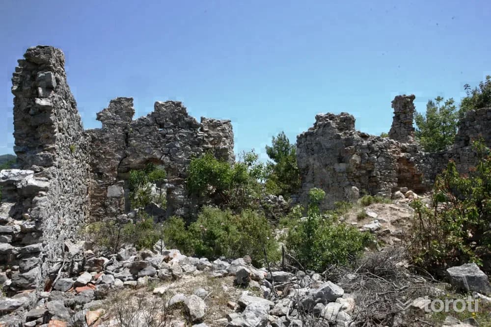
Hamaxia
Alanya, Antalya
Hamaxia is an ancient city located 12 kilometers northwest of Alanya. It has been inhabited from the Hellenistic Period to the Byzantine Period.
18
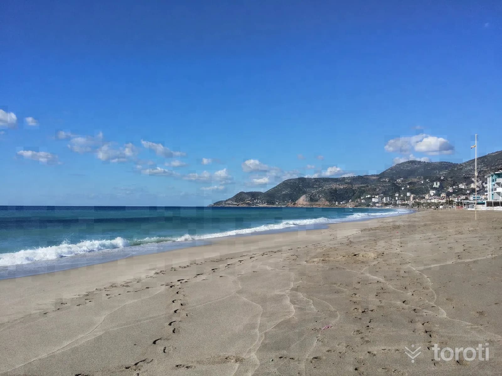
Damlataş Plajı
Alanya, Antalya
It is on the coast in front of Damlataş Cave, to the west of the historic peninsula. It has a Blue Flag. The sea and the beach are sandy. The sandy shore leans its back against the foothills of the peninsula. The small cove of the beach, extending toward the peninsula and consisting of large stones, is known by the name Cleopatra. According to legend, the Egyptian Queen Cleopatra stopped by Alanya during an expedition in the Mediterranean and swam in this cove.
19
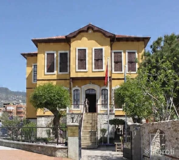
Alanya Atatürk Evi Müzesi
Alanya, Antalya
It is the house where Mustafa Kemal Atatürk, the founder of the Republic of Türkiye, stayed for a while during his visit to Alanya on 18 February 1935. The house was donated to the Ministry of Culture by its owner Tevfik Azakoğlu and was turned into a museum in 1987. On the ground floor of the three-storey building in a garden, reflecting the characteristics of 19th-century Turkish architecture, Atatürk’s personal belongings, photographs, the telegram Atatürk sent to the people of Alanya, and other historical documents are exhibited.
20
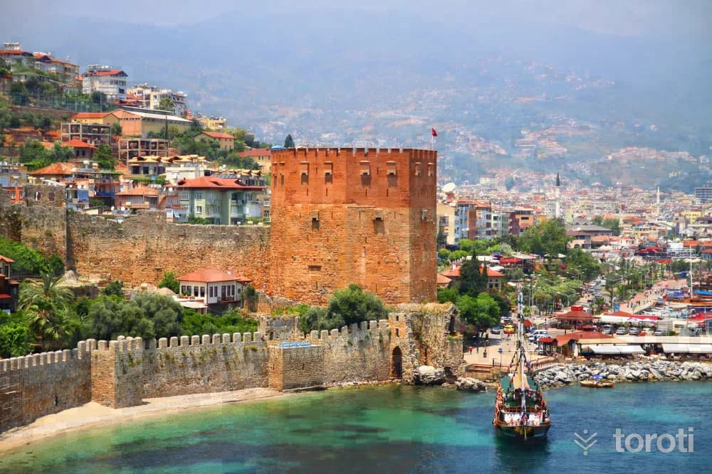
Kizilkule Etnografya Müzesi
Alanya, Antalya
The structure, one of the unique examples of Seljuk art, is a symbol of Alanya. It is a defense and surveillance structure built during the Seljuk Period in order to protect the port where trade was conducted and to prevent attacks that could come against the castle from land. It was commissioned in 1226 by the Seljuk Sultan Alaaddin Keykubat to an architect named Ebu Ali from Aleppo (Syria). The architect’s name is mentioned in the inscription on the north facade.
21
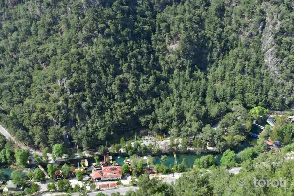
Dim Çayi
Alanya, Antalya
Completing its 60 km journey, which begins at the foothills of the Taurus Mountains, by flowing into the Mediterranean within the borders of Tosmur and Kestel Neighborhoods in the south of Alanya, Dim Çayı is one of the visitor spots that tourists coming to the district do not leave without stopping by, with the natural beauties displayed along the valley it has formed and its air and water that remain cool in summer and winter.
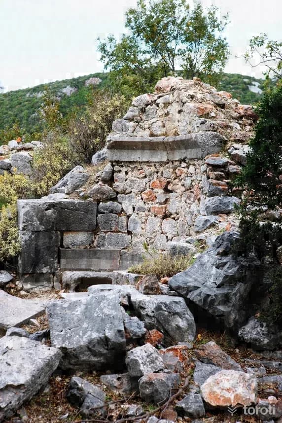
22
Laertes Antik Kenti
Alanya, Antalya
It was established on the Taurus Mountains, on the southern slopes of Cebel-i Reis Mountain rising at the mouth of Dim Valley, in a geography suitable for defense at an altitude of 850 meters above sea level. It is approximately 25 kilometers from Alanya. The nearest village is Gözüküçüklü. It lies within the borders of the region known in antiquity as Rough Cilicia. When Strabo mentions Laertes, he describes the city as having a harbor and being built on a breast-shaped hill.
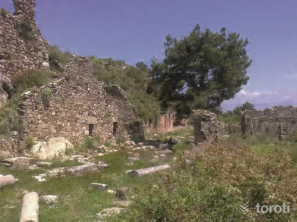
23
Syedra
Alanya, Antalya
It is located within the borders of Seki Village at approximately the 20th kilometre of the Alanya-Gazipaşa highway. The name Syedreon, which was the city's name in antiquity and preserved its importance as the western border of the Cilicia Region, appears for the first time on coins minted by the city in its own name during the reign of the Roman Emperor Tiberius (A.D. 14-17). Two large streets cut across the city, which is protected by walls, and stepped streets descending perpendicularly to them form the city plan.
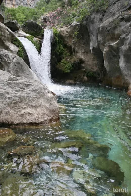
24
Sapadere Kanyonu
Alanya, Antalya
Located in Sapadere Village, to the east of Alanya District, Sapadere Canyon is 750 meters long and has a height of approximately 400 meters. With investments such as the walking path built with steel supports over the canyon located at the source of Sapadere Stream, and the picnic area and country casino constructed at the canyon entrance, the canyon has been turned into a tourism area worth seeing.
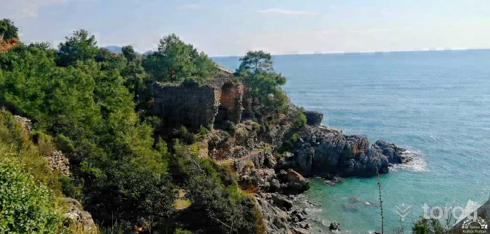
25
Iotape Antik Kenti
Alanya, Antalya
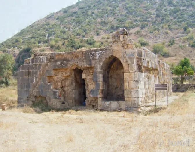
Alanya-Gazipaşa karayolunun 33'ncü kilometresinde yer alan antik kent adını Kommagene Kralı 4. Antiochos’un (MS 38–72) karısı Iotape’den alır. İmparator Trajan’dan Valerian’a kadar kent kendi adına sikke basmıştır. Kalıntılar Roma ve Bizans Dönemi özellikleri taşımaktadır. Denize doğru uzanan yüksekçe bir burun, kentin akropolü durumundadır. Alanya Müzesi Bu bölüm surlarla çevrili olduğundan kale (akropol) görünümündedir. Yapılar oldukça tahrip olmuştur.
26
Selinus
Gazipaşa, Antalya
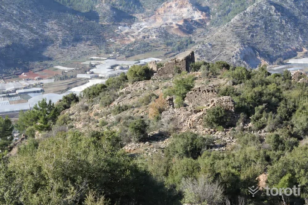
The ancient city of Selinus is located within the borders of Gazipaşa District, on and on the slope of a hill extending into the sea like an elbow to the southwest of the marina and Hacı Musa Stream. The acropolis of the city was established on the hill. The city was inhabited during the Hellenistic, Roman and Byzantine Periods. Selinus is the most important region of the Mountainous Cilicia Region. The city took this name because the Roman Emperor Trijan died in this city.
27
Titiopolis
Anamur, Mersin
In the maps showing the ancient sites in Western Cilicia, prepared by George Evart Bean and Terence Bruce Mitford as a result of their investigations in Cilicia between 1964-1968, they marked the location of present-day Kalınören Köyü as TIİTİOPOLİS. The archaeological site contains remains covering the Hellenistic, Roman and Byzantine periods. In antiquity, Titiopolis was in the position of a site not connected to Anemurium.
- No image
28
Arsinoe Antik Kenti
Bozyazı, Mersin
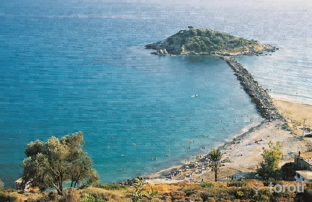
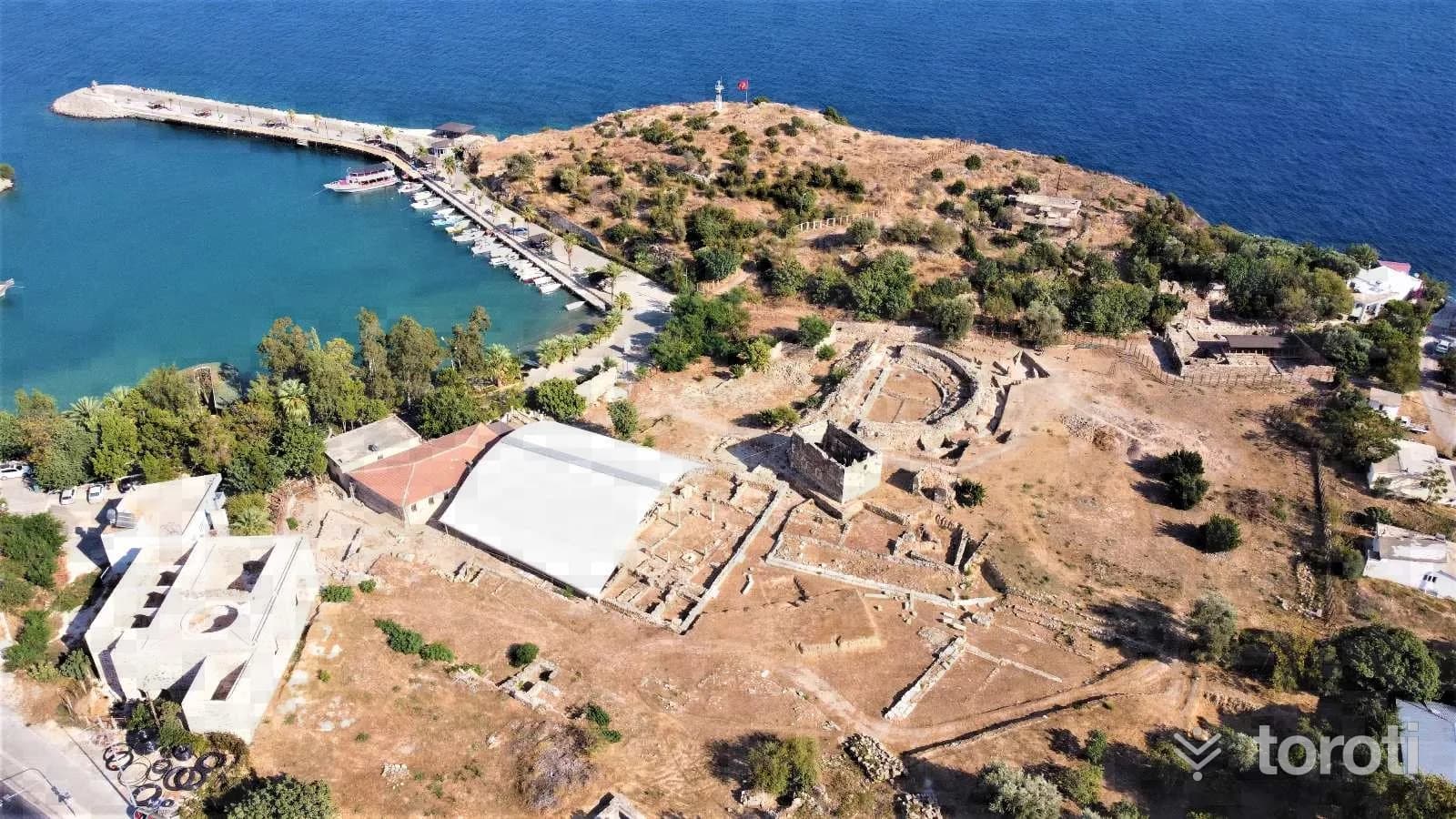
It is understood that the city was first founded around 270 B.C. during the time of Aetos of Aspendos. This city, which Aetos founded in the name of the wife of the Egyptian king Ptolemais II, who was also his sister, was referred to as the “Sacred City” of the king, his wife and his sister.
29
Nagidos Örenyeri
Bozyazı, Mersin
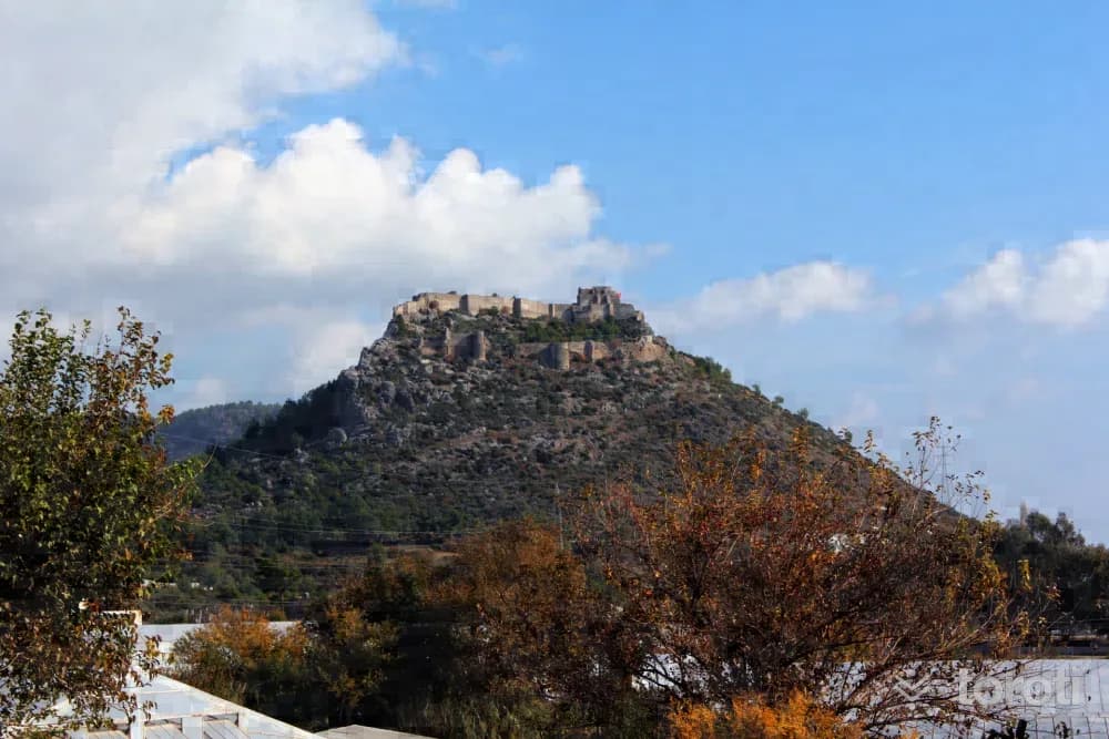
According to Hekataios, it was founded by a person of Semitic origin named “Nagis Kubernetes.” However, this is not certain. It is known to have been within the borders of the Kingdom of Tarhundaşşa, formed by the Luwian people in the 2nd millennium B.C. Its connections with the Assyrians, however, cannot be established with certainty. It is known that Nagidos was a Samos Colony in the 7th century B.C. and thus gained the identity of a port city open to trade.
30
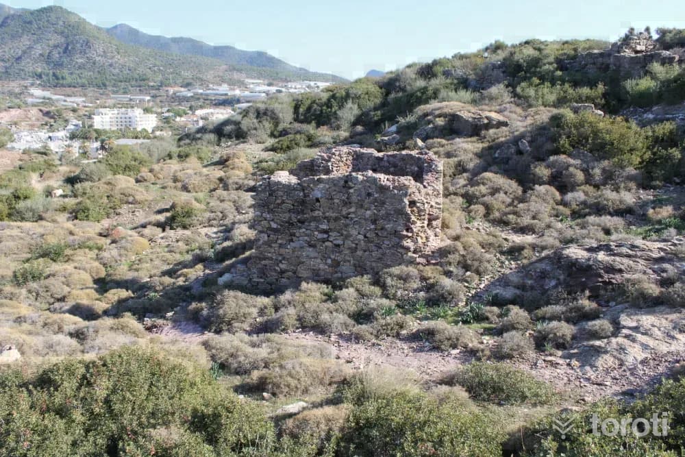
Softa Kalesi
Bozyazı, Mersin
The walls of Softa Kalesi are well preserved in places and are oval in form. The defensive strength was increased with an intermediate space at the castle entrance gate located in the middle of the western walls. The building groups located on the southern slopes of Softa Kalesi, which consists of outer castle and inner castle walls and spreads over a very large area, extend as far as “Arsinoe”, an ancient port city.
31
Arsinoe / Maraş Tepesi
Bozyazı, Mersin
The ancient geographer Strabo, while conveying information about this place, says; “After Anemurium one comes to Nagidos, the first city, then to Arsinoe, which has an anchorage.” We again learn about the foundation of the city and its relations with the neighboring city of Nagidos from the inscription exhibited in the Mersin Museum. From this inscription, it is understood that the city was first founded around 270 B.C. in the time of Aetos of Aspendos. Aetos, of the Egyptian king II.
32
Kelenderis Antik Kenti
Aydıncık, Mersin
The ancient writer Apollodoros states that Kelenderis was founded by Sandokos, who came from Syria. It is accepted that the Sandokos mentioned in this text is identical with Šanta, one of the Luwian-Hittite gods of the 2nd millennium B.C., and that this cult continued in the 1st millennium B.C. as well. Sandon /Sandan was also one of the founders and chief gods of Tarsus, and was depicted on some of the Hellenistic and Roman Period coins of this city.
33
Piramidal Çatili Mezar
Aydıncık, Mersin
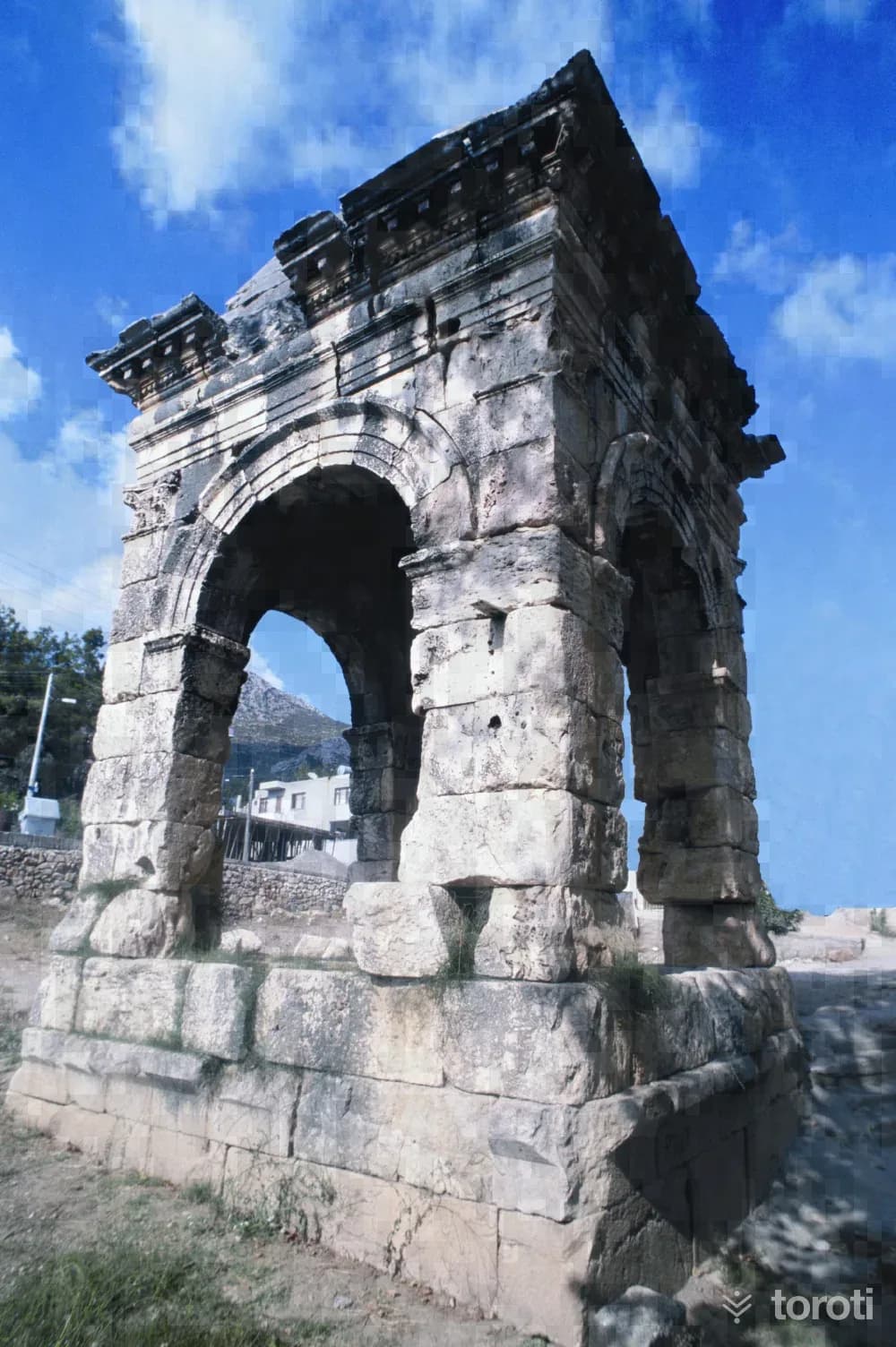
The canopied monumental tomb with a pyramidal roof, represented by a single example in Kelenderis, is in the northeast of the ancient city. It is located about 50 meters from the Mersin-Antalya highway. It is popularly known as “Dört Ayak”. The square-plan monument consists of a lower chamber in the form of four corner towers, an intermediate storey with arches on all four sides above it, and a pyramid-shaped roof. It is thought that the height of the structure is more than 13 meters. It is made of limestone.
34
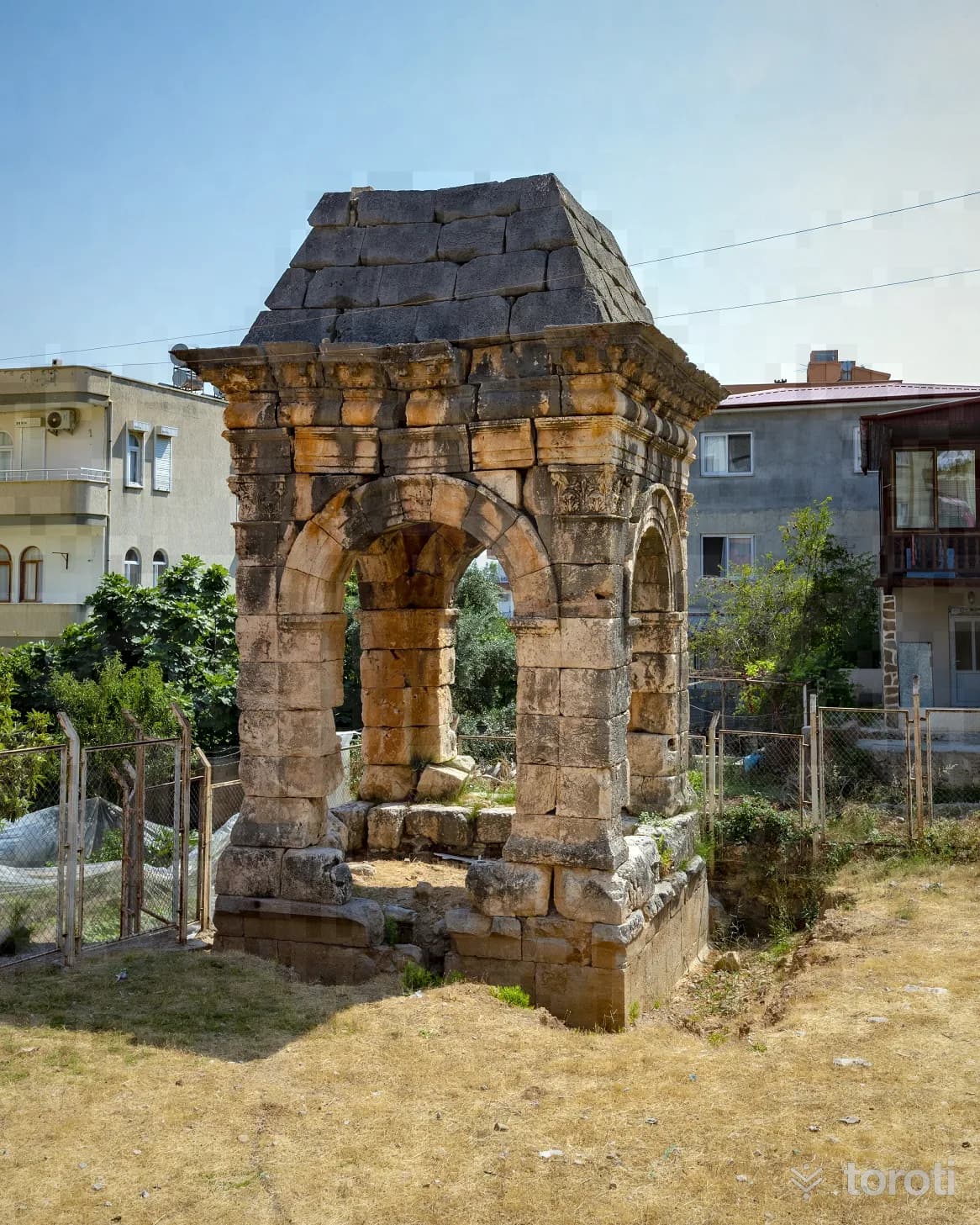
Dört Ayak Anıt Mezar
Aydıncık, Mersin
The monumental tomb with a baldachin and pyramidal roof, represented by a single example in Kelenderis, is in the northeast of the ancient city. It is known among the local people as “Dört Ayak”. The structure, thought to belong to one of the city’s leading figures, is dated to the 2nd century A.D. or the beginning of the 3rd century A.D.
35
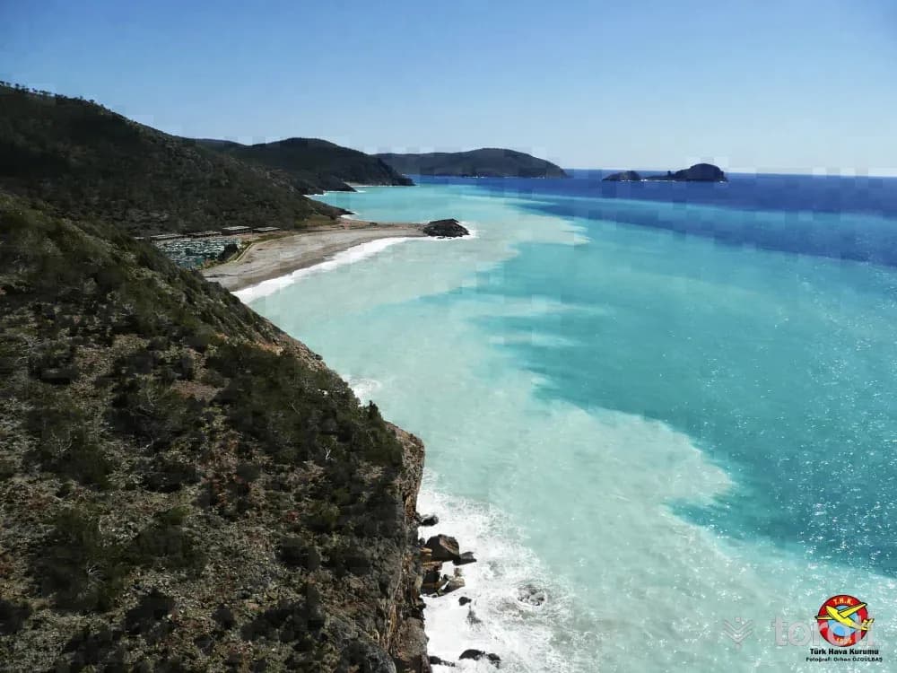
Büyükeceli Koyu
Silifke, Mersin
Wall diving can be done in the area from Tisan Koyu to the right as far as Büyükeceli. If you go out by boat from in front of Hayat Motel in Büyükeceli and turn right, wall diving can be done in the small coves as far as the Atom Santrali. Mersin Tourism Activities Important Note: For the safety of life and property, do not dive without obtaining the necessary permits and taking safety precautions.
36
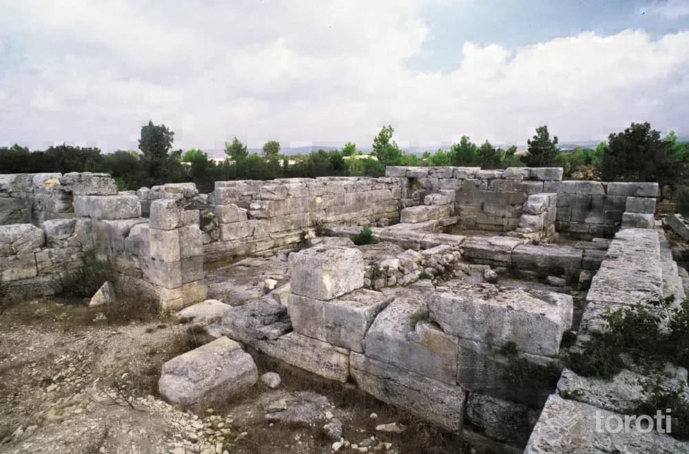
Meydancik Kalesi
Gülnar, Mersin
The castle covers a fairly large area 750 meters long. In the 7th and 6th centuries BC it was a royal city, in the 4th century BC it had a military and administrative role during the Persian Period, and in the 2nd century it became a garrison city for the Egyptian kings. Traces of the Late Roman and Byzantine Periods are also found. Especially BC.
- No image
37
Şeyh Ömer Türbesi
Gülnar, Mersin
The author of the Qur'an commentary named Bahru'l-Ulum lies in the tomb. The tomb has an octagonal plan and was built with neatly cut stone. Since the large dome on top was repaired with concrete, exact information about its original characteristics could not be obtained.
- No image
38
Akova Yaylası
Gülnar, Mersin
It is located 23 km from Gülnar on the Köseçobanlı -Ermenek road. It is a summer village that became a mukhtarship in 1994. It is known as the highland pasture of the Eskiyörük villagers. In summer, the population increases considerably. In addition to apple production, greenhouse cultivation and seasonal vegetable growing are carried out. Wheat, barley, chickpeas, and among fruits, peach, cherry, and pear are the main products.
39
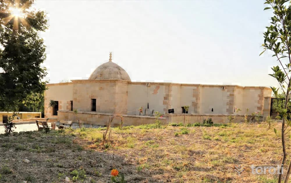
Zeyne Türbesi
Gülnar, Mersin
It was formed with the occasional addition of burial chambers to the main passage section, which was built within a large garden with a wooden roof covering and wooden columns. There are graves in the garden. The Şeyh Ali Semerkandi Tomb, known as Zeyne Tomb, is a work from the Beyliks period. Of the building groups that should have belonged to a külliye, only the tomb has survived. No written source has been found indicating that the tomb was part of the külliye.
- No image
40
Mut Kalesi
Mut, Mersin
The initial construction date of the castle, which is in the middle of the city, is unknown. According to Evliya Çelebi: “Karamanoğlu Yakup Bey attacked with many soldiers in order to take Mut Kalesi from the Greeks, but since all of his soldiers were martyred here, they call this place Darment-Darül-Mevt (Darı Mut),” he says. Later, İbrahim Bey, again one of the Karamanoğlu beys, captured this castle and had it completely demolished. After the castle passed into the hands of the Ottomans, I.
41
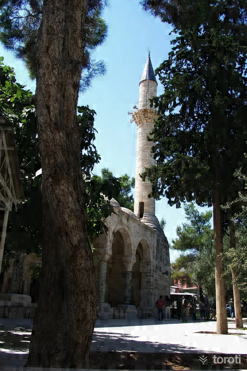
Laal Paşa Camii
Mut, Mersin
Laal Paşa, who built this mosque, was one of the slaves of Karamanoğlu Alâeddin Bey. Since Alâeddin Bey loved his slave, he had him educated and trained. Appreciating the ability he saw in Laal Ağa, Alâeddin Bey freed him from slavery and made him a free man. Because of the great success he showed in private and official state affairs, he appointed him dizdar of Niğde Kalesi.
42
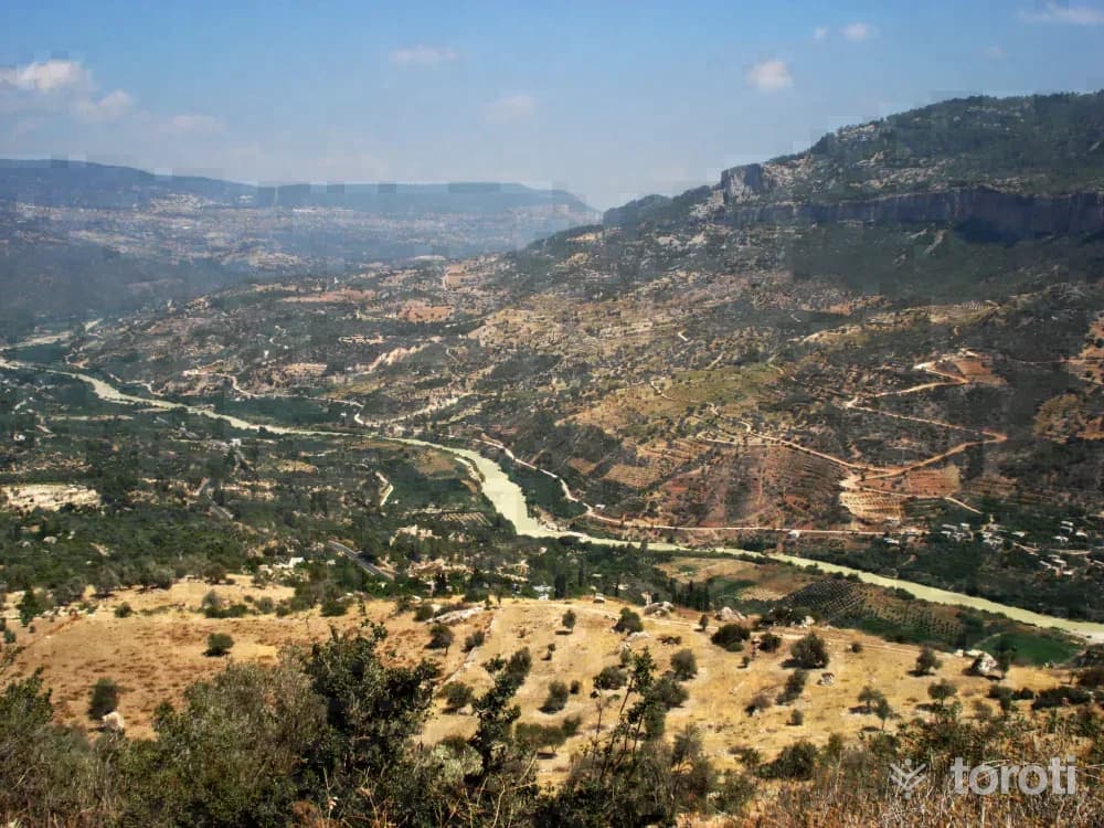
Göksu Irmağı
Mut, Mersin
It is possible to go rafting on both the Göksu Irmağı and its tributary, Ermenek Çayı. On the Göksu, the activity is carried out by passing through canyons and plains along the 91 km long course from Mut Derinçay to Silifke. Derinçay Mut is 20 km, Mut Kışlaköy 38 km, Kışlaköy Kargıcak 13 km, and the Kargıcak -Silifke stage is 20 km. The water level is also suitable in the summer months. It is an easy course, and an alternative sporting activity can be offered to tourists coming to the region.
43
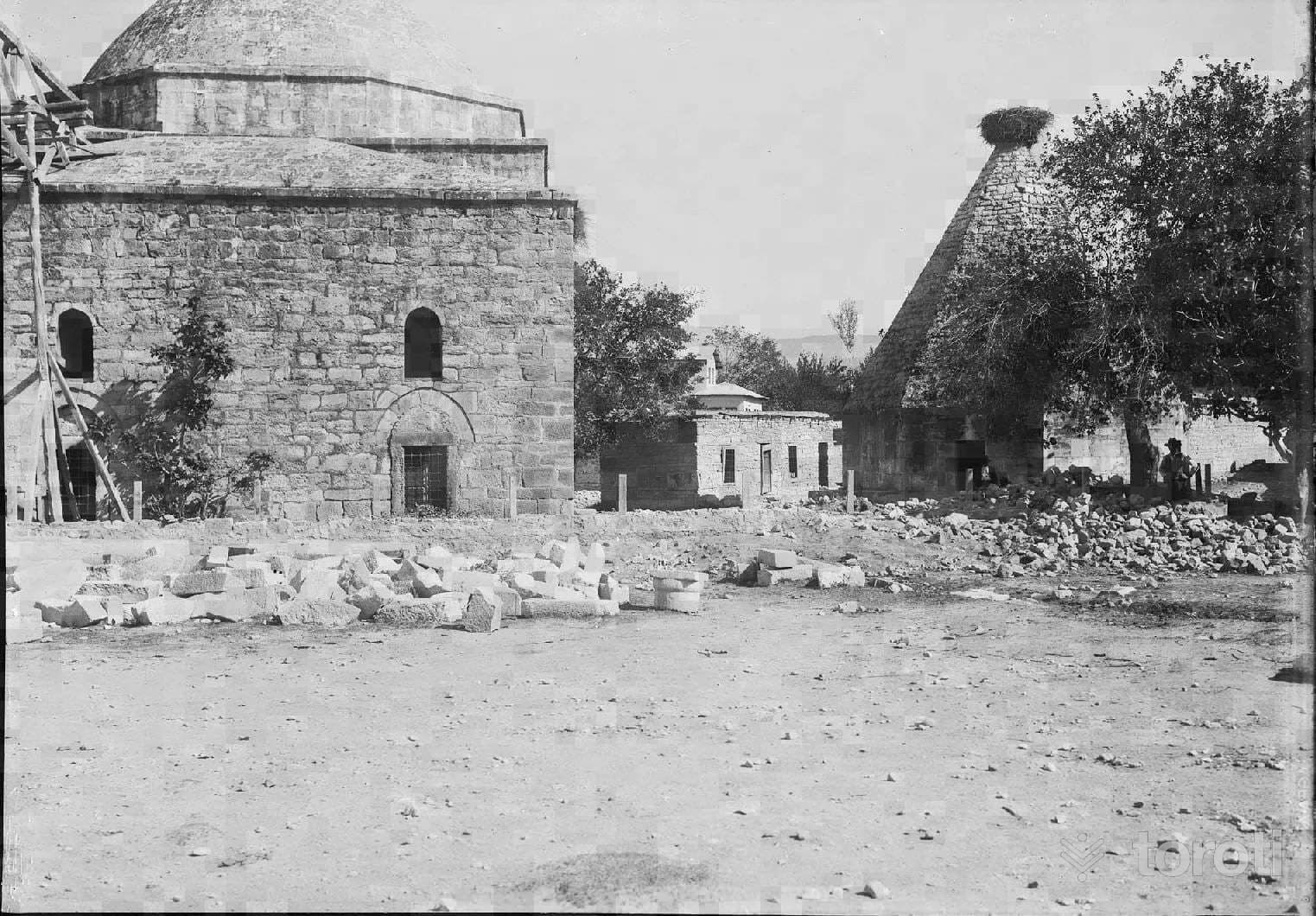
Lala Paşa Cami
Mut, Mersin
Laal Pasha, who built this Mosque, was one of the slaves of Karamanoğlu Alâeddin Bey. Because Alâeddin Bey loved his slave, he had him educated and trained. Appreciating the ability he saw in Laal Ağa, Alâeddin Bey emancipated him, freed him from slavery and made him a free man. Because of the high success he showed in private and official state affairs, he appointed him dizdar of Niğde Castle.
44
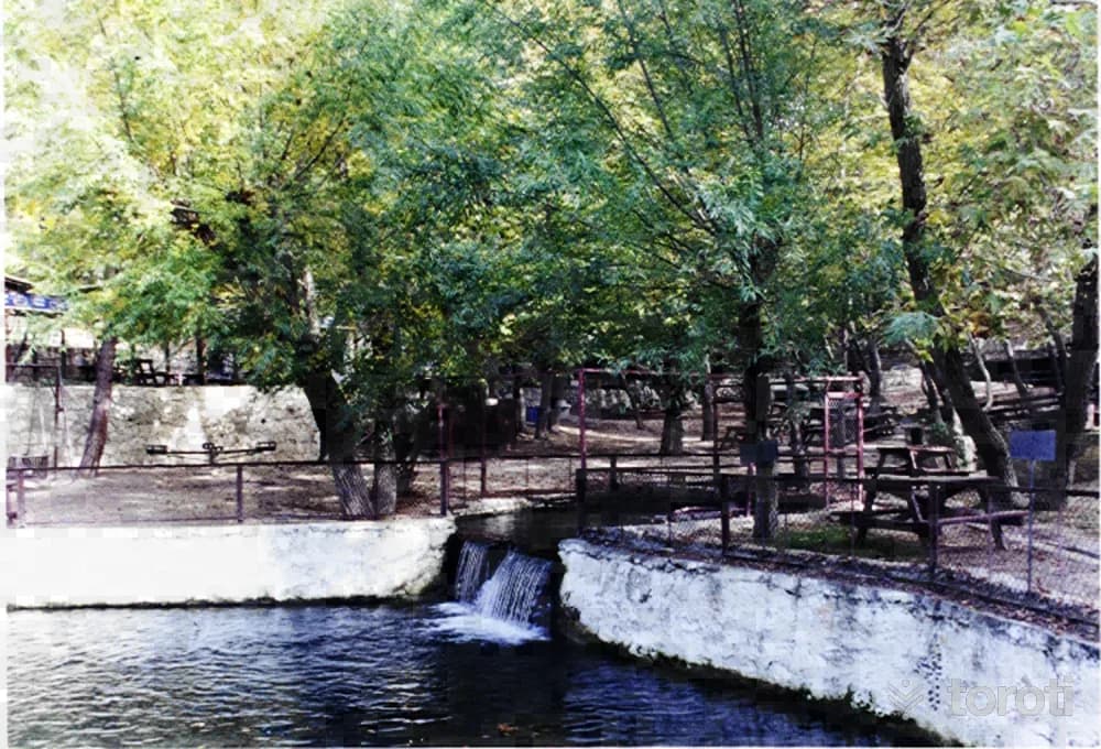
Karaekşi Mesire Alanı
Mut, Mersin
Karaekşi Recreation Area, located within the service area of Mut Nature Conservation and National Parks Engineering, is a recreation place declared a National Park by the Ministry of Agriculture and Forestry. The site was established in 1965 and is a day-use picnic area on an area of 5,0 hectares. Its characteristic is that it is within the forest and by the stream. The area is completely covered with plane trees and red pine trees.
- No image
45
Karaekşi Milli Parkı
Mut, Mersin
It is in the forest and by the stream. The area is completely covered with plane and red pine trees. In Karaekşi, which also has a trout breeding farm within its area, it is possible to see trout of مختلف ages, sizes and weights in the fish breeding pools and to eat fresh trout at the countryside casino within the area. In the area, there are also a sales kiosk, toilet, children's playground, car park and rain shelter.
- No image
46
Kesteldağı
Mut, Mersin
It is located within the boundaries of Mut District Yıldız-Topluca-Esençay and Gençali Villages, and has an elevation of 300-1200 m and an area of 4546 hectares. Since the area has natural beauty, vegetation cover and a sufficient amount of wild goat potential, it has been designated as a wildlife development area and is suitable for hunting tourism. In the 2011 inventory, 406 wild goats were identified.
- No image
47
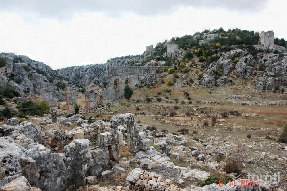
Diokaisareia Antik Kenti
Silifke, Mersin
In the Hellenistic Period, the present-day settlement of Uzuncaburç, which was the place of worship of the Olba Territorium located 4 km. east of central Uzuncaburç, was separated from Olba in the Roman Period, in 72 during the time of Emperor Vespasianus, and became an autonomous city minting coins in its own name under the name Diokaesareia (City of the God-Emperor).
48
Olba Antik Kenti
Silifke, Mersin
It was the center of the Kingdom of Olba and an important trading city in the Hellenistic Period. Olba was also an important religious center. Especially during the Christian period, this is evident not only in written sources but also in the remains of religious architecture.
Move the stops into your own plan, split them across days, and add places to sleep and eat.
Frequently asked
- How far is it between Antalya and Mersin, and how long does it take?
- Driving between Antalya and Mersin is roughly 410 kilometres and takes about 8 hours without stops.
- Where is it worth stopping between Antalya and Mersin?
- There are 452 described places within 20 km of the road between Antalya and Mersin. toroti lists 48 of them spread evenly along the drive, in the order you pass them; Etnografya Müzesi comes early on, and Olba Antik Kenti sits near the end.
- Which provinces does the Antalya to Mersin route cross?
- The route between Antalya and Mersin crosses Antalya → Mersin. The stretch richest in places to visit is in Antalya.
- Should I take the toll highway or traditional route between Antalya and Mersin?
- Toll motorways save driving time between Antalya and Mersin, whereas traditional state roads pass directly through historic town centers, local culinary stops, and scenic nature viewpoints.
- How should breaks be scheduled between Antalya and Mersin?
- For a drive of around 8 hours, taking a break every 2 to 2.5 hours is recommended. The catalogued attractions in Antalya and neighboring provinces offer memorable stopovers compared to generic highway rest areas.