
Places to visit
Things to do in Afyonkarahisar
60 destinations, each with a description, how long it takes and where it sits on the map.
In short
toroti’s catalogue holds 60 described destinations within Afyonkarahisar. The themes that come up most: History, Museum, Culture, Local culture, Nature, Faith heritage.
Districts of Afyonkarahisar
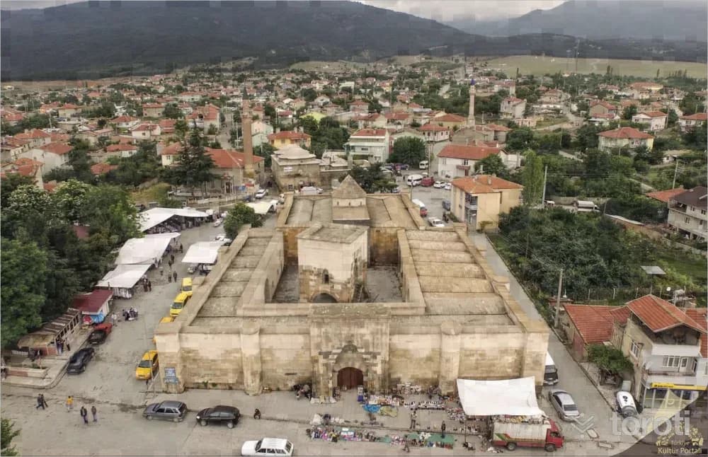
İshakli Han
İshaklı Han is on the Afyon-Akşehir-Konya route and is in the center of Sultandağı (İshaklı) District. It was built as two structural masses containing a courtyard and a covered/shelter section on a rectangular planned footprint extending in the north-east south-west direction. The exterior facade walls were supported by buttresses and corner towers with square and cylindrical forms, designed as prismatic masses projecting outward and at the same height as the facade.
45 minutes
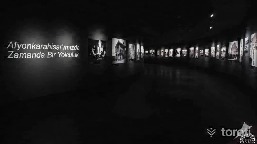
Afyonkarahisar Müzesi
With the efforts of the Asar-ı Atika Muhipleri Cemiyeti, established in Afyonkarahisar in the early years of the Republic, antiquities began to be collected in Taş Medrese; in 1931 it became an official museum depot, and in 1933 it became the Museum Directorate. Serving as a mixed museum (Archaeology and Ethnography) in Taş Medrese from 1933 to 1970, the institution moved to its second service building in 1971. In 2023, the current museum building was opened for service.
45 minutes
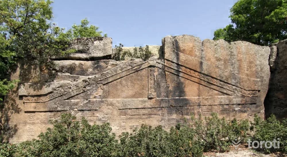
Maltaş Frig Anıti
It is an open-air worship area located within the borders of Kayıhan Town in İhsaniye District, at the southwestern corner of the Göynüş (Köynüş) Valley, on the Akkuş Yuvası Rocks that bound the valley from the west. Since it is believed that treasure is hidden inside, it is called “Maltaş” or “Malkaya” by the local people. Together with the other Phrygian rock monuments in the region, it is dated to between the 8th and 6th centuries BC. The first study related to the monument was carried out in 1881 by W. M.
45 minutes
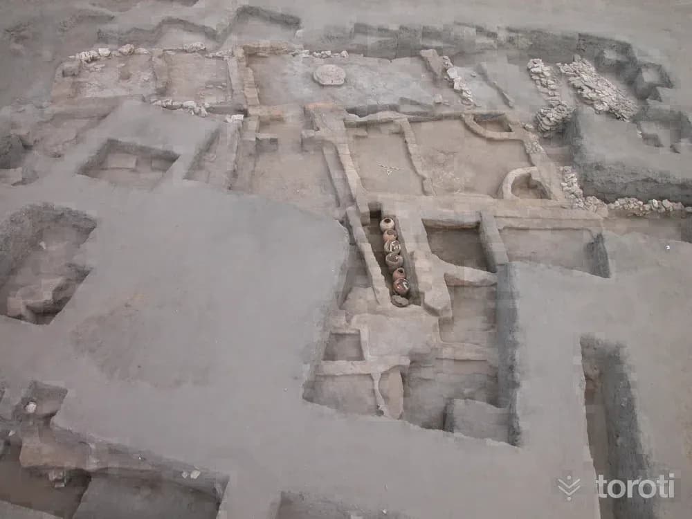
Han Yeraltı Şehri Ve Çevresi
Han, one of the most important junctions on the ancient road connecting east to west and south throughout history, is the first shelter of Christianity and the stopover city of the Seljuk and Ottoman. Ancient Han has Roman and Byzantine rock settlements on its connecting roads.
45 minutes
Leylek Kayaliği
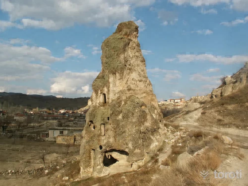
Leylek Kayalığı, located in the Harmanüstü area of Seydiler Town in İscehisar district, has natural and archaeological features. There are conical single and grouped fairy chimneys generally formed by tuffs. One of the fairy chimneys located to the west of the rock and on the lower part of the road has been carved into three storeys including the ground floor. On the ground floor there is a chapel and a space, on the first floor there is a chapel and a space, and on the top floor there is a space.
45 minutes
Ayazini Ören Yeri
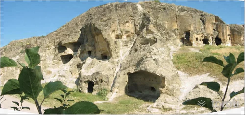
It is known that Ayazini Village, reached by going 4,7 kilometres to the right from the 27th kilometre of the Afyonkarahisar-Eskişehir highway, has been used as a settlement since the Phrygian Period. Family and single-person rock tomb chambers belonging to the Roman and Byzantine periods, churches belonging to the Byzantine Period, and rock settlements are works carved out due to the land being suitable for this type of settlement.
45 minutes
Seydiler Peribacaları
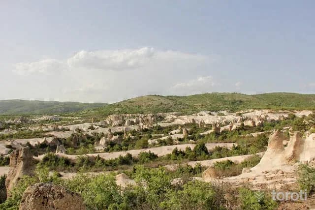
Located at the 33rd km of the Afyonkarahisar-Ankara highway, 500-1000 m east of the secondary road branching off from the main road, the area around Seydiler is the area where fairy chimneys of very different morphotypes can best be seen, within an area of approximately 1-2 km2. Due to the geological structure of Afyonkarahisar province, there are numerous fairy chimneys in various forms, with or without caps, in the districts of İhsaniye, İscehisar, Bayat and Bolvadin, which are located on volcanic terrain.
45 minutes
Çeşmeli Konak (afyon Kültür Ve Çevre Evi)
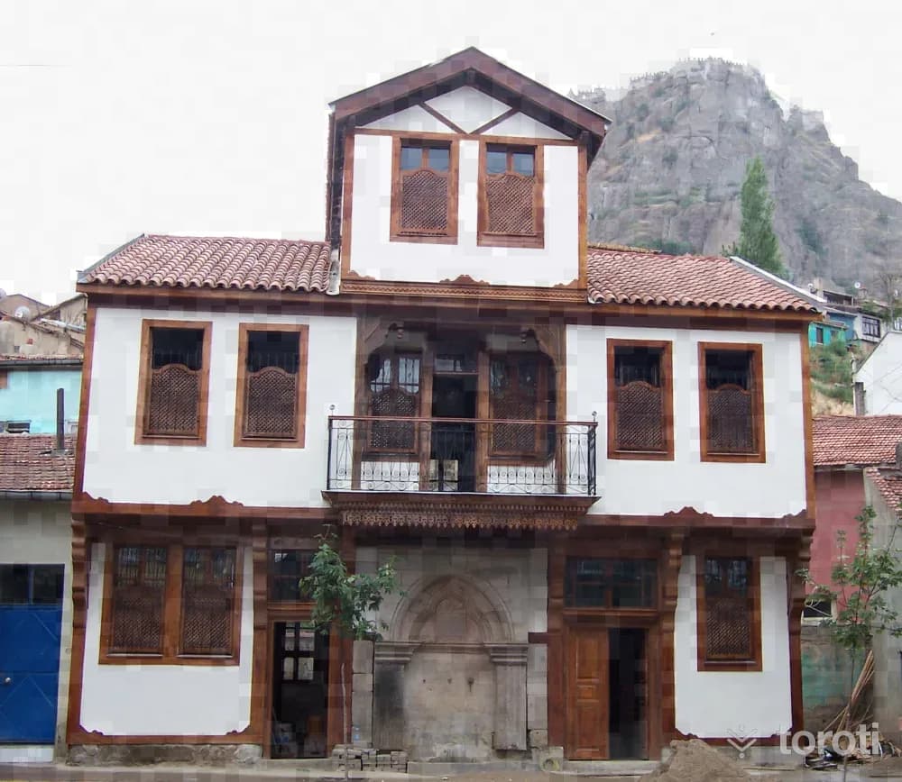
Çeşmeli Konak, located at Afyonkarahisar Province, Merkez Nurcu Mahallesi, Milli Birlik Caddesi No: 59-61, is registered in the land registry with sheet 36, block 534 and parcel numbers 16-17. It is a Late Ottoman work and forms an integral whole with the monumental fountain on its façade. The fountain was first commissioned for charitable purposes by Kahvecioğlu İsmail Efendi, who was engaged in the silk and fabric trade, and later the mansion needed by his own family was built.
45 minutes
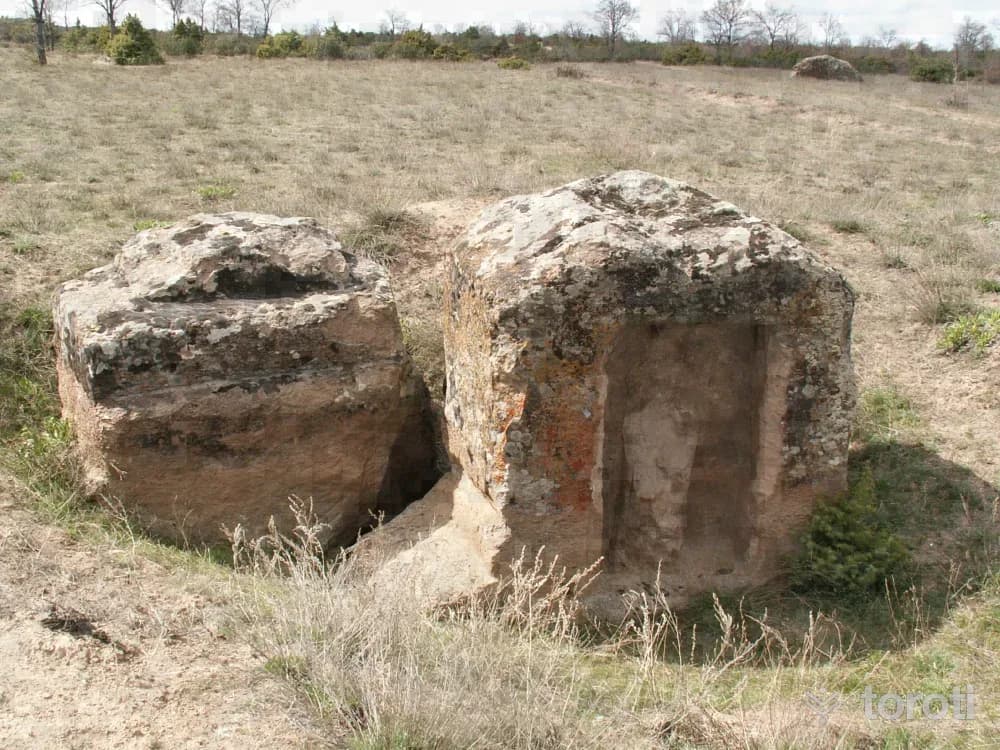
Frigya - Göynüş Vadisi
It is reached after a 2-kilometre journey by turning northwest (left) from the 36th kilometre of the Afyonkarahisar-Eskişehir state highway. It is in Kayıhan Town of İhsaniye District. In the Phrygian Valley, where there is a settlement belonging to the Phrygian Period, there are steep rocks approximately 10 metres high. On the faces of these rocks are small square-looking door openings. When entering through these doors, rooms are encountered. These rooms are rock tomb chambers belonging to the Phrygian Period.
45 minutes
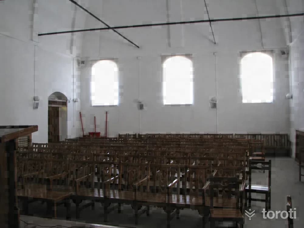
Millet Hamamı
It is located in Tac-ı Ahmet Mahallesi, on Hamam Aralığı Sokağı. In the northern section of the structure, which was built on sloping land descending from south to north, is the men's section, while in the southern section is the women's section. The women's changing room on the east facade of the structure is attached to the southern wing of the facade. The furnace on this facade is adjacent to the north wall of the changing room. In the northern section of the facade, there are three window openings.
45 minutes
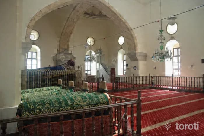
Mevlevi / Türbe Camii
It is located in the Mevlana Neighborhood in the center of Afyonkarahisar. It is also known among the public by the names “Türbe” and “Mevlevi Camii.” It is surrounded by streets to the north, west and south, and by houses to the east. It has two iron gates leading into the courtyard from the north and south. The north gate is lower down, and one ascends by steps to the courtyard, then by a second flight of steps to the mosque’s door. The entrance facade of the mosque faces east. The main unit consists of the tomb, semahane and masjid, şerbethane, bacılar mahfili, and the last congregation area.
45 minutes
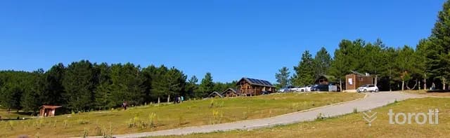
Yaban Hayati (fauna) Gözlemciliği - Akdağ Tabiat Parkı
Akdağ, at an altitude of 2 thousand 500 meters, is an ideal setting to feel the crystal-clear mountain air in your lungs. Heading south from Sorkun Town of Sandıklı District, following the winding stabilized forest road surrounded by oak forests, where black pine trees become denser as the altitude increases, at the end of the road, Kocayayla and the valley are reached.
45 minutes
Kuş Gözlemciliği - Karakuyu Göleti
Because Afyonkarahisar province is located in the Lakes Region, it has many lakes and ponds that may attract the interest of tourism. In addition to natural lakes such as Akşehir, Eber, Karamık, and Acıgöl, there are also many irrigation ponds such as Karakuyu, Pınarbaşı, Bayat, Selevir, Örenler, Kırka, Emre, and Taşoluk. Among these, the most remarkable in terms of natural and touristic aspects is Karakuyu.
45 minutes
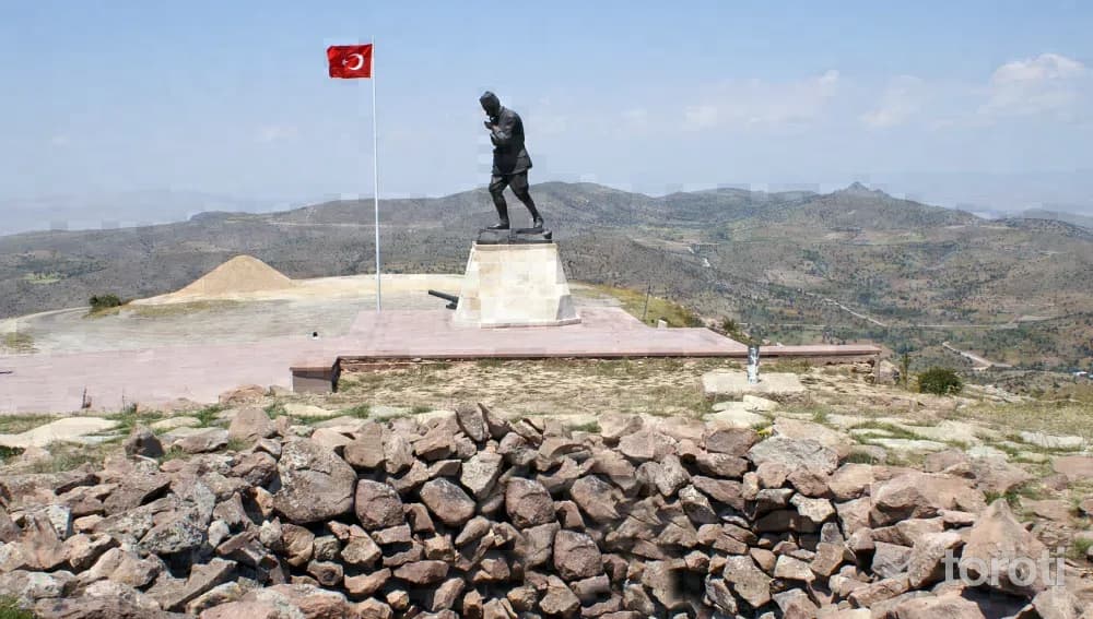
Kocatepe Atatürk Anıti Ve Kitabesi
Kocatepe Atatürk Monument and Inscription is located within the borders of Büyük Kalecik Town in the Central district of Afyonkarahisar province and on Kocatepe at an altitude of 1874. Its asphalt road is closed in the winter season due to heavy snow. Kocatepe is the place where the Great Offensive, which ensured the liberation of Anatolia and the Turkish Nation, was launched and directed by Commander-in-Chief Mustafa Kemal on 26 August 1922.
45 minutes
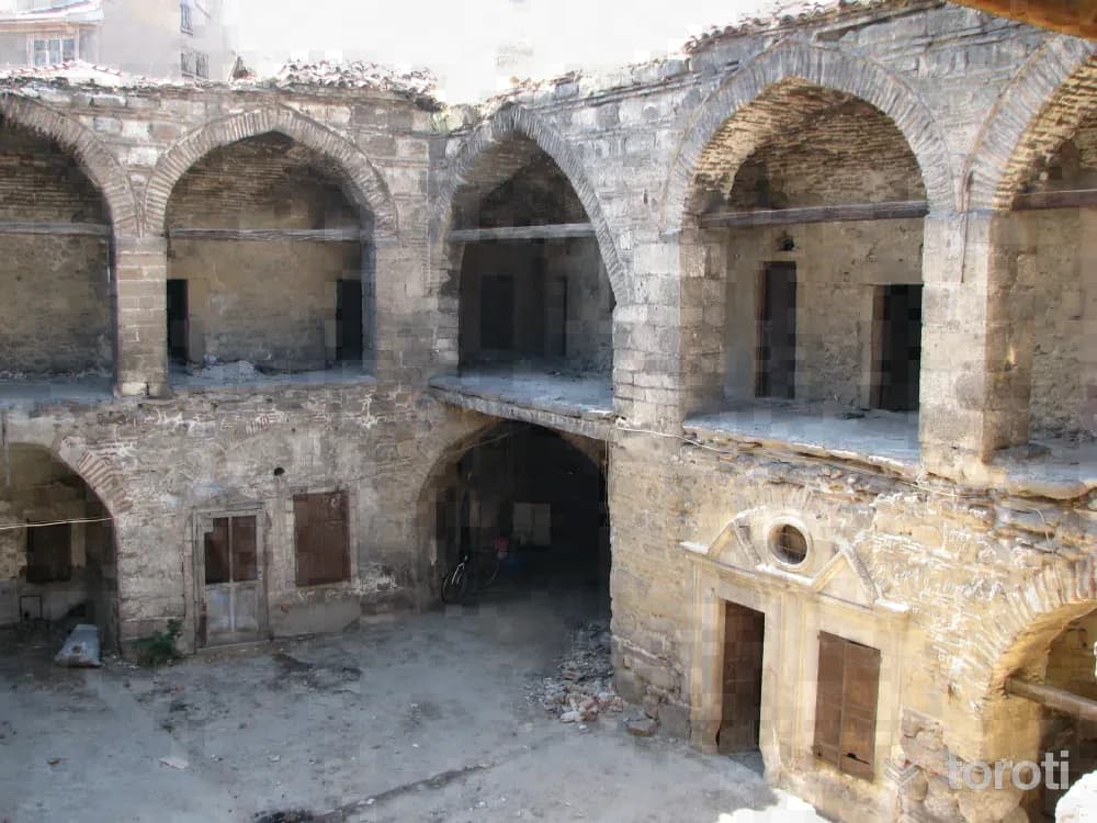
Taşhan
It is located in Yemeniciler Çarşısı, Umurbey Mahallesi, in the center of Afyonkarahisar. Also known as Hoca Üveys Hanı, the building was commissioned by Kadı Abdullah Efendi in the mid-XVII century, with contributions from the yemenici tradesmen, as a two-storey structure on a nearly square plan. The inn was built as a masonry structure of rubble stone. The stones are laid in rows, with courses of brick used between them.
45 minutes
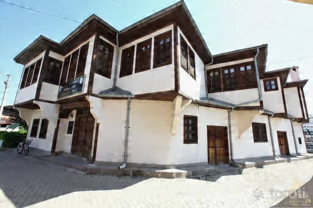
Büyük Taarruz Karargahi
Mustafa Kemal Paşa arrived in Şuhut in the evening hours on Thursday, 24 August 1922. The houses where the Pashas and their entourage would stay were determined and prepared in the best way by 1st Army Commander Nurettin Paşa, who came to Şuhut on 23 August 1922, and Oynağanlızade Osman Ağa.
45 minutes
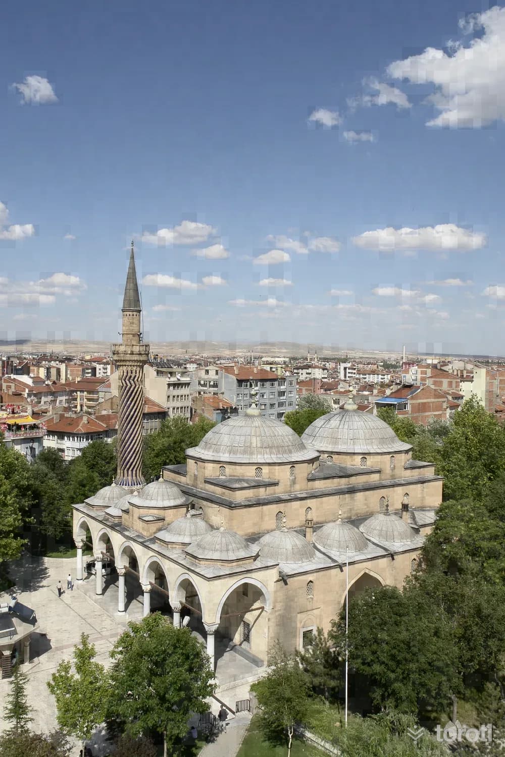
Taş Medrese (gedik Ahmet Paşa Medresesi)
It was built by the architect Ayaz Ağa as a part of the külliye, on a higher terrace to the southeast of Gedik Ahmet Paşa Camii, compared to the bath and the mosque. It is a rectangular-plan structure clad in cut stone, with 2 large and 24 small domes. Its entrance is on the west. It is a typical example of Ottoman madrasas, consisting of a courtyard in the middle, arcades on both sides of the courtyard, 7 cells opening onto the arcades, a classroom, and a summer iwan.
45 minutes
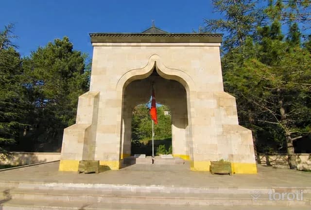
Yüzbaşi AgÂh Efendi Şehitliği
It is located within the town of Büyük Kalecik, in the central district of Afyonkarahisar province. It is 12 kilometers from Afyonkarahisar city center.
45 minutes
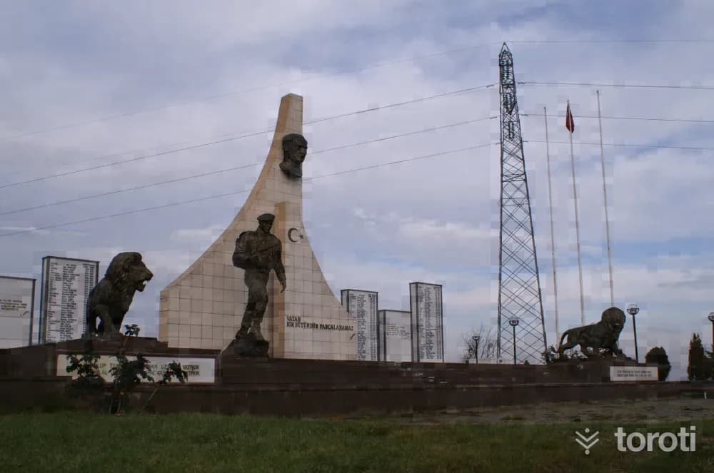
Cumhuriyet Şehitliği
The Cumhuriyet Şehitleri Monument is located 9 kilometers from Afyonkarahisar, on the İzmir-Antalya highway. It is a martyrdom built in 1999 in the name of the Mehmetçik and police officers who were martyred in the struggles during the Republican Period. Some of the martyrs of the Republican Period are in the Hava Şehitliği, and others are in cemeteries in the cities where the martyrs' families live. In 1999, a symbolic martyrdom was built on a hill overlooking Afyonkarahisar in memory of the martyrs.
45 minutes
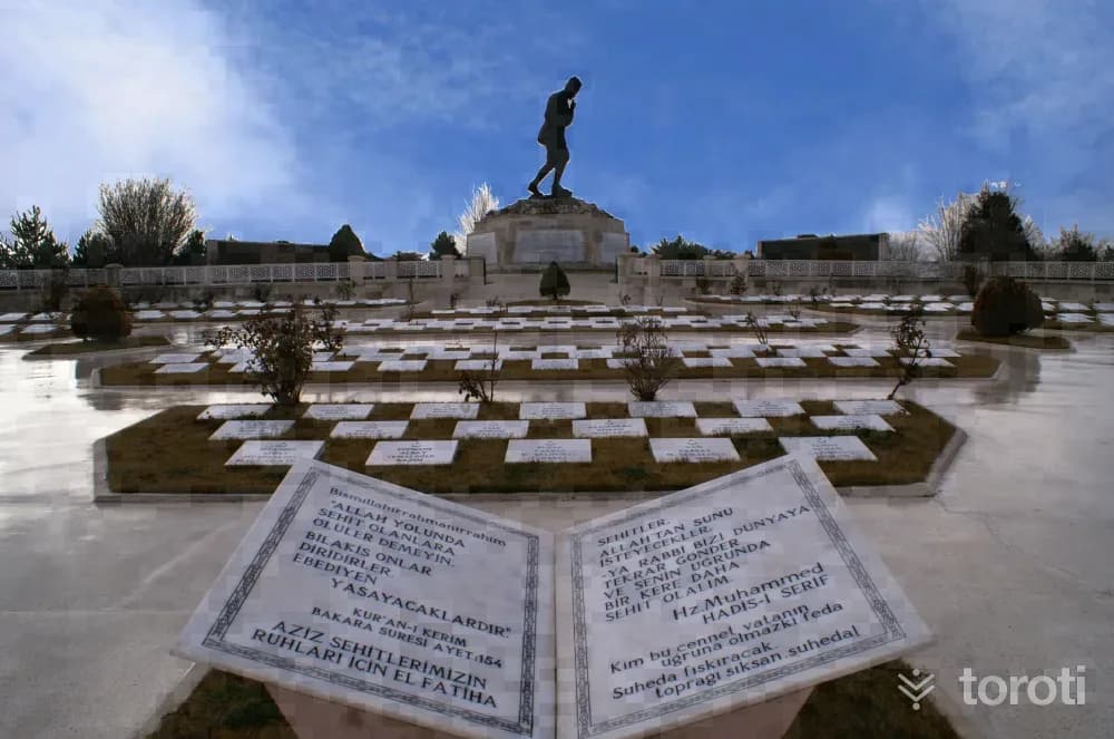
Büyük Taarruz Şehitliği Ve Mustafa Kemal Atatürk Anıti
It is located on Işık (Sarıkız) Tepe at the Antalya-İzmir road junction, 16 kilometers from Afyonkarahisar. Built so that vehicles traveling from Central Anatolia and Marmara to the Aegean and Mediterranean can see it, the Martyrs' Cemetery and Monument are open to visitors every day of the year.
45 minutes
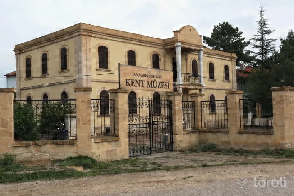
Bolvadin Müzesi
As a result of the increase in the artifacts that Muharrem Bayar had collected in the school garden through his special interest and efforts during his tenure as principal of Bolvadin High School, the need for a museum arose, and through the efforts of the then Mayor Etem Kelekçi, the “Municipal Cinema,” which was owned by the municipality, was reorganized in 1987 and opened to service as Bolvadin Museum.
45 minutes
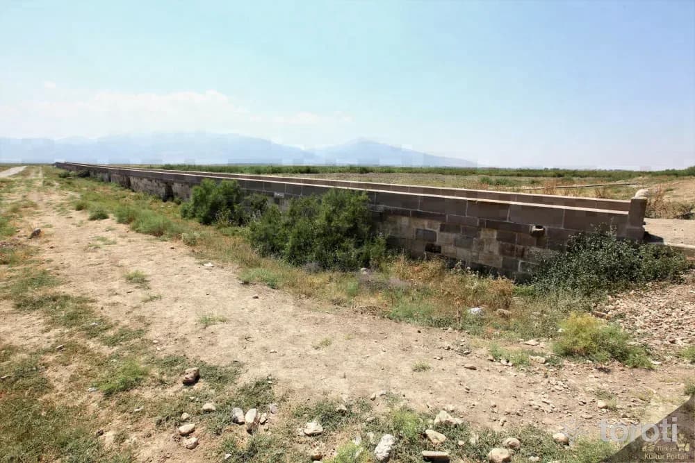
Kırk Göz Köprüsü
It is located on Akarçay, outside the Bolvadin district center. The bridge is divided into two parts as the northern and southern sections. The southern section was built around 1150 by the Byzantine Emperor I.Manuel Kommen, with forty arches, of marble and basalt stone. The bridge, located on the Surre-Hicaz road, was extended northward up to 64 arches by Mimar Sinan in the XVI century by order of Kanuni Sultan Süleyman and is 200 meters long. The number of arches that have survived to the present day is 57.
45 minutes
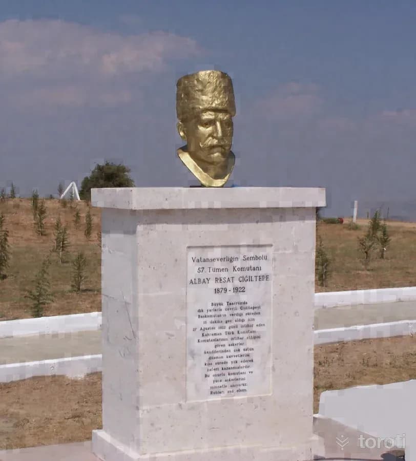
Albay Reşat Çiğiltepe Şehitliği
It is located on Çiğiltepe, at an altitude of 1591, in the southeast of Sinanpaşa District, in the southwest of Afyonkarahisar, and is 18 kilometers from Sinanpaşa District. On 27 August 1922, Miralay Reşat Bey, Commander of the 57th Division, who was assigned to capture Çiğiltepe, promised Başkomutan Gazi Mustafa Kemal that he would capture the hill within half an hour, but when he could not keep his word, he committed suicide by placing his pistol to his temple.
45 minutes
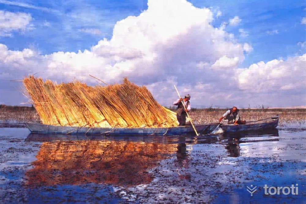
Kuş Gözlemciliği - Eber Gölü
The lake, located within the borders of Eber Town in the Çay District of Afyonkarahisar, is Turkey's 12th largest lake. Its deepest point is 21 meters. Its surface area is 150 square kilometers and its elevation above sea level is 967 meters. The endemic plant species called Eber Sarısı grows only in Eber Gölü in the world. It is one of the most important wetlands around Bolvadin.
45 minutes
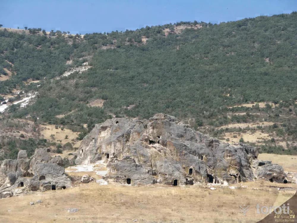
İnpazarcik Kaya Yerleşimi
İnpazarcık Rock Settlement, located 5 km from the Bayat district center of Afyonkarahir, was formed by carving a natural tuff rock mass; it is an Early Byzantine Period structure consisting of dwelling places, a chapel, and burial chambers. Afyonkarahisar Provincial Directorate of Culture and Tourism To the north are arcosolium klineli burial chambers, a church, and sarcophagus-type graves. On the lower floor of the three-storey settlement, there are spacious rock-carved living spaces connected to each other by passages.
45 minutes
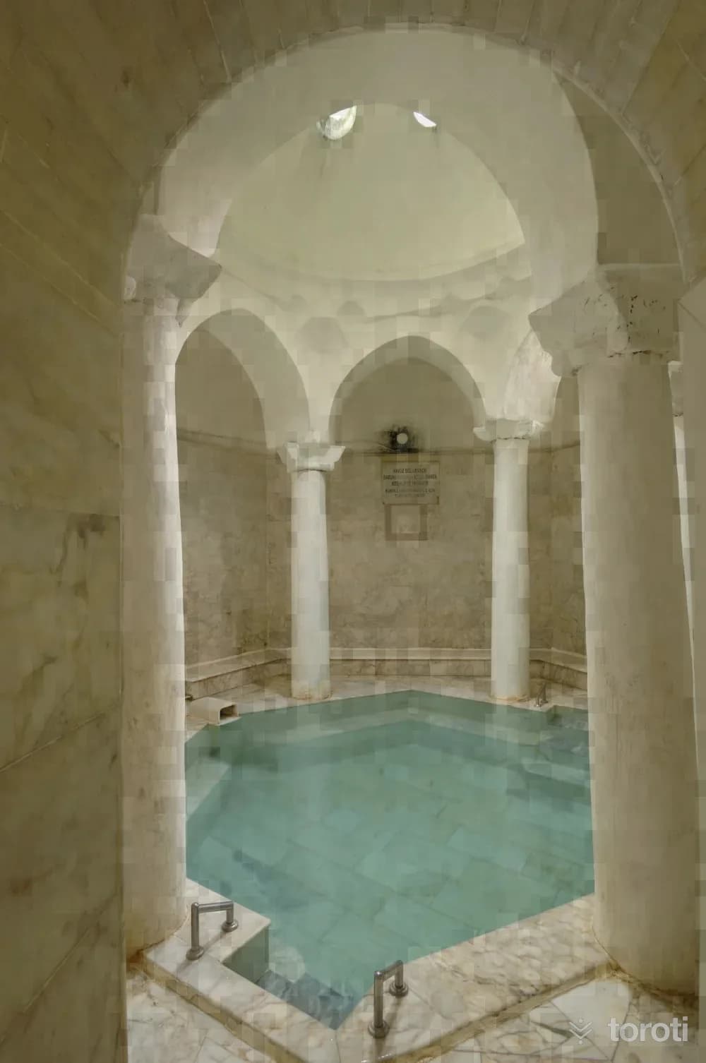
Gazligöl Kaplıcası
Gazlıgöl Hot Spring, located on the Afyonkarahisar-Eskişehir highway, is 21 kilometers from the city center. Although this area was removed from its thermal tourism center status in 2019 due to the narrowing of thermal tourism centers, it continues to be a tourist attraction. The drinking cures and baths at Gazlıgöl Hot Spring, which provide healing to hundreds of local and foreign tourists every year, are used for therapeutic purposes.
45 minutes
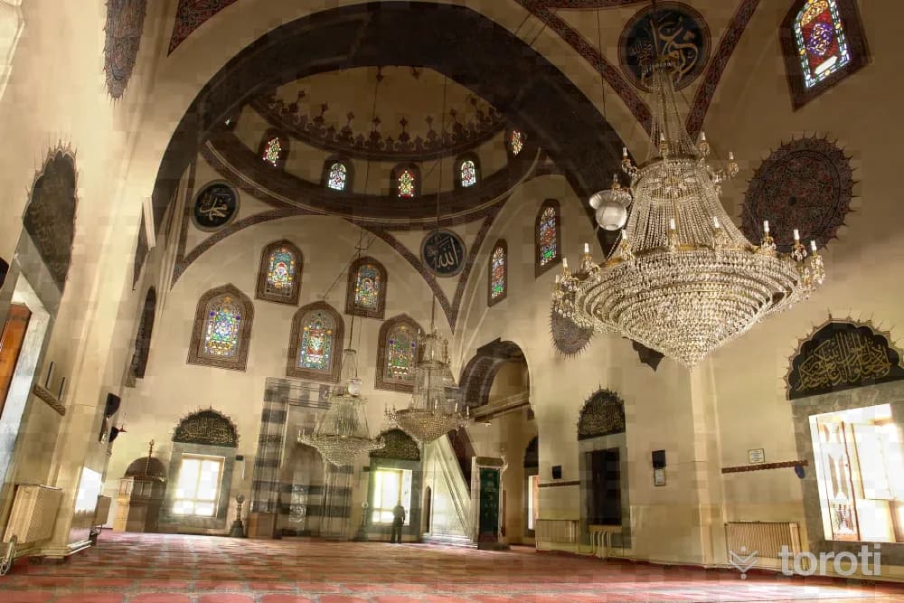
Gedik Ahmet Paşa Cami
In the center of Afyonkarahisar, on Kurtuluş caddesi, the mosque was commissioned by Grand Vizier Gedik Ahmet Paşa in 1472 to Architect Ayaz Ağa. The decorations of the mosque were made by Abdüssamedoğlu Hasan. The mosque was restored in 1795 by Müftfzade Ahmet. Servet Uygun Yapı, it has a reverse "T" shape with a plan of two consecutive domes. The last congregation area to the north is covered with 6 round columns, 5 pointed arches and 5 domes with octagonal drums. Its single-balcony minaret is decorated with fluted spiral forms.
45 minutes
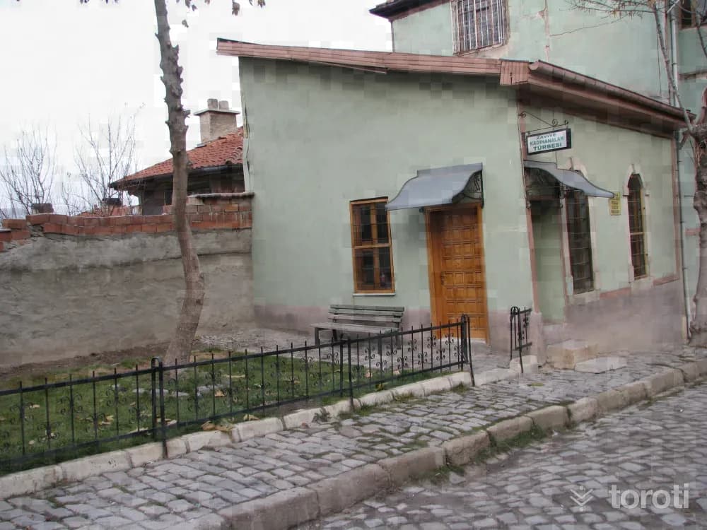
Kadınana Türbeleri
There are two tombs belonging to the three daughters of Seljuk Sultan III. Alaaddin Keykubat, named Asiye, Melek Peyker and Naime Gevher Hanım, who settled in Afyon and served the people of Afyon. The first of these was built for Asiye Hatun, and is a square-planned structure with a single dome, which underwent restoration in 1940. Its arched door faces east. There is a single sarcophagus in the tomb. Asiye Hatun, who lies in this tomb on Kadınana Caddesi, had a large number of graves built for the people.
45 minutes
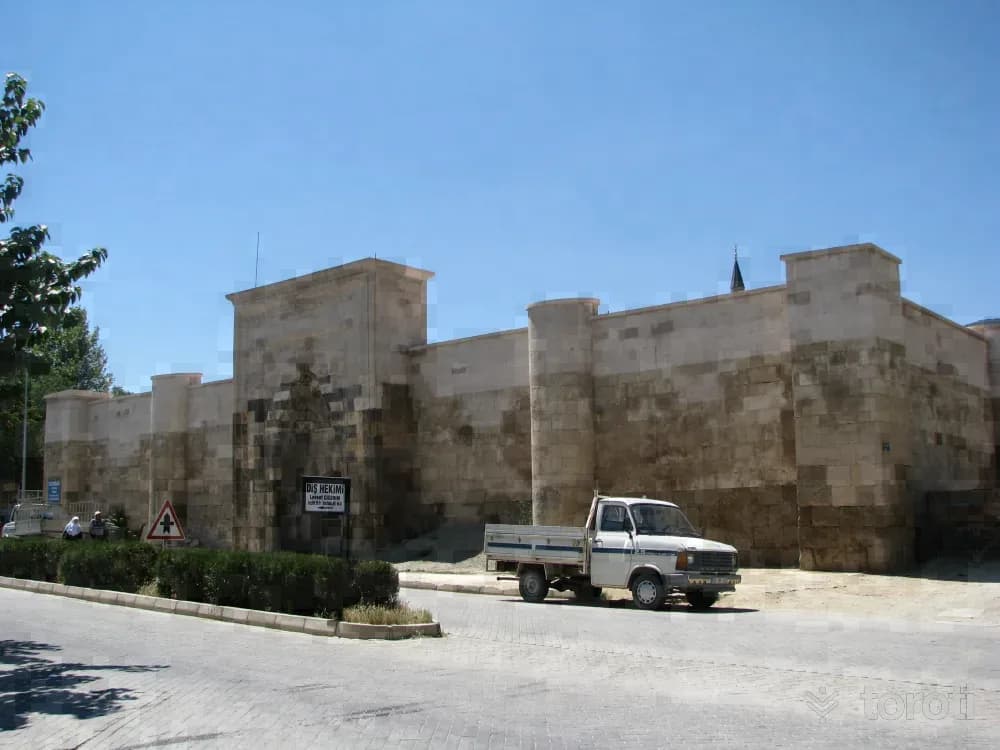
Sultandağı Kervansarayı - Sahipata Kervansarayı
It is in the center of Sultandağı district. According to its inscription, it was built in 1249 by Fahreddin Ali bin Hüseyin (Sahipata), one of the beys of II.İzzeddin Keykavus. The structure consists of a rectangular five-aisled covered section oriented east-west and a larger square-planned courtyard. The aisles in the covered section are covered with pointed vaults. Only the dome in the middle of the central aisle draws attention.
45 minutes
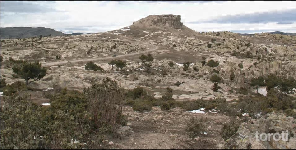
Bayramaliler Kalesi
Bayramaliler Kalesi İhsaniye ilçesi, Bayramaliler köyünün 650 metre kadar kuzeyinde yer alan ve çevreden belirgin şekilde görülebilen kaya yerleşimi ve kaledir. Kuzeybatı yamaçları nispeten hafif eğimli bir yapıya sahipken diğer yamaçlar oldukça diktir. Kalenin güneyinde yer alan kayalıklarda çok sayıda niş ve sunu çukurlarının varlığı bu alanın MÖ I. Bin yılda tapınım amaçlı kullanım gördüğünü göstermektedir.
45 minutes
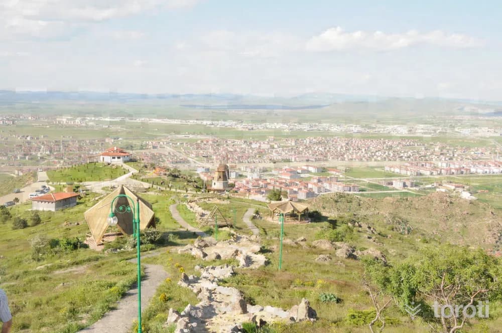
Zafer Kent Ormanı
The urban forest, created on an area of approximately 1,5 million square meters, has been arranged in the best way and put into the service of our people.
45 minutes
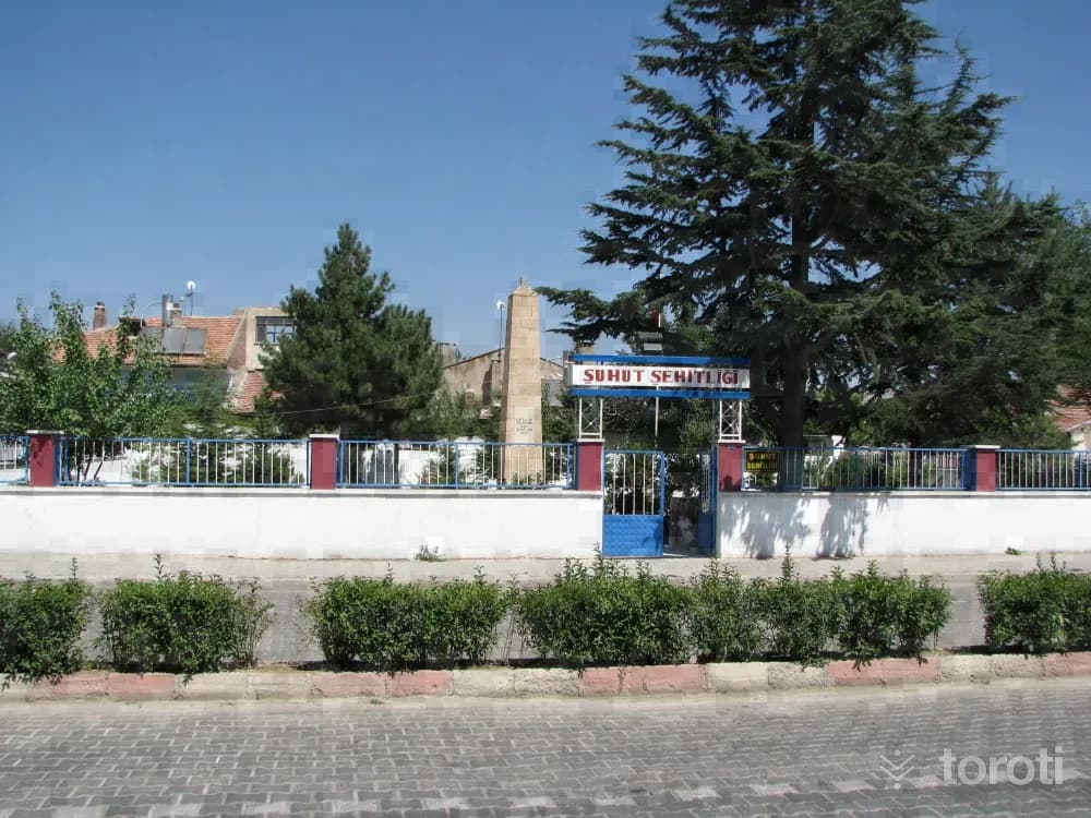
Şuhut Kurtuluş Savaşı Şehitliği
It is in the center of Şuhut district. It was built for our soldiers who were martyred in the War of Independence. On 26 August 1922, Turkish officers and privates who were wounded or fell ill in the Great Offensive and earlier battles were brought to Şuhut, and after receiving their first treatment in the Büyük Cami, which is still in use today, those who recovered were sent back to the front. The martyrs were buried in the cemeteries around what is now Demirciler Çarşısı.
45 minutes
Aslantaş
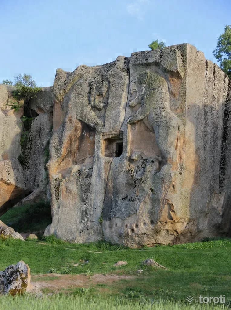
On both sides of the doorway opening on the front face of the Aslantaş Rock Tomb Chamber, one of the rock tomb chambers belonging to the Phrygian Period, two imposing lions standing up and facing each other, with a lion cub under each of their feet, and above the door a mass resembling the tree of life and above this a winged sun disk extending to both sides, were made in relief. The tomb chamber has a slightly vaulted ceiling and a small cell with a bench on the left side for laying the dead.
45 minutes
Ebheri Kümbeti
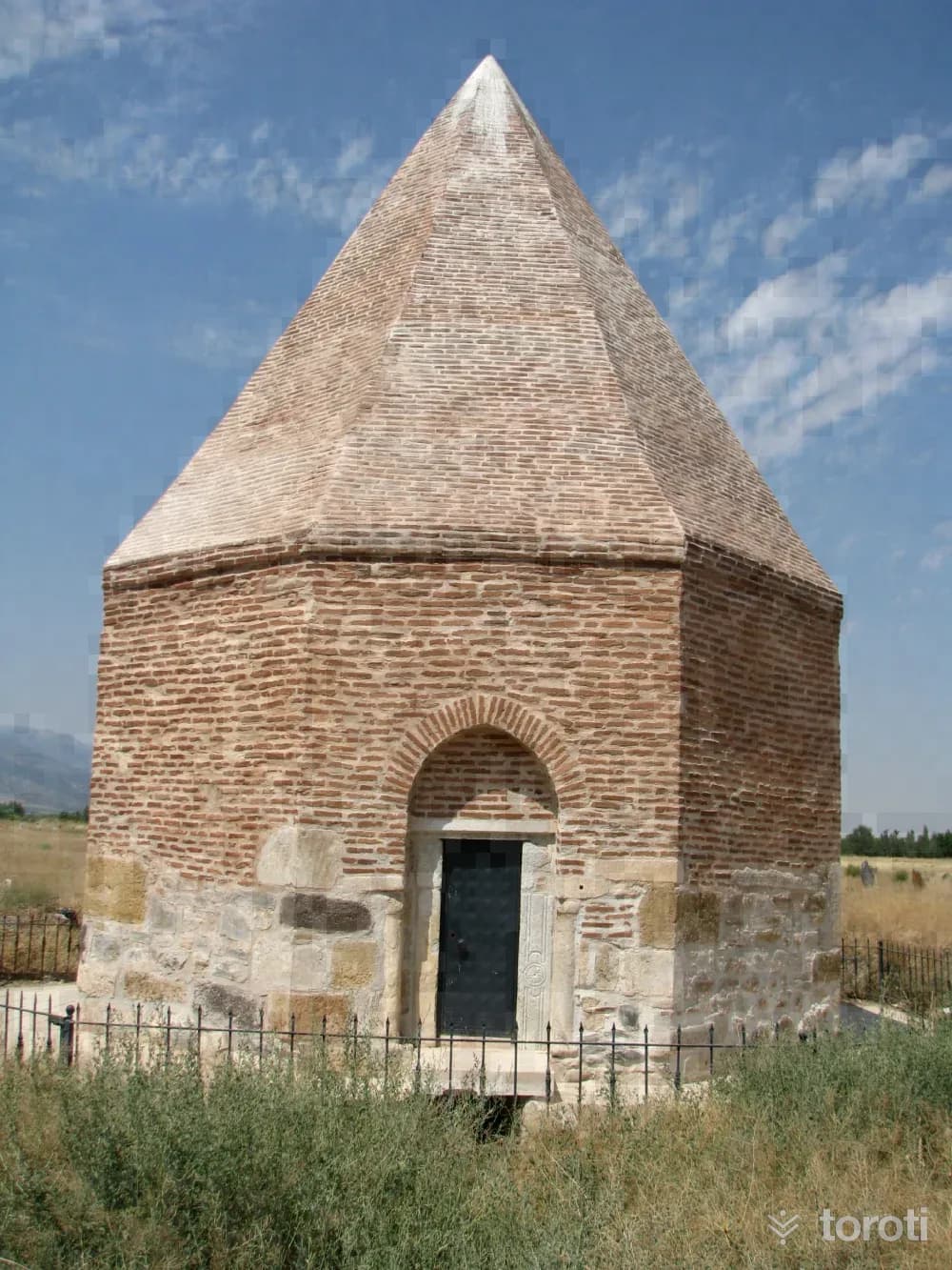
It is located in the cemetery in Eber Town of Çay District. It rises on an octagonal body and ends with an octagonal cone. The lower part of the tomb is built of rubble and spolia stone, and the upper part is brick masonry. Its entrance is on the east. The door jamb stones are from Byzantine Period building stones and were used as spolia. Under the door opening, there is a small door providing access to the base, which is the burial place. It is said that there are two sarcophagi inside the base.
45 minutes
Yılantaş
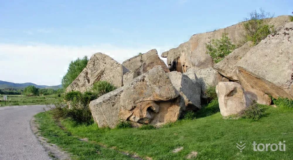
Yılantaş is another of the important burial chambers belonging to the Phrygians. Like Aslantaş, Yılantaş is also thought to have belonged to a noble person. Today, Yılantaş has toppled over as a result of an earthquake or another natural event and appears as a collapsed rock block. The head and foot sections of the lion relief on the rock block can be seen.
45 minutes
Emre Tekkesi (yunus Dergahi)
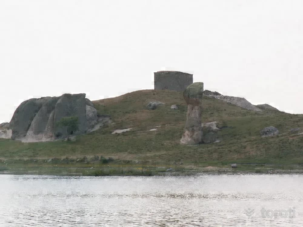
It is on a hill to the southeast of Emre Gölü, in Döğer Town, connected to İhsaniye District. It is a rectangular prismatic structure clad in cut stone. It is an Ottoman work from the end of the XVIII century. The door of the tekke is on the south side and opens to the courtyard. It is thought that the foundation remains on its western slope belong to Emre Village, whose existence in the XVII-XVIII century is known. The structure is vaulted inside, in the form of a triangular roof outside, and stone-clad. Its interior walls are plastered and whitewashed.
45 minutes
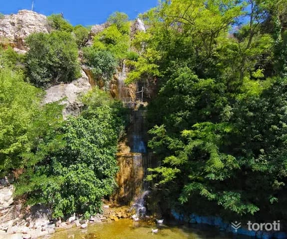
Suçikan Parkı
Suçıkan Park is in the center of Dinar district. Its entrance is the Suçıkan cave located behind Suçıkan Park Hotel. The excess water stored in Karakuyu Pond is discharged through the sinkhole near Karakuyu village, and this discharged water re-emerges from the base of the rocks in Suçıkan Park, forming a branch of the Menderes river. For this reason, it is thought that the cave is quite large and that there may also be small pools inside.
45 minutes
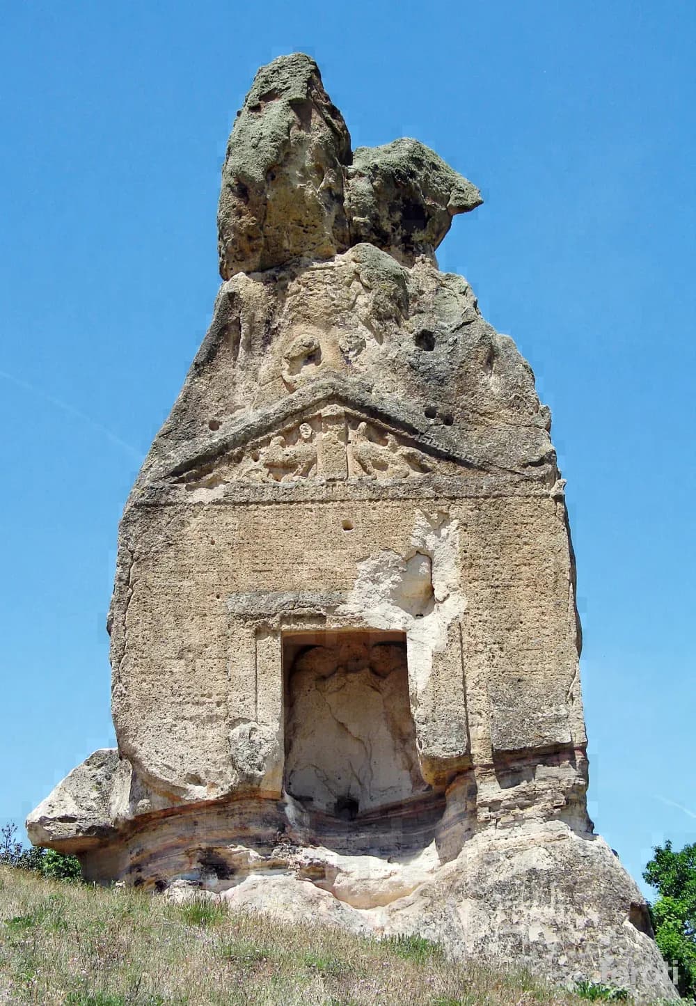
Aslankaya
It is on the shore of Emre Lake, located between İhsaniye district, Döğer Town, and Üçlerkayası Village. Aslankaya is a temple facade with a vertically cut triangular roof on the southern face of a high rock. In the beam spaces of the triangular roof are two opposing sphinxes (human-headed lions), and on the main facade, within a niche, Cybele is located between two lions. The main facade is decorated with reliefs featuring geometric patterns.
45 minutes
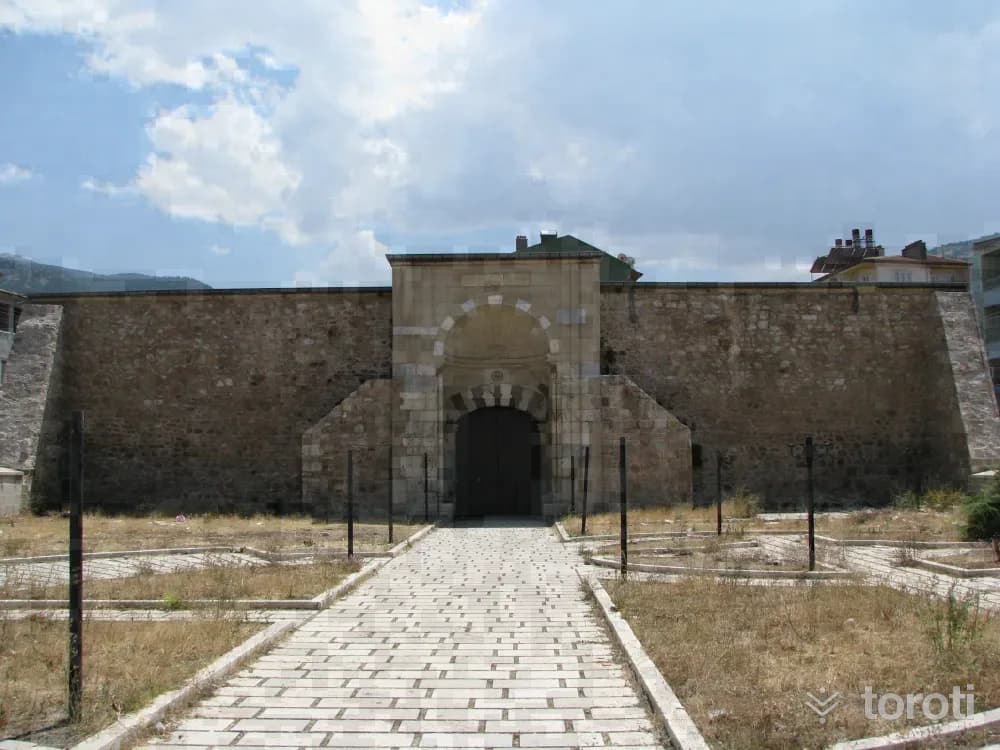
Çay Kervansarayı (taşhan)
It is a structure belonging to the stone külliye of the Seljuk Period. It is among the types of caravanserais with a courtyard and enclosed caravanserais. Its courtyard has been destroyed, and its winter enclosed section has survived. It is a square-planned masonry structure with a crown gate, four elephant-foot piers in the center topped with a skylight, and around them a vault-covered arrangement on 12 piers, with external buttress projections and a fortress-like appearance. It was commissioned by Ebul-Mücahhit Yusufhan during the time of III. Gıyaseddin Keyhüsrev, in 1278, to Mimar Mehmet oğlu Oğul Bey.
45 minutes
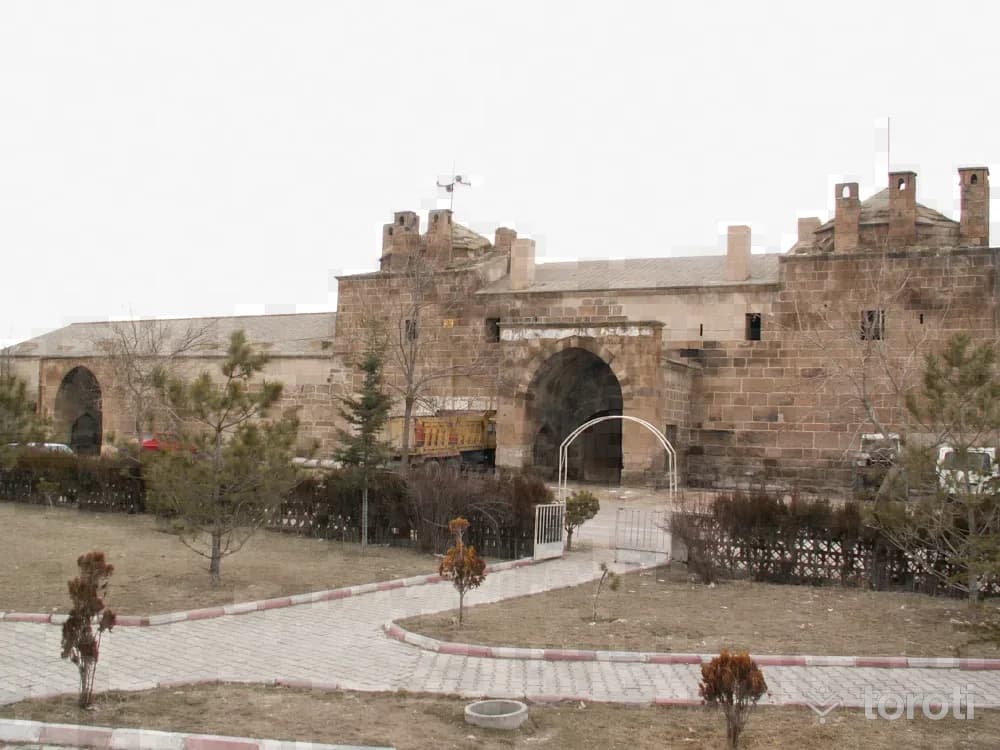
Döğer Kervansarayı
It is located in the town of Döğer, connected to İhsaniye District. It is an Ottoman work commissioned by Murat II. It is an exemplary structure with its architecture consisting of two sections, the two-storey inn section and the camel stable, and an iwan-shaped monumental portal. In the two-storey inn, the upper rooms are for travelers to sleep; the lower floor is a resting place. Two of the rooms are domed, while the other is covered with a barrel vault. The central iwan is the masjid. The exterior and roof of the building, and the conical caps of the two domes, are covered with local tuff and cut stone.
45 minutes
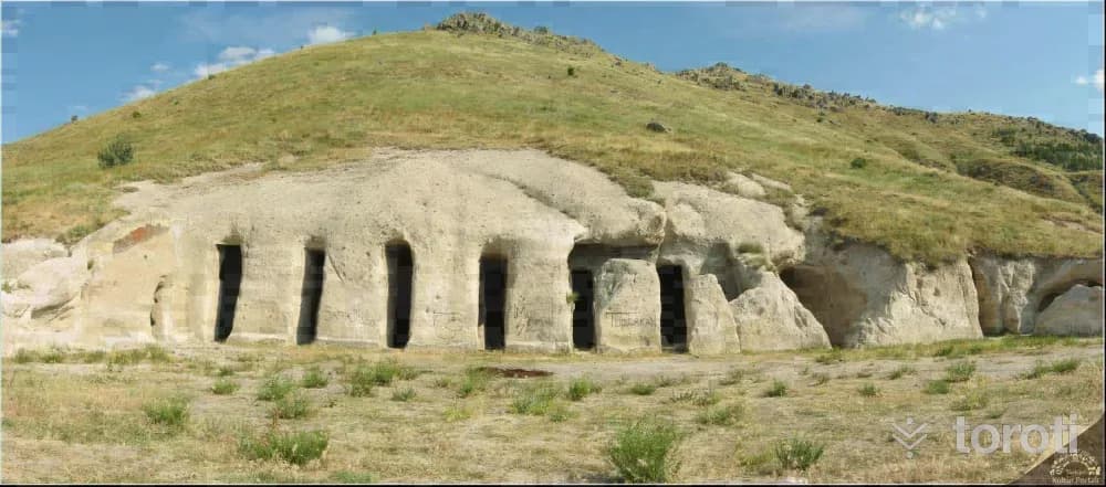
Yedikapilar Kaya Yerleşimi
Yedikapılar Rock Settlement is located approximately 3,5 km northeast of Kemerkaya village in Bolvadin district. It is a U-shaped complex carved into the main rock, consisting of interconnected rooms arranged around a courtyard. The Yedikapılar Underground Settlement, carved into the tuff rock beneath the ground, is located here. The underground settlement consists of rooms and galleries formed by carving the tuff rock.
45 minutes
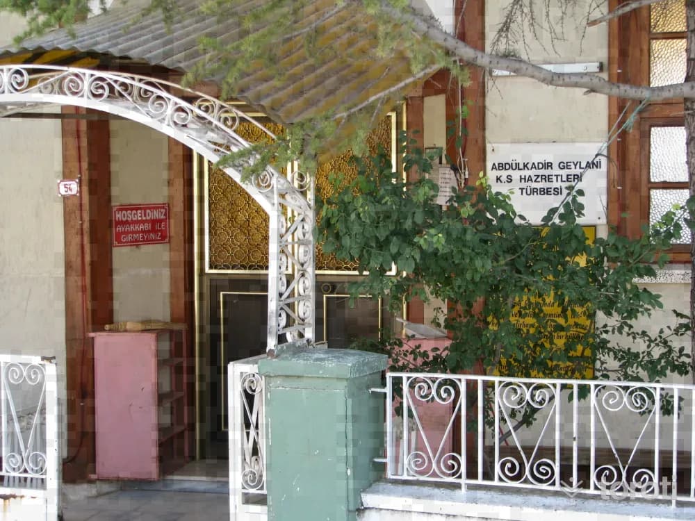
Abdülkadir Geylanı Türbesi
There is a tomb belonging to Abdülkadir Geylani, one of Abdülkadir Geylani’s grandsons, and a mosque next to it. Inside the tomb, there are also many sarcophagi belonging to disciples. According to documents, Abdülkadir Geylani came to Bolvadin at the beginning of the 17th century and founded the lodge of the Kadiri Order in Şıhlar (Ağılönü) Neighborhood. This lodge was turned into a complex with a guesthouse, retreat cell, school, and madrasa. Where is Abdülkadir Geylani Tomb?
45 minutes
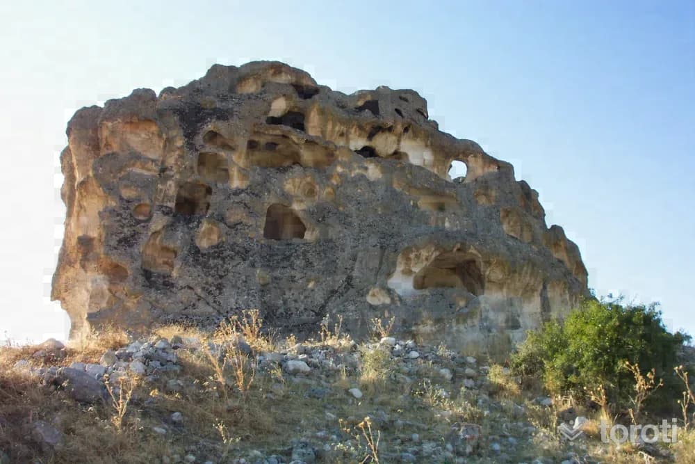
Avdalaz Kalesi Kaya Yerleşimleri
In the lower parts of the rock mass located to the east of Ayazini Town, there are burial chambers, and in the upper parts, there are interconnected multi-storey settlements. Rather than a settlement, it is a fortress built for الدفاع purposes. Inside Avdalaz Castle, there is also a large cistern to meet needs. It is understood that Avdalaz Castle was used for defense against enemies from the fact that it was built on a rock mass dominating the surrounding area.
45 minutes
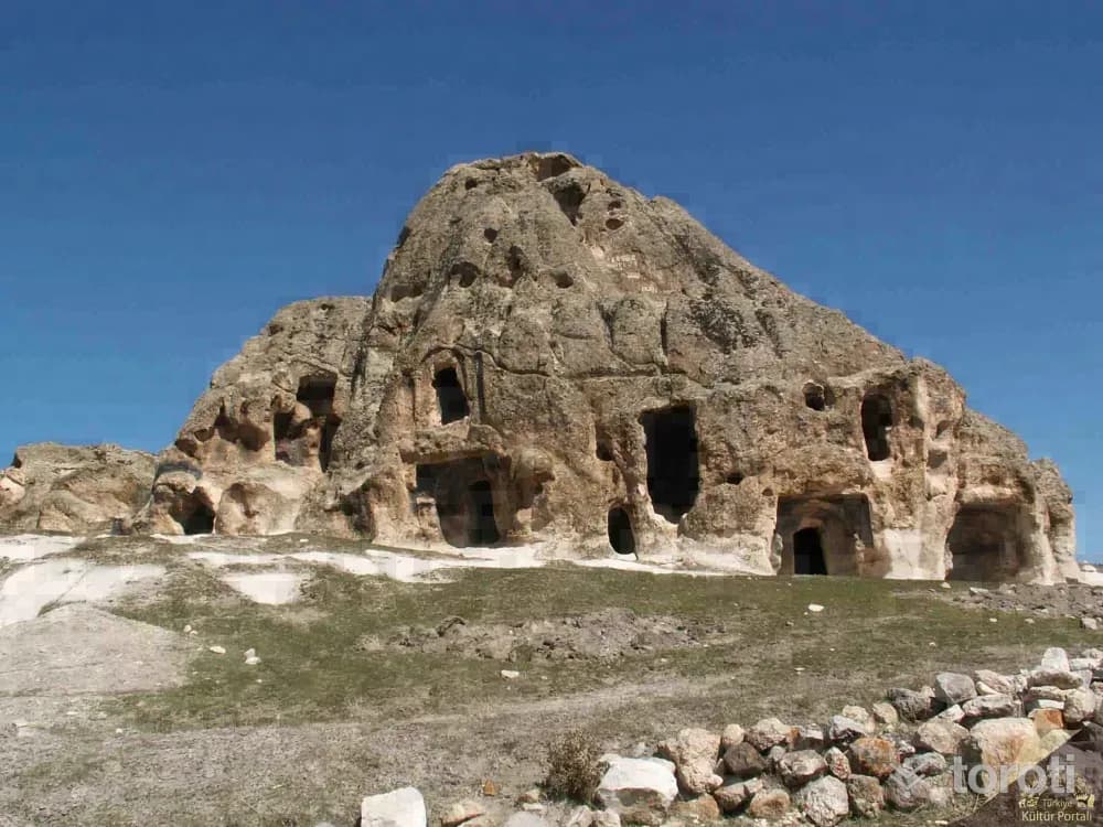
Derbent Elicek Kaya Mezar Odaları
Derbent Elicek Rock Tomb is located in Bayat district, Derbent village, in Ericek locality, 4,5 km southeast of Bayat district center. It is an archaeological necropolis and rock settlement consisting of numerous rock spaces and rock tombs. Photo: Afyonkarahisar Museum The tomb chambers are generally single-roomed, with triangular hipped roofs and vaulted ceilings. Niches are also found near the tombs and spaces.
45 minutes
Bininler Kaya Evleri
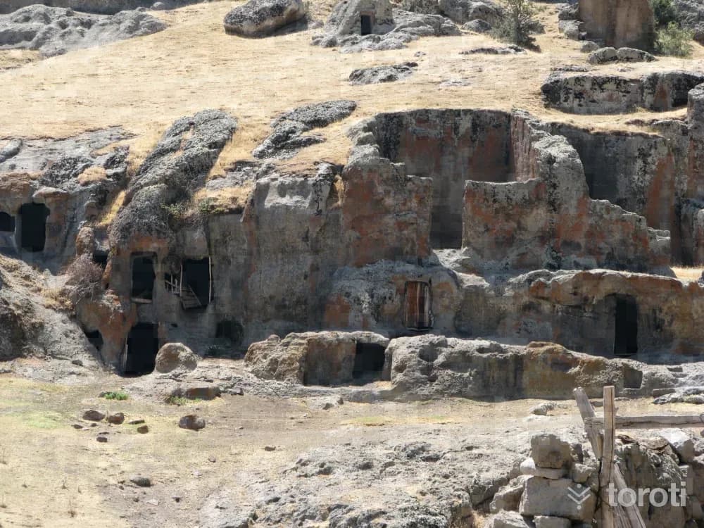
Bininler Rock Houses are located in difficult-to-access mountainous terrain in Şuhut district, in Senir village, about 4 km west of the village. On the north bank of Senir stream, along the streambed with andesite characteristics, they were carved side by side and one above the other in three sections separated by small rivulets in the rocky terrain approximately 150-200 meters long. The lower floors of the houses were made as shelters for animals, and the upper floors as living spaces for people.
45 minutes
Kano Gezintisi - Emre Gölü
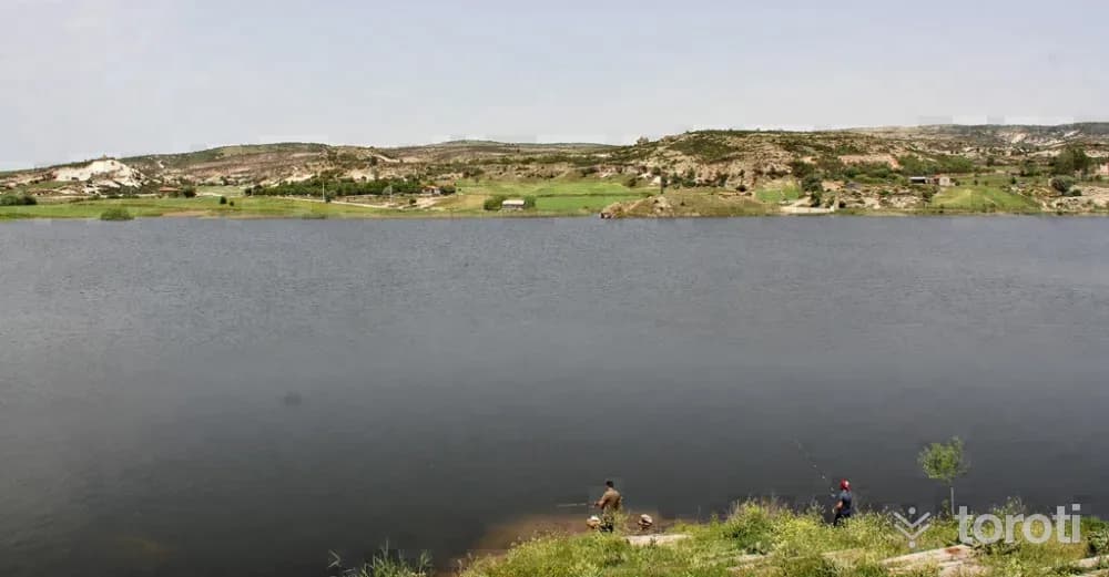
It is a naturally formed lake within the borders of Afyonkarahisar. It is between Döğer Town and Bayramaliler Village, connected to İhsaniye District. Depending on the rainy periods, its area narrows and expands. Its depth exceeds 3 millimeters in some places. Its waters are fresh. Emre Gölü provides the opportunity to see many beauties of Frig Vadisi. On the canoe trip you will take on the lake, you can also see many works located in Frig Vadisi.
45 minutes
26 Ağustos Tabiat Parkı
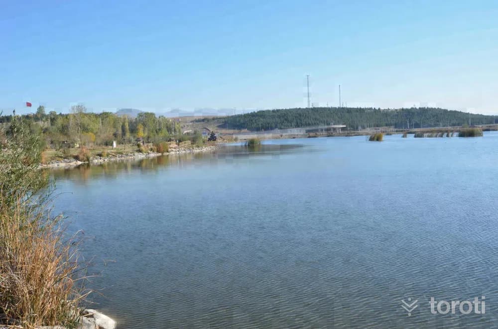
26 Ağustos Nature Park is in Afyonkarahisar Sinanpaşa district. The park's total area is 64.83 hectares.
45 minutes
Demirli Kalesi
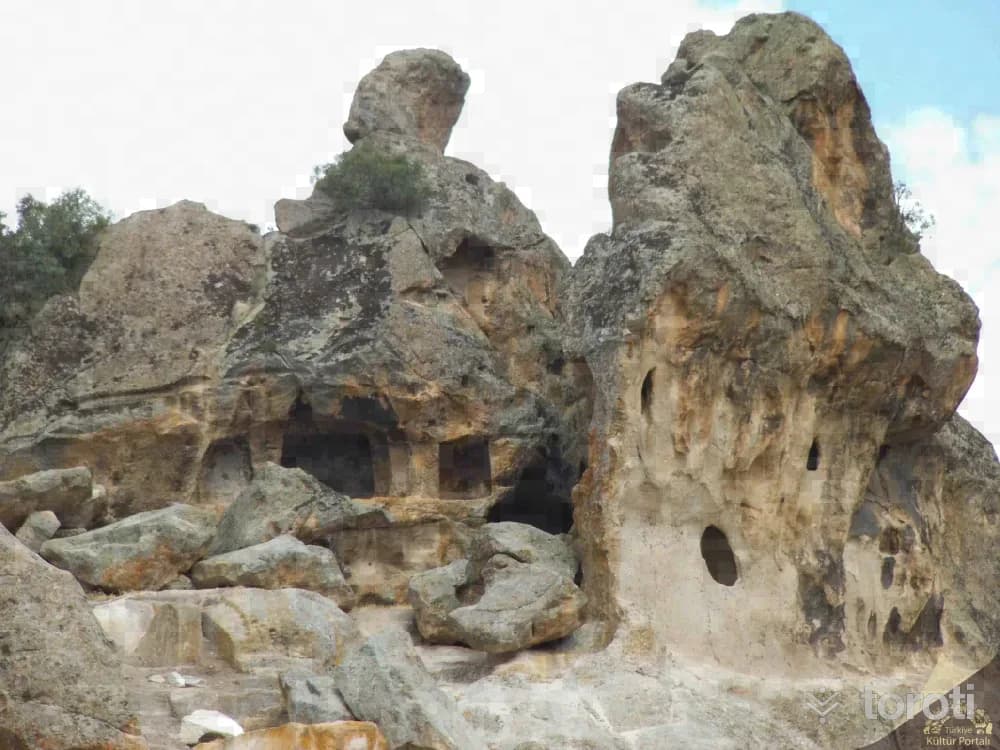
Demirli Castle, located within the borders of İhsaniye District in the northwest of Göynüş Valley, began to be used during the Phrygian Period and continued to be used during the Byzantine period. Various spaces were created by carving the natural rock formation described as a castle, and it was inhabited. Today, a large stepped cistern, now filled with stone, can still be seen.
45 minutes
Asar Kalesi
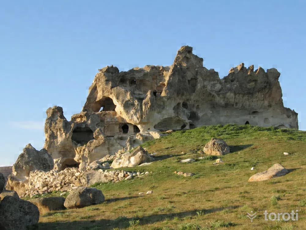
Asar Kalesi is a conical mountain and rock mass at a significant elevation on the foothills of Köroğlu Dağı, about 4 km. west of Bayat District of Afyonkaarhisar, and the open sections are surrounded by walls. Within the walls are a vaulted cistern and foundations belonging to religious and administrative structures. In the eastern part of Asar Kale, there are settlements carved into the rocks, a church, and loopholes used for observation and defense.
45 minutes
Böcü İni Kaya Yerleşimleri
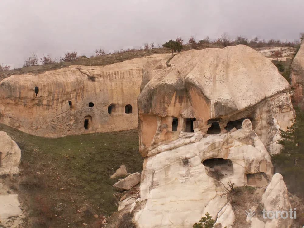
It is a rock-carved settlement called Böcü İni in the Kaynarca locality of Kıyır village, İhsaniye district. The settlement is located on slopes facing south. In this settlement on the southern slope of Laleli Tepesi, within tuff terrain, there are many rock-carved churches and settlement areas from the Byzantine period, side by side and in separate groups, together with the natural wonder fairy chimneys. The churches are vaulted.
45 minutes
Frig Vadisi - Döğer Kapikaya Ii Tapinağı
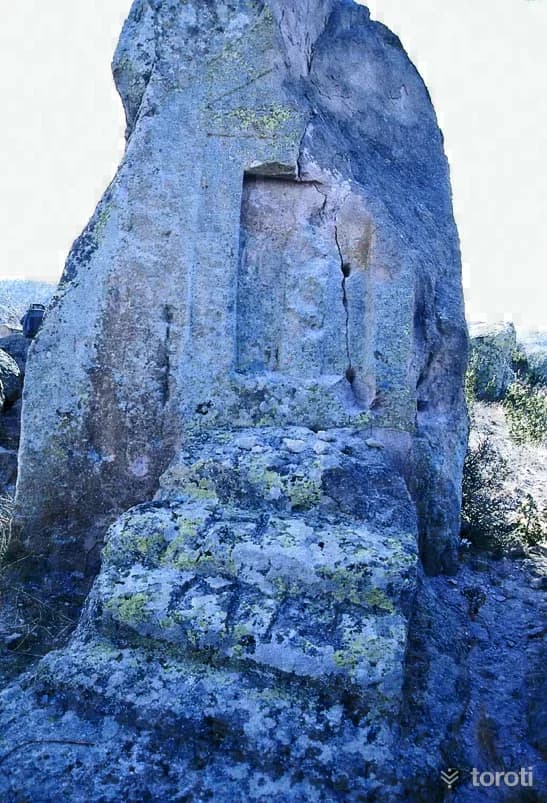
The second Kapıkaya is among the rocks extending from the shore of Emre Gölü toward Bayramaliler Köyü in the same region. It is an imitation of a wooden temple made by cutting the western face of a piece of rock whose upper part has eroded away. Because the structure of the rock is loose, the triangular roof section at the top has eroded. A niche was opened on the front face between two decorated sections, and inside it a standing relief of the Goddess Cybele was made. In front of the monument there is a platform for religious ceremonies.
45 minutes
Gazlıgöl Termal Kaplıcaları
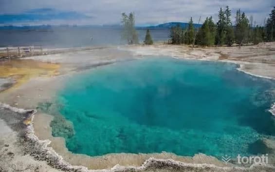
Not only the bath of this region but also its mineral water is known as an important source of healing, and Kızılay Maden Suyu, Turkey's oldest bottled mineral water, which has been operating since 1868, is also located in Gazlıgöl.According to the legend, the boils that appeared on the body of King Midas's daughter Suna could not be treated in any way. While wandering for treatment, Suna drank from the muddy puddle in the area where the hot spring is located and fell asleep.
60 minutes
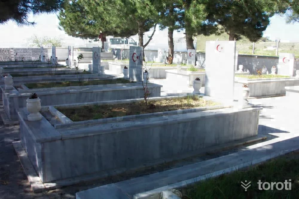
Giresunlular Şehitliği
It is located in Doğanlar Village, affiliated with İscehisar District. The first arrangement for the 14 people from Giresun who were martyred at Dedesivrisi (Sivritepe), which was captured by the 47th Regiment formed by people from Giresun during the War of Independence, was made in 1967 by Hacı Ahmet Halis Asal from Giresun, and in 1990 it was turned into the martyrdom memorial where the present monument and graves are located.
45 minutes
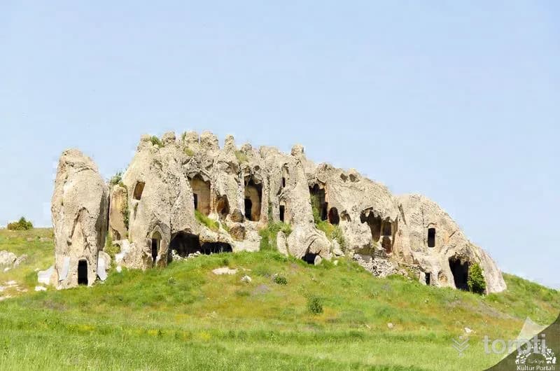
Selimiye Kayaliklari
Selimiye Rocks are located in İscehisar district, Alanyurt village, immediately south of Selimiye Neighborhood. On the eastern face of the rocks, which are also called Hanay İnleri by the local people, there are numerous rock tombs. Although there are also examples of rock tombs with plain facades, the rock tombs with triangular pediments and monumental facades are particularly striking.
45 minutes
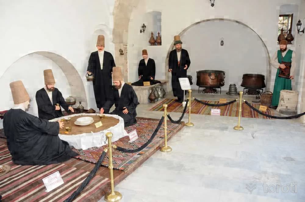
Sultan Divanı Mevlevihane Müzesi
It is one of the first Mevlevihanes established in Anatolia. Its foundation dates back to the 13th century. Afyonkarahisar Mevlevihanesi, which has been the center of many important activities throughout history, is the most important Mevlevihane after Konya Mevlevihanesi. It became a very important center in terms of Mevlevi order, especially in the 16th century during the time of Sultan Dîvânî, one of the seventh-generation descendants of Hz. Mevlânâ.
45 minutes
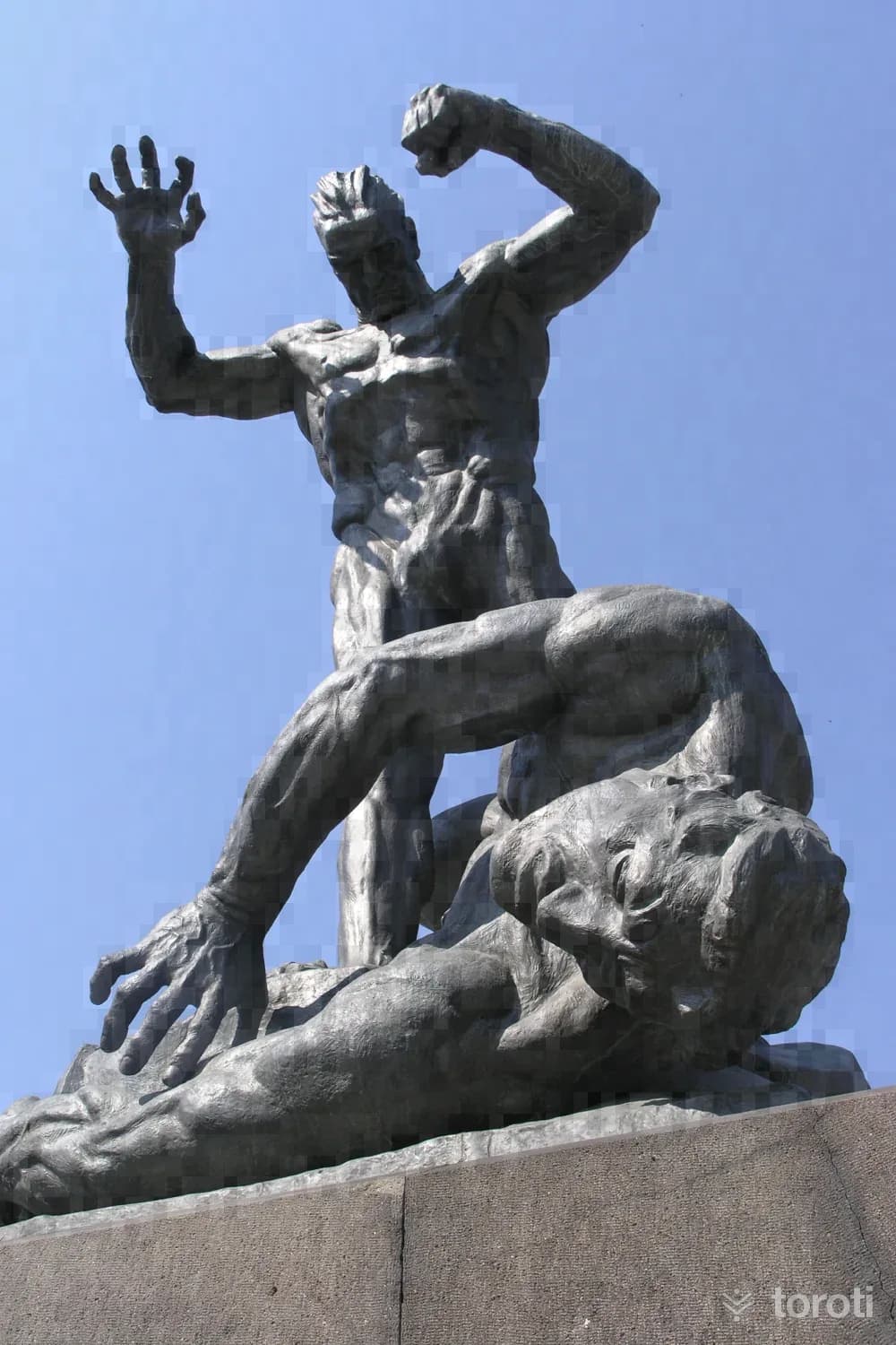
Zafer Anıti
In memory of the Great Offensive, the monument, whose construction was started in 1932 by the Australian sculptor Heinrick Krippel, was inaugurated on 25 March 1936. The sculpture in the Zafer Anıtı (Utku Anıtı) consists of two male figures on rocky terrain, one lying down and the other standing. The height of the bronze sculpture group is 5,15 metres from the base, and the monument height is 7,95 metres.
45 minutes
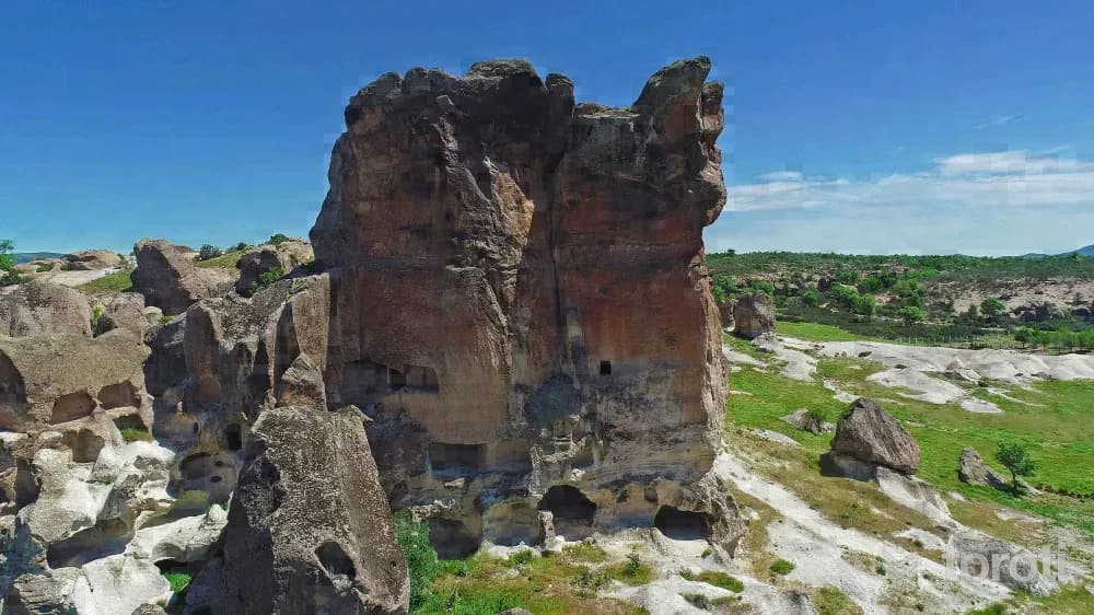
Üçlerkayası
In and around Üçlerkayası village, which is connected to the İhsaniye district of Afyonkarahisar, there are rock settlements, monumental burial chambers, Roman tombs on the upper parts of the rocks, and water cisterns belonging to the Roman and Byzantine periods. Some of the multi-storey rock settlements around the large rock mass that gave Üçlerkayası its name have not yet been reached.
45 minutes
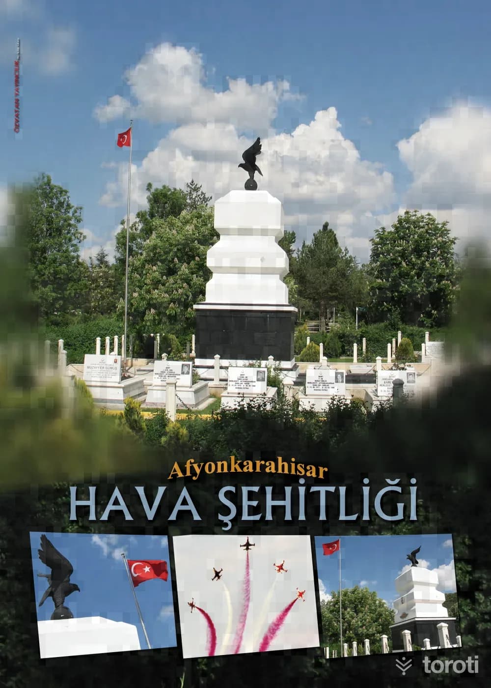
Hava Şehitliği
Hava Şehitliği is a martyrdom where, in the middle of the City Civil Cemetery, there is a monument consisting of cubic elevations rising on a cubic base, and around it are the graves of the martyrs. It was built in 1936 in memory of the pilots named Cemal and Bahattin, who joined the War of Independence on the morning of 24 July 1922 with their ramshackle plane and were martyred when their plane crashed in Gazlıgöl.
45 minutes
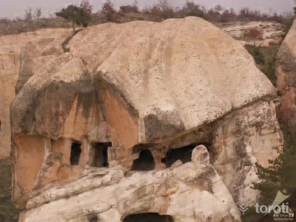
Kiyir Kayaliklari
Kıyır Cliffs is a rock-cut settlement called Böcüini in İhsaniye district, Kıyır village, Kaynarca locality. The settlement is located on slopes extending southward. Photo: Afyonkarahisar Museum This settlement on the southern slope of Laleli Hill has fairy chimneys, a natural wonder, in tuff terrain, and many rock-cut churches and settlements from the Eastern Roman period, side by side and in separate groups.
45 minutes
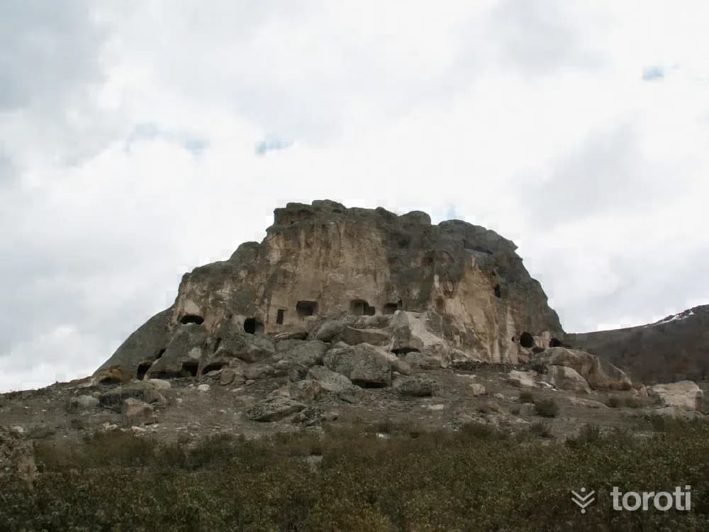
Kuzu İni Mağarası
Kuzu İni Cave is 7 km from the town of Balçıkhisar in Şuhut district and is located higher up than Karacamal Cave. Since sheep were kept at its entrance sections, it was called Kuzu İni Cave. At the end of the cave, which extends in the form of a narrow corridor, there is a medium-sized gallery. The cave, where stalactites and stalagmites are frequently seen, is the most striking among the caves examined so far.
45 minutes