
Stops along the way
Stops between Trabzon and Artvin
258 km, roughly 5 hours of driving. The stops below are ordered as you pass them — the same road in both directions.
In short
The drive between Trabzon and Artvin is 258 km and takes roughly 5 hours. There are 296 described places within 20 km of this route; it crosses 4 provinces, and the densest stretch is in Artvin (72 places).
There are 296 places within 20 km of this corridor; the 40 below are spread evenly along the drive.
1
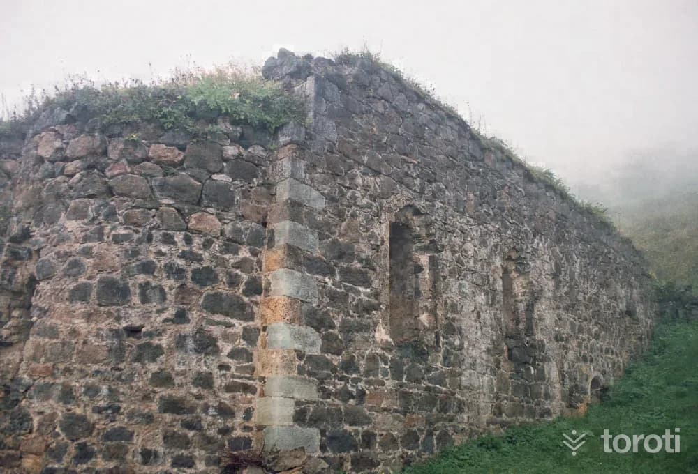
Santa Harabeleri
Gümüşhane merkez, Gümüşhane
Santa Ruins is located approximately 82 kilometers from the city center of Gümüşhane, within the borders of Dumanlı Village of Yağmurdere Township. Santa was established on three separate slopes divided from each other by the valleys where the Santa Yanbolu Stream originates. The Santa Region was conquered during the period of Fatih Sultan Mehmet - between 1461-1476 - together with the whole of Trabzon and the Eastern Black Sea region, and was incorporated into the lands of the Ottoman Empire.
- No image
2
Ahi Evren Dede Camii
Ortahisar, Trabzon
It is adjacent to Ahi Evren Dede Camii located in Boztepe. The square-planned tomb is covered with a dome. This tomb, restored by Hacı Hakkı Baba in 1887-1888, took its present form. Next to the grave of Ahi Evren Dede are also the graves of Hacı Hakkı Baba and his sons.
- No image
3
Kuş Gözlem
Ortahisar, Trabzon
Bird Watching Trabzon plateaus and especially Altındere Valley National Park offer favorable opportunities for bird watchers. The National Park is within the borders of Maçka district. It is quite rich in terms of biodiversity and bird diversity.
4
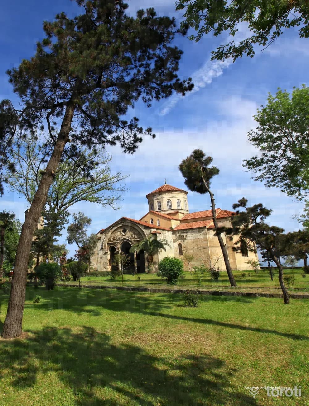
Ayasofya Cami
Ortahisar, Trabzon
Ayasofya Cami was reopened for Muslim worship after 52 years, with the performance of the daily prayer on Friday, 28 June 2013. Trabzon Ayasofya Museum, which is a mosque today, was built during the reign of 1. Manuel Komnenos, one of the kings of the Trabzon Empire (1238-1263). The bell tower, dated to 1427, is located to the west of the church. The remains of the three-apsed chapel to the north of the church belong to an earlier period.
5
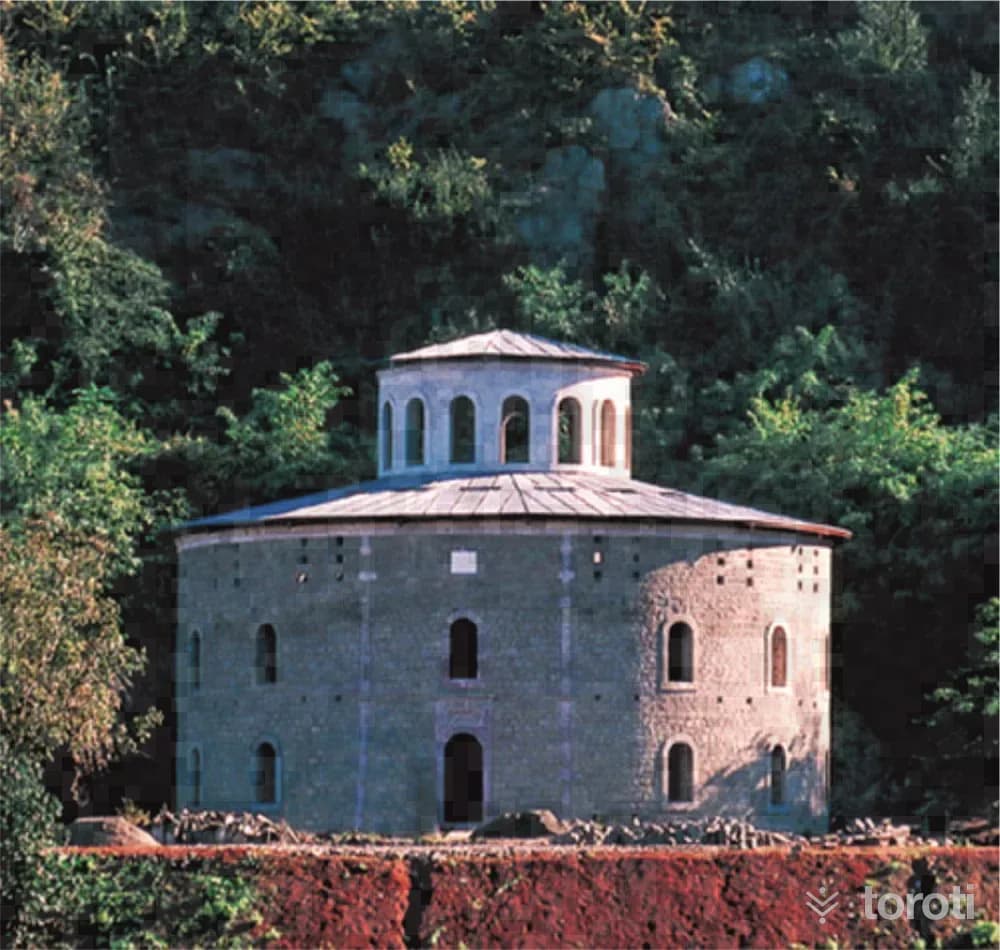
Cephanelik
Ortahisar, Trabzon
Cephanelik is one of the most striking and debated structures among the buildings of Trabzon. Under the photograph of the structure in the Yıldız Sarayı albums, it is written that it was commissioned in the year H.1305. The tughra of Abdülhamit II above its door and the inscription also confirm this. It is clearly understood that Cephanelik was commissioned in 1887. It consists of two concentric circular sections with an approximate diameter of 25-40 meters. The inner section has four storeys, while the outer section has three storeys.
6
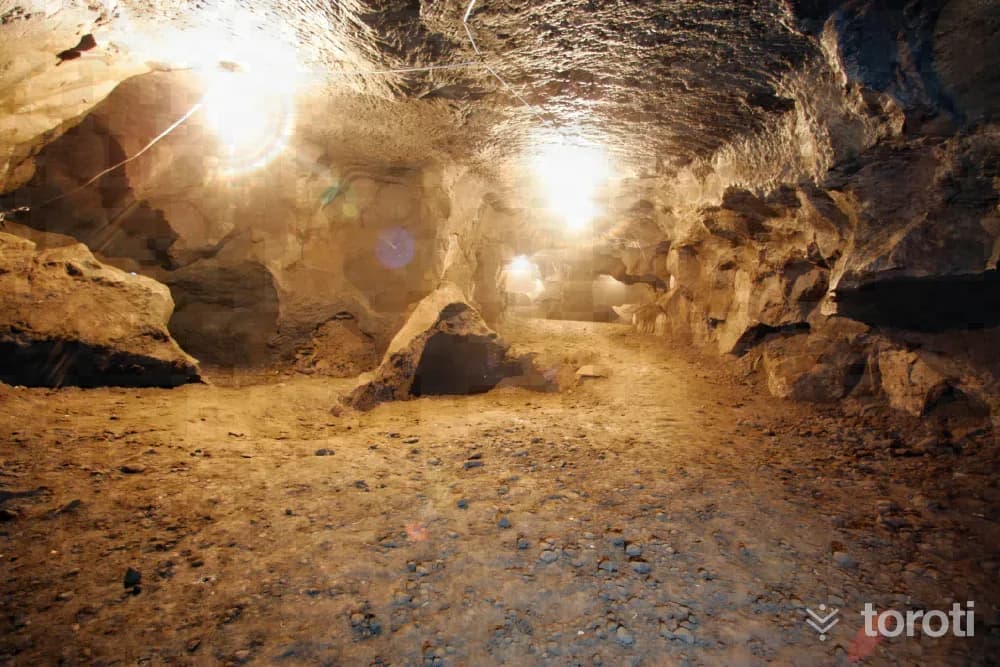
Pileki Mağarası
İyidere, Rize
Pileki, made from a special stone, is a kitchen utensil unique to the Black Sea region, and it is round and in the form of a hollowed-out bowl. This special stone is extracted and processed from Pileki Cave in İyidere Çiftlikköy, and as a result of this process, which has been carried out for thousands of years, Pileki Cave was formed. The cave consists of two large areas at the entrance and many tunnels behind them, and there are wells and lakes inside it.
7
Çay Müzesi (beyaz Ev)
Rize merkezi, Rize
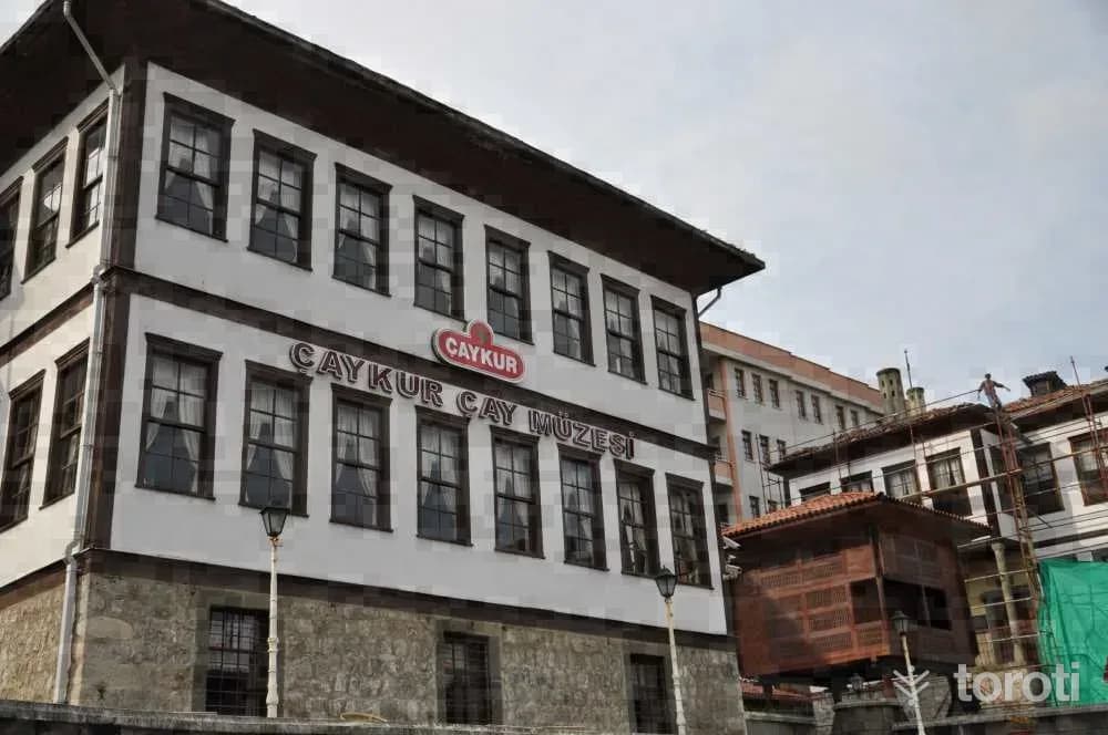
It is located in the city center next to Rize Museum (Sarı Ev). The structure, consisting of a stone basement and two normal floors, dates to the 19th century. The building, which contains local residential architectural features, has a square plan. Today, it is used by the General Directorate of Tea Enterprises as the Tea Museum called "The Adventure of Tea"; where the stages of tea production from past to present are explained and the machinery and equipment used in its production are exhibited.
8
Doğa Yürüyüşü
Rize merkezi, Rize
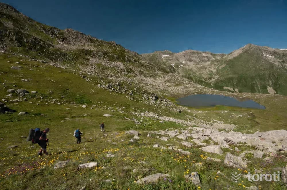
Nature walking (Trekking) is one of the most enjoyable tourism activities you can do in Rize. Nature walking offers all opportunities from the simplest to the most difficult. Nature walking can be done in Rize in every season. For nature walks where you can pursue many interests such as relaxing, doing sports, taking photographs, birdwatching and botany within a single activity, village and plateau roads, trails and many alternatives are offered.
9
Doğa Fotoğrafçiliği
Rize merkezi, Rize
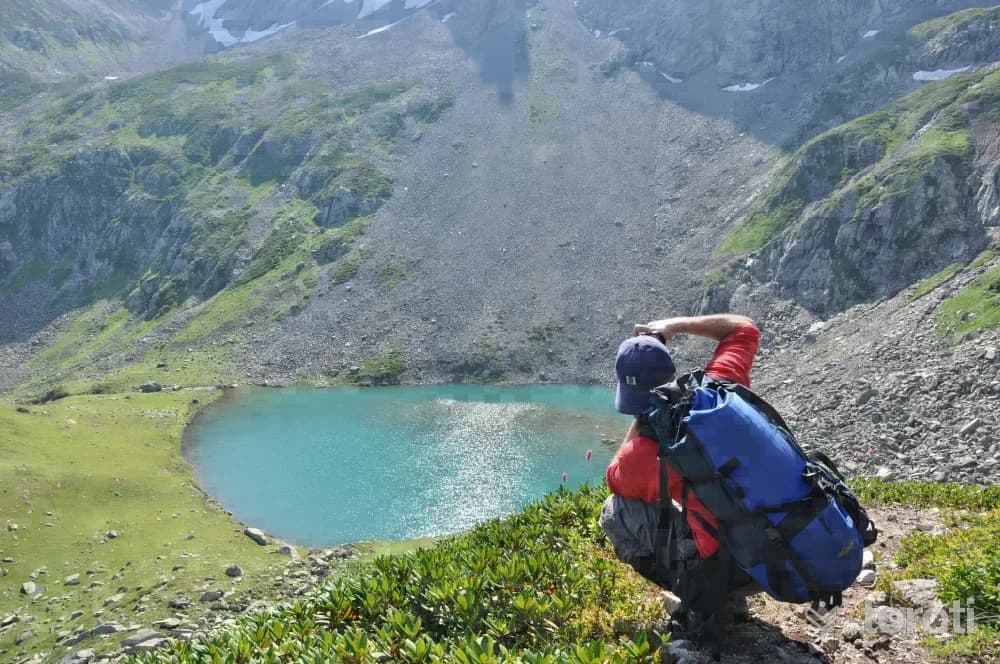
In Rize, which has a unique natural beauty, tours are organized for photography enthusiasts where unique shots can be captured. In the Kaçkarlar, reaching an altitude of 3900 meters, you can fit into a single photograph the exquisite landscapes born from the togetherness of plant and animal species as well as mountains, clouds, and people. Rize, which has a different beauty in every season, offers great opportunities for photography enthusiasts.
10
Hüseyin Hoca Köyü Sahil Camii
Rize merkezi, Rize
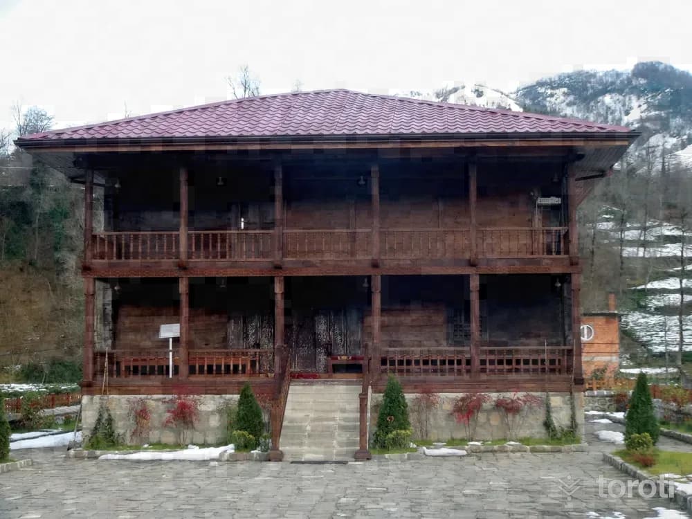
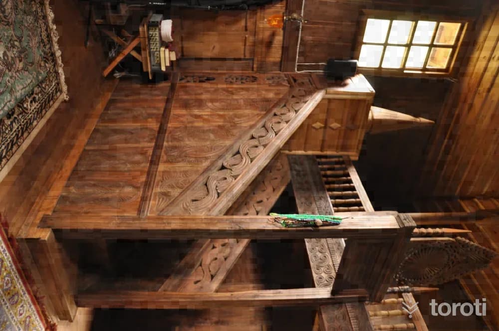
The mosque was dismantled from Keler Village of Of District and brought to Hüseyin Hoca Village in Kalkandere District. On the inscription located on its pediment, there are four lines of writing and the date H.1250. It is made entirely of wood. On the surface of the wooden mihrab, there is an ornamental band with muqarnas, braid, and tulip motifs respectively. It is a work that contains rare examples of Black Sea wood carving and woodworking arts.
11
Atatürk Evi Müzesi
Rize merkezi, Rize
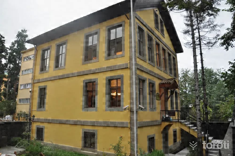
The house, reflecting the characteristics of 20th century Turkish architecture, is one of the examples of civil architecture with regional value in architectural and cultural terms. It was built as three floors over a basement within the garden. Photo: Rize Provincial Directorate of Culture and Tourism The basement, built with stone material, was used for storage purposes. The upper floors are living spaces.
12
Kaptanpaşa Köprüsü
Çayeli, Rize
Kaptanpaşa Köprüsü is an arch bridge located in the Çayeli district of Rize. The bridge has a single span and a round arch. Cut stone was used in the arch and railings of the bridge, while rubble stone material was used in the other parts. Tanıtma Genel Müdürlüğü The bridge extends in an east-west direction. The bridge roadway was built with irregular rubble stone. The arch piers were seated on the bedrock in the stream bed. The bridge is 26 meters long and 2,40 meters wide.
- No image
13
Aşıklar I Köprüsü
Çayeli, Rize
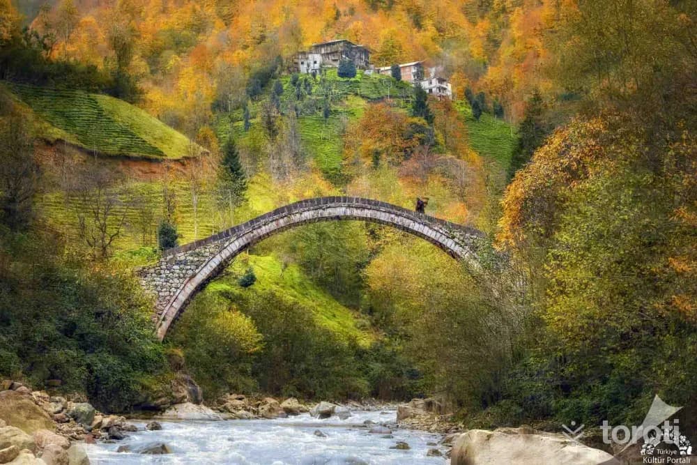
The bridge, extending in an east-west direction, has a round arch and a single span. It is located on Aşıklar stream between Yalı Mahallesi and Yeni Pazar Mahallesi, approximately 3 kilometers from Çayeli District.
14
Kız Kalesi
Pazar, Rize
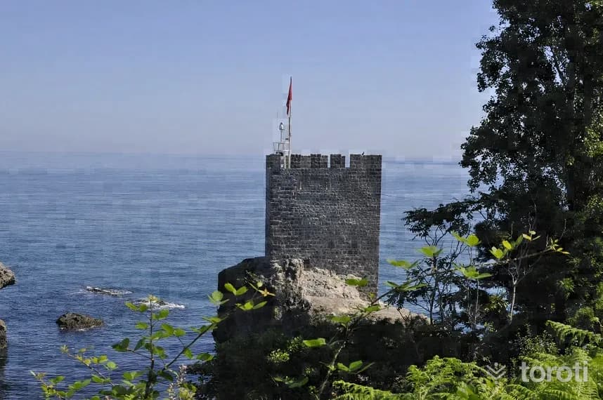
It is built on a small peninsula to the west of the Pazar district center. The castle, which stands on a rocky ground, has been cut off from the land. The regular stone workmanship on its walls is striking. Although its construction date is not known for certain, it is thought to have been used in the 13th or 14th centuries. Today, it stands with a single watchtower.
15
Ciha Kalesi
Pazar, Rize
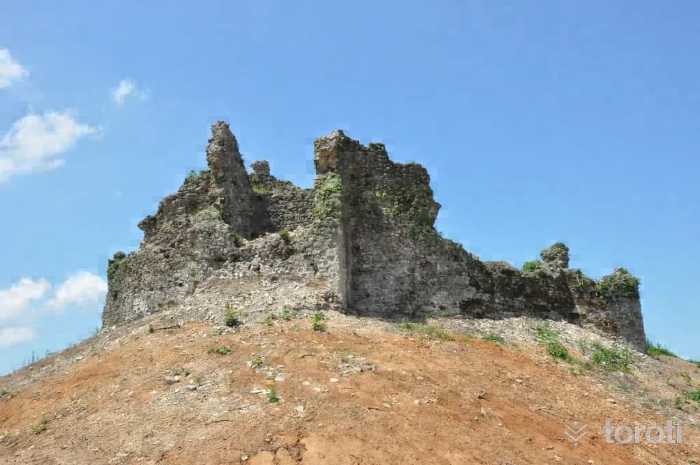
It is located to the east of Hemşin Deresi. It has a circular plan. The stonework of the fortification walls is not regular. The entrance gate of the castle is in the northeast and is supported by two towers. In the middle, there is another tower with a circular plan. It is thought to have been used for surveillance and communication. Restoration works have been initiated by the Ministry of Culture and Tourism.
- No image
16
Kavak Köprüsü
Çamlıhemşin, Rize
Kavak Bridge is the first bridge of the old transportation system located over Hala Stream in the Çamlıhemşin district. The bridge, 1 kilometer from the district center, was built by the local people in the 19th century. Kavak, one of the most photogenic bridges in Rize, is 36 meters long and 15 meters high. Like its other similar examples in Fırtına valley, it is also registered by the Monuments Board.
17
Kale-i Bala
Çamlıhemşin, Rize
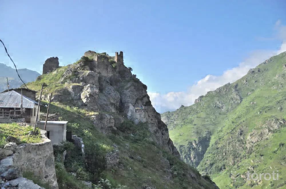
It is located within the borders of Hisarcık Village, 40 kilometers from the Çamlıhemşin district center, at a point overlooking Fırtına Deresi. It shows similarities with Zil kale in terms of topography and wall masonry, therefore it is thought to belong to the same period. (14-15th centuries) It is located close to Başhemşin and Tatos Pass, through which the Kaçkarlar provided passage to Anatolia. The rectangular-planned castle was built on a steep rock.
18
Işikli Camii
Ardeşen, Rize
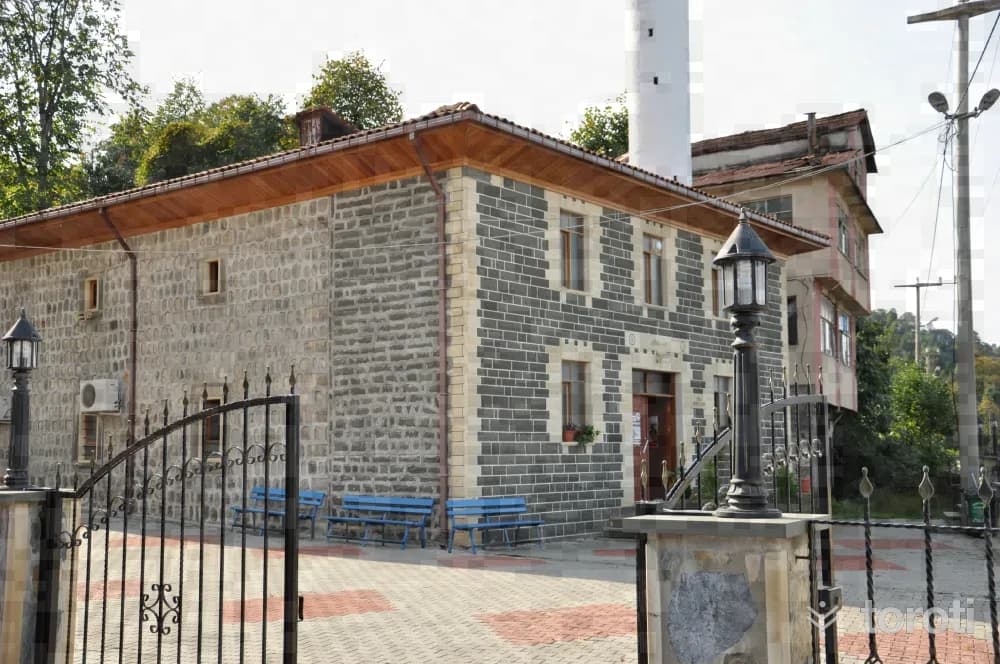
The Mosque, located in Işıklı village, was built in 1887. The structure has a rectangular plan and is made of cut stone. The narthex on the north facade and its roof have been repaired. Its wooden elements and decorations are noteworthy. On the ceiling, there is a dome with a star motif in the center, decorated with painted ornamentation.
19
Kulaber Köprüsü / Aşağı Durak Köprüsü
Ardeşen, Rize
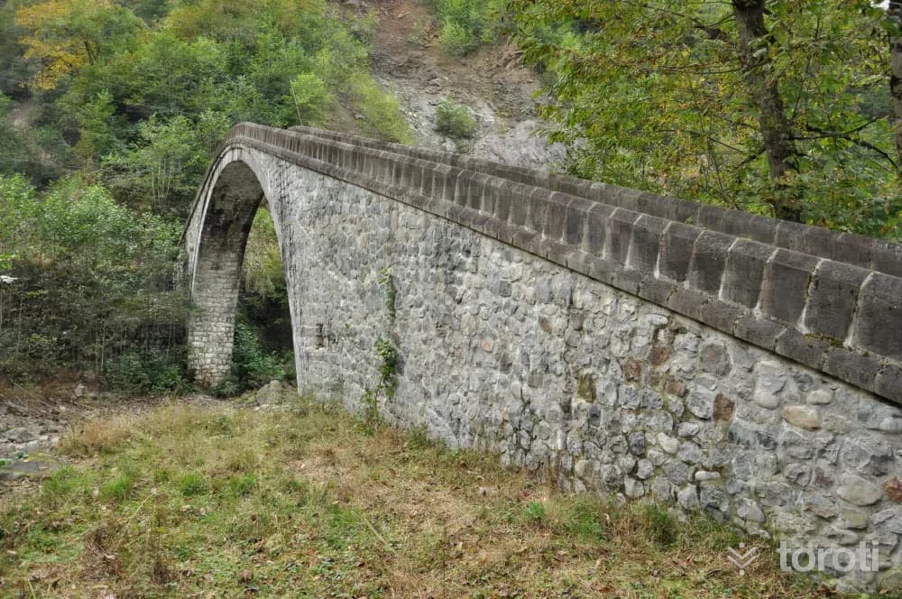
The railings and arch of the round-arched, single-span bridge were built of cut stone, while the other parts were constructed of rubble stone. In the middle of the bridge, there is a chain hanging down from the arch that provides the plumb adjustment. There are posts and steps at the bridge entrances. The date 1261 is written on the posts at the entrance on the roadside.
- No image
20
Deremezra Yaylası
Ardeşen, Rize
It is located within the Tunca Valley, which was declared a nature park. Situated at an altitude of 1100 meters in an environment surrounded by forests, the plateau offers a beautiful scene that prolongs human life. You can photograph the historic stone arch bridges you will see along the route.
21
Meyveli Köyü Camii
Fındıklı, Rize
It was built entirely of wood as a two-story structure. According to the construction inscription, it was commissioned by Mustafa Bin Alişan in H.1288- M.1871. The mosque, which has no minaret, is covered with a hipped roof.
22
Ciha Kalesi
Arhavi, Artvin
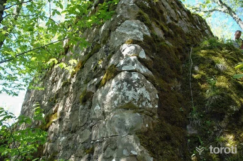
This castle, set on rocks at the summit of Arhavi district, is said to date from the Genoese Period. The trees around it are so dense that they do not allow access to the castle. Its construction date has not been determined with certainty, and only the remains of its walls have survived to the present day. The castle overlooks both the coastal side and the inland areas and has strategic importance.
23
Musazade Mahallesi Cami
Arhavi, Artvin
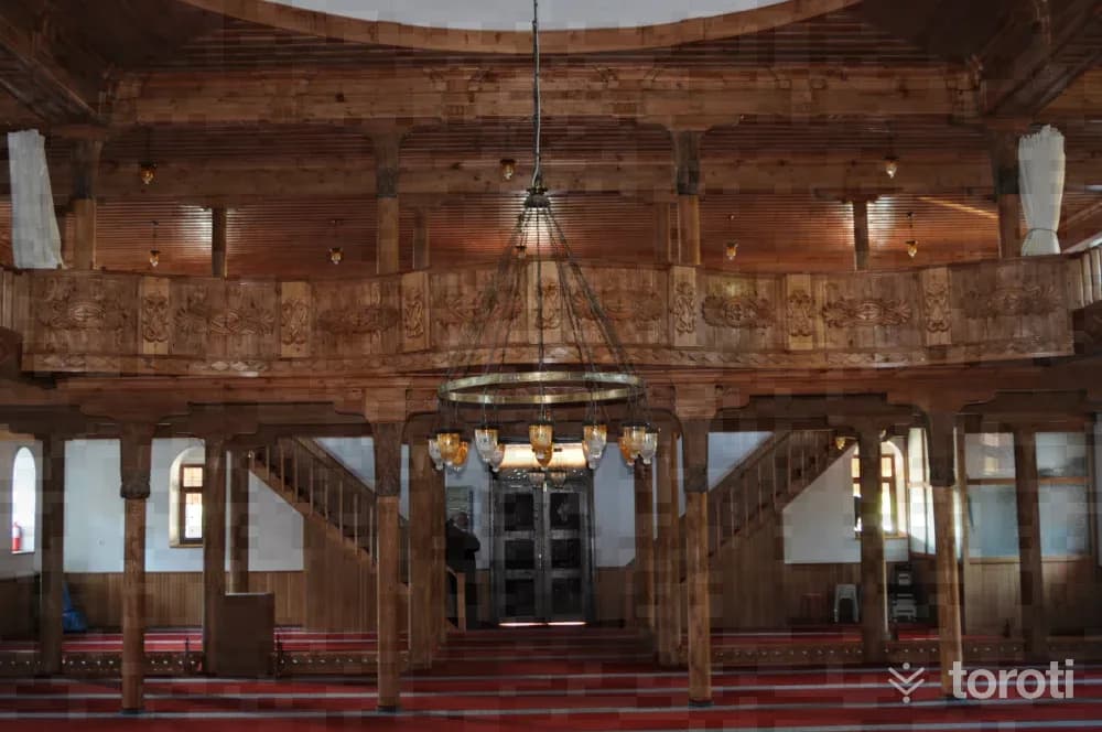
The mosque, located on a flat square near the coast, has a last congregation area to the north, its minaret to the northwest, and two doors, and has a rectangular plan measuring 22.50 X 16.50 m. externally. The east facade consists of these surfaces of the main space and the last congregation area. On the surface of the main space, there are a total of twelve rectangular windows in two rows, with the lower ones made larger, framed, and with flat lintel arches.
24
Ortacalar Köyü Cami
Arhavi, Artvin
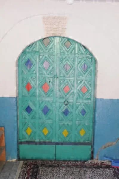
Ortacalar Merkez Camisi is located in Ortacalar Village, in the Arhavi District of Artvin. It was built in 1757 (Hijri 1170). The pulpit and ceiling decorations of the mosque are noteworthy. According to its inscription, the building was constructed in Hijri 1170 (A.D. 1757). In 1908, its wooden pulpit was made together with the wooden ceiling. In 1955, its minaret was added, and in 1964 the last congregation area was brought to its present form. The mosque, which has undergone partial repairs, is open for worship.
25
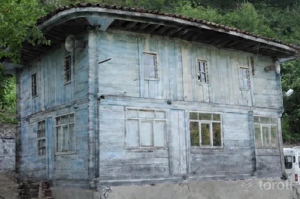
Ulukent Köyü Cami
Arhavi, Artvin
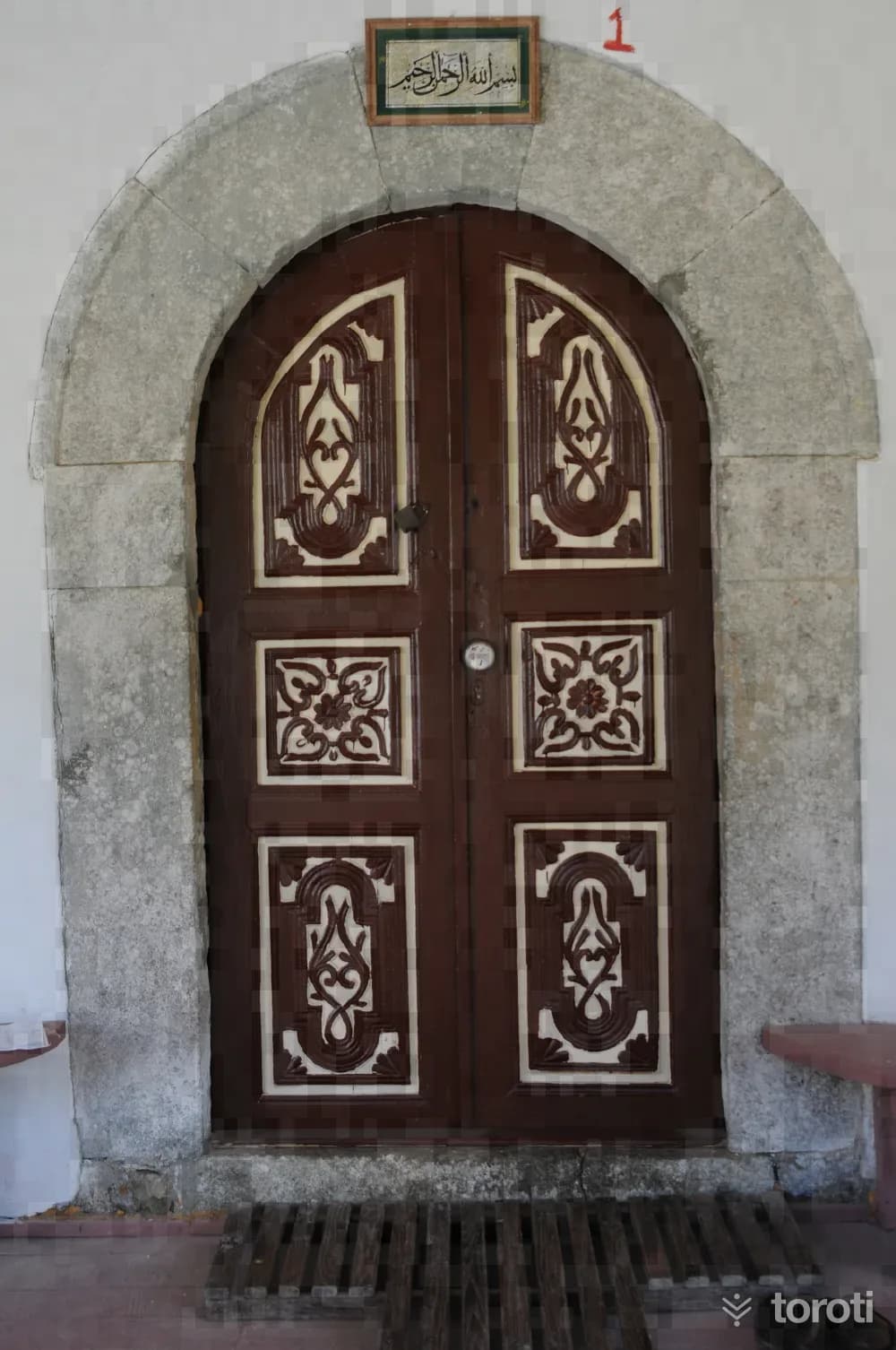
The structure, which has no inscription, was built in the early XIX century according to records. In 1896, the last congregation area was added. Its minaret, originally wooden, was blown down by the wind, and today the stone minaret has been rebuilt.
26
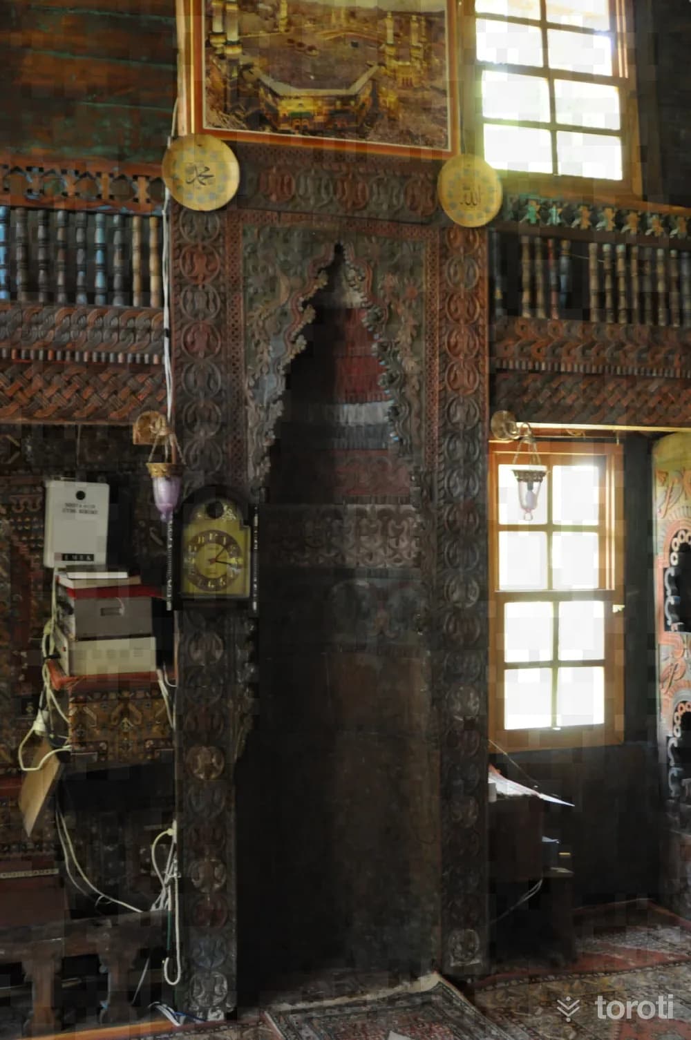
Çavuşlu Köyü Cami
Hopa, Artvin
The mosque, located in Çavuşlu Köyü in Borçka District, was built on flat land. According to the inscription above the entrance door of the mosque, the mosque was built in 1860. The two-storey structure has a rectangular plan. The entrance door is reached by means of stairs. Wood was used in almost the entire mosque. Its mihrab is wooden and was made using the carving technique. The mosque is covered with a hipped roof.
27
Düzköy Merkez Mahallesi Cami
Borçka, Artvin
It is located in Borçka Düzköy. Although it does not have an inscription, according to the plaque hung on the north facade as a result of later determinations, it was built by the villagers in Hijri 1266 (1850 AD). The mosque, which has survived to the present day with temporary repairs, is open for worship. Below it is the basement floor, which was used as a madrasa in the past, and above it is the square-planned mosque, measuring 11.39x10.97 meters externally.
- No image
28
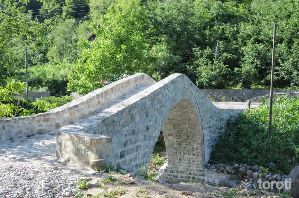
Kamilet Doğu Kayını Tabiat Anıti
Murgul, Artvin
The Beech Tree species located in Artvin Province, Murgul District, Erenköy Village, Kamilet locality is around 300 years old, 42 m tall, 3.08 m in diameter, and has a circumference of 9.70 m. It was established on 06.09.2002, and its area is 1.000 m².
29
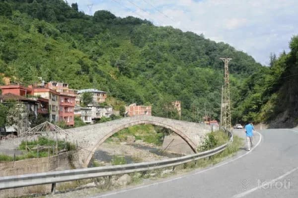
Aralik Köyü Köprüsü
Borçka, Artvin
The structure, which has no inscription, was probably built in the XVIIIth century. The bridge is 28 meters long and 2.40 meters wide. The structure, located on the stream passing by Aralık Köyü, belongs to the group of single-span bridges with a sloping roadway. The bridge opening is emphasized with a two-tiered arch. Smooth cut stone was used in the arch, and rubble stone material was used in the other parts. The road paving is also rubble stone, and the parapet walls are sound. Today it serves pedestrians.
30
Demirciler Köyü Köprüsü
Borçka, Artvin
According to local information, the structure, which has no inscription, was commissioned probably in the XVIIIth century by “Osman Paşa,” who was originally from the same village and had served as Governor in Köstence. The structure belongs to the group of single-span bridges with a sloping roadway. It is 33 meters long and 2.8 meters wide. The bridge opening is defined by a two-tiered pointed arch. The arch was built of neatly cut stone, and the other parts with rubble stone. The road paving is rubble stone.
31
Muratli Cami
Borçka, Artvin
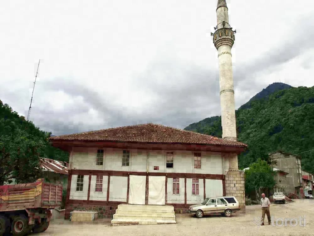
It is located in Borçka Muratlı Village. According to the inscription above the door providing access to the mahfil, the structure was built in Hijri 1262 Gregorian 1846 by Ahmet Usta (Aslan oğlu). Again, according to its inscriptions, in Hijri 1263 Gregorian 1847, its minbar was commissioned by Uzunhasan Zade Hüseyin Alemdar, and the mahfil floor by Sağıroğlu Hüseyin Ağa.
32
İbrikli Kilisesi
Borçka, Artvin
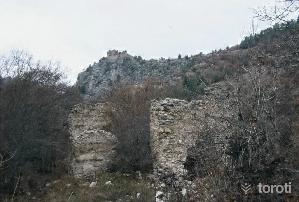
Although its name is not encountered in the literature, since it shows close similarities to other Christian religious architecture in the region, the structure was probably built during the Medieval Period in the time of the Bagratids. It is not known until what date the church continued to function; after the Islamization of the region, it was not used for any purpose. Today it is in a ruined condition. There is no inscription that has survived to the present day or been recorded.
- No image
33
Kara Göl
Borçka, Artvin
The lake is reached by climbing 200 m in elevation south of Çermeşk Lake. The entire valley can be viewed from the area, and it is in a location that can be seen on the same day as Çermeşk Lake.
34
Karçal Dağlari
Ardanuç, Artvin
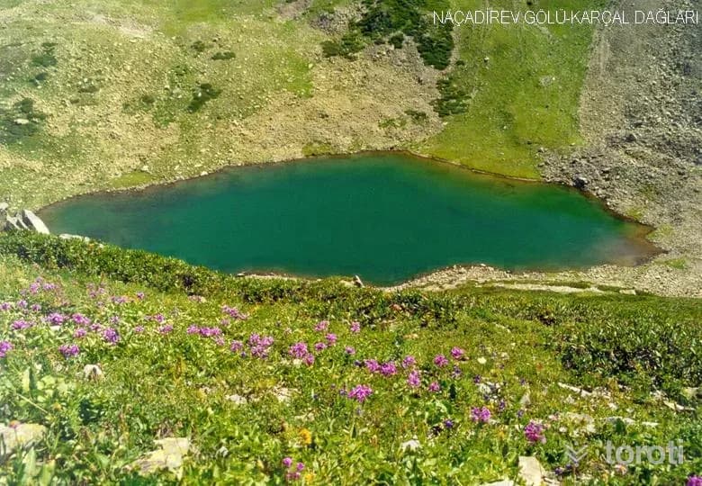
Along with the plateaus of Beyazsu Yaylası, Gorgit Yaylası, and Klaskur Yaylası, every village in the region has a plateau. These plateaus, located in the mountains between Türkiye and Georgia, are among the places to see in Artvin with their location on the migration routes of migratory birds, endemic plant diversity, and suitable trekking routes.
- No image
35
Hatila Vadisi Milli Parkı
Artvin Merkez, Artvin
Both its interesting geological and geomorphological structure and its unique plant community give Hatila Valley the characteristic of being an area rarely encountered in our country. In addition, the combination of these natural elements reveals landscape beauties and offers rich recreational potential. The Hatila Valley National Park area, within the boundaries of the central district, includes Hatila Stream and many of its tributary streams in Hatila Valley.
- No image
36
Artvin Kalesi
Artvin Merkez, Artvin
This castle, at the entrance of the city of Artvin on the bank of the Çoruh River, was commissioned in 937 by the Bagrat (Georgian) King Büyük Oşet. The old name of the castle was Livana. On the ruins of this castle, the Ottomans had a new castle built in the 6th century, and it was also repaired in various periods. It is a small castle and keeps the entrance to the city under control.
37
Merkez Çarşı Cami
Artvin Merkez, Artvin
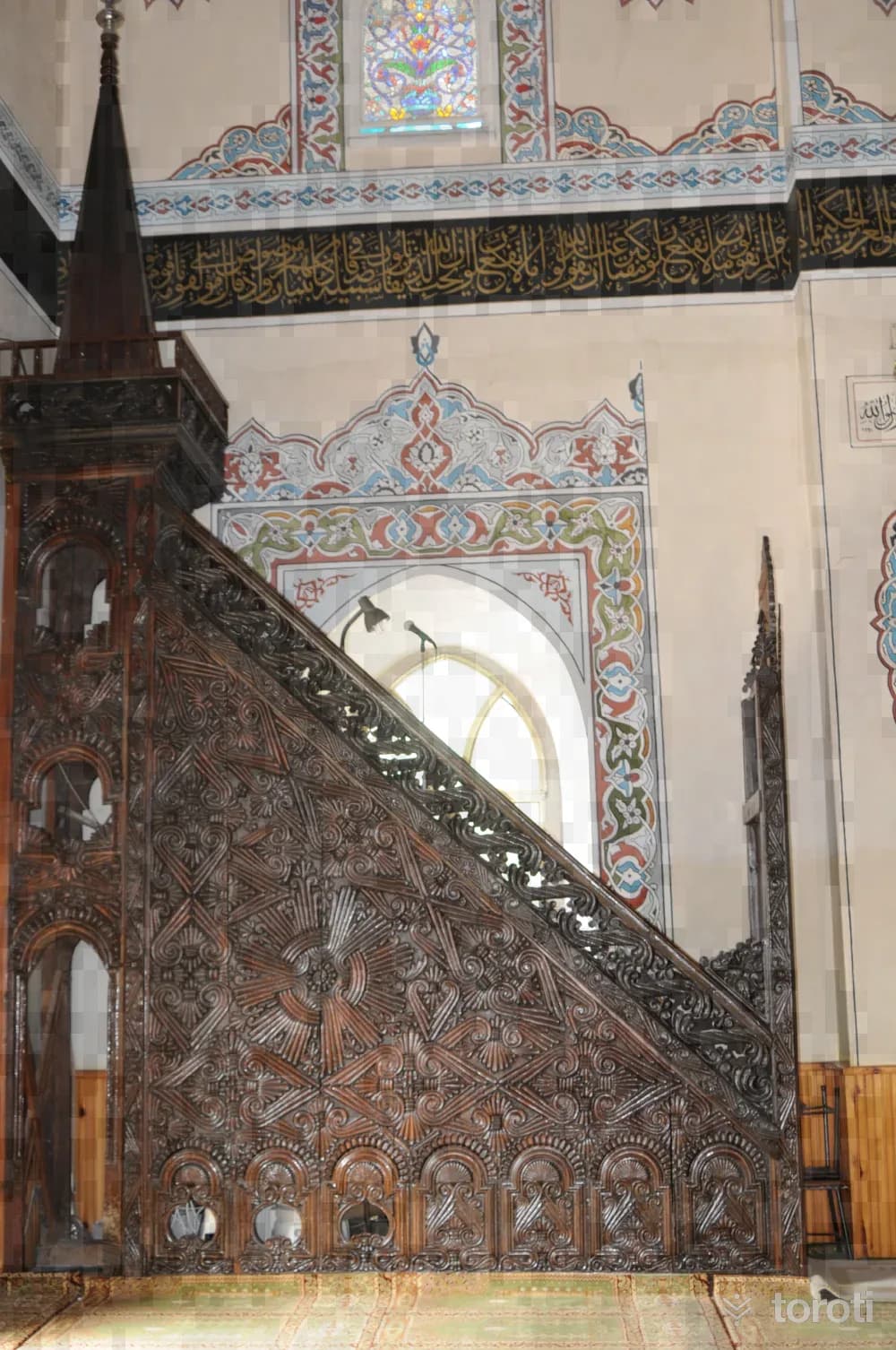
From the time the Ottomans captured Artvin and its surroundings in the 16th century, the region began to become Islamized. Although in the early period some churches and monasteries were converted into mosques and used as such, from the 18th century onwards the construction of new mosques according to mosque architectural traditions began. Çarşı (Merkez) Cami was built between 1860-1861 (Hijri 1277/1278) in the center of Artvin by the people of Artvin.
- No image
38
Deriner Hidro Elektrik Santrali ve Baraj Gölü
Artvin Merkez, Artvin
Deriner Dam is a dam whose construction began in 1998 in Artvin, on the Çoruh River, for the purpose of generating energy. With its 249-meter body height, it is the highest in Turkey and the 6th in the world.
39
Dolishane Kilisesi
Ardanuç, Artvin
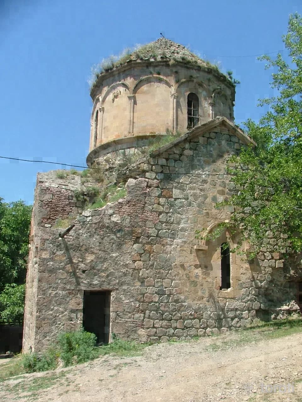
It is located in Hamamlı Village, connected to the Central District. It is reached by a 6-kilometer road heading northwest from the Berta bridge location on the Artvin-Şavşat highway. According to its inscription, it was built by the X. Bagratlı King Sumbath. Of the monastery, part of which was also used as a mosque in the late XVI. century, only its church has survived to the present day.
40
Opiza Manastiri
Ardanuç, Artvin
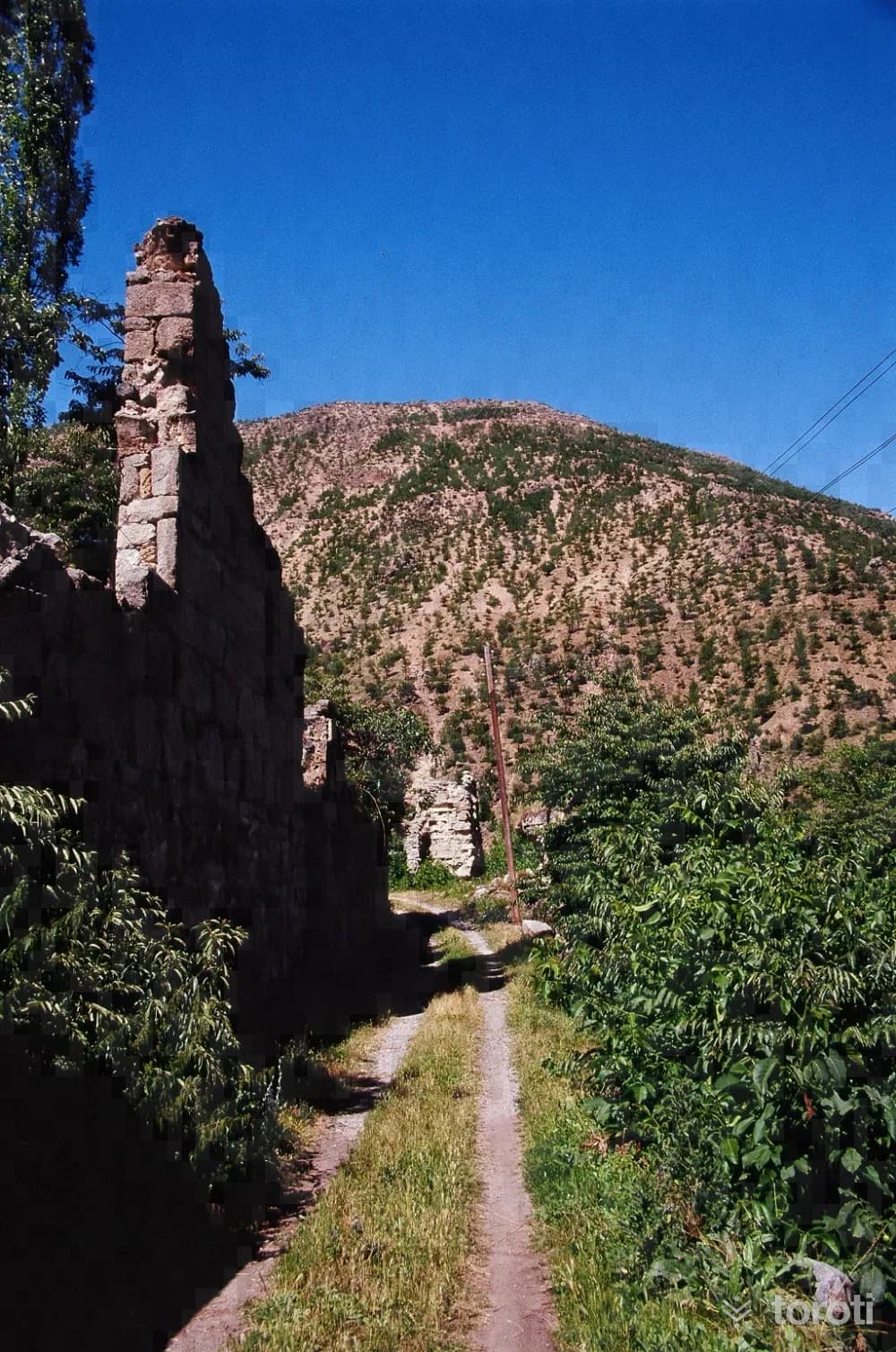
The monastery has no inscription that has survived to the present day. According to information obtained from written sources, the structures here were first established by King Vahtang Gorgaslan (449-499), who made Ardanuç Castle the center of the Kingdom of Iberia. It was destroyed during the raids of Muslim Arabs on the region in the VII. century. Later, by Priest Gripor Kanzda, from the Bagratlı Kings, I.
Move the stops into your own plan, split them across days, and add places to sleep and eat.
Frequently asked
- How far is it between Trabzon and Artvin, and how long does it take?
- Driving between Trabzon and Artvin is roughly 258 kilometres and takes about 5 hours without stops.
- Where is it worth stopping between Trabzon and Artvin?
- There are 296 described places within 20 km of the road between Trabzon and Artvin. toroti lists 40 of them spread evenly along the drive, in the order you pass them; Santa Harabeleri comes early on, and Opiza Manastiri sits near the end.
- Which provinces does the Trabzon to Artvin route cross?
- The route between Trabzon and Artvin crosses Gümüşhane → Trabzon → Rize → Artvin. The stretch richest in places to visit is in Artvin.
- Should I take the toll highway or traditional route between Trabzon and Artvin?
- Toll motorways save driving time between Trabzon and Artvin, whereas traditional state roads pass directly through historic town centers, local culinary stops, and scenic nature viewpoints.
- How should breaks be scheduled between Trabzon and Artvin?
- For a drive of around 5 hours, taking a break every 2 to 2.5 hours is recommended. The catalogued attractions in Artvin and neighboring provinces offer memorable stopovers compared to generic highway rest areas.
Other routes