
Places to visit
Things to do in Mersin
60 destinations, each with a description, how long it takes and where it sits on the map.
In short
toroti’s catalogue holds 60 described destinations within Mersin. The themes that come up most: Local culture, History, Nature, Faith heritage, Museum, Culture.
Districts of Mersin
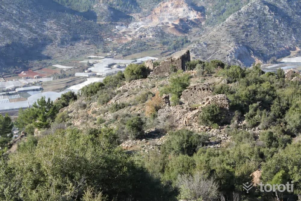
Titiopolis
In the maps showing the ancient sites in Western Cilicia, prepared by George Evart Bean and Terence Bruce Mitford as a result of their investigations in Cilicia between 1964-1968, they marked the location of present-day Kalınören Köyü as TIİTİOPOLİS. The archaeological site contains remains covering the Hellenistic, Roman and Byzantine periods. In antiquity, Titiopolis was in the position of a site not connected to Anemurium.
45 minutes
Namrun Kalesi
Namrun, which dates to the Middle Ages and is one of the most famous castles in the region, is in the Çamlıyayla district center. It was known as “Illibru” during the Hittite and Assyrian Periods. The defensive castle, built on a high hill, is reached by a ruined staircase. Namrun’s strategic importance lies in its role in protecting the Cilician Gates above Gülek Kalesi. The Hetums ruled in Namrun for a long time.
30 minutes
Mut Kalesi
The initial construction date of the castle, which is in the middle of the city, is unknown. According to Evliya Çelebi: “Karamanoğlu Yakup Bey attacked with many soldiers in order to take Mut Kalesi from the Greeks, but since all of his soldiers were martyred here, they call this place Darment-Darül-Mevt (Darı Mut),” he says. Later, İbrahim Bey, again one of the Karamanoğlu beys, captured this castle and had it completely demolished. After the castle passed into the hands of the Ottomans, I.
30 minutes
Tapureli Antik Kenti
The ruins, whose history goes back to the Hellenistic Period, are difficult to visit as they are covered by shrubs and trees. Houses are lined up at close intervals on part of the slope. It is possible to come across tomb structures belonging to the Roman Period. The necropolis area is on the southern slope. Sarcophagi and burial chambers are among the types of tombs located within this necropolis area.
45 minutes
Diokaisareia Antik Kenti
In the Hellenistic Period, the present-day settlement of Uzuncaburç, which was the place of worship of the Olba Territorium located 4 km. east of central Uzuncaburç, was separated from Olba in the Roman Period, in 72 during the time of Emperor Vespasianus, and became an autonomous city minting coins in its own name under the name Diokaesareia (City of the God-Emperor).
45 minutes
Karaekşi Milli Parkı
It is in the forest and by the stream. The area is completely covered with plane and red pine trees. In Karaekşi, which also has a trout breeding farm within its area, it is possible to see trout of مختلف ages, sizes and weights in the fish breeding pools and to eat fresh trout at the countryside casino within the area. In the area, there are also a sales kiosk, toilet, children's playground, car park and rain shelter.
60 minutes
Prensesin Ayak İzleri Parkuru
It is a route carried out among ancient cities and ruins approximately 40 km long between Silifke Uzuncaburç and Kızkalesi. On the route starting from Uzuncaburç, the Uğuralanı-Cambazlı stage is 16 km, the Cambazlı-Hüseyinler stage is 12 km, and the Hüseyinler-Kızkalesi stage is 12 km. On the route organized in the ancient areas where the life and reign of Olba Queen Aba took place, the walk can be organized as 3 or 4 days.
45 minutes
Kadıncik Vadisi
It has an area of 8776 hectares. Access is by turning right at the junction when about 6 km from Çamlıyayla District and entering the valley. There is a natural trout production facility within the valley. The natural trout produced here are later released into the streams in order to enrich them. In the 2011 inventory, 491 wild goats were identified. Protection is carried out by the Olukkoyağı Village Legal Entity.
45 minutes
Kesteldağı
It is located within the boundaries of Mut District Yıldız-Topluca-Esençay and Gençali Villages, and has an elevation of 300-1200 m and an area of 4546 hectares. Since the area has natural beauty, vegetation cover and a sufficient amount of wild goat potential, it has been designated as a wildlife development area and is suitable for hunting tourism. In the 2011 inventory, 406 wild goats were identified.
45 minutes
Soğucak Yaylası
It is reached by a 1 km asphalt road branching off at the 23rd km of the Gözne road. In Soğucak Town, which is a plateau village, there are also summer houses belonging to the people of Mersin. Its infrastructure has been completed, and PTT and a Health Center provide services on the plateau. The country restaurants and country coffeehouses in the surrounding area do not have touristic characteristics. The area around the plateau is covered with maquis and rocks.
45 minutes
Dağpazari Yaylası
On the plateau 36 km north of Mut, there are services such as electricity, water, telephone, and a PTT agency. The plateau village was built on an ancient Byzantine city, and there are remains such as a church, aqueducts, rock and sarcophagus tombs. Its surroundings are covered with juniper and maquis. Apples and chickpeas are grown. Tents and basic necessities should be brought.
45 minutes
Lamas Kanyonu
It is a canyon with steep walls on both sides. The Lamas Stream flows through the middle. The stream flows among various vegetation and vines, forming waterfalls. On the left wall of the canyon, you can see carved channels that once carried water to the city of Korykos. A footpath extends along the canyon. In the summer months, it is possible to swim in the stream. You can walk as much as you like in the canyon.
45 minutes
Akova Yaylası
It is located 23 km from Gülnar on the Köseçobanlı -Ermenek road. It is a summer village that became a mukhtarship in 1994. It is known as the highland pasture of the Eskiyörük villagers. In summer, the population increases considerably. In addition to apple production, greenhouse cultivation and seasonal vegetable growing are carried out. Wheat, barley, chickpeas, and among fruits, peach, cherry, and pear are the main products.
45 minutes
Karakizderesi Parkuru
The route, located at an altitude of 1700, is one of the suitable routes for winter tourism due to snowfall in the winter months. Within the route area is Karakızderesi Pond, one of the ideal places for angling and water sports. The route is approximately 30 km north of Erdemli Merkez district and within the boundaries of Karahıdırlı Village.
45 minutes
Gözlükule Höyük
The mound in the district center of Tarsus consists of two hills. The presence of a watchtower on the mound in the Middle Ages must have led to the name Gözlükule. Obsidian tools and fragments of baked clay vessels belonging to the Neolithic Period have been uncovered. Houses with mudbrick walls on simple stone foundations and narrow streets have been revealed.
30 minutes
Arsinoe Antik Kenti
It is understood that the city was first founded around 270 B.C. during the time of Aetos of Aspendos. This city, which Aetos founded in the name of the wife of the Egyptian king Ptolemais II, who was also his sister, was referred to as the “Sacred City” of the king, his wife and his sister.
45 minutes
Kepirli Yaylası
The plateau, connected to Mersin by a 23 km asphalt road, is at an altitude of 950 m. Passenger transportation is provided from Mersin to Kepirli. Around the plateau there are pine, juniper, oak and maquis forests, as well as various fruit orchards. Infrastructure services such as electricity and water are available on the plateau.
45 minutes
Sağlikli Köyü, Roma Yolu Ve Tarsus Parkuru
Near Sağlıklı Köyü to the north of Tarsus, the broad and impressive road is entered from beneath a Roman Arch. The road crosses the Taurus Mountains south-north and descends to İvriz. It is thought that St. Paul went to Derbe by this road on his 2nd journey. The route is a route with 3 tented overnight stays.
45 minutes
Şeyh Ömer Türbesi
The author of the Qur'an commentary named Bahru'l-Ulum lies in the tomb. The tomb has an octagonal plan and was built with neatly cut stone. Since the large dome on top was repaired with concrete, exact information about its original characteristics could not be obtained.
20 minutes
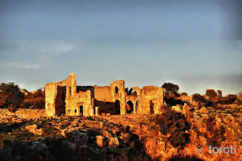
Kanli Divane Ören Yeri
Kanytella, which was within the borders of Rough Cilicia in the Ancient Period and is known today as Kanlı Divane, is located approximately 50 km from Mersin and 13 km west of Erdemli District. It is reached by a 3 km road turning north from Kumkuyu Yemişkumu Mahallesi. The ancient settlement of Kanlı Divane was established around a large sinkhole at its center, called the Kanlı Divane Obruğu.
45 minutes
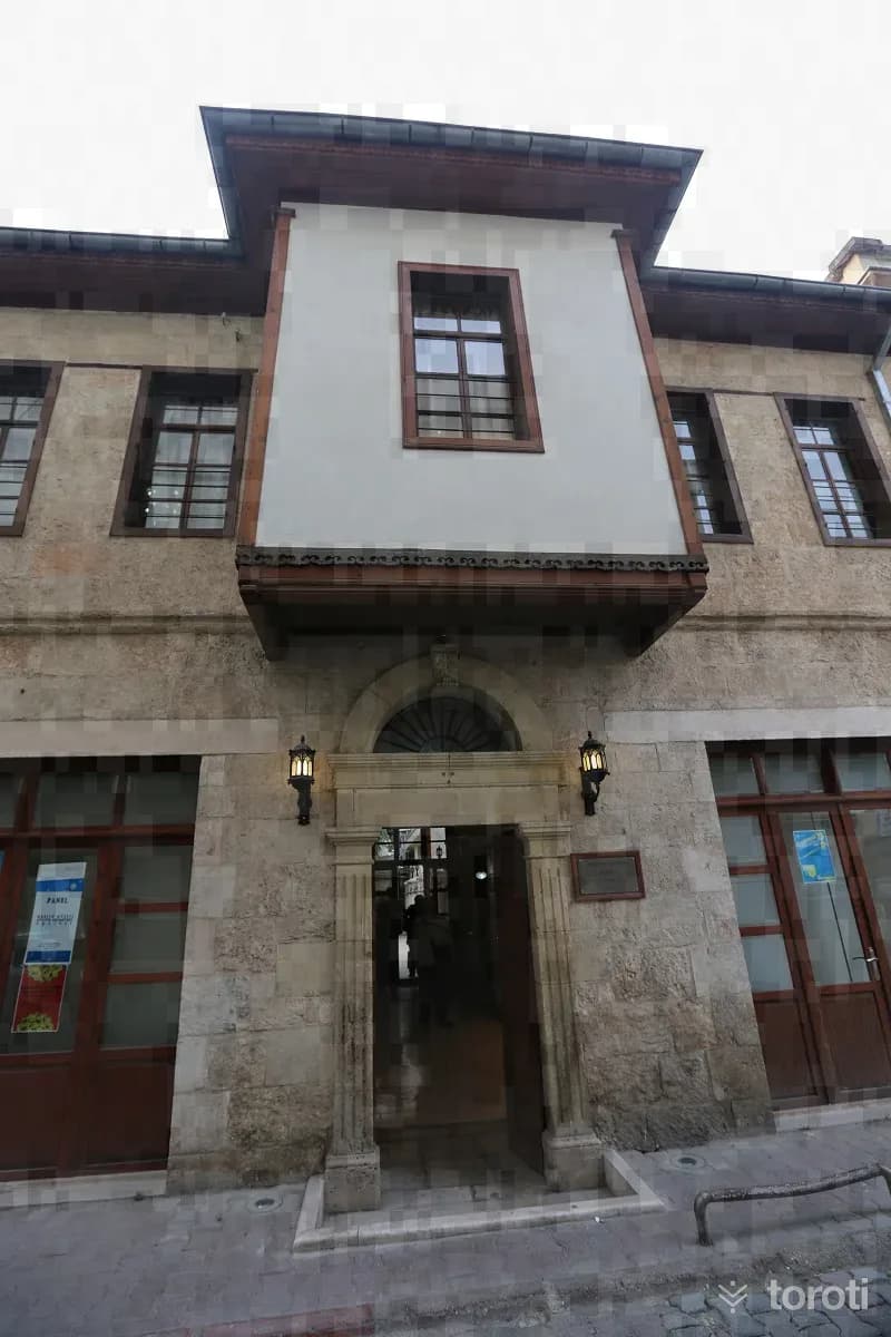
Mustafa Erim Mersin Kent Tarihi Müzesi
The "City History Museum," which brings a new color and breath to Mersin's cultural life, is an example of nearly 150-year-old civil architecture. It was restored and arranged for exhibition by Mustafa ERİM and brought into Mersin's cultural and artistic life. Mersin was also affected by the rapid change seen in all our cities in the second half of the 20th century, and very few of these examples of traditional civil architecture have survived to the present day.
45 minutes
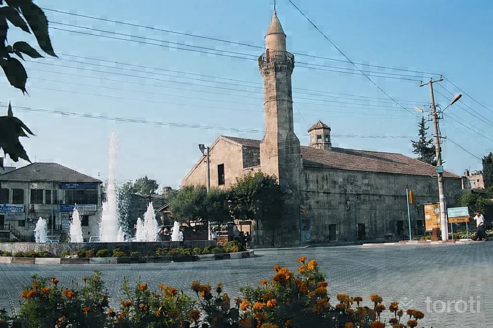
Tarsus Eski Camii
It is said that the church-based structure in Çarşıbaşı was built in 1102 as St. Paul Cathedral. It is noteworthy for its thick and high walls in the Roman style, its spacious interior, its narrow outward-facing side, its deep windows, and its thick columns.
45 minutes
Altinorfoz (silifke-mersin)
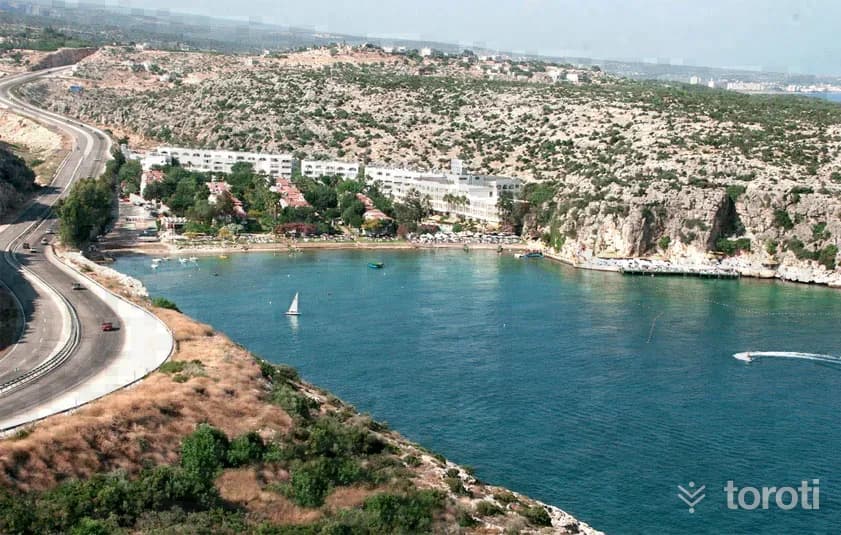
When you go 20 m offshore by boat to the western side of the bay where Altınorfoz Hotel is located (the side facing Susanoğlu) and descend to a depth of 9 m to 15 m, there is a wall on the seabed. If you go from the middle of the area called Lahit toward Cyprus, you will come across rocky areas. In dives made here, sea hares, seahorses, various fish and seashells, and sea urchins can be seen.
45 minutes
Silifke Akyar Koyu
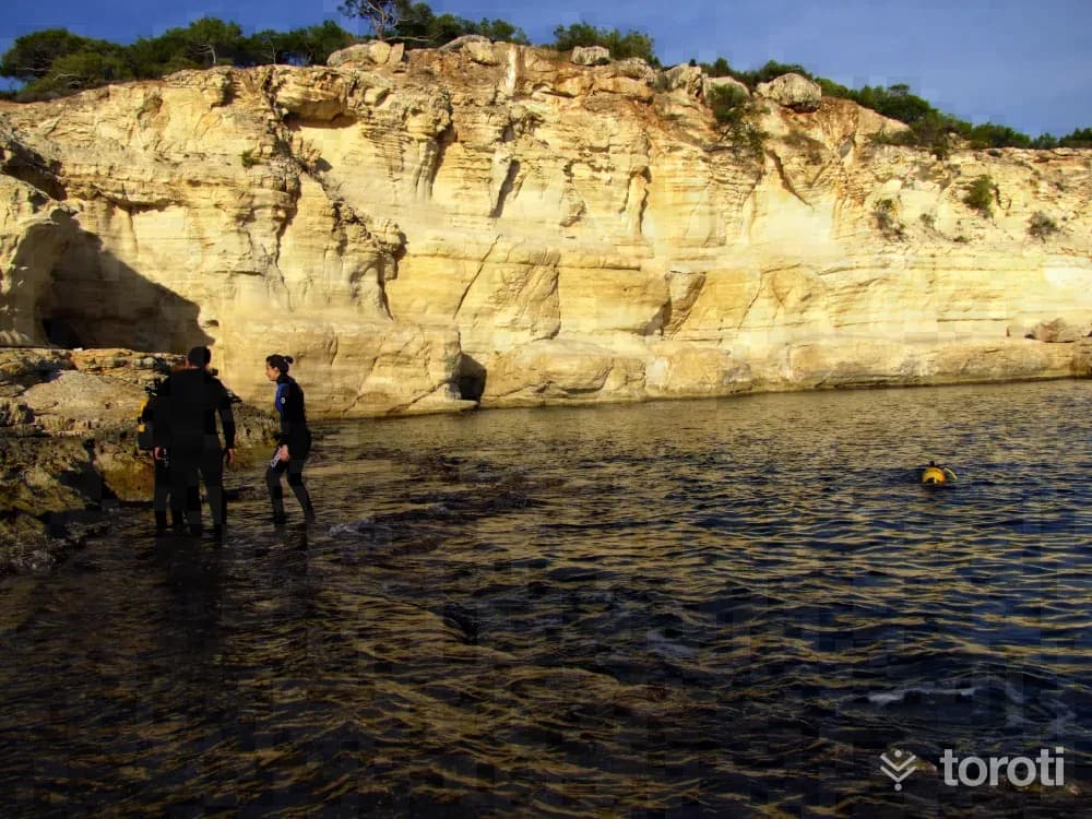
In Akyar, where the seabed structure is sandy and rocky, when descending to a depth of 14 meters, a ridge can be followed in the direction of Kızkalesi. If one turns toward the inside of the cove, diving can be done at depths of 8 meters to 12 meters. The seabed has a sandy and rocky structure. If one descends from the western corner (cape) of Akyar, Ayı Mağarası, which has a height of 3 meters, a length of 10 meters, and a rocky seabed structure, can be seen.
45 minutes
Paperon Kalesi - Çandir Kalesi
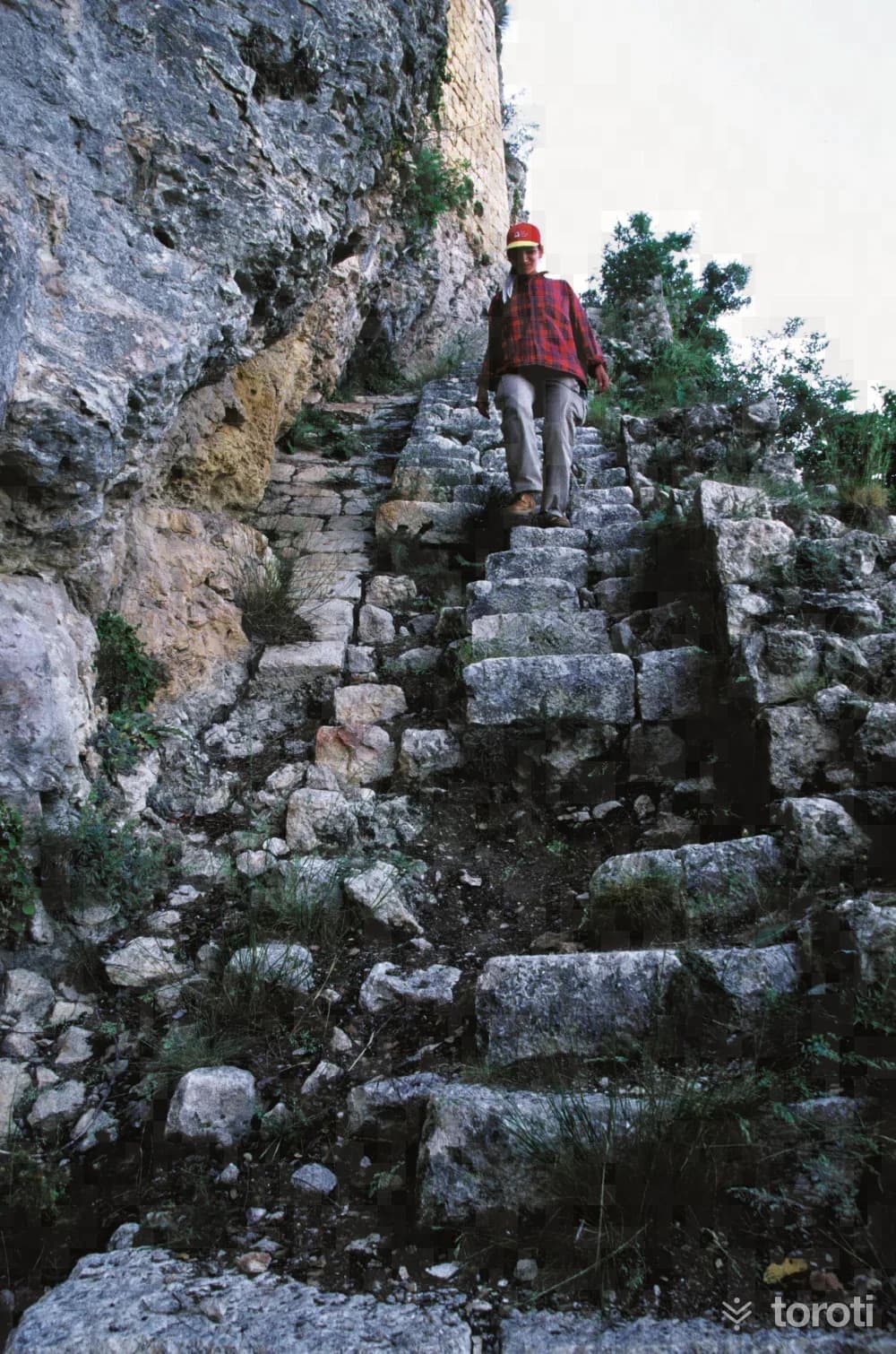
This castle is the richest in architectural terms and the most complex historically among the Armenian castles. However, the history of the castle goes back further than the Armenians. It is suggested that this place may be the Byzantine castle Papirion or Papurion. In the middle of the 14th century, it was occupied for a short time by the Karamanoğulları, and at the end of the 14th century it passed into the hands of the Mamluks. The important feature of the castle is its gate.
45 minutes
Laal Paşa Camii
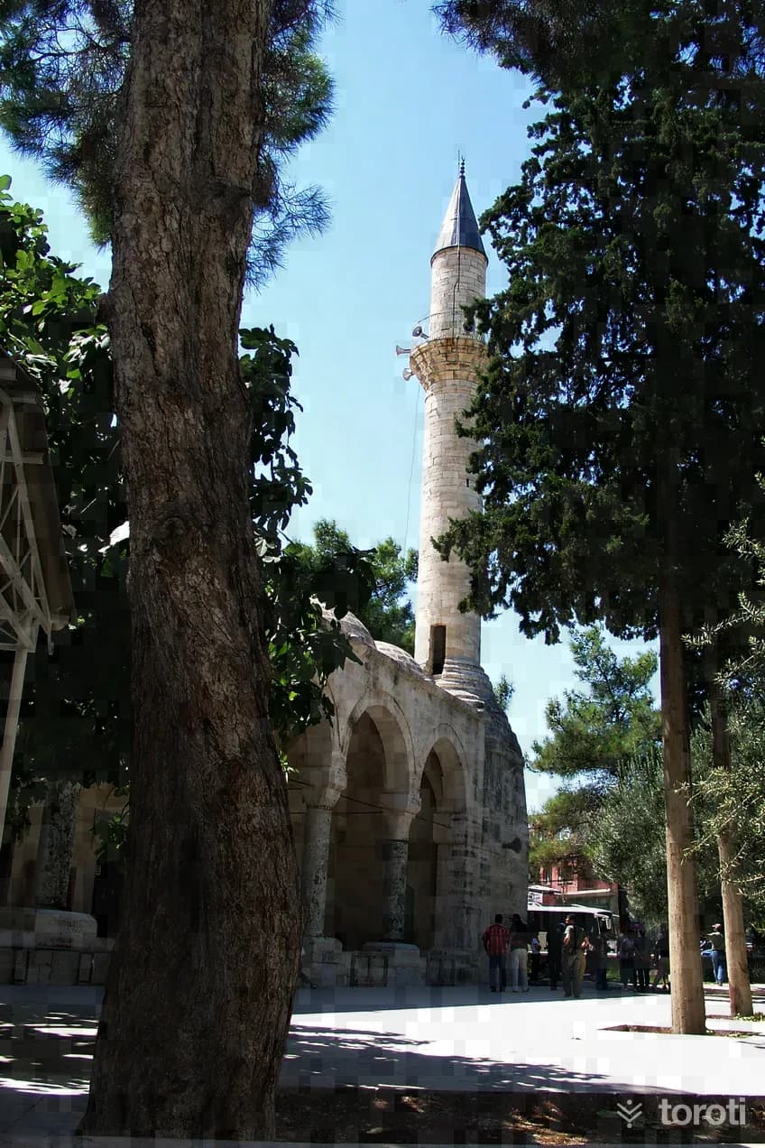
Laal Paşa, who built this mosque, was one of the slaves of Karamanoğlu Alâeddin Bey. Since Alâeddin Bey loved his slave, he had him educated and trained. Appreciating the ability he saw in Laal Ağa, Alâeddin Bey freed him from slavery and made him a free man. Because of the great success he showed in private and official state affairs, he appointed him dizdar of Niğde Kalesi.
45 minutes
İbrahim Paşa Tabyaları
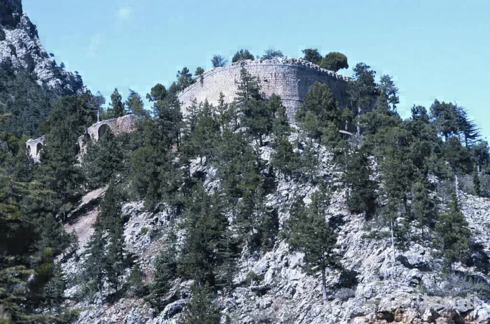
İbrahim Paşa Tabyaları is one of the quite solid structures from the Ottoman Period, of which there are very few in the region. It was commissioned by İbrahim Paşa around the 1830s to resist attacks coming from the east. While proceeding on the motorway in the direction of Tarsus Pozantı, before reaching the Tekir (Akçatekir) Yaylası area of Adana, a structure can be seen on the high hill to the left of the road. This structure is called Kızıl Tabya (Büyük or Fenerli Tabya).
45 minutes
Kız Kalesi
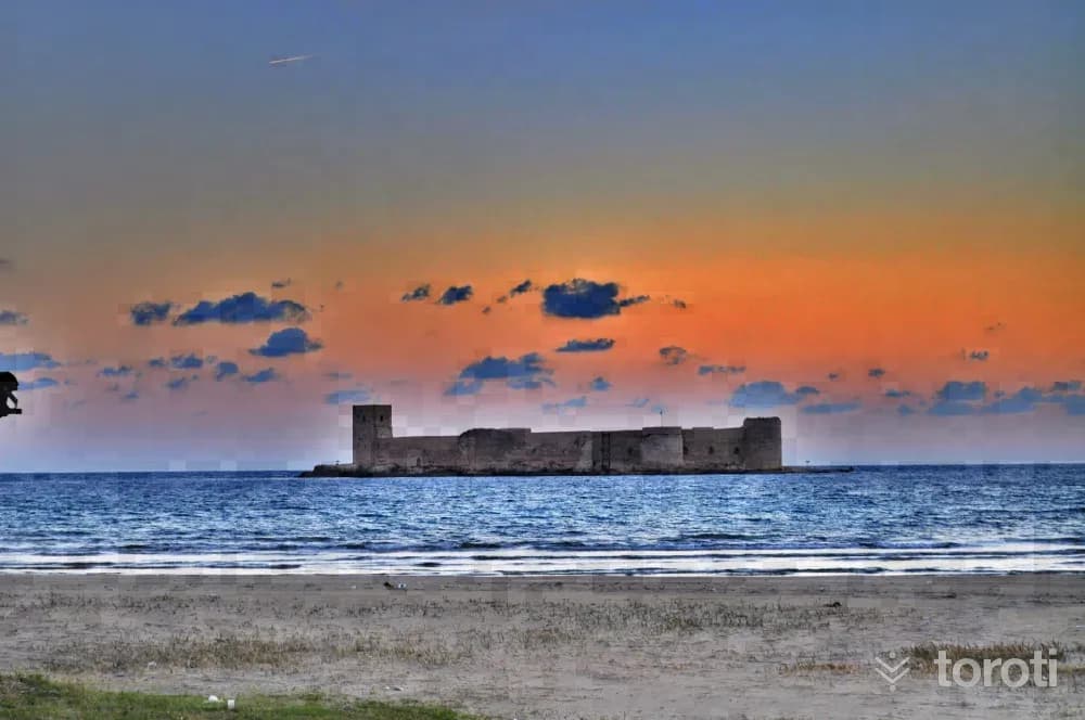
Kız Kalesi, also known as Deniz Kalesi, was built on a small islet off the coast of the neighborhood to which it also gave its name. Its distance from the shore is approximately 600 meters. It is understood from an inscription found here that it was commissioned by Leon I in 1199. Photo: Official Turkish Museums It was captured by the Kingdom of Cyprus in 1361. Strabo mentions that pirates used the castle as a shelter during the Roman Period.
45 minutes
Büyükeceli Koyu
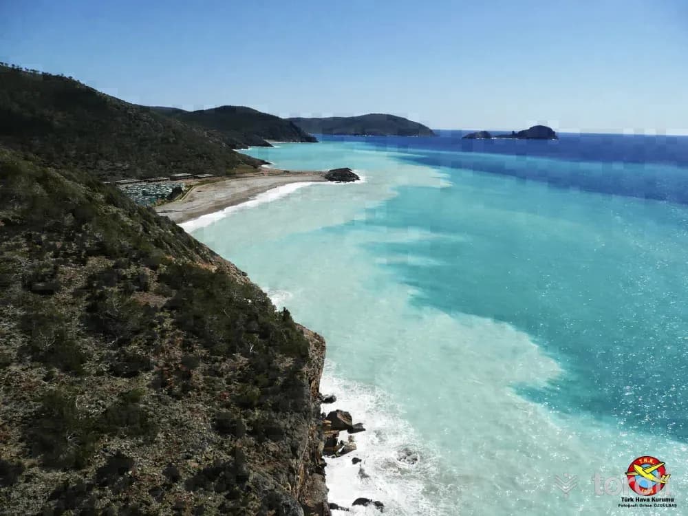
Wall diving can be done in the area from Tisan Koyu to the right as far as Büyükeceli. If you go out by boat from in front of Hayat Motel in Büyükeceli and turn right, wall diving can be done in the small coves as far as the Atom Santrali. Mersin Tourism Activities Important Note: For the safety of life and property, do not dive without obtaining the necessary permits and taking safety precautions.
45 minutes
Narlikuyu (silifke-mersin)
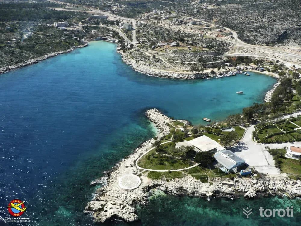
When descending to a depth of 9 m from the east of Narlıkuyu, Fok Mağarası, with a sandy and rocky bottom structure, a height of 3 m and a length of 5 m, can be seen. Here, since fresh water mixes with the sea, cold water is encountered. Important Note: For the safety of life and property, do not dive without obtaining the necessary permits and taking safety precautions.
45 minutes
Susanoğlu (silifke-mersin)
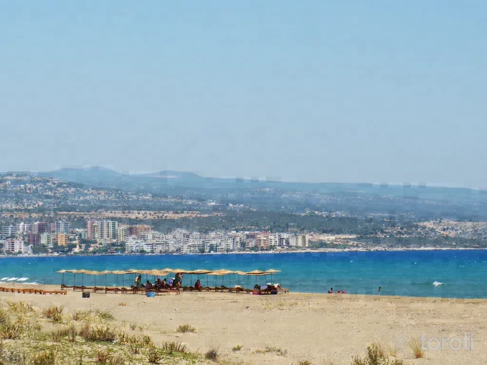
If you go 100 m out to sea by boat from Susanoğlu and dive to 9 m, a 1 km long ridge can be seen on the seabed. The ridge, which starts from Susanoğlu beach, extends as far as Yapraklı Koyu. Important Note: For your safety of life and property, do not dive without obtaining the necessary permits and taking safety precautions.
45 minutes
Taşucu Amphora Müzesi
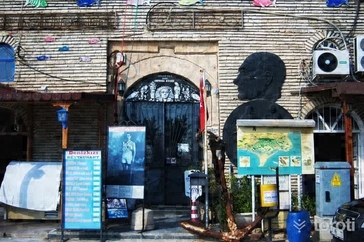
Arslan Eyce donated the amphora collection to the Taşucu Education and Wildlife Conservation Foundation in 1997, and the museum, opened in the arched historic building dating from the 1800s, was approved by the Ministry of Culture and Tourism in 1997 as Taşucu Amphora Museum. In the museum, which has the distinction of being the first and only amphora museum in Türkiye, commercial amphorae collected after becoming caught in the nets of fishermen off Taşucu, Mersin and Antalya are exhibited.
45 minutes
Alahan Manastiri
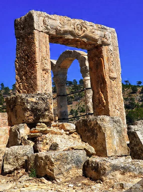
Alahan Monastery, which Evliya Çelebi described by saying, "It looks as if it has just come out of its master's hand.", is located near Geçimli Köyü on the Mersin-Karaman highway. It is situated at an altitude of 1300 meters on a steep slope overlooking the Göksu Valley. Photo: Official Turkish Museums During the spread of Christianity in Cappadocia and Lycaonia (Konya), the persecution of those who accepted this new religion and the fear of being killed by non-believers, Hz.
45 minutes
Tarsus Müzesi
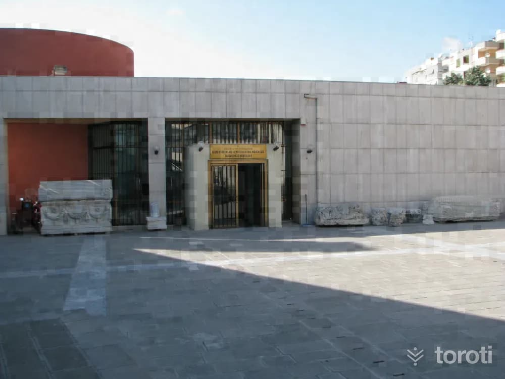
Kubat Paşa Medresesi, built in 1557 by Kubat Paşa of the Ramazanoğulları as an open-courtyard madrasa, was converted into a museum in 1971 and opened to service in order to present our historical and cultural values to local and foreign visitors. However, Kubat Paşa Medresesi was unable to meet the requirements of modern museology in the exhibition and storage of artifacts. For this reason, the artifacts were moved in 1998 to the 75, built by the Ministry of Culture and Tourism.
45 minutes
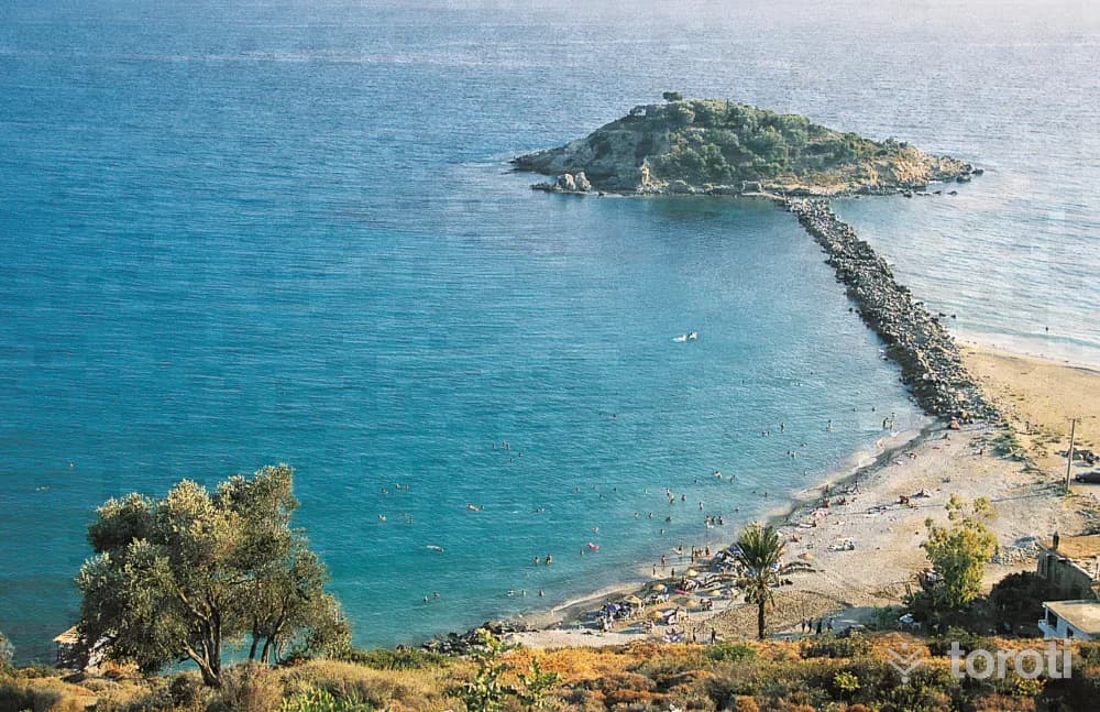
Nagidos Örenyeri
According to Hekataios, it was founded by a person of Semitic origin named “Nagis Kubernetes.” However, this is not certain. It is known to have been within the borders of the Kingdom of Tarhundaşşa, formed by the Luwian people in the 2nd millennium B.C. Its connections with the Assyrians, however, cannot be established with certainty. It is known that Nagidos was a Samos Colony in the 7th century B.C. and thus gained the identity of a port city open to trade.
45 minutes
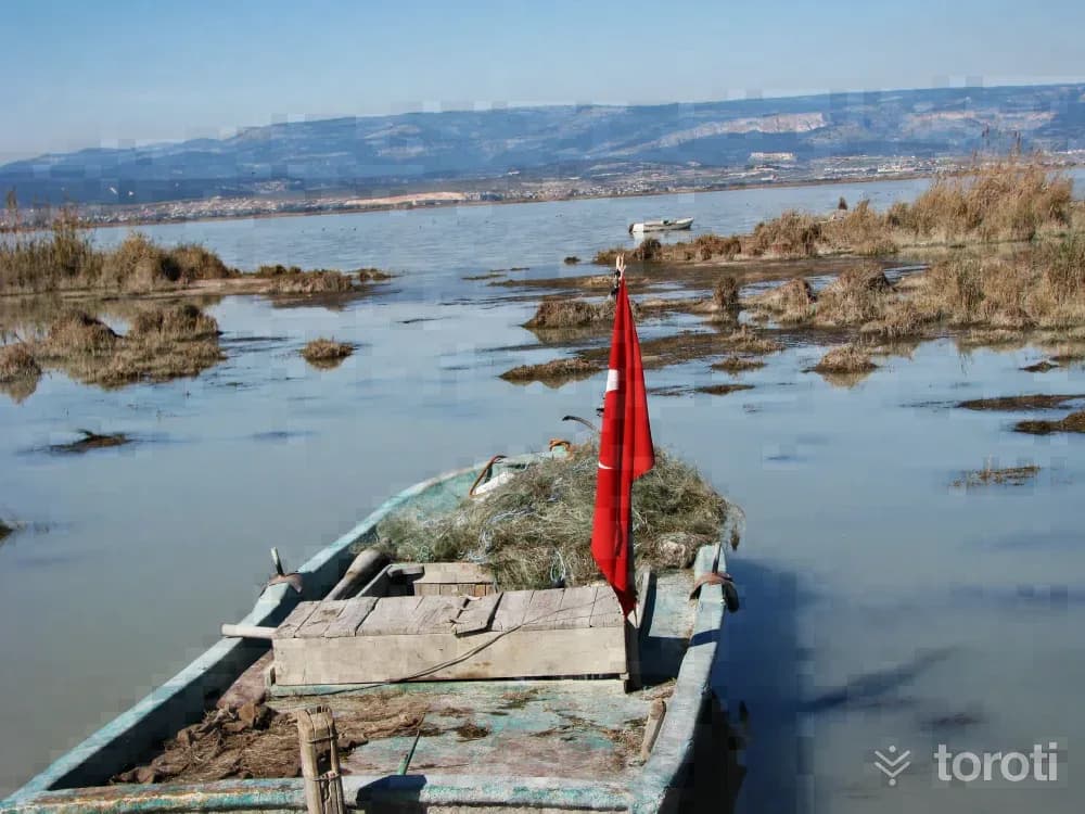
Göksu Deltası (silifke)
Numerous bird species that use Göksu Deltası as a wintering and breeding area contribute to the formation of an interesting and vibrant landscape in almost every season of the year, further increasing the Delta’s recreational potential and attractiveness. As a result of the research conducted, it was determined that birds use Göksu Deltası both as a wintering and breeding area, while some were identified as resident species.
45 minutes
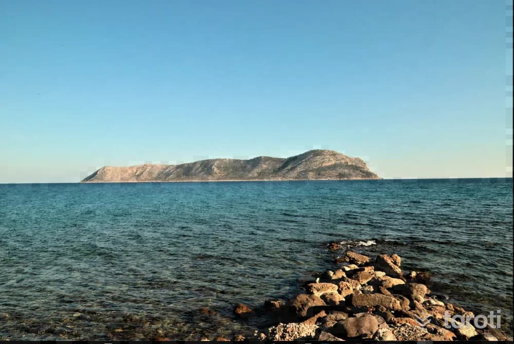
Pityussa / Dana Adası
It is a settlement on a large island located to the northeast of Aphrodisias and to the southwest of Güvercin Adası. The city, founded together with Aphrodisias, became an independent city, Pityussa, in the Roman Period. The island city had close commercial relations with Cyprus, Egypt, Aphrodisias, Komardias, Holmi and Seleukeia. In the Ancient City of Pityussa, there are numerous water cisterns, houses from the Roman Period, sarcophagi, baths, and church ruins from the Byzantine Period.
45 minutes
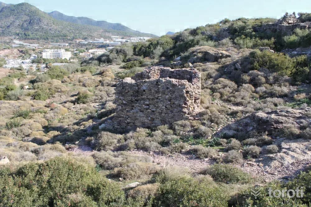
Arsinoe / Maraş Tepesi
The ancient geographer Strabo, while conveying information about this place, says; “After Anemurium one comes to Nagidos, the first city, then to Arsinoe, which has an anchorage.” We again learn about the foundation of the city and its relations with the neighboring city of Nagidos from the inscription exhibited in the Mersin Museum. From this inscription, it is understood that the city was first founded around 270 B.C. in the time of Aetos of Aspendos. Aetos, of the Egyptian king II.
45 minutes
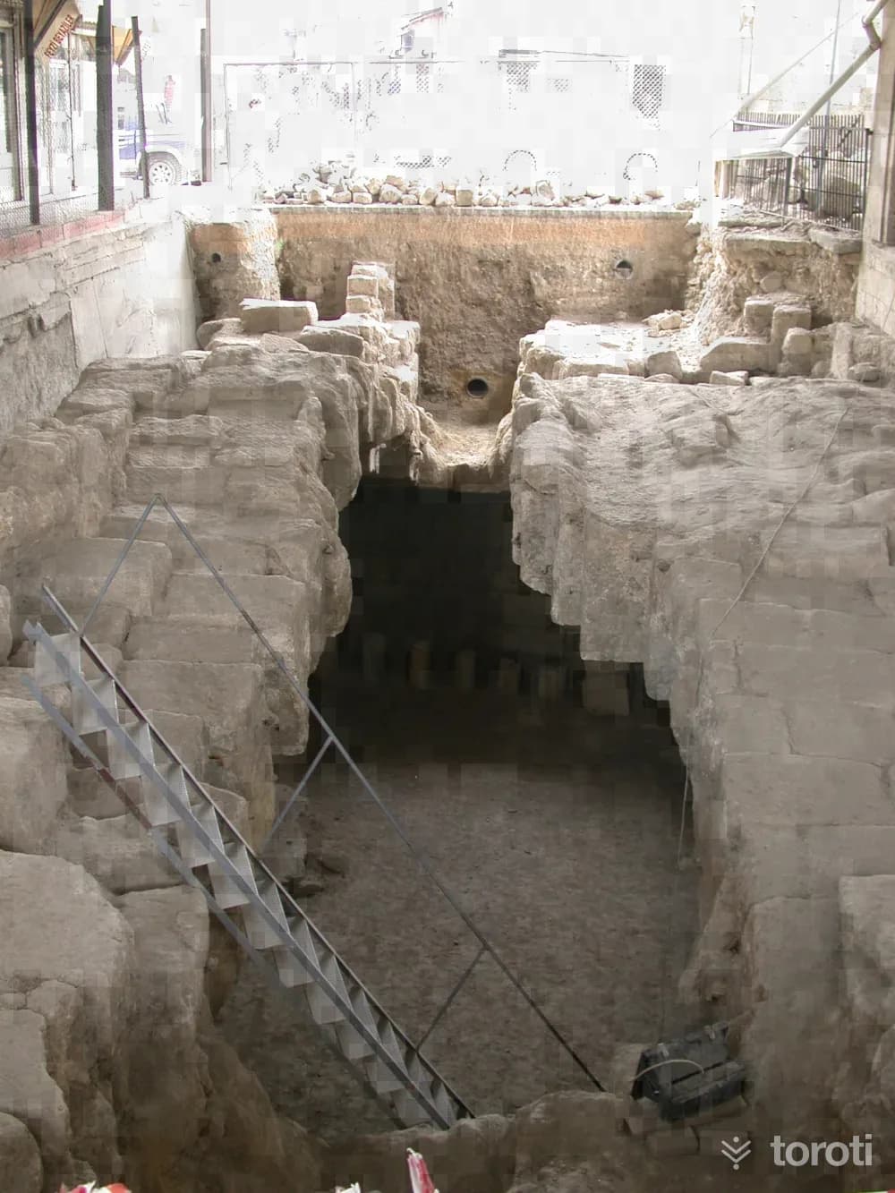
Danyal Peygamberin Makami
Prophet Daniel was a prophet who lived during the time of the 2nd Babylonian King Nebuchadnezzar (605-562 BC) and saved the Jews from Babylonian captivity with his knowledge and prophecies. According to the روایت; when the Babylonian King saw in his dream that a baby boy to be born from the Israelites would shake his throne, he ordered the killing of the male children born to the Israelites. For this reason, when Prophet Daniel was born, he was left in a cave on a mountaintop to save him from death.
45 minutes
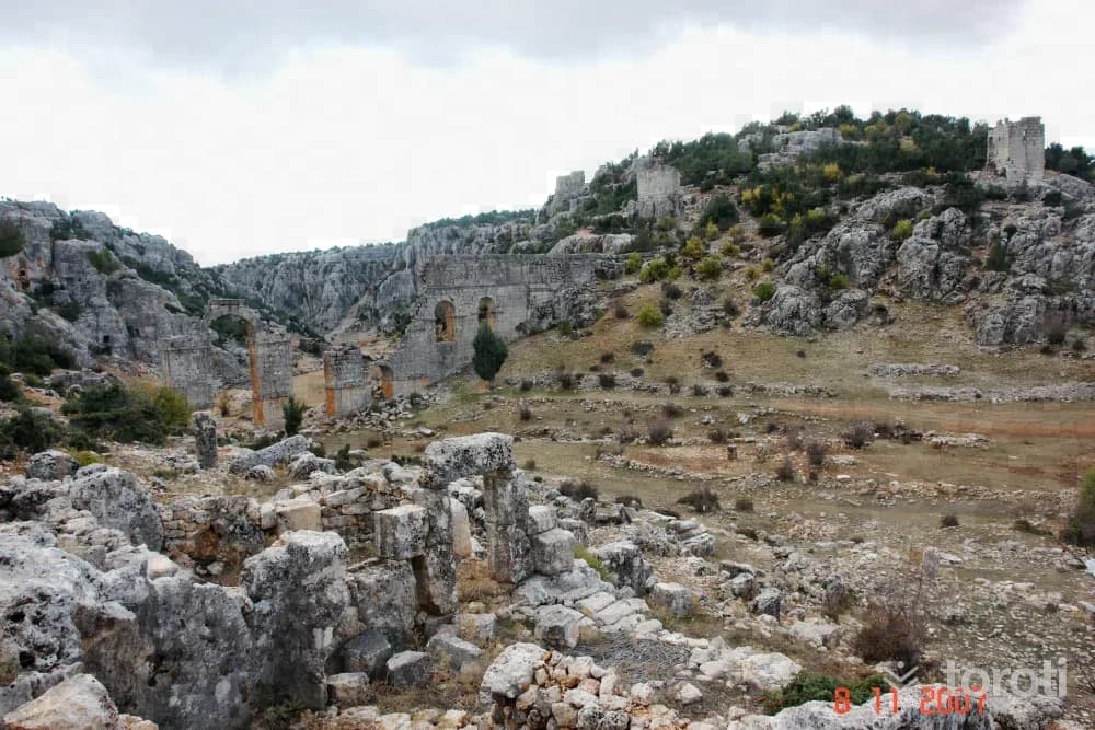
Olba Antik Kenti
It was the center of the Kingdom of Olba and an important trading city in the Hellenistic Period. Olba was also an important religious center. Especially during the Christian period, this is evident not only in written sources but also in the remains of religious architecture.
45 minutes
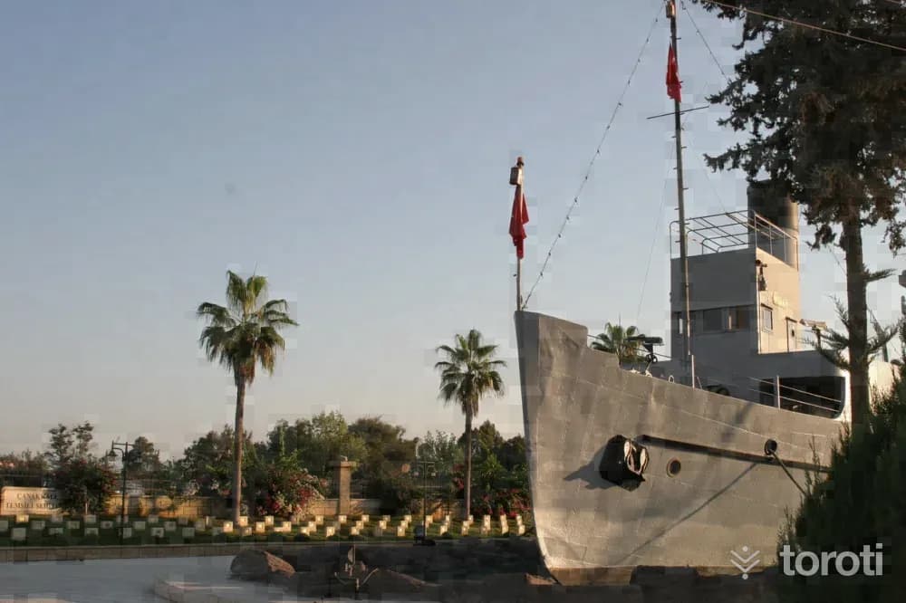
Nusrat Mayin Gemisi
The mines laid by Nusrat changed the fate of the Battle of Çanakkale on 18 March 1915, earning it the title of "the world's most famous minelayer." With its crew of 639, Nusrat's mines sent the battleships Bouvet, followed by Inflexible and Bolva, to the bottom.
45 minutes
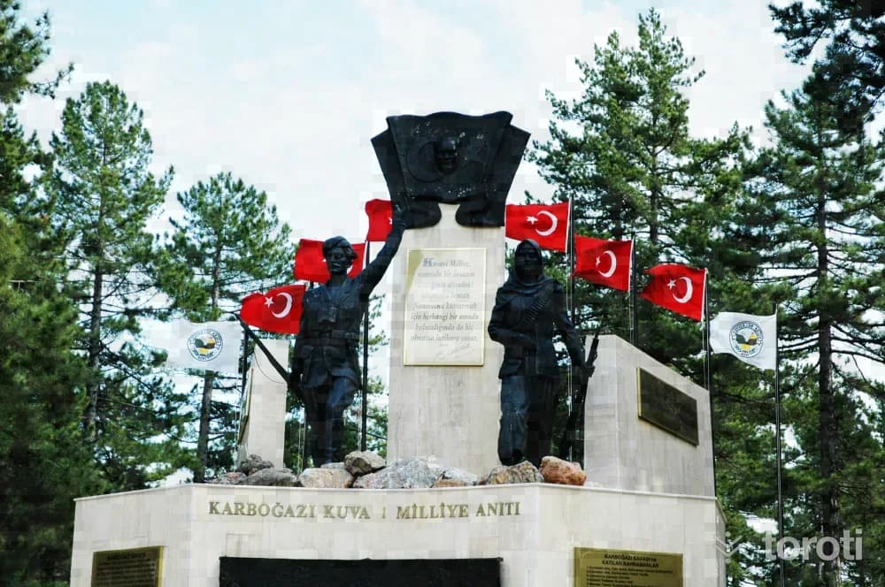
Karboğazi Kuvayi Milliye Anıti
The French forces stranded in Pozantı were being harassed every day in Pozantı by the Kuvayi Milliye militias. For this reason, realizing that they would not be able to hold on in Pozantı, the French wanted to break out of the blockade in Pozantı and go to Mersin by passing through the Namrun and Gözne highlands.
45 minutes
Kırkkaşik Bedesteni
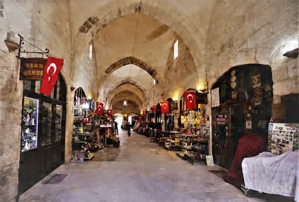
One of the most important historical structures of Tarsus, which has been a lively commercial and political center in every period and is located at the intersection of cultures, is Kırkkaşık Bedesteni. Kırkkaşık Bedesteni, commissioned in 1579 by İbrahim Bey, the son of Piri Paşa of the Ramazanoğulları Beyliği, was used as an imarethane (soup kitchen) and madrasa in its early periods, but functioned as a covered bazaar after the Republic.
45 minutes
Adamkayalar
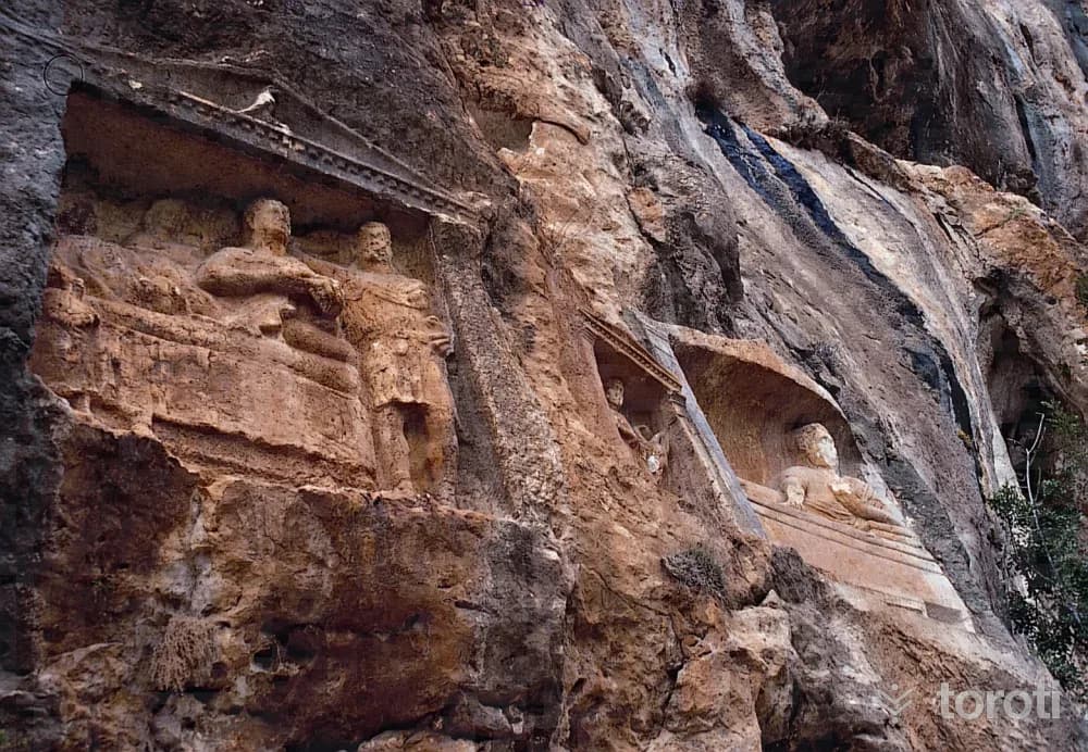
Among the compositions on the slope of the Adamkayalar reliefs, which are set within eleven separate frames, the most frequently repeated figures are those belonging to the four funerary banquet scenes. In these scenes, the deceased are shown either alone or together with their spouses and sons. In the Adamkayalar reliefs, the sons of the deceased and also two male reliefs are depicted as soldiers.
45 minutes
Refah Şehitleri Anıti
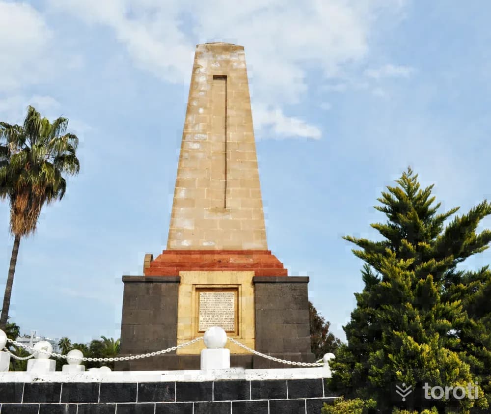
During the Second World War, in order to bring four destroyers, four submarines, twelve landing ships, and four aircraft squadrons ordered from England, a staff of 199 consisting of officers, non-commissioned officers, privates and students departed from Mersin for Port-Said on 23.06.1941 at 17.30 on the Refah Ship belonging to a company named Benjamen Benzilay. After a journey lasting five hours, the ship was torpedoed near Karpat Burnu and sank shortly afterwards.
45 minutes
Narlikuyu Mozaik Müzesi
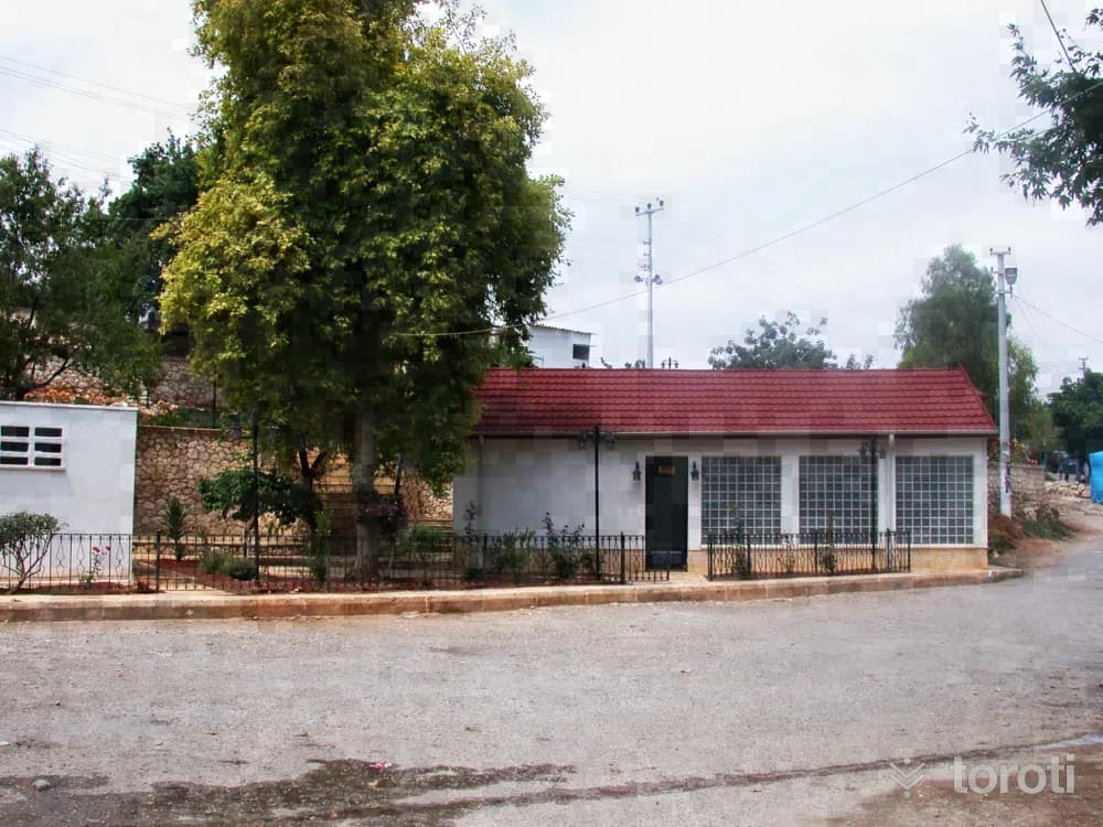
In 1975-1976, the museum was created by enclosing the mosaic floor belonging to a Roman Period bath structure within a building. Narlıkuyu Cove served as a sea gate in Antiquity and the Byzantine Period for those coming to worship and visit Cennet-Cehennem. This settlement, known as Porto Calamie in the Middle Ages, had a magnificent bath. From this bath structure dating to the 4th century AD, only the water trough and the floor mosaic in the bathing section have survived to the present day.
45 minutes
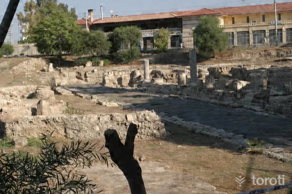
Cumhuriyet Alanı Ve Antik Cadde
In the excavations that began as a result of the accidental discovery of a number of finds during a foundation excavation in 1993, an east-west oriented street and the remains of structures from various periods around it were uncovered. Although there is deterioration in places, the street’s surface has largely preserved its appearance from Antiquity.
45 minutes
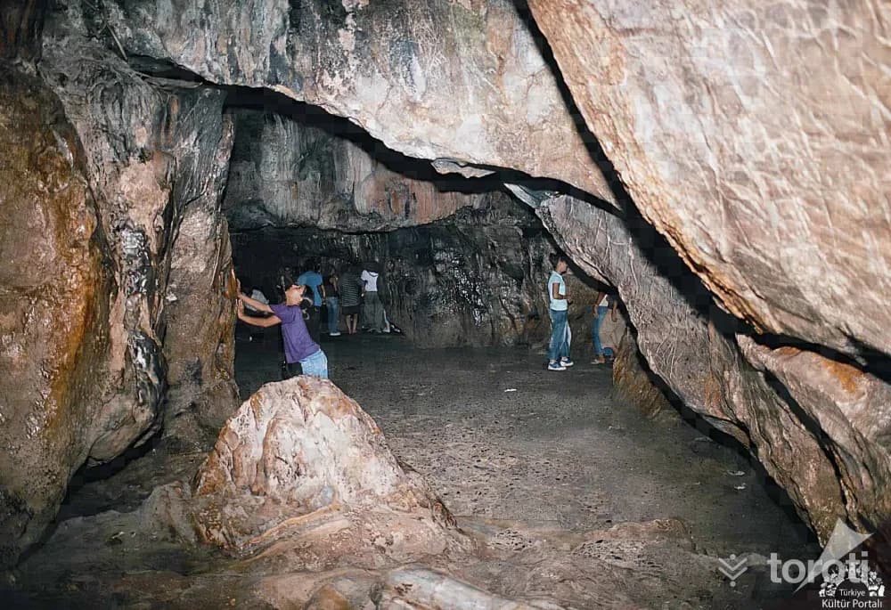
Eshab-i Kehf Yedi Uyurlar Mağarası
This cave, mentioned in the Surah al-Kahf of the Holy Quran, is considered sacred by Muslims and Christians. The cave is reached by descending 15-20 steps. A legend belonging to Eshab-ı Kehf Cave is told among the people.
45 minutes
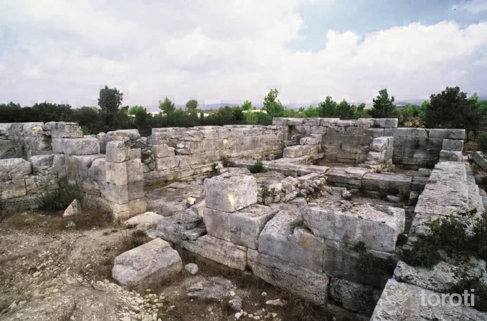
Meydancik Kalesi
The castle covers a fairly large area 750 meters long. In the 7th and 6th centuries BC it was a royal city, in the 4th century BC it had a military and administrative role during the Persian Period, and in the 2nd century it became a garrison city for the Egyptian kings. Traces of the Late Roman and Byzantine Periods are also found. Especially BC.
45 minutes
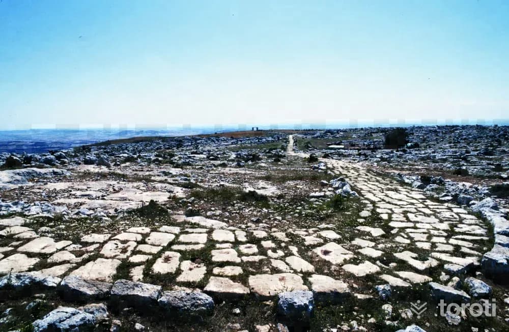
Sağlikli Mahallesi Roma Yolu Ve Kapisi
It was built on bedrock with serpentine stone. The gate can be seen from the road as far as Tarsus and the surrounding coast. Although its width varies from place to place, it averages 3 meters, and its surviving length is about 3 kilometers. The curb stones along the roadside still remain in situ.
45 minutes
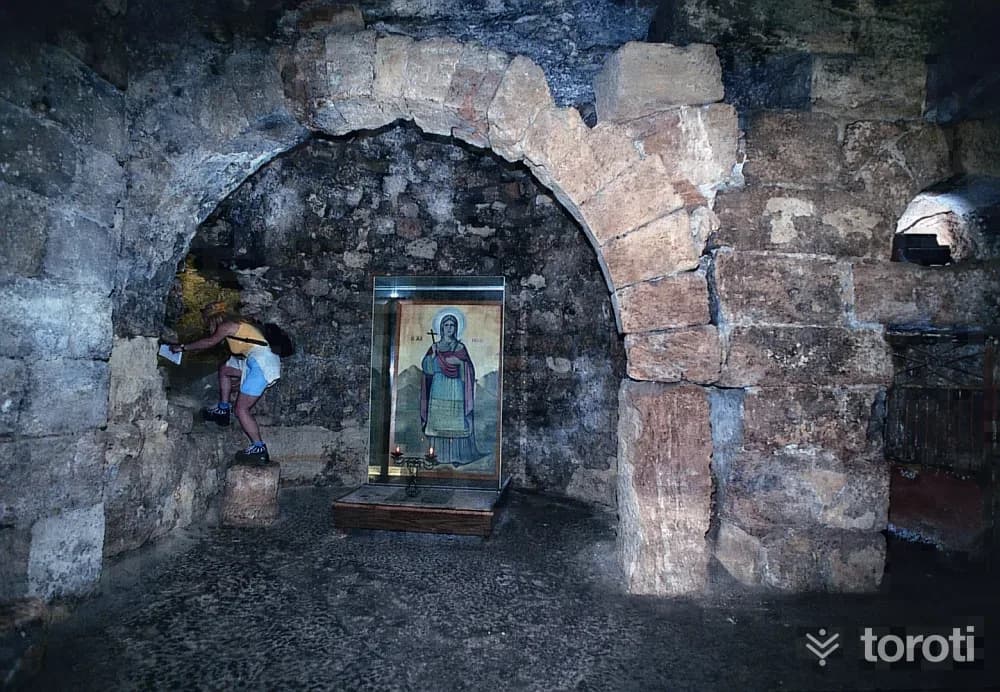
Aya Thekla Manastiri
The history of Meryemlik begins with the arrival of Saint Thekla here. Influenced by the sermons of St. Paul, one of the apostles of Prophet Jesus, 17-year-old Thekla devoted herself to Christianity. While this esteemed student of St. Paul was spreading Christianity in Konya and Yalvaç, she was subjected to the pressures of the pagans, and when she learned that she would be killed, she fled to Seleucia and hid in a cave that was later converted into a church.
45 minutes
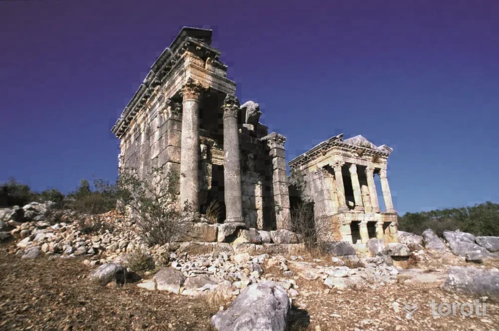
İmbriogion / Demircili
On the facade of the two-storey structure, whose roof covering has collapsed, there are four columns bearing Ionic capitals below and Corinthian capitals above. Next to this tomb there is also a rock tomb. About 300 metres further on from here, on the right, two monumental tombs standing side by side are the most striking works. The architectural decorations and the artistry in the workmanship of these two-storey tomb structures, the inscription, reliefs and animal sculptures show that the tomb belonged to an important family.
45 minutes
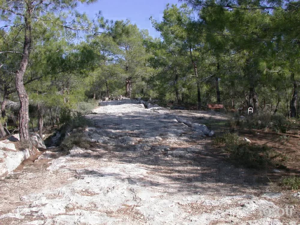
Emirler Örenyeri Ve Kent Ormanı Müzesi
As a result of the rescue excavation carried out by the Mersin Museum upon the grave finds that emerged during the works carried out by the Regional Directorate of Forestry within the scope of the Urban Forest Project, it was revealed that there were settlements here belonging to the Hellenistic-Late Roman-Early Byzantine periods.
45 minutes
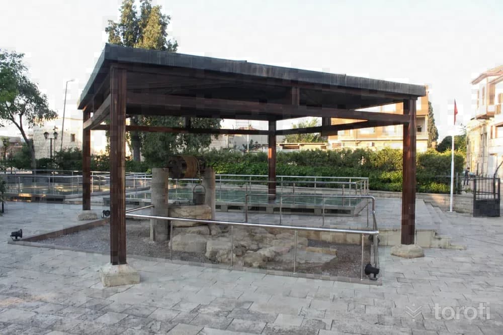
St. Paul Kuyusu
The well located in the courtyard of the place accepted as St. Paul's house in the area where old Tarsus houses are concentrated is known as St. Paul Well. In the excavations carried out in the garden of the house until recently, some walls were uncovered. Due to the importance of St. Paulus for Christianity, the fact that these remains and the well have been considered sacred since very ancient times is interpreted as traces of the belief of the Christian community that lived in the city until recently.
45 minutes
Softa Kalesi
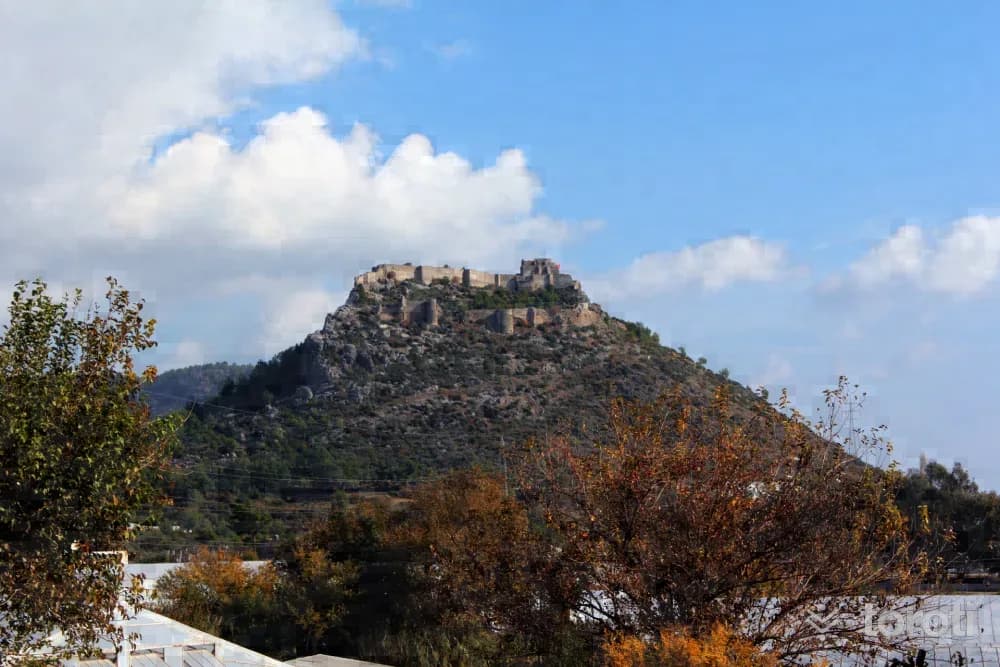
The walls of Softa Kalesi are well preserved in places and are oval in form. The defensive strength was increased with an intermediate space at the castle entrance gate located in the middle of the western walls. The building groups located on the southern slopes of Softa Kalesi, which consists of outer castle and inner castle walls and spreads over a very large area, extend as far as “Arsinoe”, an ancient port city.
45 minutes
Dağpazari Kilisesi
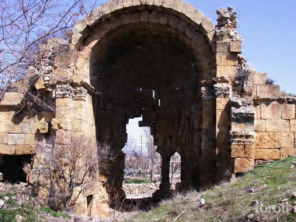
The fact that the city, whose ancient name was Corapissus, was located on the ancient road descending from Karaman to Silifke shows that special importance was attached to the city. This ancient city, surrounded by the remains of walls and bastions, has a three-aisled church with a semi-dome and apse. Emperor Zenon had this church built because he became emperor again in 476. A row of arches on either side of the central nave in the church divided this area into the side naves.
45 minutes
Silifke Atatürk Evi Müzesi
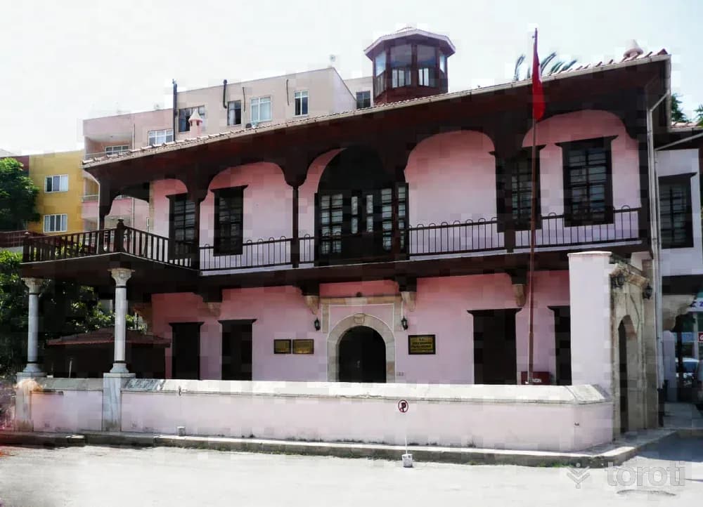
The structure, a two-storey house within a garden, was built in 1914 using wood and stone materials. The building, expropriated by the Ministry of Culture and Tourism in 1982, was opened to service as the Silifke Atatürk House Museum after being restored. Mustafa Kemal Atatürk visited Silifke four times, both due to efforts to establish cooperatives and farms and because of his domestic trips.
45 minutes
Göksu Irmağı
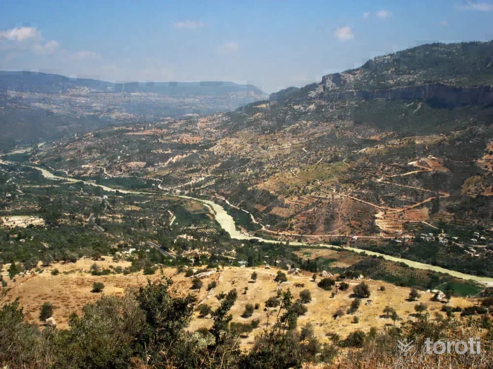
It is possible to go rafting on both the Göksu Irmağı and its tributary, Ermenek Çayı. On the Göksu, the activity is carried out by passing through canyons and plains along the 91 km long course from Mut Derinçay to Silifke. Derinçay Mut is 20 km, Mut Kışlaköy 38 km, Kışlaköy Kargıcak 13 km, and the Kargıcak -Silifke stage is 20 km. The water level is also suitable in the summer months. It is an easy course, and an alternative sporting activity can be offered to tourists coming to the region.
45 minutes
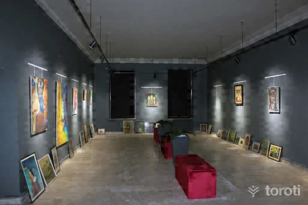
Mersin Güzel Sanatlar Galerisi
The Mersin Cultural Center building (Old Community Center), one of the first civil architectural works of the Republican Period, whose foundation was laid by Governor Tevfik Sırrı Gür in February 1944 and whose construction began, was completed in 2 years and 8 months and was opened for service on Tuesday, 29 October 1946 within the scope of the 23rd anniversary events of the founding of our Republic.
45 minutes
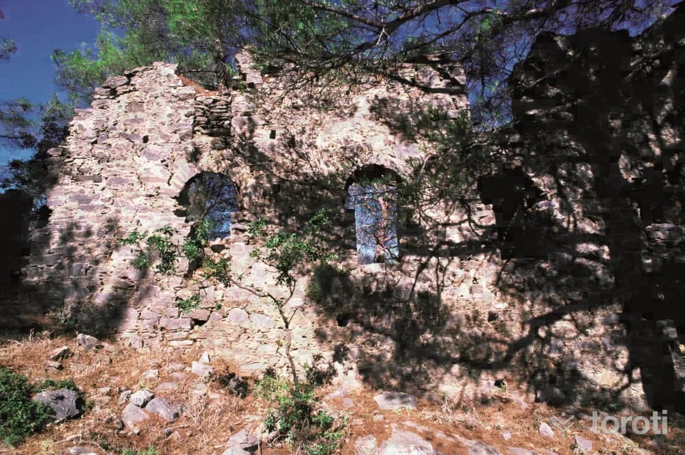
Yelbiz Kalesi
This structure, with its large courtyard, two wide halls, and most of its basilica section still standing, must have been a monastery. The entrance doors and windows were built with a round arch system. The traces of wooden beams on its interior walls give the impression that the upper covering was a wooden roof. In the middle floor of the clearly basilical structure with an apse located to the east of the building group, there are traces of mosaics in a geometric arrangement.
45 minutes