
Places to visit
Things to do in Denizli
60 destinations, each with a description, how long it takes and where it sits on the map.
In short
toroti’s catalogue holds 60 described destinations within Denizli. The themes that come up most: History, Faith heritage, Local culture, Nature, Museum, Culture.
Districts of Denizli
Hierapolis Antik Kenti
Denizli ilinin 18 km. kuzeyinde yer alan Hierapolis antik kentinin Arkeoloji literatüründe “Holy City” yani Kutsal Kent olarak adlandırılması, kentte bilinen bir çok tapınak ve diğer dinsel yapının varlığından kaynaklanmaktadır. Kentin kuruluşu hakkında bilgilerin kısıtlı olmasına karşın; Bergama Krallarından II. Eumenes tarafından MÖ. II.
45 minutes
Habib-Acem Türbesi
It is located in the cemetery of Çivril District and on a mound. There is a door opened in the middle of the southern side and a small window opened on one of the southwestern sides. Two reused Byzantine impost piers placed as wedges on its side indicate the presence of a porch in front of the tomb. All the walls and dome of the tomb have been plastered with cement mortar and painted green. On the floor there is a plain, undecorated sarcophagus.
20 minutes
Hacı Ahmet Baki Yağcı Camii
The minaret of the structure, built in 1867, has a quadrangular prismatic base and a cylindrical body. The minaret body, built of brick masonry, with zigzags. The outer door of the mosque is wrought iron, and it has iron railings. In the mosque’s last congregation area, there is a pointed-arched entrance carried by concrete columns and lozenge-shaped decorations between the arches. Its fountain, which has a round arch and an inscription, is dated 1188.
20 minutes
Ahi Sinan Türbesi
Ahi Sinan organized the tradesmen of Denizli and brought them together under one roof. He made very great contributions to the Ahi culture in Denizli and took his place in history. In the 13th century, he was serving in the lodge bearing his own name to the west of the present-day Kaleiçi Çarşısı. It is known from written sources that after his death, his tomb was also built within this lodge and that it remained in service until 1876.
20 minutes
Laodikya Antik Kenti
Laodikeia Ancient City was established at a very favorable geographical point and to the south of the Lykos River. The name of the city appears in ancient sources mostly as “Laodikeia on the banks of the Lykos.” According to other ancient sources, the city was founded by Antiochos II between 261-263 BC, and the city was given the name of Antiochos's wife, Laodike.
45 minutes
Karkin Dağı
It is within the borders of Çameli district, Gürsu village, Karagöz plateau. There is continuous snow on the summit in summer and winter. The slope of the mountain is very suitable for skiing. Since there are also many monumental trees in the region, nature is wonderful. Karkın mountain is also located on the Denizli-Fetiye touristic coastal route. Access to the mountain can be provided by stabilized road.
45 minutes
Yaprakli Baraji
Yapraklı Dam, created on Dalaman Stream at Kısık Mevkii on the Gölhisar-İbecik highway, 16 km. south of Gölhisar district center, attracts interest as a picnic area with its natural beauties. Amateur fishermen from surrounding provinces show interest in the dam, which is rich in carp and trout species, for fishing.
45 minutes
Dedeköy Camii ve Türbesi
It is located in Çivril district, on the Emirhisar road, within a külliye where the mosque and bath are located. In recent times, it has undergone restoration together with the structures around it. The tomb, which has no inscription, can be dated to the 14-15th centuries based on the characteristics of the mosque next to it.
30 minutes
Hierapolis Hamam Bazilika
The bath, located next to the Frontinus gate and built in the 3rd century A.D., had the south-facing calidarium wall demolished after the 5th century and an apse added, thus transforming the bath into a three-aisled basilica. The barrel vault belonging to the previous structure was also replaced by 3 domes.
30 minutes
Hatipoğlu Cami
The structure, which was built right at the beginning of the 20th century, is a building that needs to be preserved due to its location, dimensions, use of local materials, and facade arrangement.
20 minutes
Buldan Çarşı Cami
The mosque was built in the 17th century. The structure, built of stone material, is covered with a flat wooden ceiling and a hipped roof. Together with the registered inn located right next to it, the building constitutes an important document regarding the texture of Buldan's old bazaar.
20 minutes
Er Dinlendi Türbesi
It is highly likely that this grave is the grave of a Seljuk soldier who was martyred during the conquest of the region. The villagers, however, say that it belongs to a saintly man who came from elsewhere and died here, and that for this reason it was called Er dinlendi.
20 minutes
Gölemezli Termal Turizm Merkezi
The Akköy- Gölemezli Thermal Tourism Center Area is located adjacent to the boundaries of the Pamukkale Special Environmental Protection Area, in the northwest of this region, and greenhouse cultivation based on geothermal heating is carried out in the region.
60 minutes
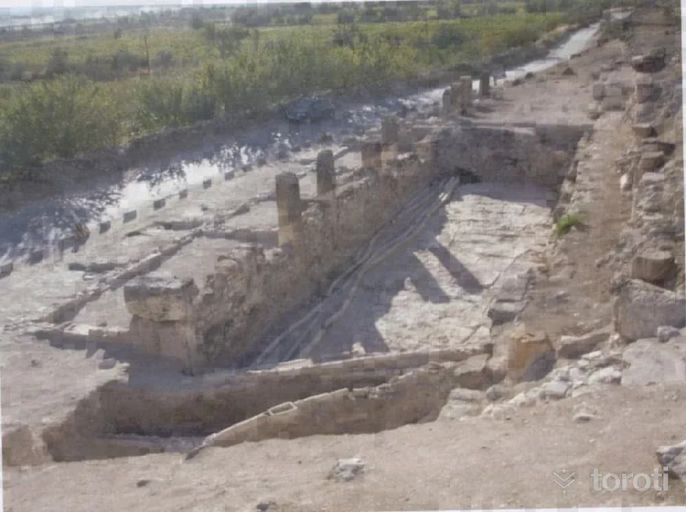
Tripolis Antik Kenti
Tripolis Ancient City; it was established on a slope on the bank of the Menderes River. It is one of the ancient cities with access to the Aegean through the valleys opening to the west and north, and to Central Anatolia and the Mediterranean through the Çürüksu Plain and its valleys to the southeast. It is 30 kilometers from its contemporary Laodikeia, established in the Çürüksu Valley to the south of the city, and 20 kilometers from Hierapolis.
45 minutes
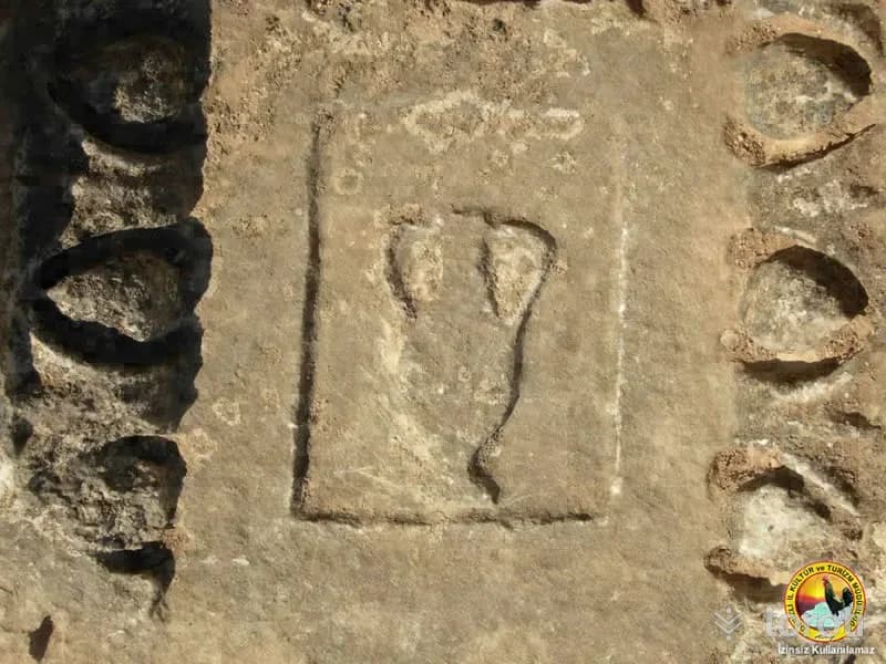
Apollon Lairbenos Tapinağı
The Temple of Apollon Lairenos, located on a small hill called Asartepe, was established on the conical hill dominating the Menderes Valley. At first glance, this temple, which gives the impression of being one of the local cult centers encountered in many regions of Western Anatolia, has for some time been attracting the attention of researchers working especially on the history of religion.
45 minutes
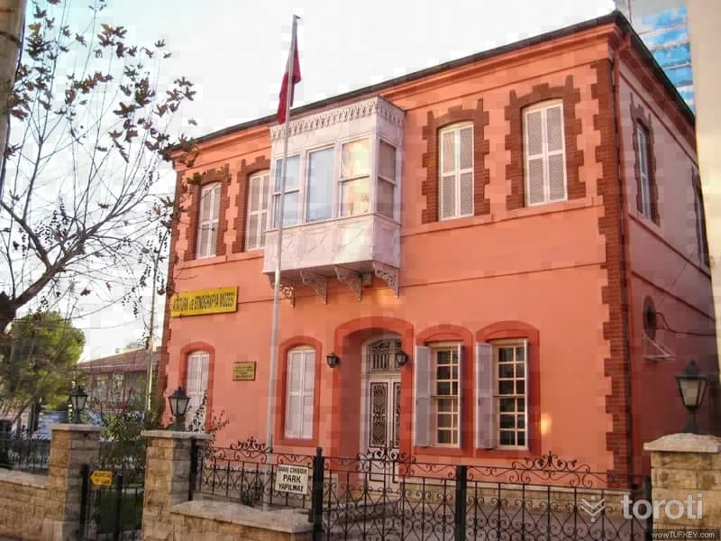
Atatürk Evi Etnografya Müzesi
Although there is no definitive document regarding the construction date of the building, according to information obtained from the local people, it is understood to have been built in the late 19th century. The building is defined as the Sakız type due to its exterior structure, plan, the form of its windows, and decorative features. Constructed as a two-storey structure, the building consists, in terms of plan, of a central hall and rooms opening onto this hall.
45 minutes
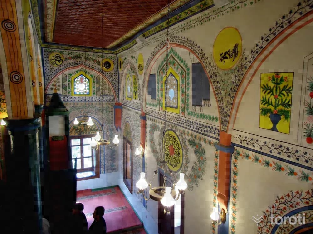
Serbanşah / Savranşah Camii
It was built in Hijri 1298, Gregorian 1882. On the inscription above the entrance door of the mosque, it is written that it was commissioned by a person named Ömer Ağa and the phrase "Didi tarih bir müferrah mabet oldu çehriya” appears. It has a longitudinal rectangular plan. In the middle, arches carried by six wooden columns, three on each side, divide the mihrab wall of the mosque interior vertically into three naves.
45 minutes
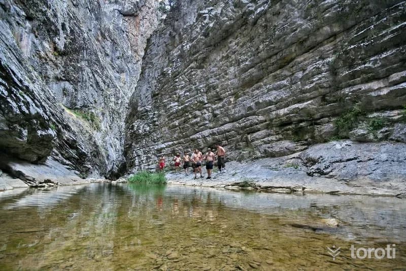
Çivril Tokali Kanyonu
Çivril Tokalı Canyon extends over an area of 20 kilometers. The canyon, at an altitude of 1600 meters, ends at the 900-meter-altitude settlement of Çivril's Gümüşsu (Homa) Town. The 1200-meter-long section of the canyon consists of rock masses, as if cut with a knife, whose height reaches 200 meters in places. Akdağ Canyon, formed by the stream flowing between these rocks, which are 4 meters apart at their widest point and 1,5 meters at their narrowest, can only be crossed in 7-8 hours.
45 minutes
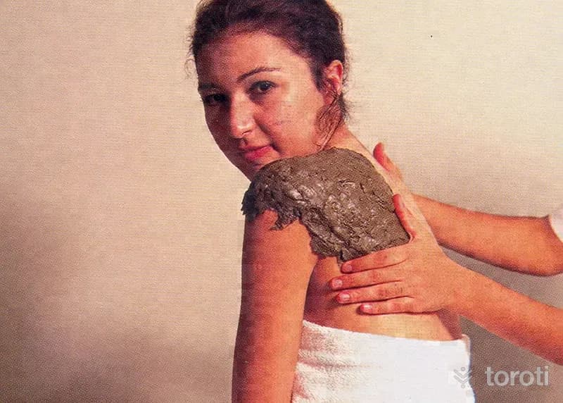
Karahayit Kaplıcaları
Karahayıt Hot Springs are in Denizli Karahayıt Neighborhood. In every season of the year, the uniquely red-colored healing thermal water and thermal mud emerging from its main source have a temperature of 58 ºC and, according to the report issued by the hydroclimatology institute of Ege University, are a unique source of health with the rich minerals they contain.
45 minutes
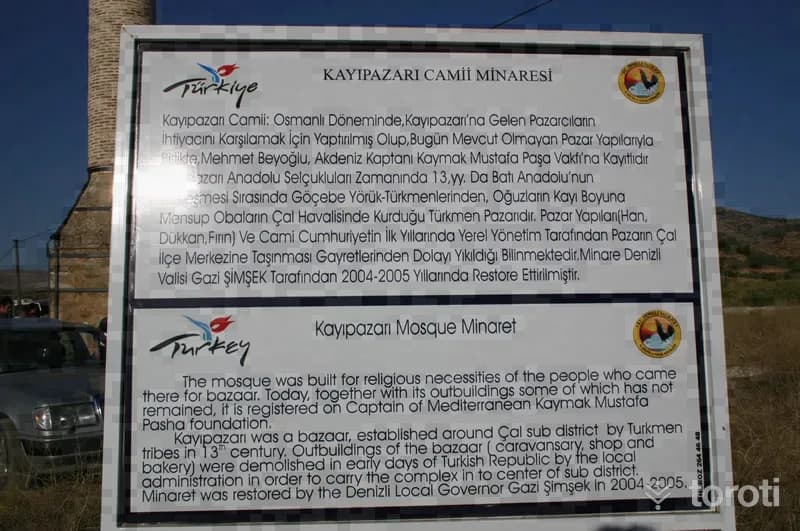
Çal Kayı Pazarı Camii
This market bearing the name "Kayı" was located in the Şeyhlu district of the Kütahya sanjak. This market, which probably began to form in the XIII. century at the crossing point of the Menderes river that constituted the Seljuk-Byzantine border, must have been active after the XIV. century. In XVI. yy dates, its name is mentioned as a medium-sized market. Today, the location of this market is indicated only by its minaret.
45 minutes
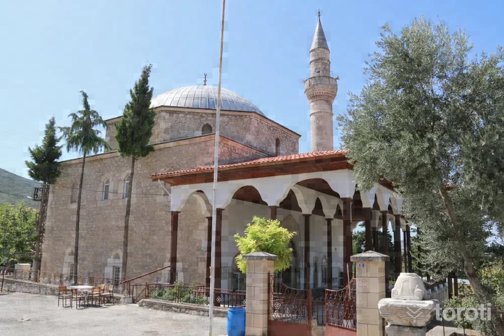
Hirka Camii
Hırka Camii, located in Hırka Neighborhood of Tavas district, is an architectural work belonging to the Ottoman Period. The prayer hall of the mosque has a square plan and is covered with a dome. To the north of the prayer hall is the last congregation area, and at its northwest corner is its minaret. Rough-hewn stone, rubble stone, and partly cut stone were used in the walls of the structure. Marble was used in the jambs and lintels of the windows and in the entrance opening of the prayer hall. The walls of the mosque are partly plastered.
45 minutes
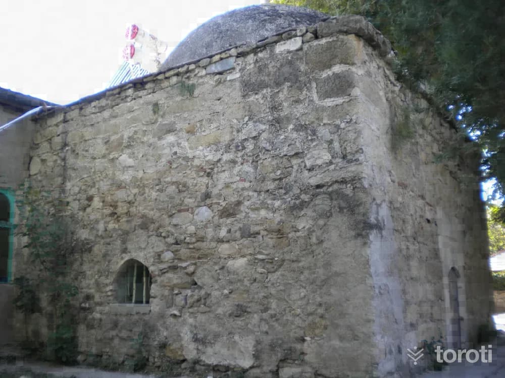
Işikli Aşağı Cami Türbesi
Işıklı Aşağı Cami Tomb was built on the eastern side of the entrance at the northeast corner of the mosque’s last congregation area. The tomb and the mosque were later joined together. The tomb was built with a rectangular plan in the east-west direction and covered with a dome. The north and east walls of the structure were built of rubble stone with brick fragments in between, while the west wall was built of cut stone material. The dome was plastered with cement mortar.
45 minutes
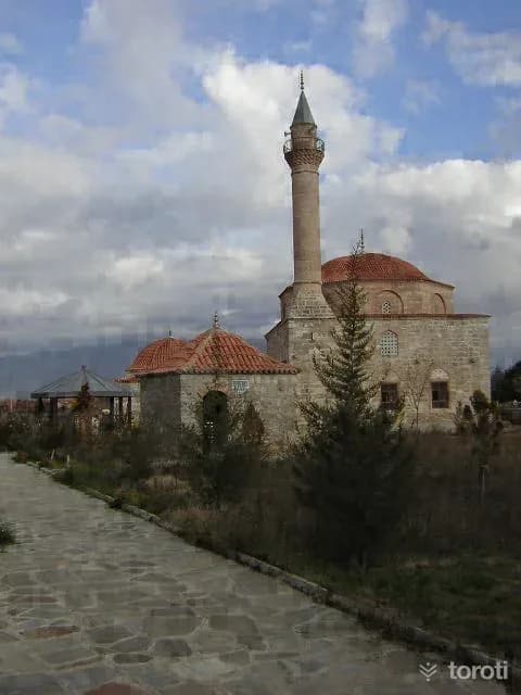
Emirhisar Dedeköy Camii
It is understood from the plan and material characteristics of Dedeköy Camii that it may have been built in the XVth or XVIth century. The mosque measures 14 x 14 meters and has a square plan. The transition from the square body to the dome is provided by squinches. As material, brick was used in elements such as the dome, arch and squinch; while spolia stones were used in the walls. The windows of the mosque are arranged in two rows. Those in the lower row are rectangular in shape, with three on the sides and two at the entrance.
45 minutes
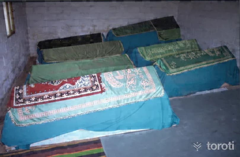
Yediler İlbadi Türbesi
İlbadi Cemetery is Denizli’s oldest cemetery and has been used from the Seljuk period (13th century) to the present day. Therefore, “Yediler Tomb” must have been inside or adjacent to İlbadi Cemetery in earlier years. However, the present road, which was later cut deeper, has separated the cemetery and the tomb from each other.
45 minutes
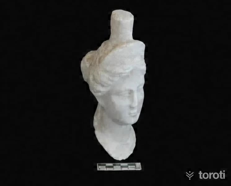
Tabea Antik Kenti
The Ancient City of Tabae has the appearance of a natural fortress. Until 30 years ago, settlement continued on the old fortress. Tabae is one of the city-states established in Anatolia after Alexander the Great. Tabae has witnessed uninterrupted settlement from the Hellenistic Period to the present day. In the Ancient Period, it minted coins in its own name. The coins were first minted in silver and later in bronze.
45 minutes
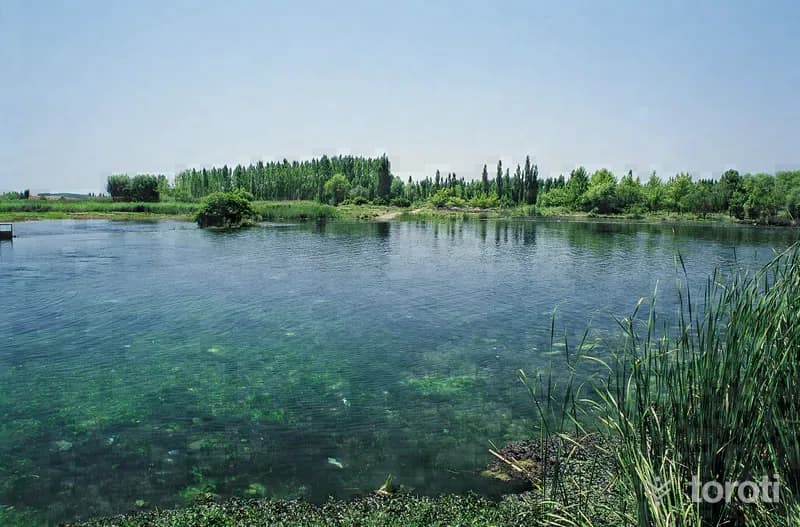
Çivril Işikli Gölü
Işıklı Lake is located in the Çivril district of Denizli. It has been granted Class A Wetland status under the International Ramsar Convention. TGA At an altitude of approximately 800 meters, its area is around 3500 hectares. The lake is fed by the Büyük Menderes River, Karanlık Dere and Kuti Stream. TGA Embankments have been built on the eastern, western and southern shores of the lake, which is fed by water sources coming from the east. For this reason, the water level in the lake has risen and the reed beds have decreased.
45 minutes
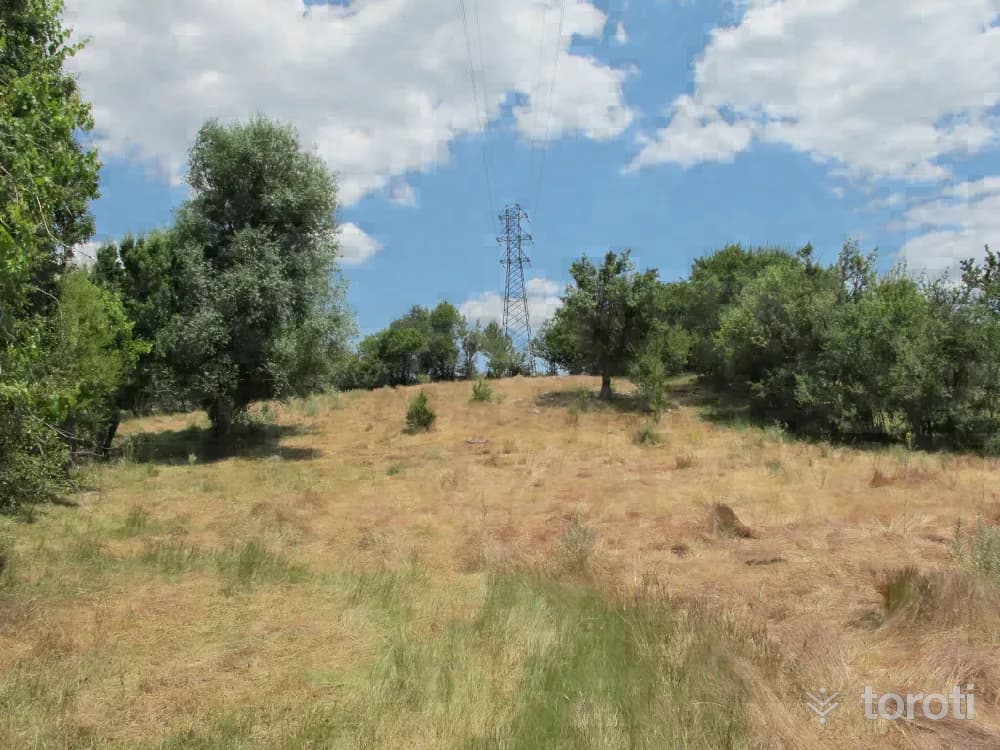
Sebastapolis Antik Kenti
Despite the extensive settlement traces of Sebastopolis Antik Kenti, it is not possible to identify structural fabric on the surface. Only some parts of the structures can be traced and seen on the surface. A large part of the city has remained under the soil due to erosion. However, some traces can be encountered during the ploughing of the land on privately owned properties used as agricultural land.
45 minutes
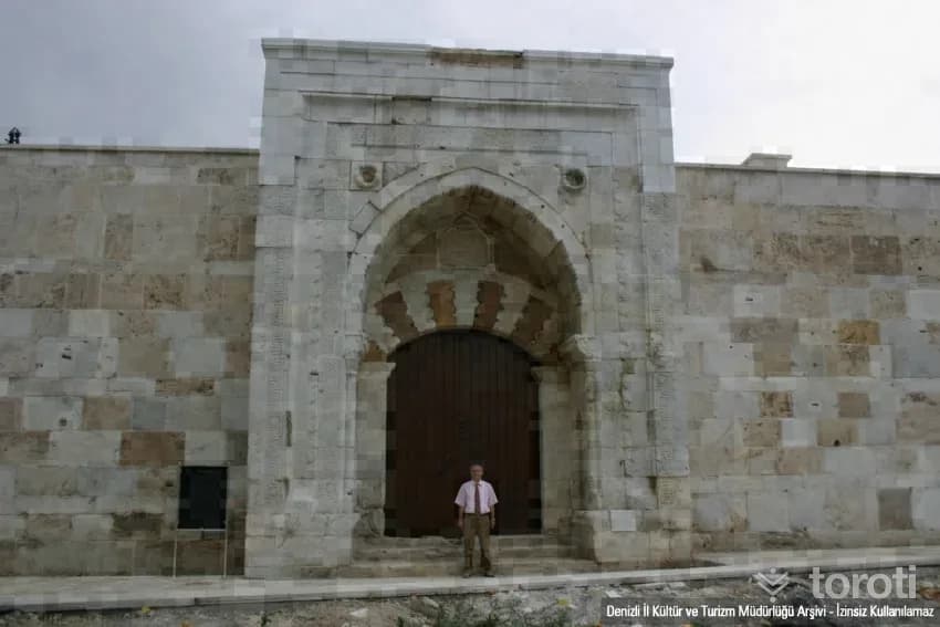
Akhan Kervansarayı
Akhan Caravanserai, one of the last caravanserais of the Anatolian Seljuks in the west and bearing two inscriptions, is a rather small inn although it conforms to the plan of the sultan hans. The inn has two inscriptions. Its enclosed section was completed in 1253 (H. 651), and the courtyard in 1254 (H. 652). It was commissioned by Governor Seyfettin Karasungur bin Abdullah. The inscription mentions the name of II. İzzettin Keykavus.
45 minutes
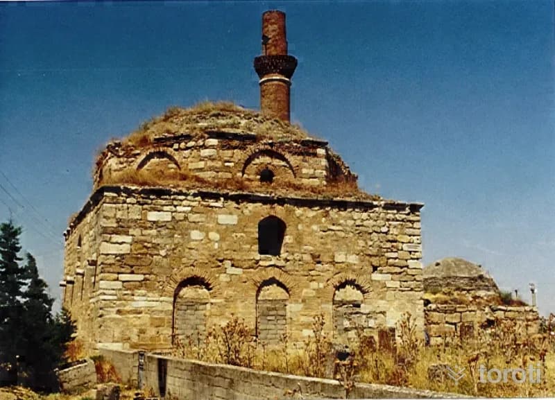
Dedeköy Türbesi
It is located in Çivril District, on the Emirhisar road, within a külliye where the mosque and bath are located. In recent times, it has undergone restoration together with the structures around it. The tomb has a square plan, a cubic body, and is covered with a dome. It was built of cut stone, with brick material used in places. Some of the stones are spolia. The dome transitions and the dome are of brick. There is an entrance door on the east, and one window each on the north and west. The south wall is blind.
45 minutes
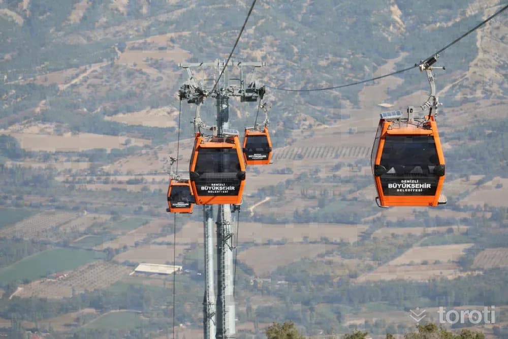
Denizli Bağbaşi Yaylası
Denizli Bağbaşı Yaylası attracts great interest in all 4 seasons of the year. Visitors enjoy cooling off at an altitude of 1400 meters. Those who go up to Bağbaşı Yaylası not only spend time as they wish, but also find the opportunity to stay here in bungalow houses and tents and enjoy local flavors together with their loved ones. The area, which is one of the centers of plateau tourism, draws attention especially for being the preference of guests coming from outside the city.
45 minutes
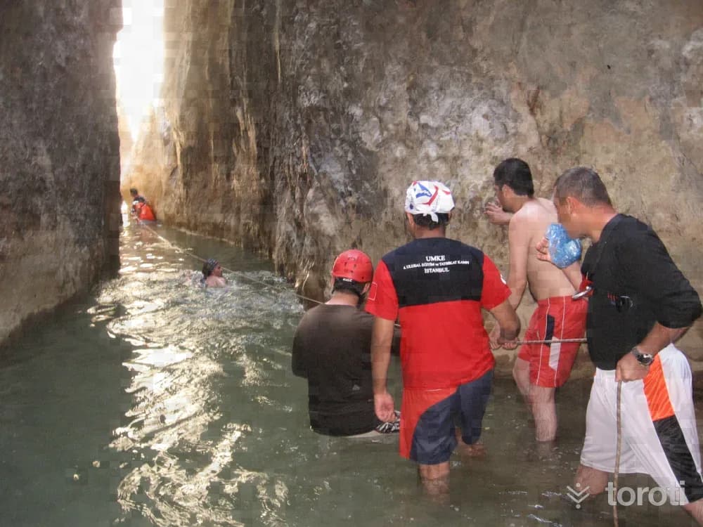
Doğa Yürüyüşü - Tokali Kanyonu
Nature Walk - Tokali Canyon Tokalı Canyon, located in Akdağ Nature Park in Sandıklı District, is a canyon with high recognition throughout the country. The canyon, estimated to be 20 kilometers long, and Akçay, which flows from the canyon into Çivril Lake, are worth seeing. Along the canyon, there are caves untouched by humans and routes that will attract the interest of those who do trekking. The narrowest part of the canyon is 1,5 meters and the widest part is 4 meters. Passing through the canyon takes 7-8 hours.
45 minutes
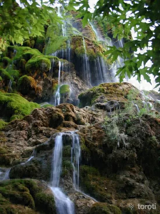
Güney Şelalesi
Güney Waterfall is located within the borders of Cinlere Neighborhood in the Güney district of Denizli province. It is on the bank of the Menderes River, which passes approximately 4 kilometers south of the Güney district. The waterfall is one of the places worth seeing in terms of its natural beauty. This hidden paradise, 70 kilometers from Denizli, is a First Degree Natural Protected Area. It is fed by water sources emerging from the slopes of Cindere Mountain, located 3 kilometers from the center of Güney district.
45 minutes
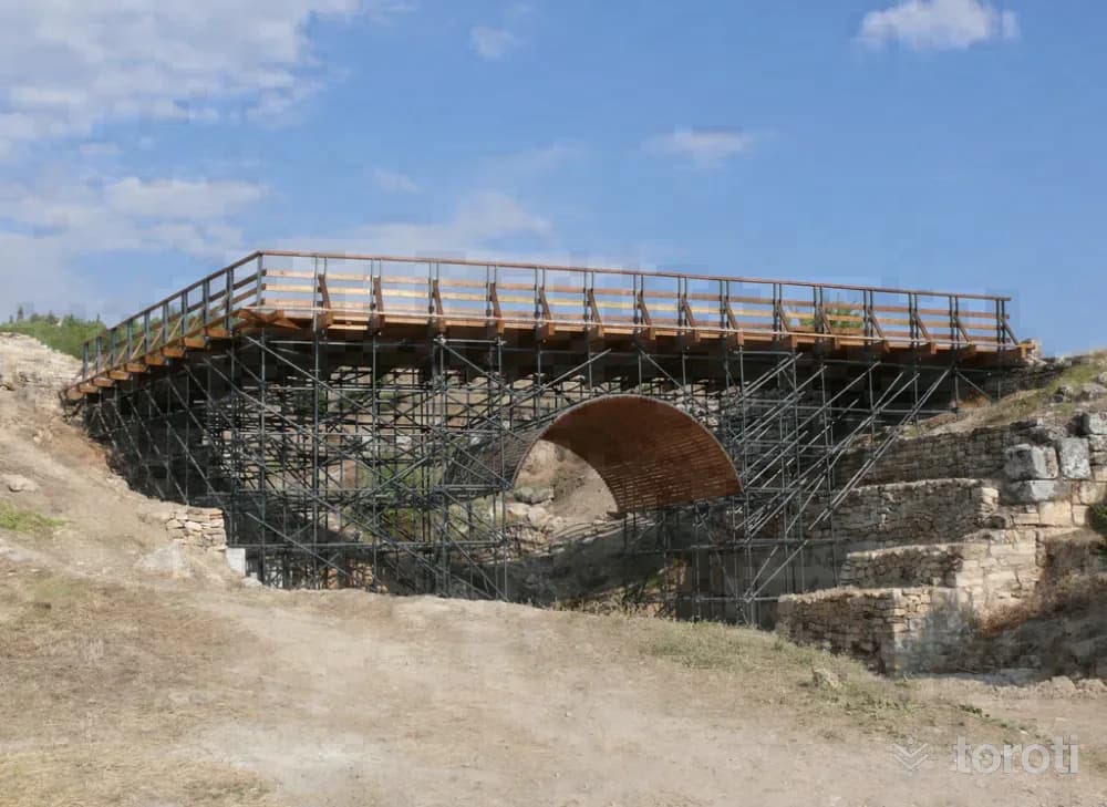
Aziz Philippus Köprüsü
In the eastern part of the Ancient City of Hierapolis, immediately after the Saint Phılıppus Gate, there is a large bridge. Of this large structure, made up of large rectangular travertine blocks (its width reaching 12 metres), only the southern back part has survived; the structure is located on the continuation of the road coming from the city centre paved with stone. After crossing the bridge, one reaches the Saint Phılıppus Martyriıon located on the dominant hill.
45 minutes
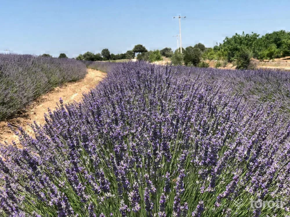
Denizli Gözler Kekik-lavanta-adaçayi Bahçeleri
A large part of thyme production in Turkey and in the world is produced in Pamukkale Gözler Mahallesi. In addition to thyme, sage and lavender are cultivated. The lavender gardens, which offer colorful views in the summer months, are open to visitors. While the lavender gardens create centers of attraction visually, lavender essential oil is used mostly in the cosmetics and perfume industry.
45 minutes
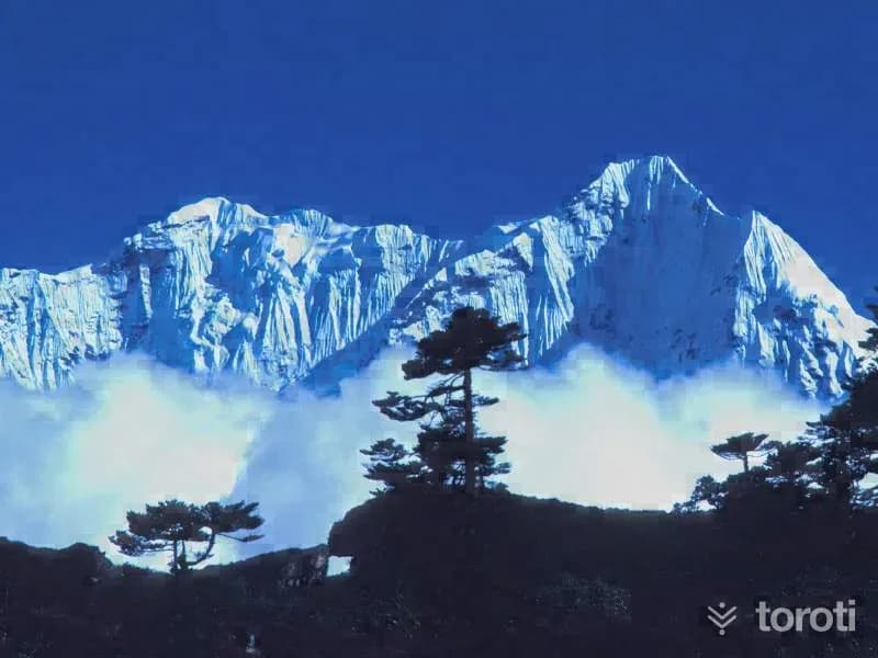
Honaz Dağı
Although Denizli province is in the Aegean Region on Turkey’s geographical map, the climate of the Aegean Region is not seen completely in climatic terms. Since it is at the point of passage from the coastal areas to the inland regions, the continental climate of the inland regions is felt, albeit slightly. Slightly lower temperature differences than the climate of the Aegean Region can be seen. Since the mountains in Denizli province generally extend perpendicular to the sea, they are open to winds coming from the sea. Winters are mild and rainy.
45 minutes
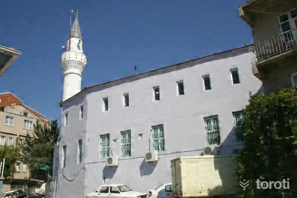
Güney Çarşı Camii
The structure, which is one of the deeply built, single-section mosques covered with a flat ceiling, has a hipped roof and is covered with tiles. On the wooden ceiling of the structure, there are octagonal-form decorations containing lozenge motifs. The mihrab, which has a niche with a semi-circular section, has a frame with moulded piers. To the west of the mihrab, there is a wooden minbar. On the north side of the harim, there is a women's gallery resting on wooden posts.
45 minutes
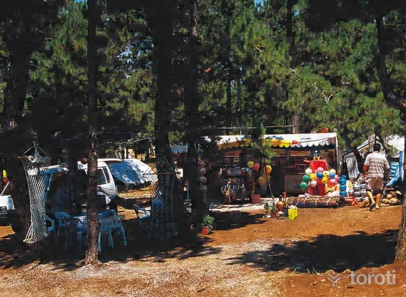
Yatağan Kefe Yaylası
Where is Yatağan Kefe Plateau? Kefe Plateau is located on the asphalt road connecting Denizli Yatağan and some villages of Honaz District. On the plateau, at an altitude of 1100 meters, there are black pine, red pine and juniper trees. Its infrastructure and superstructure, such as electricity, water, tents, picnic areas, toilets, showers, a restaurant, a market, a butcher and various sports areas, were completed by the municipality, and it has been serving domestic tourism since 2000.
45 minutes
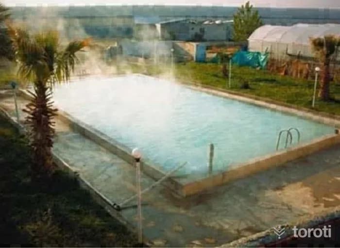
Akköy Gölemezli Termal Turizm Merkezi
The Akköy Gölemezli Thermal Tourism Center Area is located adjacent to the boundaries of the Pamukkale Special Environmental Protection Area, in the north-west of this region, and covers the residential areas of the neighborhoods of Gölemezli (Town), Çeşmebaşı (Village), and Kavakbaşı (Village), all affiliated with Pamukkale District, as well as the south-west regions outside the residential areas of the neighborhoods of Belenardıç (Village), Haytabey (Village), and Eymir (Village), also affiliated with the same district.
45 minutes
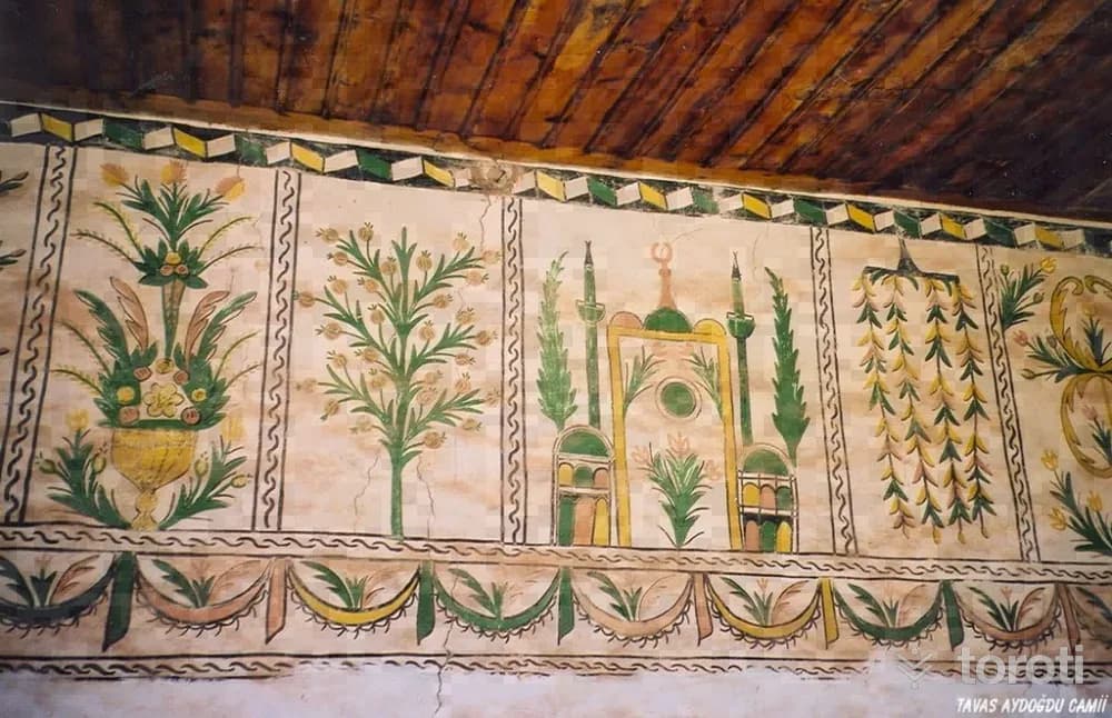
Aydoğdu Mahallesi Camii
The mosque was built with timber lacing and rubble stone walls. It has a square plan and a last congregation area opening outward with six wooden posts. Inside, the mosque is also divided into naves by six wooden posts. The interior walls of the mosque and the walls of the last congregation area are decorated with stylized plant, mosque, curtain motifs and old inscriptions within medallions. The door of the mosque was made using the false kündekari technique and has survived to the present day in quite sound condition.
45 minutes
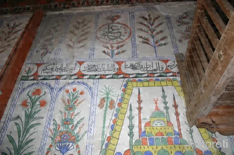
Boğaziçi Kasabası Eski Camii
Boğaziçi Kasabası Eski Camii has a vertically rectangular plan and three naves. It was built in Hijri 1181. Its walls are stone up to foundation level, with adobe masonry above. The rectangular-plan prayer hall is divided into three naves by wooden supports. The supports are connected to each other by Bursa arches. The side walls are supported internally and externally by square wooden posts. The mihrab is in the form of a semicircular niche covered with a muqarnas semi-dome.
45 minutes
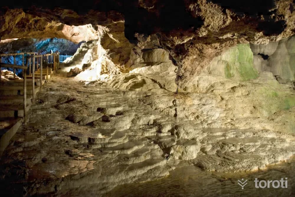
Kaklik Mağarası
Kaklık Cave is located in Kaklık Neighborhood of Honaz district, 30 kilometers from Denizli city center on the Denizli-Ankara highway. There is thermal water inside the cave. TGA It is known that the clear, colorless and sulfur-smelling water is good for some skin diseases. In addition, a swimming pool, small amphitheater, viewing areas, cafeteria and gazebos near the cave have been made available for visitors since May 2002.
45 minutes
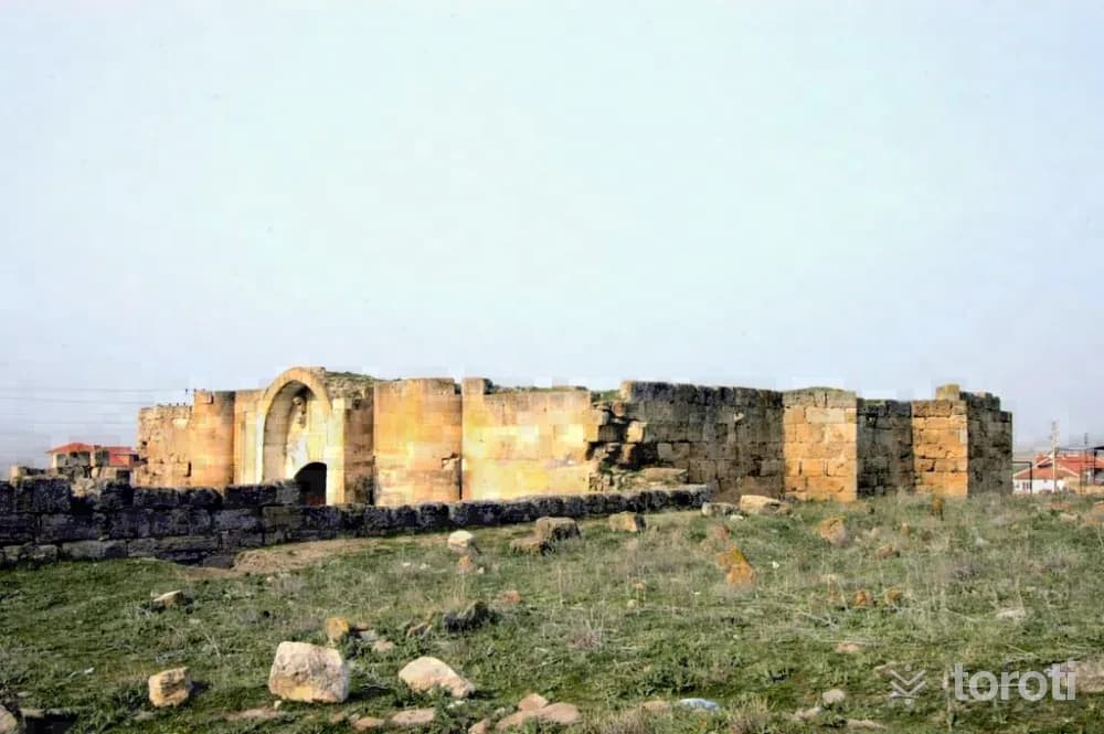
Çardak Kervansarayı
According to the seven-line inscription on Çardak Kervansarayı, it was commissioned during the time of Alaeddin Keykubat by his freed slave and one of his emirs, Esededdin Ayaz bin Abdullah el Şahabi. It was completed in the month of Ramadan in 1230 and, according to its inscription, was built as a “Ribat”. Built on an east-west axis, the han constitutes a simplified counterpart of the sultan hans with its rather large square courtyard and its hall consisting of six sections and five aisles.
45 minutes
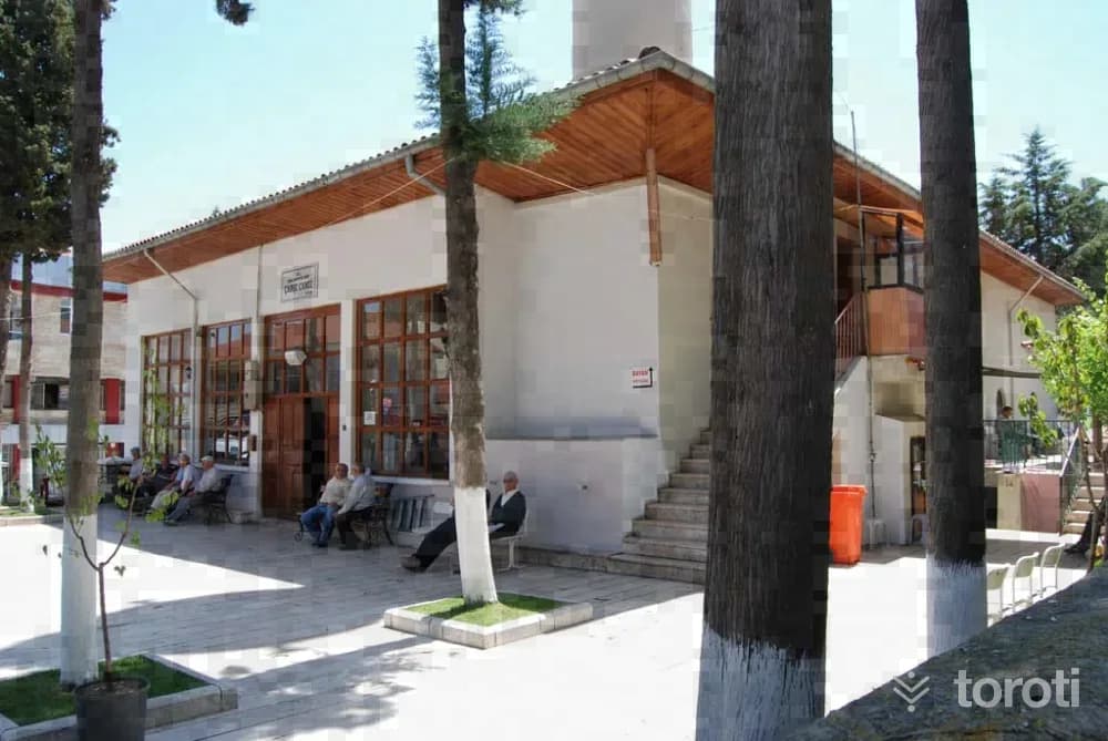
Çal Çarşı Camii
The mosque dates to the mid-19th century. The structure, which has a rectangular plan close to a square, has a last congregation area on its north side. The mosque walls were built with stones, while its minaret was built with bricks. The prayer hall is covered with a large cross vault in the center and four small cross vaults in the corners. Its minbar is in the faux kündekari technique. Its plaster mihrab has quite simple workmanship. From its inscription, it is understood that the minaret was built in the 19th century.
45 minutes
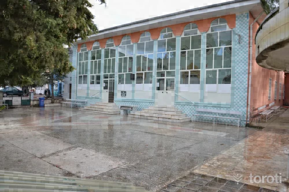
Nikfer Hasan Feyzi Efendi Camii
The load-bearing elements and eaves of the square-planned structure were built in masonry. The tomb and the mosque are under the same roof. The outer edge decorations of the windows on the exterior facades, the interior doors of the mosque and the tomb, and the arched passages seen on the lower and upper floors in the last congregation area are parts belonging to the original structure. Its current covering is in the form of a saddle roof, covered with Marseille-type tiles. The ceiling was made as a flat wooden ceiling.
45 minutes
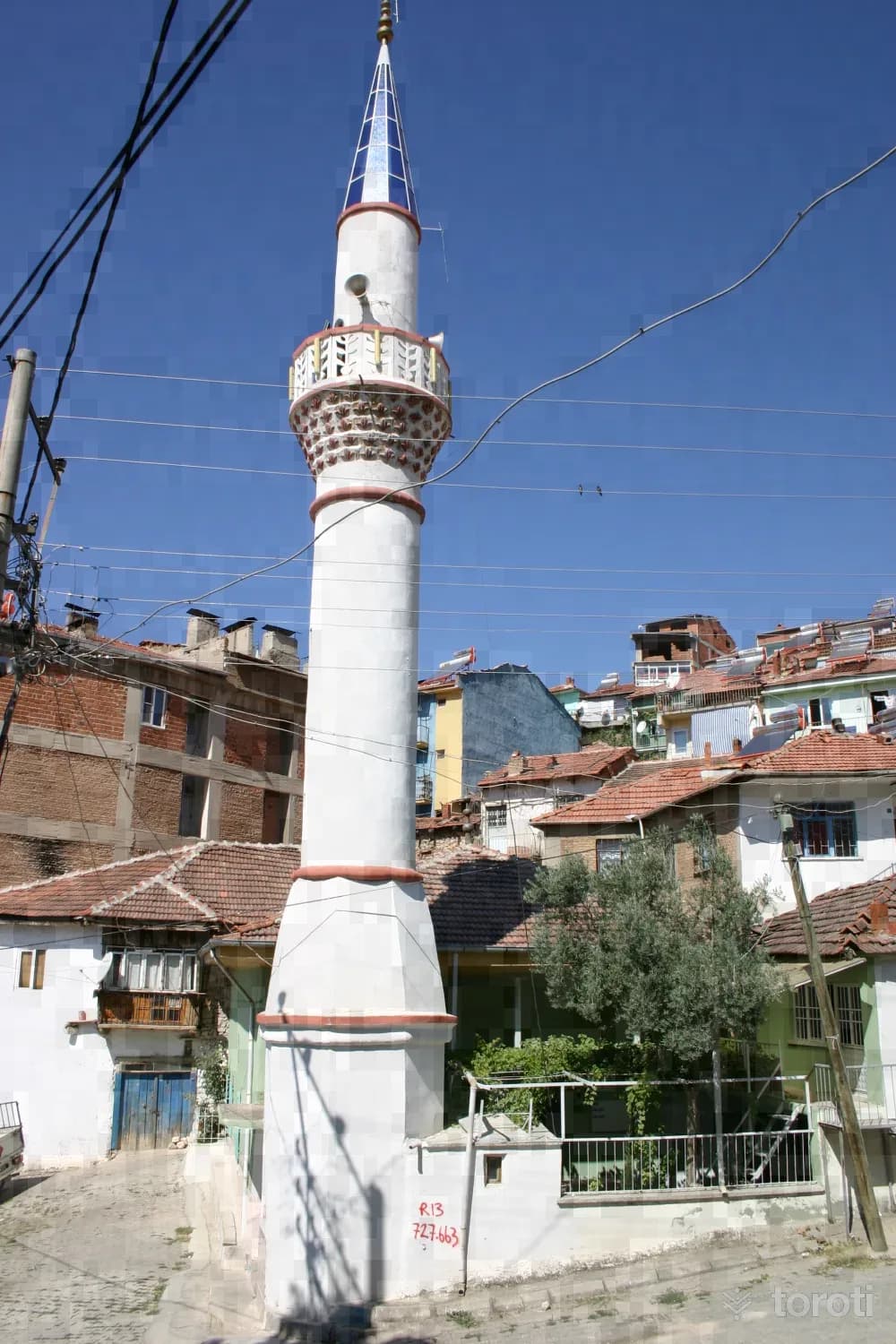
Güney Dere Camii
The square-planned structure is covered with a flat wooden ceiling and a hipped roof. The structure, which does not have a last congregation area, has an entrance section with wide eaves supported by a wooden post. Only the door of the structure has wooden joinery; its rectangular windows were later replaced with plastic joinery. In addition, it has an annex built adjacent to the structure, covered with tiles and having iron-framed windows and a door.
45 minutes
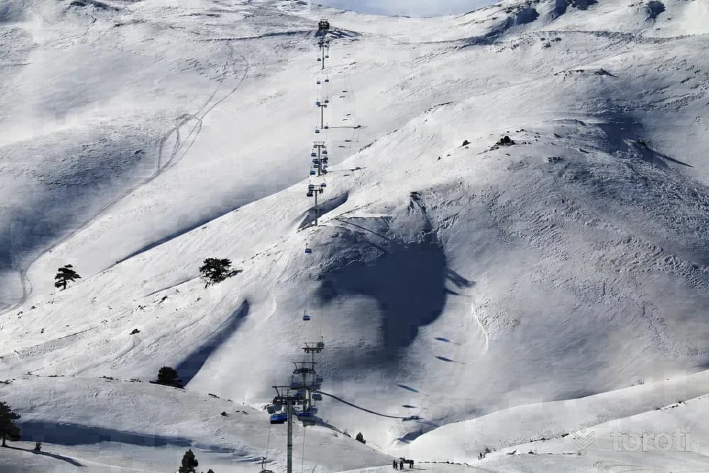
Denizli Kayak Merkezi
Located at an altitude of 2420 meters and 75 km from Denizli city center, Denizli Kayak Merkezi is situated on Bozdağ within the borders of Nikfer Mahallesi, which is connected to Tavas District. The center has 9 slopes with a total length of 13 kilometers, and features 2 chairlifts, 1 ski lift and a moving walkway. The mechanical facilities, which serve amateur and professional skiers, can carry 2,500 people per hour.
45 minutes
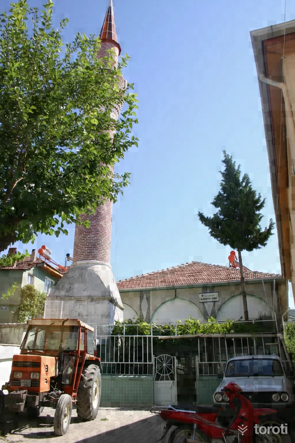
Hacı Hüseyin Camii
Hacı Hüseyin Camii is a square-planned structure covered with a flat wooden ceiling. The minaret of the structure, built in 1867, has a quadrangular prismatic base and a cylindrical body. The minaret body, built of brick masonry, is decorated with zigzags. In the minaret, which has a single balcony, the transition from the cylindrical body to the balcony is made with a projecting cylindrical molding-ring, and there are projecting triangular decorations beneath the balcony. The outer door of the mosque is of iron joinery, and it has iron railings.
45 minutes
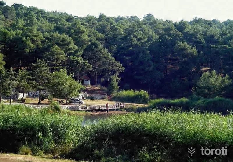
Sakli Göl
Saklı Göl, or by its other name Yukarı Dağdere Gölü, is a natural lake with a very beautiful view among pine trees. Picnics can be held around the lake. It is an ideal area for day trips and nature walks. Its water is fresh, and there are freshwater fish. Where is Saklı Göl? By following the Denizli-Ankara highway for approximately 28 kilometres, turn onto the road branching off to the south before reaching Kaklık Mahallesi.
45 minutes
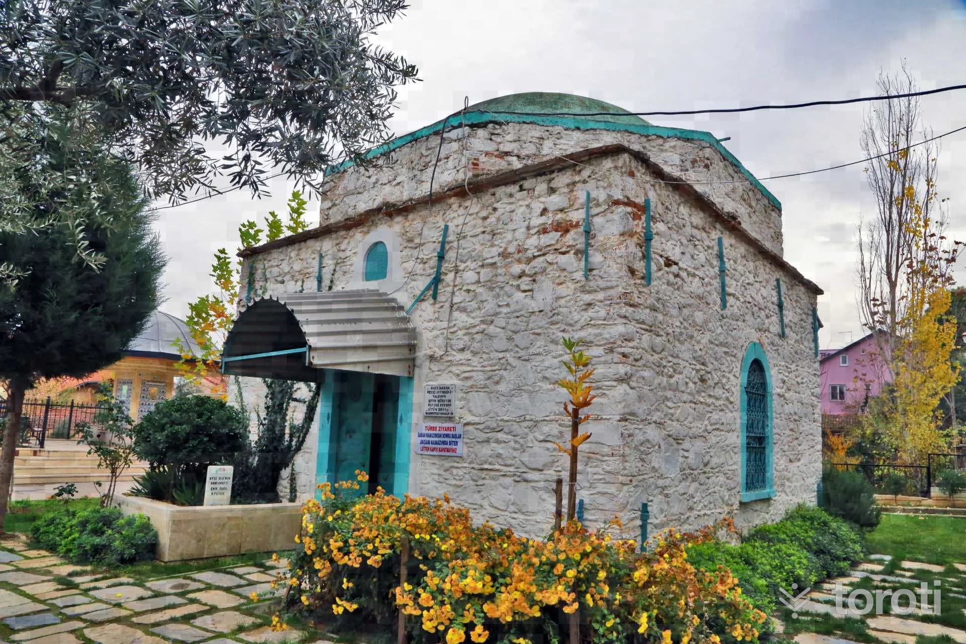
Üzüm Dede Türbesi
Üzüm Dedesi Tomb, located in the Üzüm Dedesi Area of Merkezefendi Neighborhood in Merkezefendi district, is a work from the Ottoman Period. The tomb belongs to Sheikh Hüseyin Hulusi Efendi, a student of Hacı Hasan Fevzi EFendi, known as ‘Üzüm Dedesi’. He was born in 1838 in Bayındır district of İzmir province. In his youth, he worked in spinning wheel manufacturing and, for an unknown reason, ended up in prison.
20 minutes
Solmaz Çarşı Camii Ve Haziresi
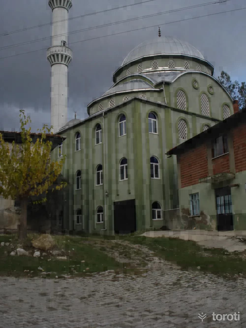
The mosque is a square-planned structure with a flat wooden ceiling, covered with a hipped roof. Its minaret is made of brick. It is a mosque that reflects the characteristics of its period with its mihrab and decorated ceiling centerpiece. In the prayer hall, the women's gallery is located on arches carried by wooden supports. Its windows are rectangular in form. Over time, some of them have been replaced with aluminum joinery. In the graveyard located in its garden, there are two old graves dated 1242 and 1244.
45 minutes
Hierapolis Arkeoloji Müzesi
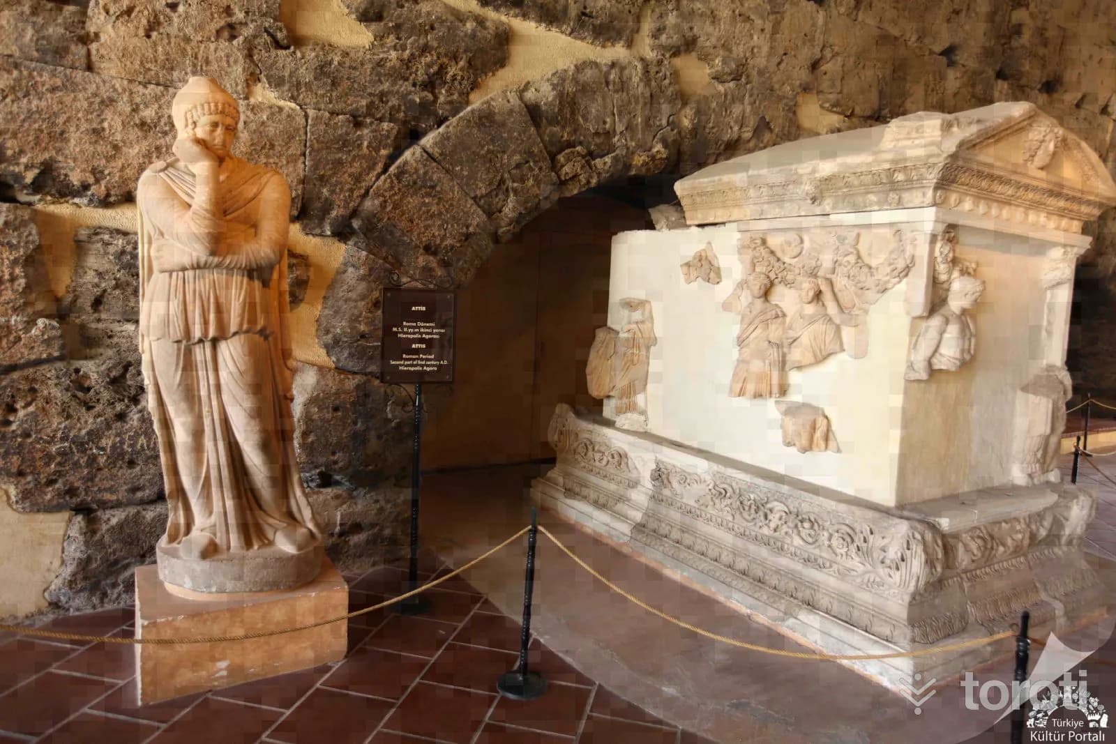
The Roman Bath, one of the largest structures of the ancient city of Hierapolis, has been serving as the Hierapolis Archaeology Museum since 1984. In addition to the artifacts unearthed in the Hierapolis excavations, the museum also contains works from the ancient cities of the Lycos (Çürüksu) valley such as Laodikeia, Colossai, Tripolis, and Attuda. In addition, archaeological finds obtained from Beycesultan Höyüğü, which presents some of the finest examples of the Bronze Age, constitute an important section of the museum.
45 minutes
Herakleia Hieronu
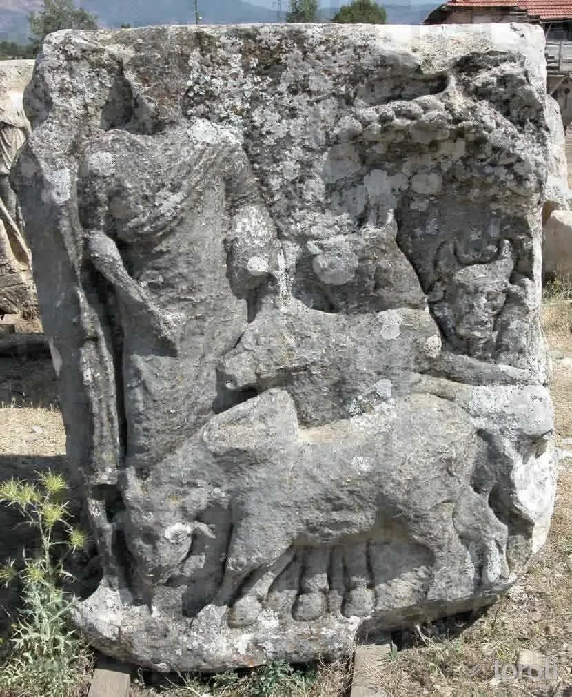
It is located in the place called Ören Sırtı and Kocapınar locality. Hieron, located on the ridge of Salbacos (Babadağ) mountain, is rectangular in shape. Reliefs consisting of plaques surround its four sides. Mythological scenes related to Armetis, Apollon, Pan, Dionysos and Herakles are depicted in the reliefs. It belongs to the 1st century AD Roman Period. Symbols representing the 12 zodiac signs are found on the triangular pediments. It was made by masters from Aphrodisias.
45 minutes
Yediler Cami ve İlbadı Türbesi
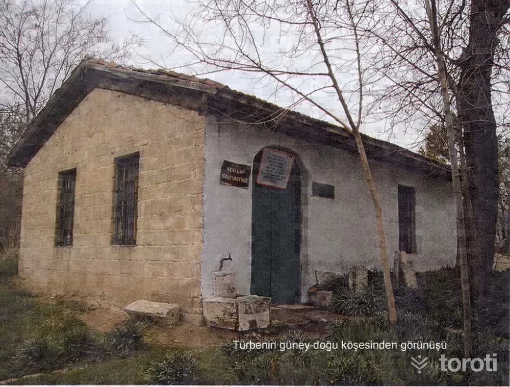
İlbadi Cemetery is Denizli’s oldest cemetery and has been used from the Seljuk period (13th century) to the present day. Therefore, “Yediler Tomb” must have been inside or adjacent to İlbadi Cemetery in earlier years. However, the present road, which was later opened by deepening, has separated the cemetery and the tomb from each other. Apart from this, in earlier years, M., which was located in İlbadi Cemetery.
30 minutes
Apollonia Salbace Antik Kenti (Medet Höyüğü)
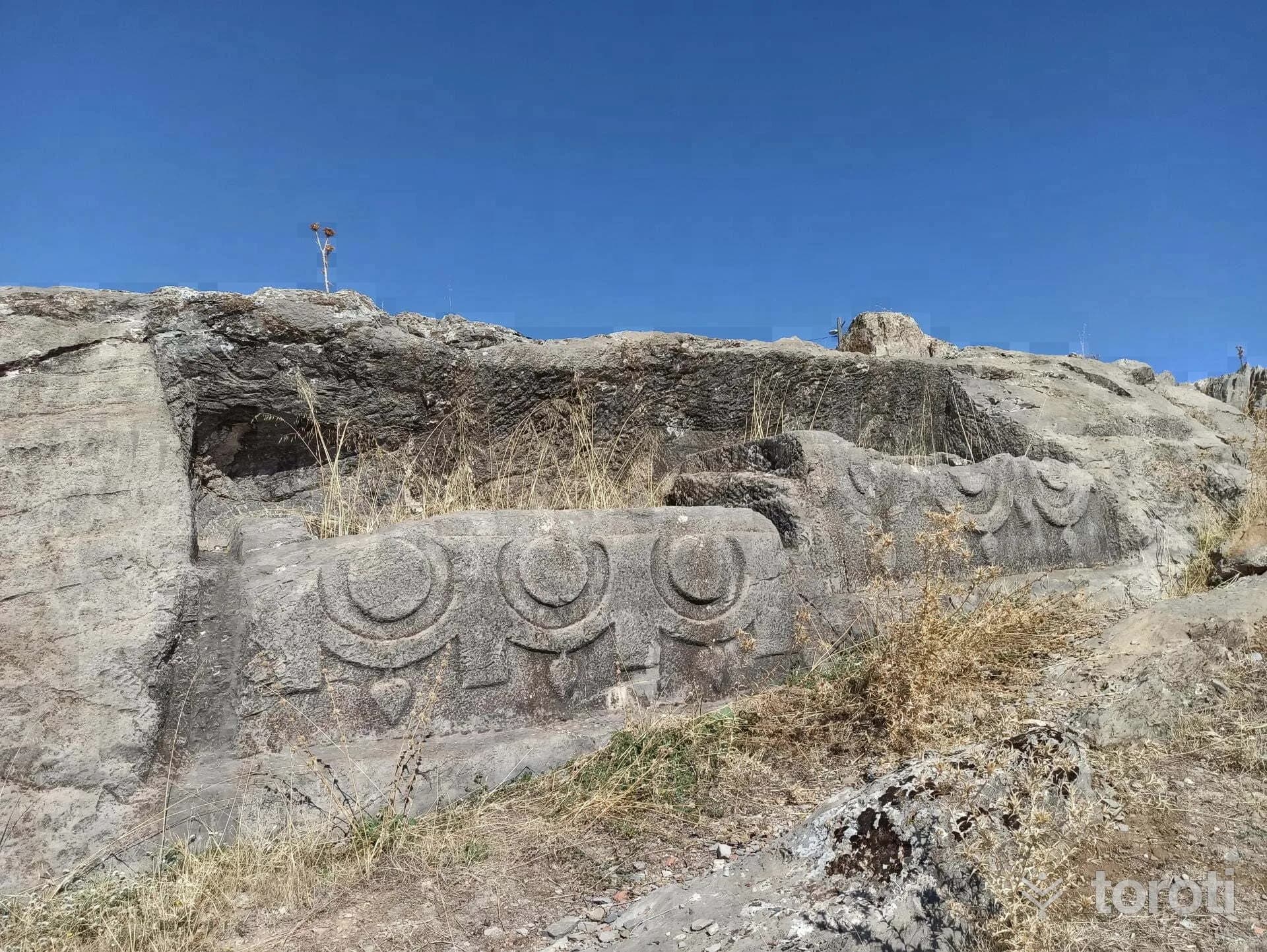
The ancient city of Apollonia and Medet Höyüğü are located within the settlement area of Medet village, established on a flat plain 7 km west of Tavas district of Denizli province. Apollonia, established on the most fertile lands of the Tavas plain, is one of the ancient cities with access to the Caria region via the Tabae road to the west, to the Lycia region via the Sebastopolis road to the south, and to the Lycia region and the Phrygia region via the Tavas road to the east.
45 minutes
Hierapolis Büyük Hamam Kompleksi (Roma Hamamı)
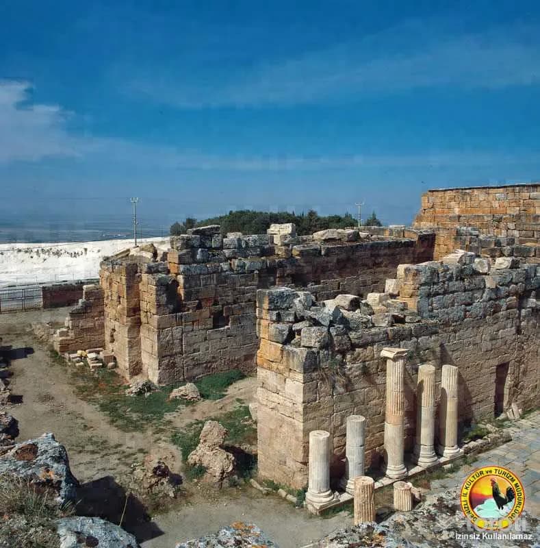
Today, there are traces indicating that the interior spaces of the structure, whose massive walls and some vaults have remained standing, were covered with marble. The plan of the bath is like other typical Roman baths. First, at the entrance, there is a large courtyard, an enclosed rectangular area with large halls on both sides, and the main bath structure added later. In the side wings of the palaestra, there are two large halls, one in the south and the other in the north, reserved for the emperor and ceremonies.
30 minutes
Hierapolis Antik Kenti Katedral
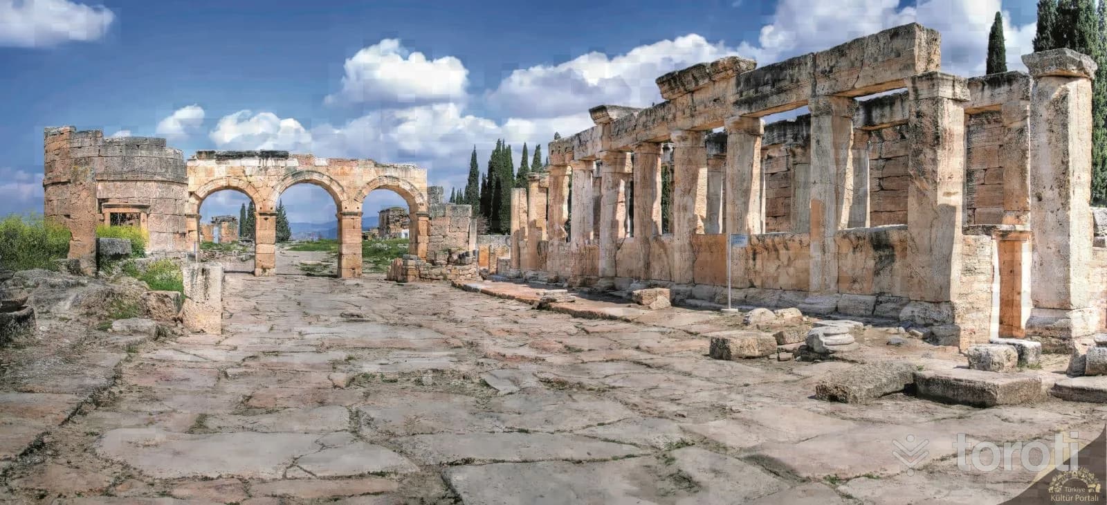
It is one of the most important Christian cult structures of Hierapolis Antik Kenti. The baptismal area is entered through the door on the right; the rectangular, apsidal space is divided into 3 naves by columns. The entablature was carried by the second row of columns belonging to the section where women sat. The apse has a round interior and a polygonal exterior plan. Inside the main apse is the concentric stepped seating, synthronon, where the priests and the bishop sat during the ceremony. The building plan shows us, with the medieval repairs and A.D.
30 minutes
Aci Göl
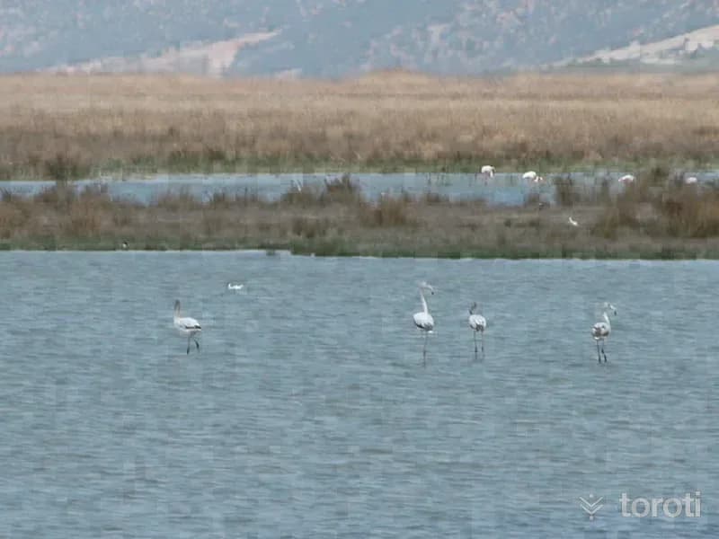
Acı Göl, or by its other name Çardak Gölü, is a tectonic lake. Its surface area is 41,34 km. It is between Çardak district and Afyon-Dazkırı district. The lake is fed by waters descending from the Söğüt mountains. The lake, also called a bitter salt lake, has an altitude of 836 meters. In the lake there are potassium, sodium and sulfate combined with salt. In Gemiş (Kasabası) Mahallesi, south of Çardak, there is a bird observation tower for the birds living on the lake.
45 minutes
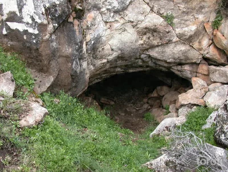
Sirtlanini Mağarası
The cave is 13.5 kilometers from Karacasu District and 9.5 kilometers from Afrodisias. The cave is, in general, a natural wonder. It is 348 meters long. After the entrance section, which can be entered by crawling for approximately 4 meters, the cave suddenly becomes a large gallery. The ceramic fragments seen in the part of the gallery close to the entrance suggest that there was an ancient settlement. There are stalactites and stalagmites.
45 minutes
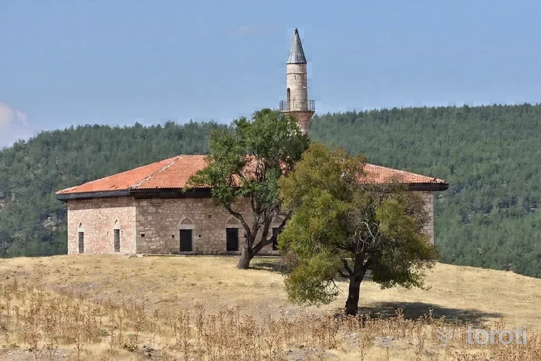
Cevherpaşa Cami
The Hijri date 1235 can be read on the inscription band above the door. The structure is covered with a hipped roof and clad with Marseille tiles. Although its original covering was a flat roof, in later years a hipped roof was built to ensure the protection of the structure. In the Ottoman period, 19th century.
20 minutes
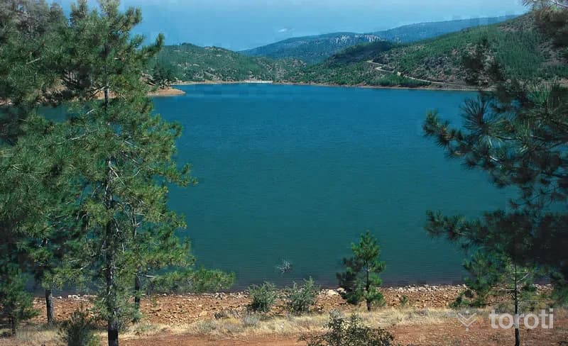
Eşen Göleti
Eşen Pond and its surroundings were granted the status of an in-forest recreation area in 1995. Its total area is 231.50 hectares. The pond, located at an altitude of 850 meters, has a water surface area of 75 hectares and sport fishing is practiced there. Mirror carp have been bred in the pond. Its potential for water sports is high. Its surroundings are covered with red pine forests. There are no facilities in the area.
45 minutes