
Places to visit
Things to do in Çivril
15 destinations, each with a description, how long it takes and where it sits on the map.
In short
toroti’s catalogue holds 15 described destinations within Çivril, Denizli. The themes that come up most: Faith heritage, Local culture, Nature, History.
Habib-Acem Türbesi
It is located in the cemetery of Çivril District and on a mound. There is a door opened in the middle of the southern side and a small window opened on one of the southwestern sides. Two reused Byzantine impost piers placed as wedges on its side indicate the presence of a porch in front of the tomb. All the walls and dome of the tomb have been plastered with cement mortar and painted green. On the floor there is a plain, undecorated sarcophagus.
20 minutes
Dedeköy Camii ve Türbesi
It is located in Çivril district, on the Emirhisar road, within a külliye where the mosque and bath are located. In recent times, it has undergone restoration together with the structures around it. The tomb, which has no inscription, can be dated to the 14-15th centuries based on the characteristics of the mosque next to it.
30 minutes
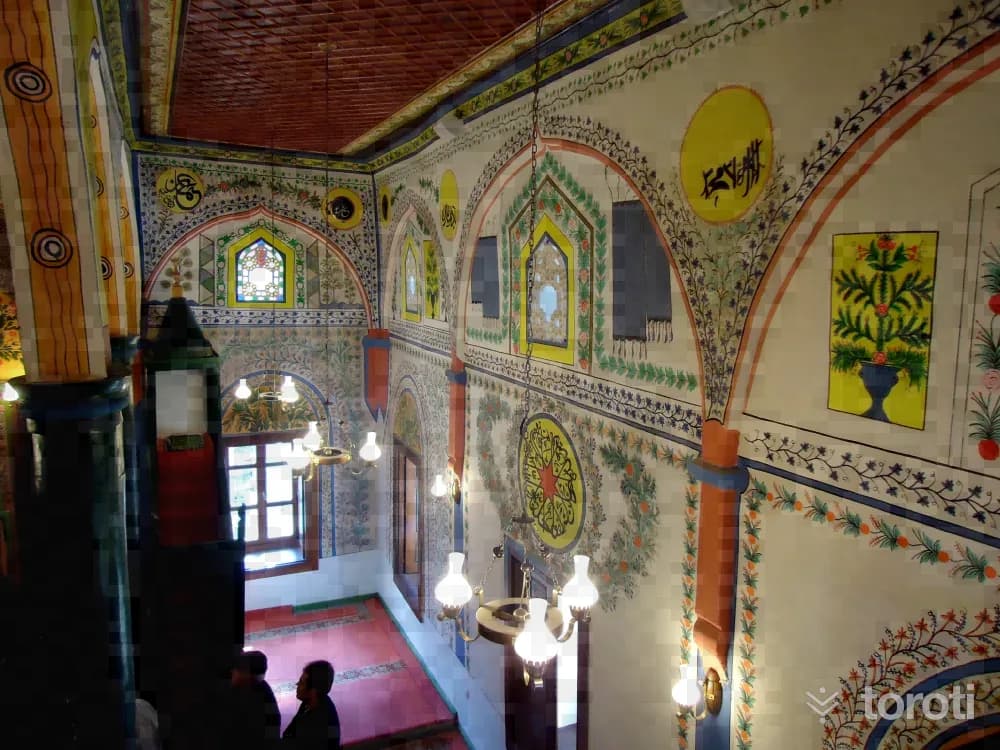
Serbanşah / Savranşah Camii
It was built in Hijri 1298, Gregorian 1882. On the inscription above the entrance door of the mosque, it is written that it was commissioned by a person named Ömer Ağa and the phrase "Didi tarih bir müferrah mabet oldu çehriya” appears. It has a longitudinal rectangular plan. In the middle, arches carried by six wooden columns, three on each side, divide the mihrab wall of the mosque interior vertically into three naves.
45 minutes
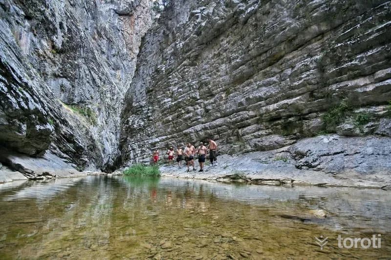
Çivril Tokali Kanyonu
Çivril Tokalı Canyon extends over an area of 20 kilometers. The canyon, at an altitude of 1600 meters, ends at the 900-meter-altitude settlement of Çivril's Gümüşsu (Homa) Town. The 1200-meter-long section of the canyon consists of rock masses, as if cut with a knife, whose height reaches 200 meters in places. Akdağ Canyon, formed by the stream flowing between these rocks, which are 4 meters apart at their widest point and 1,5 meters at their narrowest, can only be crossed in 7-8 hours.
45 minutes
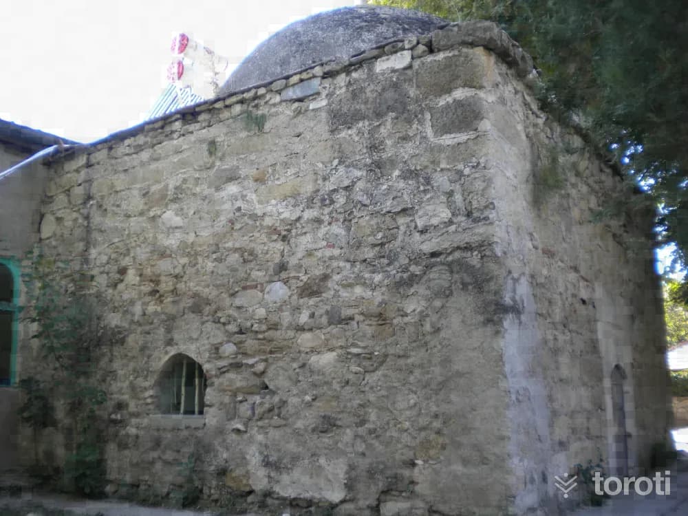
Işikli Aşağı Cami Türbesi
Işıklı Aşağı Cami Tomb was built on the eastern side of the entrance at the northeast corner of the mosque’s last congregation area. The tomb and the mosque were later joined together. The tomb was built with a rectangular plan in the east-west direction and covered with a dome. The north and east walls of the structure were built of rubble stone with brick fragments in between, while the west wall was built of cut stone material. The dome was plastered with cement mortar.
45 minutes
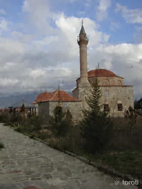
Emirhisar Dedeköy Camii
It is understood from the plan and material characteristics of Dedeköy Camii that it may have been built in the XVth or XVIth century. The mosque measures 14 x 14 meters and has a square plan. The transition from the square body to the dome is provided by squinches. As material, brick was used in elements such as the dome, arch and squinch; while spolia stones were used in the walls. The windows of the mosque are arranged in two rows. Those in the lower row are rectangular in shape, with three on the sides and two at the entrance.
45 minutes
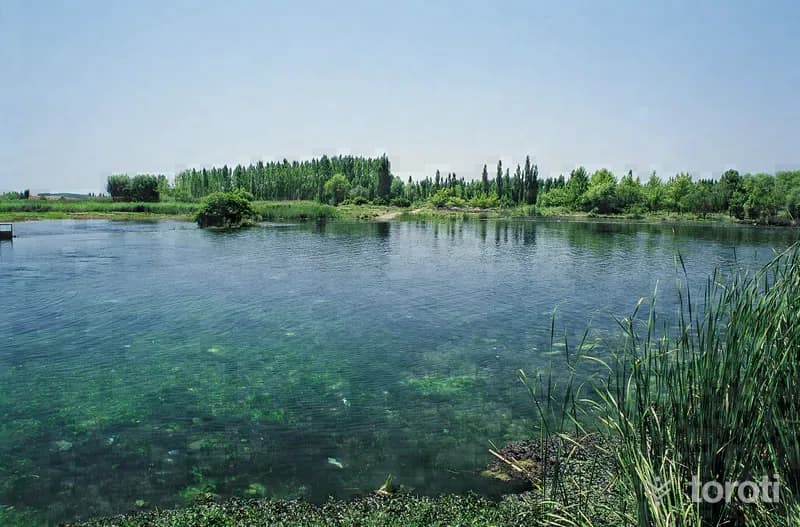
Çivril Işikli Gölü
Işıklı Lake is located in the Çivril district of Denizli. It has been granted Class A Wetland status under the International Ramsar Convention. TGA At an altitude of approximately 800 meters, its area is around 3500 hectares. The lake is fed by the Büyük Menderes River, Karanlık Dere and Kuti Stream. TGA Embankments have been built on the eastern, western and southern shores of the lake, which is fed by water sources coming from the east. For this reason, the water level in the lake has risen and the reed beds have decreased.
45 minutes
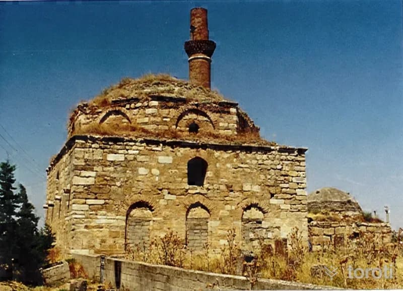
Dedeköy Türbesi
It is located in Çivril District, on the Emirhisar road, within a külliye where the mosque and bath are located. In recent times, it has undergone restoration together with the structures around it. The tomb has a square plan, a cubic body, and is covered with a dome. It was built of cut stone, with brick material used in places. Some of the stones are spolia. The dome transitions and the dome are of brick. There is an entrance door on the east, and one window each on the north and west. The south wall is blind.
45 minutes
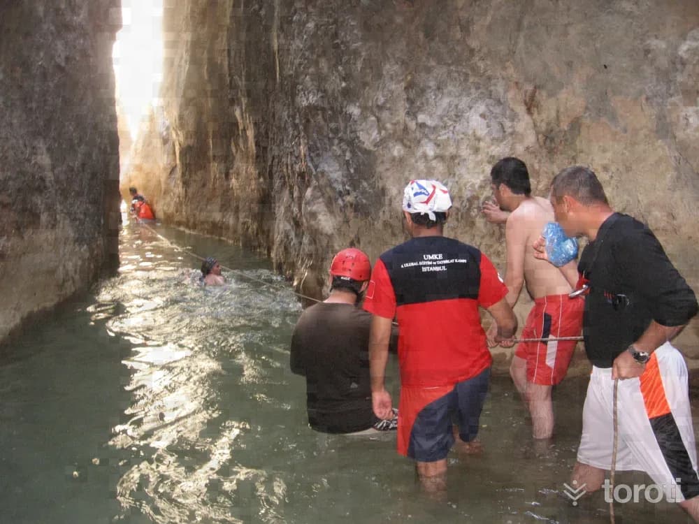
Doğa Yürüyüşü - Tokali Kanyonu
Nature Walk - Tokali Canyon Tokalı Canyon, located in Akdağ Nature Park in Sandıklı District, is a canyon with high recognition throughout the country. The canyon, estimated to be 20 kilometers long, and Akçay, which flows from the canyon into Çivril Lake, are worth seeing. Along the canyon, there are caves untouched by humans and routes that will attract the interest of those who do trekking. The narrowest part of the canyon is 1,5 meters and the widest part is 4 meters. Passing through the canyon takes 7-8 hours.
45 minutes
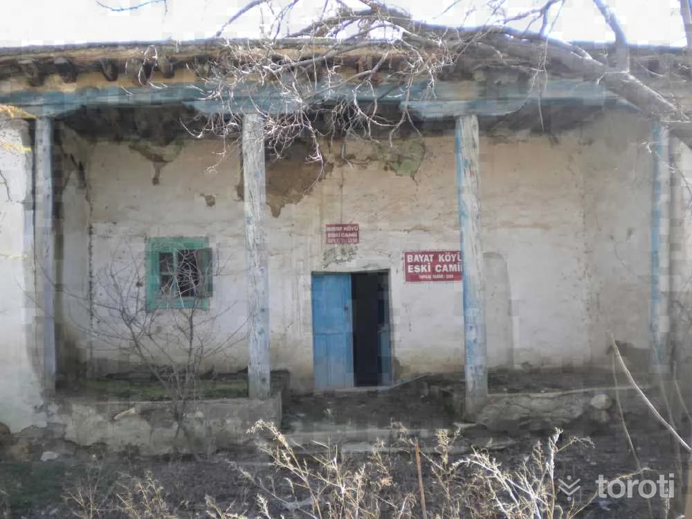
Bayat (Köyü) Mahallesi Cami
Its roof, which had been an earthen roof, was renewed as a hipped roof in 1963 and covered with Marseille-type tiles. All the walls of the mosque, including the mihrab walls inside, and the surfaces of the wooden beams are decorated with ornaments made with colored paint. Among these decorations are depictions of Mecca, stylized floral motifs emerging from a vase, and medallions formed with old script. On one of the beams on the ceiling, H.
20 minutes
Eumania Antik Kenti
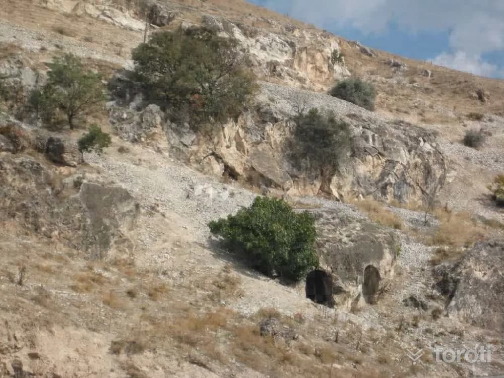
The ancient city is in the area where Işıklı (Kasabası) Mahallesi is located on the Çivril-Dinar highway. The city was founded in the name of Pergamon King Eumenes II. Traces belonging to the ancient period can be seen near the water source located to the southeast of Işıklı town. The plain on the mountainous area today called “Sarıbaba Tepesi” was used as a fortress especially during the Byzantine period. The slopes of this hill are Eumenia's necropolis.
45 minutes
Tokalı Kanyonu
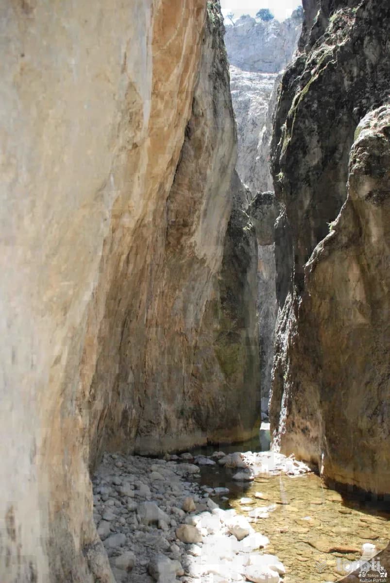
The canyon as a whole extends over an area of 20 km. The canyon, at an altitude of 1600 m., ends at the 900 m. altitude settlement of Çivril's Gümüşsu (Homa) town. A 1200-meter-long section of the canyon consists of rock masses that look as if cut with a knife, reaching heights of 200 m. in places. The canyon, formed by the stream flowing between these rocks, which are 4 meters apart at the widest point and 1,5 meters apart at the narrowest point, can only be crossed in 7-8 hours.
45 minutes
Homa Gümüş Su Şelalesi
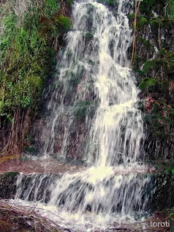
Homa Gümüş Su Şelalesi is to the east of Çivril. The town on the Çivril-Dinar road was given the name Gümüşsu because of the good quality of the water here. The water of the waterfall, which is approximately 30 meters high, is very cold and sweet.
45 minutes
Sportif Amaçli Olta Balikçiliği
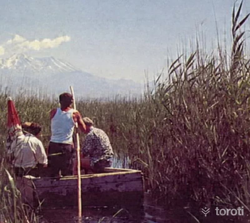
The waters of Işıklı Gölü, located in the Çivril district, are fresh and contain freshwater fish. In addition, Büyük Menderes Nehri, Adı Güzel Barajı, Kartal Gölü and Dalaman Çayı are waters suitable for Sport Fishing with a Rod due to the presence of various species of fish.
45 minutes
Işıklı Gölü Su Kuşları Koruma Alanı
It has been granted Class A Wetland status under the International Ramsar Convention. Due to its potential, its registration as a “Waterfowl Protection Area” was proposed by Denizli National Park Engineering. It is at an altitude of approximately 800 m., and its area is around 3500 ha. The lake is fed by the Büyük Menderes River, Karanlık Dere and Kuti Stream. Embankments have been built on the eastern, western and southern shores of the lake, which is fed by water sources coming from the east.
60 minutes