
Places to visit
Things to do in Tunceli
48 destinations, each with a description, how long it takes and where it sits on the map.
In short
toroti’s catalogue holds 48 described destinations within Tunceli. The themes that come up most: History, Local culture, Faith heritage, Museum, Culture, Coast.
Districts of Tunceli
Atlanti Köyü Tarihi Yerleşim Kalintilari
The building ruins belonging to the historical settlement located in Pah Mezrası of Atlantı Village in the center of Tunceli were registered as a “Civil Architecture Example” by the Erzurum Cultural and Natural Heritage Preservation Board in 1991 and taken under protection. Since no scientific study has yet been carried out on the said building ruins, there is no information about its historical period.
45 minutes
Aşağı Doluca (harik) Kaplıcası
It is located in Nazımiye District, in Aşağı Doluca Village, and is 16 km from the district center. The flow rate of the water emerging from a single source is 2 lt/sec, its temperature is 39 oC, and its pH value is 5.0. There is an accommodation facility at Harik Kaplıcası. The spa water, which belongs to the group of calcium sulfate and hot waters, is considered suitable for use as a bath in the treatment of rheumatic diseases, fracture-dislocation sequelae, and gynecological diseases.
45 minutes
Elti Hatun Türbesi
It is thought that the octagonal tomb located in the district center was commissioned by the Akkoyunlu ruler Uzun Hasan in the name of his sister Elti Hatun. There is no inscription on the tomb; however, the stone material used in its construction is the same as the material used in the construction of the nearby Elti Hatun Mosque dated 1252. For this reason, it would be correct to say that it is a 13th-century work, a kümbet.
20 minutes
Yeni Hamam
According to the inscription above the entrance door on the south facade, this structure, stated to have been commissioned by a person named Hacı Bayramoğlu Hüseyin between 1701-1702, was built on a rectangular plan in the east-west direction and consists of the soğukluk, sıcaklık, ılıklık and külhan sections. The structure was built with smoothly cut stone and brick materials.
20 minutes
Şahverdi Arkeolojik Sit Alanı
Günümüze kadar ulaşan eski uygarlıkların yaşadıkları devirlerin sosyal, ekonomik ve kültürel özelliklerini yansıtan bulgulara rastlanılması nedeniyle söz konusu alan 2002 yılında Erzurum Kültür ve Tabiat Varlıklarını Koruma Kurulu tarafından “I. Derece Arkeolojik Sit Alanı” olarak ilan edilmiştir.
45 minutes
Göktepe Höyüğü
Göktepe Höyüğü, located in Mazgir, is situated in the village bearing the same name. No comprehensive research or examination has been carried out on the mound, which is located 500 metres south of Göktepe Köyü. For this reason, there is not much information about it. The mound is reached by a dirt road.
20 minutes
Meydan Çeşmesi
It is in the square of Ulukale Village. Based on the forms of the arches and the details in the structure, it is thought to have been built in the late 16th century and early 17th century. The structure, made of cut stone, is in the form of an iwan with a pointed arch resting on small corner columns.
20 minutes
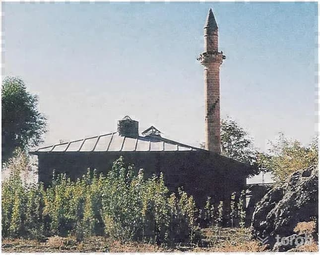
Elti Hatun Camii
The mosque, commissioned by Elti Hatun, the daughter / granddaughter of 11. Süleyman Şah, son of II. Kılıçaslan, has a rectangular-plan harim section whose original covering was an earthen roof. Inside, there are two rows of two piers each, parallel to the mihrab. These piers divide the harim section into three naves. The window arches are brick. The mihrab projects outward and displays mihrab stonework. The mihrab niche is shell-shaped. The portal is in the form of a shallow niche. The niche arch is pointed, while the inner arch is round.
45 minutes
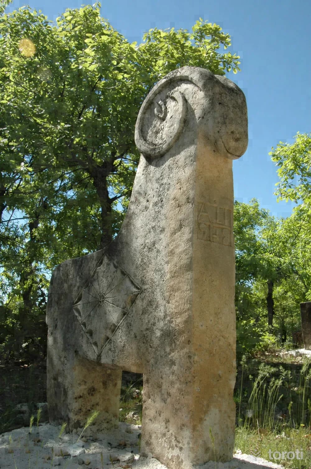
At-koç-koyun Biçimli Mezar Taşlari
It is seen that cultural traditions have been maintained in the historical gravestones that have survived to the present day in various parts of Tunceli. In the region, gravestones in the form of horses, rams and sheep bear witness to the Turkmen tradition in the Akkoyunlu Period. The old graves in the Tunceli region are located either on a hill or in a high place above the village, and on the gravestones it is possible to see religious and mythological elements as well as traditional customs and practices.
45 minutes
Munzur Suyu Vadisi
Rising from the foothills of Ziyaret Tepesi on the Munzur Mountains to the north of Ovacık and joining Pülümür Stream in the central district before flowing into Keban Dam Lake, Munzur Suyu travels a very long distance within the provincial borders.
45 minutes
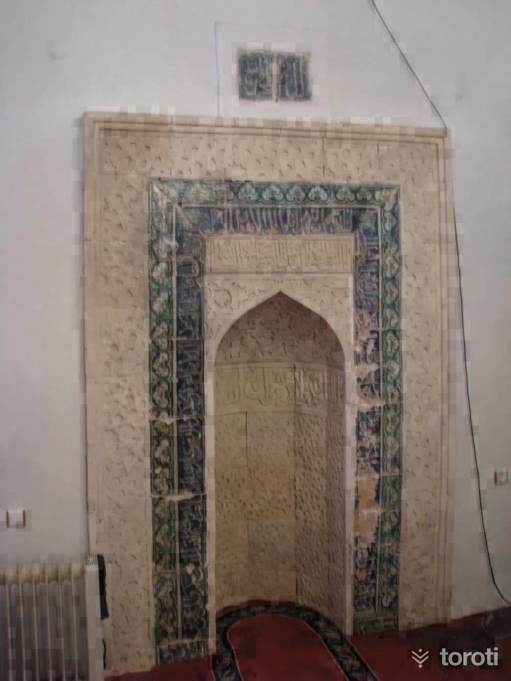
Yelmaniye Cami / Medrese Cami
The mosque, located on a hill dominating the district in Tepebaşı (Medrese) Neighborhood of the Çemişgezek district center, is thought to have been built as a madrasa by Emir Taceddin Yelman bin Keykubat bin Halit el-Kürdi during the time of Timur between the Hijri dates 800-809. In its inscription; “Emere-i bi imaret ül medresetü’l mübareketü el Melik-ül Adil Tacüddin Yelman bin Keykubad bin Halid el kürdi fi eyyami Timurhan min Maveraünnehir haledallahu devlet hüma Sene sitte semane.
45 minutes
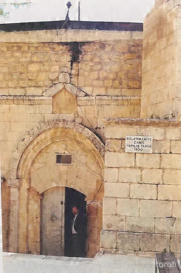
Süleymaniye Camii / Kale Cami
There is no inscription giving the construction date of the mosque, nor is there any information about the structure in historical sources. When the structure is evaluated in terms of its plan, material and technical characteristics, it reflects the regional architectural style that began with the Great Seljuks and continued with the Artuqids. We know that construction activity increased in Çemişgezek, which was given to Pir Hüseyin by Yavuz Sultan Selim after the “Battle of Chaldiran” (1514) in the region.
45 minutes
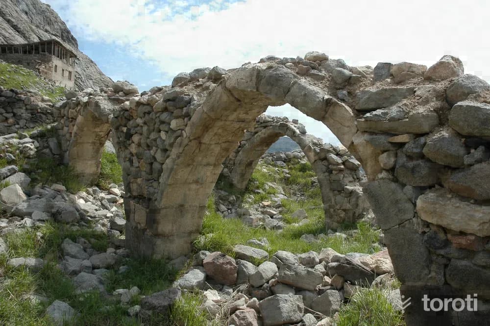
Ulukale Camii
The mosque located in Çemişgezek Ulukale Village is a rubble-stone structure squeezed in among houses. The mosque, built in 1793, is entered through the later-added last congregation area. The entrance door is not on the central axis but shifted to the side. The main space is divided by piers into four naves transversely. The interior and exterior of the flat-roofed structure are plain. According to old records, it was a foundation of Yusuf Paşa, who served as Governor in Diyarbakır, and was commissioned in Hijri 1208 (1793–1794).
45 minutes
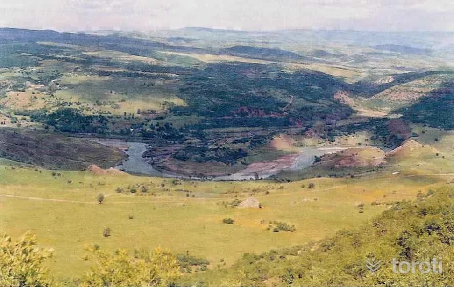
Peri Suyu Vadisi
Peri Suyu, which forms Tunceli’s eastern border and has abundant water even in the summer months because it is fed by snowmelt, flows in a southwesterly direction and empties into Keban Baraj Gölü. In the sections where Peri Suyu Vadisi forms the border of Tunceli, although it is not very narrow and steep, it is rich in terms of forest presence and natural environmental features.
45 minutes
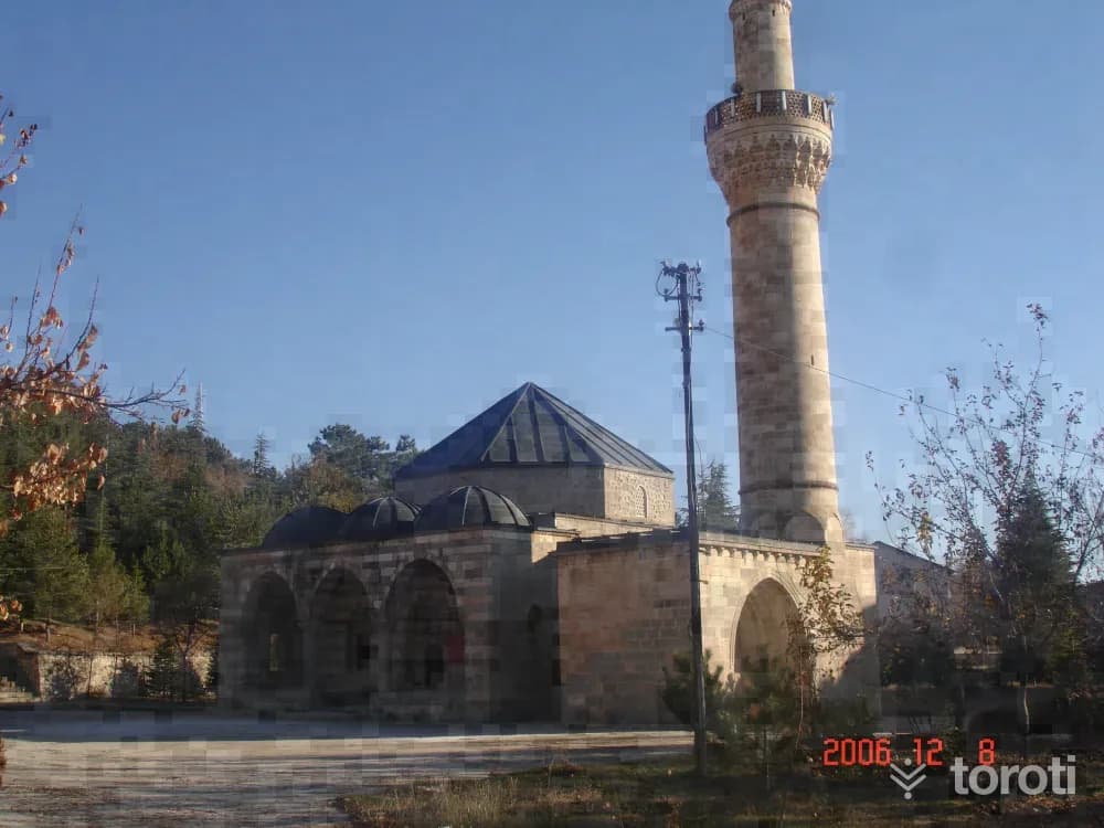
Çelebi Ağa Camii
The mosque, located on the bank of the Murat River to the south of Pertek District, was commissioned in the month of Ramadan in 1569, according to the inscription above the entrance door. In the inscription written in Arabic thuluth script above the entrance door, it says: “Emera bi’imareti hâzihi’l-mescid’ş-şerife el mubâreke ani’l-ekremi Çelebi Bey bin Ali Koca hacili gafferallâhü zünû beümâ fi tarihî şehr-i Ramazan sitte ve seb’în ve tis’a miete 976”.
45 minutes
İn Delikleri / Derviş Hücreleri
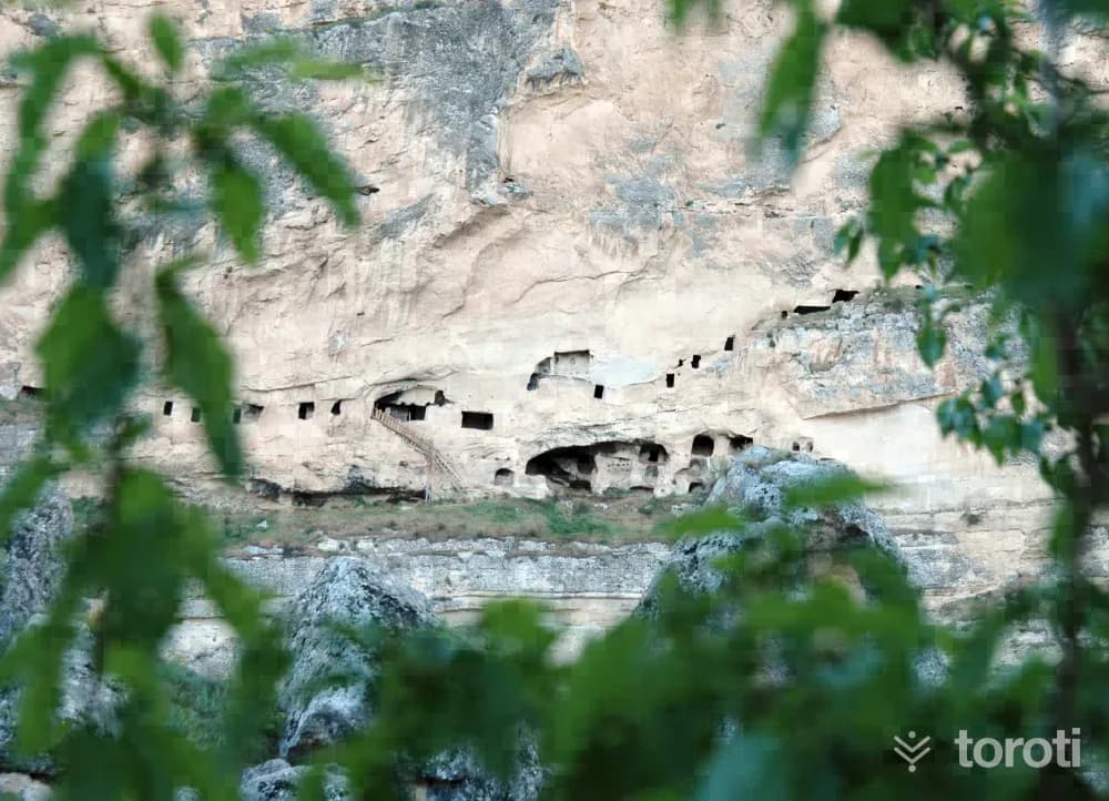
There are around 20 rooms carved for residential purposes into the steep limestone rocks extending upward in the Tahar Stream Valley, to the west of the Çemişgezek district center. It is not known by whom the cave holes were made. It consists of rooms arranged in three levels, large windows illuminating these rooms, and long corridors. The rooms were made 2.5 meters wide and 1.7 meters deep.
45 minutes
Sülbüs Dağı
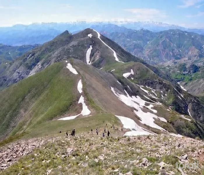
Sülbüs Dağı, a volcanic mountain, is located to the northwest of Yayladere district. Its summit is always seen as snowy. It has the appearance of a sharp cone. Mountaineers come here every year. In addition, various hunting activities are also carried out on this mountain. Although the top of the mountain is flat, it appears pointed from afar. There is a ziyaret on it, and because it has a majestic appearance, it keeps various legends alive. According to the روایت, a young man named sülbüs falls in love with a beautiful girl named starı.
45 minutes
Dereova Şelalesi
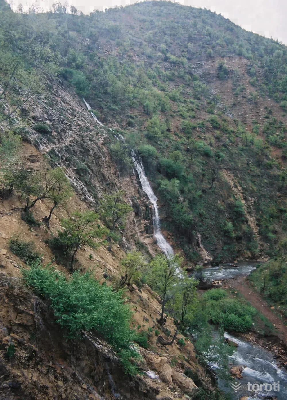
The waterfall, also known as Gelin Pınarı, is located in Dereova Village, 46 kilometers from the provincial center and 13 kilometers from the Nazimiye district center. The waters, pouring broadly from 3 sources from a height of 20 meters, join the stream that is one of the branches of Pülümür Çayı and flows through a very deep valley. The waterfall both adds coolness to its surroundings and offers a very impressive and different منظر in summer and winter.
45 minutes
Sağman Cami
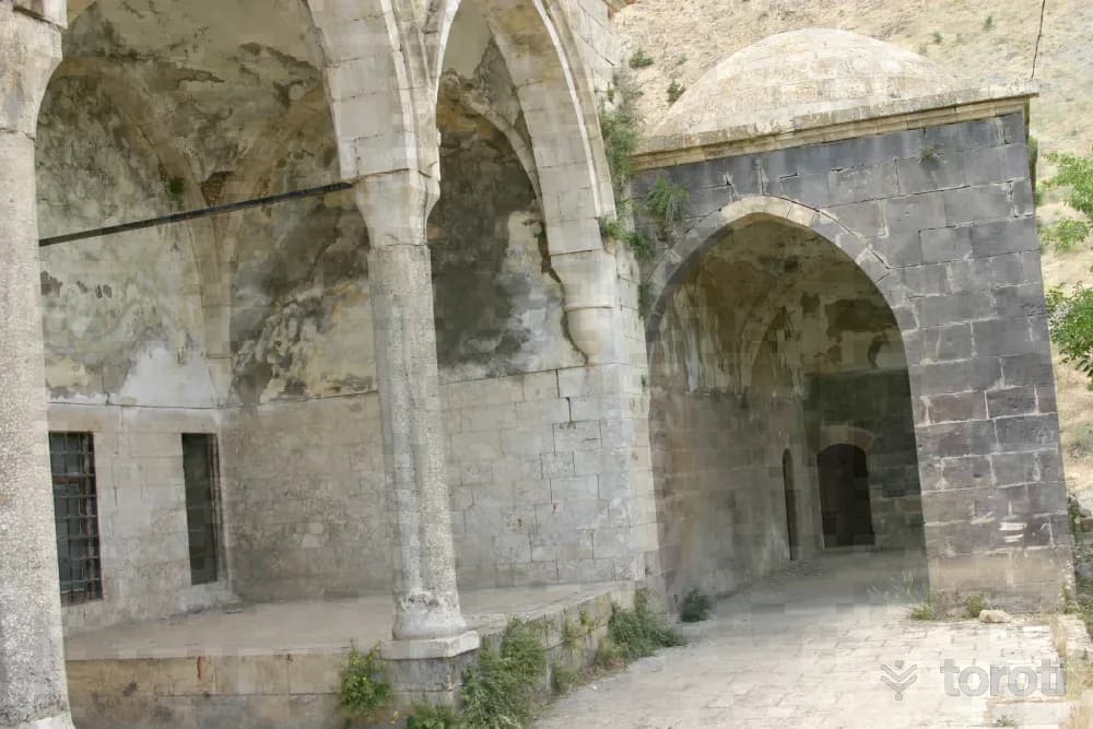
It is estimated that the mosque in Sağman Village, located to the north of the Pertek district center and 20 kilometers from Pertek, was commissioned in 1555 by Salih Bey, the son of Keyhüsrev Bey. The square-planned, domed main space is entered through a monumental portal made of colored stones. The dome, which sits on an octagonal drum, is covered with stone. The minaret is accessed from outside the mosque. The adjacent hexagonal-planned tomb is decorated with bands of colored stones.
45 minutes
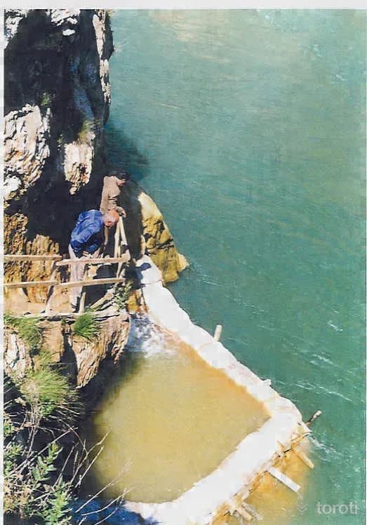
Dedebağ (bağin) Kaplıcası
The hot spring in Dedebağ Village, Mazgirt District, is 65 kilometers from the district center, on the bank of Peri Suyu. In Bağın Hot Spring, which falls into the 3'ncü priority hot spring class, the flow rate of the water emerging from a single source is 5 lt/sn, its temperature is 35 oC, and its PH value is 5.0. The hot spring water belongs to the group of calcium sulfate, sodium sulfate, and chloride bicarbonate waters.
45 minutes
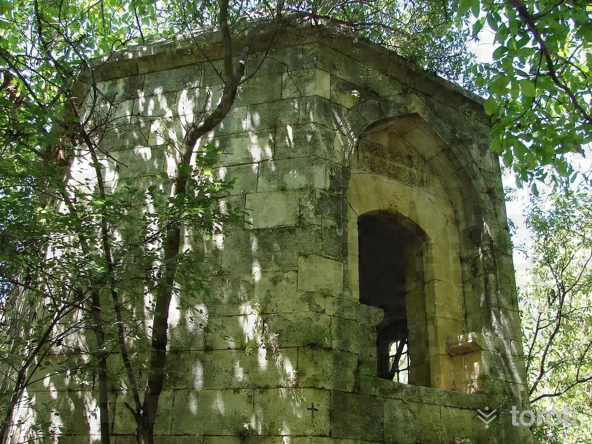
Uzun Hasan Türbesi
At the entrance of the district, in Tekya Mevkii, it is an octagonal-plan structure built on a massive rock. The two-storey tomb, made of cut stone, is covered inside and outside with a pyramidal roof. Although it is popularly believed to belong to the Akkoyunlu ruler Uzun Hasan, according to the information written in the inscription of the tomb, it is understood that the tomb was actually commissioned in 1572 for Şah Bey, son of Behlülbey, and his two sons.
20 minutes
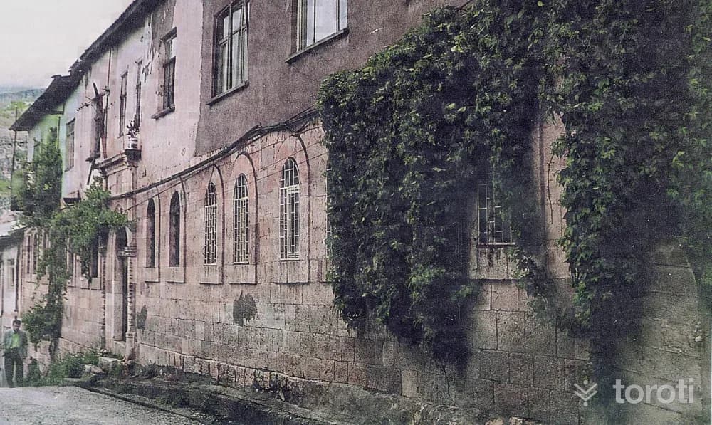
Hamidiye Medresesi
It is understood from the inscription of Hamidiye Medresesi, located in the district center of Çemişgezek, that it was built during the time of Sultan II.Abdulhamit in 1861-1862.
45 minutes
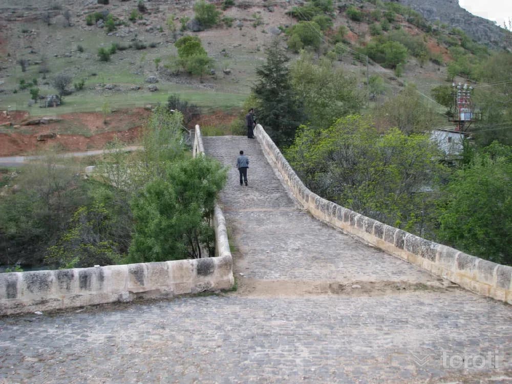
Tahar Köprüsü / Yusuf Ziya Paşa Köprüsü
In the Tekya locality, the stone bridge over Tahar Stream consists of a single pointed arch. The inscription of the bridge, commissioned by Yusuf Ziya Paşa, shows the date 1807. According to one source; it is understood that it was repaired in 1902 by the Governor of Diyarbakır, Akif Paşa. The bridge, which has a single span with a pointed arch, was built of cut stone. On the upper part of the bridge, there are railings 70 centimeters high on both sides.
45 minutes
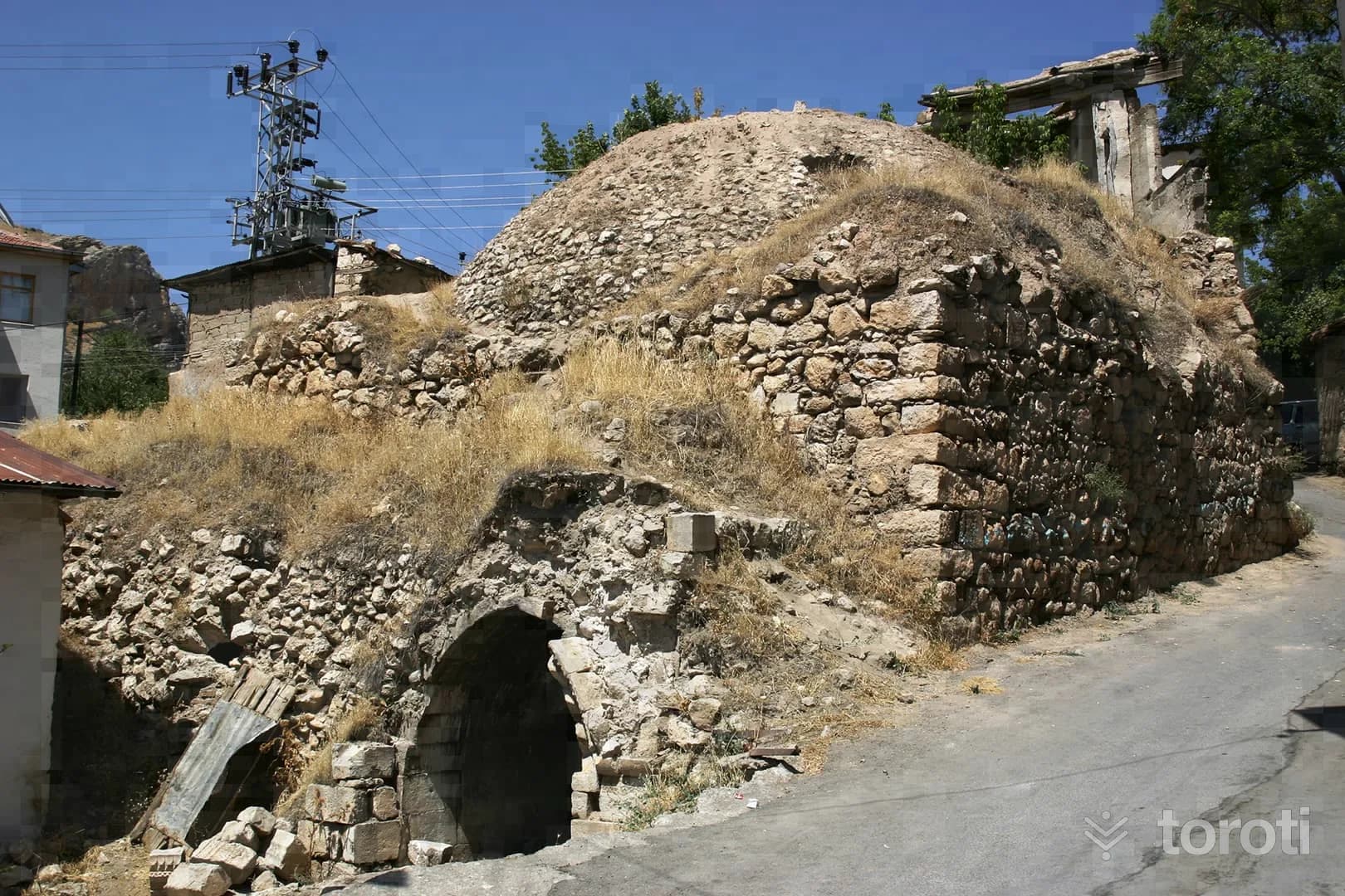
Hamam-ı Atik (Eski Hamam)
From the two inscriptions in Turkish and Arabic at the entrance of the structure, located in the bazaar in the district center, it is understood that the bath was built in the 15th century and underwent repairs in the 18th century. It is the only structure definitely known to have survived from the period of the Akkoyunlu, who ruled in Çemişgezek for a long time. The bath, built with a mixture of cut stone, rubble stone, and brick, consists of a central domed section and barrel-vaulted spaces opening onto it on the sides.
20 minutes
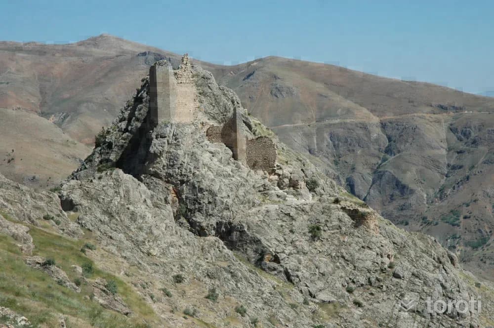
Sağman Kalesi
Sağman Castle is on a steep rock to the east of Sağman village, 20 km from Pertek. There is no definite information about the date the castle was built. According to information obtained from Evliya Çelebi's Seyahatnâme, it is thought to have been commissioned by a Turkish Bey from the Artukoğulları dynasty in Diyarbakır. On the western and southern slopes of the hill where the castle is located, the castle walls have survived intact to the present day.
45 minutes
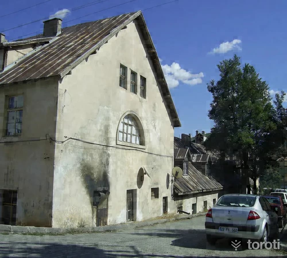
Kişla Binası
This structure, located in the center of Tunceli province on an area of 4304 square meters, consists of four square-shaped blocks complementing each other and was commissioned by the state in Teşrin-i evvel 1937 as a military barracks building. This building has been used as civil servant housing since 1949. The building, which has rectangular windows, has a 3-storey northern block, while the southern and western blocks are 2 storeys.
45 minutes
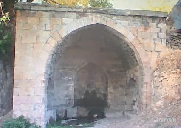
Meydan Çeşmesi
There is no inscription on this fountain, which is located in the square of Ulukale Köyü in the Çemişgezek district. For this reason, its construction date and patron are unknown. Based on its architectural style, it is thought to have been built at the end of the XVIth century or at the beginning of the XVIIth century. The fountain is made of cut stone and has a pointed arch resting on corner columns. At the same time, the side walls of this fountain, which is in the form of an eyvan, have been given a lively appearance with arched niches. The eyvan wall was built of two-colored cut stone.
45 minutes
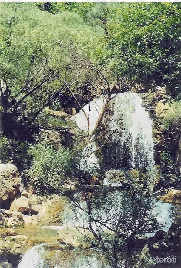
Zenginpinar (zağge) Şelalesi Ve Mesiresi
Located by the Tunceli-Pülümür highway, approximately 40 km. from the city of Tunceli, Zenginpınar Waterfall flows very powerfully down a very steep slope from the valley sides and reaches Pülümür Suyu from beneath the road. Zenginpınar Waterfall has very impressive natural features, both with the richness of its vegetation and the striking depth of the valley.
45 minutes
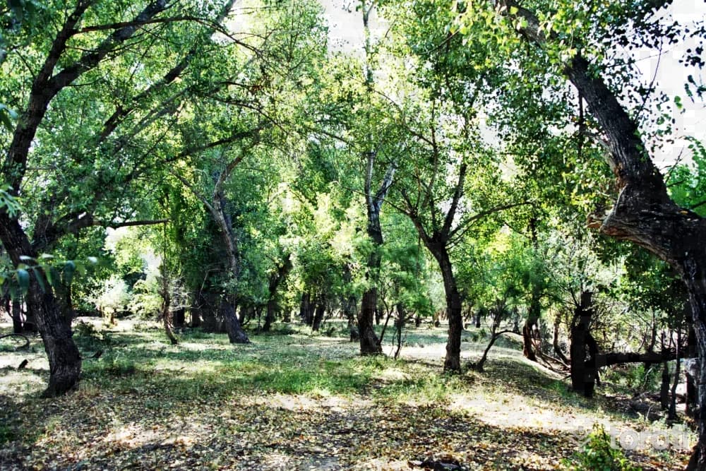
Kutudere Mesire Yeri
Located on the Tunceli-Pülümür highway, approximately 30 km from the city center and on the bank of Pülümür Stream, a small stream also passes through Kutudere Mesire Yeri. Kutudere, which also has springs, is one of the most heavily used picnic areas by the local people with its ease of access, quality drinking water and natural beauties.
45 minutes
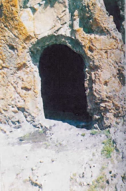
Kale Köyü Kalesi
It was built on a hill in Kale Köyü, 20 kilometers from the district, to the east of the center of Mazgirt district. The castle is reached by stairs, a large part of which have been worn away. Most of the cuneiform inscriptions next to the entrance gate of the castle still remain. The entrance gate and interior sections of the castle were constructed by carving the rocks. There is a large cistern inside the castle.
45 minutes
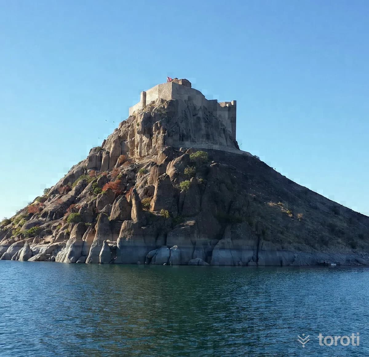
Pertek Kalesi
Pertek Castle, built on a hill on the bank of the Murat River to the south of the Pertek district, now has the appearance of an island because this area remained under the waters of the Keban Dam Lake. The exact construction date of the castle, which was repaired during the Ottoman period, is not known. In the castle, which consists of two concentric walls, there are structural remains between the walls.
45 minutes
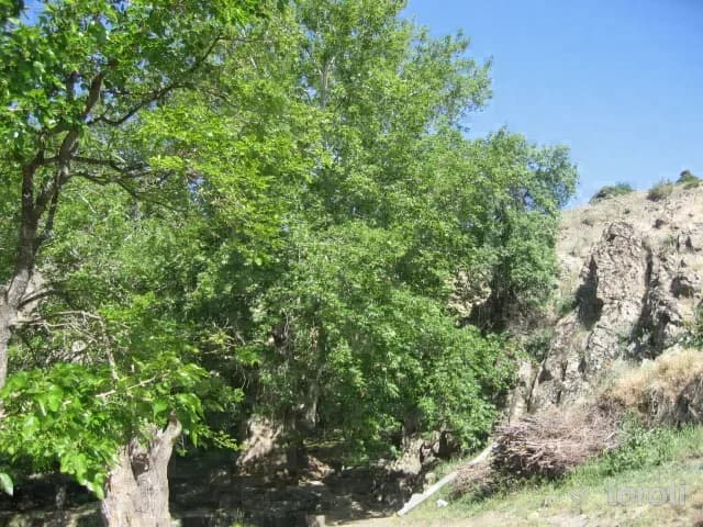
Anıt Çinar Ağaci
The Plane Tree located in Sağman Köyü, Cino Köyiçi Mevkii was registered as a Monumental Tree and placed under protection by the decision of the Erzurum Council for the Protection of Cultural and Natural Assets dated 31.10.2009 and numbered 1490, in accordance with principle decision no. 666 of the High Council for the Protection of Cultural and Natural Assets. 20 sheep can fit into the hollow in the trunk of the said tree, in front of which there is a fountain and a pool with water flowing continuously in summer and winter.
45 minutes
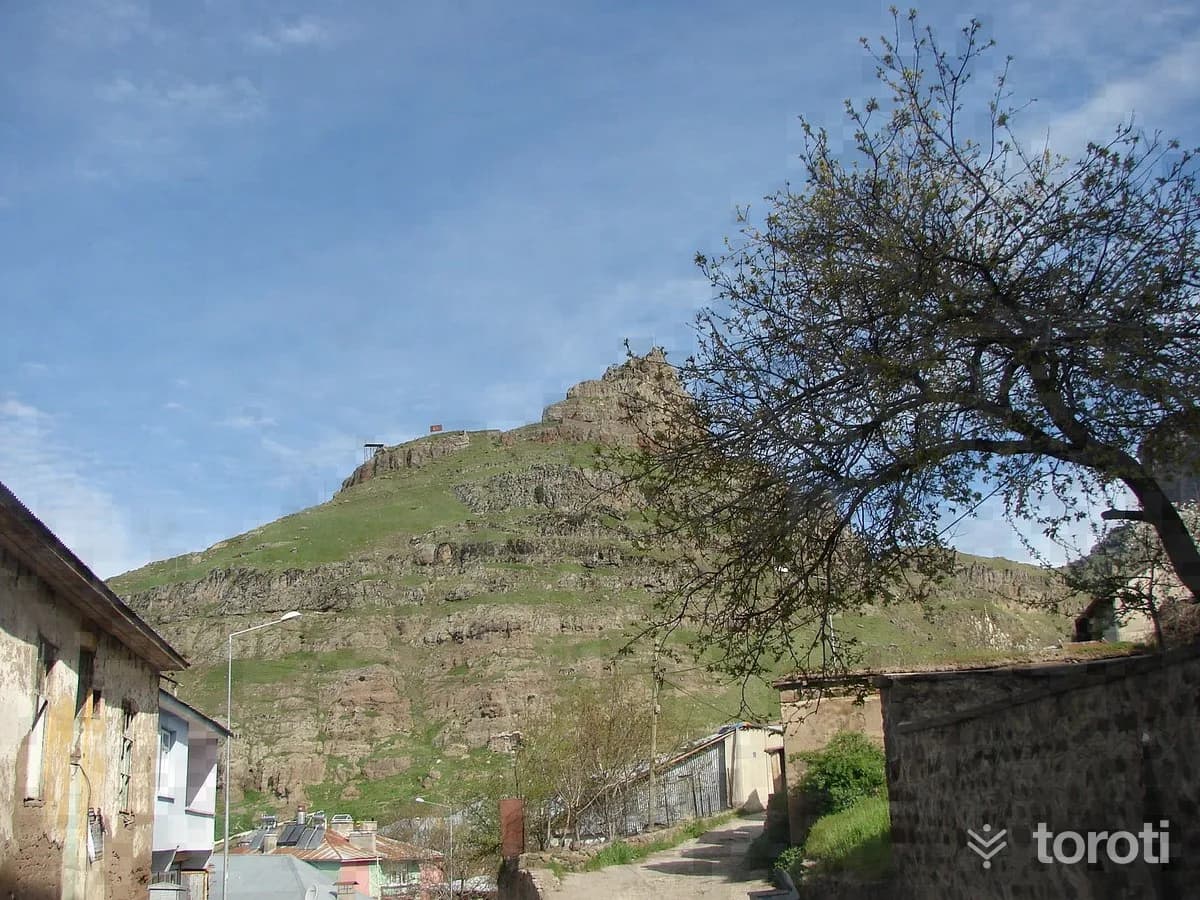
Mazgirt Kalesi
It was established on a hill dominating the district, to the north of the Mazgirt district center. A large part of the castle walls, which have been largely destroyed, is still standing. The construction date of the castle is not known for certain. The castle is reached by way of a cave, and there is a forty-step staircase in front of the cave. At the highest point of the castle, there are ruins thought to have been a pavilion and a windmill.
45 minutes
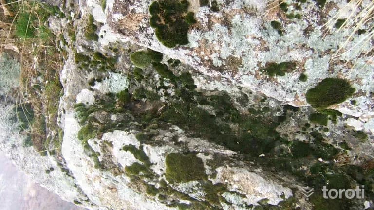
Ambar Kalesi
There are two minarets around the castle located in Ambar Village of the central district. The entrance gate is made by carving stones, and it has three nested rooms. Around the castle are the remains of irrigation channels. In the upper part of the castle, pools were made with stone carvings.
45 minutes
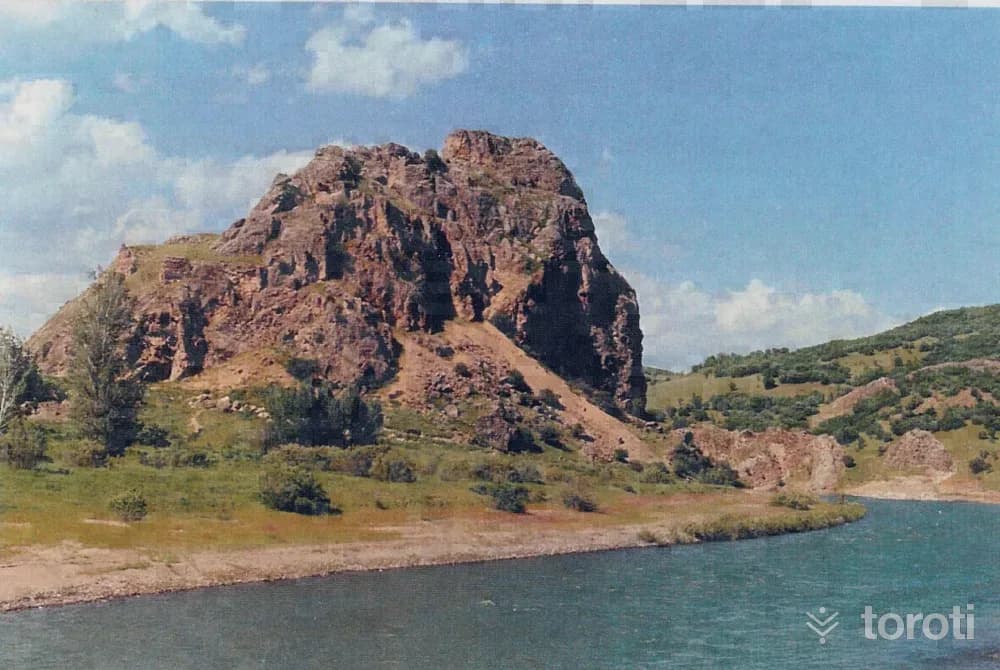
Bağin Kalesi
It was established on a hill on the bank of Peri Suyu in Dedebağ Village, located to the east of Mazgirt district center, adjacent to the end of the provincial border. The construction date of the castle is not known with certainty. The walls of the castle, whose entrance gate is on the slope facing Peri Suyu, have largely been destroyed.
45 minutes
Halbori Gözeleri
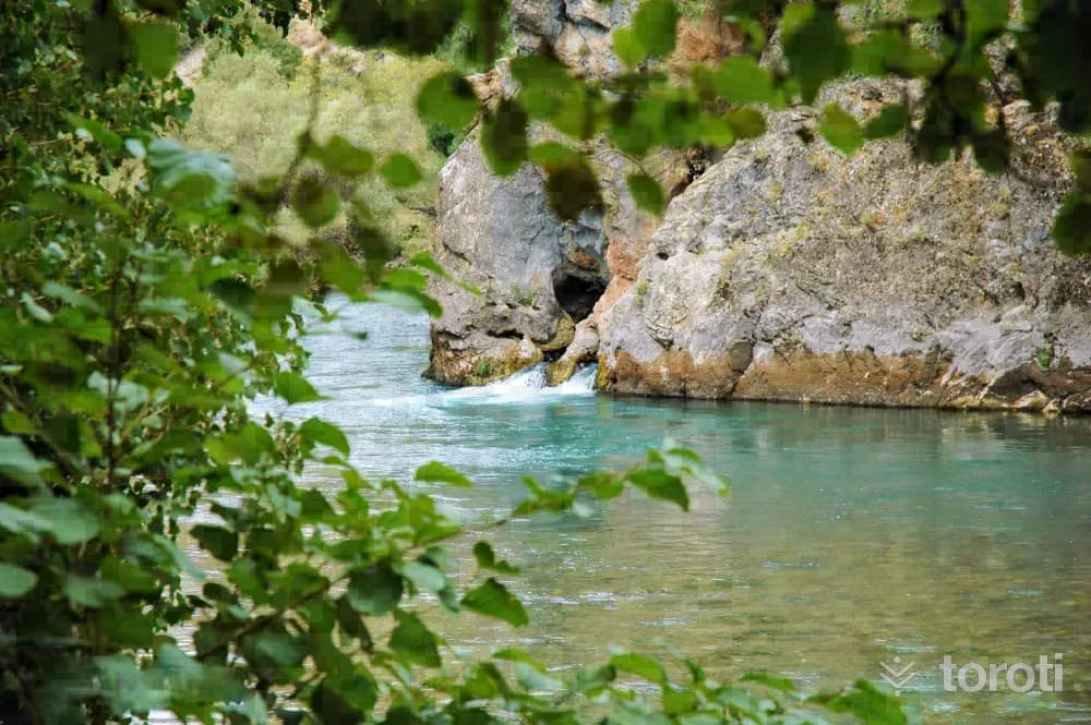
Halbori Gözeleri is located on the Tunceli-Ovacık road, approximately 20 kilometers from the city center, on the bank of Munzur Suyu, within a deep and rocky valley. Halbori Gözeleri is a recreation and picnic area with very cold spring waters and is visited quite heavily.
45 minutes
Ferruh-Şad Bey Türbesi
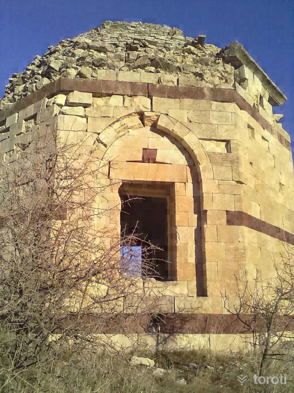
Ferruh Şad Bey Tomb is located in the district of Çemişgezek. According to the information in its inscription, the tomb, which was built between 1550-1551, was constructed in the name of Emir Ferruh Şad Bey. The tomb has an octagonal architecture, and cut stone was used during its construction. Its architecture is quite in keeping with the Seljuk tomb tradition.
20 minutes
Sütlüce (harçik) İçmecesi
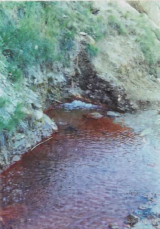
It is located within the borders of the central district, by the Tunceli-Erzincan highway, 4 km from the city center. The flow rate of the water, which consists of two springs, is 2.4 lt/sec, and its temperature is 24.5 oC. This radioactive spring, which is of a quality that can be used as mineral water, flows away in nature because it has not been developed.
45 minutes
Sivdin Köprüsü
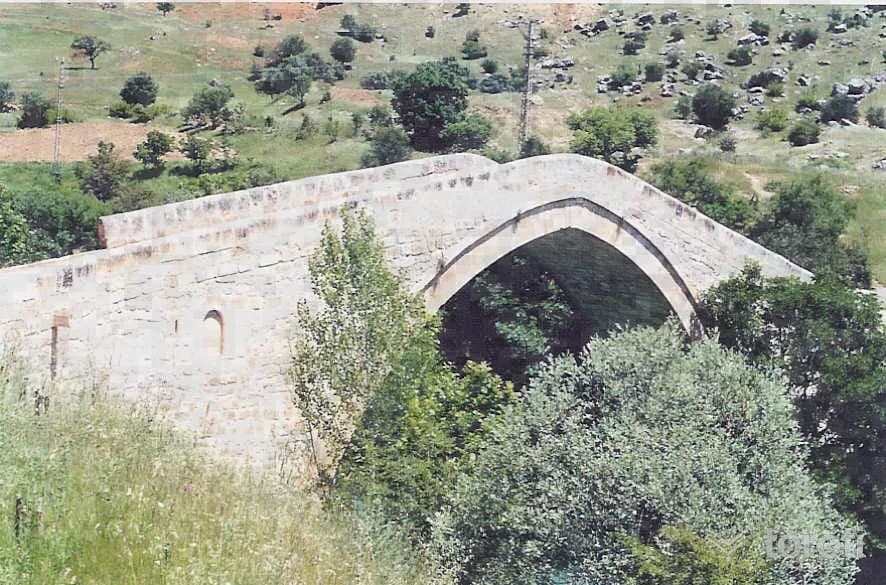
The stone bridge over Karar Deresi consists of a single arch resting on the rocks on both banks of the water. Its parapet walls are made of rubble stone. The structure is dated to the 12th or 13th century.
45 minutes
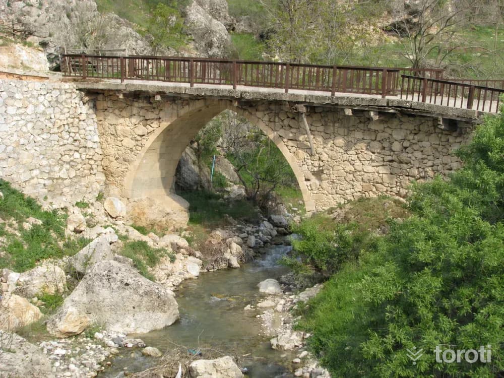
Aşağı Köprü
The historic bridge, which in the past provided transportation between the district center and the southern plain villages, was built in 1203. Today, it is not used for transportation purposes.
45 minutes
Pulur Höyüğü
In the excavations that began in 1968 at Pulur Höyüğü, located on a natural hill to the northeast of Pulur Köyü, which remained under Keban Baraj Gölü, 11 building layers from the Late Neolithic/Early Chalcolithic Period to the Early Bronze Age were identified. It was understood that layers 6-9 and 11 had undergone fire. Obsidian and animal bones were found in the cultural layer of the Late Neolithic/Early Chalcolithic Period.
45 minutes
Askeri Gazino Binası
This structure, located in Alpdoğan Neighborhood in Tunceli Center and consisting of four square-shaped blocks complementing each other, was built by the state in Teşrin-i evvel 1937 as a military headquarters building. Used for many years as the Government House, this building is still used as the “Korhan Koç Askeri Gazinosu.” The building, which has rectangular windows, is 2 storeys high. The blocks are connected to each other by narrow passages, and its interior and exterior are plastered, while its roof is covered with sheet metal.
45 minutes
Yeniköy Höyüğü
It is 3 kilometers north of Laluşağı Village, which remained under Keban Dam Lake, to the east of Pulur (Sakyol). Four building levels were excavated in the settlement, also known as Gâvur Höyüğü. In the mound, where a large part of the Byzantine and Roman remains on the hill were dismantled by villagers, there are few architectural remains from earlier periods, but many ceramic finds. There are also black and burnished vessels or vessels with red or dark brown decoration on a cream-colored ground.
45 minutes
Mahsume (Besime) Hatun Türbesi
There is no inscription giving the construction date of the tomb, which is thought to belong to a woman named Mahsume, known among the public as Besime, nor is there any information about the structure in the sources. Although it is possible to say that the structure, which shows similarities in plan and material to the other tombs in the vicinity, was built in the late XVth century and early XVIth century, an exact date cannot be given.
20 minutes
Çemişgezek Kalesi
A small part of one wall of the castle, built on a hill on the bank of Tahar Çayı to the west of the Çemişgezek district center, has survived to the present day. It is not known when the castle, built of cut stone and rubble stone, was constructed.
45 minutes
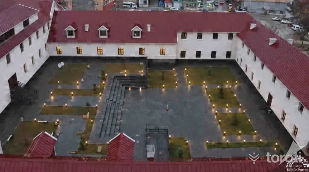
Tunceli Müzesi
The 3-storey Barracks Building, which was designed by German architects in 1937 and built for military purposes, and was registered and placed under protection due to being an “Early Republican Period Structure” and showing the characteristics of a cultural asset, was the first large structure of its period during the establishment of the city center, and was used as a Military Barracks between 1937 and 1949, and as civil servant lodgings from 1949 to 2015.
45 minutes
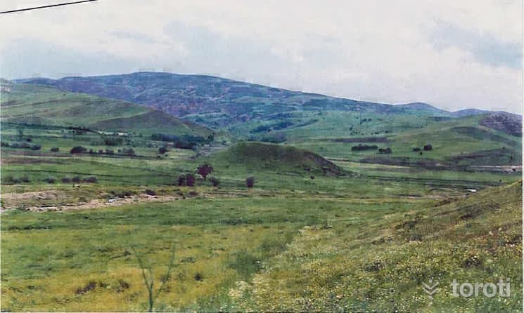
Til Höyüğü
Til Höyüğü, located in Kuşçu Village of Mazgirt, lies approximately 1 kilometer south of the highway. Reached by a dirt road, Til Höyüğü was declared a 1st Degree Archaeological Site in 1996 by the Council for the Protection of Cultural and Natural Assets, but no excavation has been carried out here to date.
45 minutes
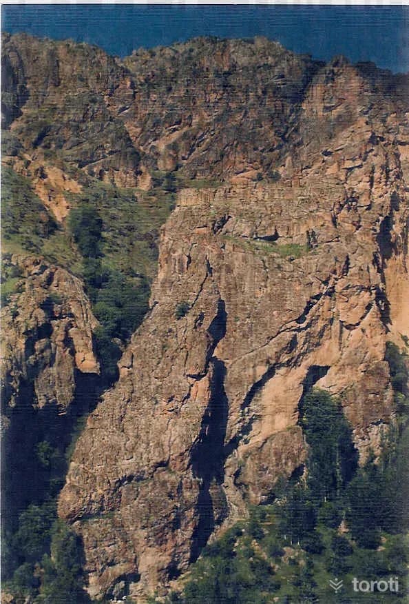
Gelin Odaları Ve Mağaraları
These are carved rocks, thought to have been made by the Urartians, 3 kilometers from the district center. There is a secret passage in which there is a king's throne and a dungeon where prisoners were punished, and by descending very deep into the rock on carved stone stairs, carved within the rock, the stream at the point where Hanım Köprüsü is located was reached and water was taken.
45 minutes