
Places to visit
Things to do in Rize
58 destinations, each with a description, how long it takes and where it sits on the map.
In short
toroti’s catalogue holds 58 described destinations within Rize. The themes that come up most: History, Nature, Museum, Culture, Local culture, Faith heritage.
Districts of Rize
Kavak Köprüsü
Kavak Bridge is the first bridge of the old transportation system located over Hala Stream in the Çamlıhemşin district. The bridge, 1 kilometer from the district center, was built by the local people in the 19th century. Kavak, one of the most photogenic bridges in Rize, is 36 meters long and 15 meters high. Like its other similar examples in Fırtına valley, it is also registered by the Monuments Board.
20 minutes
Kaleköy Yaylası
The main feature of the plateau at an altitude of 1990 m. is that it is home to Kale-i Bala Castle. The castle on the historic road coming from Fırtına Valley is located in a strategic area at the junction point of the valley.
60 minutes
Huser Yaylası
A plateau at an elevation of 2400m connected to the district of Çamlıhemşin. A plateau in Rize.
60 minutes
Kaçkar (Ombole) Yaylası
The plateau, located at an altitude of 2056 m in the district of Çamlıhemşin, is also known as Yukarı Yayla. The plateau, which has a settlement of 350-400 households, is also famous for the Vartavor Festivals held every year in August and lasting for one month. With its nature and local architecture, it continues the plateau culture.
60 minutes
Haçivanak Yaylası
It is located at an altitude of 2587 m in Çamlıhemşin District. It has a settlement of approximately 100 households. The plateau, which is one of the places worth seeing with its untouched natural beauties, is especially ideal for day trips and nature walks.
60 minutes
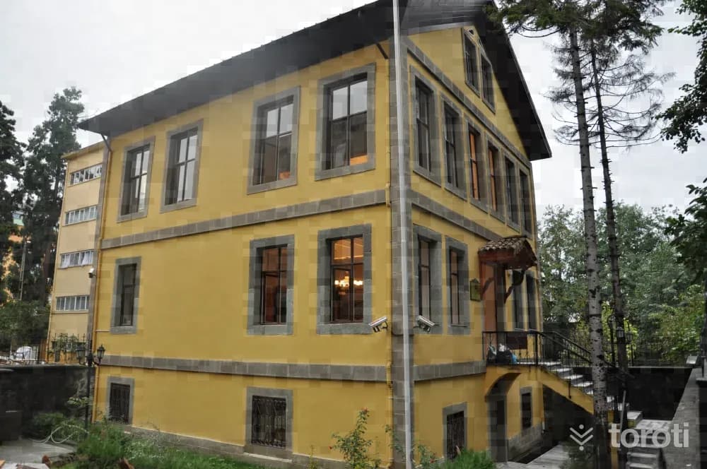
Atatürk Evi Müzesi
The house, reflecting the characteristics of 20th century Turkish architecture, is one of the examples of civil architecture with regional value in architectural and cultural terms. It was built as three floors over a basement within the garden. Photo: Rize Provincial Directorate of Culture and Tourism The basement, built with stone material, was used for storage purposes. The upper floors are living spaces.
45 minutes
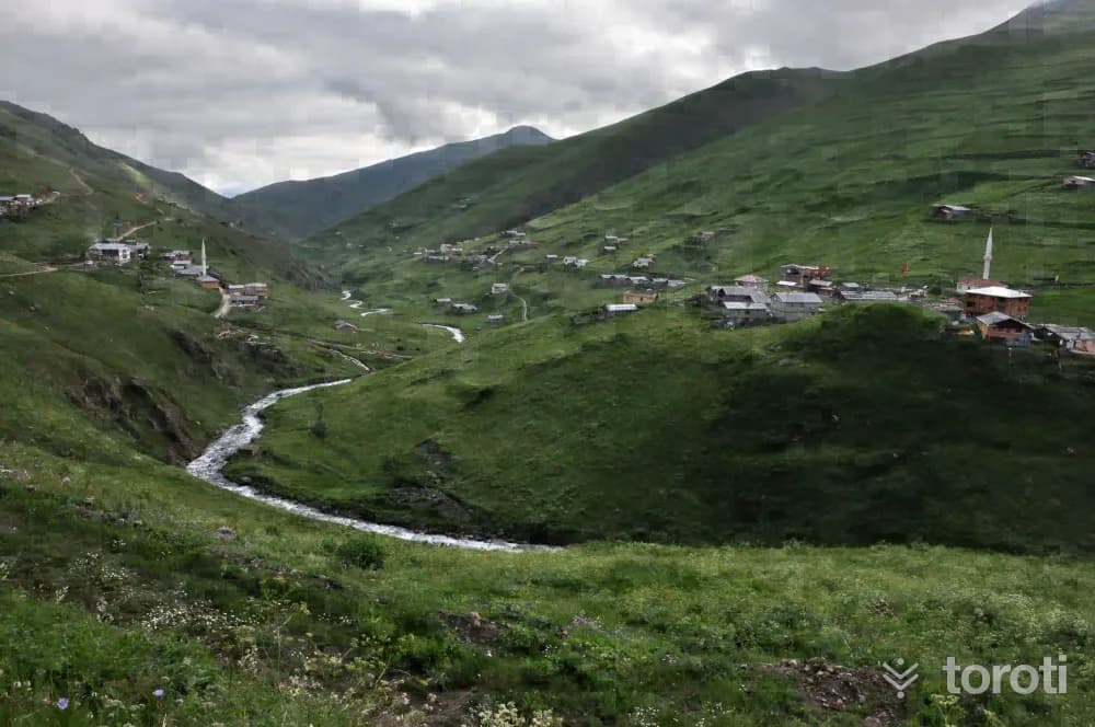
Anzer Yaylası / Balliköy Yaylası
It is at an altitude of 2105 meters in İkizdere District. Anzer, also known as Ballıköy, is connected on one side to the Çoruh River and the city of Bayburt, and on the other side to Trabzon Uzungöl Tourism Center. In addition to the cultural influences brought by being in a transition region, with its location surrounded by the Meles, Petran, Kabahor and Garzavan plateaus, it is on its way to becoming one of the important tourism centers of the future. Its location on the foothills of Kırklardağı gives it the character of a plateau center.
45 minutes
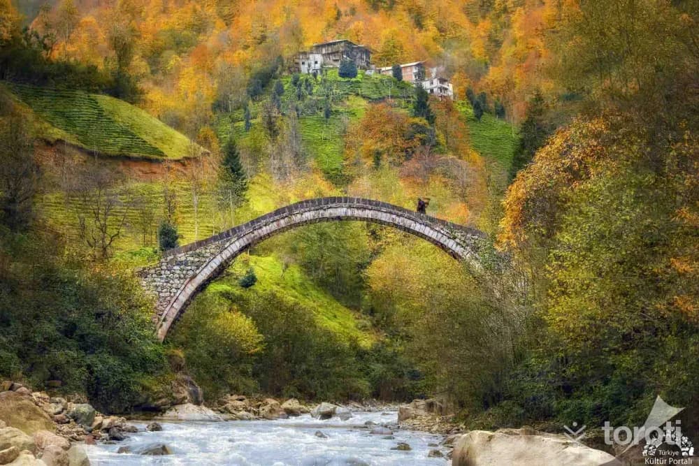
Kaptanpaşa Köprüsü
Kaptanpaşa Köprüsü is an arch bridge located in the Çayeli district of Rize. The bridge has a single span and a round arch. Cut stone was used in the arch and railings of the bridge, while rubble stone material was used in the other parts. Tanıtma Genel Müdürlüğü The bridge extends in an east-west direction. The bridge roadway was built with irregular rubble stone. The arch piers were seated on the bedrock in the stream bed. The bridge is 26 meters long and 2,40 meters wide.
45 minutes
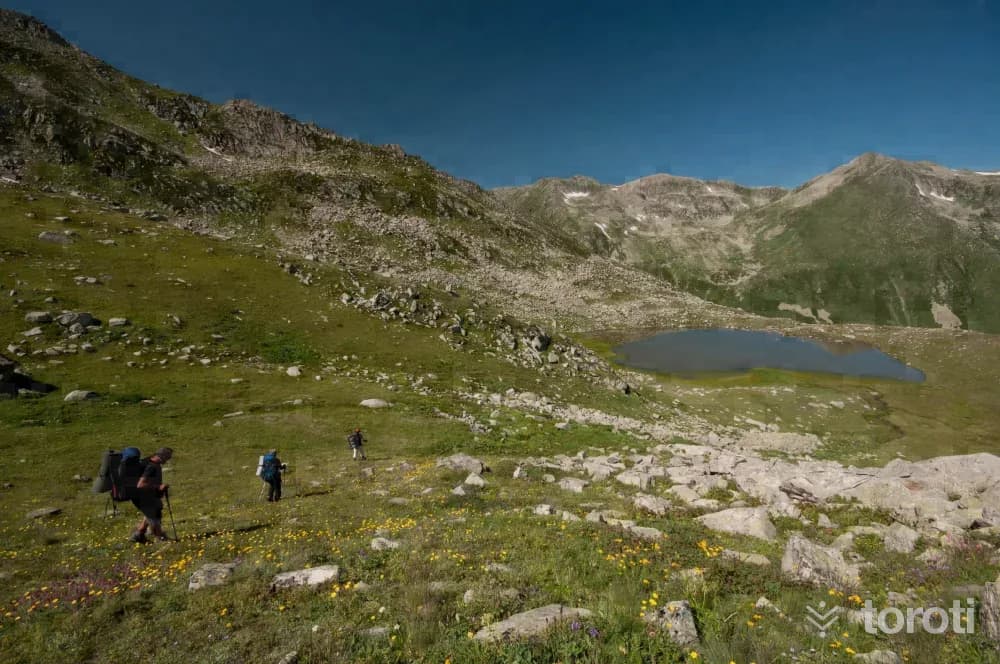
Doğa Yürüyüşü
Nature walking (Trekking) is one of the most enjoyable tourism activities you can do in Rize. Nature walking offers all opportunities from the simplest to the most difficult. Nature walking can be done in Rize in every season. For nature walks where you can pursue many interests such as relaxing, doing sports, taking photographs, birdwatching and botany within a single activity, village and plateau roads, trails and many alternatives are offered.
45 minutes
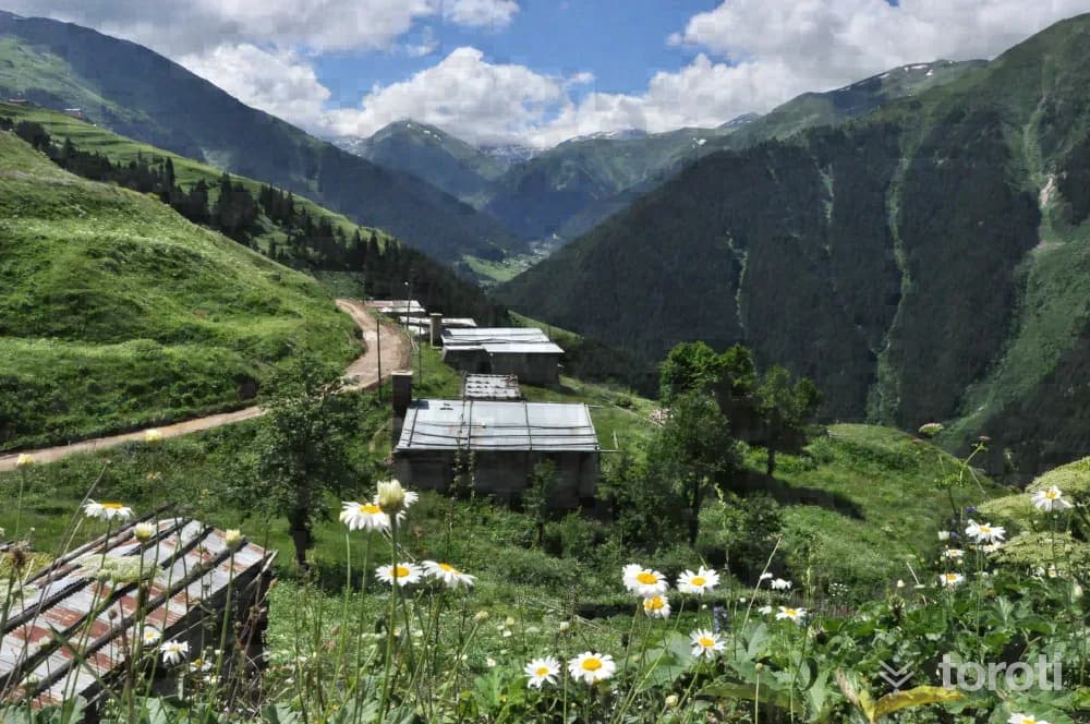
Meşeköy Yaylası
The plateau, located at an altitude of 1352 meters in İkizdere District, is in a position very close to busy plateau roads. Reached by turning off from the 'Kamanın Dibi' area on the İkizdere Anzer Yaylası road, Meşeköy/Petran Yaylası attracts the interest of nature lovers with its magnificent nature, rich endemic plant species, and clean air. In recent years, the plateau's recognition has increased throughout the country with the Petran Ski Festival organized and the use of Lazboard (ski board).
45 minutes
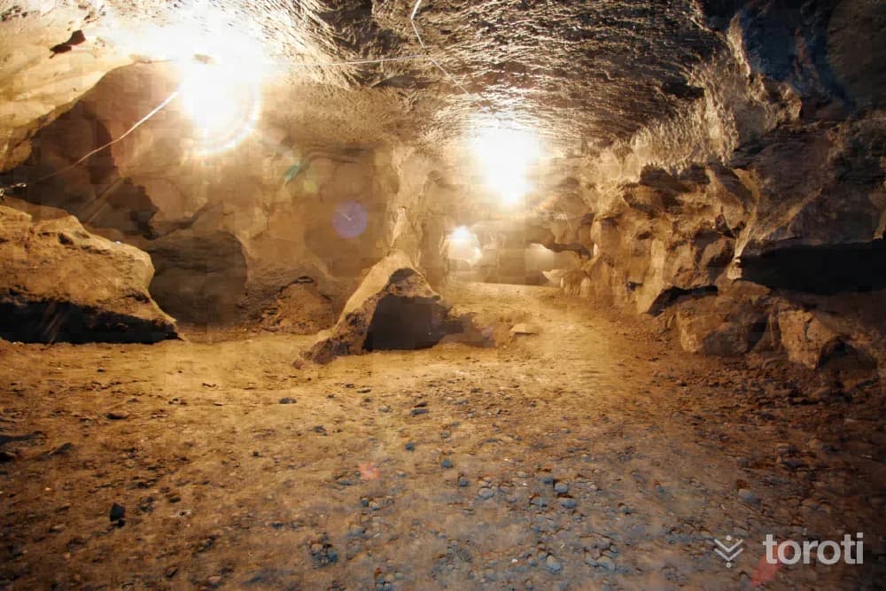
Pileki Mağarası
Pileki, made from a special stone, is a kitchen utensil unique to the Black Sea region, and it is round and in the form of a hollowed-out bowl. This special stone is extracted and processed from Pileki Cave in İyidere Çiftlikköy, and as a result of this process, which has been carried out for thousands of years, Pileki Cave was formed. The cave consists of two large areas at the entrance and many tunnels behind them, and there are wells and lakes inside it.
45 minutes
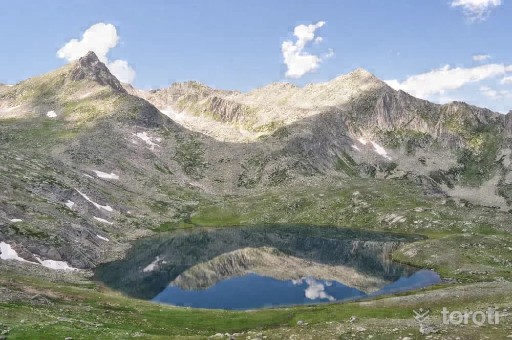
Büyükdeniz Gölü
By following the valley on the left from Yukarı Kavron Yaylası, you can reach the lake in approximately 5-6 hours; it is the largest among this series of lakes. Since the hike takes a long time, it is recommended that you take only enough food for one day. You may also encounter endemic plant species around the lake. In order to take good photographs, you may need to walk a little further toward the ridges around the lake and climb higher.
45 minutes
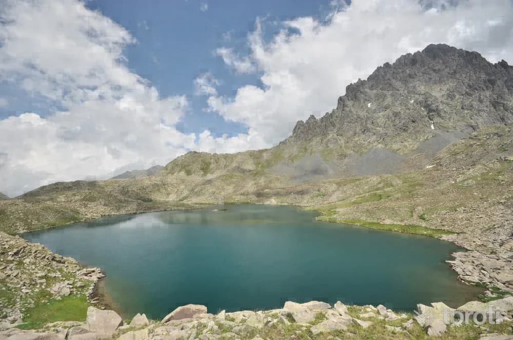
At Gölü
It is one of the rare lakes within the borders of Rize that can be reached so easily. Provided that weather conditions are suitable, a walk starting from Verçenik Yaylası will end at At Gölü after at most two hours. As the walk is in an area where transhumance continues, it proceeds along the path by the river through pastures and herds of animals, and the majestic northern face of Verçenik Dağı will also remain constantly in your field of view.
45 minutes
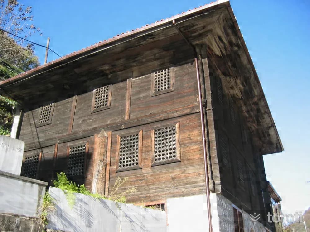
Hacı Şeyh Camii
According to the Turkish inscription on the minaret of the mosque located in Güneyce Beldesi, it was commissioned by Hacı Şeyh Osman Niyazi Efendi in 1886. The lower floor was built of cut stone and the upper floor of wood. The mosque, covered with a traditional tile roof, has a square plan. The mihrab was made from a single log. It projects outward on the qibla side. On the north, there is a single-balcony minaret whose shaft is covered with tiles.
45 minutes
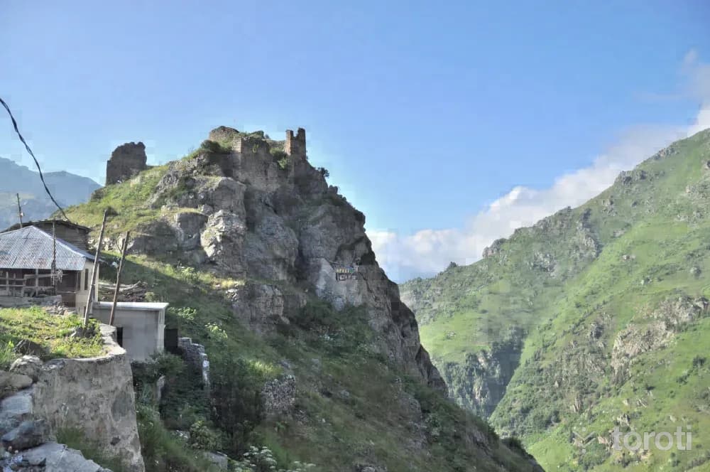
Kale-i Bala
It is located within the borders of Hisarcık Village, 40 kilometers from the Çamlıhemşin district center, at a point overlooking Fırtına Deresi. It shows similarities with Zil kale in terms of topography and wall masonry, therefore it is thought to belong to the same period. (14-15th centuries) It is located close to Başhemşin and Tatos Pass, through which the Kaçkarlar provided passage to Anatolia. The rectangular-planned castle was built on a steep rock.
45 minutes
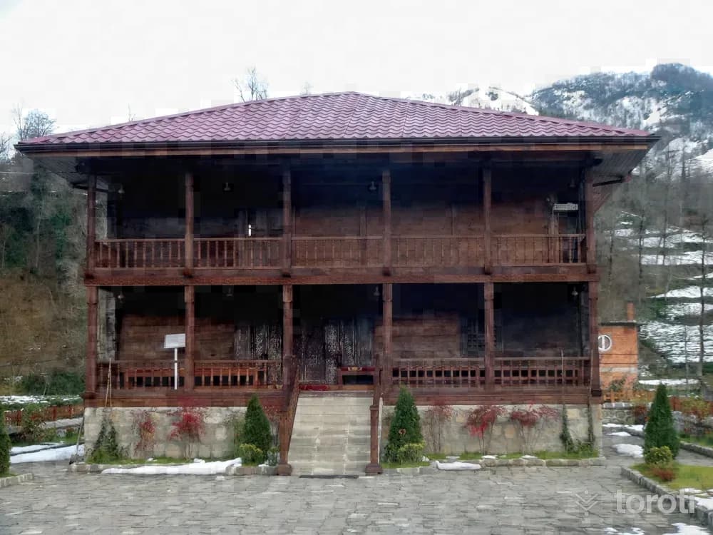
Hüseyin Hoca Köyü Sahil Camii
The mosque was dismantled from Keler Village of Of District and brought to Hüseyin Hoca Village in Kalkandere District. On the inscription located on its pediment, there are four lines of writing and the date H.1250. It is made entirely of wood. On the surface of the wooden mihrab, there is an ornamental band with muqarnas, braid, and tulip motifs respectively. It is a work that contains rare examples of Black Sea wood carving and woodworking arts.
45 minutes
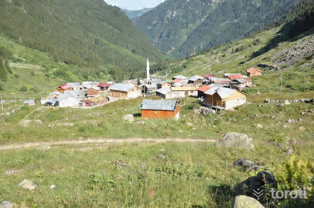
Elevit Yaylası
It is located at an altitude of 1884 meters in Çamlıhemşin District. The plateau is mostly visited by expatriates during the summer months. The traditional plateau houses of the plateau, which has accommodation facilities, are also आकर्षive. Elevit Yaylası also draws attention with the festivals held in August, as it is famous for its horons. Other wild animals unique to the Black Sea, especially the wild goat, are also found.
45 minutes
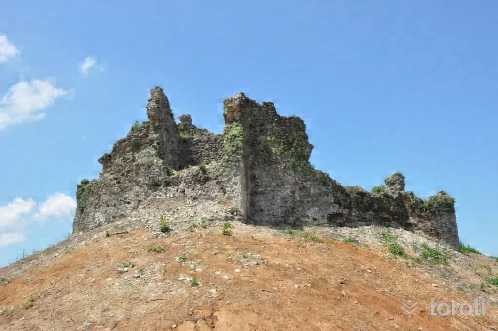
Ciha Kalesi
It is located to the east of Hemşin Deresi. It has a circular plan. The stonework of the fortification walls is not regular. The entrance gate of the castle is in the northeast and is supported by two towers. In the middle, there is another tower with a circular plan. It is thought to have been used for surveillance and communication. Restoration works have been initiated by the Ministry of Culture and Tourism.
45 minutes
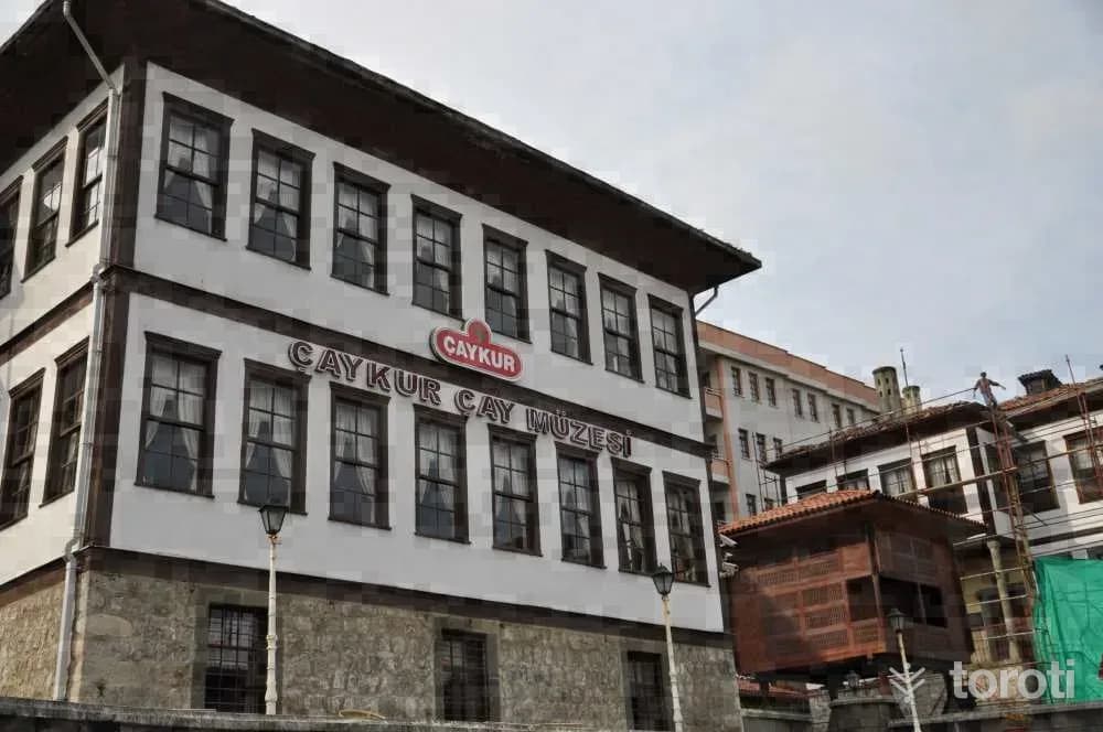
Çay Müzesi (beyaz Ev)
It is located in the city center next to Rize Museum (Sarı Ev). The structure, consisting of a stone basement and two normal floors, dates to the 19th century. The building, which contains local residential architectural features, has a square plan. Today, it is used by the General Directorate of Tea Enterprises as the Tea Museum called "The Adventure of Tea"; where the stages of tea production from past to present are explained and the machinery and equipment used in its production are exhibited.
45 minutes
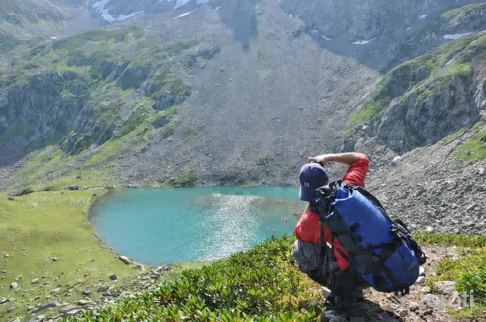
Doğa Fotoğrafçiliği
In Rize, which has a unique natural beauty, tours are organized for photography enthusiasts where unique shots can be captured. In the Kaçkarlar, reaching an altitude of 3900 meters, you can fit into a single photograph the exquisite landscapes born from the togetherness of plant and animal species as well as mountains, clouds, and people. Rize, which has a different beauty in every season, offers great opportunities for photography enthusiasts.
45 minutes
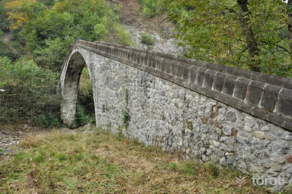
Kulaber Köprüsü / Aşağı Durak Köprüsü
The railings and arch of the round-arched, single-span bridge were built of cut stone, while the other parts were constructed of rubble stone. In the middle of the bridge, there is a chain hanging down from the arch that provides the plumb adjustment. There are posts and steps at the bridge entrances. The date 1261 is written on the posts at the entrance on the roadside.
45 minutes
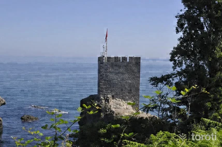
Kız Kalesi
It is built on a small peninsula to the west of the Pazar district center. The castle, which stands on a rocky ground, has been cut off from the land. The regular stone workmanship on its walls is striking. Although its construction date is not known for certain, it is thought to have been used in the 13th or 14th centuries. Today, it stands with a single watchtower.
45 minutes
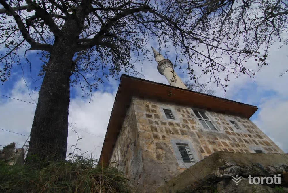
Demirkapı Köyü Camii
According to the inscription located at the entrance of the last congregation area, the mosque was built in H.1106-M.1695. According to the inscription on the preacher's pulpit, on which the date H.1308 is read, the mosque was renovated in M.1891. The square-planned mosque, built of smoothly cut stone, is covered with a hipped roof clad in sheet metal. There is an adjoining historic cemetery next to the mosque.
45 minutes
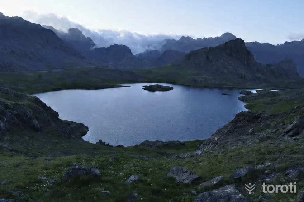
Yedi Göller
Located at an altitude of 3048 metres, Yedi Göller is situated 125 kilometres from Rize city centre, in the Çayırözü area of the Rize-Erzurum border, in the Verçenik Dağı region, in the south-western part of the Kaçkar Dağı range. It consists of 7 crater lakes close to each other on the mountain peaks.
45 minutes
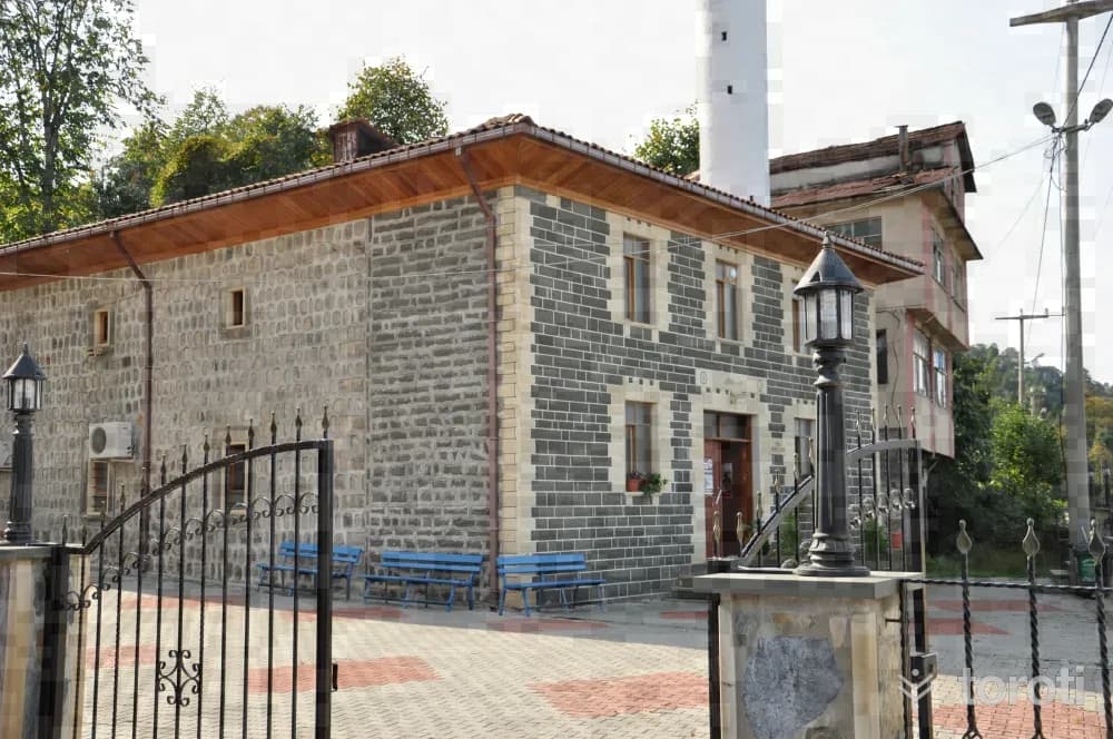
Işikli Camii
The Mosque, located in Işıklı village, was built in 1887. The structure has a rectangular plan and is made of cut stone. The narthex on the north facade and its roof have been repaired. Its wooden elements and decorations are noteworthy. On the ceiling, there is a dome with a star motif in the center, decorated with painted ornamentation.
45 minutes
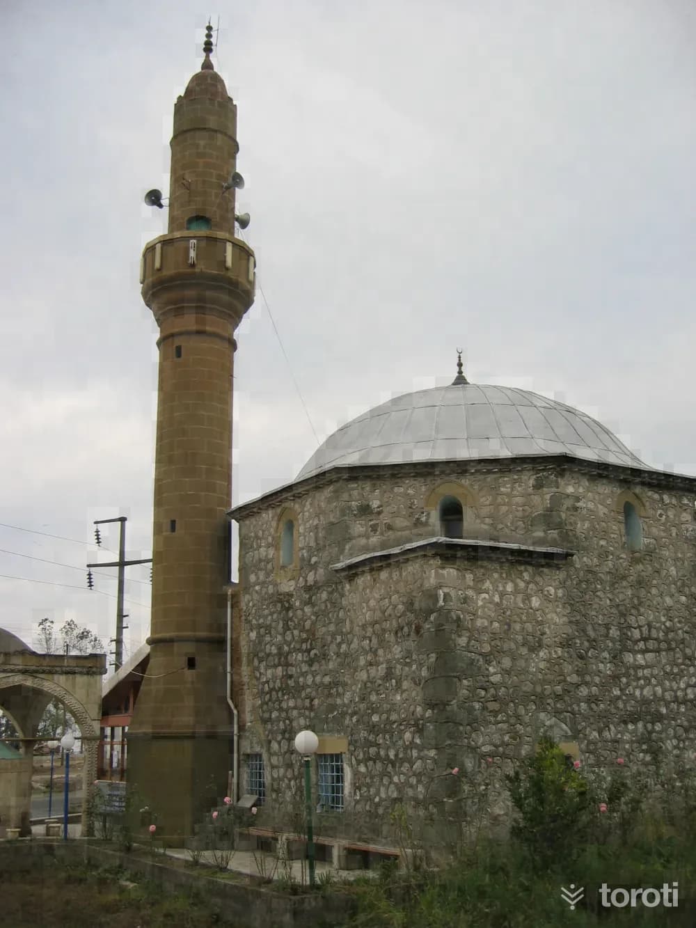
Kurşunlu Camii / İslampaşa Camii
The mosque, located within a large cemetery in İslampaşa Neighborhood in the center of Rize, is known as İslam Paşa Mosque or Kurşunlu Mosque. It was commissioned by İskender Cafer Paşa in H.978- M. 1571. Built of rubble stone with a rectangular plan, the mosque has a dome with 24 windows.
45 minutes
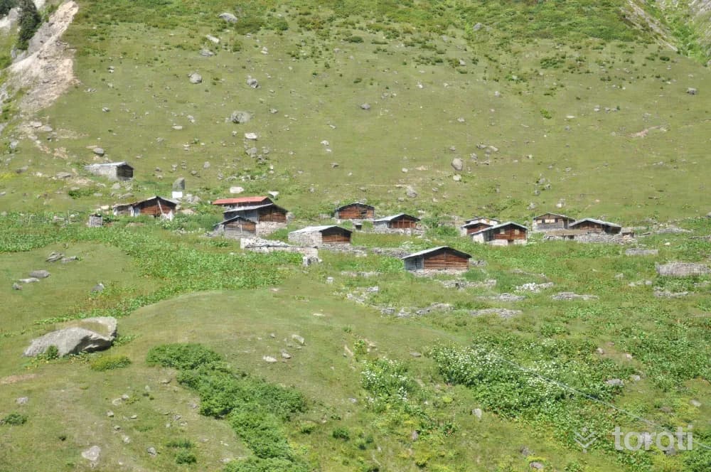
Yukarı Kaçkar Yaylası
The plateau, located at an altitude of 2056 meters in Çamlıhemşin District, is also known as Yukarı Yayla. The plateau, which has a settlement of 350-400 households, is also famous for the Vartavor Festivals held every year in August and lasting for one month. With its nature and local architecture, it continues the plateau culture.
45 minutes
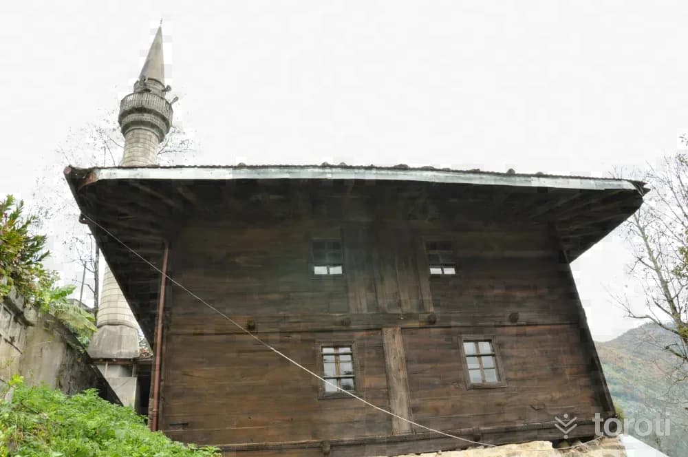
Şimşirli Köyü Cami
According to the inscription above the entrance door, the mosque was built in H.1265- A.D. 1849. Around the entrance door there is a border decorated with tulip motifs. Next to the mosque, there is also a separate structure used for educational purposes.
45 minutes
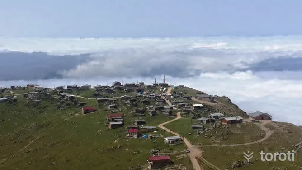
Homeze Yaylası
It is located at an altitude of 2368 meters in İkizdere District. It is an important viewpoint where new-period constructions have been carefully built, generally using wooden materials. It is a plateau that stands out as a 360-degree panoramic point.
45 minutes
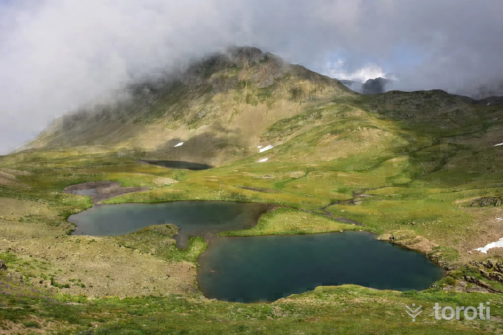
Ambarlı (Balıklı) Gölü
Ambarlı Lake is reached with a walk of approximately 3,5 km from Ambarlı Plateau. From Fırtına Valley to Kito Plateau, Ambarlı Plateau is reached by following a scenic dirt road through the forest and then along the ridge line. Ambarlı Plateau is the last point that can be reached by vehicle.
60 minutes
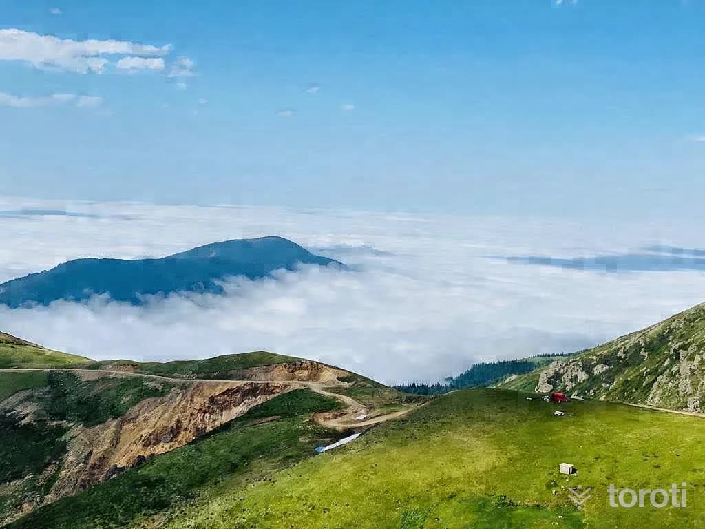
Handüzü Yaylası
The plateau, which is 16 km from Güneysu district center, is at an altitude of 1790 m. It is a plateau that has lost its authentic character. Due to its proximity to the center, it is a very developed, large plateau that has become popular because it is easily accessible. Roads leading to many plateaus to the south and southwest pass through this plateau.
60 minutes
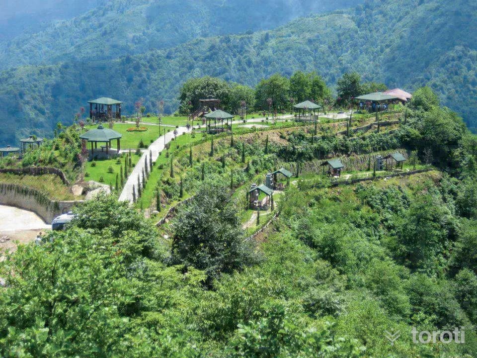
Kibledağı Mesire Yeri Ve Kent Ormanı
In the area arranged as a picnic area within the framework of the “Urban Forest Project,” there are 12 open gazebos and 3 enclosed social facilities. It is a social facility equipped with walking paths and wooden children’s playgrounds.
45 minutes
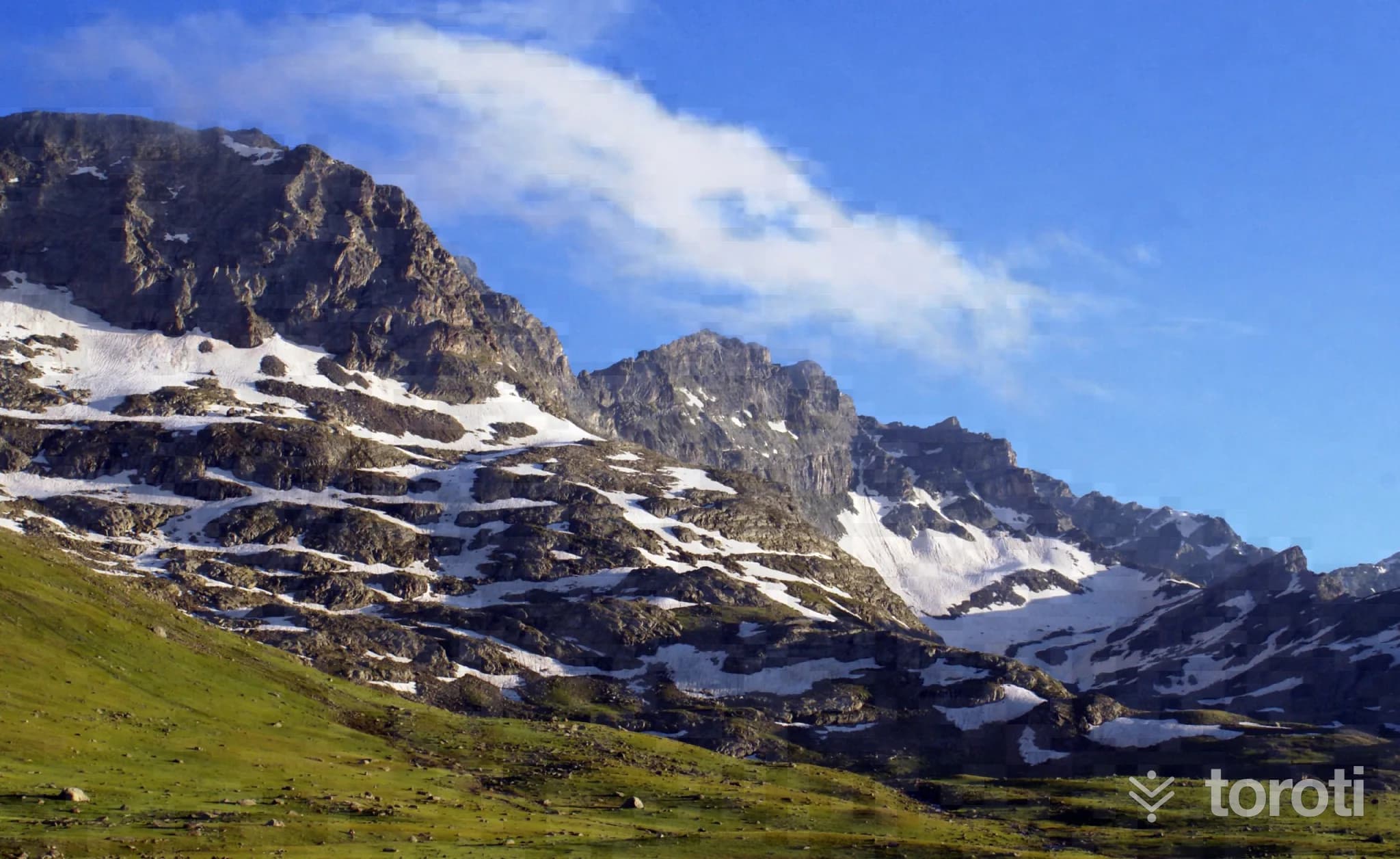
Ovit Yaylası
Ovit plateau is on the İkizdere-İspir road. Broad-leaved trees extend up to places reaching an altitude of 1000 meters; after this elevation they give way to pine trees up to 1600 meters, and after 1600 meters to wide, lush green meadows. It is approximately 52 km from the center of İkizdere.
60 minutes
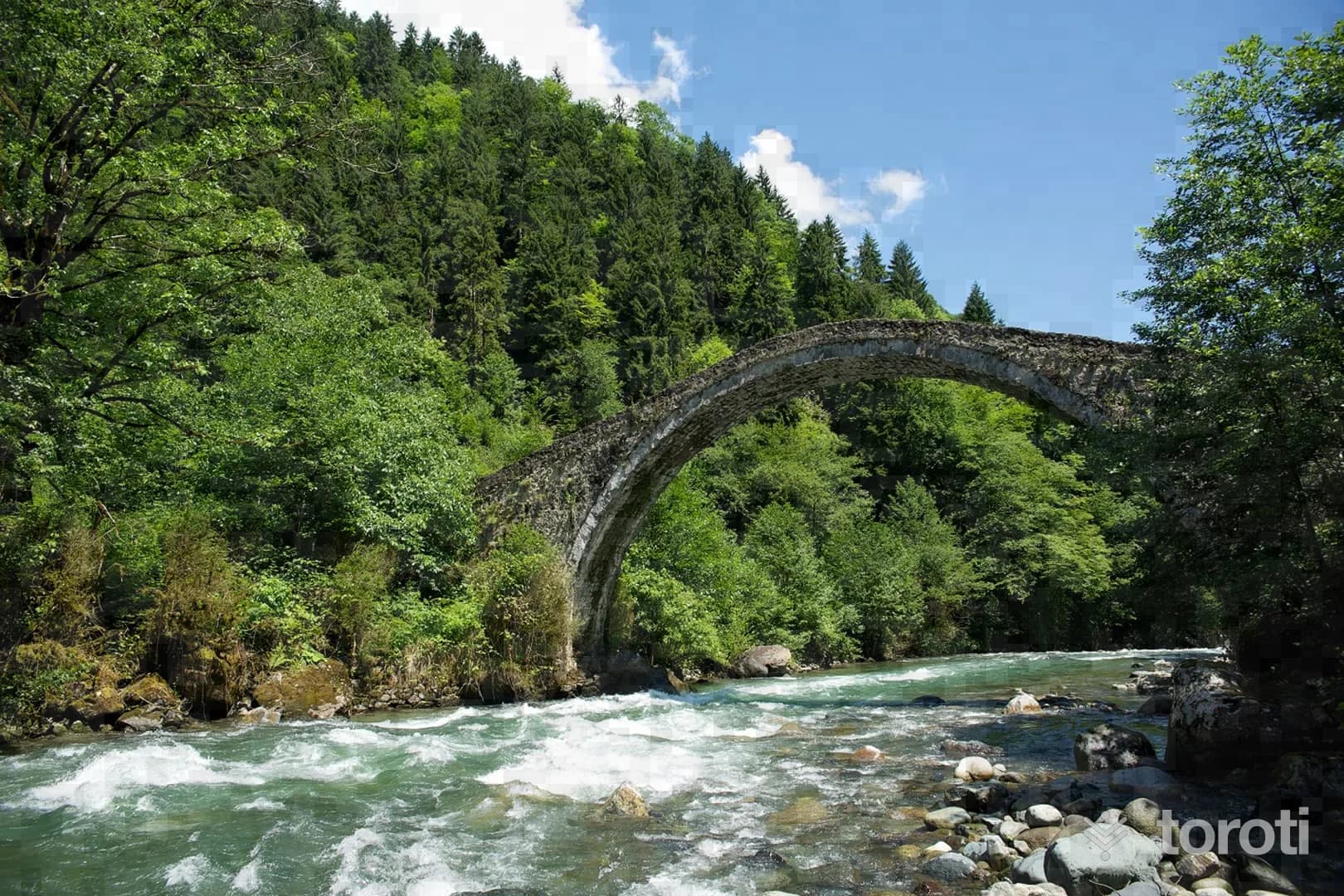
Dereköy Köprüsü
It was built with a depressed pointed arch and a single span. A bridge in İkizdere.
20 minutes
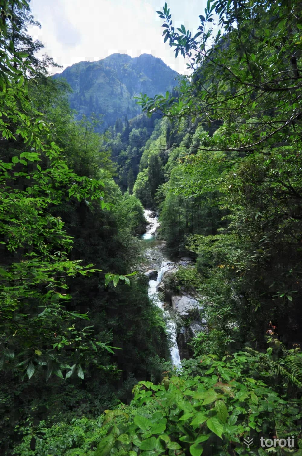
Gürcüdüzü Yaylası
It is at an altitude of 910 meters in Fındıklı District. It is the district's best-known and most accessible plateau, which can actually be described as a picnic area. It offers the opportunity for walking within dense forest cover.
45 minutes
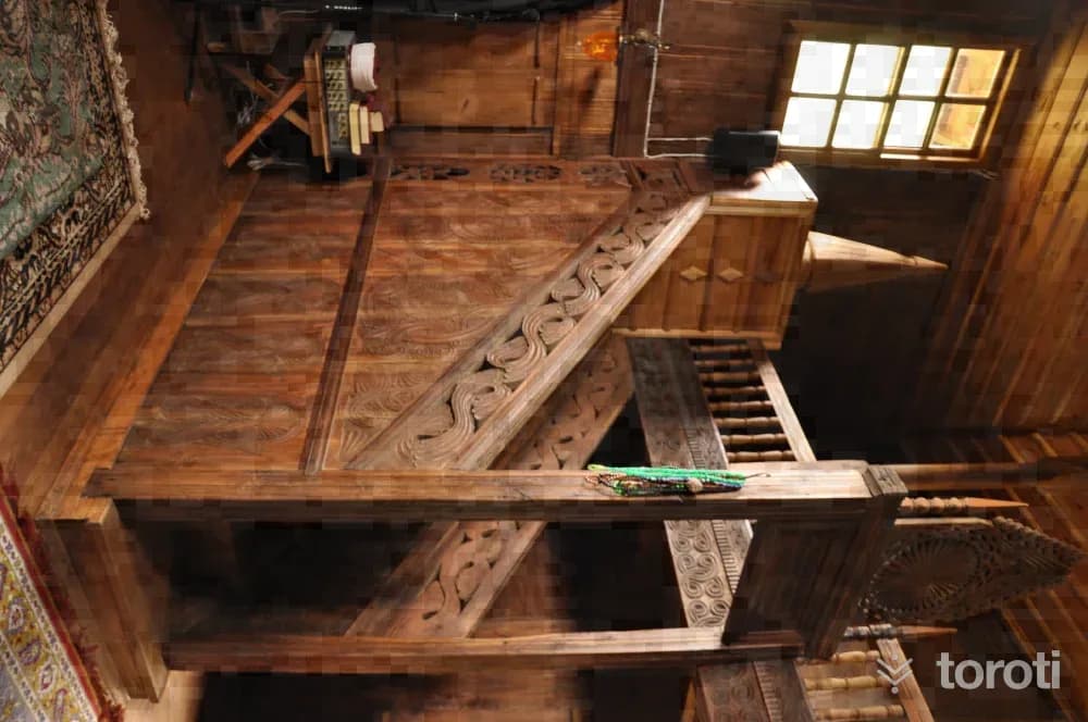
Meyveli Köyü Camii
It was built entirely of wood as a two-story structure. According to the construction inscription, it was commissioned by Mustafa Bin Alişan in H.1288- M.1871. The mosque, which has no minaret, is covered with a hipped roof.
45 minutes
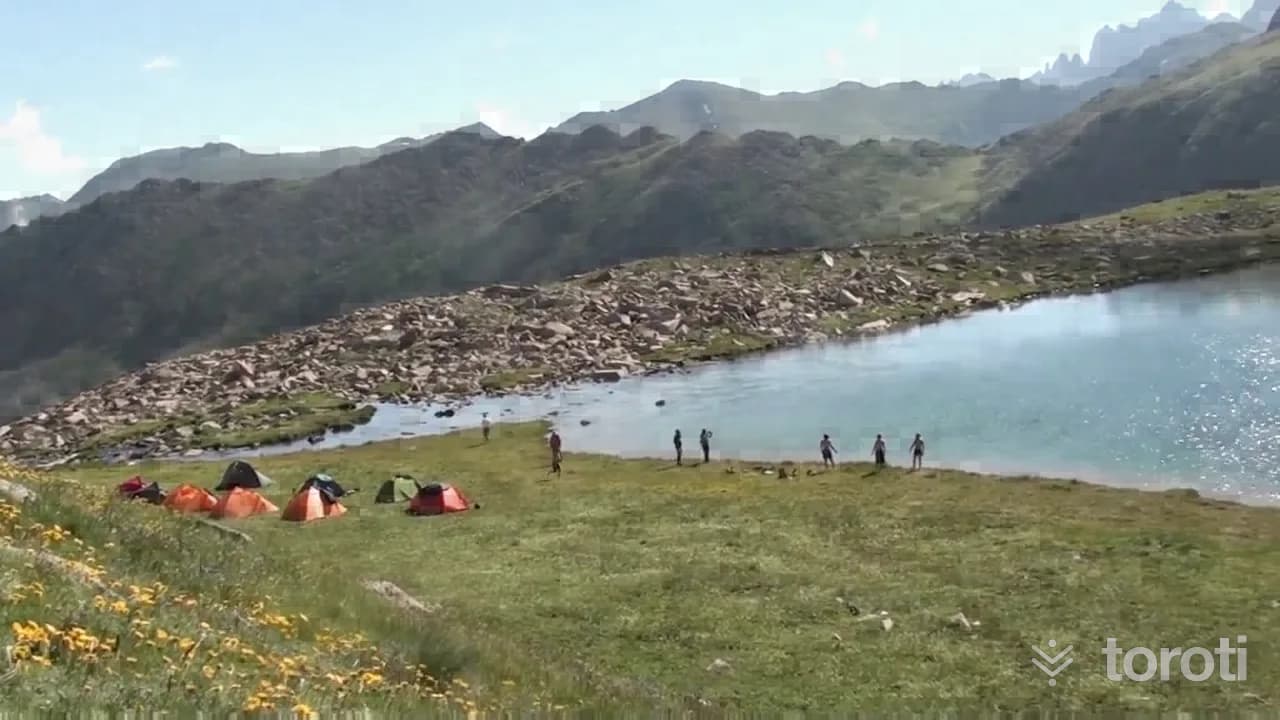
Karmik Gölü
Karmik Lake can be reached with an approximately 2.5-hour walk from Tirovit Plateau. When you head up toward Tirovit Plateau and proceed toward the valley on the right, the lake appears before you. This lake, around which endemic plant species can also be found, will offer you the opportunity to take beautiful photographs.
60 minutes
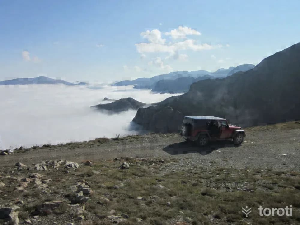
Jeep Safari
In Rize, the Jeep Safari is carried out from İkizdere to Fındıklı within the unique scenery of the Rize plateaus. Along the way, passing by stream banks and cooling off in front of waterfalls, you can experience a beautiful nature holiday full of adrenaline.
45 minutes
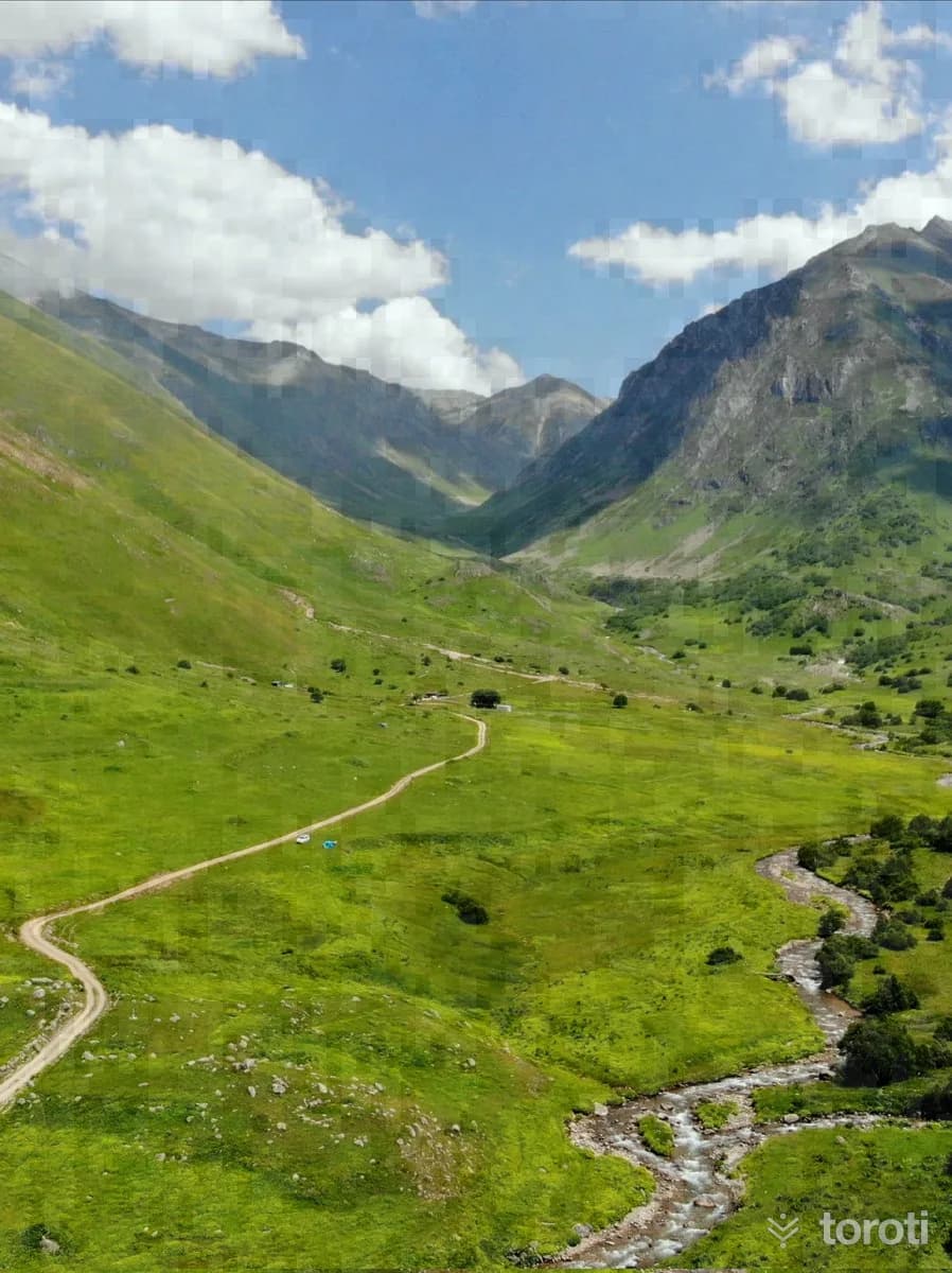
Cimil Başköy Yaylası
It is a plateau that has lost its local architectural character. Multi-storey houses have replaced the old houses. Due to its location, it receives sunlight at all hours of the day.
60 minutes
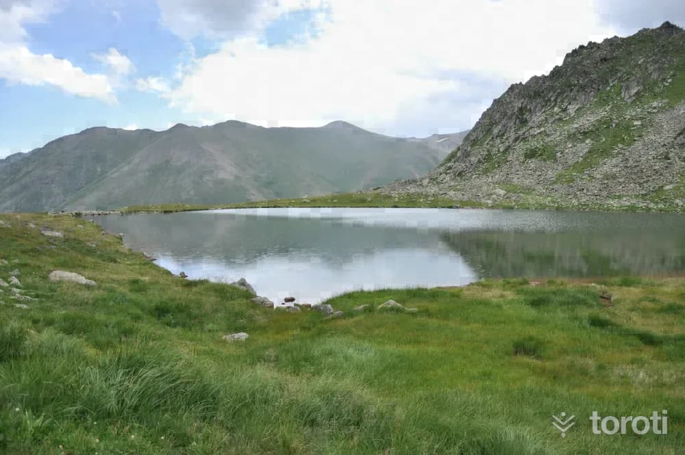
Micovit / Mezovit / Yıldız Gölü
It is reached with a walk of approximately 2,5 kilometers from Haçivanak Yaylası. It can easily be found by following the stream flowing from the slope located to the southeast of the plateau.
45 minutes
Rize'nin Köprüleri
The topography of Rize, reaching an altitude of 2000 m above sea level and a distance of 50 km, reveals quite steep slopes. Streams that rapidly flow from the highlands to the sea carve deep valleys. Numerous bridges have been built to cross stream valleys and provide access to houses, highlands, and agricultural areas. Thus, the architecture of stone arch bridges throughout the city is quite developed. Bridges that wear out in a short time due to the effect of the regional climate have undergone frequent repairs.
45 minutes
Aşağı Kavron Yaylası
Yukarı Kavron Yaylası, one of the plateaus established on the foothills of the Kaçkar Mountains, is located at an altitude of 2267 m, and Aşağı Kavron Yaylası is at an altitude of 1953 m. There is an approximate distance of 1,5 km between the two plateaus. The plateau, which offers eating-drinking and accommodation facilities, has a very high tourism potential in the summer months. It has the characteristic of being the final departure point for walks and climbs to the Kaçkars.
60 minutes
Kaçkar Dağı
While the great ice route on its northern face requires completely technical equipment and knowledge, the route continuing over the eastern ridge, if climbed in summer conditions, is a long summit walk stage with occasional short grade 3 rock passages and requires basic safety equipment. In winter conditions, however, it turns into a difficult and dangerous climb.
60 minutes
Gülbahar Merkez Camii
It is in the city center. The construction date of the mosque, which is thought to have been built in the name of Gülbahar Hatun, the mother of Yavuz Sultan Selim, is not known for certain. The inscription of the present mosque bears the date 1906. The mosque, which underwent restoration in 1952, has a single dome on a square plan and a minaret with a single balcony.
20 minutes
Hapivanak Yaylası
In the region, this plateau is also called Hapivanak, Avivonag, and Hapivona. Its distance to Çamlıhemşin is 80 km. It is the last plateau of the Palovit valley on the passage to Erzurum. Its houses are entirely stone and single-storey. Its drinking water is known to be delicious.
60 minutes
Deremezra Yaylası
It is located within the Tunca Valley, which was declared a nature park. Situated at an altitude of 1100 meters in an environment surrounded by forests, the plateau offers a beautiful scene that prolongs human life. You can photograph the historic stone arch bridges you will see along the route.
60 minutes
Karos Yaylası
The plateau, located at an altitude of 2252 metres, is situated on the slopes of the hill known in the region as Karos’un taşı. The region has always maintained its importance due to being on the old migration routes of Çağırankaya-İncesu-Cimil and Çağırankaya- İncesu- Baltaş-İspir.
60 minutes
Ambarlı Yaylası
It is a plateau located in the mountainous terrain in the district of Çamlıhemşin. It is reached by passing through Karap plateau. Since Kito, Karap, and Ambarlı plateau are close to each other, those who practiced transhumance in Kito plateau used to migrate here for a short time.
60 minutes
Palakçur Yaylası
It was established on a valley slope at an altitude of 2100 m and consists of three neighborhoods. It is used by the villages of Ardeşen-Beyazkaya, Hala and Civik. It is 5.5 km from Ayder and 25.5 km from the district.
60 minutes
Avuser(Dobecelezane) Gölü
When seasonal conditions are suitable, Avuser plateau can be reached by vehicle from the Çamlıhemşin-Ayder direction. The lake is reached with a walk of approximately 2 km from the plateau. It is a suitable route for a hike with mountain views.
60 minutes
Aşıklar I Köprüsü
The bridge, extending in an east-west direction, has a round arch and a single span. It is located on Aşıklar stream between Yalı Mahallesi and Yeni Pazar Mahallesi, approximately 3 kilometers from Çayeli District.
20 minutes
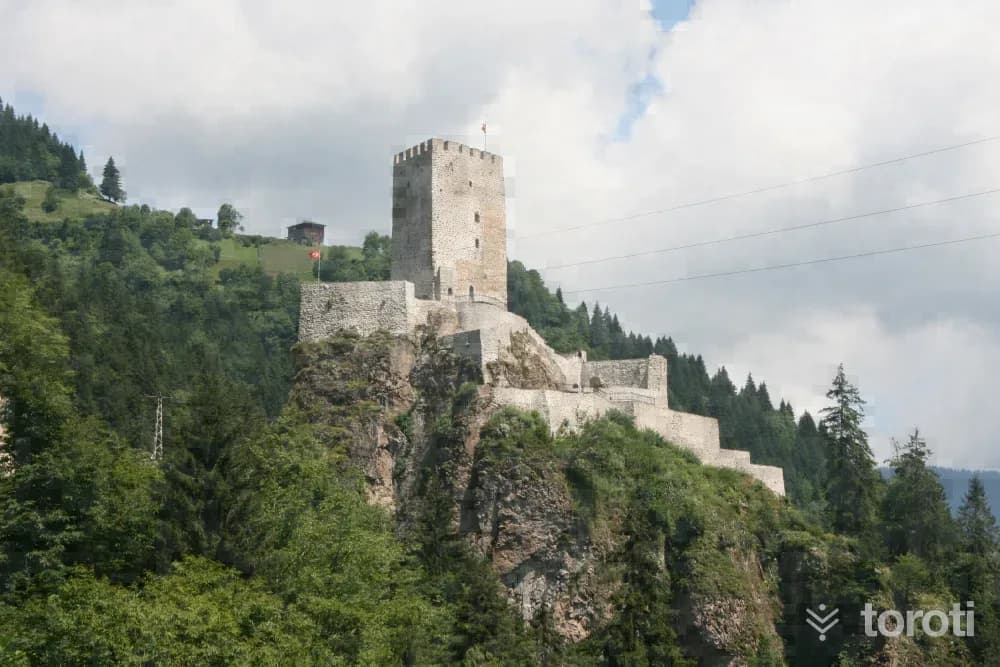
Zilkale
It is one of the most remarkable works of the region. It is situated 15 kilometers south of the district center, on the western slopes of Fırtına Deresi. The steep rock mass on which the castle was built is 750 meters above sea level and approximately 100 meters above the stream bed. The castle consists of outer walls, middle walls, and an inner castle. The gate of the outer castle is reached by a footpath from the northwest. With the help of a terrace, one ascends to the level of the middle walls.
45 minutes
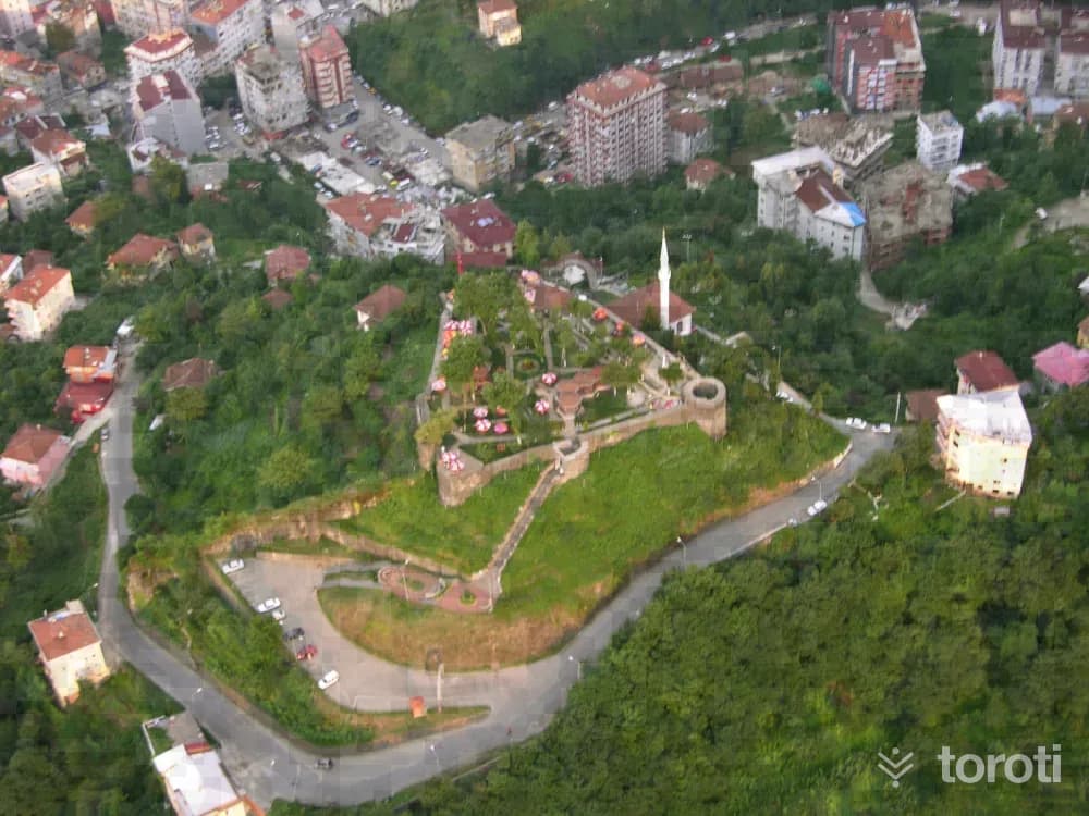
Rize Kalesi
The castle is built on an area of 480 square meters to the southwest of the city center. It consists of the inner and lower castles. It is thought that the inner castle was built during the reign of Justinian I (527-565), and the lower castle in the 13th century. The surroundings of the castle are operated as a tea garden with the environmental arrangement that has been made. It is one of the ideal points in the city center for viewing the city. The castle, which does not have a regular plan, is built on a natural hill 150 meters high.
45 minutes
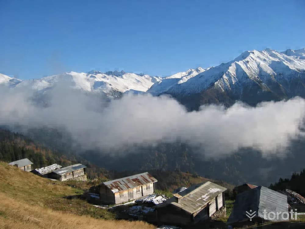
Pokut Yaylası
Located to the south of Çamlıhemşin District, between the valleys formed by the Fırtına and Hala streams, the plateau is situated at an altitude of 2032 meters around the upper forest limit. The plateaus, offering an ideal setting for hiking and relaxation, have a unique civil architectural structure in addition to their rich biodiversity. Located 15 kilometers from Çamlıhemşin District, the plateau is notable for its distinctive architecture.
45 minutes
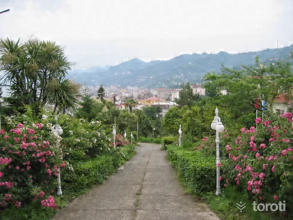
Botanik / Ziraat Çay Bahçesi
The park, which is a frequent destination for those who want to meet nature in the city center, is one of the panoramic viewpoints overlooking the Black Sea, Rize Kalesi, and the city. The tea garden, serving as a cafe, makes the place a suitable option not only for those seeking simply to enjoy a pleasant view, but also for those who want to snack on light foods.
45 minutes
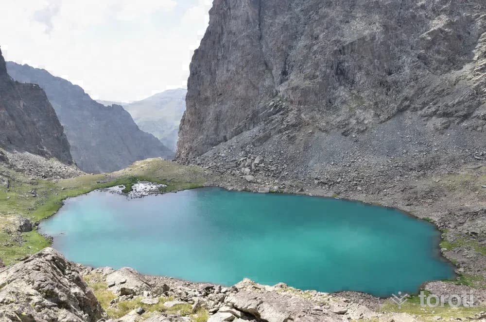
Deli Göl
It is an area that can be reached with a 2-hour walk after Kapılı Göller in suitable weather conditions. The second is reached by crossing two passes consisting of steep rocks. Although its slope is gentler, there is another route that requires descending into and climbing out of the Aksu Valley. Due to the cloud-retaining effect of Verçenik Zirvesi, it is an area where rain and fog may be encountered regularly at certain hours of the day.
45 minutes
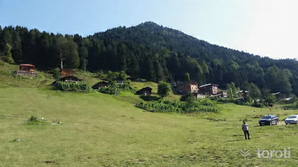
Ayder Yaylası
It has an altitude of 1350 meters. It is the starting point for climbs to the Kaçkar Mountains from the north. On the plateau, there are many accommodation options, from bungalows to the concept of a typical plateau house, from family-run guesthouses to hotels. In addition to being Rize's most popular tourism center and its rich flora and fauna, it is also one of the most preferred holiday destinations in the region with its hot spring.
45 minutes
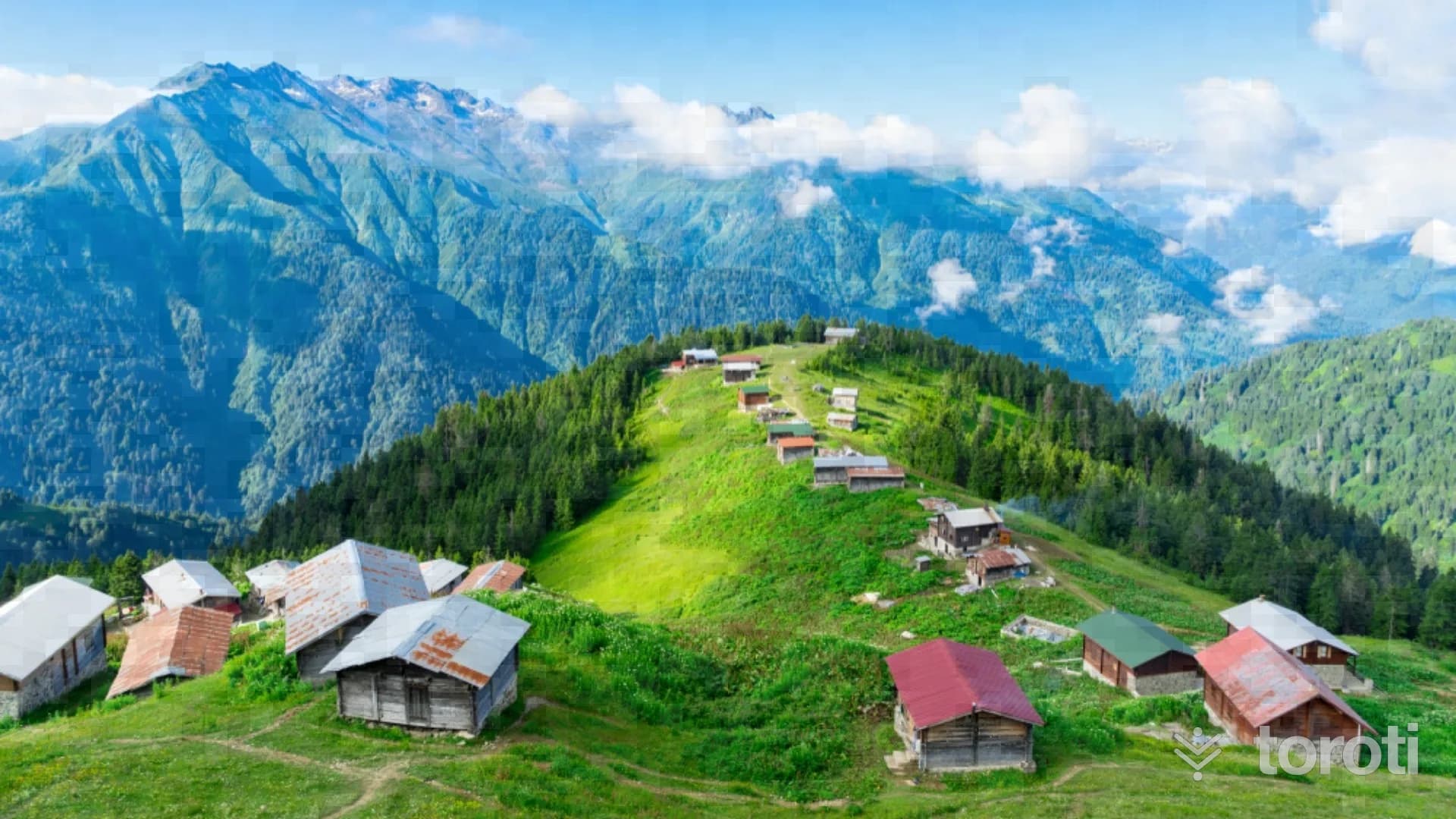
Palovit Yaylası
Palovit Yaylası, located 4 hours by vehicle from the Çamlıhemşin district center, has an altitude of 2338 m. Palovit Yaylası, notable for its traditional stone plateau houses, is one of the most beautiful elevations of the Black Sea, on the northwestern slope of the Kaçkar Mountains, with one side completely covered with forests and the other backed by the mountain slope.
60 minutes