
Places to visit
Things to do in Şırnak
59 destinations, each with a description, how long it takes and where it sits on the map.
In short
toroti’s catalogue holds 59 described destinations within Şırnak. The themes that come up most: Local culture, History, Faith heritage.
Districts of Şırnak
Halmun (elamun)
Andaç village, where the church is located, is an old Nestorian settlement, and its original name is Halmun. Today, this is a village settlement connected to Uludere. It is located within 3 km of the Hakkari –Şırnak highway, very close to the Iraqi border. The church was built on flat land within the village. Village houses are located to its north and south. It has a rectangular plan in the east-west direction, with dimensions of 16.11X21.80 m.
45 minutes
Görümlü
The bridge, located to the north of the town of Görümlü in the district of Silopi, has survived intact to the present day. The bridge, built over the Görümlü stream, belongs to the group of single-arched bridges.
45 minutes
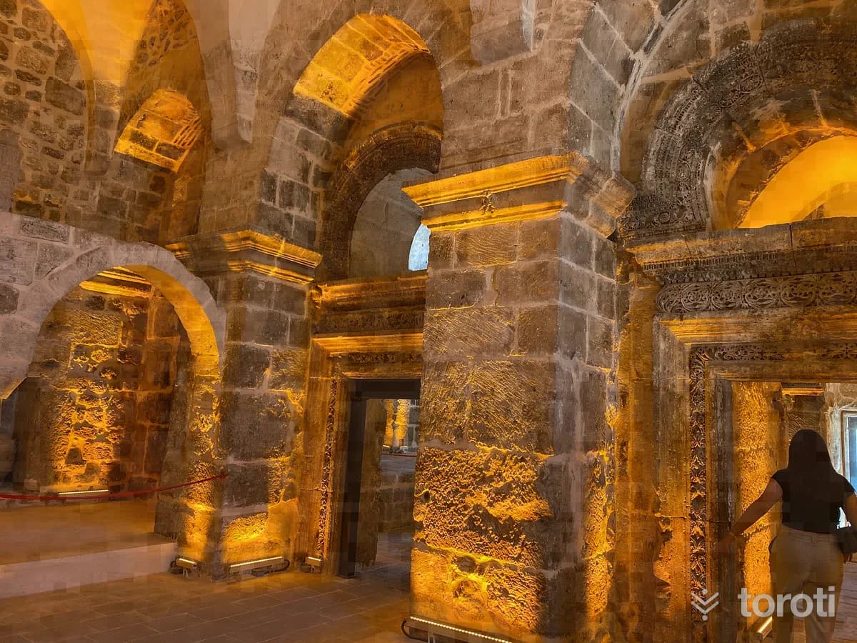
Mor Yakup Kilisesi
İdil Öğündük Mor Yakup Church- Öğündük, reached by a one km asphalt road branching off from the Şırnak İdil- Midyat highway, is one of today's Assyrian villages, formerly known as Midin. The church was built within the village as a monastery complex. The church is active and well maintained. The church is registered and open for worship and visits.
30 minutes
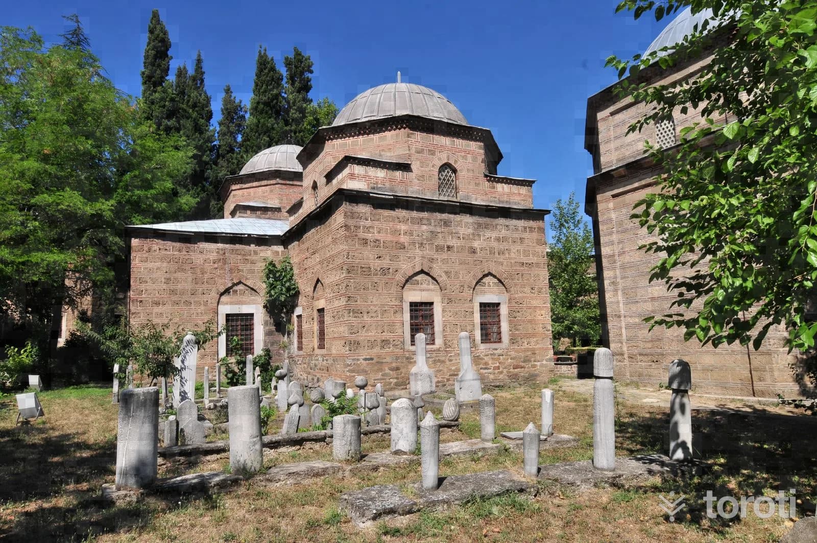
Kul Mustafa Türbesi
The tomb is located to the east of the cemetery in the south of Cizre. The top of the structure, which is partially intact, was later covered with a reinforced concrete flat roof. In places, traces of reinforced concrete repairs can be seen on the exterior walls of the tomb and inside it.
30 minutes
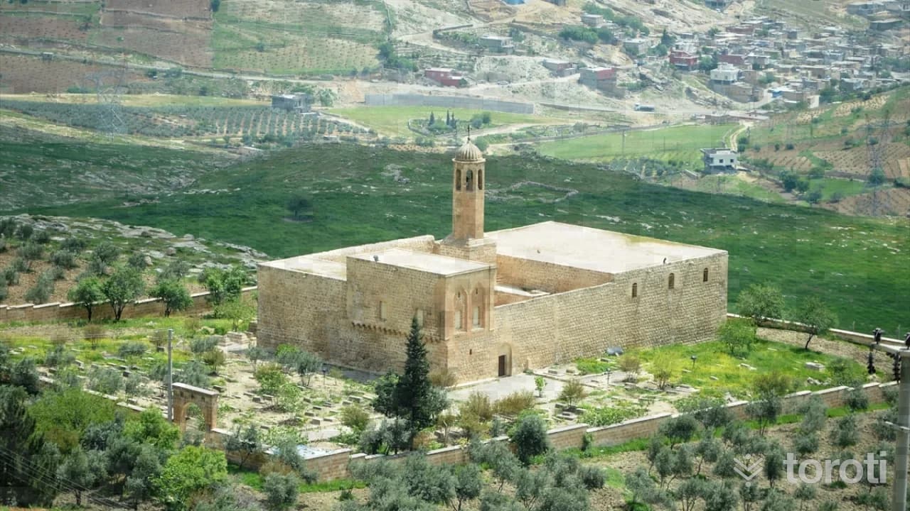
Mor Şumunı Kilisesi
The church, located in Aksu (Herbol) village, 10 km from the town of Çalışkan in the district of Silopi, has survived to the present day in a sound condition. When examined in terms of its plan, it displays Nestorian plan typology.
30 minutes
Ciddeyt Değirmenleri
The mills are located on Saklan Deresi, north of Ciddeyt Köprüsü. 1st Mill: It is located at the corner of the side road connecting to the Mardin Cizre Highway, 100 meters northwest of Ciddeyt Köpüsü. 2nd Mill: It is located on the bank of Saklan Deresi, just 50 meters east of the 1st mill. 3rd Mill: It is located 30 meters north of the 2nd mill.
45 minutes
Mir (Cencekir) Kalesi
The historic Şırnak Gurkel or Mir (Cencekir) Castle is located in Şenoba Town of Şırnak - Uludere and stands on the bank of Hezil Stream. Reaching the castle requires approximately a one-and-a-half-hour walk. In the castle, which was built on a naturally high rock, there are water cisterns carved in square and round shapes, traces of mihrabs, most of which have been destroyed, a masjid, and remains of structures ruined down to foundation level.
30 minutes
Deşti Akabin Köprüsü
It was built outside the city walls of Cizre, near Deşt Gate. There is dense squatter housing around it. Since the stream on which it stands has been completely filled with soil, only a small wastewater channel passes beneath it. The bridge, which has survived to the present day in the condition restored on the instructions of Marshal Fevzi Çakmak, is in sound condition.
45 minutes
Katip Yusuf Evi
Katip Yusuf Evi, located in the Cizre district of Şırnak, has a rectangular plan. This immovable property, built of neatly cut basalt stone, is entered through a door opening onto the street on the east side. The entrance door, set within a rectangular molded frame, has a round arch. After the entrance door, the courtyard is reached by means of a passage. The courtyard floor, where the tandır and the well are located, has its original stone paving.
30 minutes
Geramon Kilisesi
Yarma Neighborhood, attached to Andaç village where the church is located, is an old Nestorian settlement, and its original name is Geramon. It is one km from Andaç, which is located 3 km inside the Hakkâri–Şırnak highway, very close to the Iraq border. To the south of the church, which was built on land sloping from north to south, there is a square; on the north and west sides, a garden; and to the east, a road.
45 minutes
Mor Şalito Kilisesi
It was built on land sloping from north to south and east. Externally, it is a rectangular structure in the east-west direction. There is a courtyard to its north. The church is entered from the courtyard through a projecting doorway on the west side of the north façade, recessed in the form of an eyvan. The door projection is also arranged as a staircase providing access to the upper roof. It has stone walls and a single nave.
45 minutes
Sitti Nefis Pınarı
Sitti Nefis Spring, located in Yafes Neighborhood in the center of Cizre, was built on a sloping terrain in the north-south direction. The structure measures 5.10 x 6.15 m externally, has a rectangular plan in the east-west direction, and its entrance is located in the middle of the north facade. Inside, there is a small pool and a water channel. Today, the structure is largely intact, but its water source has greatly diminished.
30 minutes
Han Mahmut Köprüsü
It is located within Kasrik Town. Extending in the northeast-southwest direction, the bridge belongs to the group of bridges with three arches and a flat roadway. Since there is no inscription on the bridge, it is not known for certain by whom and when it was built. Today, the bridge is largely in a ruined condition. Two of its three arch openings are intact, and the third opening in the northeast has partially collapsed.
20 minutes
Mehmet Ağa Sor Kasri
The building, located on Sönmez Street in Aydınlık Evler Neighborhood, is under private ownership. It is the most important registered building in the center of Şırnak. According to the inscription on it, it was built in 1892.
45 minutes
Ensari Malikanesi
Ensari Malikanesi, located in Alibey Neighborhood in the center of Cizre, was built on a flat terrain in a north-south direction with a rectangular plan. The building was constructed with a courtyard, an eyvan, and two storeys. It is covered externally with a flat roof. It was built of finely cut stone material. The ground and upper floors are porticoed, and the building has a 'U'-shaped plan with a courtyard in the middle.
30 minutes
Ali Han Ağa Evi / Uysal Evi
The house, located on Büyük Cami Sok. in İsmet Paşa Mah., is within a garden. The garden is entered through the street gate facing west. Ali Han Ağa House is arranged as a two-storey building. There are two rooms on the ground floor, and the second floor is reached by the stairs inside the house.
45 minutes
Havindi Kaya Oyuğu Yerleşimleri
Havindi Rock Hollow Settlements were made by carving the rocky areas on the right and left sides of the road at the 9th km of the Oyalı Village road. On the right side of the road, 33 rock settlements have been identified, 28 of which are understood to have been used as dwellings, 4 as water cisterns, and 1 as a mosque. On the left side of the road, there are 4 rock settlements.
60 minutes
İdil Öğündük Mor Yakup Kilisesi
Öğündük, reached by a one-kilometer asphalt road branching off from the İdil - Midyat highway, is one of today’s Syriac villages, formerly known as Midin. The church was built within the village as a monastery complex. The church is active and well maintained. The church is registered and open for worship and visits.
45 minutes
Birlik Köyü Taş Köprü
It belongs to the group of bridges with a single-span arch opening and a sloping roadway. The arch of the bridge, which is located in a north-south direction on the Cuma stream passing below Birlik (Cuma-Cem’a) Village, connected to the center of Silopi, has collapsed, and only the piers on both sides remain.
45 minutes
Mor Aday Kilisesi
The church is located in the Basak hamlet of Öğündük village. The village, an old Assyrian settlement, was abandoned at the end of the 19th century. After this abandonment, the church, which was used for a while as a house, has now been left to its own devices. When it was converted into a house after the church, some additions and alterations were made.
30 minutes
Mor Meryem Kilisesi
The church is located on the southern opposite slope of Haberli village. It was built on rocky ground on a terrain sloping eastward. Externally, it is a rectangular structure in the east-west direction. It has stone walls and a single nave. It is entered through a simple door on the north facade.
45 minutes
Kavuncu Köyü kilisesi
The church located in Kavuncu Village, connected to Şırnak Center, is 6 km from the Şırnak Cizre main road. The church has survived to the present day without being heavily damaged. When examined in terms of its plan, it shows Nestorian plan typology. It has a rectangular plan in the east-west direction.
30 minutes
Birlik (Cuma-Cem'a) Köyü Taş Köprüsü
It belongs to the group of bridges with a single-span arch opening and a sloping roadway. The arch of the bridge, which is located in a north-south direction over the Cuma stream passing below Birlik (Cuma-Cem’a) village, connected to the center of Silopi, has collapsed, and only the piers on both sides remain.
30 minutes
Osman Ağa Kasrı
The southern and northwestern parts of the pavilion have remained. Smooth cut stone was used on its exterior facades. Snake, mountain goat and fantastic figures were carved on its exterior facades. The pavilion, located on Eğil Street in Gazi Paşa Neighborhood, was built on sloping land in the north-south direction.
30 minutes
Değirmen I
Değirmen-I was established on the Meşe içi Akçay road connected to Kasrik Town and on the opposite slope of Hoşal Stream. It consists of a mill structure together with a water channel and tower built on terrain sloping from south to north.
45 minutes
Nasfaran Kaplıcası
In this hot spring, located a few km from Merkez Kumçatı Beldesi, there are two springs, one used as a mud bath and the other for bathing and drinking. It is said that the mud bath definitely cures acne, eczema and fungal diseases.
45 minutes
Muhammed (mehmed) Ağa Sor Kasri
Only the front eastern facade of the structure located on Büyük Cami Street in İsmet Paşa Neighborhood has survived. The interior has been completely altered by additions. For this reason, its plan could not be determined.
45 minutes
Kavuncu (naniv) Hanı
Located about 3 km east of the Kavuncu village settlement, on the approximately 3rd km of the stabilized road leading south to Kavuncu village from about the 25th km of the Şırnak-Cizre highway, the inn has a rectangular plan extending in the north-south direction.
45 minutes
Mehmet Ağa Sor Kasrı
The historic Mehmet Ağa Sor Kasrı is an important cultural heritage site from the Ottoman period, located within Şırnak University, next to Şırnak' University. Inside the restored historic building, there is a museum, restaurant, cafe and meeting rooms.
30 minutes
Zümrüt Kaplıcası
It is in Ilıcak village, 7 km from the center of Beytüşşebap district. Its flow rate is estimated at 1 lt/sec, and the water temperature is 39 C. Since the thermal spring water is sedimentary, it is not drinkable. Water bathing is beneficial for skin, kidney and rheumatic diseases.
120 minutes
Şerif Cami
The structure, located on the bank of a stream outside the residential area, 1 km from Birlik (Cuma-Cem’a) village connected to the center of Silopi, and known among the local people as Şerif Camii, has a rectangular plan extending in the east-west direction.
45 minutes
Mehmet Ağa Kasri
The Mehmet Ağa house, located in Cizre center in the Dağkapı neighborhood, was built on a flat piece of land in the north-south direction. It was commissioned by Hamidiye Major Fettah Ağa.
45 minutes
Yikik Han
It is located immediately to the left of the main road at the 30th km while going from Şırnak province, connected to Şırnak Merkez, to the Cizre district. The inn is located in the Grabe locality. It is within the borders of Kızılsu town.
45 minutes
Mor Barsavmo Manastiri
The monastery is located outside the residential area to the southeast of Haberli village. It was established on a high place among almond trees. It is reached from the village by a footpath.
45 minutes
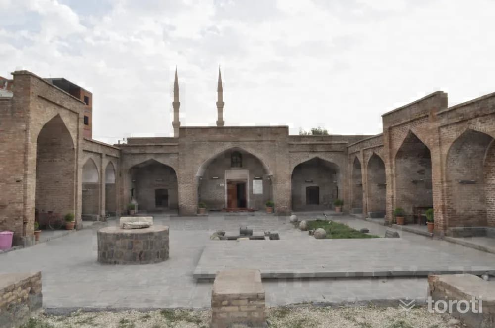
Kirmizi Medrese
Kırmızı Medrese was commissioned by II. Han Şeref Bey in the 14th century during the period of the Cizre Principality. It was named Kırmızı Medrese because it was built of red bricks. It served as an institution of higher education where the region’s scholars of the period were trained. Mahmut Peynirci Medrese was built in the Dağ Kapı Neighborhood, on the remains of the city walls to the west of the city. The madrasa was built within an area that also contains many other important structures dating to different periods.
45 minutes
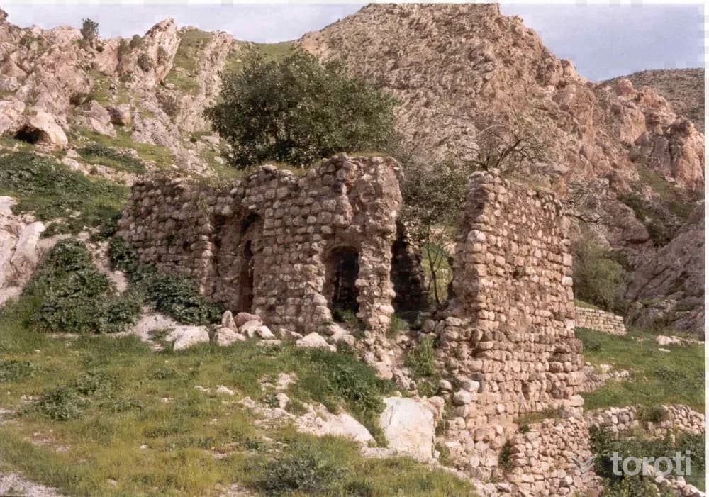
Faki Teyran Medresesi
The mosque, located within the borders of Güçlükonak Damlarca Village, is known among the local people as Faki Teyran Medresesi. Faki Teyran's real name was Muhammed, and he was from Van's Bahçesaray (Müküs) District. His grave is today in a grove in Bahçesaray's Kartal (Verezuz) Village. Faki means madrasa student, and based on the rumor that he spoke with birds, he was named Faki Teyran among the people during his lifetime and afterwards.
45 minutes
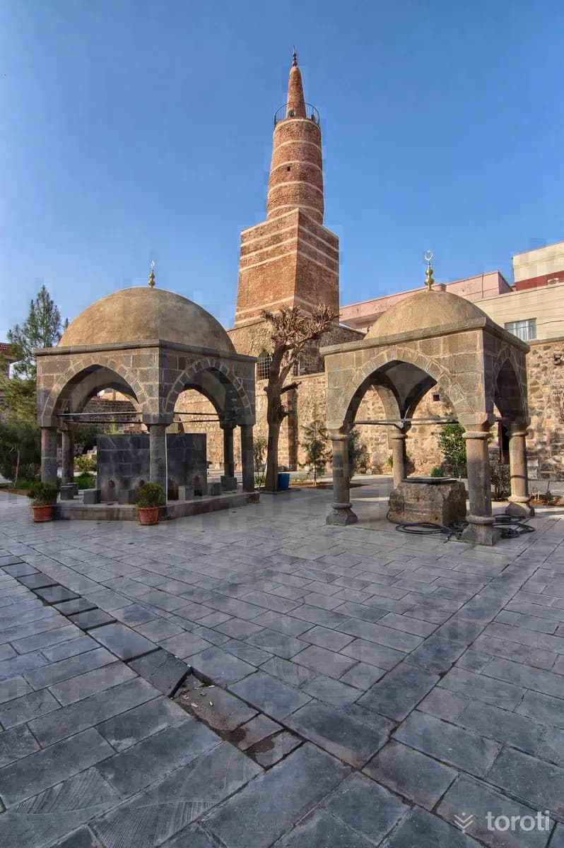
Ulu Cami
With Cizre’s acceptance of Islam, it was converted from a church into a mosque in 639. During the Abbasid period, the mosque was demolished and taken into repair. In 1160, it was rebuilt by Al Sencer, the son of Cizre Beyi Baz Şah. Its square minaret, built in 1156, underwent restoration 2 times in 1945-1946 and 1971. One of the famous dragon figures made by Ebul-İz on the doors of Cizre Ulu Camii is located in the Turkish and Islamic Arts Museum in Istanbul.
30 minutes
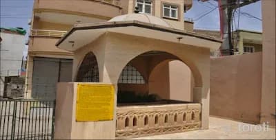
Ebu'l-İz El Cezeri Türbesi
Ebu'l-iz El Cezeri is a scientist, engineer, and pioneer of the science of cybernetics. In his work titled Kitab-ı Hiyel, he describes in detail his automatic machines, water clocks, water pumps, water balances, and musical instruments. Cezerî provided the designs of 50 devices in his book. For this reason, he has deserved to be one of the sources of pride of these lands.
45 minutes
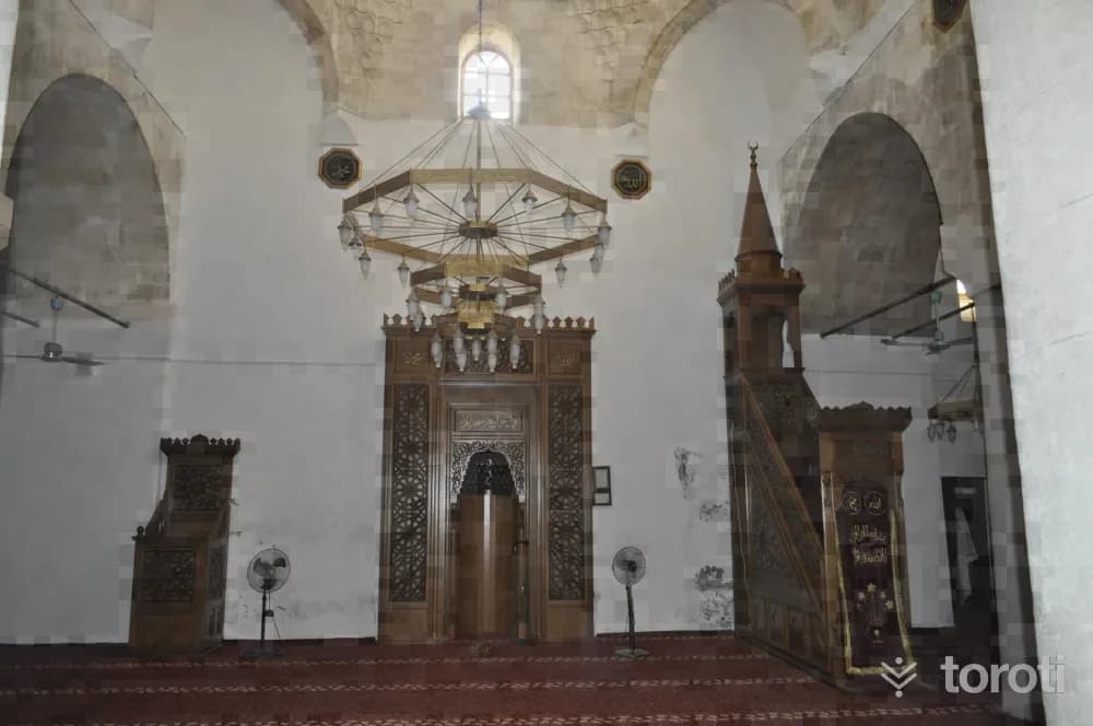
Cizre Ulucami
Located in the city center of Cizre, in Dağ Kapı Mahallesi, the structure has survived to the present day through additions and repairs made at different times. There are 8 inscriptions on the structure. According to these inscriptions, it is understood that the mosque was built during the period of the Atabegs of Mosul in the years A.D.1155-1160, and was repaired in 1203 and 1284. The most recent restoration was carried out in 2007 by the General Directorate of Foundations.
45 minutes
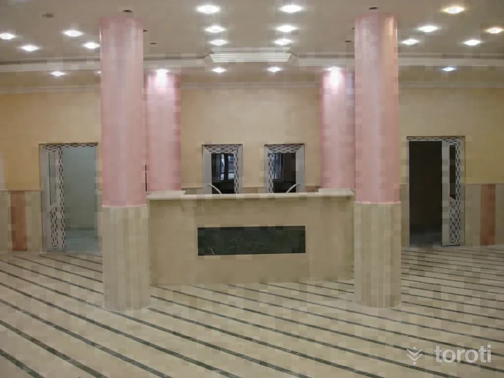
Belkis Ana Kaplıcası / Hista Kaplıcası
It is located on the bank of the Dicle River, near Düğünyurdu Village in Güçlükonak District. Its temperature is 67 degrees. The spa water contains calcium and sulfite. Its flow rate has been determined as 7 lt/sec, PH:7.15. There are hydrogeological conditions indicating that the existing flow rate can be increased. Spa bathing is beneficial for rheumatic diseases and women's diseases. There is a thermal hotel at the spa.
45 minutes
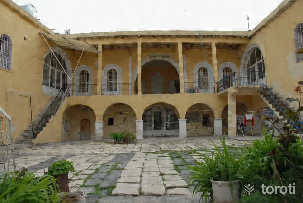
Ensari Evi
Ensari Evi, located in Alibey Mahallesi in Cizre Merkez, was built with a rectangular plan on a flat terrain in the north-south direction. The structure was built with a courtyard, an iwan, and two storeys. It is covered externally with a flat roof. It was built of smoothly cut stone material. The ground and upper floors are porticoed, and the structure has a 'U'-shaped plan with a courtyard in the middle.
45 minutes
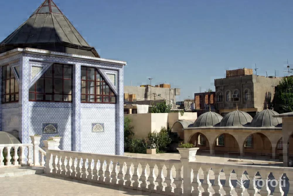
Hz. Nuh Cami
Prophet Noah, who has been regarded as the second father of humanity since the Flood, lies in the mosque named after him. The tomb of Prophet Noah is on the basement floor. Since the second-floor sections of the mosque collapsed over time, repairs were made, flat concrete was poured, and it was altered from its original form. The tomb and the mosque have been restored.
45 minutes
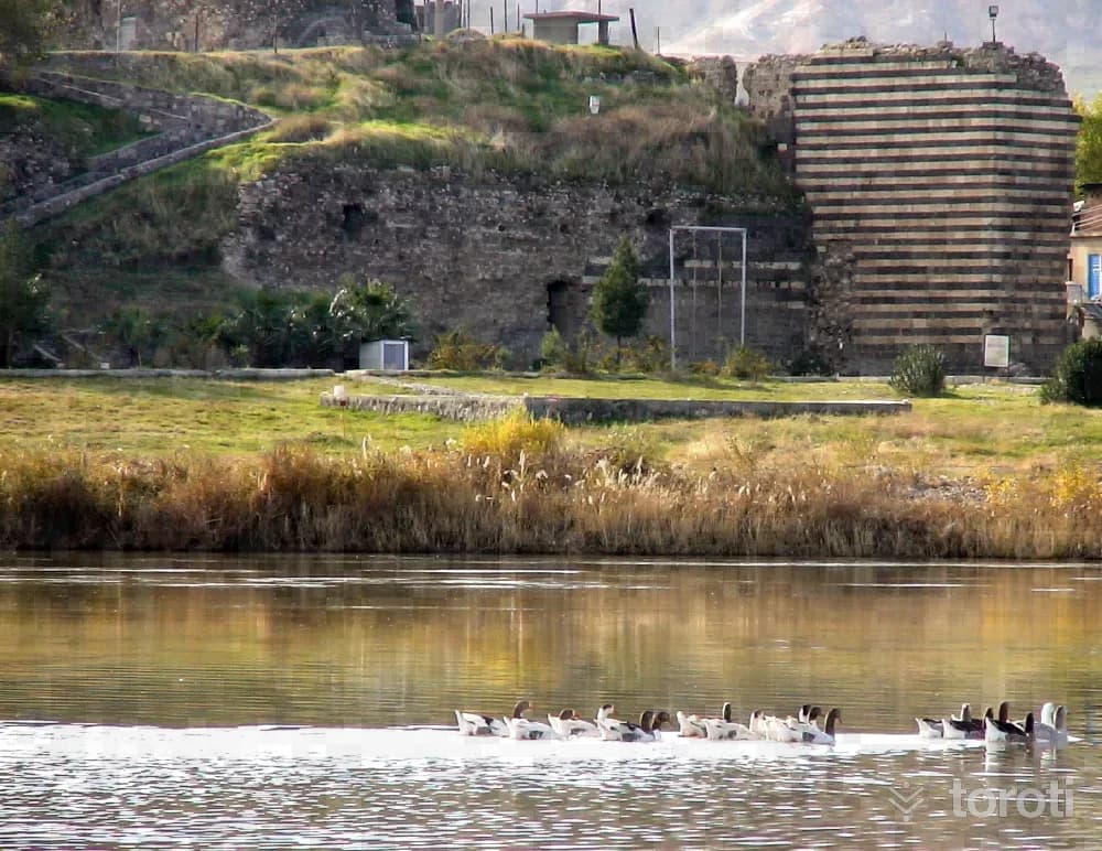
Cizre Kalesi
The castle, established on the bank of the Tigris River in the city center of Cizre, consists of an outer castle and an inner castle. From the remains, the construction process of the castle can be traced from the Roman and Byzantine periods onward, and it has survived to the present day in the form it took during the period from the XIIth century to the XVIth century, that is, during the periods of the Mosul Atabegs and the Cizre Beys.
45 minutes
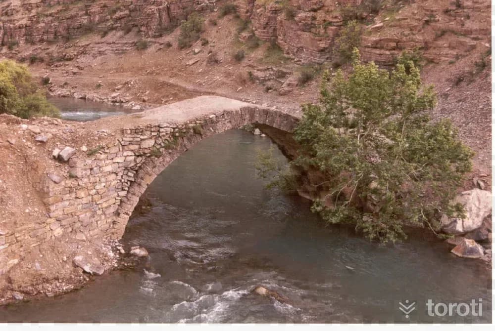
Beyaz Köprü
The bridge extending in the east-west direction has an arch span of 11,20 meters, a width of 4,47 meters, and a height of 5 meters. The arches are made of cut stone, and the other parts are made of rubble stone. Due to water floods, the west side wall has been completely destroyed. There is no information about its period.
45 minutes
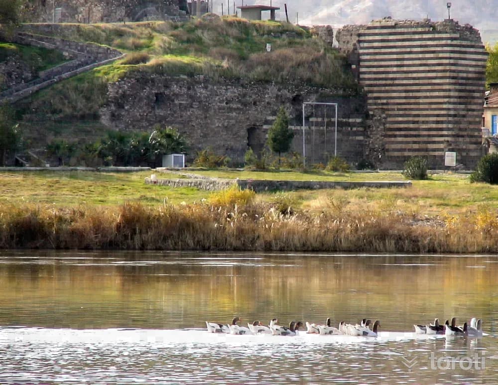
Cizre İÇ Kale
Cizre city center was established on the bank of the Tigris River. It is located within a military zone. It is in use by the Border Battalion Command. Here, two parallel fortification walls extend in an east-west direction. The first wall to the north is close to the river and joins the outer walls from the east.
45 minutes
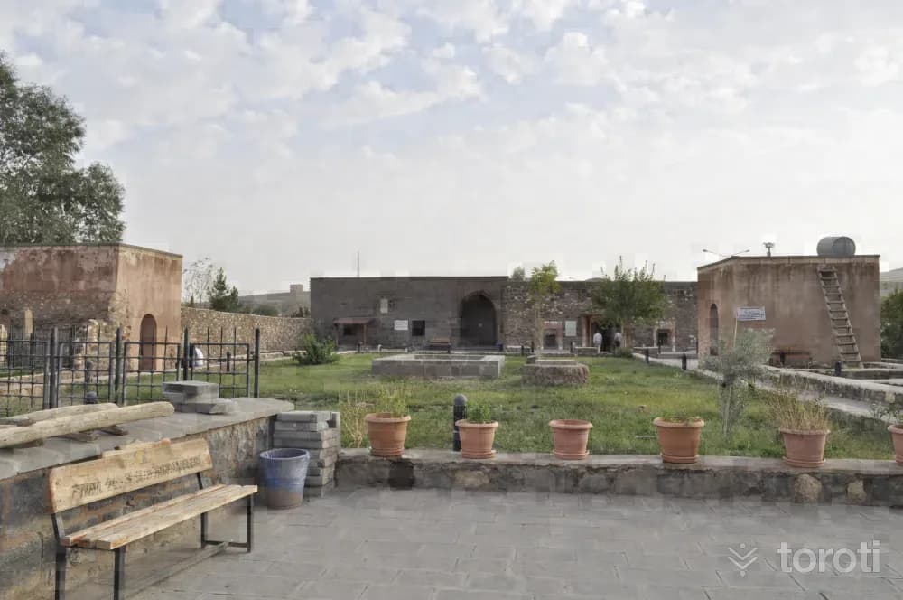
Abdaliye Medresesi
The madrasa was commissioned in 1437 by Emir Abdal (Abdullah) ibn Abdillah Seyfettin Bohti. Of the structure, the mosque, tomb, one madrasa cell, the entrance unit providing access to the courtyard, and one iwan have survived to the present day.
45 minutes
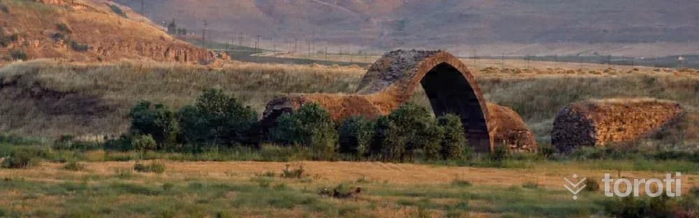
Yafes Köprüsü
Although it is located in Cizre, today it remains within the borders of Syria because the bed of the Tigris River has changed. Today it is in the state of a ruin, with only its large arch and some piers remaining intact. Yafes Köprüsü was built in the XIIth century, during the Seljuk Period, by the Atabegs of Mosul.
45 minutes
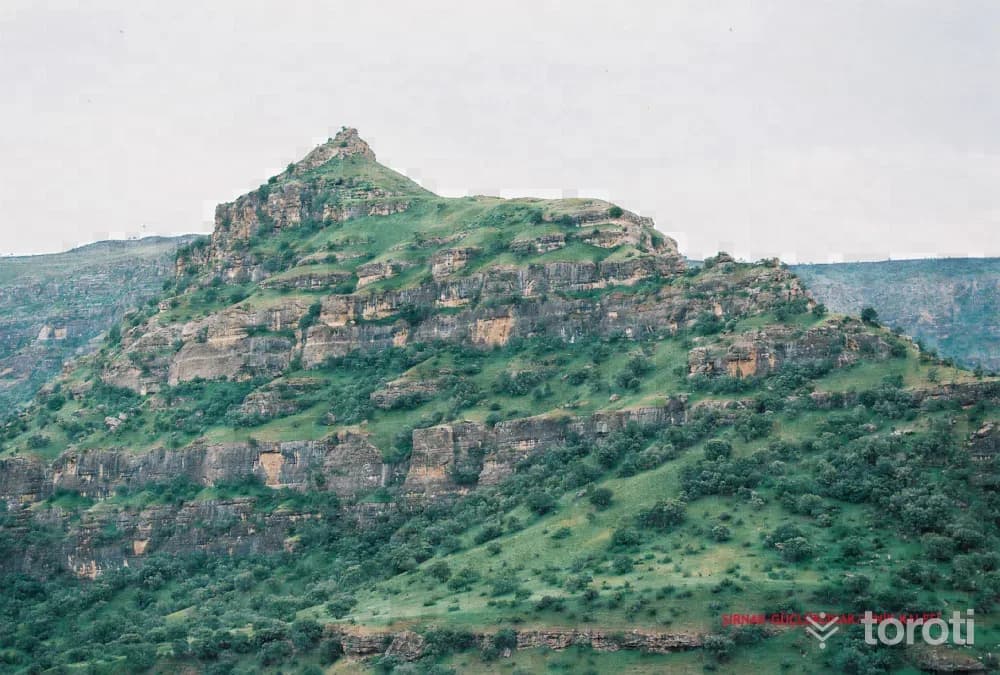
Finik Kalesi
Finik Castle and its surroundings are an important center for the region. While it remained in Eruh within the lands of Siirt, especially in the late Ottoman period, it was connected to Şırnak in 1990 and made the district center.
45 minutes
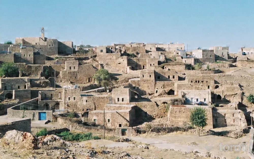
Mor Dodo Kilisesi
The church is located to the northwest of Haberli Village (Basibrin) in İdil District, at a point overlooking the village. The structure was built entirely of stone material. The church is in good condition and open for worship.
45 minutes
Hamidiye Kışla Binası
It is the building commissioned by Mustafa Paşa, the Commander of the Hamidiye Regiments established in Cizre during the reign of Sultan Abdulhamid II, after 1892 at the southeast corner of Cizre Castle in order to manage the regiments’ dispatch and administration. The Hamidiye Barracks Building began to be built after 1892, when the regiments were established. Today, the building is one of Cizre’s cultural assets that has preserved its characteristics and remains standing in good condition.
30 minutes
Yeşiltepe Höyüğü
It is located in the town center of Silopi District of Şırnak, to the east of the Silopi Municipality building. Its dimensions are approximately 90 meters in the north-south direction and approximately 95 meters in the east-west direction. Its surroundings are enclosed with wire fencing and it is used as a park area. Its surface is covered with trees. The top of the mound is reached by stairs, and on this top, which has been made into a flat surface, there are seating areas. Ceramic fragments are clearly visible on the surface of the slopes of the mound.
45 minutes
Havindi Kaya Yerleşimleri
Havindi Rock-Cut Settlements are located 29 km south of the center of İdil district. The area where the caves are located is 9 km south of the Oyalı Village junction, which is at the 20th km of the İdil-Midyat highway. These rock settlements were made by carving the rocky areas on the right and left sides of the road at the 9th km of the Oyalı Village road.
45 minutes
Eski Belediye Binası
It is located on Belediye Caddesi in the center of Cizre. It was built as a municipal building in the late Ottoman period. It has remained squeezed in among the other houses on the street. It has a rectangular plan in the north-south direction and is two storeys. It has a plan consisting of one room on each side, arranged around a central hall. The west facade facing the street is enlivened with windows, a door and a balcony.
30 minutes
Finik Kalesi
Located at a point close to 20 kilometers from Cizre, between the villages of Damlarca and Eskiyapı, Finik Ören Yeri dates back to 4000 B.C. Finik Castle and its surroundings are an important center for the region.
30 minutes
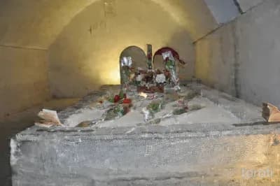
Mem U Zin Türbesi
Abdaliye Medresesi is built on the Cizre Wall connecting Cizre Dağkapı Neighborhood to the cemetery. Mem-u Zin Tomb is in the basement beneath the administrative rooms of this madrasa. There are three graves inside. The graves belong to Zin, Bekir and Mem. On one of the gravestones, there is the inscription “his death was in 854, may Allah have mercy on him and all Muslims.” Mem-u Zin is a story of divine love.
45 minutes
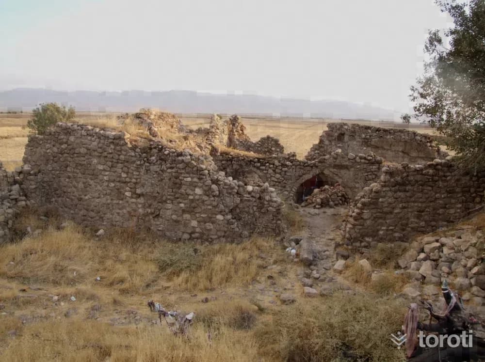
Nuh Nebi Cami Ve Medresesi
The mosque and madrasa, located 2 kilometres from the centre of Silopi in Birlik (Cuma) Village and popularly known as Nuh Nebi, are situated within the cemetery to the southwest of the village. There is no inscription on it. Therefore, its exact date is not known. Considering the historical course of the region and the plan and architectural features of the mosque, it is appropriate to date the structure to the Seljuk Period, that is, the beginning of the XIII century.
45 minutes
Kasrik Köprüsü
It was built over (Akçay) Güneş Stream, within the town of Kasrik. Extending in a northeast-southwest direction, the bridge belongs to the group of three-arched bridges with a flat roadway. It is also known as Han Mahmut Bridge. Since there is no inscription on the bridge, it is not known for certain by whom and when it was built. It was probably built by the Cizre Beys in the 16th century.
45 minutes
İdil Meryem Ana Kilisesi
Its history dates back to A.D. 57. The first name of İdil Meryem Ana Kilisesi is recorded as Mor Yuhan. After apostles such as Mor Yuhan and Maria Magdalena, who were among the first apostles to come to the region, came to the region and preached Christianity, and after the people began to accept Christianity, today's Meryem Ana Kilisesi was established under the name Mor Yuhan. Meryem Ana Kilisesi A.D.
30 minutes
Kasrik Kaya Kabartması
Among the ruins located in Kasrik Gorge, there is a relief of a human figure on horseback within a niche on natural rock. Various structural remains are present in Kasrik Gorge, located 6 kilometers north of Cizre. Among these ruins, there is a relief of a human figure on horseback within a niche on natural rock. The figure was made in low relief and depicts a person riding on horseback.
45 minutes