
Destination
Saripolat
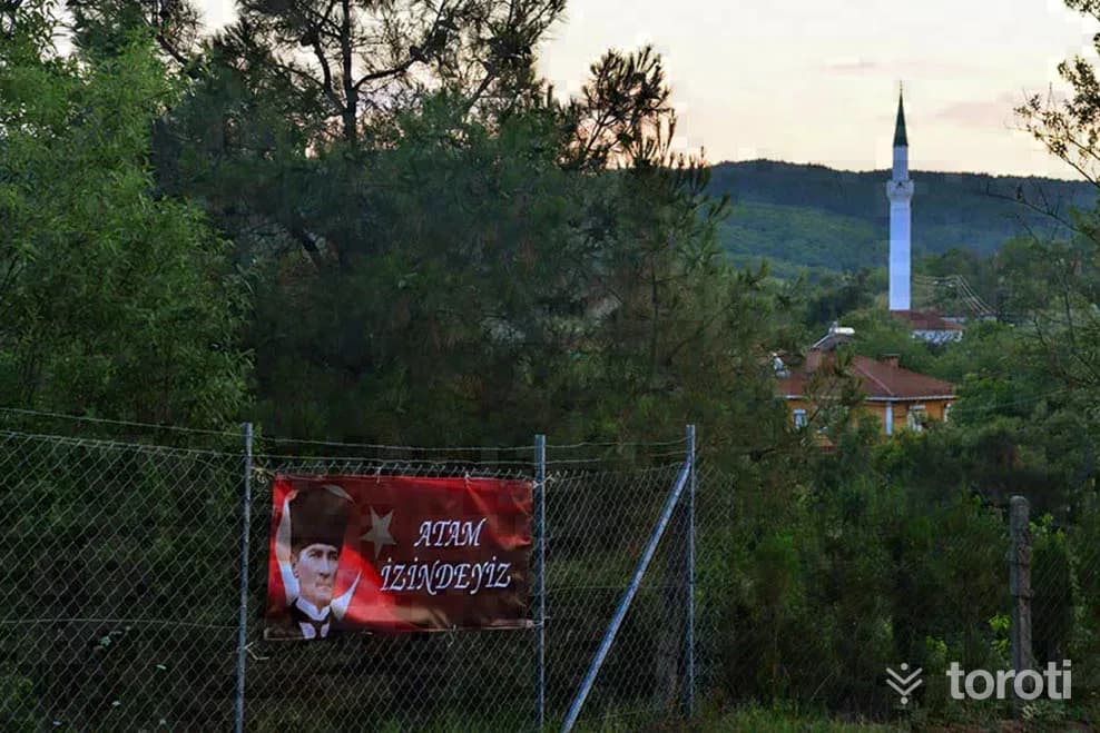
It is 76 km from Tekirdağ province and 16 km from Malkara. It is situated 3,5 km inland from the Malkara–Keşan road, in a deep valley among high hills. The south and north of the valley are open, while the east and west are high mountains covered with forests. The village’s economy is based on agriculture and, to some extent, forestry. Around 1,5–2 tons of milk are produced per day. Hıdrellez festivities are held during the month of May.
Saripolat and 6 places around it
Free · no sign-up needed
Highlights
- Local culture
Suggested visit:45 minutes
It is 76 km from Tekirdağ province and 16 km from Malkara. It is situated 3,5 km inland from the Malkara–Keşan road, in a deep valley among high hills. The south and north of the valley are open, while the east and west are in the form of high mountains covered with forests.
The village economy is based on agriculture and, to some extent, forestry. Around 1,5–2 tons of milk are produced per day.
Hıdrellez festivities are held during the month of May. Although many kinds of food are prepared in the village, there are some that have almost become identified with Sarıpolat. Akıtma, tarhana, yahni, bulgur pilaf, bulgur pastry, varieties with yogurt, cheese halva, village bread are some of them.
There is an opportunity to do nature sports in the neighborhood. You can picnic under the plane trees, enjoy your drinks with cold spring water, and fish in the dam located within the lands of our neighborhood.
You can buy goat cheese, butter and similar products made in the village using traditional methods.
Source: http://kirsalturizm.tekirdag.bel.tr/saripolat.html
According to Wikipedia
Saripolat is a neighbourhood in the municipality and district of Malkara, in Tekirdağ Province, Turkey. It is located in the eastern Thrace plains and has an elevation of 156 metres. Its population was 195 in 2022, and the settlement was formerly known as Teslim.
Source: Sarıpolat, Malkara, Wikipedia (CC BY-SA 4.0). Summarised in our own words.
At a glance
- Type
- mahalle
- Elevation
- 156 m
Last updated: 19 October 2026
Location and surroundings
Saripolat sits within Malkara, Tekirdağ. The toroti catalogue holds 97 described stops across Tekirdağ, 7 of them in Malkara.
The nearest stop is Hüsrev Kethüda Çeşmesi, 12 km to the northeast. Another 6 catalogued points lie within a 30 km radius.
See Saripolat and its surroundings in one plan
- Order your stops on the map and spread them across days
- See driving and visiting time at a glance
- Get places around it suggested automatically
- Free — no sign-up needed to start
Other places nearby
Frequently asked
- What is Saripolat?
- It is 76 km from Tekirdağ province and 16 km from Malkara. It is situated 3,5 km inland from the Malkara–Keşan road, in a deep valley among high hills. The south and north of the valley are open, while the east and west are high mountains covered with forests. The village’s economy is based on agriculture and, to some extent, forestry. Around 1,5–2 tons of milk are produced per day. Hıdrellez festivities are held during the month of May.
- Where is Saripolat?
- Saripolat is in Malkara, Tekirdağ.
- How long does it take to visit Saripolat?
- The suggested visit time for Saripolat is about 45 minutes.
- What else is there to see near Saripolat?
- toroti’s catalogue holds other destinations within 30 km of Saripolat; the closest are Hüsrev Kethüda Çeşmesi, Hacerzade İbrahim Bey Camii, Gazi Ömer Bey Camii Ve Türbesi.