Destination
Muradiye Şelalesi
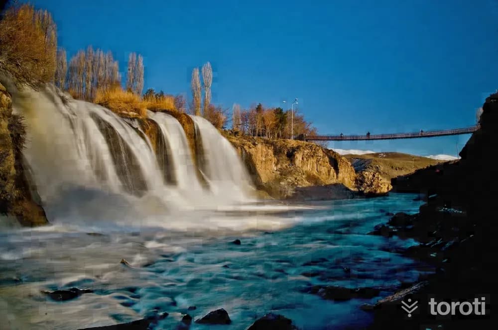
The magnificent Muradiye Waterfall on Bend-i Mahi Stream, fed by Tendürek Mountain, is located within the borders of Muradiye district. It is 80 kilometers from Van city center. The waterfall takes its name from the Ottoman Sultan IV. Murat, who set out on the Baghdad campaign. The height of Muradiye Waterfall is 18 meters. The area on the opposite side of the waterfall is used by the local people as a recreation area.
Muradiye Şelalesi and 2 places around it
Free · no sign-up needed
Highlights
- Nature
Good for
- Nature break
Suggested visit:45 minutes
Last updated: 19 October 2026
Location and surroundings
Muradiye Şelalesi sits within Muradiye, Van. The toroti catalogue holds 56 described stops across Van, 3 of them in Muradiye.
The nearest stop is Şeytan Köprüsü, 10 km to the south. Another 2 catalogued points lie within a 30 km radius.
The Van – Erzurum route passes 18 km away, so this works as a stop along the drive.
See Muradiye Şelalesi and its surroundings in one plan
- Order your stops on the map and spread them across days
- See driving and visiting time at a glance
- Get places around it suggested automatically
- Free — no sign-up needed to start
Other places nearby
Routes that pass close by
Frequently asked
- What is Muradiye Şelalesi?
- The magnificent Muradiye Waterfall on Bend-i Mahi Stream, fed by Tendürek Mountain, is located within the borders of Muradiye district. It is 80 kilometers from Van city center. The waterfall takes its name from the Ottoman Sultan IV. Murat, who set out on the Baghdad campaign. The height of Muradiye Waterfall is 18 meters. The area on the opposite side of the waterfall is used by the local people as a recreation area.
- Where is Muradiye Şelalesi?
- Muradiye Şelalesi is in Muradiye, Van.
- How long does it take to visit Muradiye Şelalesi?
- The suggested visit time for Muradiye Şelalesi is about 45 minutes.
- What else is there to see near Muradiye Şelalesi?
- toroti’s catalogue holds other destinations within 30 km of Muradiye Şelalesi; the closest are Şeytan Köprüsü, Bend-i Mahi Köprüsü.
- Is Muradiye Şelalesi on the way anywhere, and which route?
- Muradiye Şelalesi lies 18 km from the Van – Erzurum route, close enough to add to that drive with a short detour.