
Destination
Karagöl Yaylaları
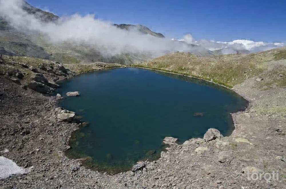
They are highland pastures established around the Karagöl Mountains (3.107 metres), located at the southernmost end of the Dereli and Bulancak districts, at the point where the provincial borders of Ordu, Giresun and Sivas meet, and around the lake named Karagöl here, which has the characteristics of a cirque (glacial) lake. There are many glacial lakes to visit in the vicinity. These are Camlı Göl, Aygır Gölü, Bağırsak Gölü, and Sağrak Gölü.
Karagöl Yaylaları and 6 places around it
Free · no sign-up needed
Highlights
- Nature
Good for
- Nature break
Suggested visit:45 minutes
These are highland pastures established around the Karagöl Mountains (3.107 metres), located at the southernmost end of the Dereli and Bulancak districts, at the point where the provincial borders of Ordu, Giresun and Sivas meet, and around the lake named Karagöl here, which has the character of a cirque (glacial) lake. There are many glacial lakes to visit in the vicinity. These are Camlı Göl, Aygır Gölü, Bağırsak Gölü, and Sağrak Gölü. Its impressive appearance, ice-cold spring waters, crystal-clear air and local cultural attractions constitute a remarkable potential.
In the Karagöl Mountains, which are very suitable for hiking, hiking can be done in the summer months. In the highlands, in July, the Sağrak Göl Highland Festival and the Aksu Köyü Karagöl Keşkek Day Highland Festivals are held.
Source: Giresun Provincial Directorate of Culture and Tourism
Places to Visit in Giresun Address: Karagöl Yaylası Dereli/ Giresun
Last updated: 19 October 2026
Location and surroundings
Karagöl Yaylaları sits within Dereli, Giresun. The toroti catalogue holds 74 described stops across Giresun, 8 of them in Dereli.
The nearest stop is Bektaş Yaylası, 21 km to the northeast. Another 6 catalogued points lie within a 30 km radius.
See Karagöl Yaylaları and its surroundings in one plan
- Order your stops on the map and spread them across days
- See driving and visiting time at a glance
- Get places around it suggested automatically
- Free — no sign-up needed to start
Other places nearby
Frequently asked
- What is Karagöl Yaylaları?
- They are highland pastures established around the Karagöl Mountains (3.107 metres), located at the southernmost end of the Dereli and Bulancak districts, at the point where the provincial borders of Ordu, Giresun and Sivas meet, and around the lake named Karagöl here, which has the characteristics of a cirque (glacial) lake. There are many glacial lakes to visit in the vicinity. These are Camlı Göl, Aygır Gölü, Bağırsak Gölü, and Sağrak Gölü.
- Where is Karagöl Yaylaları?
- Karagöl Yaylaları is in Dereli, Giresun.
- How long does it take to visit Karagöl Yaylaları?
- The suggested visit time for Karagöl Yaylaları is about 45 minutes.
- What else is there to see near Karagöl Yaylaları?
- toroti’s catalogue holds other destinations within 30 km of Karagöl Yaylaları; the closest are Bektaş Yaylası, Şebinkarahisar Asarcik Kilisesi, Mavi Göl.