
Destination
Meteor Çukuru
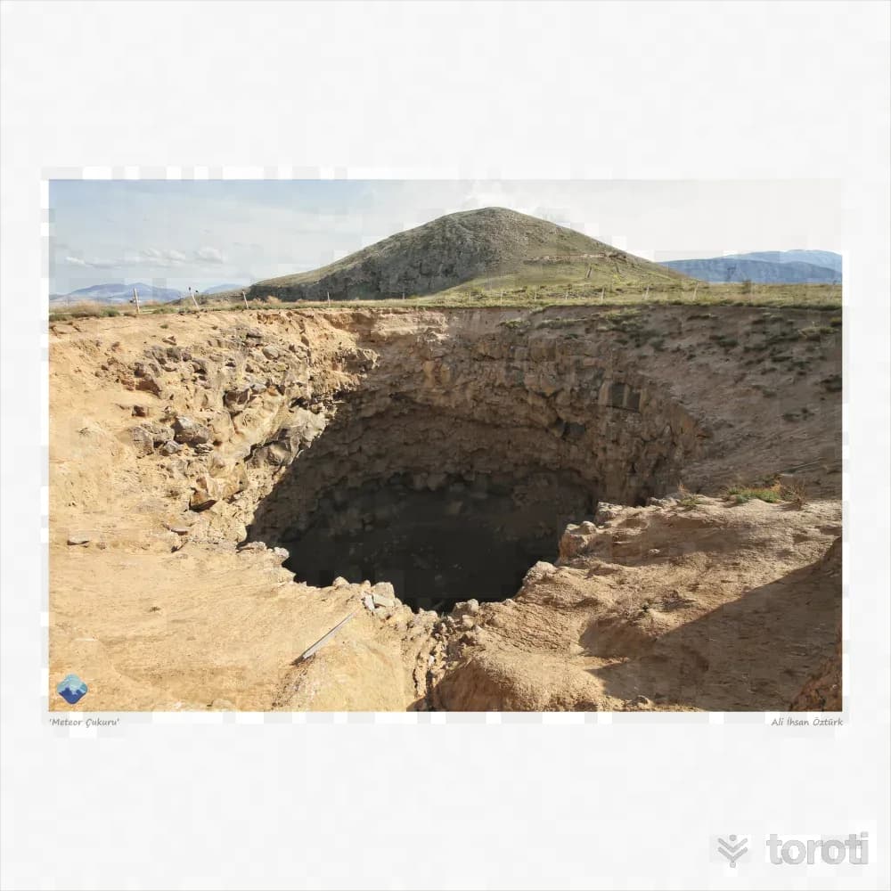
It is located 35 kilometers east of Doğubayazıt district center, approximately 2 kilometers northeast of the Gürbulak border gate. It is a 2nd degree natural protected site registered in 1988 by the Erzurum Cultural Heritage Preservation Regional Board. It is a karstic depression, with a depth of 60 meters and a diameter of 35 meters. Among the local people, it is said that in 1892 a large meteorite fell at night, causing tremors, and that the water sources of Gülveren Village flowed muddy.
Meteor Çukuru and 6 places around it
Free · no sign-up needed
Highlights
- Local culture
Suggested visit:45 minutes
It is located 35 kilometers east of Doğubayazıt district center, approximately 2 kilometers northeast of the Gürbulak border gate. It is a 2nd degree natural protected site registered in 1988 by the Erzurum Regional Board for the Protection of Cultural Assets.
It is a karstic depression, with a depth of 60 meters and a diameter of 35 meters. Among the local people, it is said that in 1892 a large meteorite fell at night, causing tremors, and that the water sources of Gülveren Village flowed muddy.
It has significant tourism potential. It is visited by thousands of tourists every year.
Source: Alpaslan, İ. (1995). Her Yönüyle Ağrı. Tutibay Yayınları. Çetin,Y. (2013).Ağrı Kültür ve Doğa Varlıkları Envanteri. Doğuş Ofset Matbaacılık
Places to Visit in Ağrı Address: Doğubayazıt/AĞRI
Last updated: 19 October 2026
Location and surroundings
Meteor Çukuru sits within Doğubayazıt, Ağrı. The toroti catalogue holds 14 described stops across Ağrı, 9 of them in Doğubayazıt.
The nearest stop is Buz Mağarası, 9.5 km to the west. Another 6 catalogued points lie within a 30 km radius.
See Meteor Çukuru and its surroundings in one plan
- Order your stops on the map and spread them across days
- See driving and visiting time at a glance
- Get places around it suggested automatically
- Free — no sign-up needed to start
Other places nearby
Frequently asked
- What is Meteor Çukuru?
- It is located 35 kilometers east of Doğubayazıt district center, approximately 2 kilometers northeast of the Gürbulak border gate. It is a 2nd degree natural protected site registered in 1988 by the Erzurum Cultural Heritage Preservation Regional Board. It is a karstic depression, with a depth of 60 meters and a diameter of 35 meters. Among the local people, it is said that in 1892 a large meteorite fell at night, causing tremors, and that the water sources of Gülveren Village flowed muddy.
- Where is Meteor Çukuru?
- Meteor Çukuru is in Doğubayazıt, Ağrı.
- How long does it take to visit Meteor Çukuru?
- The suggested visit time for Meteor Çukuru is about 45 minutes.
- What else is there to see near Meteor Çukuru?
- toroti’s catalogue holds other destinations within 30 km of Meteor Çukuru; the closest are Buz Mağarası, Nuh'un Gemisi, Nuhun Gemisi.