
Destination
Yama Dağı Yaylası
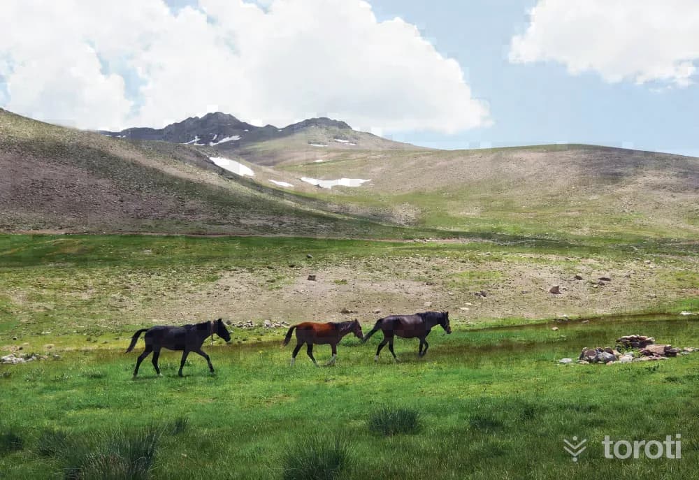
The Yama Dağı massif, a large part of which lies within the provincial borders of Sivas, opens toward the south and southeast and completely covers the north of Malatya. Extending in the west to the Kuruçay Valley and in the southeast to the Fırat Valley, Yama Dağı and its extensions are generally of volcanic structure. Its elevation is above 1500 meters. These mountains form a broad, massive and high relief. Apart from the major peaks, this area generally has the appearance of a plateau.
Yama Dağı Yaylası and 5 places around it
Free · no sign-up needed
Highlights
- Nature
Good for
- Nature break
Suggested visit:45 minutes
The Yama Dağı massif, a large part of which lies within the provincial borders of Sivas, opens toward the south and southeast and completely covers the north of Malatya. Extending west to the Kuruçay Valley and southeast to the Fırat Valley, Yama Dağı and its extensions are generally of volcanic structure. Its elevation is above 1500 meters. These mountains form a broad, massive and high relief. Apart from the important peaks, this area generally has the appearance of a plateau. Its highest point is Ozan Gediği Tepesi, at 2.375 meters. There are plateaus among the high hills.
In summer, transhumants can be seen on the Yama plateaus. It is possible to see tents wherever there is water. Within the scope of alternative tourism activities, with the initiative of the Malatya Governorship, ski facilities are being built on Hekimhan Yama Dağı. At the facilities on Yama Dağı, which is 117 kilometers from Malatya and at an altitude of 2500 meters, it is aimed that the facility, which has an accommodation unit, a Teleski Capacity of 800 people/hour and a slope 1150 meters long, will serve not only Malatya but also citizens coming from nearby Gaziantep, Adıyaman, Kahramanmaraş, Şanlıurfa, Elazığ, Diyarbakır and other places.
Source: Malatya Governorship Publication, Malatya City Guide, İstanbul 2013, Print: Seçil Ofset
Places to Visit in Malatya Address: Köylü Köyü Hasançelebi Hekimhan /MALATYA
Last updated: 22 October 2026
Location and surroundings
Yama Dağı Yaylası sits within Hekimhan, Malatya. The toroti catalogue holds 57 described stops across Malatya, 4 of them in Hekimhan.
The nearest stop is Hasançelebi Ilıca Mesire Alanı, 8.4 km to the south. Another 5 catalogued points lie within a 30 km radius.
See Yama Dağı Yaylası and its surroundings in one plan
- Order your stops on the map and spread them across days
- See driving and visiting time at a glance
- Get places around it suggested automatically
- Free — no sign-up needed to start
Other places nearby
Frequently asked
- What is Yama Dağı Yaylası?
- The Yama Dağı massif, a large part of which lies within the provincial borders of Sivas, opens toward the south and southeast and completely covers the north of Malatya. Extending in the west to the Kuruçay Valley and in the southeast to the Fırat Valley, Yama Dağı and its extensions are generally of volcanic structure. Its elevation is above 1500 meters. These mountains form a broad, massive and high relief. Apart from the major peaks, this area generally has the appearance of a plateau.
- Where is Yama Dağı Yaylası?
- Yama Dağı Yaylası is in Hekimhan, Malatya.
- How long does it take to visit Yama Dağı Yaylası?
- The suggested visit time for Yama Dağı Yaylası is about 45 minutes.
- What else is there to see near Yama Dağı Yaylası?
- toroti’s catalogue holds other destinations within 30 km of Yama Dağı Yaylası; the closest are Hasançelebi Ilıca Mesire Alanı, Alacahan Kervansarayı, Alacahan Cami.