
Destination
Sarıçiçek Yaylası
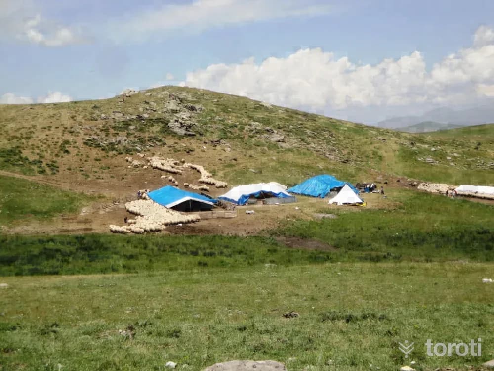
Sarıçiçek Plateau, which was within the borders of the Dağili subdistrict during the Ottoman period, became famous as a “source of cheese and honey.” The plateau’s average elevation is between 1500 and 1700 meters. In the area surrounded by mountains, Kozluk Stream flows through deep valleys called Kayaarası. The vegetation includes sparse oak, and along the water’s edge willow, poplar, plane trees, and fruit trees.
Sarıçiçek Yaylası and 6 places around it
Free · no sign-up needed
Highlights
- Nature
Good for
- Nature break
Suggested visit:90 minutes
Sarıçiçek Plateau, which was within the borders of the Dağili subdistrict during the Ottoman period, became famous as a “source of cheese and honey.” The average elevation of the plateau is between 1500 and 1700 meters. In the region surrounded by mountains, Kozluk Stream flows through deep valleys called Kayaarası. The vegetation includes sparse oak, and along the water banks willow, poplar, plane trees, and fruit trees. The plateau, surrounded by the districts of Arapgir, Arguvan, Divriği and Kemaliye, marks the border of the provinces of Malatya, Erzincan and Sivas. Every summer, nomadic tribes from surrounding provinces, districts, and villages come to this plateau, which has abundant grass and water. The tribes that come to the plateau with the spring stay here until September. Milk obtained from flocks consisting of thousands of sheep is made into cheese and sent to cities for sale.
Source: Malatya Governorship Publication, Malatya City Guide, İstanbul 2013, Print: Seçil Ofset
Places to Visit in Malatya Address: Arapgir, Arguvan / MALATYA
Last updated: 21 October 2026
Location and surroundings
Sarıçiçek Yaylası sits within Arapgir, Malatya. The toroti catalogue holds 57 described stops across Malatya, 8 of them in Arapgir.
The nearest stop is Kozluk Çayı Kanyonu, 21 km to the southeast. Another 6 catalogued points lie within a 30 km radius.
See Sarıçiçek Yaylası and its surroundings in one plan
- Order your stops on the map and spread them across days
- See driving and visiting time at a glance
- Get places around it suggested automatically
- Free — no sign-up needed to start
Other places nearby
Frequently asked
- What is Sarıçiçek Yaylası?
- Sarıçiçek Plateau, which was within the borders of the Dağili subdistrict during the Ottoman period, became famous as a “source of cheese and honey.” The plateau’s average elevation is between 1500 and 1700 meters. In the area surrounded by mountains, Kozluk Stream flows through deep valleys called Kayaarası. The vegetation includes sparse oak, and along the water’s edge willow, poplar, plane trees, and fruit trees.
- Where is Sarıçiçek Yaylası?
- Sarıçiçek Yaylası is in Arapgir, Malatya.
- How long does it take to visit Sarıçiçek Yaylası?
- The suggested visit time for Sarıçiçek Yaylası is about 90 minutes.
- What else is there to see near Sarıçiçek Yaylası?
- toroti’s catalogue holds other destinations within 30 km of Sarıçiçek Yaylası; the closest are Kozluk Çayı Kanyonu, Gümrükçü Osman Paşa Camii, Ulu Cami.