
Destination
Sirakayalar Şelalesi
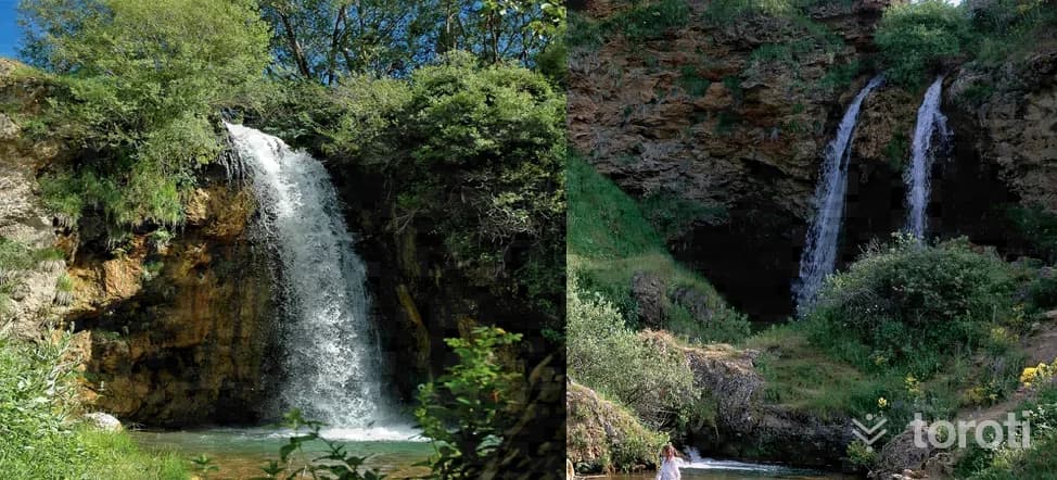
The Sırakayalar Waterfalls, reached by turning off at the 6th kilometre of the Bayburt-Erzurum highway and traveling 16 kilometres to Sırakayalar village, are two in number, one at the entrance of the village and one within the village. The waterfall and its surroundings, offering a visual feast, are used as a picnic area in the summer months.
Sirakayalar Şelalesi and 6 places around it
Free · no sign-up needed
Highlights
- Nature
Good for
- Nature break
Suggested visit:45 minutes
Last updated: 19 October 2026
Location and surroundings
Sirakayalar Şelalesi sits within Bayburt merkez, Bayburt. The toroti catalogue holds 14 described stops across Bayburt, 13 of them in Bayburt merkez.
The nearest stop is Korgan Köprüsü, 230 m to the west. Another 6 catalogued points lie within a 30 km radius.
See Sirakayalar Şelalesi and its surroundings in one plan
- Order your stops on the map and spread them across days
- See driving and visiting time at a glance
- Get places around it suggested automatically
- Free — no sign-up needed to start
Other places nearby
Frequently asked
- What is Sirakayalar Şelalesi?
- The Sırakayalar Waterfalls, reached by turning off at the 6th kilometre of the Bayburt-Erzurum highway and traveling 16 kilometres to Sırakayalar village, are two in number, one at the entrance of the village and one within the village. The waterfall and its surroundings, offering a visual feast, are used as a picnic area in the summer months.
- Where is Sirakayalar Şelalesi?
- Sirakayalar Şelalesi is in Bayburt merkez, Bayburt.
- How long does it take to visit Sirakayalar Şelalesi?
- The suggested visit time for Sirakayalar Şelalesi is about 45 minutes.
- What else is there to see near Sirakayalar Şelalesi?
- toroti’s catalogue holds other destinations within 30 km of Sirakayalar Şelalesi; the closest are Korgan Köprüsü, Baksi Müzesi, Bayburt Saat Kulesi.